2021: My Highlights

Another year, another fluctuating labyrinth of lockdown restrictions and uncertainties. Like most of my projects I’m behind on the blog, although I did manage to do a bit of catching up earlier this year – who cares if I write about my January 2020 Alps trip 18 months later, with the wistful knowledge that – to my contemporaneous blissful ignorance, the reminiscence of which is bittersweet – the following 17 months would be spent in varying levels of lockdown?

It’s been a whirlwind: I’ve been rejected from a couple of jobs, spent a lot of money fixing the van, lost my beloved dog and a funny, kind uncle, missed family and friends, experienced the stress of buying a house in complicated circumstances and regularly questioned what I want to do with my life. But I’ve also qualified as a lawyer, got my first full-time permanent “proper” job, started the process of buying a house and juggled work with regular running, hiking, climbing, cycling and mountain biking, as well as a few art projects, an ongoing environmental project and this blog, and a bunch of other, less regular activities. Swings and roundabouts.

In keeping with the focus (or lack of) of this blog, here’s a summary of my year in adventure:

January/February

The deep, dark depths of winter lockdown. I saw no family or friends and my only solaces were the comforting buzz of activity at Hill HQ, running, cycling and walking (notably a 15-mile hike one grey January weekend) in and near the New Forest, a bit of snow towards the end of January and wildlife-watching.

March

Lockdown eased very slowly. Ryan’s powerkite gave me an unsolicited flying lesson one windy afternoon, we built and slept in a shelter in Godshill Wood (a very uncomfortable night but stubbornness prevailed), went coarse fishing locally, climbed at Hedbury on the Dorset coast, attempted and failed to surf and paddleboard at Christchurch and saw my parents for the first time all year. I became a fully fledged lawyer.

April

We managed a van weekend in the South Downs, which involved a good hike  and a trip to mum and dad’s. We celebrated Ryan’s grandad’s 80th birthday with a “day at the races” fancy dress party and went to the pub for a drink on the day it reopened. Ryan rescued a baby squirrel (Cyril) from a road at work and we released it into the wood. We visited Monkey World in Dorset, met my parents at a campsite in the New Forest and visited Bucklers Hard.

May

The first “proper” van trip – we climbed at the Devil’s Jump on Bodmin Moor and at Sennen cliffs, visited Porthcurno and Lands End and explored Padstow and Port Isaac. We started weekly indoor climbing sessions with our friend Luke, visited Shaftesbury, both fell off skateboards, had a Hill family fancy dress Eurovision party, saw more friends and family and celebrated our birthdays – Ryan’s with a climbing session followed by pub lunch, driving range and barbecue, and mine with a party and a visit to the local raptor and reptile centre.

June

A sunny weekend van trip to the Dorset coast saw us climbing at Winspit, snorkelling in the cold, clear water over a “coral reef”, exploring Corfe and visiting the naturist beach at Studland. We explored pretty Warwick and impressive Warwick Castle with Ryan’s family and saw more of my family. We spent a few days in the van in Cornwall again, this time climbing at Cheesewring Quarry on Bodmin Moor, surfing, beach exploring, drinking and “rave in a cave”ing at Perranporth, and visiting Newquay, Bodmin Jail and Tintagel Castle. Started a week-long holiday in Pembrokeshire with my parents and brother.

July

Pembrokeshire continued – we visited Castell Henllys Iron Age village, explored St David’s and Whitesands Bay, hiked across the Preseli Hills, had a barbecue on Newport Sands, tombstoned and swam in Blue Lagoon at Abereiddy, kayaked and paddleboarded at Llys y Fran, walked along Newgale Beach, visited Pembroke Castle, explored and powerkited at  Broadhaven beach, climbed at St Govan’s Head, visited Stackpole gardens, surfed (unsuccessfully)/bodyboarded in fierce waves at Freshwater West and came back via Cardiff National Museum. Back home we watched England lose the Euros final, went bouldering at St Aldhelm’s Head and swimming in Chapman’s Pool, visited Blue Pool near Wareham, swam in the river Hamble, trad climbed at Subliminal cliffs (including the Avernus blowhole) and took the van to the Forest of Dean/Wye Valley.

August

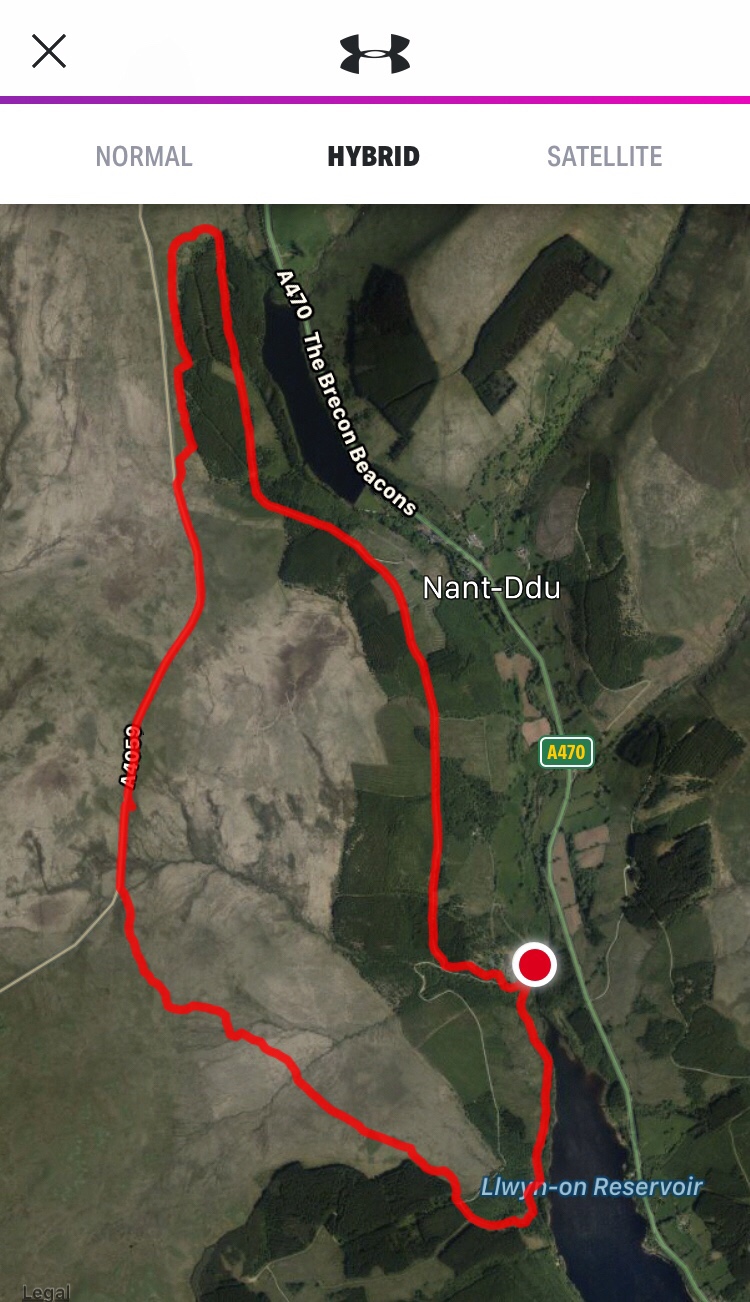
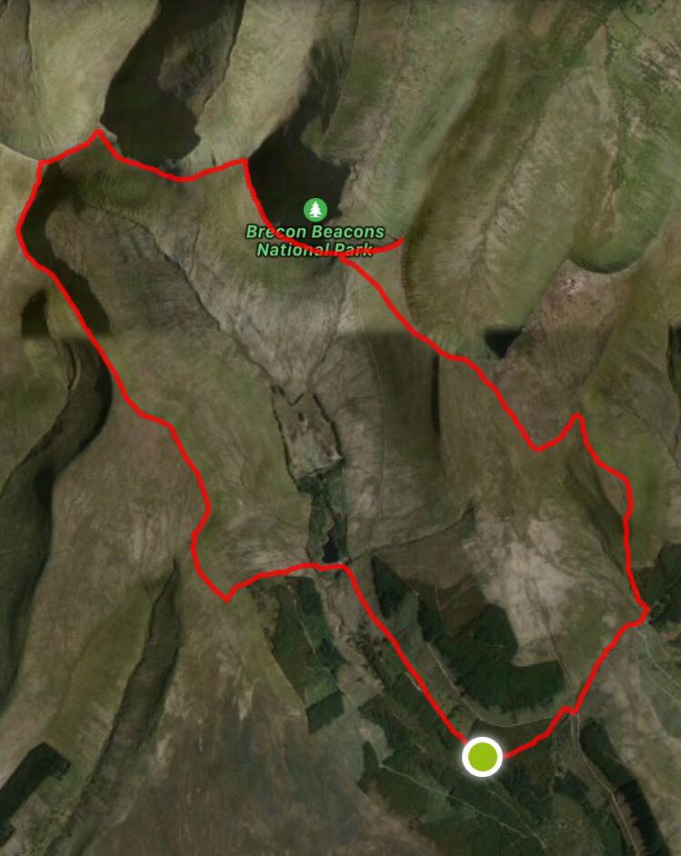
Forest of Dean/Wye Valley weekend continued – we looked for wild boar, mountain biked the red trail at Coleford, explored Clearwell Caves, walked into Wales without realising, spent a day canoeing along the Wye from Ross-on-Wye to Symonds Yat and walked up to Yat Rock. Locally we powerkited, swam and paddleboarded on Bournemouth beach (the day before a “large marine animal” was sighted in the water), went clubbing in Chichester and hiked, cycled and indoor climbed. We took the van to the Brecon Beacons, where we mountain biked the epic “Gap” route, did the Four Waterfalls walk at Ystradfellte and trad climbed at Llangattock escarpment. On the last bank holiday weekend we took our friend Gus to the Dorset coast, where we frequented the Square and Compass, paddleboarded from Winspit to Swanage, swam and climbed at Winspit, night-hiked back to the van from the Scott Arms and mountain biked at Puddletown Forest.

September

We put in an offer on a house and the seller promptly passed away (still buying, still awaiting probate). We mountain biked at Queen Elizabeth Country Park and the New Forest, celebrated Ryan’s dad’s 60th, went coasteering at Dancing Ledge, barbecued at Poole Harbour and went to Snowdonia for a week. Here we trad climbed up Little and Big Tryfan, took a road trip round Anglesey (including Beaumaris town, Baron Hill abandoned mansion, Din Lligwy ancient site, Parys Mountain copper mines, Holy Island and South Stack lighthouse),  explored Betws-y-Coed, mountain biked the Marin Trail, hiked/scrambled the Snowdon Horseshoe – Crib Goch, Garnedd Ugain, Snowdon and Y Lliwedd, sport climbed at Dinorwig Quarry, hiked/scrambled up Bristly Ridge, Glyder Fach and Glyder Fawr, mountain biked at Coed y Brenin and wild swam/dipped near Dolgellau.

October

We explored the aquariums, museums and pubs of Lyme Regis in west Dorset, climbed up Golden Cap hill, met my parents’ new puppy, I went on my friend’s stag do near Bath, which involved clay pigeon shooting, paintballing and drinking, we visited Gilbert White’s museum and the Oates exhibition (notably the Antarctic section) in Selborne village, fished unsuccessfully at Todber, walked around the New Forest and went to the local pub for a Halloween party.

November

I played rugby for the first time since before lockdown, visited the puppy as much as possible, went to a best friend’s beautiful wedding in the New Forest, spent a day exploring Bradford on Avon, took the pup to Meon beach and tried to keep up with a heavy workload. We spent a weekend in Brecon with some friends, which involved completing the Pen y Fan horseshoe hike (Fan y Big, Cribyn, Pen y Fan and Corn Du) in below freezing 70mph gusts and drinking enough to write off the next day.

December

Suddenly Christmas loomed. We walked the pup (and my parents) up the zig zag at Selborne, I went for a tough 32 mile mountain bike ride across the Forest in freezing winds and explored Bristol after a practically unheard of day in the office, we mountain biked the blue and red routes at Swinley Forest, bouldered and climbed at Portland with Ryan’s younger brother Adam, rode our bikes at Moors Valley with Gus, had a Christmas climbing social and have spent Christmas seeing a lot of family and getting (quite frankly) fat and drunk.

And so ends a turbulent year. I think I’m getting better at keeping my life in order – occasionally I tidy my room now and I’m sure I eat more spinach. Progress is progress. I’m never really sure which direction I’m going in, but wherever it is I just have as much fun as possible along the way, and although sometimes idiotic I try to be a good person. I’m not yet rich enough to travel the world or influential enough to stop climate change, but I’ll keep trying – maybe next year.

Endnote: I’ve kept it to one photo per month for the sake of my ebbing sanity, and that was tough enough… read my other posts for more pictures!

An Abandoned Welsh Mansion: Baron Hill

This was going to be part of my upcoming Anglesey-in-a-day post recounting the second day of our recent Snowdonia trip, but I think it deserves its own.

We found Baron Hill in the Wales Wild Guide, which describes it as “an extraordinary and completely overgrown ruined country mansion and gardens”. We were in Beaumaris anyway and as the place was nearby we thought we’d look for it, not knowing what to expect. We parked in a housing estate on the edge of the town and followed the book’s obscure directions across a road and over a shoulder-high wall into a wood thick with mature trees, shrubs and near-impenetrable rhododendron.

Garden

We wandered through the thick vegetation along narrow, criss-crossing paths. We were a little dubious until we came to a strange, rectangular structure made of waist-high stone, like the bottom half of a long room. I thought it might have been some kind of water tank or outdoor pool until we found several others nearby, all nestled in the trees. I’m still not entirely sure what they are and can’t find much about them online, but my guess is that they were the foundations of greenhouses or similar outhouses.

Next we came across a long brick wall with shallow, symmetrical alcoves and an arch leading into a large, extremely overgrown courtyard garden. Nearly every inch of brick had been consumed by ivy, the floor was smothered by ferns that looked straight out of Jurassic Park and skeletal greenhouses retreated shyly into leaf cover. It was enchanting. I looked at Google Maps on satellite view to guide us to the house, as its straight walls are easily visible from above as a fascinating, overgrown floorplan nestled in the trees.

Stables & Servants’ Quarters

It was hard to believe that we’d actually find anything as the vegetation was so thick, but suddenly we were standing in front of a building with high stone walls and an open corridor formed by several large, rectangular, perfectly repeating arches. It was obviously a big building but it was difficult to tell where the architecture ended and nature began, as the two had seemingly fused into one inseparable whole. What little was left of the roof had fallen to the floor and mostly been absorbed by roots, leaves and tendrils.

We walked along the corridor and looked curiously into the large rooms that lined its left hand side. Through the ivy, ferns and now-resident trees we saw the remnants of colourful, patterned tiles, strange semi-circular recesses set into the walls and what looked like a rusty, once-elaborate metal divider of the type used for separating horse stalls. This object, along with the large arches, occasional fireplace and several water troughs stationed along the corridor, suggested that this building – despite its apparent bygone grandeur – was perhaps just the stables and servant’s quarters.

Mansion

At the end of the corridor we turned right and our eyes were drawn instantly upwards, just above the canopy of trees. If this were a novel I’d say we found ourselves rooted to the spot with dropped jaws, rendered speechless by astonishment. This is not a novel so I’ll leave out the embellishment, but the sight of the enormous, ancient-Rome-or-Athens-esque building rising from the jungle in front of us, well into the process of being devoured by ivy, really was like nothing I’d ever seen before. We approached it almost apprehensively, instantly struck by the eerie juxtaposition of lavish grandeur and ruinous dereliction.

The house was three high-ceilinged storeys high, with huge windows that were empty apart from foliage, birds nests and the occasional remnant of a wooden frame. Stone doorways granted access to the inside, which was full of wild plants and building detritus, some of it teetering precariously against walls. The main entrance was a bit further on and on the same side, framed by four enormously high, ivy-covered columns and a colossal doorframe. Inside, only the basic structural elements were left to imply the house’s size and magnificence, with the occasional stubborn detail left as a strange reminder that this place was once a home. Bare walls (save for some graffiti) towered around us under an uncovered grey sky that seemed disproportionately small, particularly in the claustrophobic corridors, where the multitudinous wires of an old servant calling system hung suspended in an inextricable tangle. Thick RSJ beams spanned the huge rooms like bones, impervious to the decay of the grand floors, carpets and furniture they once supported. A staircase fell away to nothing after a few steps then started again a bit higher up, and trees grew from first and second floor iron fireplaces which were strange to view from below. We were captivated.

We explored the house with fascination and a little trepidation, well aware of its obvious structural un-soundness. We  padded around the old rooms, crossed a plank of wood over a gap that hinted at a basement, and marvelled at the way nature had slowly, effortlessly and almost entirely reclaimed the land. The slightly sinister cawing of several nearby crows seemed to fill the walls, but otherwise it was completely still and pin-drop silent, as if time had stopped. The atmosphere is hard to describe; it felt like a place of contradictions – majestic but ruined, peaceful but eerie, benign but dangerous, neither dead nor alive, and constantly as if we were being quietly observed. A stark demonstration that where humanity ceases, nature thrives.

We could have explored all day but were conscious of time, so after a cautious poke around we went through to the other side of the house, where more window and door frames towered high above us and the remains of a huge trellis spanned all three storeys, seemingly held up only by the ivy that grew thickly on it. The place is clearly well-known by local kids, evident from the graffiti, the odd bit of rubbish and the rope swing that I couldn’t resist before we ducked and weaved our way back through the thick vegetation to the wall we’d clambered over about an hour before. Carefully avoiding the low barbed wire fence, presumably installed as a half-hearted way of preventing access to the private land, we dropped down over the wall and back into the real world.

I now fancy myself as the next Indiana Jones.

Endnote – the History

I can’t find much detail on the history of the place, but Wikipedia reliably tells me that the ruined mansion was built in 1618 by politician Sir Richard Bulkeley and has been in the family ever since, although it was reconstructed in its current style in 1776. During World War I, death duties (inheritance tax) depleted the Bulkeley fortune so much that they could no longer afford the upkeep and the house became used to station Royal Engineers. In 1939 the government requisitioned it to temporarily house Polish soldiers following the outbreak of World War II, but they found it too cold and started a fire in the hope they would be moved somewhere warmer. The fire destroyed much of the interior and the soldiers were removed – to tents in the grounds, ironically – and the abandoned mansion was left to nature.

Snowdonia, Sep 21: Climbing Little & Big Tryfan (Pinnacle Rib Route)

What a week. We’ve just returned from an incredible trip to Snowdonia and the mountain blues have hit us like a steam train. Hiking, scrambling, climbing, mountain biking, an island road trip, a smidgeon of wild swimming and several pubs – the last few days have had everything I could have asked for and more.

Friday 17th September

We drove up on Thursday night and stayed in a layby just before Betws y Coed. After a good night’s sleep and eggs on toast for brekkie, we drove west along the A5 through the picturesque valley that cuts through the lush, green Gwydir Forest. Past the trees, the landscape opened out to wild country, where mountains sprawl lazily for miles across rugged land untainted by concrete or tarmac.

Little Tryfan

After a 20 minute drive we parked in the long layby on the A5 just after Gwern Gof Uchaf campsite, nestled in the Ogwen Valley. We fancied a gentle introduction to what we (rightly) anticipated would be a full-on week, so we started with some easy trad climbing on Little Tryfan, where I’d climbed with army cadets a decade ago and Ryan had climbed a couple of years ago. We tramped past Gwern Gof Uchaf and a short distance up the south side of the valley to the huge, slanting rock face, whose gentle angle and solid, grippy rock make it the perfect destination for new or casual climbers.

Most of the wall was being used by a big army group so we walked past them to the far end and climbed “Mossy Slab”, an easy two-pitch route graded HVD. I led the first pitch and Ryan led the second. Some of the gear was good but I found that several of the crack constrictions were “wrong” in that they were V-shaped and didn’t allow nut placements to correspond with the direction of fall, but the climbing was so easy that I was comfortable with running the gear out. At the top we paused to appreciate the stunning view of the Ogwen Valley, then walked down the rightward descent scramble.

We felt that Little Tryfan was one of those “if you’ve climbed one route, you’ve climbed them all” crags, so at the bottom I put forward a case for climbing “big” Tryfan. My arguments were:

  1. the weather was drier and clearer than forecast,
  2. we were part way there anyway,
  3. we’d packed enough equipment to not have to return to the car, and
  4. we’d already discussed climbing it via a certain route called First Pinnacle Rib.

Ryan put up precisely no resistance and insisted that he’d be fine in his battered old Nike skate shoes. It was one of those off-the-cuff decisions that lead to the best days out, and the verdict was unanimous. Off we went.

Tryfan: to Heather Terrace

The first bit involved a steep walk/scramble up to Heather Terrace, the path that runs roughly north-south along Tryfan’s east face and is characterised by uneven rock, unavoidable grey boulders, resolute purple heather and lovely high views over the valley of Cwm Tryfan. Heather Terrace is probably the gentlest and flattest route up Tryfan, a mountain whose summit requires at least a scramble regardless of which way you go.

Once we were in roughly the right place along the path, we searched the rock for the start of the climbing route. We’d eyed up First Pinnacle Rib (also called Overlapping Ridge Route), a classic VDiff multi-pitch that featured in both our new Rockfax book and Kev’s (Ryan’s dad) 1990 Constable guide, which Kev had climbed years before. We couldn’t easily tell exactly where the routes were as the rock to our right was high, steep and looked very much the same, and the photos in the guidebooks were taken from further back – we’d have fallen off the side of the mountain if we stepped back to gain the same vantage point.

After a frustrating 20 minutes or so I spotted “FPR” vaguely etched into a slab. Kev had told us that “1PR” was scratched at the bottom of the route, so we assumed that the “1” had been turned into an “F” at some point and didn’t investigate further. A few days later we spotted in the Rockfax book that FPR actually and misleadingly denotes the start of Pinnacle Rib Route, fortunately another classic VDiff which is next to First Pinnacle Rib, so that’s what we set out on.

Tryfan: Pinnacle Rib Route, the nice bit

We shoed, harnessed, helmeted, geared and roped up and I led the first pitch, an easy line up a big groove with good gear and solid holds. Ryan followed me up and led the second pitch up a rib, again with good gear and holds. I came up and led the third; we weren’t exactly following Rockfax’s instructions as to where to climb/belay, but just doing what looked good and felt right. I paused a couple of times to snack on some wild bilberries that grow on scrubby bushes all over the mountain.

The first slightly sketchy section came at what I thought was “Yellow Slab”, an infamous polished wall. With hindsight and research I don’t think it was Yellow Slab, but I found myself on a flat, vertical face covered in thin yellowish lichen, few holds and fewer gear placements, just past a flat ledge and out of Ryan’s view. I felt strong and confident so I pulled myself up, managed to place a small blue nut which subsequently popped out shortly after I climbed above it, and belayed from just above it – fortunately it was quite short.

We were enjoying the climbing hugely and flying up quickly until Ryan finished the fourth pitch and belayed me up. The sky was starting to cloud over and at one point I was climbing above a rainbow, which was cool. However, Ryan had gone slightly off-piste by climbing in whichever direction he liked the look of, and we weren’t entirely sure where we were. We read something in the book about walking rightwards for 20m and belaying, so we tramped right up some awkward wet, heathery ground and stopped at a slightly ominous-looking corner crack.

Tryfan: Pinnacle Rib Route? The ordeal

For reasons that will become clear, I don’t have any photos of this section. The weather had closed in, the stunning views had gone, we were starting to get damp and Type 1 fun was rapidly turning into Type 2. Looking a little reluctantly at the wet corner, I started up it and quickly realised that opportunities to place gear were scarce. It followed a crack up a corner between two fairly bare slabs which tilted towards each other at a shallow angle, not enough to properly bridge, meaning that I had to trust my shoes to grip the damp rock on tiny or next-to-no holds while I made some awkward upper body moves. The crack itself was slimy and mossy and the gear placements just got worse.

I climbed quite slowly, constantly weighing up whether to carry on or come down. The gear became so run-out that if I slipped it’d have been a ground fall onto the ledge where Ryan was belaying (very supportively and encouragingly despite his soaking wet shoes, to his credit), a fact of which I was painfully conscious. When I was climbing my head was calm, clear and acutely aware of everything, but when I paused to look for a much-needed gear placement I felt genuine fear. I’m not used to that feeling – there’s a difference between the adrenaline-inducing thrill of climbing above a bolt at a crag, flying down a steep mountain bike trail or scrambling along an exposed ridge, or even worrying a little that we’d get back later than planned after a big day out, and real, spine-chilling, one-wrong-move-means-hello-mountain-rescue fear.

Eventually I reached a good handhold where I placed two nuts. I didn’t allow relief to wash through me because the next few metres looked as bare as the previous few. I convinced myself to carry on, then proceeded to put myself through the same torment as before, with a long, run-out, balancey few moves up slippery rock until eventually (another potential ground fall later) I reached a horn of rock, which I threw a sling over, clipped into and fully exhaled for the first time in a good few minutes. From there I clambered up onto another horn, which I straddled tightly and belayed Ryan up from, genuinely relieved to be unscathed.

Ryan followed me up and congratulated me on being alive and unbroken, then led the next pitch up an awkward channel which luckily had plenty of gear placements. I followed him, a bit shaky from my belaying position, and met him at his belay. I was a bit disheartened not to see Adam and Eve, the two adjacent pillars that mark the summit, but after a slightly awkward scramble up a column of rock they emerged through the clag to our immense relief.

Tryfan: summit, descent

Ryan clambered up first and did the famous leap between the pillars to gain the “freedom of Tryfan”. I followed, still a little shaken from that hellish pitch, and jumped across before I could ponder the sheer drop to the left, the wide gap between the rocks or the slippery-looking, uneven surfaces on the tops. Ryan thought it funny to tell me I had to do it again as he’d missed the photo; I did not find it funny. Fortunately (for him) he’d captured it perfectly.

We swapped climbing shoes for Scarpa approach shoes / Nike pumps (joking that Ryan was now “that person” we hate to see up mountains), munched a cheese salad sandwich and walked down the steep south side of the mountain until we branched left and rejoined Heather Terrace. The terrain was awkward, uneven and very rocky, and our knees took a battering all the way down. The clag lifted as we descended, the landscape-defining artery of Nant Gwern y Gof appeared way below us to the right, and eventually the views over the long Ogwen Valley returned.

The Perfect Ending: pub, curry, van

We passed behind Little Tryfan, through Gwen Gof Uchaf and returned to the van around 5.30pm, pleased to see the bikes hadn’t been stolen and slightly amused that we’d only travelled just over 4 miles (2,000ft elevation aside). We threw our stuff in and drove the short distance down the A5 back to Tyn-y-Coed, a nice, welcoming pub Ryan had frequented on a previous trip with his brother. I was revived by a cider and an Irish coffee, then Ryan drove us back along the A5 to a car park by Llyn Ogwen, a wild, peaceful mountain lake overlooked by Tryfan.

Several vans were already parked up and there were no signs so we decided to settle for the evening. I cooked a Thai green chicken curry which was admittedly pretty good, especially after the day we’d had, and with hindsight, we could (almost) laugh about the strange route we’d taken up the mountain. We slept very well.

North Pembrokeshire, June 2021 (2/2)

Thursday 1st July

Newgale Beach

The fog was still thick around our wild camping spot on the Preseli Hills when we woke up. We were due travel to South Pembrokeshire for the second half of the holiday and had arranged to meet mum, dad and Angus at Pembroke Castle at 1pm.  We spent the morning driving down via Newgale Beach on the west coast, with a view to seeing as much of the national park as possible.

We dropped down into Newgale after an hour’s drive through pretty farmland and parked at the large beachfront car park. Newgale is a small village in a basin that opens onto St Brides Bay, with a large, lively-looking campsite set just across the road from the beach. The beach is long, sandy and scattered with smooth pebbles. The weather was strange – still, warm and bright, but grey sea mist stopped sunlight penetrating and gave the sea and sky a serene, dream-like quality. We walked along the shore until we reached some cliffs and caves at the southern end, explored for a little bit and headed back to the van.

Pembroke Castle & Town

We stopped at Morrisons in Haverfordwest for shopping and fuel, then met the others in Pembroke early afternoon. Pembroke is a small, bustling town that still seems to revolve around the castle, which has high, well-preserved walls that tower over a long pond on one side and the high street on the other. Inside, the large, grassy courtyard is contained by walkable walls and several towers which house a lot of interesting information about the castle’s history, including some realistic mannequin scenes and the room where Henry VII was born. It has a “proper” castle feel, with its huge keep (sadly closed), dungeon room, herb garden, scattered flowerpots, battlements, towers and high walls. Definitely worth a visit.

After a thorough poke around the castle we  wandered up the high street, where we looked round an old fashioned convenience store and a tiny shop that sells handmade, surfwear type clothes. I bought a pair of yoga shorts with a honeycomb pattern and a couple of headbands, all made in the shop with organic cotton – would recommend, see the website here – https://www.iseasurfwear.co.uk/. Ryan and I then went on to the Watermans Arms pub and enjoyed a cold cider on the deck, which is raised on stilts over the edge of the pond and has a lovely view over the water, the castle and the town. We watched in amusement as a single, angry-looking swan chased a group of at least 30 much more passive swans around.

Camping, Kiting & Broad Haven South Beach

We drove a little way south along tiny roads to the new campsite, Trefalen Farm, late afternoon. This is another lovely site with sea views, basic facilities and a really remote feel. The first thing we did was find an open field near the cliffs and fly Ryan’s powerkite, as so far the weather had been record-breakingly non-windy (for Wales) and having felt a slight breeze, we were very keen to get it in the air. There wasn’t lots of wind but there was enough to have some fun for half an hour or so before going back to the van and cooking fajitas for tea.

After eating we all tramped down the hill to Broad Haven South, a deep, attractive sandy beach with dunes set way back from the sea and impressive rocks and caves on either side. We walked and footballed our way to the far side, where we explored narrow caves and clambered around on the rocks. Angus was introduced to the slimy delights of large, light-hating cave lice and we found some random sea junk wedged high in damp cave systems, including ropes, buoys, jerry cans and a tyre. Satisfied with a day spent poking around castles and caves, we went back to the campsite and played some stupid card game Angus bought at the castle gift shop, which became hilariously long-winded.

Friday 2nd July

Climbing at St Govan’s Head

Ryan, Angus and I set off from the campsite to climb at the nearby coastal crag of St Govan’s Head. We walked west along a wild section of the Pembrokeshire coast path which had lovely views of dramatic cliffs towering over little rocky beaches and coves filled with clear blue water. We’d definitely chosen the right day for it as it was dry, still and kind of sunny, kind of cloudy, so not too hot or cold. We arrived at some abseil stakes by the edge of a cliff near a military training zone and after a little bit of faff, worked out the right stake to abseil off.

We set up the rope, took what gear we needed and one by one, abseiled over the edge of the cliff. As always the most awkward bit was going over the lip, where your legs go from vertical to horizontal against the wall. The abseil was really fun – about 30m high and against a pleasantly sheer wall, with some free space to hang into in the middle, and with dramatic views of the wild, intimidating cliffs and calm sea below.

The climbs were graded quite high and described as high in the grade, so we went for easy stuff. Angus hadn’t trad climbed for ages and Ryan and I hadn’t done much at all during a year of lockdown. First Ryan led “Exit Corner”, a straightforward VDiff up a blocky corner, I seconded and Angus toproped. We abseiled down again and I led “Lemming Way”, a Severe route up another corner with a fairly exposed, awkward section which had a disconcertingly damp crack where I faffed around with some tricky gear placements.

I belayed the other two up and we abseiled down again. This time Ryan picked “Centurion”, a Severe line up a nice-looking crack with one difficult looking move under an overhanging block. He got to that move without much difficulty but got stuck there, so he came down and I had a go without any real expectation of getting any further. It was an awkward and fairly bold move involving a high right leg and some dubious holds, but I committed to it and to my surprise pulled up over the block. The finish was quite loose but otherwise fine, and I belayed Ryan and Angus up (using a munter hitch as I’d given Ryan my belay plate) feeling quite pleased with myself. As I was doing so I watched a little nervously as a cow approached and sniffed another belayer’s rope anchor at the edge of the cliff –  I didn’t want anyone to have to contend with curious cows while belaying, and I definitely didn’t want a cow to fall off a cliff. Luckily the cow lost interest and wandered back to safety.

Trad climbing always takes longer than you expect, especially when you’re a little out of practice and there are three of you. By this time we’d only done three climbs and three abseils, but it was mid-afternoon and we were getting hungry (having overlooked the value of packing lunch). We were satisfied with our taster of Pembrokeshire climbing (although Ryan and Angus slightly more so than me) so we packed up and headed for the nearest pub.

We walked west and took a detour via St Govan’s Head chapel, a tiny, ancient limestone chapel down steep steps built into the side of a cliff and perched above a small cove. It’s a striking building which merges into the cliff quite naturally, as if it’s always been there, and some of the etchings on the stone altar suggest that it’s drawn interest for a very long time.

We climbed back up the steep steps and walked north for half an hour into the village of Bosherston and found the pub, the St Govan’s Head Inn. Dad had left me a voicemail saying that he’d booked the five of us in for dinner at (unhelpfully) “the local pub” and nobody had any phone signal to find out which pub it was, so we had a couple of drinks there and after a bit of phone-waving, I received a text suggesting that we were in the right one so we stayed.

Mum and dad turned up about 6 and true to form, I was decidedly wavy after two or three ciders while Angus and Ryan were fine. The pub was lovely inside, with wooden beams and low ceilings, and the food was very good – I had dressed crab and some chocolate thing for pudding, and my only complaint was that Ryan promised me one of his prawns but ate them all before I could get there. We split the bill between Ryan, Angus and I and walked back to the campsite along a narrow, hedge-lined road, happy with a good day’s climbing and pubbing.

Saturday 3rd July

Stackpole Gardens

It was mum’s turn to pick something to do, so we ended up at Stackpole Walled Gardens. Entry is free and a lot of the gardening is done by adults with learning difficulties as part of a charity thing. It’s a nice place to go, with long greenhouses, strange plants and sculptures, and it had lots of little corners to explore. Our favourite part was the rows of fruit available to pick for free, including strawberries, raspberries, gooseberries, blackberries and tayberries. We were there for an hour or so, until we ended up getting drizzled on while waiting for mum to finish bumbling around.

Surfing at Freshwater West

Taxi of dad then took us to Freshwater West beach, where we just about found a parking spot. Ryan and I changed into wetsuits and took the surfboard and bodyboard down to the long, sandy beach just down from the car park, and waded into the rough sea. We didn’t get far at all before being batted back by the waves. The surf was beyond our skill level in that we couldn’t even get the surfboard out far enough to catch the longer waves – the ones close to shore were short and ferocious, crashing high above our heads and pulled quickly back from under our feet.

We were washing machined around for a while, which involved getting hit multiple times with the boards and noting that a hard surfboard is considerably more painful than a foamie. One such collision (with my thigh) resulted in one of the three fins snapping off the surfboard and from then our attempts at proper surfing ceased. I’d managed to stand twice, both times in the shallows, and both times for a record-breakingly short duration. Body boarding was good fun though, and less calamitous.

After about an hour of being battered by the sea, we tramped back along the beach. Dobby’s grave, consisting of a lot of stones all piled up, was up on the sand dunes to the left – apparently it’s where the scene was filmed (spoiler – Dobby dies). The sea, and our attempt to find some surfable waves, had dragged us quite a long way to the right, and annoyingly we noticed on our way back that the surf to the left had calmed down a lot to the point where surf schools had started eyeing it up.

Feeling half-starved, we grabbed lunch from the famous Café Mor burger van in the car park. I had the vegetarian burger and Ryan had the classic Mor burger with chips. The people were really friendly and the burgers were amazing, served with some kind of seaweedy pickles and relish.

Powerkiting at Broad Haven South

We went back to the campsite via Pembroke so that mum could grab some bits from (ie. spend an inordinate length of time in) the shop. We helped pack up the awning and for tea mum cooked a strange but very nice mix of bits that needed using up, which included buckwheat, mackerel and salad.

That evening we wandered back down to Broad Haven South beach to show the others Ryan’s powerkite. There was practically no wind but we just about managed to get it up and give dad and Angus a go. It was nice to fly it on the beach regardless and the only downside was that in my enthusiasm to take the mountain board despite the lack of wind, I graunched my heel on the axle while scooting along and it bled quite a lot.

On the walk back up the hill the heavens opened. I’m not exaggerating when I say it was like a tropical storm – we were dry one minute and drenched to the bone the next, so much so that it stopped being annoying and became funny. Once back at the vans and changed into dry clothes, we all huddled in dad’s van and spent the last evening chatting away.

Sunday 4th July

National Museum & Cardiff

We parted and left, a little sad, quite early on Sunday morning. It was grey and wet and we counted ourselves lucky that the Welsh weather had arrived just as we were leaving. Ryan and I came back via the National Museum at Cardiff as I was keen to see the city, having never been before, and thought the museum would be a good rainy day activity.

We parked in the city centre quite cheaply – £5.50 for 4 hours – and walked the short distance to the museum, through an attractive, leafy park and past the grand university and court buildings. Entry was free and it was very interesting. The ground floor was all about the natural history of Wales and housed an incredible collection of rocks and meteorites, dinosaur and prehistoric animal skeletons and information about plants, fungi and habitats. After a lot of reading I sensed Ryan’s growing impatience and we moved upstairs to the art floor.

This had lots of cabinets filled with pottery which was, in our untrained opinion, of uncertain aesthetic value. It was a bit of a labyrinth, with different rooms housing works of photography, paintings and sculptures. The work ranged from very old-looking portraits of heavy-eyelidded, curly-wigged posh people to modern paintings in blocky colours with dubious justifications as to what makes them worthy of gallery status. One exhibition featured huge paintings by a couple of artists which I thought were excellent and very poignant, having read about their cultural backgrounds, but I can’t remember their names.

After a couple of hours we left the impressive building through the large marbled, columned foyer and went for a wander around Cardiff city centre, pleased that the weather had cleared up. I thought it was a very attractive and clean city, with a young, lively atmosphere and lots going on. There were all sorts of shops, cafes and bars in a very small area and the castle was impressive, set near the centre with high, well-preserved walls. After a quick excursion to a phone shop so Ryan could sort out a new phone contract, we grabbed a subway and headed back to the van.

And so concludes our holiday in Wales. We had a lovely, busy week and it was really nice spending some time with my family, especially after lockdown(s). The two van, one tent setup worked well and we got to see a lot of Pembrokeshire, although there’s definitely more to see. I have a feeling we’ll be back…

Brecon Beacons: 3 Days, 4 Waterfalls, 5 Mountains – Day 3

Inside a tent is my second favourite place to wake up, topped only by outside a tent. Welsh weather dictated that this was an “inside” day. The mist cleared by breakfast and the dewy grass cooled my flip-flopped toes. After porridge and packing up (the new netflix n chill), we headed South West to walk the “must-see” four waterfalls trail.


We drove along the road that we’d trudged along, semi-lost, two days before, and it was breath-taking. I’ve never seen the Brecons in all their glory – on previous visits they’d been shrouded in thick, grey fog. I suppose the landscape was the same as it had been on the Friday, but we were slightly higher and could appreciate it so much more. We pulled over to take photos and admire the view: golden, grassy plains edged by dark, evergreen forests backed by protective, sweeping ridges. It wasn’t the wet, wind-beaten landscape I’d experienced before; the unfamiliar sun was shocking Wales into calm serenity and I couldn’t get enough.


We arrived at the car park near Ystradfellte an hour or so later and were surprised to find it manned by a handful of forest wardens. We knew it was popular but had no idea it would get so busy. We got there early so had no problem parking, checked the route and set off. The beginning and end of the trail is along a gravel track through the forest. It’s lined by tall, dark evergreens which are far enough from the path so as not to block the sun, and the route is well-marked enough so no need for a map.


The first waterfall was pretty but inaccessible, the second was wide and entered into a deep, round, inviting pool, and the third was my favourite. From the woody, leafy bank, we de-shoed and crossed the river onto a sunny, flat slab of rock to have lunch. The water here flowed between deep, round pools, all connected by shallow mini-waterfalls, with the main one on our left. A couple of guys in wetsuits joined us, and after lunch I dived into the pool for a swim.


It was lovely (after the initial shock!) – cool, deep and refreshing. I swam around and explored up and down river, scrambling over slippery rocks and scaling the jagged walls, nearly injuring myself only once. Apart from the people walking and sitting on the opposite bank, it was idyllic: the sky was clear blue, the water was cold and fresh and we were surrounded by the bright, glowing green of sun-drenched spring leaves.


We could have been there minutes or hours for all I knew, but eventually we packed up and headed off. A semi-strenuous uphill section took us back to the main path, and when we got near waterfall four we had to join a queue of slow-moving traffic to take the stairs down to see it. It seemed like the whole world had taken their children, husbands, grandparents and grandparents’ dogs to look at this waterfall; I don’t know where they all appeared from.


The waterfall itself was stunning  – the widest and tallest one yet, with lots of space behind it. However, the sheer number of people devalued it almost entirely. There was a crowd of yellow, blue, red, any-colour-you-can-think-of t-shirts and no space to walk around at all. I couldn’t believe that so many people would choose to hang about or have their picnic in a spot so teeming compared to the rest of the trail. One photo later, we turned and trudged painfully slowly back up the steps.


The signpost at the top reckoned it was 55mins back to the car park, but we did it in 35. It was an attractive walk back; forest-ey, but not boring. MapMyWalk says the route was 8.4km and we did it in 1hr32mins, not including breaks and stops. I’m dubious.


When we left, the car park and the drive up to the car park was rammed with cars and the wardens looked exasperated. We drove back to Brecon for an ice cream before heading to the Black Mountains – the easternmost of the three mountain groups in the Brecon Beacons. Confusingly, the western mountains of the National Park are called the Black Mountain Range.


This area is more agricultural than the wild, central Beacons. After driving along several narrower-than-narrow farm roads, we reached the car park of our target fifth mountain: Lord Hereford’s Knob. At only 690m high, it was the smallest peak of the weekend but it won the name competition hands-down. We’d tried to climb it previously but the weather had been against us and we were pushed for time, so we failed. This time the weather was much clearer and we were determined to find the elusive summit.


I enjoyed the walk to what we thought was the summit, clad in a knitted grandad jumper and flip flops (until I took them off a hundred yards in and went barefoot). At the top there was a lovely, panoramic view that was semi-cultivated, semi-wild, with rolling farmland shouldered by dramatic ridges. There was a small cairn but surprisingly nothing to announce the mountain’s glorious name, so we broke a rule and pulled our phones out to check sat nav. We hated the thought of thinking we’d done the Knob, only to find out later that we’d missed it. Unfortunately, Google Maps said the actual summit was ahead of us and to the left, so we begrudgingly followed it downhill and towards the next peak (which looked a long way away).


The land we walked through was more rugged, and shortly after passing through a herd of super-photogenic wild ponies the path disappeared and sat nav decided that the Knob was actually in roughly the direction we’d come from. Frustrated, hungry and aware of the fog rolling up the valley to our left, we took what looked like a quad-bike track back towards the ridge we’d started on. The terrain was all bracken and bog, and I nearly lost a flip flop more than once. We climbed the steep side and followed sat nav along the top, back to the very cairn we’d been at about 45mins previously. We couldn’t help but laugh.


We walked back down the same way we came. We’d done five mountains and four waterfalls in two days, plus spent an extended period being lost on a hike on Friday; needless to say, the Subway we eventually found open at 10pm in Gloucester was the most well-earned “dinner” I’ve had in a long time.


Lesson learnt: trust Ordnance Survey (and your navigation skills) more than Google Maps.


Brecon Beacons: 3 Days, 4 Waterfalls, 5 Mountains — Day 2

I was up with the sun and raring to hit the mountains, but the weather had other ideas. It would  have been do-able in the wet, but I was interested in visibility more than anything and my Met Office app told me it was due to clear in the afternoon. I’ve been up Pen y Fan in the fog before and done enough beautiful mountains in poor conditions to barely differentiate between them, so I fancied taking the chance to appreciate the scenery.

I’d found out that Brecon had a cathedral and I’m interested in historic buildings (don’t tell my cool friends) so we killed some time wandering round there, then found a pretty, wooded walk by the river. I’d expected (and half-remembered) Brecon to be a bustling, outdoorsy hub like the Fort William of the Highlands or the Betwys-y-Coed of Snowdonia, but it was fairly quiet on Saturday night and totally dead on Sunday morning.

Given the saving we made on dinner the previous evening (see Day 1’s post), we returned to Wetherspoons for breakfast and route-planning. I picked a circular route based very roughly on one described in an outdoorsey magazine that started at one of the car parks in Taf Fechan forest and encompassed the “Big Four” peaks: Fan y Big (719m), Cribyn (795m), Pen y Fan (886m) and Corn Du (873m). It’s an interesting area, geographically speaking: a big, semi-circular ridge linked to six smaller, semi-circular ridges, each with sweeping, sloped sides and long, smooth spines. If anyone ever wants to talk about maps and landforms I’m just a geeky message away.

On the way there it p***** it down and I thought of all the waterproof clothing I didn’t want to wear, but as we drove uphill and into the forest it eased and we were enveloped in thick, blinding fog. We set off in waterproofs but didn’t need them. The first part of the walk took us up a cycle path and along a bit of road. We turned up a steep, rocky footpath past some misty waterfalls, which plateaued onto a foggy, steep-sided ridge. Although we were on the Beacons Way, the route turned off the path and (according to the map) across an open area of land with just “pile of stones” and “stones” marked to prevent us wandering into the middle of nowhere.

Fortunately it was quite easy to follow and we ended up along Craig Cwmoergwm, headed towards peak number one – Fan y Big (behave). Unfortunately we missed the path that led straight there and ended up skirting along the side. After realising we were heading downhill when we should be going up, a quick map check revealed we’d taken a parallel path that took us past the peak; a few paths converged at Bwlch ar y Fan, so we decided to carry on and take a different path up from the other side.

We had jam sandwiches and salad (pre-prepared and super pretentious: quinoa, avocado, beetroot – you get the idea, but mega-nutritious) where the paths met, just as the sun was breaking through. Turning back on ourselves we took the short, steep path up Fan y Big, past a sluggish DofE/cadet group, and only recognised the summit by a distinctive, diving board-esque ledge we’d seen in a photo and a small, easily-missable metal plaque engraved with a picture of some hikers. We admired the smooth U-shaped valley, the river nestled between its shoulders and the long, sweeping sides of Bryn Teg ridge opposite, then realised we were being eaten by nasty black flies and turned back down the steep path.

When we were halfway down, the loud, bleak caw of a couple of ravens reverberated around the valley, so when they landed on the opposite ridge I ran off to take photos. I’d forgotten how large, wild and impressive these fairytale-villain birds are; they cruised and swooped around the valley like majestic, jet-black rangers who didn’t want to be photographed.

Next up (and I mean very up) was Cribyn. Standing opposite Fan y Big, this sharp ascent was the toughest of the route. We powered up earthy footholds that had been toe-punted into the steep side, taking short, aggressive steps and settling into steady, silent rhythms. At the top there was sadly no trig point, and we were sadly attacked once again by hundreds of bitey little f***flies so we didn’t hang about. We didn’t miss the view as we’d wandered into cloud almost as soon as we left the trough of the valley.

We headed to the left and downhill, along the long, steep path between Cribyn and Pen y Fan that follows the curve of another horseshoe ridge. No navigation was necessary, so as soon as we descended below the cloud we could enjoy the sun and the rich, springtime green of the surrounding landscape. What seemed like the “main” valley was to our left, broad, long and shouldered by the horseshoe ridges of Fan y Big & co on one side and a long, straight ridge – Craig Gwaun Taf – on the other.  The glassy water of Lower Neuadd Reservoir was nestled in the valley’s wide, smooth trough, and the black pines of Taf Fechan forest seemed to mark the distant end of the long basin. In contrast, the valley to our right was shrouded in cloud, which crept towards us but was driven upwards in a towering, misty wall by the protective sides of Cribyn.

The adjoining sides of Cribyn and Pen y Fan are like a giant’s half pipe skate ramp, smooth and gently curved. The path is rocky and (in my opinion) easier to climb up than down. Approaching Pen y Fan from the Cribyn path, the last section is a half-scramble up some steep rocks before popping up onto the plateaued summit to surprise the mass of “tourists” who had ambled up from the Storey Arms car park via the heavily-trodden, straight-up-straight-back-down route.

Once again, the summit was swarming with f***flies. I don’t know why but they only seemed to hang about right at the very tops of the mountains. They’re jet black, chunkier than mosquitos and live on a diet of human. A couple of obligatory summit photos later we were keen to get away from flies and people, so headed along the busy ridge at the “head”  of the valley to Corn Du. The section between Pen y Fan and Corn Du is so short and relatively flat that it seems like cheating to count it as the fourth summit, but it’s marked on the OS map so I’ll take it. Again, too many flies/people meant we didn’t hang about for long, so we hit the long, straight ridge of Craig Gwaun Taf (or Rhiw yr Ysgyfarnog?) that lies on the opposite side of the valley to Fan y Big & co.

This was one of my favourite parts of the walk. We came across four people in about an hour (a fell runner, a photographer and a hiking couple with a dog – more my kind of people), ate more jam sandwiches, the sun broke through, we’d escaped the day’s fog and the views were magnificent. The path runs along the top edge of the ridge so I could really enjoy the panorama; the long U-shaped valley that I’ve waffled on about was on the left, cradling its reservoir, opening out onto swathes of dark green-black forest and sided by the foggily elusive horseshoe peaks. A meandering, river-veined valley was on the right, the gracefully sweeping sides of the ridge were ahead and brothers Pen y Fan and Corn Du watched over the valley from behind. All around, the distance was filled with gentler hills, blacker forests and grassy, green-yellow plains.

We eventually came to the steep “footpath” that cut left down the side of the ridge and back towards the car park. From a distance it looked more like a steep rockfall than a path, but we made it down and into the belly of the valley. We walked past the half-drained Lower Neuadd Reservoir, which was surreal as it was bordered with bright pink rhododendrons and some unknown shrub with vibrant yellow flowers. The air was as still as anything, not a soul was in sight and a derelict dark stone building on the edge gave the place a Call of Duty-esque eeriness, but it was equally serene and beautiful. The late afternoon sun highlighted the tall pines against the distinctive blue silhouette of Pen y Fan, the bushes were every shade of green and the water remaining in the reservoir was black and as smooth as glass. The only sound we’d heard all afternoon – beyond our own voices, the scuffing of walking boots and the click of my camera – was birdsong; not one road or aeroplane.

The track back to the car park was lined by trees and rugged sheep fields. Sitting down and de-booting after a day’s hiking was (as always) wonderful. It was about 7pm and my head was swimming with the thought of pub grub and a pint, so after a brief and picturesque goose chase (we accidentally found ourselves in a Thai restaurant disguised a pub, still in hiking gear – we realised we made a mistake when the waitress lit a candle) we ended up at the Three Horseshoes near the campsite. The steak and ale pie and cider went down way better than the bar karaoke, and I slept like a log. Little did I know that the following day I’d play around in waterfalls and get lost on Lord Hereford’s Knob… Day 3 to follow!

Mapmywalk reckons we did 19.4km in 4 hours 18 minutes, if anyone is interested. Google / walking forums said that similar routes take about 6 hours, but we do maintain a decent steady pace so I wouldn’t say they’re necessarily wrong. Generally we walk briskly but were by no means rushing – I often faffed around taking photos, having a snack or admiring some bit of nature. I have a feeling the app might take that into account, as it felt like we were out longer. Fitbit reckons I did 35,773 steps.35151289_10216632388587715_7897664822563569664_n

Brecon Beacons: 3 Days, 4 Waterfalls, 5 Mountains — Day 1

This trip concluded in an unusual way: we accidentally climbed Lord Hereford’s Knob twice. I’ve had worse Monday evenings.

There were some strange bits in the middle too: once we ended up in a field with a bull, twice we got lost (not so unusual), thrice we found ourselves in Wetherspoons (even less unusual) and we got swarmed by “f***flies” four times. If nothing else, I learned to count.

We left about 6am on Saturday and got to Go Outdoors Gloucester for when it opened at 9. I could spend so much money in that shop, if I had so much money. We got to the campsite about midday after cursing our way through the Hay-on-Wye festival traffic and were pitched and heading to Brecon within half an hour, hoping to get some afternoon inspiration from the visitor centre. Turned out the visitor centre had moved, but eventually we ended up parking near Garwnant (a lovely eco-tourist-information-car park-café-woodland-centre thing) and planning a rough route over the car bonnet.

We set out at 3ish in the sun, heading South and admiring the serene black water and idyllic fishing spots of Llwyn-on Reservoir. Before long we veered off the road, across a stream and onto a windswept, golden plain. A little way in we realised the path went slap bang through the middle of a group of cows. Having grown up in the countryside, this didn’t faze me until I spotted an enormous “cow” with rippling muscles, a tree-trunk neck and an unmistakeably un-udder-like undercarriage. We thought it unlikely there would be a bull in a field of cows, but there definitely was. To spice things up there were a handful of calves in the melée, and anyone who knows anything about animals will know that mums don’t like blundering, invasive humans getting near their babies.

Regardless, we gave them a wide-ish berth, survived and came across our next, often-frequented challenge: the elusive, disappearing footpath. As usual we took a blasé approach and headed in “roughly the right direction”, North West across the knee-deep tufty, grassy, boggy, extremely untrodden plain (I had flashbacks to my last Dartmoor trip). I nearly lost them to the suctionney, hidden, black mud a few times, but apart from that my trusty flip flops served me well.

The sun was warm and despite some haze, the visibility was pretty good. Although frustrating to cross, we’d found an extremely picturesque bit of Wales. Pen y Fan and its horseshoe-shaped brothers lay to the North East, ahead and on our right, and an anonymous green ridge sloped and curved protectively behind us and to the West. Black forests broke up the rugged, green mountainsides and we were surrounded by the rippling, golden (deceptively deep and tufty) grass of the open plain, interrupted only by a few anomalous trees and whispering streams. I spent a while fiddling with my Nikon, trying to capture an arty close-up of pretty little pastel pink flowers which cropped up occasionally, alone and peaceful.

I think we crossed the Nant Ffynnonelin, the Garwnant Fach and the Garwnant Fawr streams, as well as about 2km of this wild, beautiful, slow and hugely irritating terrain, before we reached the A4059 and plodded a few kilometres North along the roadside and past a lot of (surprisingly photogenic) sheep.

We’d hoped to be able to cut down into the forest to the East via one of the footpaths marked on the map, or even over the fence and down a firebreak, but the map was a few years old, the fence looked a few years new, it looked like new trees had been planted and naturally we couldn’t see even a trace of a path. It was coming up late afternoon and the pub had been beckoning for a while; it wasn’t the first time I’d half-formed a plan ready for if/when we were lost, hungry, miles from anywhere and facing a cold, dark night.

We ended up pulling away from the road, cutting across more nasty ground and down a steep hill to the East, right along the North-Western edge of the forest that had been taunting us for over an hour. Halfway down the valley, it was a huge relief to find a gate and a disused-looking track heading back into the forest, criss-crossed by fallen pines and lined by half-uprooted trees whose earthy, rooty bases yawned and groaned as the wind pulled the branches back and forth.

Having kept half an eye on the mist that had been creeping up the valley from Pen y Fan way, we pulled waterproof coats on when we felt the sudden, pre-rain temperature drop and stillness of the air. Fortunately it didn’t materialise and we followed the track a long way through the forest, straight back to the car. 13km and just under 3 hours later (it felt like longer, bearing in mind we’d expected to do half that) we headed to the pub, dizzy at the thought of a pie and a pint.

Unfortunately it wasn’t that simple – several pubs had stopped serving food by the time we arrived (to our horror), so we had to backtrack to Brecon and resort to Spoons. It’s not often I feel underdressed in a Wetherspoons, but half the population of the town seemed to be dressed up and congregating in there while I sat and people-watched in my second hand hoodie, outdoorsy trousers and flip flops. Nevertheless, it hit the spot and saved us enough pennies to warrant returning for breakfast the next morning… Adventures of Day 2 to follow!

Tip of the day: as any other ex-army cadet will tell you, a map is only accurate to the day (the minute, in fact) that it’s drawn!