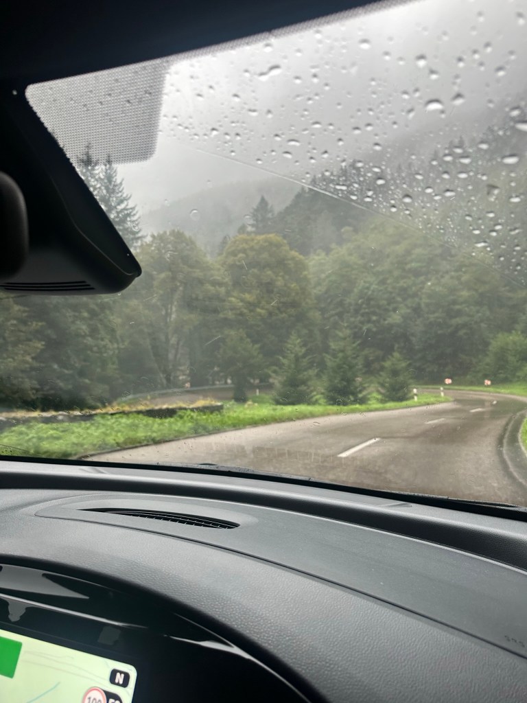
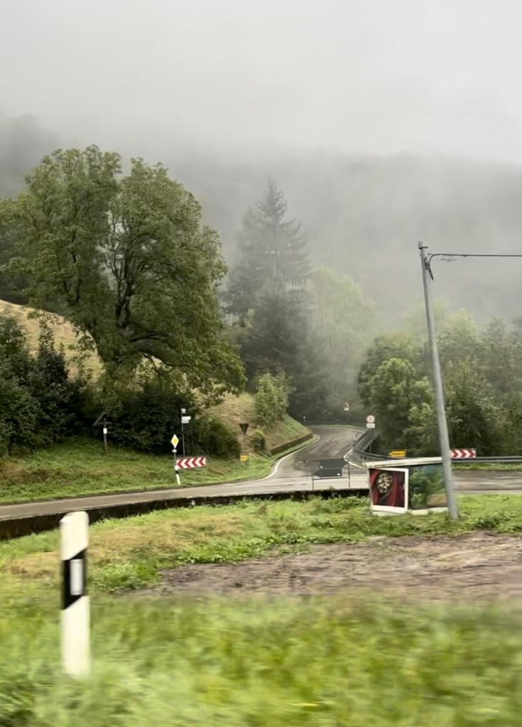
Scotland, Feb ’23: Ullapool, Lael Forest Garden, Corrieshalloch Gorge

Monday 6 February

Following the previous day’s unexpectedly adventurous excursion up Ben Wyvis, we indulged in a “rest day”. This meant exploring the area with no real agenda, so after a cup of coffee and a quick google we decided to head to Ullapool, a lochside fishing village 25 minutes northwest of our picturesque parking spot overlooking Loch Glascarnoch.

It was a fine day, although forecast to be windy up in the mountains, so we didn’t feel like we were missing out too much – particularly with Ryan’s ongoing (but thankfully improving) blister situation. The road to Ullapool was quiet and beautiful, carving through rugged hillsides carpeted in reddish heather and golden grass that glowed in the morning sun against a blue sky made wilder by smooth clouds that hung portentously over the dramatic, dark peaks and ridges of An Teallach mountain range straight ahead – another one high on the to do list. This was followed by a pretty drive along the bank of Loch Broom before arriving at the village, which is nestled on a low-lying promontory on the northern edge of the loch.

Ullapool

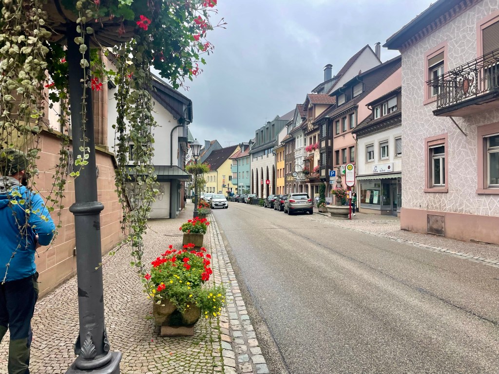
We parked at Tesco, which was just about the only indication (in a good way) that the village was connected to the rest of the world. A short walk through quiet, pretty, uniform streets took us to Ullapool Outdoors, a lovely independent shop where we picked up some stove gas and washing up liquid. From there we continued on to the water’s edge, which was lined by a row of whitewashed cottages overlooking a narrow, stony beach. We absorbed the tranquility as we wandered along the shore, skimming stones and marvelling like children at enormous mussel shells and seaweeds that clung to pebbles with masses of rubbery roots, all the while taking in the mountains that surrounded the loch. It was an utterly self-contained, other-worldly place.
We walked along the loch front past the ferry terminal, where a bustle of construction work was taking place, then popped into a country clothes shop, a charity shop, a small gallery and a delicatessen. We returned to the van with our bounty – a new jacket for Ryan, some charity shop clothes for me and a couple of rolls for lunch. We ate them overlooking the loch and left Ullapool feeling very tranquil.
Lael Forest Garden

Our next stop, just south of Loch Broom,  is perhaps best described as a living tree museum. Lael Forest Garden was founded in the 1870s by Victorian seed collectors who planted over 200 species from all around the world.

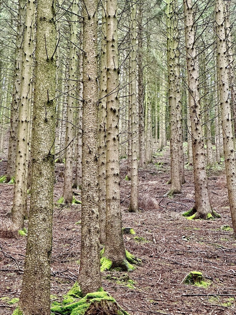
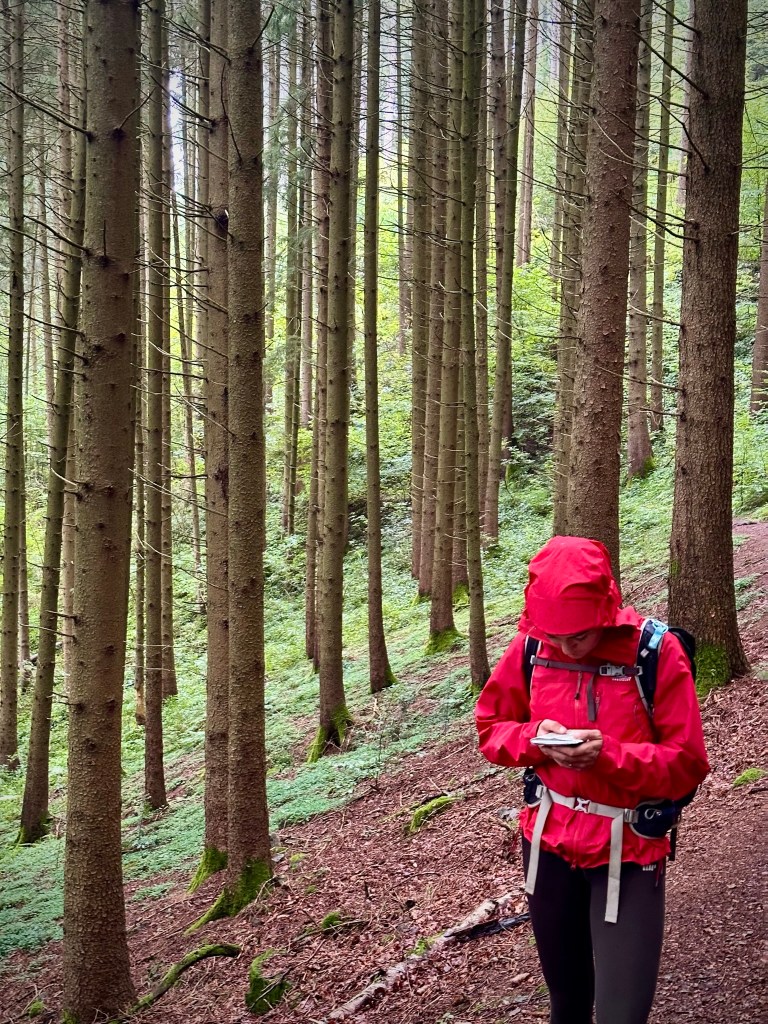
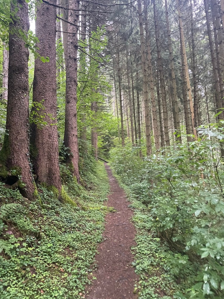
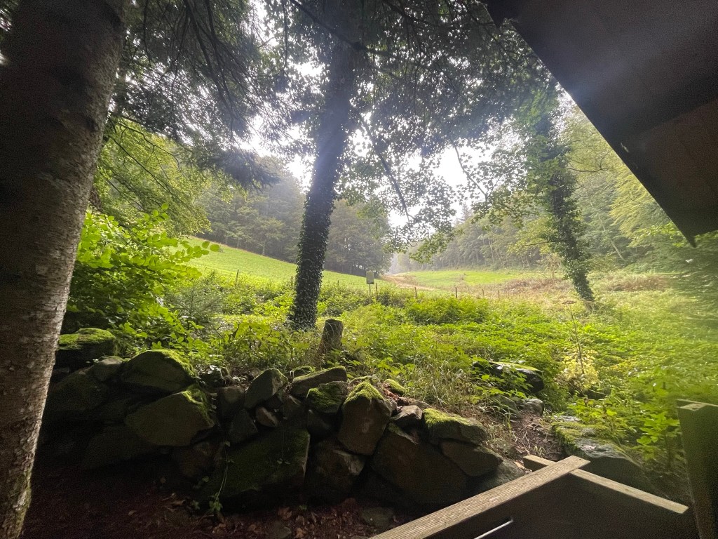
We pulled up in the small car park, entered through a gate and wandered the short trails, which showcased an interesting variety of trees and a wild, tumbling waterfall. Despite Scotland’s barely temperate winters the trees seemed to be thriving, perhaps because of their position up the steep eastern bank of a deep gorge. A personal highlight was the soft-barked sequoia redwoods, which – in their immense stillness – dwarfed everything else with a quiet, humbling majesty.
It only took half an hour to walk around in a loop, but there was nobody else around and that half hour felt very peaceful. I’d like to come back in spring or autumn.

Corrieshalloch Gorge & the Falls of Measach

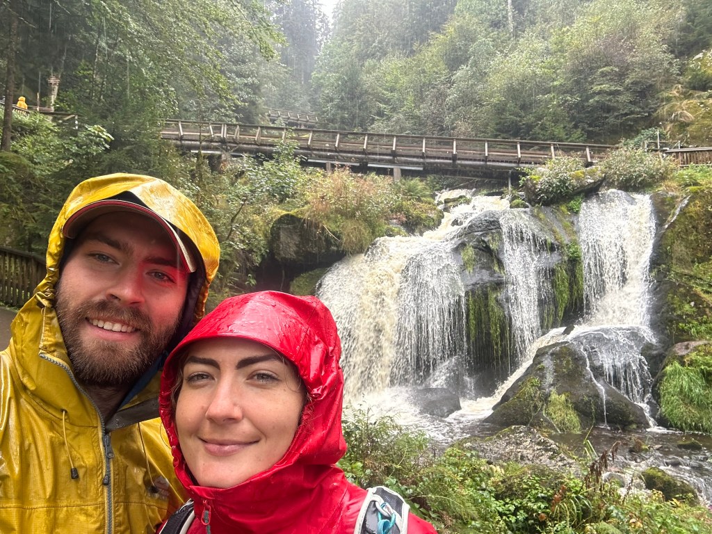
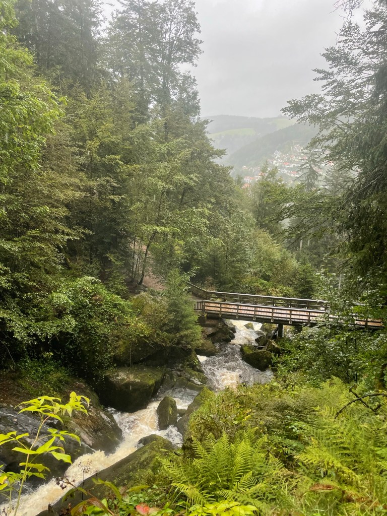
Our next stop was a few minutes’ drive south. Corrieshalloch Gorge is a narrow, sheer-sided cut in the landscape that was formed during the ice age by a strong river flowing beneath a glacier into Loch Broom. The path from the roadside car park took us down through woodland to a narrow, 25 metre long Victorian suspension bridge that spanned the deep gorge quite spectacularly and bounced slightly underfoot.

Looking down into the vertigo-inducing 60 metre chasm below was a memorable experience. A white river rushed urgently through a narrow channel at the base of the gorge, fed by what seemed an impossibly voluminous, 45 metre high waterfall – the impressive Falls of Measach. It was wild, beautiful and, with nothing but air between my feet and the rocky water way below, quite unnerving to consider the consequences if the bridge failed.

We crossed the gorge, nipped along to a protruding, equally vertiginous platform for a good view of the bridge and the waterfall – which seemed even bigger from a distance – then crossed back and walked along the wooded brink for about half a kilometre. The gorge’s dark, sheer rock walls were covered in mosses, lichens, shrubby little plants and – wherever their audacious roots could take hold – trees, which all seemed to thrive in their damp, inaccessible sanctuary.

The path curved back on itself as it climbed towards the car park, and as we rose above the lilac birch tops we enjoyed a stunning view of the valley at the northern end of the gorge, looking back towards Ullapool. Loch Broom appeared in the V, backed by heathery slopes, and in the foreground deep green forests sprawled over undulating, yellow-brown hillsides. The air was still and once again I felt uncommonly peaceful.

North West Coast

I can’t tolerate serenity for too long, so we formulated a plan to climb another mountain the next day. Ryan had researched Beinn Alligin in Torridon, so we set off from Corrieshalloch on a 70-mile journey southwest along the not-very-direct, but scenic, road that snaked down the remote, jagged northwest coast.

As I’d hoped, the road was quiet and afforded lovely views of wild mountains, dark lochs, clear blue sea and tiny, timeless villages. We stopped briefly at the coastal village of Gairloch for a token beach trip, where the sand was pale, fine and backed by grassy dunes, then – sufficiently wind-nipped – we returned to the van and continued on to the wilderness of vast Glen Torridon, where we’d previously had an epic day mountain biking the Torridon Loop. It almost felt like going home.

We drove a short way up the hill behind Torridon village to the Beinn Alligin car park, arriving about 6pm. Ryan cooked sausage pasta and we spent a couple of hours researching the mountain, then went to bed early in anticipation of a 6am start. Like I said, serenity doesn’t last long.

Mountain Leader Training: Part 2 of 2

Thursday: Scrambling in the Ogwen Valley

As if repentant for the previous day’s soaking, the weather looked to be dry and sunny – perfect for a day scrambling in the Ogwen Valley. After rushing back and forth to collect my gear from various locations around Capel Tanrallt, I bundled into Graeme’s van and spent the 45 minute journey interrogating him about a trip he’d taken to Greenland.

The route became very scenic as we entered the sweeping Nant Ffrancon valley from Bethesda. Rugged hills rose upwards either side of us and a wide, meandering river snaked between lush green fields along the broad base of the valley. The anticipation of approach grew with the mountains and reached its pinnacle as we rounded a corner into the long Ogwen Valley, which sits between the towering, lumpy Carneddau range and the set-back Glyderau, whose dark, jagged faces – although now quite familiar – never lose their ominous, tantalising mystery. After a short drive along the bank of Llyn Ogwen, we met the others in a roadside car park and walked to the little National Trust centre by Ogwen Cottage.

Lou met us there just after 9am, delivered the sad news that Geoff had developed a cold so couldn’t make it, and introduced us to Dave, who would be in charge of the other group for the day. She then went over some scrambling “theory”, which covered what equipment to take and key considerations when leading a group. We split into our two groups of six and headed up towards Llyn Idwal, with Lou taking charge of my group.

Testing the Group

The walk up to Idwal was as scenic as ever. The great, craggy ridge of the Glyderau towered in a great silhouette over undulating, rugged moraines carpeted in swathes of sandy grass, clumps of heather and a hectic array of boulders, and the morning sun – which hung low in the gap between Tryfan and Bristly Ridge – accentuated the darkness of the mountains against the warm, golden glow of the moors. On the way up we stopped several times at different boulders for little lessons on leading a scrambling group, which I summarise as follows:

  •  Before committing to a route, assess each individual’s ability on technical terrain by watching them move up and over steep-angled, low-level boulders, giving pointers on technique where appropriate
  • Help others on difficult moves by holding their heel and pushing their foot into the rock at a 90 degree angle
  • “Spot” others on steep or insecure sections by standing below them, feet wide, hands out and elbows bent, ready to control their direction of fall in the event of a slip
  • Use games such as “the floor is lava” (a personal favourite in all situations) combined with “race to the lake” to determine the more and less confident members of a group on rocky ground

After lots of practice on various boulders near the path, we reached glassy Llyn Idwal via a floor is lava race, in which Darren indiscriminately charged through the rest of us scattering bodies as he went. This hanging lake is elevated in an atmospheric glacial cwm and has its own fittingly charming (if slightly melancholic) legend, which Lou conveyed very well – we were captivated.

Idwal Legend

Prince Idwal was the much-loved and widely talented grandson of an ancient Welsh king, who was taken to the lake one day by his jealous cousin. His cousin, knowing that the prince could do everything except swim, pushed him in. The prince drowned, the lake was given his name, and to this day no bird will fly over the lake’s surface as a mark of respect.

After scrutinising the sky above Llyn Idwal for signs of avian passage to no avail, we accepted the legend as fact and stopped for “first lunch” (a unanimously celebrated concept) on the eastern side of the lake. As we ate we took in the great cwm, whose vast, craggy faces towered menacingly above us on three sides. On the far side the sinister, black cleft of the Devil’s Kitchen loomed high above the water; mist often emanates from that rocky chasm and drifts around the bowl-like cwm, which means the Devil is cooking – another fact, although harder to verify. Today was clear, and the only mist in sight came as steam from my thermos of interminable stew.

Leading a Scramble

First lunch finished, we walked to the south-eastern end of the lake and stood by Idwal Slabs, which I’d climbed the previous year. We were to scramble up Senior’s Gully, a grade I route that follows a blocky channel up the northern side of Glyder Fawr. We set off upwards and Lou demonstrated how to lead a group scramble. From memory, the notable points were:

  • Choose the safest-looking route, taking into account difficulty, protectability and consequence, but allow confident group members to pick their own route within reason
  • As a leader, station yourself at the crux of difficult sections in a place where you can help group members without getting in the way
  • Help others on technical moves by spotting, holding their boots into the wall and steering them in the right direction by holding their rucksack
  • Ensure you can communicate with (and ideally see) the whole group at all times by staying within calling distance and letting everyone catch up before rounding corners
  • Position stronger group members next to less confident members so they can provide assistance, and place a stronger member at the back of the group

Senior’s Gully

The gully was fairly “technically” easy, with an abundance of good holds and grassy, heathery ledges, a relatively shallow gradient (for a gully) and just a couple of trickier moves up slabs, but although solid the rock was quite wet, which made it slippery and slowed us down significantly. It did, however, mean that we had plenty of practice helping others up the more technical moves, as water dampens confidence as well as rock.

We took turns leading and found that there was significantly more to think about on-the-spot than when leading a hike. Visibility of the gully ahead was often limited to just the next few moves, so the safest route wasn’t always obvious, and it was quite tricky focusing on personal safety, route choice and the rest of the group at the same time. I also found it quite hard to determine the best place to stop and assist others, having never really scrambled with anyone other than Ryan, who is so absurdly confident that I never really think about him.

We reached the top just after 3pm, a couple of hours after setting off upwards. We had second lunch at the edge of the Nameless Cwm, which isn’t actually nameless as it’s called Cwm Cneifion. Google reckons this means “cwm of the tufts of sheared wool” – I prefer the more mysterious (and more pronounceable) title. I celebrated the long-awaited final mouthful of stew and watched enviously as a couple of climbers made their way up Cneifion Arete. After pinpointing our location on the map (we were never safe from nav practice) we started the descent down the steep, winding path that takes a diagonal line down the western flank of Y Gribin.

We wound down the side of the grassy ridge, chatting away and making plans to go to the pub. We reached Llyn Idwal and returned to Ogwen Cottage area on the slabby path we’d walked in, coincidentally meeting the other group right at the end. Lou debriefed our group, which was really helpful as it cemented in everything we’d covered, and we returned to the cars in great anticipation of a good pub meal.

Evening

All twelve of us reconvened in the Black Boy at Caernarfon, a large, quirky, charmingly old-fashioned and necessarily haunted pub set within surprisingly intact, battlemented castle walls. We took two six-seater tables and most of us tucked into a hearty pie and pint, which was too much for Darren, who completely lost all decorum in a mad giggling fit just as the waitress came over – I can’t remember why but it was at Jack’s expense. The merriment continued in Connie’s car and back at the chapel, where Jack produced an elaborate cheeseboard and we celebrated the week over a few drinks with the help of an 80’s classics playlist. I wasn’t ready to leave the following morning, both literally and emotionally.

Friday: Expedition up Yr Aran, Wild camp, Night navigation

After a mad morning doing all the packing I should have done the night before instead of eating cheese and drinking wine, I loaded all my gear into poor Scabbers and – with great sadness – left Capel Tanrallt for the last time. After a relatively dismal 25 minute drive along narrow, winding roads, rain pounding the windscreen the whole way, we all met at Caffi Gwynant, a cosy, elegant converted-chapel-come-cafe nestled in the Nant Gwynant valley.

We had our fill of sausage sandwiches and coffee, then met Lou and Smyrff (the other instructor) in the courtyard for an expedition brief. We were to hike up Yr Aran via a set but undisclosed route, taking it in turns to navigate legs individually using a 1:50,000 scale map. Then we would hike to an overnight camp spot, pitch our tents, spend the evening doing a night navigation exercise and return to the cars the next morning.

Morning: wet, windy & very nearly miserable

We set off towards Snowdon on the Watkin path just after 11am. The first section took us gently uphill along the edge of an old broadleaf wood, overlooking the increasingly scenic Nant Gwynant valley, which was green, lush and flanked by thickly forested hillsides set beneath high, oddly lumpy ridges. We were bemused to spot an alpaca chewing nonchalantly among sheep in a clump of copper-coloured bracken, and Darren – who was leading this leg – talked us through the seven S’s of camouflage, which are useful to consider if you need to attract (or avoid) attention in the mountains: shape, silhouette, sound, shadow, shade, shine and speed (movement).

We reached the Afon Cwm Llan after a kilometre and continued on the Watkin path, which ran parallel to the river and climbed steadily up a wide valley. Trees no longer shielded us from the weather and I felt sorry for Mohan, who led this section through torrential rain and relentless wind. Thankfully the scenery was stunning despite the grim sky. The river cut a snaking channel down from Cwm Tregalen ahead, whose towering walls loomed high in the distance, and carved between the sloping sides of Y Lliwedd, Allt Maenderyn and Yr Aran. The water plunged downwards in several places via rushing falls, which were so white they seemed to emit light amongst the swathes of russet-coloured bracken, yellow-green grass and fading early autumn trees.

We rounded a craggy corner and turned left off the Watkin Path onto the Cambrian Way, which was slightly sheltered thanks to Yr Aran’s bulky presence. Connie took the lead and (being a doctor) gave a very useful crash course in first aid, which kept us entertained during a long, steady slog up the side of Snowdon’s south ridge. As we climbed, Lou pointed out a disused slate quarry across the valley, which consisted of some ruined buildings, spoil heaps and great slate terraces forming large platforms up the lower reaches of Y Lliwedd. The steady chatter fortified our collective mood against the miserable weather.

The weather breaks

We stopped for first lunch just below the col between Yr Aran and Snowdon’s south ridge, then tramped up its slippery, slatey side to receive a hearty battering from the wind. We left the path and Jack navigated us south along the rugged crest to a small mound, at which point the rain finally abated and the sun cast an ethereal, entirely unexpected golden glow over the landscape, which now revealed itself as a vast, wild sprawl of lumpy ridges and irregular summits. Old slate works formed a strangely industrial foreground, spread across the flattish area by the col, and the Nantlle Ridge stretched out along the western horizon, its green flanks now bathed in low sunlight above the wide Beddgelert valley. Accordingly, we all took a sudden interest in photography:

Yr Aran

My turn to navigate was spent leading the group down the awkward back of the mound, over a wall, through a bog and up the steep north side of Yr Aran. The others had all given interesting talks on relevant subjects while navigating, which I failed to match with my sermon on the ecological importance of peat bogs. In an attempt to be more interesting I mentioned that George Mallory, the Everest pioneer, trained for the Himalayas on the craggy northeastern side of Y Lliwedd, the vast ridge over to our left. Having exhausted my reserves of tenuously relevant knowledge, I tramped up the mountain with the others trailing behind.

We had second lunch on Yr Aran’s sheltered eastern face, which provided a lovely view of Snowdon under a newly blue sky scattered with pale clouds. We all watched amusedly while Graeme instigated a conversation between a phone recording of a raven and a real raven, which had materialised at the rustle of a bag of jelly babies. Once the croaking had concluded we continued up and over the mountain’s symmetrical top, where I managed to miss the remains of an RAF helicopter that caught fire after an emergency landing a few years ago. Graeme then led us down the western side, a long, grassy ridge, stopping at intervals to crush my peat bog lecture with interactive dissections of fox poo and/or owl pellets, one of which contained the unmistakeable shell of a species we’d learnt to identify while on the Nantlle Ridge hike – the violet ground beetle, which glinted in the afternoon sun.

To camp

Having navigated only a short leg, Lou gave me the cruel job of getting us to a specific, indistinct point on the northwestern slope of Yr Aran. In the absence of features and paths I could only use a bearing, pacing and contours, so was relatively satisfied to be only a few metres out on arrival. After a bit more bogtrotting we rejoined a path and returned to the slate-strewn col, where old spoil heaps, walls and ruins lay vast and still in the hazy, waning light, looking serene and wistful in their abandonment.

We crossed the col and dipped back down the other side, then followed Mohan along a vague path along the base of Snowdon’s south ridge for about a kilometre. We stopped at a flattish grassy area nestled between the hillsides of Cwm Tregalan, which towered above our camp spot on three sides, and busied ourselves by erecting tents, offloading sleeping bags and preparing dinner. Jack joined me while I munched boil in a bag chicken and rice, gave me half his hot chocolate and was unshaken by everyone’s relentless teasing: by sharing Connie’s tent and my jetboil, he’d achieved what was deemed a “lightweight hike” and concluded, quite rightly I suppose, that he’d simply “taken initiative”.

Night nav

Our preparations for a night navigation exercise were interrupted by the arrival of a poorly-looking lamb, which stood very close to Lou’s tent, swaying slightly, and seemed quite unaware of its surroundings. It looked a little forlorn but otherwise happy enough, but it clearly wasn’t well, so Lou texted a local farmer to arrange for its collection. Once this minor drama had been seen to we partnered up and set off in the dark, taking it in turns to lead short but time-consuming legs across the rugged terrain.

Jack and Darren led the first leg downhill, across a stream and to a small stone sheepfold, while the rest of us followed by taking a bearing off the leaders each time they changed direction and counting paces. This was slow and difficult on the rough ground, but it was quite exciting hiking in pitch dark and we were thankful for the lack of wind and meaningful rain (drizzle doesn’t count in Wales). Connie and I took over, took a bearing to a stream then handrailed it up a steep bank, helpfully advising the others not to fall in. We reached our destination – a featureless point on a small hill, denoted by the curve of a contour – using a bearing and pacing, and remarked how different the landscape seemed in the dark. Using contours as visual features was almost useless, as each tiny mound seemed extremely large without the context of its surroundings. This was the key thing I took away from the exercise – focus on bearings and pacing.

Mohan and Graeme led the final leg across undulating mounds and we bumped into the other group, a cluster of headtorches and cheery voices, just before returning to camp. I scouted round for the lamb but it was nowhere to be seen, so – hoping that the farmer would come and look for it early in the morning – we inspected each others’ tents. I admired Darren’s two porches, while he described mine as “palatial”, and I inwardly added “smaller tent” to my shopping list before heading to bed. I certainly do not need a new tent.

Saturday: Return, River Crossings, Debrief

After a good night’s sleep (the rain only woke me once) we were all breakfasted, packed and ready to leave by 8. Gold-lined clouds sat low above the distant hill that spanned the V of our valley as the sun crept above the horizon, making for a spectacular start to our final day. We hiked down the rugged slope for a kilometre, commenting on how near the features from the night nav seemed in daylight, and I quizzed Graeme on the merits of sphagnum moss while Connie recited the lichens she’d learnt.

Back on the Watkin path, the river rushed vigorously alongside us and we passed a small weir which Lou explained forms part of a local hydroelectric scheme (I think these should be widely endorsed). Lou then diverted the conversation back to the ML syllabus and we discussed campcraft, which encompasses various considerations around taking a group on a multi-day expedition such as hygiene, safety, cooking, equipment and environmental impact. Then, just as I was reading an information board about the Watkin Path being the first official footpath in Britain, Lou’s friend the farmer appeared on a quad bike on his way up to search for our poorly lamb, to everyone’s relief. He later reported that it had been found and collected.

By the time we descended into the pretty broadleaf wood we’d passed the previous day, people had started up Snowdon in droves and I was glad for the relatively quiet experience we’d had up Yr Aran. We emerged onto the Nantgwynant Valley road and saw that the laybys we’d parked in were now full, being a dry Saturday morning. With the expedition over, we crossed the road and commenced our final practical exercise of the week – river crossings.

River crossings and emergencies

We found the other group knee-deep in the wide, relatively shallow Afon Glaslyn and made our preparations to get wet. I thought I’d experiment by tying a spare bootlace tight around the top of my waterproof socks, outside my waterproof trousers, to see if my feet stayed dry (they did not). As Glyn led the other group across the river in a loud, military fashion, Lou talked us through how to deal with emergencies in the mountains, useful phone apps/services and demonstrated how to evacuate casualties using firstly a group shelter, then a jacket and hiking poles. After parading each other around on makeshift stretchers, we practised several methods of crossing rivers in a group – I’ll attempt to summarise what we learnt:

  • Choose the safest looking place to cross, taking into account the depth and speed of flow
  • Face upstream, maintain a wide, stable stance and walk sideways like a crab
  • Straight line: the group crosses together in a line facing upstream, one behind the other, holding on to each others’ shoulders/rucksacks. The leading person creates an eddy that protects the others from the brunt of the flow
  • Wedge: the strongest person forms the apex of a wedge and the others form a triangle behind them, all holding onto each other. The smallest/weakest people at the back are protected by an eddy and the group moves sideways together
  • Chain: the group spans the width of the river, holding on to each others arms/bags, and the last person moves from one end of the chain to the other by passing behind the line of people, taking it in turns to move one at a time until the chain reaches the opposite bank

With that done, we wobbled and giggled our way out of the water and back to the cars, wet to the knees, and drove in a loose convoy to Llanberis via the winding Nantgwynant valley road and the ever-scenic Llanberis Pass. I parked by Llyn Padarn and joined some of the others for a coffee and sausage roll in a little café, then we made our way to the previously visited Y Festri village hall.

Conclusion

The final session covered how to record Quality Mountain Days (40 of which are required to pass the assessment) on the online database, QMD requirements, how to navigate the training portal and useful learning resources. Lou gave us feedback and we all parted, slowly and reluctantly, with many promises to meet up for catch ups and QMDs in the near future. Llanberis’s colourful high street seemed uncharacteristically gloomy on leaving Y Festri and I set off on my drive home at 2:30pm, keenly feeling the quiet dullness of unaccustomed solitude after the constant camaraderie of the course.

To conclude, I had an incredibly enjoyable and memorable week making new friends and learning an abundance of new skills. Our group became quite tight in just a few days and we remain in contact – in November I met some of the others in the Brecon Beacons for a lovely hike, and the group chat still pops up fairly regularly. Having already spent a fair amount of time in the mountains, I was amazed at the depth of the syllabus, the variety of useful skills I learnt, and the knowledge imparted by the course instructors – for example, I never expected to come away able to identify an arsenal of plants, mosses and lichens. I plan to book the assessment within the next year or so, but in the meantime I’ll be off to the mountains again – now (hopefully) with corresponding competence and confidence!

Croatia 2023: Plitvice Lakes National Park

Disclaimer: Strap in – this was a difficult, lengthy post to write as I wanted to do justice to the intricacy and other-worldly beauty of Plitvice. Please excuse my rambling descriptions, inclusion of utterly unpronounceable names and repetitive variations of “blue”, “green” and “clear”…

Wednesday 5 July

After researching Plitvice Lakes, we’d initially decided that 40€ each was too much to pay to visit a National Park. However, I’d seen some photos and the seed had been planted, which meant (as it always does) that I’d inevitably reverse that decision. I decided to treat us to the trip on the conditions that Ryan a) get up early, and b) drive us there without damaging the rental car.

The journey

We were on our way by 6am. The 1h40 journey was traffic-free, which was just what Ryan needed to get used to driving on the “wrong” side of the road. We joined the tunnel-ridden E71 motorway shortly after leaving still, peaceful Starigrad, nestled between the Paklenica mountains and an inlet of the Adriatic sea, and entered Lika-Senj County to the north, which was – to our mild surprise – shrouded in early morning fog.

We arrived at Plitvice at 7:30am, parked very carefully at Entrance 1 and made our way to the chalet-style ticket office. There was already a long-ish queue and I was concerned that having made the journey without booking, we’d come across some issue that would prevent our visit. My foreboding was not unwarranted as the card machine didn’t like my bank card, but luckily a different card worked and we received tickets after an anxious few minutes.

We passed through the entrance and went straight to the information boards showing seven waymarked hiking routes, which I’d already researched online. We naturally picked the longest, an 18km trail that circumnavigates nearly all the lakes and cuts out the land trains and electric boats (bar one) that shortcut around the park. Having photographed the board, we wandered over to the start of the trail and were instantly blown away by the landscape.

Lower Lakes:  Veliki Slap waterfall to Milanovac

If we’d have been in a cartoon, our jaws would have hit the floor. A vast limestone valley opened up below us, pale rock walls rising from large pools that were bluer than blue and so clear that we could see the bottom from our high vantage point. These pools were set at different levels, and fell into each other via multitudinous cascades that tumbled as vertical columns of pure white water so bright that they seemed to emit light. A forest of the lushest, most brilliant green covered every inch of land that wasn’t rock or water, almost glowing, and across the valley the highest waterfall, Veliki Slap, dropped out of the trees at eye-level and disappeared behind a vegetation-covered, natural limestone dam, which held the torrent back from a series of small, tiered, turquoise pools set low in the basin. A distant mountain ridge stretched hazily across the horizon, just visible above the forested valley side, beneath clouds of white and lilac-grey interspersed by occasional blue patches. It was as if the sky, in deference, reflected the land.

We followed the handrailed, switchback walkway down the side of the valley, feeling as though we were dropping into a real life Avatar set. It was already getting busy so we were keen to see Veliki Slap, “Big Waterfall”, before the crowds descended. The lakes grew in size and clarity as we approached from above and looked impossibly, almost unnaturally blue. We reached a rustic (but solid) boardwalk across the water between Novakovića brod lake, which was level with us, and the Korana river, which was set low in the valley and fed by an abundance of falls bursting improbably from invisible sources concealed by leafy vegetation. We wandered along this boardwalk marvelling at everything: the lakes, the falls and the incredible variety of water grasses and leafy plants on either side of us. It was impossibly beautiful.

The boardwalk snaked around a sheer limestone face to Veliki Slap, a 78-metre high column of water surrounded by tens of narrower, only slightly shorter falls. It was utterly magnificent: I wondered how there was enough water on Earth to feed this powerful, constant giant, which erupted from the clifftop treeline high above. Once we’d gazed in sufficient awe we snapped a couple of photos and returned to the boardwalk, aiming to break away from the growing number of tourists collecting at the base of the unimaginatively but accurately named Big Waterfall.

We followed the boardwalk along the western side of Kaluđerovac lake, still awestruck by the water, and crossed a low limestone barrier between tiered pools to a path along the eastern side. The shallows were gin clear, melting to translucent turquoise and almost opaque blue-green in the middle as the lakes deepened. Fish basked nonchalantly in the open water, and the perfectly flat surface reflected pale rock walls and green forest across the valley.

The path bordered Gavanovac and Milanovac lakes under a leafy canopy and we walked past several tantalising, dark caves set into pale limestone walls on either side of the valley. The number of visitors had dwindled, as we’d predicted, and after a kilometre we crossed another low dam via a boardwalk over shallows brimming with vegetation. Wide, multi-columned Slapovi Milke Trnine and Milanovači Slap waterfalls rushed out of these shallows below us, connecting great Kozjack lake to its smaller sister Milanovac about six metres below, and I was in awe at how the rock held these vast waters back from each other.

Upper Lakes: Kozjak to forest trail

We followed the edge of enormous, irregularly shaped Kozjak to a large visitor area containing dozens of picnic tables, wooden food kiosks, a gift shop, toilet block and the first boat station, where tens of people queued to cross the lake. Happy not to join this rush, we continued along the western edge for a couple of kilometres, snaking round the lake’s undulating border through the fringe of a rich beech forest. We drank in the quiet serenity of the flat water and almost overwhelming brightness of the blues and greens, feeling utterly content now that there was nobody else around, save for the occasional pair of other visitors looking to experience the place in solitude.

The path climbed a short way into the trees, affording stunning views over Kozjak, which – now that the sun had emerged – was a perfect mirror of the verdant forest on the opposite bank. I was amazed by the biodiversity of the woodland, where all kinds of low plants, shrubs and fungi covered the floor beneath a glowing canopy. We had a good view of thickly forested Štefanijin otok, the park’s sole small island, before finding another waterfall about eight metres in height and width tucked away – somehow subtly – in a leafy corner.

We climbed a set of stone steps up into the forest, then walked down a bank and found the ferry dock, where most visitors disembarked having caught the boat across Kozjak. We had a minor disagreement over which way to go – I was keen to continue on Route K but Ryan was concerned that we’d miss out on the waterfalls, so wanted to go with the throng along the low path by Burgeti lake. I conceded at first but after about a hundred metres became stressed by the influx of slow-walking people constantly stopping for photos, so – to Ryan’s initial chagrin, but eventual approval – we turned back, climbed the wooded bank above the busy path and continued on a quiet, sun-dappled trail beneath towering, impossibly green trees.

Upper Lakes: Forest trail to Okrugljak

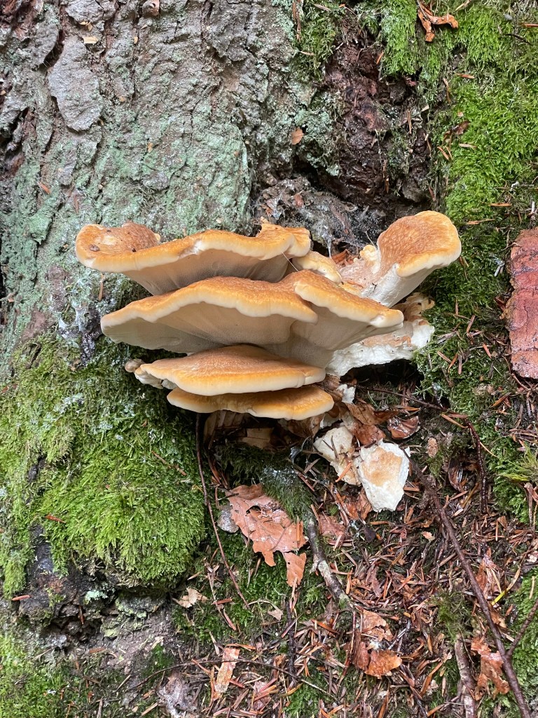
After a short way we came to a clearing and looked down across the glassy blue water of lagoon-like Gradinsko lake to Veliki Prštavac, the second highest fall in the park, which formed a wide series of white pillars erupting from the forest above. To call it a fairytale scene wouldn’t do it justice. The path then continued for a few kilometres under a high beech canopy that covered a steep bank overlooking a multitude of smaller lakes, which formed a watery patchwork that filled the valley floor, separated by snaking, leafy rock barriers. I was looking out enthusiastically for grizzly bears, featured in the National Park’s logo, but (to my disappointment) was only successful in spotting some large bracket fungi and some pretty nine-spotted moths:

Any remaining sourness from our disagreement dissipated the minute we emerged at another clearing, where the path turned sharply left before descending to the popular trails. We gazed over the blue glass of lake Ciginovac, surrounded by rising green forests, and above it, the vast, hanging lake of Prošćansko – almost as big as Kozjak, and just as irregularly shaped – whose mirrored surface shone into the sky, the unimaginable weight of water impossibly suspended by a steadfast limestone dam. It was as if the rock stoically kept the lakes in check, permitting water to move between levels via numerous regulated falls, but had no control over the vegetation, which spread on all but its most vertical surfaces and encroached in the shallows as if showing off its leafy mastery of the landscape.* I pointed out to Ryan, blissfully aware of my capacity to irritate, that we’d never have seen Prošćansko on the popular trails. I think he forgave me.

*This later made sense, on learning about the formation of tufa barriers – no spoilers here, you’ll have to read on

We wandered down the hill through more forest, paused at a viewpoint over three of the little patchwork lakes to admire more falls bursting from various treelines, took a couple of switchback turns and emerged back onto the tourist route by the edge of Okrugljak lake, where we rejoined the steady flow of visitors.

Upper Lakes: Okrugljak to Galovac

Another curving, handrailed boardwalk granted passage across the green strip of vegetation between small, bright blue Veliko jezero and Batinovac lakes, and I was delighted to see a two-foot long brown snake zipping effortlessly through the clear shallows in a graceful S-shape between roots and reeds.

Having crossed the water, a path took us slightly away from the azure lakes into a rainforest-like area of woodland, then north along the eastern side of Galovac, where an information board taught us how the limestone dams between water levels are actually called “tufas”. They are formed by a gradual build-up of calcium carbonate deposits from moss, invertebrates, bacteria and the blue-green algae that give the water its bright blue colour. These barriers are estimated to be 6,000-7,000 years old and grow at an average rate of 13.5mm per year. It was as if the science behind the landscape was necessarily explained to convince visitors of its reality.

Water tumbled in tens of narrow pillars down the tufa at the head of Galovac, its vertical course replicated by green columns of grass and moss that hung over the side of the dam. Yellow, pink and purple wildflowers climbed the tall, grassy bank below the forest edge, and fallen trees below the water’s surface accentuated its blue clarity, the long forms of their majestic trunks fully visible as they stretched far from the bank. We skirted along the edge of the lake, passing a photogenic trio of goosanders (it was strange to see a UK-dwelling bird in this exotic place), and stopped for our customary holiday lunch of highly processed ham and cheese sandwiches on a fallen tree trunk just off the path, overlooking an irresistible little lagoon.

Veliki Prštavac waterfall and Upper Lakes: Galovac to Kozjak

We didn’t hang around for too long, noting the presence of several large ants, before continuing past the gin clear shallows at the northern end of Galovac. The path took us through a wooded area between lakes, past another high, grassy waterfall and down a steep bank onto a busy, snaking boardwalk between Galovac and Gradinsko, where completely colourless water flowed steadily beneath our feet. We ambled along at the slow pace of the single-file line, approaching the base of 28-metre high Veliki Prštavac, which we’d seen earlier from high in the forest. It had looked quite tranquil from a distance, but proximity betrayed its intensity as white water rushed urgently in a wide, multi-columned wall into the pool below, its fine spray relieving us of the hot sun. Again, vegetation was everywhere: trees grew above the falls, grasses hung low over the edge of the barrier, mosses concealed every inch of rock and rhubarb-leaved water plants (I’m a poor botanist) crammed the edges of clear pools.

We passed a small crowd taking photos of the waterfall and continued on the boardwalk, which twisted tightly between several small, clear pools lined by reeds and slim, pale-trunked trees. Numerous falls poured from forest-topped tufas thick with hanging, trickling grasses and opportunistic shrubs, bursting from every nook and cranny that would take a root, and every inch of ground was covered by what seemed like a hundred different plant species. It was fascinating, and I wished desperately (despite the in-fittingly rustic boardwalk) that I could have seen the park before the age of tourism and slipped into its cool, clear, blue-green waters.

We wandered through this surreal, intensely detailed, prehistoric oasis until the boardwalk straightened along the edge of Gradinsko. A path took us through verdant pine and beech forest to the boat station at the southern end of Kozjak, and after a short wait we boarded and sat at the front of the electric boat as it carved smoothly across a narrow section of the lake past Štefanijin otok island to the eastern bank.

Return from Kozjak

After a quick loo break at a chalet-style café, we set off north on the quiet, shady path back to the park entrance. This trail hugged the eastern edge of the lake, and on clambering onto an overhanging tree for a terribly touristy photo, I – to Ryan’s great amusement – very nearly overbalanced and fell in. I dismounted quickly, muttering something about how a rucksack affects balance, and we continued on the final 4km stretch. Highlights of this last section include a dice snake slithering through the water a couple of feet away from us, more fallen trees emphasising the clarity of the lake, which shelved steeply on this side, and stunning views of waterfall-backed, dazzling blue depths as we climbed into the leafy forest above Milanovac, Gavanovac and Kaluđerovac on a high path parallel to the lakeside route we’d taken that morning.

We reached a viewpoint overlooking the curving boardwalk that crosses the pale turquoise water to Veliki Slap, which was now suffused with a long, moving string of ant-like people. This vantage point gave us a new perspective over the tiered series of green-and-white-dammed lakes stretching up the valley, and it seemed impossible that the high, pale limestone walls on the opposite bank could hold the weight of the immense leafy forest that climbed towards the sky like a long, green afro. Returning to the entrance above that first-described view of Veliki Slap was like being struck by déjà vu, or suddenly remembering a striking dream. I thought that if, even I’d looked over that verdant, rocky, watery basin a thousand times, I’d never not be awestruck.

We tore ourselves away from the view and after a quick peruse of the gift shop, we returned to the car. I expressed my disproportionate fury at paying for seven hours’ parking despite being just a couple of minutes over six, and we started the drive back to Starigrad at 1:30pm.

Journey back to Starigrad

On the return journey, we were astonished by the beautiful countryside that had been concealed by the morning’s fog. For some reason I’d thought the landscape would have been quite arid, but the lush fields, swathes of forest and abundance of shrubs and wildflowers revealed my naivety. Rolling hills and yellow-green meadows all around us were backed by the undulating, forest-covered Velebit mountains, which stretched in a wide panorama across the horizon ahead. Remote farm buildings were scattered thinly across the countryside and we drove past lots of quaint little roadside stalls selling homemade cheese and honey.

We passed through a couple of peaceful-looking villages containing stone churches, several hotels and large buildings painted pastel orange and yellow, guessing nervously at the uncertain speed limit. At the risk of sounding like a naïve British tourist (again), I thought it looked very “European”, not dissimilar to parts of France or Switzerland. We joined the motorway and cruised back to Starigrad, enjoying mountain views the whole way, Ryan’s driving confidence having soared to the point he was willing to overtake the occasional car and sing merrily (if poorly) as the road snaked into the now-familiar little town.

We picked up a couple of supplies from the supermarket and returned to the apartment, where we relaxed for a couple of hours, making the most of the air con. We had our customary dinner of cheap, tasty slop, this time a rudimentary paella with rice, fake sausage and tomato sauce, then headed into town for a swim.

Evening: sea swim and surprise street party

We walked all the way along the pretty seafront, past the market by the main quay, and stopped on a concrete block jutting into the water between small, stony beaches backed by a leafy walkway and a little seafront campsite. I swam around while Ryan watched a snorkeler collect clams and stash them on the beach under (presumably) his mother’s straw hat. The sun dropped into the sea at the foot of the dark, jagged Velebit ridge that stretched behind the town, casting a soft orange glow between the deep, textured blue of the water and the smooth pastel sky. It was indescribably tranquil.

When the sun disappeared, we walked up a quiet street past rustic stone and whitewashed houses, then headed back to the town centre via the main road. It was a very homely place: washing hung in colourful lines from the verandas of terracotta-rooved houses, small, cosy restaurants served pizza and seafood, children of all ages played football in a small, fenced sports court and people congregated in little groups on the pavement, laughing and smoking.

Back at the main quay, which we’d only seen quiet and still under a hot sun, we stumbled into what felt like a random, Wednesday night street festival. It was 9pm but the seafront was alive with lit-up stalls selling all kinds of peculiar little gifts and edible treats. Open-fronted restaurants served food and drink to tables that had popped up across the walkway and people milled around everywhere. We bought a curly fried potato on a stick, which was spicy, salty and greasy but in a delicious way, and listened to an excellent live band that had popped up on a small seafront stage. Children and adults danced to the music and people wandered around left, right and centre with ice creams, pushchairs and dogs on leads. We finally felt like we understood the culture, and it was so charming.

We’d have liked to stay all night, but had ambitious designs on the towering vertical face of Anića Kuk in Paklenica National Park the following day. It would be our first “big wall” climb and we knew that it’d require a good night’s sleep, so we left the party after half an hour. We returned to the apartment, packed our rucksacks and went to bed feeling a strange mix of extreme contentment after our wonderful day, and intense anticipation for what we knew was to follow – “an epic”.

Croatia 2023: Starigrad Paklenica, Mirila hike

Monday 3 July

Following the stress of preparing for our last minute holiday, it was blissful to wake up in our peaceful Croatian apartment with no urgent responsibilities. I did battle with the window blind and the coffee machine, two of my arch-nemeses (objects that I always struggle to operate, no matter the make/model), and ate cereal while Ryan worked on getting up.

Starigrad town

Our plan was to walk into central Starigrad on a reconnaissance mission – a term I used to help justify a relaxing day in this wild, exciting country – to gather information on the area and obtain a local map. We left the apartment at 9am and headed down the road towards the sea, drinking in everything about the place: the constant croaky hum of cicadas, the generously spaced out buildings, the variety of shrubs and trees, the clean streets and the hot sun. Most houses were painted white or cream, with red tiled rooves, verandas and shuttered windows. The gardens contained large, stone-chimneyed outdoor ovens, seating areas and abundant vegetable patches filled with all kinds of produce, and several residents had set up little stalls selling homemade jams, liqueurs, oils and home-grown fruit and veg. I was instantly sold on the place.

We walked past houses, campsites, cafes, supermarkets, restaurants and a petrol station, all lined up along the main E65 road through the long, narrow town, which is sandwiched between the Velebit mountains and a large inlet of the Adriatic Sea. On reaching the town centre we were drawn straight to the water, which was calm and impossibly clear. Little boats were moored in little quays and a small tourist market spread along the wide waterfront walkway, but – unlike other places we’ve visited – nobody tried to draw us in, despite our apparently obvious Englishness (throughout the week lots of people greeted us with “hello” rather than the Croatian “dobar dan”).

Remembering our mission, we peeled away from the inviting water and headed for the tourist information centre across the road. We picked up some leaflets and free maps, which we perused on a little wall outside. One of them described a 3-mile circular hike from Starigrad to the Mirila, a series of stone monuments in the Velebit foothills dedicated to the departed relatives of local people. I pitched the idea to Ryan, who must have inwardly rolled his eyes before agreeing.

Starigrad-Mirila hiking trail

We returned to the little market to buy a much-needed pair of sunglasses each, then headed up a peaceful, residential street to the start of the hike, examining the sun-drenched, productive, leafy gardens along the way. We followed a quiet road which climbed above the town, tried some not-quite-ripe fruit from a wild fig tree, and stopped at a viewpoint to gaze contentedly at the view. Orange rooves sprawled among lush trees, and we looked across the flat, blue water to the stretch of semi-arid mainland on the other side of the inlet. In, that moment, we knew that the hassle of travelling was well worthwhile.

We left the road and took a narrow gravel trail into the Velebit foothills and Paklenica National Park. It didn’t take long for me to regret – for once – wearing flip flops, as they became quite greasy under my hot feet and much of the route involved balancing across large, uneven boulders, but the karst limestone was too sharp to go barefoot. This, however, wasn’t my main concern: I was busy concentrating on not being bitten, having glimpsed a sandy brown snake (which I retrospectively identified as probably a balkan whip or aesculapian – both non-venomous) slither into a crevice a few metres away.

I struggled along, holding Ryan up for once, but I was far too happy to turn back. The way was marked by intermittent red paint on the rocks and required some careful route-finding – at one point we lost it in a boulderfield, so Ryan acted as scout while I examined a snakeskin and fended off a large hornet. We were keen not to stray as I’d read of unexploded land mines off the trails within Paklenica, but thankfully we regained the path and continued up the hill. I developed a snake-scaring tactic, which involved picking up handfuls of stones and tossing them onto the path a short way ahead to frighten off any lurking creatures prior to the arrival of my feet – this seemed to work, as apart from a few scratches I remained unscathed and unbitten.

After about a mile of this precarious fun we reached the mirila stones, which are set in a kind of basin between the hills of Mali Vitrenik and Veliki Vitrenik. This was our first taste of Paklenica’s beautiful wilderness: high, rounded hills of pale grey rock and dark green shrub dominated the landscape and the valley ahead of us brimmed with lush vegetation, filled with the ever-present buzz of cicadas. The bare, 350m vertical face of Anica Kuk instantly drew our attention, rising prominently above the valley and looking – from a climber’s point of view – both ominous and irresistible. We perceived (correctly, as we’d find out that coming Thursday) that Paklenica would become a very special place.

The stones themselves are small and so in-fitting that they could almost be missed among the textured, busy scenery. They were placed by the people of the mountain hamlets in the 17th to 20th centuries in memory of their loved ones, and the tradition was that the bodies must be carried there without stopping – a strenuous task – to greet the sun for the last time. Stone tablets were laid at the head and feet (the people must have been quite short), carved with various symbols, then the bodies were returned to local graveyards. It was believed that the souls of the deceased would remain at the site of the mirila, which the families visited more often than the actual graves.

There were several of these stones dotted around a small area, and I found the markings – mostly circles and crosses, some celtic-looking – mysterious and very interesting. It felt serene, poignant and strangely humbling, and I informed Ryan of my desire for a similar ritual in the event of my inevitable snake-induced demise.

After a thorough and respectful poke around we headed back down another rocky path towards Starigrad. I was interrupted during a “wild wee” (as my mum calls it) by the jingling of a large, multicoloured goatherd passing across the valley above us, led by a tanned, bare-chested man wielding a crook, the first person we’d seen since setting out on the mountain trail. The way down was otherwise uneventful and very pleasant, save for my continued struggle across rocks in sweaty flip flops, which I had to fix a few times after pulling the strap through the sole – this was very frustrating.

We were back on tarmac after about a mile, and as we walked through quiet streets we observed yet more thriving vegetable gardens thick with tomatoes, cucumbers, melons, grapevines and – strangely, I thought – cabbages. I was delighted to find a scarce swallowtail butterfly, retrospectively identified, basking on the street, with large, zebra-striped wings and two long tail points. We returned to the town centre and went straight to the sea for a dip.

First swim

The waterfront at Starigrad was unlike any I’ve seen. A wall stretched along the length of the perfect little town, with a 4-5 foot drop down to the clear, blue water, and the walkways were peppered with trees, flowers, benches and bins. Small, square concrete sections jutted into the sea at regular intervals, providing moorings for several boats, separated by slipways and little grey pebble beaches. Because the front was broken up in this way, it never felt too busy despite lots of people – mostly Croatians on holiday, it seemed – having set up inflatable mats (there was no sand) and towels.

We followed a wide walkway from the little tourist market to a small, empty beach between two mooring blocks and settled on the wall. Houses, a small restaurant and a pretty cream church were set back from the water on the other side of a quiet road, and I watched a young man on a moped cross himself as he rode past – the majority of Croatian people are Catholic.

I was in the sea within minutes and wore flip flops until it was deep enough to swim, as I’d read of painful sea urchins and noticed that children, paddleboarders and bobbers-around were all wearing water shoes. Once treading water I awkwardly fastened them to my bikini, then went exploring. The water was mild – a great relief in the 30 degree heat – and incredibly clear. Little fish shoaled and sniffed around, avoiding me, and I could see spiky urchins and squishy anemones among the pebbles at the bottom. Warm and cool currents came and went as I swam about, and I didn’t get far from the shore before it got too deep to see the bottom.

A balmy afternoon/evening

After my dip I munched crisps on the wall while Ryan bobbed around, then we headed back to the apartment via a little climbing shop, where I bought a map of Paklenica. We drank fruity cider and had an early dinner of sheep cheese ravioli (delicious), then sat out on the veranda and did our first real bit of holiday planning. We sprawled maps, leaflets and books across the table, ate slices of melon and came up with a rough itinerary for the rest of the trip.

In the evening we walked up the road towards the official entrance to Paklenica, which was just 15 minutes from our apartment. Its towering, lumpy rock faces loomed invitingly above the large houses on the outskirts of the town, where locals lounged on verandas as they watched the world go by and enjoyed the balmy air. A series of old stone buildings sat quaintly below the vast backdrop of the national park, the town’s final outpost before the great, rocky canyon that cleaves southern Paklenica in two, and people drank on a square of decking under a leafy tree. There was a lovely, quiet buzz of community where everybody seemed to spend the evening casually socialising outdoors, rather than tucked up in their homes.

We turned left onto a quiet, leafy road and returned to the seafront along attractive residential streets, noting again how spaced out the houses were – no greedy developers rubbed their hands together for a few square feet in this undefiled place. We stood on the sea wall and watched the sun dip behind smooth lilac clouds, then fall into the flat sea at the toe of a long, jagged mountain ridge that rose up high behind the town. In finding Starigrad, we’d stumbled across a little slice of paradise.

Croatia 2023: Travelling to Starigrad

Saturday 1 July

At the time of beginning this post (11 July), if you’d told me two weeks ago that we were about to spend a week in Croatia, I’d hardly have believed it. We found out on Friday 23 June that Ryan had managed to get annual leave for the first week of July and my work confirmed the following Wednesday. This was excellent news, as on Tuesday night we’d booked the cheapest flights we could find from Bournemouth airport – we were off to Zadar, Croatia, that coming Sunday.

We’d had minimal planning time as I was at a conference all week, but in the evenings we’d managed to book flights, accommodation and – with some difficulty – car hire. Ryan picked me up from Salisbury train station on Saturday afternoon and we rushed to Southampton to collect a Croatia climbing book from a friend and buy a pair of 60m half ropes, having discovered that Zadar County is a renowned destination for climbers. To say that packing was stressful is an understatement: the evening was spent – not without argument – trying to squeeze two 3kg ropes, a bunch of climbing equipment (the majority of which is metal), hiking gear and (minimal) clothing into our 20kg hold bag and two small cabin rucksacks.

Sunday 2 July

Our friend Cam picked us up at 9am and dropped us off at the airport, full of nervousness about the weight of the hold bag and size of the cabin bags. Fortunately both were fine, but on realising that I might have left a very much prohibited lighter in a pouch of hiking stuff, I spent the entire two-and-a-half hour flight expecting that our hold bag wouldn’t turn up in Croatia. After a stressful wait, we flew at 1pm, landed at 4:30 local time, and were immensely relieved when our bag appeared on the conveyor belt.

First impressions were good: towards the end of the flight I’d caught glimpses of multitudinous islands, azure sea and sprawling mountains from my aisle seat at the front of the plane, and Zadar airport was pleasantly tiny and clean. We sat on a grassy patch at the front of the airport as we waited until 6pm to pick up our hire car, and I spent the whole time marvelling at lizards, snails, bugs, moths, pine cones, cacti, flowery shrubs and long trains of large ants making their way up and down the pine trees that shaded us from the warm sun.

We picked up our pre-booked car at 6pm, and – although the rental man was very friendly – we were once again racked with anxiety at the revelation of having to put down a €1,100 deposit, at least some of which we’d lose in the event of anything happening to the brand new Renault Clio – even a tiny scratch – due to paying with a debit card. We were quite unlucky in this regard, as we were hard-pressed to find a hire place that accepted debit cards: I have a credit card but unfortunately my driving licence expired a couple of weeks before and I hadn’t yet been able to renew it thanks to DVLA’s hopeless systems, but Ryan only had a debit card, which meant we ended up paying about £100 more than if a) my licence was valid, or b) he had a credit card. I’m waffling on about this because it remains a sore subject. Lesson learnt: use a credit card in the driver’s name to hire cars abroad.

The 45 minute drive through rural Zadar County to Starigrad, the town where we were staying, would have been interesting and far more enjoyable if we weren’t reeling from the pressure of not damaging the car. Ryan had never driven on the “wrong” side of the road before and found it very strange at first, mainly getting the road positioning right – I found the same thing when I drove abroad for the first time in the Alps. Being so new and fancy, the car kept emitting beeps seemingly at random, which we later discovered was an indication that he was straying towards the lines at the edge of the road. Speed limit signs were few and far between, and for the first time in, I believe, his entire life, he welcomed some gentle back-seat driving.

We stopped at a supermarket on the way, parking as far from the entrance as possible in order to preserve the car. We were yet to realise how welcoming and friendly the Croatian people are, and felt very conspicuous and foreign among aisles of unfamiliar cheeses, meats and dry goods. We picked up some supplies, including fruit, pasta, bread, a kilogram of dubious-looking reformed sausage, cheap cheese, cheaper wine, frozen seafood risotto for that evening and crisps of an unidentifiable flavour, and continued our journey to Starigrad.

We arrived at our accommodation at 8pm and were greeted by our host, a smiling Croatian lady who barely spoke a word of English but welcomed us warmly, showed us into our apartment, taught me how to pronounce “hvala” (thank you) after I clearly failed miserably, indicated that an unlabelled glass bottle of thick, dark red liquid was a gift for us, then returned to the ground floor veranda where she’d been sitting out with her family. On her leaving, we decided that the liquid was a kind of cherry brandy. The apartment was perfect: a simple, clean bedroom with a little kitchen and bathroom in a family home, the first floor of which had been split into three apartments. It felt like an authentic stay in a Croatian house, with the added advantage of privacy – we were free to come and go as we pleased without disturbing anyone, as the first floor had its own staircase and veranda looking down onto the street below, which was quiet except for the constant trill of cicadas. With the car parked safely on the drive, we finally relaxed.

I cooked seafood risotto with chunks of the mysterious sausage for dinner and we crashed on the huge bed, exhausted by the stress of overcoming various travelling hurdles and relieved at the effectiveness of the room’s air conditioning unit. After the last minute planning, rushing around to collect climbing gear, packing stress, airport stress, lighter-in-bag concerns, car anxiety and anticipation of finding our accommodation as we’d hoped it to be, we could scarcely believe that we’d made it to Croatia. Our holiday had begun.

Girona, Spain: Exploring the City

7 July 2022

We decided to spend our first full day exploring the city after the fiasco we’d been through to get into Spain (read here). We left the room quite late, about 10.30am, and walked through the beautiful, quiet, cobbled streets of Old Town to the cathedral, which was barely 10 minutes from our apartment.

Cathedral

We wound through medieval stone streets, past a large round turret, under a huge arch and into a castle-like courtyard. Girona Cathedral loomed above us up a flight of about a hundred wide steps, a vast, majestic building with a clean-lined, simple shape but incredible intricacy in the stone details and carved figures that watch over the city. I could see why it was chosen as a set for Game of Thrones, with its perfectly preserved, timeless grandeur.

We climbed the stairs and paid for entry (€7 each), which included a free recorded audio tour – this turned out to be well worth doing. We entered the enormous, striking Gothic nave and learnt how it was the widest of its kind in the world: the architects had decided to forego the two columned aisles usually found on either side of a cathedral. An enormous wooden organ stood in the middle behind models of the cathedral’s development, and the edges were lined with 28 different chapels dedicated to saints. They all had unique stories and contained varying styles of carving, painting and sculpture, some dramatically ornate and some strikingly simple.

After about 45 minutes walking around the nave listening to the audio tour, we went through to the cloisters, the columned walk that encloses a grassy outdoor courtyard on all four sides. My favourite part was the several wide columns pointed out by the audio guide, each of which were engraved with 360 degree carvings telling biblical stories. We went up some stone stairs into a room featuring pieces of stained glass from different periods, then back down and out of the cloisters into the tapestried, chandeliered Chapel of Hope, where the lavish, gold-gilded “bed of the Assumption of Mary” sat under a high-ceilinged tower.

The last bit took us into the cathedral treasury museum, which contained various religious artefacts – sculptures, paintings, silverware, chests and manuscripts – and notably the fascinating 12th century Creation Tapestry, depicting the months and seasons. It was all so interesting that I almost wish I’d taken notes to remember it all. We left through a corridor back onto the façade overlooking the medieval square and the red-tiled city rooves, nearly two hours after we’d entered, and went off to find some lunch.

Lunch

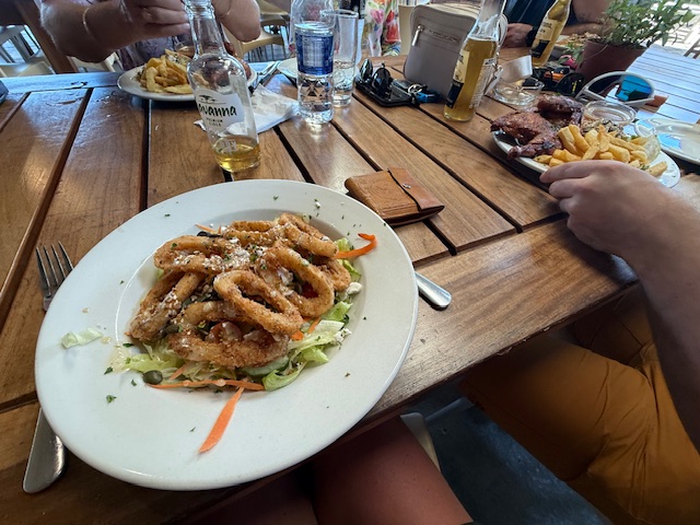
We walked through the pretty, cool stone streets of Old Town, crossed the river and went to Placa de la Independencia, the large, restaurant-lined square we’d found the previous night. We sat down for lunch at Konig, a reasonably priced restaurant (we decided it was possibly the Wetherspoons of Girona, but no complaints), and I had a smoked salmon, avocado and ricotta bagel while Ryan had some kind of rice, pepper and calamari salad. A couple of glasses of sangria made me quite tipsy – I blame the heat – and we relaxed (to my initial agitation) there for a while before heading off to find the city wall walk.

Medieval Walls

We went back across the river, through the old streets and behind the cathedral, where incredibly tall, thin cypress trees stood over high stone walls, little public gardens and criss-crossing footpaths. On our way up some steps we bumped into a friendly local who told us his favourite spot in Girona to get a good view of the city, so we followed his directions down the hill and up some steep steps onto a high, narrow wall near the John Lennon gardens. We walked along this wall to the highest point, where we stopped to look over the city. The cathedral sat on a hill, the highest point in Girona, and dominated the foreground, along with the high stone tower of the San Felix Basilica. Tiled rooves sprawled between swathes of bright green trees, and the horizon was shaped by distant, hazy blue mountains. It was as stunning as the heat was stifling.

We backtracked along the wall and through the peaceful John Lennon gardens, then headed east along a path set between tall, lush trees towards the main medieval wall, pausing to look at a pair of striking green monk parakeets perched on a branch above us. We got to a large stone tower by the Jardins dels Alemanys and climbed the stairs inside to the top. We stood on the tower and stared across the terracotta rooves of Old Town, large modern blocks beyond the stone buildings, and layers of rolling mountains spanning the skyline, all interspersed with leafy vegetation.

The wall ran in a long, straight line with several towers spread along it, almost all of which we climbed. The views of the city were incredible, a mix of old and new, and somehow – despite the sprawling streets and mass of buildings – it seemed small set beneath the thickly forested hills. We bimbled along the length of the medieval walk, which took about half an hour with the tower stops, and climbed down the stairs at the other end, returning to the southern part of old town.

Old Town & Tapas

We took a rambling route back to the apartment through narrow, cobbled, litter-free streets, admiring the pretty, balconied, shuttered five-storey buildings of pastel orange, beige and bare stone that sat above a diverse array of little shops and restaurants. We got back about 5pm and went for a late siesta, exhausted by the heat. We headed back out around 8pm having realised the previous evening that the Spanish eat very late.

We crossed the carp-filled river and returned to the Konig bar on Placa de la Independencia for tapas. We shared potatoes with truffle cheese sauce, squid and scallop croquettes, beef strips with peppers, prawns in coconut, ginger and lime sauce, iberian ham croquettes, grilled octopus and a little bread basket, which seemed to come free with meals as standard. I wouldn’t normally order as much meat but I was desperate to try the local dishes. It was all very nice for only €40, including half a litre of Sangria and two pints of San Miguel. We ate, drank and people watched, charmed by the social, relaxed atmosphere – people of all ages were out until late and there was a nice, quiet buzz around the square.

We crossed back to Old Town over the bridge by the Basilica and walked through castle-like streets to see the cathedral at night. A bright, warm light accentuated its geometrical edges, detailed carvings and hundred steps, making it look even more striking than in daylight. It was lovely walking through the narrow stone back roads – although the bars and restaurants were bustling, particularly in the evening, there were plenty of quiet, timeless, totally empty little alleys and streets that we could dive down, where it felt as if we had the city to ourselves.

We shared a delicious vegan ice cream (one scoop each of passionfruit, snickers and caramel) on our way back to the apartment and found ourselves in a little square listening to a Catalonian three-man band, who sang and played guitar in that distinctive twangy, lively Spanish style. The music was lovely and we sat on a little wall behind the tables that spilled across the square, where people sat, sang and waved napkins to some well-known song. I was amusedly watching a chocolate labrador hoover the floor and be retrieved by its owner for the third or fourth time when a lady suddenly appeared in front of us offering a tray of small disposable cups, so we took one each and thanked her. It was some kind of hot, thin, strong, coffee flavoured alcohol, and after one sip I donated it to Ryan.

We went back to the apartment as the band packed up, amazed by the friendliness of people – the local who stopped to tell us his favourite spot in the city, an English-speaking man we befriended in the ice cream queue who recommended the Indian restaurant where we had our last meal of the trip and the lady who’d given us a free drink, despite us obviously only stopping in the square to listen to the music. I was quite taken with Girona.

Girona, Spain: First impressions

5 – 6 July 2022

Poor planning

I had an extremely stressful evening on Tuesday 5 July. We went indoor climbing as normal and on the way back I decided it’d be a good idea to check the covid requirements for our flight to Spain at 12:25 the following day. It turned out that although we were double vaccinated, we could only enter Spain if our second vaccine had been received within 270 days of the flight, we’d had the booster (which takes up to 5 days to register on covid records), or we had a negative test result. Negative (by about 25 days), negative, and negative, respectively.

After hours of googling, despair at realising most test centres (including the one at Bournemouth airport) had 24-hour turnaround times, and a small degree of extremely sceptical relief at having found a centre in Southampton offering £22.50 lateral flows with 2-hour results and an 8am appointment slot, we packed at 1am, hoping that we weren’t tempting fate. We went to bed at 2am and were up by 6.

Ryan’s dad rushed us into Southampton for 7.30, we had our lateral flows at the test centre – surprisingly busy for 8am – and we went to a nearby walk-in vaccination centre to get our boosters at 9am, just in case the covid app updated on time. Miraculously our negative test results were emailed through as we were queuing, to our immense relief, but we were still slightly anxious that they wouldn’t be accepted at the airport.

On the way to Bournemouth airport I filled out our Spanish government issue entry forms, uploaded our test result documents to our boarding passes, and breathed for the first time in 12 hours. We went through security, had a drink in the bar, bought a phrase book from the shop and boarded our busy flight without any hassle.

Arrival in Girona

We stepped off the plane to that intense, slightly stifling wave of heat that marks the beginning of a hot summer holiday. We left the airport, slightly incredulous that Spain had let us in without batting an eyelid, and waited half an hour for a bus in the searing heat. I was delighted to find a vending machine at the bus stop selling impossibly processed ham and cheese sandwiches and paprika crisps, which kept us going until the bus came.

The 30-minute trip to Girona bus station took us past dry, golden fields, dusty buildings and the industrial southern end of the city, which seemed to be full of car and motorbike dealerships. We left the large, air conditioned station building and were once again hit by the heat of a Spanish summer as we walked out onto a large, open, very clean plaza. We headed east through intermittent, warm rain towards our airbnb past slightly tired-looking offices and flats, then along a long, straight, smooth-cobbled street flanked by tall, six-storeyed buildings with a variety of narrow shops underneath.

Then we reached the river Onyar and realised what Girona was all about. We stopped on the wide stone Pedra bridge to admire the river, which consisted of a barely flowing channel of clear water between two lush green strips of grasses, reeds and wetland plants, set about 15 feet below street level. It was incredibly clean, and large carp swam lazily around the weeds directly below us, to Ryan’s delight. The river was lined on both sides by pretty, flat-fronted buildings two to six storeys high, painted in a striking array of oranges, yellows, reds and creams, and the elegant grey towers of the cathedral and basilica soared above the flat rooves on the right bank. This was the view that came up when we’d google imaged Girona, but it was even more beautiful.

We crossed the bridge and wandered down the cobbled, tree-lined Rambla de la Libertat, which was bustling with pretty shops and little restaurants with tables spilling across one side of the street. We turned right at the end onto a narrower street squeezed between attractive, five storey high buildings, some painted pastel oranges and some bare-stoned, all with pretty balconies and shutters or blinds to keep out the heat. The streets brimmed with all kinds of little shops and restaurants and it was remarkably clean and tidy – not a speck of litter. Old town had delighted us already.

Accommodation

Our airbnb was in a third floor apartment right in the middle of old town, down a narrow alley on the Placa dels Raims, the smallest square in Europe. It took a little bit of finding but we were delighted with it. Our host – despite barely speaking a word of English – was extremely welcoming and our room was along a corridor in a separate part of the apartment to the main bit where she lived with her family. It was high-ceilinged and timeless, with whitewashed walls and a lovely stone feature wall, shelves full of books, towels and trinkets, a tall shuttered window opening out onto a narrow gap between the tall buildings, and our own large, clean private bathroom. It was lovely to be spending the trip in a Catalonian home, rather than a common-or-garden hotel room.

Paella & Chill

We took some time to settle and relax in the room following the stress of our poor-planning-related near miss, then got changed and went to explore a little. We had a little walk around the picture-postcard narrow, cobbled streets, enjoying that distinctive summer smell of warm, fat raindrops (none of that nasty British drizzle) hitting the stone floor. My flip flops were slippery on the smooth slabs so I walked around barefoot with my silky trousers rolled up. We went back to the tree-lined Rambla de la Libertat for dinner and found a reasonably priced (we later found out that most restaurants were reasonable) Catalonian restaurant with street seating under large stone arches and grappled – probably quite poorly – with ordering our dinner in Spanish.

We shared a lovely seafood paella and “fideua”, a similar dish but with noodles and a different sauce. I enjoyed my first ever (!) sangria and we sat people watching, drinking in the unfamiliar and refreshing lack of English-ness. The rain subsided and we went for an evening walk. We crossed back over the Onya, which was equally beautiful under a fading, grey-pink sky, and wandered around the clean, more modern, slightly wider streets on the west side of the river, intrigued by the randomly situated but bustling small eat-and-drinkeries. We found the large, buzzing Placa de la Independencia square, lined on all four sides by long, tall, balconied apartment buildings above a multitude of bars and restaurants, and decided to return for lunch the following day.

We crossed back over a bridge further down the river and returned to our little flat in the middle of old town. We were extremely pleasantly surprised by Girona’s charm and atmosphere and planned to spend the next day exploring the city more thoroughly. My biggest qualm was my aching left arm from the booster jab that morning and the warm temperature, which made getting to sleep difficult, particularly as I was concerned about jab side effects. After some tossing and turning I drifted off, probably thanks to the air con unit in the room and the thin sheet instead of a duvet, excited for the rest of the holiday.

Edinburgh: Scotland Day 9, Sep ’20

We woke in an Edinburgh hotel, excited to explore the city. Covid dictated that indoor activities would require advance booking, and we aren’t exactly “advance booking” people (we’re more “last minute”, “impulsive”, “on a whim” people), so annoyingly two of the places I’d wanted to go most – the National Museum of Scotland and Edinburgh Castle – were fully booked. I’ve been before but I know that Ryan would love both, so at least we have good reason to return.

Instead we went to the Surgeons’ Hall Museum, which was even more interesting than it looked online. Jars of every body part imaginable lined hundreds of shelves in an impressive columned, balconied hall, and we learnt about an incredible array of diseases, injuries and body-snatching stories. It was fascinating and irresistibly grotesque, and I’d recommend it as an excellent couple of hours’ excursion for anyone who isn’t squeamish.

After lunch in The Advocate pub on the high street of Edinburgh old town, we spent the afternoon exploring the city centre on foot. Of all the cities I’ve been to, I think Edinburgh, with its hilly topography and incredible architecture, is my favourite. Standing at the top of the high street, the castle feels like the centrepiece of a bustling, timeless metropolis, with clean, cobbled streets lined by tall, straight-edged, regular-windowed buildings made of attractive yellow-grey stone. Pay attention and you notice the intricately carved details on window frames, corners, rooves and chimneys. Intriguing alleyways entice you in, staircases carry you to different levels of the city and monuments boast of its illustrious history. It feels like a place of paradoxes – colourful but classy, old but impeccable, stately but quaint.

After a good poke around, we had a couple of drinks in a Wetherspoons and walked the half hour back to the hotel to drop off the presents we’d bought to atone for being in Scotland on Ryan’s brother’s and dad’s birthdays. The walk took us past the towering Scott Monument, the columned Scottish National Gallery, the busy green Princes Street Gardens, a bunch of tourist shops and some lovely, posh-looking residential streets lined with tall, (I think) Georgian townhouses.

We changed clothes and walked back into town for dinner. We went to the old and incredibly charismatic Deacon Brodie’s Tavern on the high street, which was painted white, black and gold and adorned with an eye-catching array of hanging baskets and window boxes. It was quite striking inside, with dark walls, panelled ceilings and mahogany furniture, but for all that it was also cosy and inviting, and it definitely felt like a proper pub. It was named after William Brodie, a respected and wealthy Edinburgh cabinet maker and locksmith who, by night, copied the keys he had made for his clients and stole their money. He was caught and hanged in 1788, and his double life inspired Robert Louis Stevenson to write the Strange Case of Dr Jekyll and Mr Hyde.

We ate upstairs and I performed my signature move of drinking half a pint of cider and knocking the other half over. The food was divine and very reasonable – we shared a fish platter, then I had Balmoral chicken and Ryan had a burger. Not quite finished with Edinburgh, we left and went to Biddy Mulligans Irish bar at Grassmarket for another drink (or maybe two, I can’t remember). We walked back to the hotel totally enamoured with the city and already eager to return.

And so ended our trip to Scotland. We had an incredible nine days, fell in love with pretty much everywhere we went and did a whole load of cool stuff. It’s taken me an age to get round to writing about it, but now it’s done and I can get on with catching up on everything else.

To the land of glens, bens, tartan and thistles… we’ll be back.

Torridon, Inverness and Aviemore: Scotland day 5, Sep ’20

Following the previous day’s physical and emotional rollercoaster of a bike ride, we decided to have a rest day. We had breakfast in a quiet layby overlooking the lovely Upper Loch Torridon, backed by dark pine forest and the vast, dark gold Torridon hills, and decided to travel across Scotland towards the Cairngorms, ready to climb Ben Macdui the following day.

Our first stop was Torridon village, a tiny, pretty place on the edge of the loch where we picked up a few snacks (including a bottle of Irn Bru and haggis crisps) from the local shop before heading east through the belly of the great Glen Torridon.

We needed something to do during our day-long abstinence from any arduous physical pursuit, so we decided to explore Inverness. The journey from Torridon took about an hour and a half, and I was very sad to leave the dramatic glens of the west Highlands. As we drove east wild hillsides turned into huge cattlefields, fences turned land into property and the scenery softened into more gentle, habitable shapes. As we came into the city, fields gave way to concrete and bricks and we felt a thousand miles away from the wild, western glens we’d spent the last few days exploring.

We found a cheap central car park and got out for a look around. I’m not really sure what to think of Inverness. I’d been there twice before but couldn’t remember it that well. The middle is nice, with some pretty old buildings and a bustling high street, but some bits feel a little sad and run down – I suppose like most cities. The River Ness splits Inverness in two, connecting Loch Ness to the Moray Firth and the North Sea. We walked up to the castle, which was unfortunately closed due to covid and/or building work, and looked over the city’s rooves to the hulking blue mountain plateau on the horizon.

Next stop was Aviemore, perhaps the mountaineering hub of the Cairngorms, about 40 minutes south east of Inverness. It was bustling with people, many dressed in the signature bright colours of Mountain Equipment, Rab, Arcteryx and the like, and the main high street was lined with outdoors shops and cafes. We wandered round a few of the outdoorsey shops, stocked up with supplies from Tesco and drove the short distance to Loch Insh for a drink at the cosy lochside bar, where Ryan’s family had spent New Year a couple of years ago.

Keen to climb Ben Macdui (1,309m and the highest summit in the Cairngorms) and Cairn Gorm the next day, we left the bar, drove towards the mountain and found a big flat, car park overlooking Glenmore, the Rothiemurchus Forest and they Spey Valley. It was a lovely spot to watch the sun go down, cook dinner and plan our hiking route.

Alps 2020, Day 1: England – Switzerland – France

We flew from Bournemouth and landed in Geneva an hour and a half late, around midday. A combined baggage allowance of 23kg, which included climbing gear (ie. a bunch of metal) and winter clothes, meant that I was uncomfortably warm and resembled a shallot in both shape and number of layers. It was touch and go whether we’d make it to the car hire place before we lost our booking as we had less than an hour and our collection instructions weren’t clear, but we got there and happily accepted the keys to a Polo, which was better than the VW Up that we’d booked.

Unfortunately all we saw of Geneva was tarmac, concrete and industrial / “functional” residential buildings. Driving on the wrong side of the road was fine – the hardest thing was adjusting to sitting on the wrong side of the car. It took a little while before Ryan stopped wincing in anticipation of scraping the curb, but it was otherwise surprisingly easy to pick up. We drove down to the French Alps, watching excitedly as increasingly large, jagged mountains emerged from either side of the autoroute, and arrived in a pretty town called Les Houches. We picked up some groceries from Carrefour and headed to our AirBnB cabin, half an hour down the road in a tiny village near Saint Gervais Les Bains.

The cabin was dreamy. Tiny, cosy and well-equipped, with an easy to use (even drunk) pull-out sofa bed, small kitchen area and a bathroom so little that Ry had to sit diagonally on the toilet to fit his gangly limbs in. My only qualm was the coffee machine, which I just couldn’t get the hang of. Ryan made all kinds of hot drinks with ease and admittedly it did only have one button to contend with, but every drink I made was too small, too weak, too cold or served in a wet cup because I nailed the volcano effect – where the water exploded out the top of the machine, rather than the bottom.

He cooked a lovely sausage and prawn stir fry that evening, with an unknown orange fishy-smelling sauce which was horrible on its own but lovely in the stir fry, and we spent the first night drinking a €6.50 3l box of heinous wine mixed with grenadine syrup, working out how (not?) to vlog, climbing around the little wooden cabin and planning the next day.

90631368_237246007661705_1523638376945680384_n

This photo summarises our first attempt at vlogging. At least we can laugh about it