Hiking the Black Forest’s highest mountain: The Feldberg

Thursday 12th September 2024

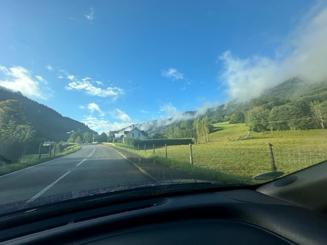
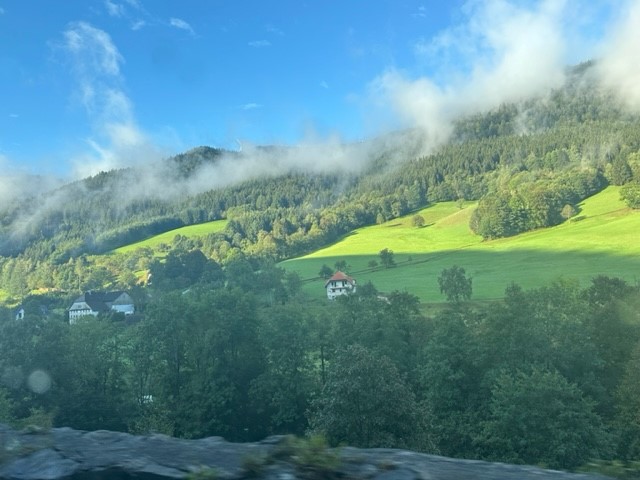
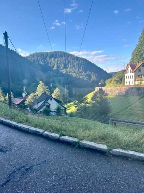
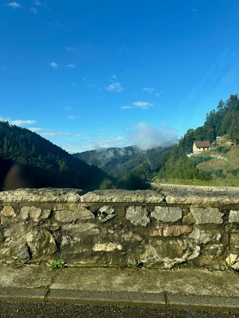
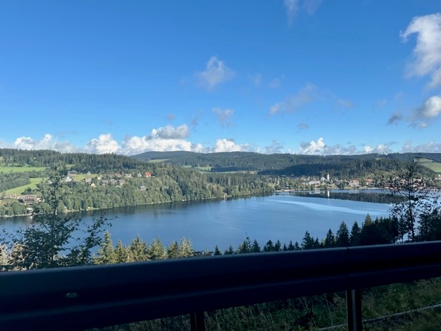
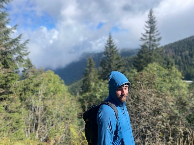
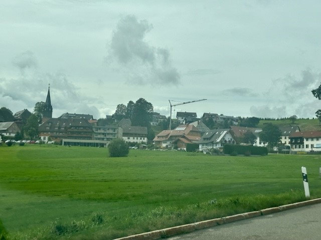
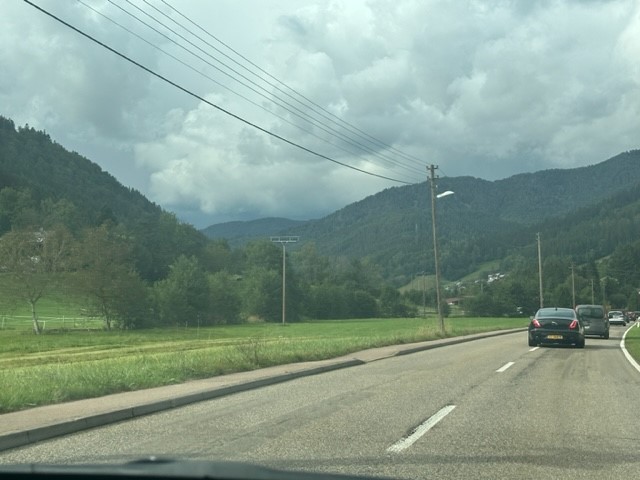
We’d kept a close eye on the forecast since arriving in Germany and today looked to be the first (and perhaps only) sunny day. Consequently we had reserved it for the main thing on our holiday to do list – a hike up Feldberg, the Black Forest’s highest mountain. We left the apartment at 8:30am and set off south in our little hire car, itching to explore the hills. Bright morning sunshine saturated the green fields that filled the valleys as we snaked through the vast landscape, lifting mist from dark, thickly forested hillsides in atmospheric veils. We navigated an unexpected road closure, passed high above the glassy surface of Lake Titisee and arrived in a small roadside car park at 10am.

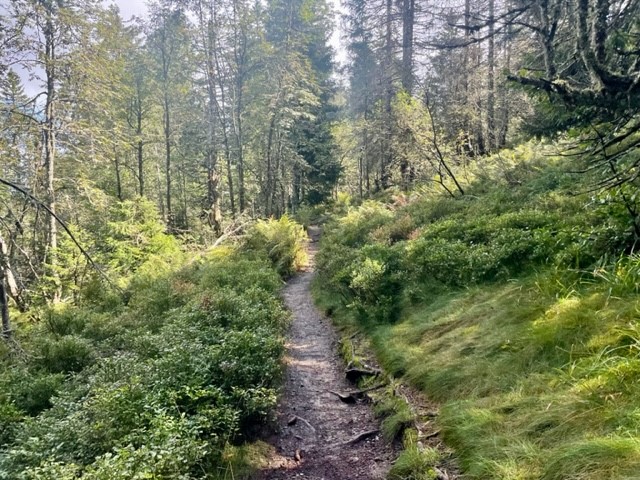
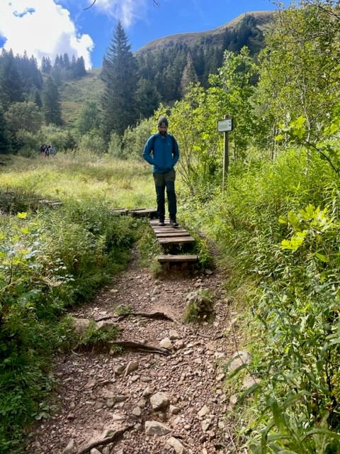
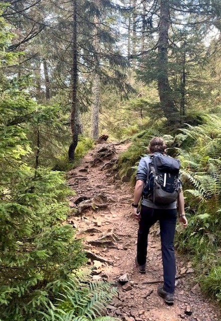
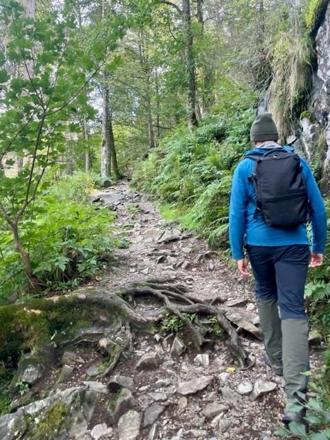
The Feldbergsteig trail

We set off uphill past a modern, sharp-angled church and found ourselves in an outdoorsey resort containing a large hotel, ski centre and cable car base. Eager to escape the tourist trap, we found an information board showing our intended route, the Feldbergsteig. We hadn’t appreciated that the trail starts at an elevation of 1,287m so it felt like cheating to say we were climbing a 1,493m peak, but nevertheless we were excited for a varied, circular hike in a new mountain range.

To the Bismarck memorial

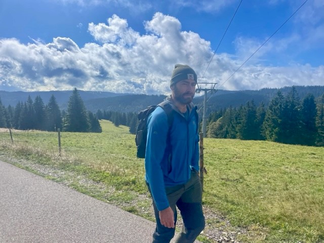
We headed northwest up a wide, gently inclining track that ran roughly parallel to the cable car line, passing several small groups who greeted us with a friendly “hallo”, and soon began soaking in the view. The surrounding yellow-green meadows melted into dark treelines formed by tall, deep green spruces, beyond which stretched endless forest spread thickly over distant, hazy blue ridges arranged in undulating layers. It was sunny, still and resoundingly quiet.

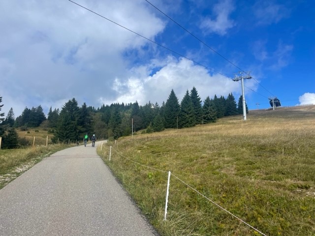
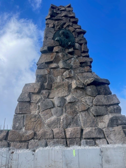
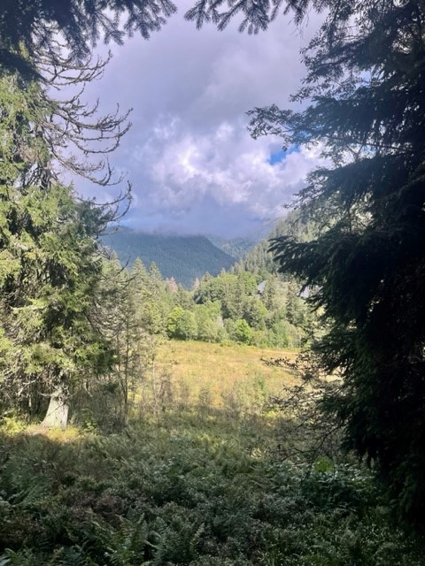
The track narrowed and took us into a verdant coppice, then continued through rugged meadows past a severe-looking concrete tower laden with satellite dishes. The first landmark we arrived at was the Bismarck memorial, a great stone pillar dedicated to the first Chancellor of the German empire. It was a wonderful viewpoint; a continuous swathe of forest covered the surrounding  hills and valleys like a dark green blanket stretching all the way to the distant horizon, broken only by occasional ragged-edged, grassy clearings.
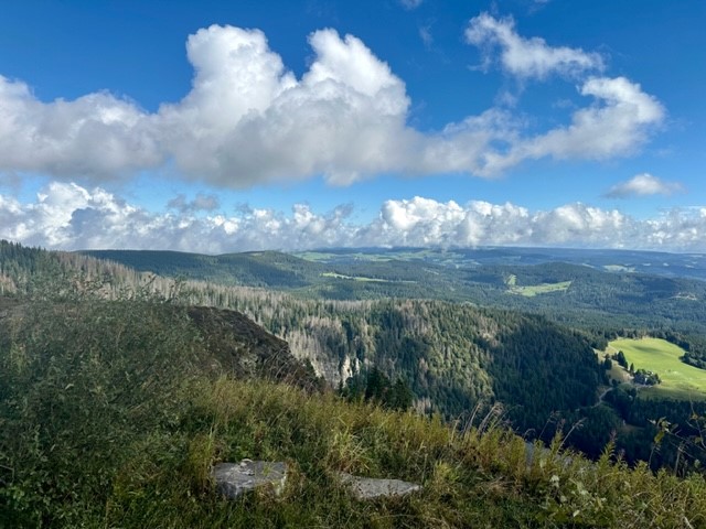
Up Feldberg

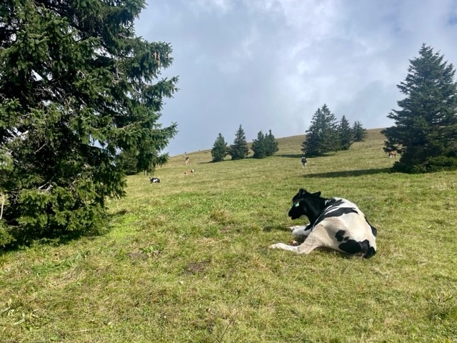
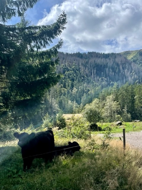
We left the memorial and headed down the side of the hill across open meadow. We went through a gate and followed a wide gravel path along the side of a ridge, which was covered in rough, yellowish grass and sloped gently downhill towards the endless forest. A strange, tinny sound tinkled across the valley and a thin curtain of fluffy cloud – which had drifted down the ridge and obscured the path ahead – cleared to reveal a small herd of Fresian cattle blocking the path. I’ve been averse to cows since getting charged by a bull a few years ago, so I gave them a wide berth and reached a gate with some relief.

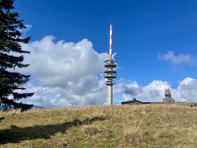
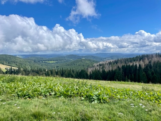
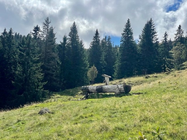
We gained the summit of Feldberg via a straight path up a gentle incline, the only drama being the loud and alarming receipt (on our phones) of Germany’s annual nationwide emergency alert test at 11am. It was a grassy and oddly subtle, unremarkable peak marked by a low, flattened mound topped with a trig point and a circle of benches, marred slightly by a tall communications tower and grim looking building a short distance away. We munched a sandwich with our backs to the tower and gazed across gently rolling, forest-carpeted hills, pondering on the ethics of saying we’d climbed a mountain.

Through field and forest

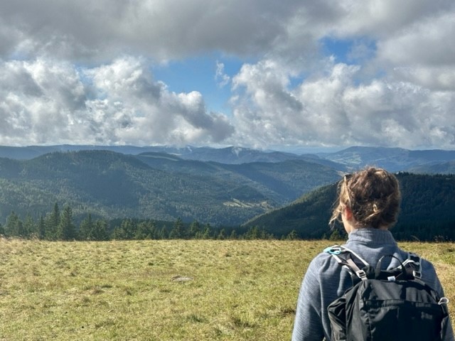
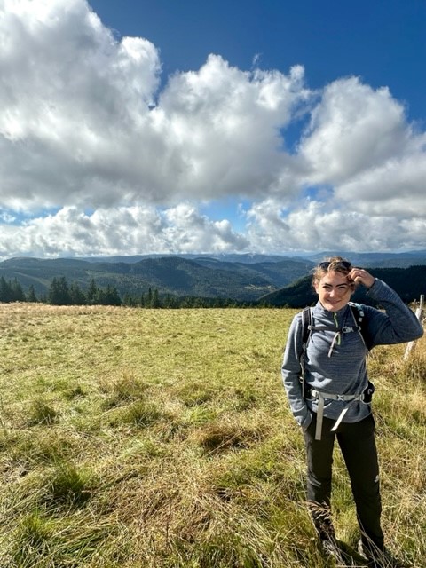
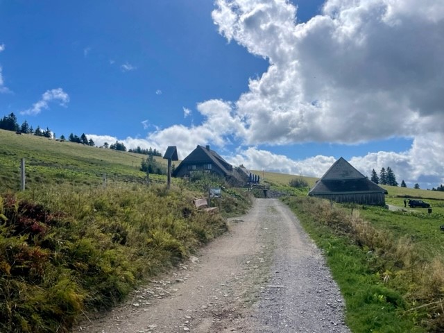
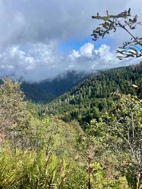
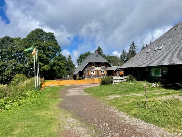
My doubts about the mountainous nature of the area were allayed once we left the summit and headed down a track that passed the ugly tower. The peaks ahead of us to the west were steeper, more undulating and completely forested compared to the gentler, grassier slopes to the east, and the horizon was formed by wide, hazy triangles of more mountain-shaped mountains. We headed downhill past a lush, green meadow dotted with fir trees and cattle, their cowbells tinkling whimsically in the breeze, and reached the first alpine hut along the route – a large, tiled, welcoming-looking building. Resisting the temptation to stop and grab a drink, we continued on the path, which flattened out and arced around Feldberg’s lower reaches in a smooth curve.

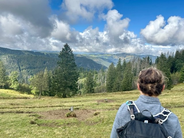
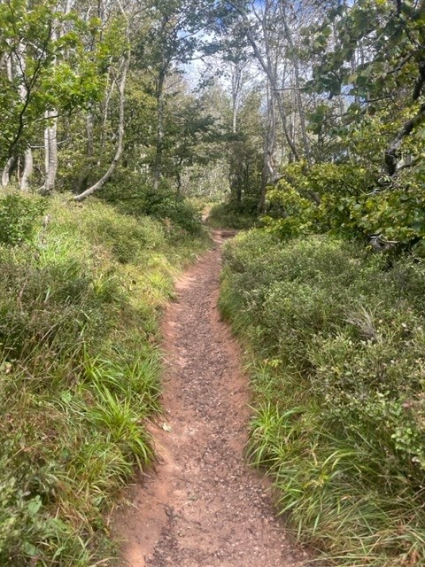
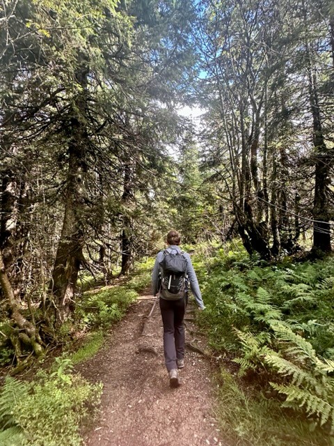
We tramped across charming, rugged meadows, then entered the thickly forested hillside to the north of Feldberg. A thousand shades of green emanated from ferns, shrubs, trees, grasses, mosses and lichens, which grew in Jurassic Park-like abundance on the steep slope. Shrubby clearings allowed us to gaze across a deep valley to opposite, equally living slopes, which were drenched in warm sunlight that slipped beneath thin clouds that drifted lackadaisically over the valley tops. It was incredibly tranquil, as if the rest of the world didn’t exist.

Past river and lake

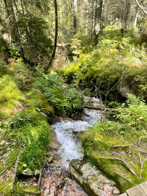
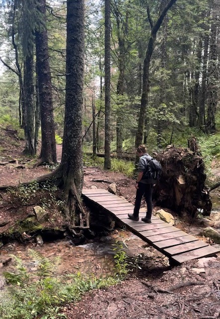
We followed the path diagonally down the hillside, crossed a marshy section via a boardwalk and found ourselves at another alpine hut. A steep climb through the forest took us up to another swathe of meadow on the east side of Feldberg’s neighbouring hill, which dropped gently down into more verdant forest. We crossed the narrow, crystal clear Sagenbach river and followed its wonderfully overgrown, mossy banks downstream, marvelling at several rocky waterfalls and – on seeing the many bridges made by fallen trunks – wondered what storm could possibly have touched this serene place.

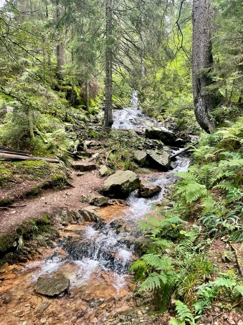
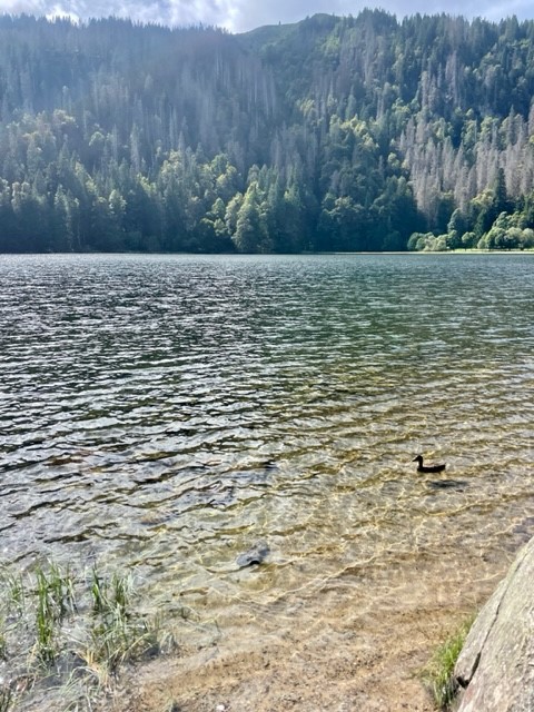
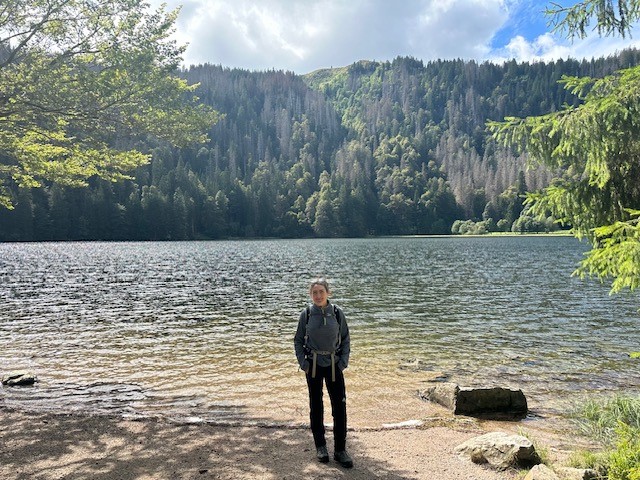
After winding down the river via bridges, steps and rocks, the route bore us east along a straight, flat track along the side of a hill between legions of tall pines. We stopped for another sandwich at a picnic table, then followed the arc of a spur to the edge of a valley clearing, where another large hut sat below us among cattle fields and meandering tributaries. We followed the treeline down into a peaceful wood, then came to the shores of the perfectly round, cwm-like Feldsee Lake. The clear, gently rippling water was surrounded on three sides by towering, green walls that looked too steep to accommodate the dense mass of huge trees that had somehow taken root. We stood on the “beach” for a moment, watching the ducks and listening to the silence, then set off on the final section of the route.

Last leg

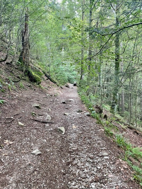
The path followed the east bank of the lake, then climbed steeply into the thicket of beech, sycamore, pine and spruce. We zigzagged up rocky sections until the ground levelled and we emerged from the trees quite suddenly at the cable car base. It felt slightly surreal to be back in the busy resort after the serenity of the hike, which had felt quite wild despite the clear, well-signposted trail. We headed straight back to the car and, after debating whether a trip to the city of Freiburg would be worth it at rush hour, left for home (via Lidl, of course).

To summarise, it had been a lovely, varied hike with beautiful scenery that made us feel truly immersed in the Black Forest. The trail was very easy to follow (we barely used my guidebook map) and I just wish it had been longer than 8.5 miles. We came away feeling very refreshed, happy with a good day exploring a new mountain range.

Evening

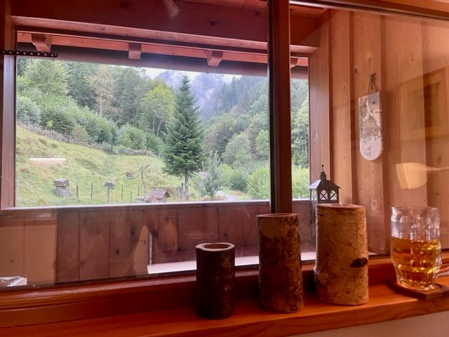
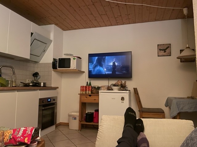
We got back at 4:30pm and spent the evening relaxing on the balcony, drinking wine/beer, watching Rings of Power on Netflix and playing with Kraut the cat. Ryan cooked a lovely dinner of homemade schnitzel with steak, salad and potatoes and I came up with a rough plan for another hike the next day, this time starting from our apartment. Three days in and we felt very at home in the Black Forest.

Snowdonia, Sep ’21: Coed y Brenin MTB, wild swim

Thursday 23 September

We woke for the last time in the Dyffryn Mymbyr valley and went straight back to the Moel Siabod café (see my post on the previous day for more about the café – amazing place) for breakfast. I had a vegan full English and Ryan had a normal full English and as before, we were very pleased.

We left the café and drove wistfully back along the lovely A5 valley, joined the picturesque A470 at Betws y Coed and travelled south for about 45 minutes , via Blaenau Ffestiniog (a remarkably grey town), before reaching Coed y Brenin Forest Park. We’d decided to make use of the mountain bikes one more time before heading home and this place prides itself on being “the UK’s first and largest dedicated mountain bike trail centre”, so we decided to try it as it was “kind of” on the way back. We parked up, took the bikes off the van and went to look at the ample selection of trails shown on a board by the large visitors centre.

Ryan was feeling a bit sluggish so he suggested that we do the blue “Minor Taur” trail and see how we get on. This is a 12km loop (which can be shortened to 3, 5 or 9km) through the forest that runs along the sides of the Afon Eden and adjoining Afon Mawddach. As expected of a blue trail it was fairly smooth, flowy and enjoyable, with nothing particularly challenging but a lot of fun nonetheless and a few quick sections. We felt sorry for a man right in front of us whose tyre blew out on a root near the beginning of the trail, but a little relieved as it allowed us to overtake and zip along the fun singletrack.

We were a little confused by the loops at first (the 12km route is made of 4 loops, making each section optional) and nearly went wrong at an unclear signpost, but heard someone explain it to their friend and followed them onto the right track. The forest was lovely – leafy, green and quiet, and riding along next to the river felt quite idyllic. We passed a rushing waterfall, disused gold mine and gunpowder works, which I’m sure have an interesting history but are now just a strange bunch of ruins, crossed a couple of bridges and had a pleasant, easy ride.

We found ourselves back at the car park after an hour or so and, well aware of the 5 hour drive ahead of us, decided resolutely to save the three red and three black trails for another trip. We did, however, have enough time to check out the “skills area”, which consists of four zones:

  1. Training zone – to practise braking, turning etc
  2. Singletrack zone  – four short runs graded green, blue, red and black
  3. Freeride zone – a pump/jump track
  4. Drop-off zone – a drop-off slab at the end of the red singletrack that can be taken from various lines

We started at the singletrack zone and had so much fun whizzing along the blue and red runs that apart from a quick go on the black, which was bumpy and twisty to the extent that it was much less fun, we didn’t do the other zones. The red was good but I actually preferred the blue because the lack of technicality meant it was flowy and very quick. The runs were short and we must have whizzed along them tens of times to the amusement of a group having a lesson (we weren’t in their way!) before finally packing it in and heading back to the van.

The last thing remaining on my “things I wanted to do [but Ryan didn’t really]” list was a wild swim, or at least a dip, and fortunately my Wild Guide informed me that there was a swimming place just 10 minutes down the road. We pulled into a quiet, leafy parking spot near the attractive, multi-arched old Llanelltyd Bridge, went through a little gate that led into an open field and walked over to the large, round pool described in the book, which sits under the bridge and forms part of the Afon Mawddach river. After a little customary cold-water hesitation I enjoyed a beautifully refreshing, if brief, swim-float around the cold, clear pool, and Ryan “enjoyed” an even briefer dip before retreating to the stony beach to watch me wallow around like an excited hippo.

Wallowing finished, I shivered into a changing robe and we trudged reluctantly back to the van, steeling ourselves for the impending farewell. Leaving Snowdonia was never going to be easy but the bitter sting of parting was softened slightly by the sunny weather and the pretty drive through idyllic mid-Wales and rural Shropshire before hitting the bigger roads.

And just like that, our busy week in North Wales was all over. We visited so many beautiful places and hiked, climbed, scrambled, mountain biked, road tripped, ate, drank and just about swam. As usual I don’t really know how to conclude, other than the common-or-garden words can’t do it justice, or simply even what a trip. One thing is certain: we’ll be back before long.

Mountain biking the Torridon Loop: Scotland day 4, Sep ’20

After much deliberation about the day’s activities, we decided that taking on a renowned mountain bike route would be more fun than hiking up Liathach in the clag. The Torridon loop is a 30-mile trail around some of the vast glens of the northwest Highlands, rated on various websites as “hard”, “advanced”, “expert” and “very hard”. Irresistible.

We parked in a layby outside the pretty lochside village of Torridon and set off along the road. The first few miles took us through the belly of the vast Glen Torridon, flanked by the towering Torridon Hills. The road flowed through the valley like the river that ran alongside it (unsurprisingly enough, the River Torridon), its path dictated by the unheeding topography of this great Scottish wilderness.

Eventually we turned right off the road and cycled along the east side of Loch Clair. A couple of ownerless black labradors ran over to investigate our intrusion on their land, and we lamented the fact that we weren’t born into rich Scottish estates. We took a left along a muddy path through a wood and encountered our first hill; I spent the climb telling Ryan all about the Jacobite movement in the 17-18th century, a piece of Highland history which I find fascinating. I’ll spare the detail. At the top we realised that we’d climbed the hill unnecessarily as we’d missed a right fork which would have kept us on the flat, but it was worth it for the fast descent along a gravel track to rejoin the route.

Another bit of gentle cycling saw us across the sweeping farmland around the head of the small Loch Coulin, then along the River Coulin. By this time we were suspicious about the lack of ascent/descent/anything that felt like real mountain biking, especially on a route that was supposedly so difficult. And rightfully so – we had no idea what was to come.

The gradient gradually increased, and soon we were chugging up a steep track running parallel to the river. We reached a small bothy, had a quick nose inside, then crossed a bridge by a waterfall. It was uphill from there, along a narrow path littered with rocks large enough to render the way largely unrideable. We found ourselves on a wide, upland heath surrounded by yellow grass, purple heather and hills hidden in cloud. Then the rain came.

It crept in silently but quickly; one minute we could look back on the hills and valleys behind us, the next we were engulfed by wet mist. Eventually the ground levelled out to a high, scrubby plateau and we jumped back on the bikes.

The next section was totally unexpected and pretty epic. A long, extremely rocky couple of miles of incredibly technical downhill over big chunks of solid slickrock, with some very tight corners and definitely-don’t-want-to-fall-off steep bits. Our bikes clattered over massive rocks in a quick – slow – quick – slow pattern, and we finally understood why the route was graded difficult. It was a shame the rock was so wet as the slipperiness slowed us down, but it was an incredible trail nonetheless. I hit a rock side on and ended up over the handlebars only once, which – considering I was riding my 12 year old, bashed up hardtail – I thought was good going.

The most annoying thing was the frequent channels cut in the path, which consisted of two slabs placed vertically opposite each other with a big gap in the middle for drainage. Our rear tyres whacked the harsh edge of the slabs repeatedly, so  when the ground finally levelled out I wasn’t surprised to find a slow puncture. We pumped it up, then made our way through a forest section and across a railway track to the hamlet of Achnashellach. For some reason, it seemed strange to be in civilisation again. We munched a sandwich in a layby, swapped my inner tube and carried on west along the road for a few long, grey, very wet miles, wondering whether we were actually having a good time.

After what felt like a long time we turned right and followed a gravel track up along a river that headed into the mountains, which were ominously dark and shrouded in thick cloud. It was just about rideable, but the big, wet rocks on the path made it very awkward, and the wheel-bashing channels had returned. After a lot more time we reached the coolest bothy I’ve ever seen: a two-storey cottage with two big rooms downstairs and three “bedrooms”. It was the stuff of horror films, but would have been a great place to stay.

If we weren’t so stubborn, the next couple of hours might have seen us lose the will to live. We walked our bikes most of the way along the soaking wet, boggy, rocky path up, up and up. At first we tried to retain some element of dryness by avoiding the worst of the bog, but before long we were wading through rivers halfway up to our knees and dragging our bikes through dark mud and mire. It just kept going. The most soul-destroying part was that while the cloud above was bright grey where the light of the distant sky shone through, the cloud ahead and on all sides was dark grey. The kind of grey that announced that we were surrounded by high, steep ridges, which meant that we hadn’t reached the top of anything – we were effectively trapped in a big bowl of misery.

We stopped at the high Loch Choire Fionnaraich and did the thing we only ever do when in dire straits: had an energy gel. It perked us up enough to push on up the hill, barely speaking. After what felt like another age we pulled up onto a kind of rocky plateau pass between Maol Chean-dearg and Meall Dearg. Our relief was dampened by the pressing concern that we’d soon start losing daylight, so – happy to be back in the saddle, but still racked with anxiety and suspicion at what this wretched day would throw at us next – we pedalled along the rocky path, startled a few red deer which had inexplicably chosen this godforsaken place to graze, then flew past Loch an Eoin and another couple of small lochs (imagine the dead marshes from Lord of the Rings) which were backed by mysterious ridges. The trail was steep in places, very technical, quick and (most notably) often indistinguishable from a narrow, fast-flowing river.

Despite the treacherous weather and unforgiving terrain, we made it across the wild plateau quite quickly and relatively unscathed. I wish my GoPro hadn’t died, as we weren’t in a position to take photos and I can’t convey with words how wet, fast and rocky the trail was. We emerged on the other side of the plateau and the gradient got steeper, the rocks slipperier and the drops bigger. Our bikes (mine in particular, poor old thing – Ryan was on his new, full suspension Giant) clattered down the rocks begging for mercy, and my brakes had gotten soft to the point of uselessness. But ever since we’d been going downhill, I was secretly having a good time again.

It’s a shame the weather was so bad, my brakes were shot, we were exhausted from lack of food and the light was fading, as otherwise the way down would have been amazing. It was unlike anything we’d done before, but we couldn’t quite appreciate it or go as quickly as we’d have liked. We’d climbed for hours and it was a long, steep descent, well worthy of any hard / expert / advanced / very hard label. As the houses of Torridon and the little silver speck of the van appeared, we made our way down the final technical slickrock descent, knackered and very relieved.

We got to the van soaked to the bone. We threw the bikes on the rack, shivered awkwardly into dry clothes and fumbled around arranging a wet bag, which everything went into. I made the best hot chocolate we’d ever tasted and we polished off a pack of shortbread in minutes, then we drove the short distance back up the hill to the picturesque layby we’d stayed in the previous night. Ryan cooked the best carbonara in the history of the universe and we didn’t take anything for granted that evening: food, warmth, dryness, cider and rest. We slept well that night.

Torridon loop conclusion: Largely unrideable. Probably a different story in good weather / a big group / plenty of daylight. Would recommend if you like Type 2 fun. Scenery is probably lovely. Oddly enough, would do again.

NB: The photos don’t do justice to the awkwardness of the trails – the awkward bits were too awkward to move along while taking pictures.

Ultra Training Update: Week 1

It’s been almost a week since I signed up for an ultramarathon at 2am after an impromptu drinking session and for some reason I haven’t cancelled my booking. Friends have told me I should postpone it until another year to give myself enough time to train (alongside study and work), among them a personal trainer and an ex-marine.


Perhaps that’s why I’m keen to give it a go; being told I can’t do something triggers my resolve and makes me dig my heels in, absolutely determined to do (or at least attempt) whatever silly thing it is. So far it hasn’t proved fatal.


Anyway this week I started “training”. I’m reluctant to use that word as it seems too formal and serious, when really I’ve just been running a few times. I looked up 4-month 50-miler training plans, but a) they were aimed at seasoned marathoners, and b) I didn’t like them anyway. So instead I just ran. Maybe I’ll devise a written plan at some point, but for now I’ll focus on putting one foot in front of the other and not dying.


After last Saturday’s 13.1 miles, I ran 2.5 miles on Monday (with a friend, otherwise I would have gone further) followed by 10mins barefoot on the treadmill. I’m keen to train my body to run barefoot after reading Christopher McDougall’s Born to Run, but that’ll be another blog post. I did 7 miles on Tuesday followed by 12mins barefoot treadmill, 5 on Wednesday (with another friend) and 9 on Thursday. I probably shouldn’t have run Weds or Thurs because of the blisters on the balls of my feet – from the treadmill, although I’m reluctant to admit it – but I have an addictive personality and I was addicted.


Unfortunately yesterday and today I admitted that I should let my feet heal (and my legs rest, although they’re itching to run) before I make them worse, so no running. Somehow one blister has extended to between my big and second toe, where the flip flop strap goes, and has left a sore, red split in the skin. This is super annoying as you’ll rarely catch me in anything other than flip flops or barefoot from April to October. If it wasn’t for that I’d be running now. I hate resting.


So far I’ve found that the first couple of miles are easy, the next three-ish are the toughest, then it gets easier again. At the end of each run I thought I could happily carry on, but stopped because I had plans or felt I should go easy on my body to begin with. I’m the most impatient injured person ever to have existed. My breathing has been fine, I’ve had no joint pain and the initial calf soreness seemed to ease after going barefoot on the treadmill, stretching and using a foam roller. I’m being kind to myself by focusing on distance, not pace, and enjoying each run.


Blisters on the balls of feet are particularly irritating as plasters don’t do much, seeing as you put pressure on them every time you take a step. I’d never burst a blister running until Thursday’s 9-miler, when I was happily into mile 7 and all of a sudden it felt like my left foot landed on one of those washing machine liquitab things. I didn’t even realise that blister was still there until then, but it was horrible. Would not recommend.


We’re coming to the end of a mini heatwave which started on Wednesday, so the 5 and 9-milers were  balmy. The meadows, fields and streams I stumbled through on Thursday’s run were picture-postcard lovely, but I felt like I attracted, inhaled and swallowed enough flies to hit my protein target for at least the next week. At one point I tried and failed to extract one from my eye mid-run, only to come across it later as I attempted to apply mascara on my way to the pub.


Another thing I noticed on that run was that when I went exploring and ended up on rocky, rooty, hard mud-ridged narrow paths, it got easier and I got quicker. I was amazed that I’d been struggling a moment before on the smooth road, yet I hit more technical terrain and ran better. I suppose that goes to show how significant the mental aspect of running is – despite considering myself relatively resilient and self-aware, I was sub-consciously focusing on my tired legs until I was forced to concentrate on my footing in order to not break a leg.


So that’s where I am with four months to go. I’m hoping to get a run in tomorrow, foot-dependent. In other news, I finished Born to Run and started Eat & Run by Scott Jurek, an ultramarathon legend who featured in the former book, I’ve got a couple more blog posts planned (very loosely, in my head), and today I swam in a cold, dirty river. Uni is boring and I’m still poor.


31093351_10216239742051797_2866265417330982912_n