Ben Macdui, Cairn Gorm & Loch Morlich: Scotland day 6, Sep ’20

We had heard from Ryan’s dad how difficult Ben Macdui could be to navigate in poor conditions, so we set off around 8:30am from the Cairngorm Mountain upper car park. It was clear and dry but the clouds hung like a heavy, grey blanket just above the tips of the distant peaks behind us. To our left was a short valley headed by a ridge of bare rock towering over a small loch, Coire an Lochain, and in front was a vast expanse of brown heather and rock-strewn, yellow-gold grass, ascending gradually towards the high horizon that hid the great plateau of Ben Macdui.

The mountain lay directly south of the car park and the walk-in was long and gentle. Because the Cairngorm peaks perch on a plateau that already rises way above sea level, they don’t have the jagged drama of the western mountains and they’re generally more walkable. The gravel path was easy to follow for the first 3 or 4 miles (obviously a different story in snow), until the ground turned from grassy moorland to boulderfields. We hopped from rock to rock, reassured by the occasional cairn. The last mile was steeper and as we climbed the fog thickened, so we were glad for the many cairns that led up to the summit.

There were lots of little rock shelters at the top and after a quick trig point photo (10:30am), we huddled into one and made a brew. As is often the case with high, beautiful places, the fog ruined all our chances of appreciating the landscape and allowed us a view only of the barren, flat, rock-strewn top of the mountain. It felt like we had walked onto another planet.

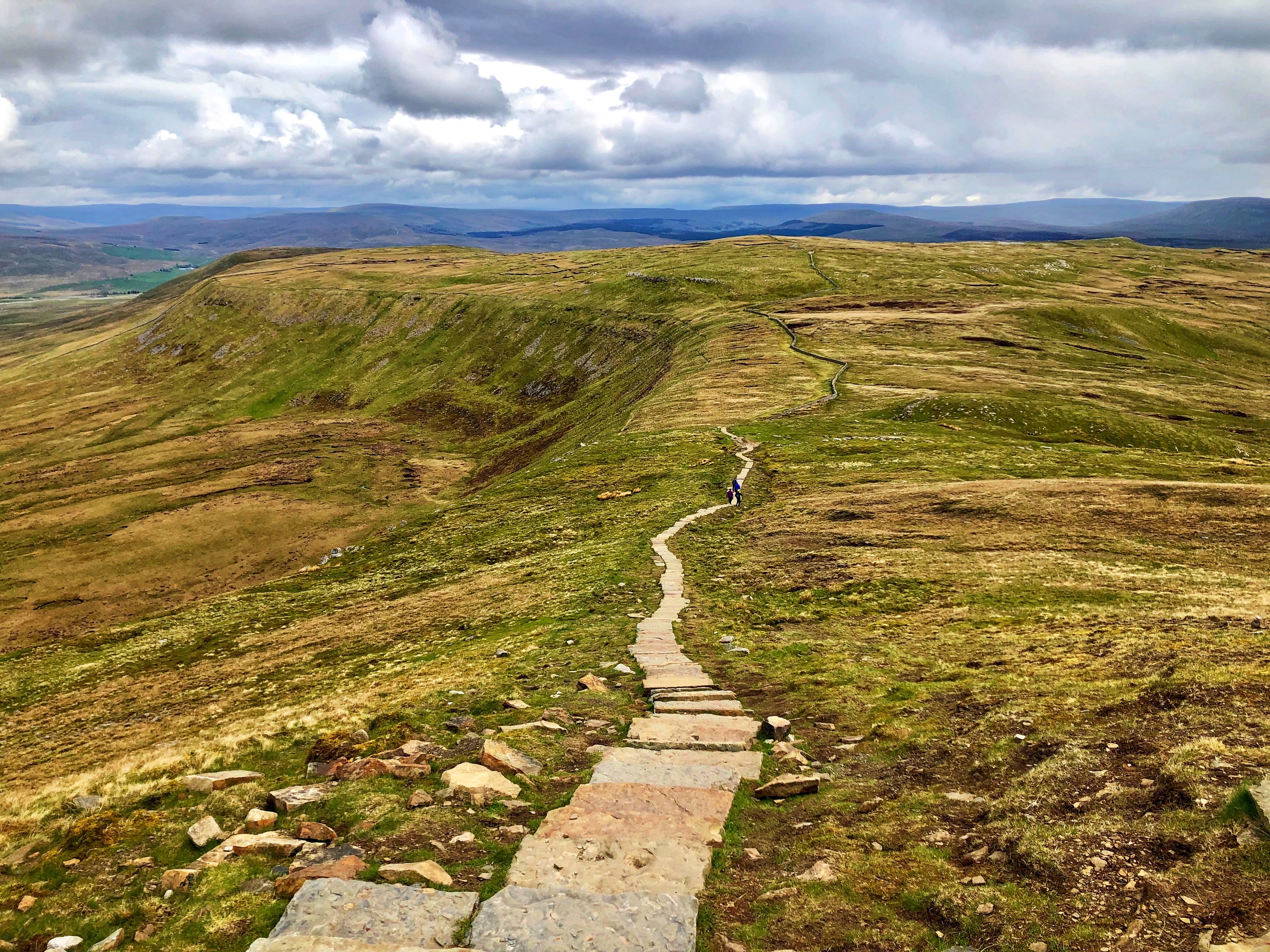
We headed back down the way we came and when the steep bit levelled out, we took a right fork along a new path towards Cairn Gorm. The fog cleared as we walked past the high, glassy Lochan Buidhe, and we enjoyed a leisurely stroll for the next 2 miles along relatively flat ground. We looked back at Ben Macdui and saw that the cloud had lifted, revealing its dark, hulking peak peering over the vast expanse of yellow-brown, open land, backed by similar dark summits and veined with rivers reflecting the white cloud above.

Looking towards Cairn Gorm (over the hill on the left)

We walked along the rocky ridge that towers above Coire an Sneachda with the grassy plain on our right and a sheer drop down bare rock to our left. The last 500m up Cairn Gorm were very steep and rocky, and we summited about 1pm. At the top sits a big cairn and a weather station, which consists of a small scaffold tower with some metal contraptions sticking out of it and a big black cylinder on a raised platform. It was quite busy as a lot of people walked to the top and back from the car park, so we didn’t hang around, although the view was lovely – panoramic, the horizon formed on all sides by rolling blue mountains.

We descended the steep-ish path north past the Ptarmigan centre and the ski lift, keeping a hopeful eye out as Ryan wanted to see a ptarmigan. Sadly the rocky, heathery ground was birdless. We finished our circular route back at the van around 2pm, had a quick nose in the visitor centre (which was largely closed due to covid) and decided to head down to Loch Morlich in the Glenmore valley for a swim.

We had set aside the whole day for our hike as we’d expected navigation to be a lot more difficult than it was, so I was happy to fit a quick swim in. There were signs at Loch Morlich warning of blue-green algae, but having been exposed without any effects before I decided to swim anyway. I wasn’t in the water for long as I was hungry and still a little wary of the algae (and the duck poo – I found myself in the middle of a flock), but the cold was exhilarating. The worst bit was peeling off my wetsuit in the car park as I shivered myself dry.

Ryan wanted to camp in the same place as we had the previous night, but that was on a dead-end road and as we’d ticked Ben Macdui off I wanted to explore somewhere else. After a brief “negotiation” we decided to grab some supplies from Aviemore and take the A939 road that runs south down the east side of the Cairngorms so we could see the town of Braemar and perhaps climb Lochnagar. The drive was lovely, and after an hour or so we found a good overnight spot at a quarry just outside the village of Tomintoul.

On our customary poke around we found a sculpture on a hill above the quarry, which was like a 3D mirrored picture frame a couple of metres deep that framed the pretty hills behind it. We had tinned chicken in white wine sauce (surprisingly good), rice and veg for dinner, and my highlight of the evening was Ryan returning from a toilet trip with reports of swooping owls and screeching rabbits, and one soggy foot from the only boggy ground in the vicinity.
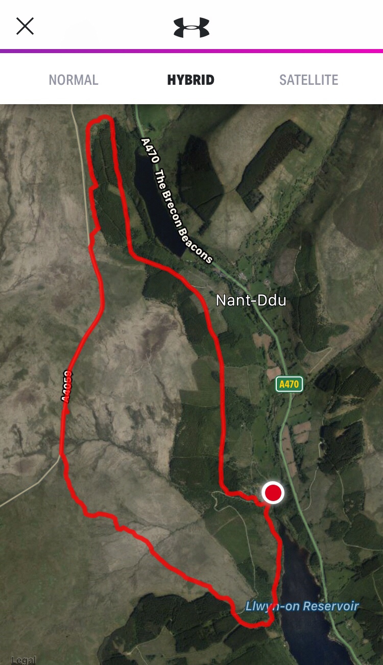
Lochnagar, May ’19

Last time I went up Lochnagar I couldn’t see a thing for blinding snow, cloud and ice. No crampons, broken compass, zero visibility, precipitous ridge, 10/10 could have died. During a visit to the Cairngorms in May I went up again to see what it looks like.

We started at the Spittal of Glenmuick and went up the same route as last time, following a straightforward gravel track which goes through a greener-than-green wood and up a long, gentle incline. It cuts through a few sweeping miles of high, heather-covered moorland, then becomes a less gentle incline and turns into a slabby path. It gets steeper still and the slabs disappear, leaving hikers to carve their own routes up the scrambley, bouldery rocks. As we climbed snow appeared, thickened, and soon covered everything.

We hiked/scrambled our way along the long, icy, rocky ridge which curves in a C-shape around a bleak, high tarn. The ridge drops precipitously down to the still, black water, exposing an intimidatingly sheer, dark granite face, and as we followed it round I was struck by the distance around the top to the summit. I realised that it was quite a feat to have climbed this munro in the middle of winter with zero visibility and minimal gear.

Eventually we reached the trig point, which stands proudly on a high outcrop, and stopped to gaze dramatically into the distance. We watched the mountains’ reddish-brown heather carpets fade to hazy blues and lilacs as they stretched out to touch the 360degree horizons, interrupted only by snowy peaks, and we could see for tens of miles all round.

I can’t think of a comparable landscape – at least not one that I’ve seen. Mountains often seem to envelop everything, standing high and imposing, shouldering each other as if competing for space. This place is different; equally dramatic, but in an open, rolling, panoramic way. If Glencoe in the Highlands or the Southern Fells of the Lake District are great white sharks, the Cairngorns are blue whales. Majestically vast, gentle and quiet. On a clear day.

We indulged in a picnic of olives, houmous, pitta and other posh bits (I didn’t even have porridge) and a cup of tea at the summit, then headed down the path which rolls over the hump-like southeast side of the ridge and lies parallel to our route up. We headed in the right general direction, then followed the path down along a crystal clear river. The snow retreated as we descended past lush, green vegetation and rushing waterfalls, and we found ourselves in a wood carpeted and roofed with unbelievably bright green foliage on the edge of Loch Muick.

The walk back was long and pleasant, along the flat, birch-lined north bank of Loch Muick. The rich trills of birdsong and the crunch of our gravelly footsteps emphasised the absence of background noise, and if I didn’t have a flight to catch I’d have been lured in for a swim by the still, dark water. We saw a herd of red deer in the open moorland beyond the loch and failed to identify several birds before returning to the pine wood by the car park, de-kitting and driving off [very, very] reluctantly.

With equal reluctance I caught my flight back to Manchester, lungs longing for more mountain air but chest otherwise empty as, once again, I’d left my heart in Scotland.

Great Gable, Lake District

I had one three-quarter day left in the Lakes and wanted to climb Great Gable or Bowfell. I decided on Great Gable as I could start at Seathwaite; I’d never approached these fells from the north, and as lovely as Wasdale is I wanted to see somewhere new.

I drove from Coniston and parked along the road just down from Seathwaite. I fell in love with the little cottages and farmyard feel of the hamlet, with its roaming chickens, stone walls and sleepy dogs. It sits nestled quietly in a valley carpeted by lush, green fields beneath wild, rocky ridges, alive with the sound of whispering rivers and rushing waterfalls, and feels a bit “F-you society”. Perfect.

I took the Gillercomb route as I’d read something that recommended it. I climbed the steep path which goes up the east side of the valley, through fields, over rocks and past a waterfall, and found myself on a gently ascending moorland plateau covered in the sandy-yellow grass that only grows in wild places. It rained but I didn’t mind; it meant I had the mountain (almost) to myself.

It got steeper and at the top of a ridge I made the mistake that I’ve made too many times before – to assume. This time I decided that the thick, green footpath on the map must be the obvious, well-trodden footpath on the ground at the top of the slope I’d just climbed, and that I was at spot x. I turned left, and it turns out I’d been a short distance from spot x at spot y, as I found myself inadvertently summiting a different hill – Base Brown.

Exasperated, I backtracked along the ridge and tramped up Great Gable’s little sister, Green Gable. After a quick detour to the fog-shrouded summit cairn, I descended the path south west and reached “windy gap”, a narrow gulley between the steep shoulders of the two Gables. It couldn’t be more aptly named – it was like all the wind in Cumbria was concentrated into that little gap, where it rushed and howled relentlessly as if it were trying to turn me into a squawking little human kite.

I escaped the noise and wind-beating by scrabbling round the side of Great Gable, which loomed ominously over me like a steep, rocky monster, shrouded in thick cloud. Then the all-too-common near-summit occurrence reared its smug, ugly head: the path became indistinguishable from the rock-strewn, scrambley mountainside. Footing was quite poor; steep, wet and loose, and I narrowly avoided a rockfall which, although small, would have knocked me a long, bone-breakingly hard way down the near-sheer edge.

I decided to stop searching for the path and climb directly upwards. Perilous but the right decision, as I realised when a tall cairn suddenly appeared through the fog. Relieved, I followed a series of just-visible cairns to the summit, which is marked only by a mountaineers’ memorial.

I descended back to windy gap via the proper path, then turned right to head back down Stye Head. I love a circular hike. This path is more well-trodden than Gillercomb, passes an attractive tarn and runs parallel to a crystal clear river down a long, gentle valley into Seathwaite. I arrived back at the van wet, triumphant and sad that I had to leave the Lakes.

Then I drove to Manchester for work the following day, which is not worth writing about in itself… But after a few days in the mountains a hotel shower felt indulgent!

The Old Man of Coniston (Lake District)

This was possibly the most heroic day of my life. It was an emotional rollercoaster that took me from 4am surrounded by wedding-drunk friends in a Blackpool kebab shop to three hours’ sleep in a hotel car park to 4pm alone at the top of a mountain.

Given the previous night’s antics, I never really expected to bag any summits that day. I left the wedding place around midday and headed to the Lakes, lonely and a little worse for wear. I had half-formed ideas about climbing the Old Man of Coniston and/or Great Gable before heading up to Scotland, so I found a quiet parking spot in Coniston and submitted to the pull of the mountain. Despite the dwindling day, hangover and rain, I couldn’t resist.

I chose a straightforward up-and-down route along the old miner’s track from Coniston, recommended by the internet. It started in an incredibly scenic valley; on my left was a hillside covered by a sea of bluebells which led steeply down to a stream flanked by bright, almost luminescent green oaks and birches. The water ran between rushing, white waterfalls and clear blue pools, and on another day I’d have jumped in like a graceful nymph gollum.

I crossed a bridge and continued along the valley, which opened up to form a wide U-shape backed by low, homely-looking ridges. An odd description but it fits – a few whitewashed miner’s cottages are nestled cosily in the low, flat plain in the middle, fronted by a wide, shallow, rocky river, and the peaks aren’t jagged or intimidating like some of the high fells. Because of this and its proximity to Coniston, this place feels wild without being isolated.

The track continued along the left bank of the valley, then got steeper, rockier and twistier as it curved around the side of a hill. Old machinery has been abandoned along the route, and the stone ruins of mining buildings remain overlooking the scrubby, heathery, rocky landscape in front of Coniston. It didn’t really feel like a proper mountain until I got to the tarn north of the summit, which the steep, long ridge loomed ominously over. From there the path got a bit more serious and it finally felt like I was climbing a mountain.

After a brief half-scramble I reached the plateau at the top and headed for a stone igloo-shaped thing. Then the Lake District repeated what it did when I summitted Helvellyn last year – caught me off guard and took my breath away. Layers of hazy blue mountains emerged from the horizon,  basking in the sultry glow coming from the moody, grey-gold sky. The view was panoramic, from the flat, glassy sea beyond wide salt plains to the west, through the rich, green pastures to the south to the mysterious, inviting mountains to the north east. The sheep were my only company and in that moment I was in heaven. The hangover was a distant memory.

After enjoying the lonely summit long enough to feel the cold, I defaulted to the Black Bull at Coniston. I flew back down the mountain, exhilarated to have defied the odds and made it up there, got the bed ready and wandered round the town before treating myself to a drink in the pub. I got funny looks from the locals but I’m used to that, and I set about planning the next day’s hike up Great Gable… Next post coming soon!

Endnote – I love all mountains but for some reason I particularly enjoyed this one. It could have been the fact that I had no expectations as I hadn’t expected to hike that day, the interesting and visible mining history, the variety of scenery, the fact I didn’t beast myself (for once) or the solitude, but I’d recommend this route to anyone and everyone – it’s beautiful, good fun and very do-able.

Ingleborough and Malham Tarn (Yorkshire Dales)

Monday 6th May 2019

Ingleborough

Blencathra and Skiddaw had whetted my appetite for mountains (not that it ever needs whetting), so we were up earlyish to climb Ingleborough in the Yorkshire Dales. We’d done the highest Dales summit, Whernside, a few years ago but I subsequently read that Ingleborough is more of a “must-do”. I didn’t do much research and we had a wedding near Blackpool to attend that evening, so we settled for what I’d call the “donkey track” that starts near the Old Hill Inn north of the mountain.

It was a very straightforward path that took us through sheep fields strewn with odd, low limestone walls, then over tufty, heathery ground to the base of the hill. Ingleborough is a long, steep-sided, yellow-green-grey lump whose distinctive lion’s back/loaf of bread shape dominates the valley. The climb up the steep north side was short and sharp; a few minutes of thigh-burning rocky ascent showed me that my legs had registered the previous day’s exploits, and I was puffing like a magic dragon towards the top.

From there, the summit was just a short walk west along the gently inclining plateau. We sat in the shelter thing at the top so I could marvel once again at the speed at which my jetboil makes me a cup of tea, took an obligatory trig point photo and headed back down a grassy path that runs parallel to the one we came up, taking in the rolling, yellow-green dales and quiet valleys. At the bottom of the steep bit we guessed our way back through fields of sheep and rocks and got back to the van early afternoon.

60486827_352301248757507_8521045464055808000_n

Malham Tarn

I wanted to see Malham Tarn for no better reason than I’d heard of it. We drove across the dales past rolling hills, drystone walls and escaped sheep, parked up and wandered over to the tarn. It was a pretty spot and fairly busy, but I’m not sure why I’d heard of it before as I wouldn’t call it spectacular. However, I did spot a climbable-looking rock face and plenty of camping spots so it may be worth more consideration.

We walked around the tufty moorland before hurrying back to get to the wedding reception, via a shop and a friend’s hotel shower. It was great fun (feat. tequila, spacehoppers, a caricaturist and an inflatable kangaroo), and that day (night) ended majestically at 4am in a Blackpool kebab shop. I’ll spare any more detail.

Scotland, Day 4: The Cairngorms – Lochnagar

Lord Byron eulogised this mountain in 1807:

England! thy beauties are tame and domestic

To one who has roved o’er the  mountains afar:

Oh for the crags that are wild and majestic,

The steep frowning glories of the dark Loch na Garr.

In contrast, Queen Victoria wrote of Lochnagar in September 1848:

“But alas! Nothing whatever to be seen; and it was cold, and wet, and cheerless. At about twenty minutes after two we set off on our way downwards, the wind blowing a hurricane, and the mist being like rain, and everything quite dark with it”.

After experiencing Lochnagar on a bleak day in December, I agree with the poet’s “wild”, “steep” and “dark” but otherwise I’m with Queen Vic. We woke bright and early in the Spittal of Glenmuick and met our friend Mike at the Lochnagar car park before sunrise. We set off on the 10ish-mile hike in a mix of fog, drizzle and gloom, disappointed with the weather but glad for the company.

The first section took us across a flat, heather-covered plain, with Loch Muick away to the south and a dark line of trees to the north. We couldn’t see much through the fog, but I knew that Loch Muick was cradled on three sides by steep ridges; I expect it’s stunning on a clear day. Lochnagar is within a few miles of the Balmoral estate, and I could just imagine the Queen (maybe a few years ago) tearing round the track in a Landrover, or a shotgun-wielding Philip bumbling after some grouse.

It was an easygoing route  for about three miles, along a wide, stony track up a gradual incline. We branched off left about a mile east of Meikle Pap, where the track turned into a slabbed stone path. I got overexcited at catching a glimpse of a few startled red grouse, then we hit the snow and the hike got a bit more complicated.

Just as the path started getting scrambley, patches of snow appeared. Snow does a great job of concealing paths, especially when the landscape is strewn with rocks, covered in wild, tufty vegetation and bereft of other summit-seeking humans. We followed it as best we could but did a lot of guessing, aiming in the direction of “up” and “west-ish”.

The vegetation disappeared, and after scrambling up a formless sea of steep, slippery rocks, keeping close to avoid losing each other, we hit real trouble – just as I got excited at a flock of winter-white ptarmigans. Mulling over why on earth anything would choose to live up there, we struggled through an annoying mix of soft, calf-deep snow and hard, unyielding ice. As we reached a kind of plateau, the rocks grew sparse, the climb became less steep, and the already hurricane-like conditions worsened.

Lochnagar stands at a lofty 1,156m above sea level and curves around a beautiful northern corrie (I know it’s pretty thanks to Google images). The path follows the ridge along the top edge of the corrie, so the exposure is huge and complacency could result in a massive fall. This was problematic as by this time visibility was non-existent, we were ill-equipped (no crampons or axes – terrible foresight) and we didn’t know exactly where the summit was. Or where we were.

52669907_1980525335379703_1916488697524518912_n

White-out

As we pushed on, I truly understood the term “white-out” for the first time. The only way to distinguish “up” and “down” was by looking at the other two and seeing where their feet were in relation to their heads. Ice, snow, cloud and sky all merged into one disorienting, blinding, infinite nothingness, like in a dream in a film, until little dark specks appeared and I tried to blink them away. Communication was limited to shouting in each others’ ears, and any exposed inch of skin was beaten raw by the strong, bitterly icy winds.

Just when it couldn’t get any worse, it did. We reached a false summit and the ground became sheet ice. Literally like an ice rink, only harder and less flat. I’m sure we went round in circles for a bit, slipping over constantly, resorting to bum-shuffling and actually laughing at our own ridiculousness while remaining acutely aware of our proximity to the deadly edge of the ridge. Still determined to reach the summit, we paused for a painfully cold moment to check the map and decided simply to follow the compass north to where we thought it was.

This decisiveness saved the day, and as the towering pile of rocks loomed through the whiteness I almost collapsed with relief – I’ve never been so delighted to reach a trigpoint. I slipped onto my trusty old compass and snapped it, fortunately without stabbing myself, but it had done what it needed to do. We fumbled about for a quick photo, then practically flew back down the mountain, eyebrows, eyelashes and beards (even mine) heavy with ice.

I would have liked to make it a circular route and gone back along the north side of Loch Muick, but given the conditions we decided the way we came was the quickest and most certain way to the pub, and it’d look the same anyway. The fog had cleared slightly once we were back on the wide, stony track, revealing a rugged, heathery landscape. From there, the walk back was made a drag by our cold, wet-through clothes and desperation for a drink, but we reached the car park eventually. Lochnagar is definitely one to come back to on a better day, but I was glad for the adventure we had.

Semi-thawed, we drove to find a pub before heading to Perth for the night. We ended up collapsing on the sofas in the Deeside Inn at Ballater. It couldn’t have stood in starker contrast to the bleakness of a few hours earlier; the lounge was a huge room with deep red walls, thick curtains and dark wood beams, lit softly and warmed by a roaring fire. It had tartan sofas with pheasant-patterned cushions, a big Christmas tree, books, boardgames, a piano, complimentary crisps and (most importantly) cider. I think my life peaked at that moment – in there, the world was perfect.

52985861_2373960469515791_200852427610521600_n

Scotland, Day 3: The Highlands – Kinlochleven, Fort William

Admin

We woke later than usual, around 7.30am. I was surprised by how much later the sun rose and how much earlier it set compared to home – about 8-8.30am and 3.30-4pm. Morning admin was a repeat of yesterday; porridge, coffee, tidying and jam sandwich making.

Ice climbing

50442196_1979578599017896_1329863299524722688_n

After a 10-minute drive from our overnight spot, we arrived at Ice Factor in Kinlochleven – the largest indoor ice climbing centre in the world. It’s an impressive building which houses an indoor rock climbing wall, shop, cosy café and ice climbing area, which is pretty much a giant freezer. We’d booked in for the earliest taster session of the day, keen to have as much exploring time left over as possible. I started to write about ice climbing in this post but I got carried away, so for the fine detail read my separate post – Ice Climbing for Idiots. Basically, it was really fun and I want more.

Hiking

We left the centre with big smiles, grabbed our hiking kit from the van and set off on a route we’d planned the previous evening. We had hoped to climb some munros (Scottish mountains over 3,000ft high) in the Mamores range, which lies between Kinlochleven and Ben Nevis. We actually ended up doing a different route which took us up and west, rather than north, due to a disappearing footpath and some dodgy-looking weather over the mountain tops, so unfortunately we didn’t reach any summits.

Nevertheless, we didn’t mind deviating from the plan because we’d set off late, got some breathtakingly-awesomely-stunningly beautiful views down the length of Loch Leven and had a lovely couple of hours anyway, despite some questionable “footpath” terrain and glute-burningly steep bits. The hike also took us past Grey Mare’s Tail waterfall, which is well worth the short walk from Kinlochleven.


Fort William50474548_550658935436708_6670099998987780096_n

Our alternative route meant that we got back to Björn with enough time spare to get to Fort William for a wander round. It’s an attractive town with plenty of shops and pubs, and seems to be a kind of outdoorsey “hub” with a nice buzz. We managed to do a bit of Christmas shopping before treating ourselves to a meal in a café – I don’t think a jacket potato has ever tasted so good. Fed, warmed and out of daylight, we got in the van and headed east.

The Cairngorms

We’d arranged to meet a friend to climb a munro in the Cairngorms the following day. I chose Lochnagar after reading about it in a “Britain’s greatest mountains” feature of The Great Outdoors magazine (don’t tell my cool friends), so we drove the three hours there from Fort William. It was a shame to drive across so much of the National Park in the dark, but we’d seen it before and were keen to make the most of the daylight hours outside. We arrived at the Spittal of Glenmuick quite late and quite tired, so we parked along the dead-end road, admired the blackness of the sky and the utter, pindrop silence, packed bags ready for an early start and slept.

Brecon Beacons: 3 Days, 4 Waterfalls, 5 Mountains — Day 2

I was up with the sun and raring to hit the mountains, but the weather had other ideas. It would  have been do-able in the wet, but I was interested in visibility more than anything and my Met Office app told me it was due to clear in the afternoon. I’ve been up Pen y Fan in the fog before and done enough beautiful mountains in poor conditions to barely differentiate between them, so I fancied taking the chance to appreciate the scenery.

I’d found out that Brecon had a cathedral and I’m interested in historic buildings (don’t tell my cool friends) so we killed some time wandering round there, then found a pretty, wooded walk by the river. I’d expected (and half-remembered) Brecon to be a bustling, outdoorsy hub like the Fort William of the Highlands or the Betwys-y-Coed of Snowdonia, but it was fairly quiet on Saturday night and totally dead on Sunday morning.

Given the saving we made on dinner the previous evening (see Day 1’s post), we returned to Wetherspoons for breakfast and route-planning. I picked a circular route based very roughly on one described in an outdoorsey magazine that started at one of the car parks in Taf Fechan forest and encompassed the “Big Four” peaks: Fan y Big (719m), Cribyn (795m), Pen y Fan (886m) and Corn Du (873m). It’s an interesting area, geographically speaking: a big, semi-circular ridge linked to six smaller, semi-circular ridges, each with sweeping, sloped sides and long, smooth spines. If anyone ever wants to talk about maps and landforms I’m just a geeky message away.

On the way there it p***** it down and I thought of all the waterproof clothing I didn’t want to wear, but as we drove uphill and into the forest it eased and we were enveloped in thick, blinding fog. We set off in waterproofs but didn’t need them. The first part of the walk took us up a cycle path and along a bit of road. We turned up a steep, rocky footpath past some misty waterfalls, which plateaued onto a foggy, steep-sided ridge. Although we were on the Beacons Way, the route turned off the path and (according to the map) across an open area of land with just “pile of stones” and “stones” marked to prevent us wandering into the middle of nowhere.

Fortunately it was quite easy to follow and we ended up along Craig Cwmoergwm, headed towards peak number one – Fan y Big (behave). Unfortunately we missed the path that led straight there and ended up skirting along the side. After realising we were heading downhill when we should be going up, a quick map check revealed we’d taken a parallel path that took us past the peak; a few paths converged at Bwlch ar y Fan, so we decided to carry on and take a different path up from the other side.

We had jam sandwiches and salad (pre-prepared and super pretentious: quinoa, avocado, beetroot – you get the idea, but mega-nutritious) where the paths met, just as the sun was breaking through. Turning back on ourselves we took the short, steep path up Fan y Big, past a sluggish DofE/cadet group, and only recognised the summit by a distinctive, diving board-esque ledge we’d seen in a photo and a small, easily-missable metal plaque engraved with a picture of some hikers. We admired the smooth U-shaped valley, the river nestled between its shoulders and the long, sweeping sides of Bryn Teg ridge opposite, then realised we were being eaten by nasty black flies and turned back down the steep path.

When we were halfway down, the loud, bleak caw of a couple of ravens reverberated around the valley, so when they landed on the opposite ridge I ran off to take photos. I’d forgotten how large, wild and impressive these fairytale-villain birds are; they cruised and swooped around the valley like majestic, jet-black rangers who didn’t want to be photographed.

Next up (and I mean very up) was Cribyn. Standing opposite Fan y Big, this sharp ascent was the toughest of the route. We powered up earthy footholds that had been toe-punted into the steep side, taking short, aggressive steps and settling into steady, silent rhythms. At the top there was sadly no trig point, and we were sadly attacked once again by hundreds of bitey little f***flies so we didn’t hang about. We didn’t miss the view as we’d wandered into cloud almost as soon as we left the trough of the valley.

We headed to the left and downhill, along the long, steep path between Cribyn and Pen y Fan that follows the curve of another horseshoe ridge. No navigation was necessary, so as soon as we descended below the cloud we could enjoy the sun and the rich, springtime green of the surrounding landscape. What seemed like the “main” valley was to our left, broad, long and shouldered by the horseshoe ridges of Fan y Big & co on one side and a long, straight ridge – Craig Gwaun Taf – on the other.  The glassy water of Lower Neuadd Reservoir was nestled in the valley’s wide, smooth trough, and the black pines of Taf Fechan forest seemed to mark the distant end of the long basin. In contrast, the valley to our right was shrouded in cloud, which crept towards us but was driven upwards in a towering, misty wall by the protective sides of Cribyn.

The adjoining sides of Cribyn and Pen y Fan are like a giant’s half pipe skate ramp, smooth and gently curved. The path is rocky and (in my opinion) easier to climb up than down. Approaching Pen y Fan from the Cribyn path, the last section is a half-scramble up some steep rocks before popping up onto the plateaued summit to surprise the mass of “tourists” who had ambled up from the Storey Arms car park via the heavily-trodden, straight-up-straight-back-down route.

Once again, the summit was swarming with f***flies. I don’t know why but they only seemed to hang about right at the very tops of the mountains. They’re jet black, chunkier than mosquitos and live on a diet of human. A couple of obligatory summit photos later we were keen to get away from flies and people, so headed along the busy ridge at the “head”  of the valley to Corn Du. The section between Pen y Fan and Corn Du is so short and relatively flat that it seems like cheating to count it as the fourth summit, but it’s marked on the OS map so I’ll take it. Again, too many flies/people meant we didn’t hang about for long, so we hit the long, straight ridge of Craig Gwaun Taf (or Rhiw yr Ysgyfarnog?) that lies on the opposite side of the valley to Fan y Big & co.

This was one of my favourite parts of the walk. We came across four people in about an hour (a fell runner, a photographer and a hiking couple with a dog – more my kind of people), ate more jam sandwiches, the sun broke through, we’d escaped the day’s fog and the views were magnificent. The path runs along the top edge of the ridge so I could really enjoy the panorama; the long U-shaped valley that I’ve waffled on about was on the left, cradling its reservoir, opening out onto swathes of dark green-black forest and sided by the foggily elusive horseshoe peaks. A meandering, river-veined valley was on the right, the gracefully sweeping sides of the ridge were ahead and brothers Pen y Fan and Corn Du watched over the valley from behind. All around, the distance was filled with gentler hills, blacker forests and grassy, green-yellow plains.

We eventually came to the steep “footpath” that cut left down the side of the ridge and back towards the car park. From a distance it looked more like a steep rockfall than a path, but we made it down and into the belly of the valley. We walked past the half-drained Lower Neuadd Reservoir, which was surreal as it was bordered with bright pink rhododendrons and some unknown shrub with vibrant yellow flowers. The air was as still as anything, not a soul was in sight and a derelict dark stone building on the edge gave the place a Call of Duty-esque eeriness, but it was equally serene and beautiful. The late afternoon sun highlighted the tall pines against the distinctive blue silhouette of Pen y Fan, the bushes were every shade of green and the water remaining in the reservoir was black and as smooth as glass. The only sound we’d heard all afternoon – beyond our own voices, the scuffing of walking boots and the click of my camera – was birdsong; not one road or aeroplane.

The track back to the car park was lined by trees and rugged sheep fields. Sitting down and de-booting after a day’s hiking was (as always) wonderful. It was about 7pm and my head was swimming with the thought of pub grub and a pint, so after a brief and picturesque goose chase (we accidentally found ourselves in a Thai restaurant disguised a pub, still in hiking gear – we realised we made a mistake when the waitress lit a candle) we ended up at the Three Horseshoes near the campsite. The steak and ale pie and cider went down way better than the bar karaoke, and I slept like a log. Little did I know that the following day I’d play around in waterfalls and get lost on Lord Hereford’s Knob… Day 3 to follow!

Mapmywalk reckons we did 19.4km in 4 hours 18 minutes, if anyone is interested. Google / walking forums said that similar routes take about 6 hours, but we do maintain a decent steady pace so I wouldn’t say they’re necessarily wrong. Generally we walk briskly but were by no means rushing – I often faffed around taking photos, having a snack or admiring some bit of nature. I have a feeling the app might take that into account, as it felt like we were out longer. Fitbit reckons I did 35,773 steps.35151289_10216632388587715_7897664822563569664_n

Brecon Beacons: 3 Days, 4 Waterfalls, 5 Mountains — Day 1

This trip concluded in an unusual way: we accidentally climbed Lord Hereford’s Knob twice. I’ve had worse Monday evenings.

There were some strange bits in the middle too: once we ended up in a field with a bull, twice we got lost (not so unusual), thrice we found ourselves in Wetherspoons (even less unusual) and we got swarmed by “f***flies” four times. If nothing else, I learned to count.

We left about 6am on Saturday and got to Go Outdoors Gloucester for when it opened at 9. I could spend so much money in that shop, if I had so much money. We got to the campsite about midday after cursing our way through the Hay-on-Wye festival traffic and were pitched and heading to Brecon within half an hour, hoping to get some afternoon inspiration from the visitor centre. Turned out the visitor centre had moved, but eventually we ended up parking near Garwnant (a lovely eco-tourist-information-car park-café-woodland-centre thing) and planning a rough route over the car bonnet.

We set out at 3ish in the sun, heading South and admiring the serene black water and idyllic fishing spots of Llwyn-on Reservoir. Before long we veered off the road, across a stream and onto a windswept, golden plain. A little way in we realised the path went slap bang through the middle of a group of cows. Having grown up in the countryside, this didn’t faze me until I spotted an enormous “cow” with rippling muscles, a tree-trunk neck and an unmistakeably un-udder-like undercarriage. We thought it unlikely there would be a bull in a field of cows, but there definitely was. To spice things up there were a handful of calves in the melée, and anyone who knows anything about animals will know that mums don’t like blundering, invasive humans getting near their babies.

Regardless, we gave them a wide-ish berth, survived and came across our next, often-frequented challenge: the elusive, disappearing footpath. As usual we took a blasé approach and headed in “roughly the right direction”, North West across the knee-deep tufty, grassy, boggy, extremely untrodden plain (I had flashbacks to my last Dartmoor trip). I nearly lost them to the suctionney, hidden, black mud a few times, but apart from that my trusty flip flops served me well.

The sun was warm and despite some haze, the visibility was pretty good. Although frustrating to cross, we’d found an extremely picturesque bit of Wales. Pen y Fan and its horseshoe-shaped brothers lay to the North East, ahead and on our right, and an anonymous green ridge sloped and curved protectively behind us and to the West. Black forests broke up the rugged, green mountainsides and we were surrounded by the rippling, golden (deceptively deep and tufty) grass of the open plain, interrupted only by a few anomalous trees and whispering streams. I spent a while fiddling with my Nikon, trying to capture an arty close-up of pretty little pastel pink flowers which cropped up occasionally, alone and peaceful.

I think we crossed the Nant Ffynnonelin, the Garwnant Fach and the Garwnant Fawr streams, as well as about 2km of this wild, beautiful, slow and hugely irritating terrain, before we reached the A4059 and plodded a few kilometres North along the roadside and past a lot of (surprisingly photogenic) sheep.

We’d hoped to be able to cut down into the forest to the East via one of the footpaths marked on the map, or even over the fence and down a firebreak, but the map was a few years old, the fence looked a few years new, it looked like new trees had been planted and naturally we couldn’t see even a trace of a path. It was coming up late afternoon and the pub had been beckoning for a while; it wasn’t the first time I’d half-formed a plan ready for if/when we were lost, hungry, miles from anywhere and facing a cold, dark night.

We ended up pulling away from the road, cutting across more nasty ground and down a steep hill to the East, right along the North-Western edge of the forest that had been taunting us for over an hour. Halfway down the valley, it was a huge relief to find a gate and a disused-looking track heading back into the forest, criss-crossed by fallen pines and lined by half-uprooted trees whose earthy, rooty bases yawned and groaned as the wind pulled the branches back and forth.

Having kept half an eye on the mist that had been creeping up the valley from Pen y Fan way, we pulled waterproof coats on when we felt the sudden, pre-rain temperature drop and stillness of the air. Fortunately it didn’t materialise and we followed the track a long way through the forest, straight back to the car. 13km and just under 3 hours later (it felt like longer, bearing in mind we’d expected to do half that) we headed to the pub, dizzy at the thought of a pie and a pint.

Unfortunately it wasn’t that simple – several pubs had stopped serving food by the time we arrived (to our horror), so we had to backtrack to Brecon and resort to Spoons. It’s not often I feel underdressed in a Wetherspoons, but half the population of the town seemed to be dressed up and congregating in there while I sat and people-watched in my second hand hoodie, outdoorsy trousers and flip flops. Nevertheless, it hit the spot and saved us enough pennies to warrant returning for breakfast the next morning… Adventures of Day 2 to follow!

Tip of the day: as any other ex-army cadet will tell you, a map is only accurate to the day (the minute, in fact) that it’s drawn!