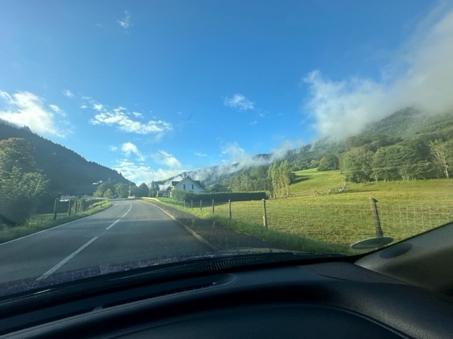
Having just emerged from an English winter full of cold, dark mornings, it was blissful to wake up to warm air and bright sunshine. Reece and I set off on a run around the block at 8am, before the heat of the day set in. Harare sits on a plateau at an elevation of 1,500m above sea level and – as Reece had warned – 6km felt a lot harder than usual (particularly the long, steady hills) due to the lower air pressure and warm temperature.
I enjoyed the run regardless, which was mostly on the road except for the occasional dirt “pavement”. We passed lots of leafy, walled gardens filled with trees, people going about their mornings, a couple of schools and a few rickety-looking market stalls. At one point a lanky teenage boy started running after us and I gripped my phone a bit tighter until Reece turned, unperturbed, and complimented his pace. At this, he sprinted off ahead – his feet barely touching the ground – before returning to his friends. That was a bit weird.
Errands
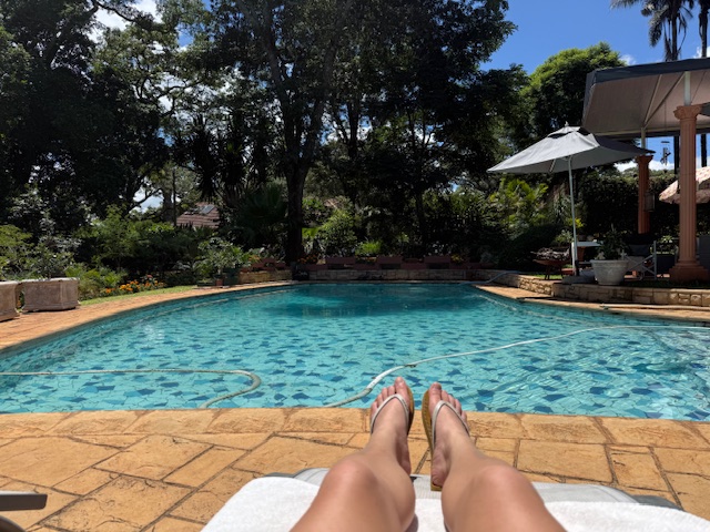
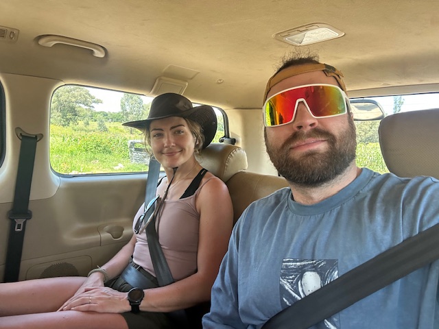
We returned to the house, puffing, and took brief respite in the pool. After a breakfast of croissants with ham and cheese, the six “kids” – Reece, Bryn, Ryan, Isabelle, Tilman and myself – drove 20 minutes to Kieran’s house, which is set in a fancy-looking golf estate with its own security guards, to collect his people carrier. We met Kieran’s lovely wife Trish, had a quick look around the garden – which backs onto the fairway and reportedly receives the occasional golf ball (and cobra in the pool) – and continued on errands.
We stopped at a petrol station (full service) to get fuel, then went to a pharmacy to consider a course of malaria tablets. Shelley had done the right thing and advised us to take them, with the caveat that if we didn’t then we could take antibiotics home just in case, and on learning that they’d set us back $60 each – and might make us feel rough – I decided against it. We bought coffee from a little cart instead.
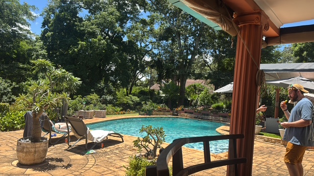
After a quick detour to drop off a deposit for tattoos, we returned to the house and chilled for a couple of hours. I chatted to Iz by the pool while the boys wound each other up playing darts until lunchtime, when we all headed out to Tin Roof, the local bar/bistro that Reece used to manage.
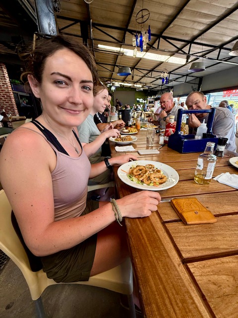
Tin Roof
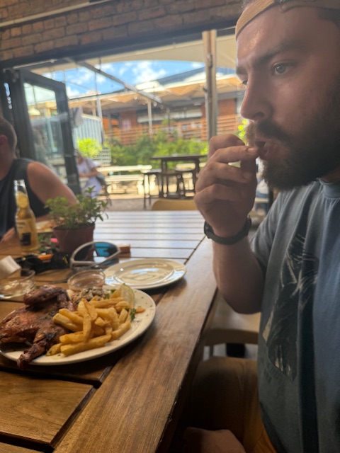
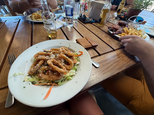
Set in a small shopping park, we found Tin Roof to be a lively place with an open-sided, indoor-outdoor feel, cheap drinks and a great menu. We sat at a long table and tried to keep up with the introductions – Reece’s family seemed to know just about everyone in there. Between us, Ryan and I had a calamari salad and a half chicken with chips, both of which were very good. An ice bucket of beers kept thirst at bay.
Venturing outside Harare
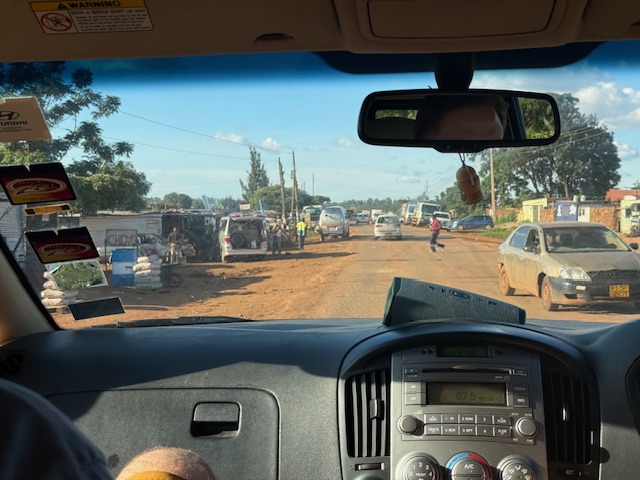
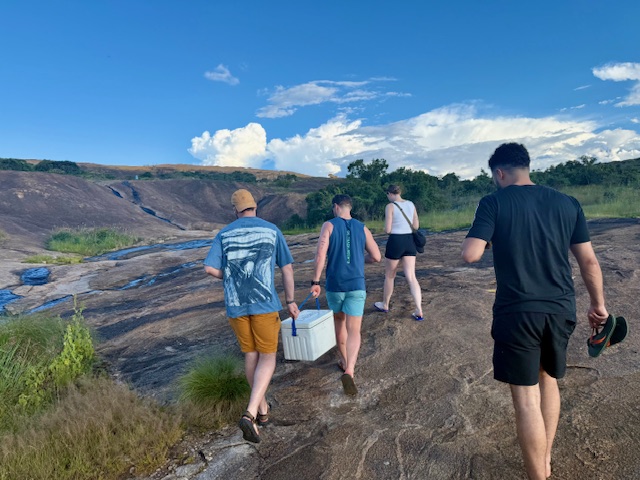
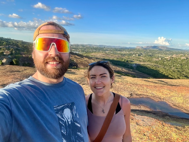
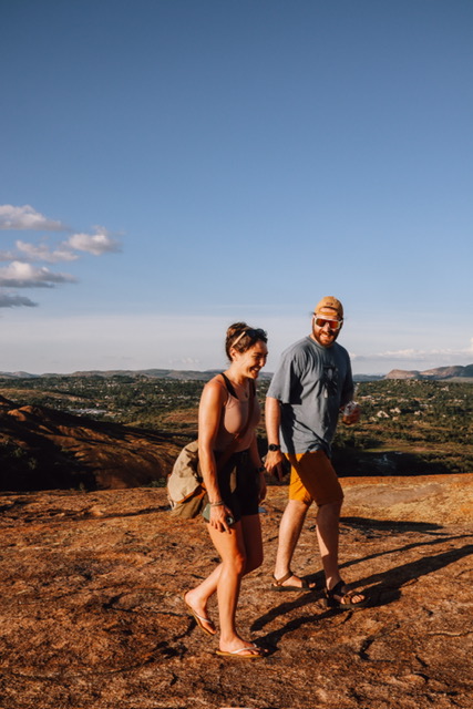
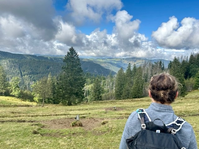
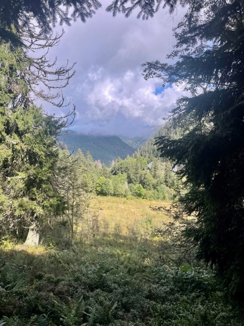
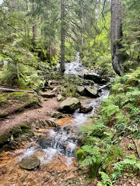
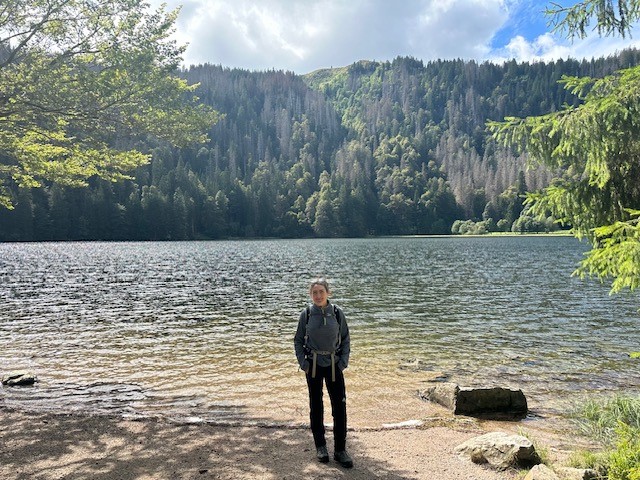
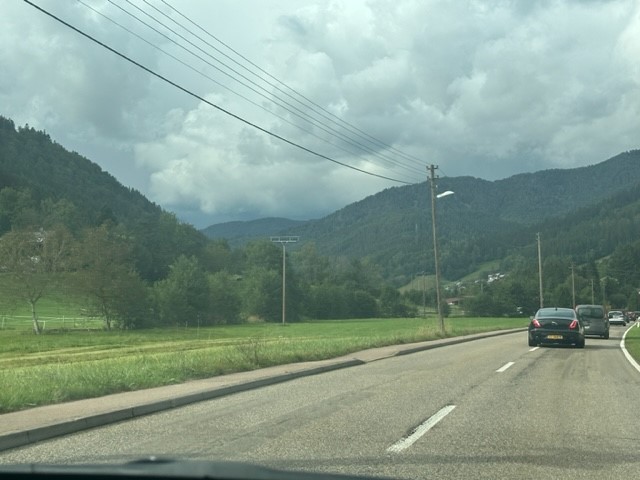
We got back to the house about 4pm to fill a coolbox, then headed straight out for an easy hike and “sundowners” – drinks and a sunset – at a place called Domboshava. Reece conducted the 40-minute drive, which took us north out of rush-hour Harare and provided our first experience of more rural Zimbabwe.
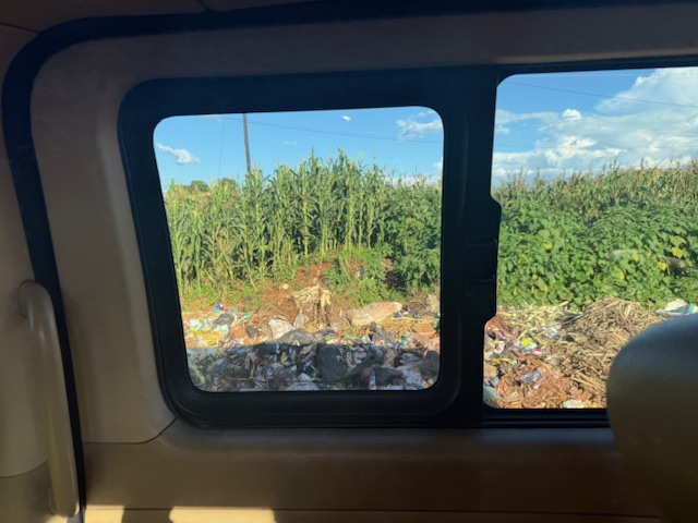
We passed a few farms and a lot of barren-looking scrubland, then came to a shabby-looking village where numerous huts made of just about every material under the sun – wood, chipboard, corrugated metal, tyres, cloth and cardboard – seemed to merge into one another. A boundary was formed between the potholed road and small maize fields by plonked cars, trucks and a ditch completely filled with black sacks and plastic rubbish – Reece explained that public bin services were non-existent. People milled around everywhere and we soon found ourselves behind a pickup truck rammed with a dozen haphazard-looking passengers.
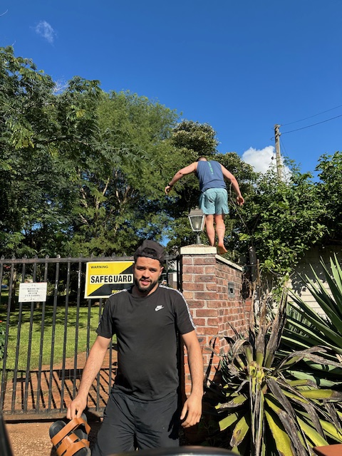
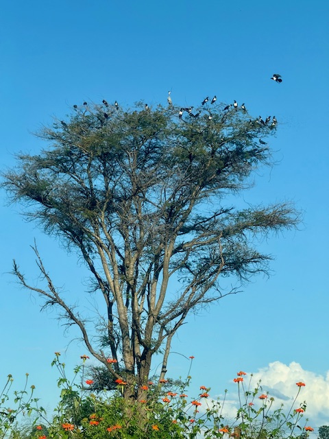
Forgot the gate key…Tree full of pied crows
After more potholes, fields, assorted settlements, scrub and the occasional smart-looking bungalow, we turned onto an even bouncier dirt track and soon arrived at a small car park. We each paid the $10 tourist fee for entry to Domboshava and set off on our walk.
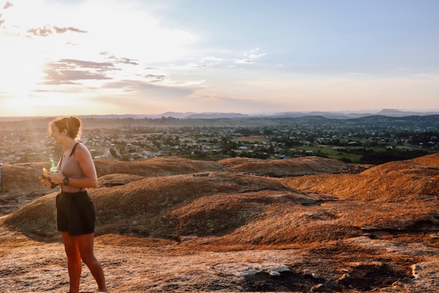
Domboshava hike and sunset
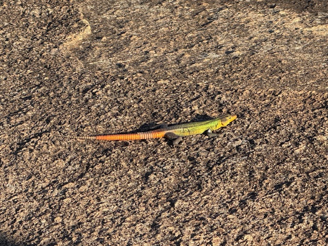
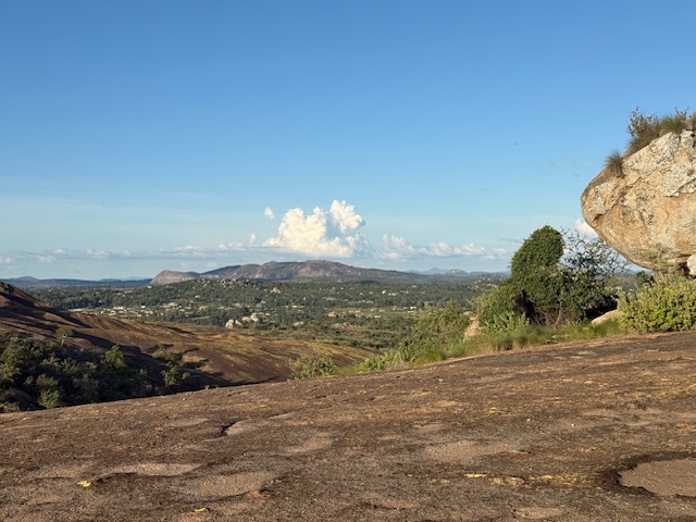
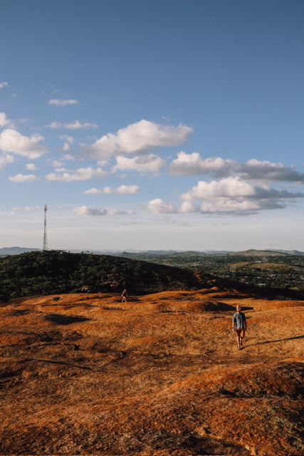
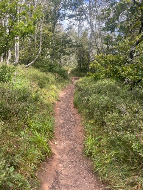
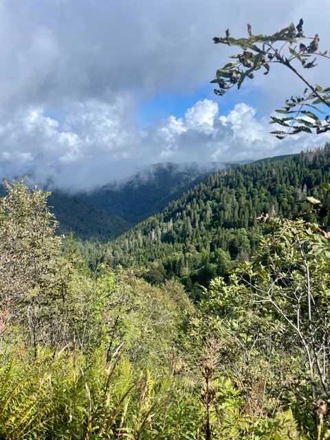
Domboshava is an area of granite hills that features caves, unusual rock formations and ancient paintings. The landscape was unlike any I’d seen before: a great, rolling mass of bare, grey-pink rock rose up ahead like the back of a great, sleeping beast, punctuated by occasional fine cracks, thin streams and inexplicable pockets of greenery. We followed painted arrows up the side of the hill, stopping to watch colourful lizards that basked in the sinking sun and darted away as we approached, their legs wheeling comically in a quick, circular motion.
Some lizards……are better camouflaged than others
Barefoot and new to Zimbabwe, I remained conscious – to Reece’s amusement, I think – of the snakes I’d read about, whose venom can kill or maim in diverse and unpleasant ways. However, this fear was overridden by my fascination with the vegetation that somehow took hold in the seemingly soil-less granite, which ranged from patches of yellowish grass to thickets of shrub and swathes of verdant trees. In the “wild” for the first time, I was in my element.
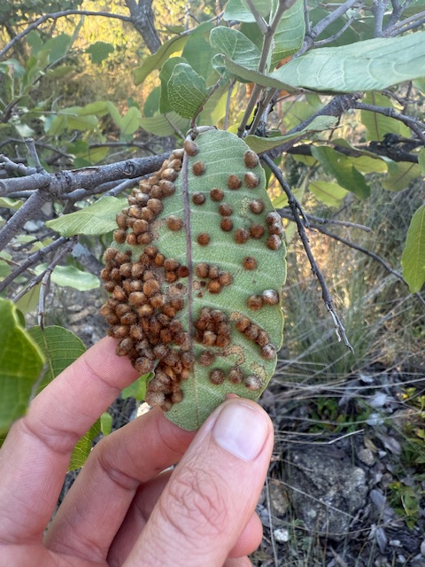
Some kind of parasite/fungus/spawn
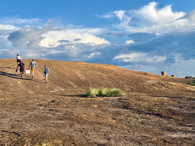
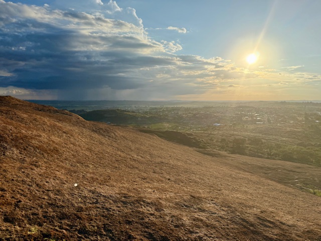
As we gained the rounded crest of the ridge, the greenery receded. A low sun cast exaggerated shadows across the rolling undulations ahead and illuminated the thin layer of yellow-orange lichen that covered the rock, such that the land appeared to glow copper-gold. This, combined with the ominous, blue-grey sky on the horizon, gave the other-worldly impression that the normal order of light – bright above, dark below – had inverted. We could have been walking on Mars.
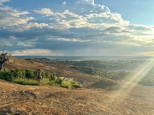
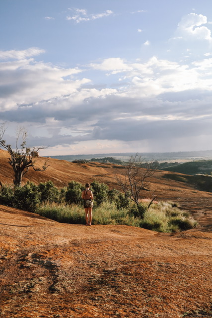
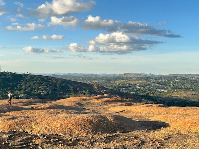
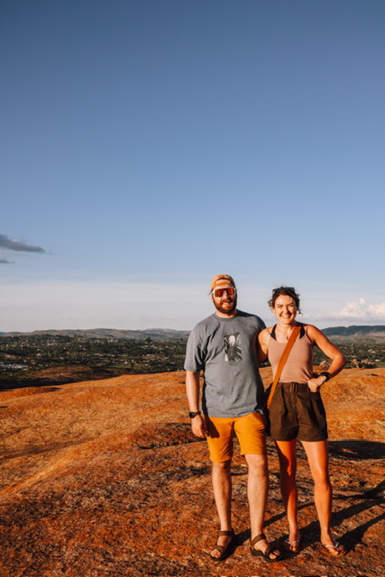
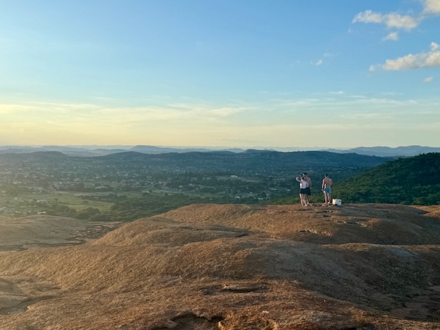
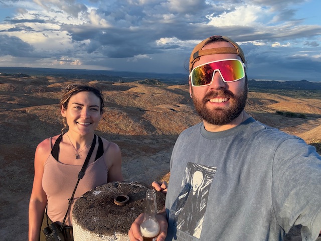
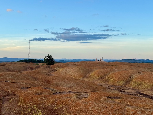
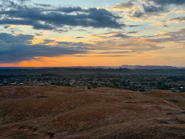
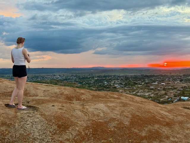
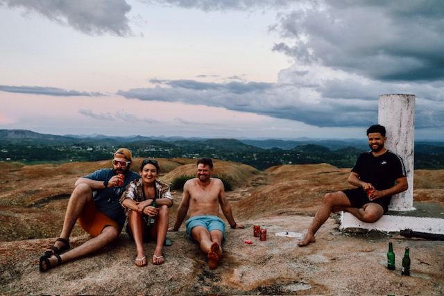
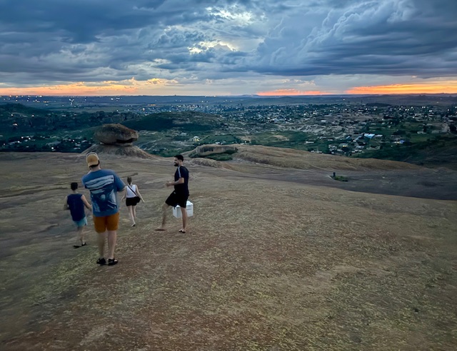
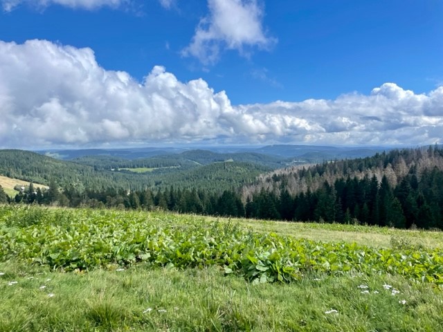
We followed the wide, humpy ridge all the way to the summit, which was marked by a round trig point. The view was spectacular: a 360 degree panorama of surrounding hills arranged in long, layered ridges, separated by wide, flat-bottomed valleys filled with fields, plains, forests and scattered villages. The sky above was clear and blue, with occasional fluffy white clouds drifting above the horizon, and we could hear some happy Friday evening clamour coming from indistinct parts of the basin below. We cracked the beers and I wandered alone across the strangely undulating plateau, drinking in every detail and looking for bugs, while the others sat and watched the sun as it fell towards the westerly hills.
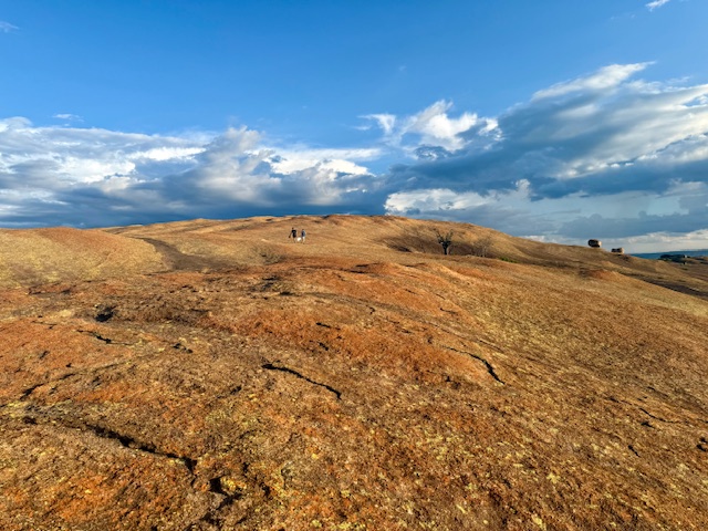
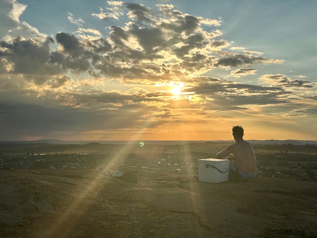
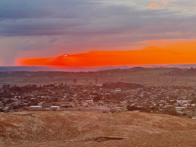
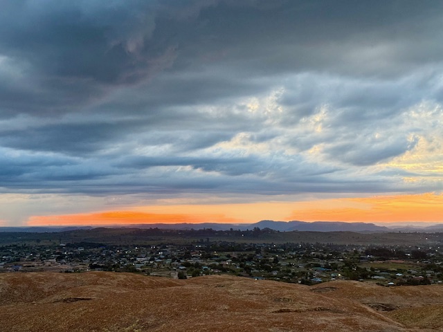
Dark clouds crept towards us from the south and east in long, thick fingers and I returned to the others just in time to see the sun setting beneath a foreboding, grey veil. It sunk behind the horizon through a clear, lava-red stretch of sky, which faded at the edges to a perfect watercolour of orange, pink and yellow that accentuated the hazy blue silhouettes of distant peaks. As the soft breeze picked up, we looked east to thick columns of localised rain and flashes of lightning and decided that it was time for tea.
We descended the side of the hill via a couple of huge boulders balanced extraordinarily on natural plinths, connected by a very small surface area. They looked like abstract, unlikely works of art, ready to topple at any minute. The light faded and we found our way back by more painted arrows. As we approached the trees at the bottom, the air became alive with the incessant buzz of cicadas and the distinctive trill of a nightjar. We returned to the car just as the darkness closed in, and on the journey back – in between being brain-rattled by the roads and wincing at a few close overtakes – I watched lightning explode inside clouds above the hills as if someone had put a light bulb inside a balloon.
Probably won’t win any photography awards but this shows lightning inside a cloud
Home
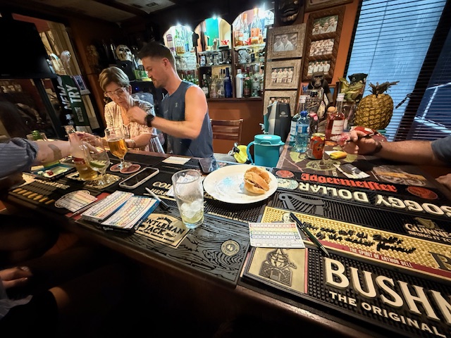
Back at the house we sat at the bar and played Iz and Tilman’s game “Quixx”, which was good fun despite my record-low score, and Shelley made us plates of ham and cheese rolls while the rains came again. We each negotiated our individual attendance on the morning run Reece had planned and – in light of the run and tomorrow’s upcoming party – went to bed around 11pm.
My main takeaway from day two? Sundowners are a winner.
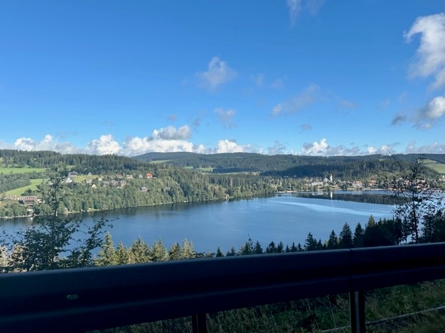
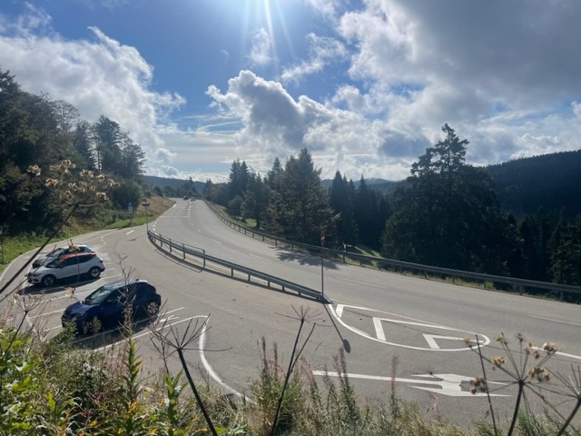
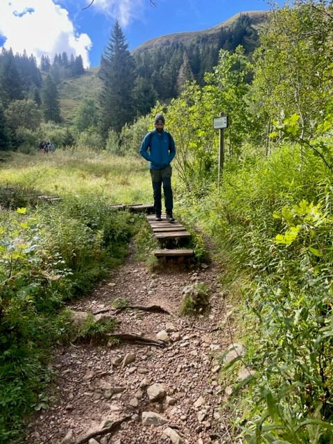
We’d kept a close eye on the forecast since arriving in Germany and today looked to be the first (and perhaps only) sunny day. Consequently we had reserved it for the main thing on our holiday to do list – a hike up Feldberg, the Black Forest’s highest mountain. We left the apartment at 8:30am and set off south in our little hire car, itching to explore the hills. Bright morning sunshine saturated the green fields that filled the valleys as we snaked through the vast landscape, lifting mist from dark, thickly forested hillsides in atmospheric veils. We navigated an unexpected road closure, passed high above the glassy surface of Lake Titisee and arrived in a small roadside car park at 10am.
The Feldbergsteig trail
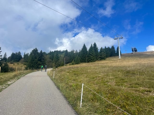
We set off uphill past a modern, sharp-angled church and found ourselves in an outdoorsey resort containing a large hotel, ski centre and cable car base. Eager to escape the tourist trap, we found an information board showing our intended route, the Feldbergsteig. We hadn’t appreciated that the trail starts at an elevation of 1,287m so it felt like cheating to say we were climbing a 1,493m peak, but nevertheless we were excited for a varied, circular hike in a new mountain range.
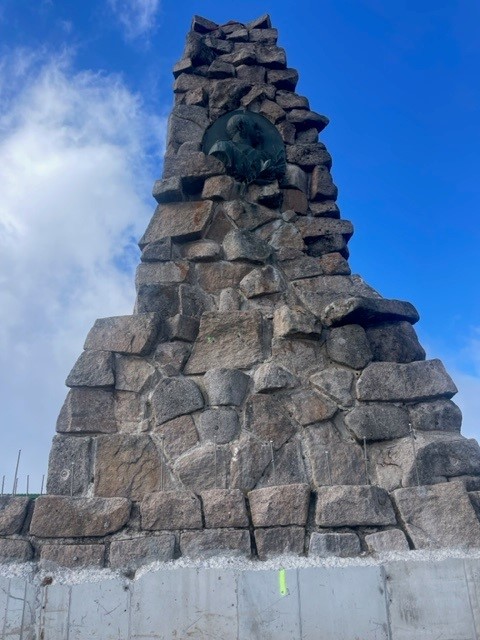
To the Bismarck memorial
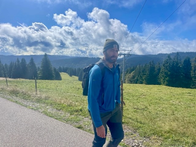
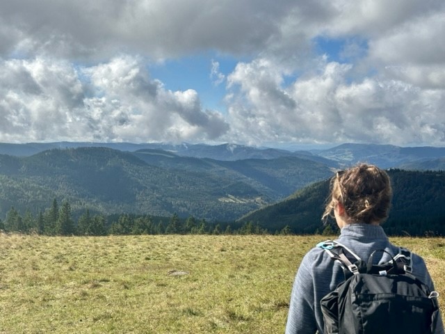
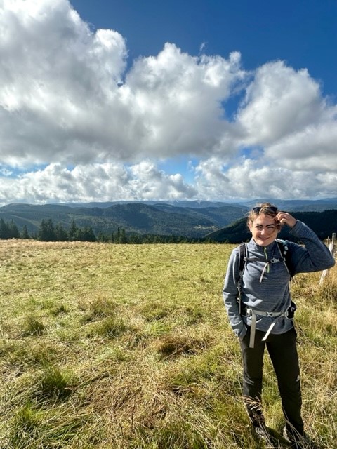
We headed northwest up a wide, gently inclining track that ran roughly parallel to the cable car line, passing several small groups who greeted us with a friendly “hallo”, and soon began soaking in the view. The surrounding yellow-green meadows melted into dark treelines formed by tall, deep green spruces, beyond which stretched endless forest spread thickly over distant, hazy blue ridges arranged in undulating layers. It was sunny, still and resoundingly quiet.
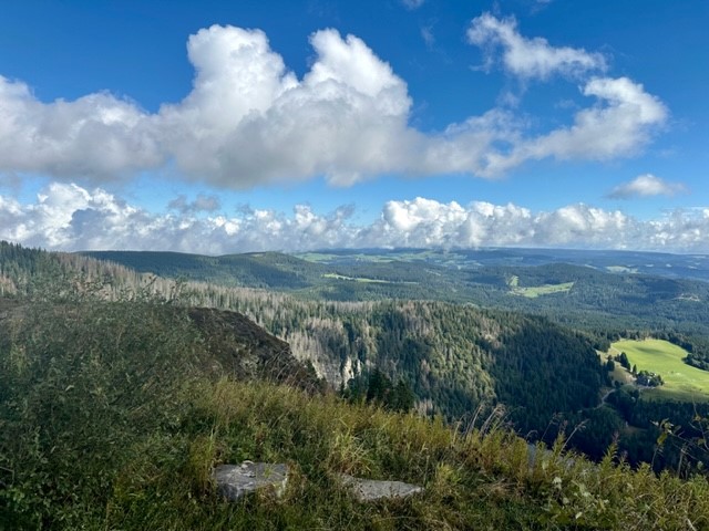
The track narrowed and took us into a verdant coppice, then continued through rugged meadows past a severe-looking concrete tower laden with satellite dishes. The first landmark we arrived at was the Bismarck memorial, a great stone pillar dedicated to the first Chancellor of the German empire. It was a wonderful viewpoint; a continuous swathe of forest covered the surrounding hills and valleys like a dark green blanket stretching all the way to the distant horizon, broken only by occasional ragged-edged, grassy clearings.
Up Feldberg
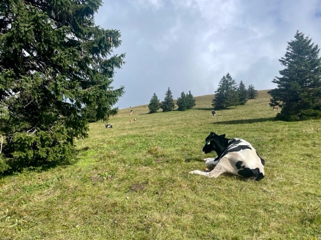
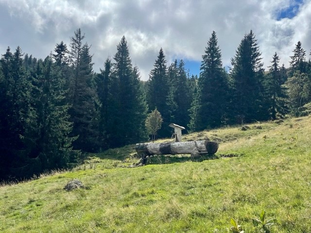
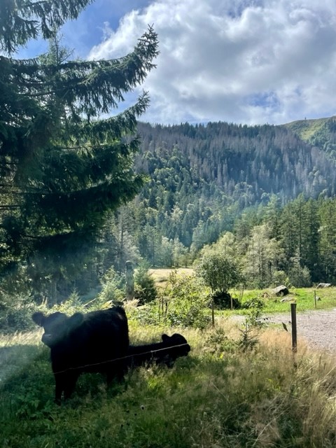
We left the memorial and headed down the side of the hill across open meadow. We went through a gate and followed a wide gravel path along the side of a ridge, which was covered in rough, yellowish grass and sloped gently downhill towards the endless forest. A strange, tinny sound tinkled across the valley and a thin curtain of fluffy cloud – which had drifted down the ridge and obscured the path ahead – cleared to reveal a small herd of Fresian cattle blocking the path. I’ve been averse to cows since getting charged by a bull a few years ago, so I gave them a wide berth and reached a gate with some relief.
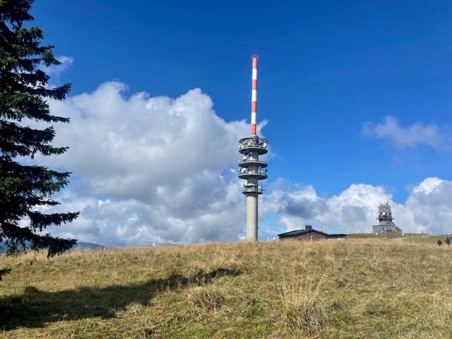
We gained the summit of Feldberg via a straight path up a gentle incline, the only drama being the loud and alarming receipt (on our phones) of Germany’s annual nationwide emergency alert test at 11am. It was a grassy and oddly subtle, unremarkable peak marked by a low, flattened mound topped with a trig point and a circle of benches, marred slightly by a tall communications tower and grim looking building a short distance away. We munched a sandwich with our backs to the tower and gazed across gently rolling, forest-carpeted hills, pondering on the ethics of saying we’d climbed a mountain.
Through field and forest
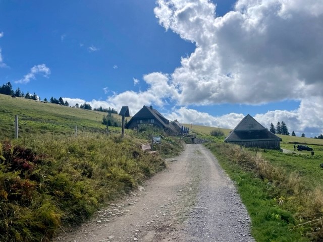
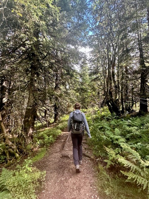
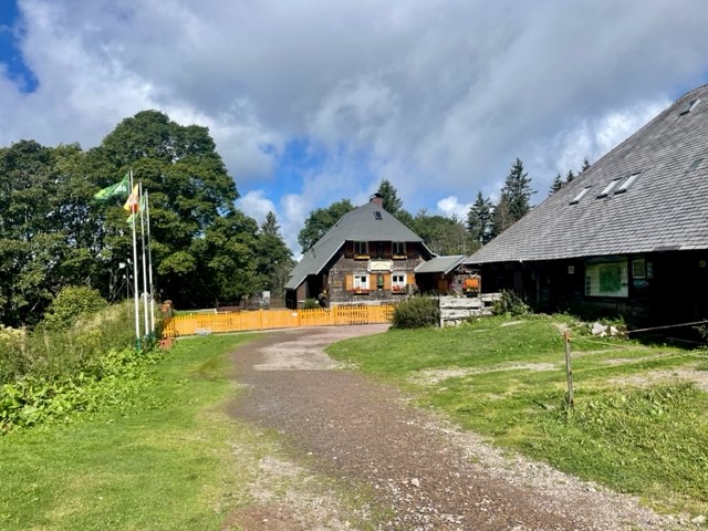
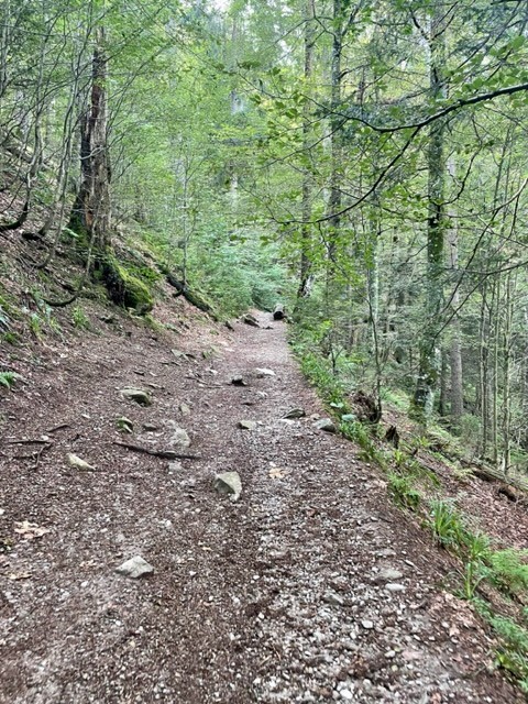
My doubts about the mountainous nature of the area were allayed once we left the summit and headed down a track that passed the ugly tower. The peaks ahead of us to the west were steeper, more undulating and completely forested compared to the gentler, grassier slopes to the east, and the horizon was formed by wide, hazy triangles of more mountain-shaped mountains. We headed downhill past a lush, green meadow dotted with fir trees and cattle, their cowbells tinkling whimsically in the breeze, and reached the first alpine hut along the route – a large, tiled, welcoming-looking building. Resisting the temptation to stop and grab a drink, we continued on the path, which flattened out and arced around Feldberg’s lower reaches in a smooth curve.
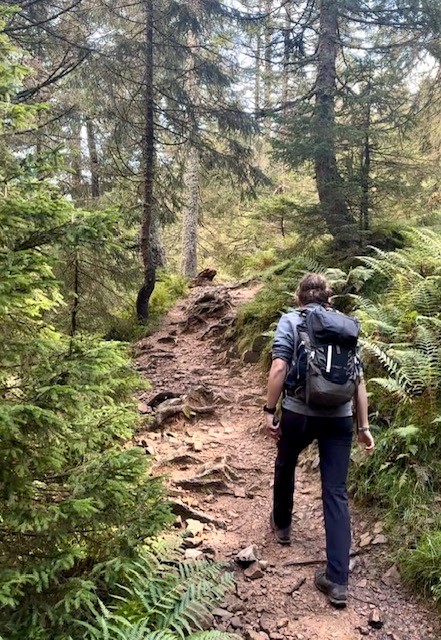
We tramped across charming, rugged meadows, then entered the thickly forested hillside to the north of Feldberg. A thousand shades of green emanated from ferns, shrubs, trees, grasses, mosses and lichens, which grew in Jurassic Park-like abundance on the steep slope. Shrubby clearings allowed us to gaze across a deep valley to opposite, equally living slopes, which were drenched in warm sunlight that slipped beneath thin clouds that drifted lackadaisically over the valley tops. It was incredibly tranquil, as if the rest of the world didn’t exist.
Past river and lake
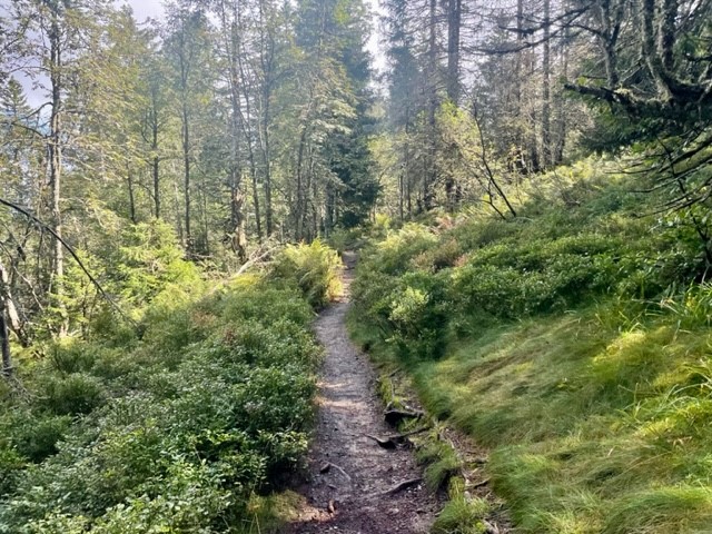
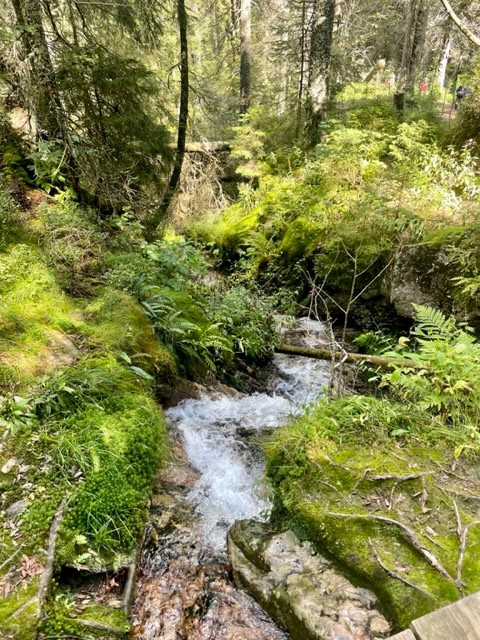
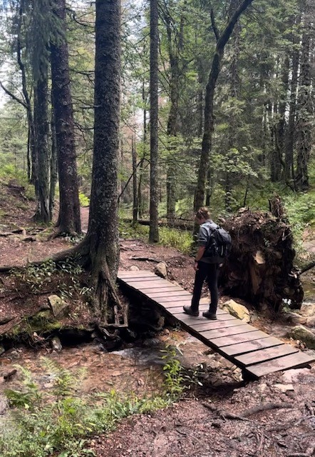
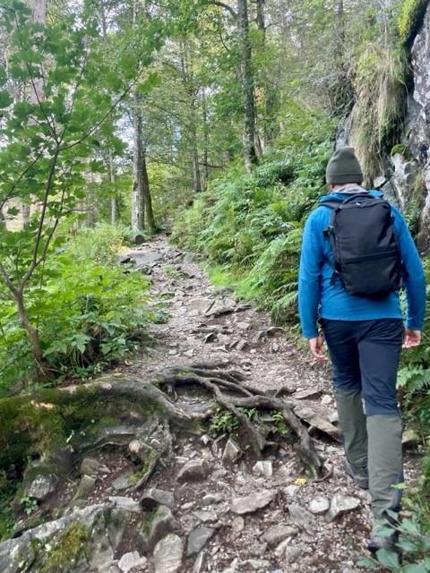
We followed the path diagonally down the hillside, crossed a marshy section via a boardwalk and found ourselves at another alpine hut. A steep climb through the forest took us up to another swathe of meadow on the east side of Feldberg’s neighbouring hill, which dropped gently down into more verdant forest. We crossed the narrow, crystal clear Sagenbach river and followed its wonderfully overgrown, mossy banks downstream, marvelling at several rocky waterfalls and – on seeing the many bridges made by fallen trunks – wondered what storm could possibly have touched this serene place.
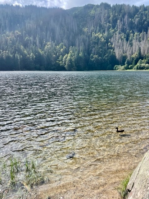
After winding down the river via bridges, steps and rocks, the route bore us east along a straight, flat track along the side of a hill between legions of tall pines. We stopped for another sandwich at a picnic table, then followed the arc of a spur to the edge of a valley clearing, where another large hut sat below us among cattle fields and meandering tributaries. We followed the treeline down into a peaceful wood, then came to the shores of the perfectly round, cwm-like Feldsee Lake. The clear, gently rippling water was surrounded on three sides by towering, green walls that looked too steep to accommodate the dense mass of huge trees that had somehow taken root. We stood on the “beach” for a moment, watching the ducks and listening to the silence, then set off on the final section of the route.
Last leg
The path followed the east bank of the lake, then climbed steeply into the thicket of beech, sycamore, pine and spruce. We zigzagged up rocky sections until the ground levelled and we emerged from the trees quite suddenly at the cable car base. It felt slightly surreal to be back in the busy resort after the serenity of the hike, which had felt quite wild despite the clear, well-signposted trail. We headed straight back to the car and, after debating whether a trip to the city of Freiburg would be worth it at rush hour, left for home (via Lidl, of course).
To summarise, it had been a lovely, varied hike with beautiful scenery that made us feel truly immersed in the Black Forest. The trail was very easy to follow (we barely used my guidebook map) and I just wish it had been longer than 8.5 miles. We came away feeling very refreshed, happy with a good day exploring a new mountain range.
Evening
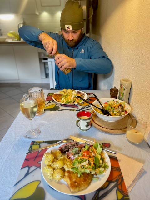
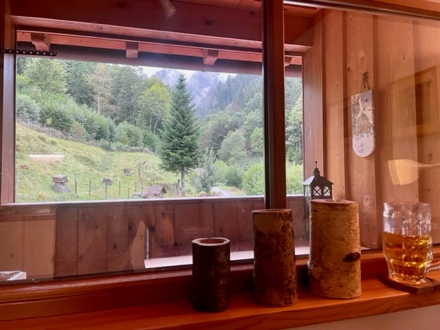
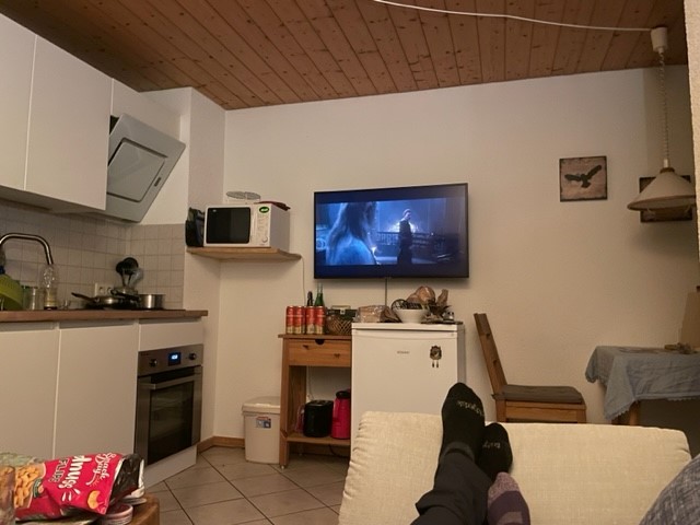
We got back at 4:30pm and spent the evening relaxing on the balcony, drinking wine/beer, watching Rings of Power on Netflix and playing with Kraut the cat. Ryan cooked a lovely dinner of homemade schnitzel with steak, salad and potatoes and I came up with a rough plan for another hike the next day, this time starting from our apartment. Three days in and we felt very at home in the Black Forest.
Disclaimer: Strap in – this was a difficult, lengthy post to write as I wanted to do justice to the intricacy and other-worldly beauty of Plitvice. Please excuse my rambling descriptions, inclusion of utterly unpronounceable names and repetitive variations of “blue”, “green” and “clear”…
Wednesday 5 July
After researching Plitvice Lakes, we’d initially decided that 40€ each was too much to pay to visit a National Park. However, I’d seen some photos and the seed had been planted, which meant (as it always does) that I’d inevitably reverse that decision. I decided to treat us to the trip on the conditions that Ryan a) get up early, and b) drive us there without damaging the rental car.
The journey
We were on our way by 6am. The 1h40 journey was traffic-free, which was just what Ryan needed to get used to driving on the “wrong” side of the road. We joined the tunnel-ridden E71 motorway shortly after leaving still, peaceful Starigrad, nestled between the Paklenica mountains and an inlet of the Adriatic sea, and entered Lika-Senj County to the north, which was – to our mild surprise – shrouded in early morning fog.
We arrived at Plitvice at 7:30am, parked very carefully at Entrance 1 and made our way to the chalet-style ticket office. There was already a long-ish queue and I was concerned that having made the journey without booking, we’d come across some issue that would prevent our visit. My foreboding was not unwarranted as the card machine didn’t like my bank card, but luckily a different card worked and we received tickets after an anxious few minutes.
We passed through the entrance and went straight to the information boards showing seven waymarked hiking routes, which I’d already researched online. We naturally picked the longest, an 18km trail that circumnavigates nearly all the lakes and cuts out the land trains and electric boats (bar one) that shortcut around the park. Having photographed the board, we wandered over to the start of the trail and were instantly blown away by the landscape.
Lower Lakes: Veliki Slap waterfall to Milanovac
If we’d have been in a cartoon, our jaws would have hit the floor. A vast limestone valley opened up below us, pale rock walls rising from large pools that were bluer than blue and so clear that we could see the bottom from our high vantage point. These pools were set at different levels, and fell into each other via multitudinous cascades that tumbled as vertical columns of pure white water so bright that they seemed to emit light. A forest of the lushest, most brilliant green covered every inch of land that wasn’t rock or water, almost glowing, and across the valley the highest waterfall, Veliki Slap, dropped out of the trees at eye-level and disappeared behind a vegetation-covered, natural limestone dam, which held the torrent back from a series of small, tiered, turquoise pools set low in the basin. A distant mountain ridge stretched hazily across the horizon, just visible above the forested valley side, beneath clouds of white and lilac-grey interspersed by occasional blue patches. It was as if the sky, in deference, reflected the land.
We followed the handrailed, switchback walkway down the side of the valley, feeling as though we were dropping into a real life Avatar set. It was already getting busy so we were keen to see Veliki Slap, “Big Waterfall”, before the crowds descended. The lakes grew in size and clarity as we approached from above and looked impossibly, almost unnaturally blue. We reached a rustic (but solid) boardwalk across the water between Novakovića brod lake, which was level with us, and the Korana river, which was set low in the valley and fed by an abundance of falls bursting improbably from invisible sources concealed by leafy vegetation. We wandered along this boardwalk marvelling at everything: the lakes, the falls and the incredible variety of water grasses and leafy plants on either side of us. It was impossibly beautiful.
The boardwalk snaked around a sheer limestone face to Veliki Slap, a 78-metre high column of water surrounded by tens of narrower, only slightly shorter falls. It was utterly magnificent: I wondered how there was enough water on Earth to feed this powerful, constant giant, which erupted from the clifftop treeline high above. Once we’d gazed in sufficient awe we snapped a couple of photos and returned to the boardwalk, aiming to break away from the growing number of tourists collecting at the base of the unimaginatively but accurately named Big Waterfall.
We followed the boardwalk along the western side of Kaluđerovac lake, still awestruck by the water, and crossed a low limestone barrier between tiered pools to a path along the eastern side. The shallows were gin clear, melting to translucent turquoise and almost opaque blue-green in the middle as the lakes deepened. Fish basked nonchalantly in the open water, and the perfectly flat surface reflected pale rock walls and green forest across the valley.
The path bordered Gavanovac and Milanovac lakes under a leafy canopy and we walked past several tantalising, dark caves set into pale limestone walls on either side of the valley. The number of visitors had dwindled, as we’d predicted, and after a kilometre we crossed another low dam via a boardwalk over shallows brimming with vegetation. Wide, multi-columned Slapovi Milke Trnine and Milanovači Slap waterfalls rushed out of these shallows below us, connecting great Kozjack lake to its smaller sister Milanovac about six metres below, and I was in awe at how the rock held these vast waters back from each other.
Upper Lakes: Kozjak to forest trail
We followed the edge of enormous, irregularly shaped Kozjak to a large visitor area containing dozens of picnic tables, wooden food kiosks, a gift shop, toilet block and the first boat station, where tens of people queued to cross the lake. Happy not to join this rush, we continued along the western edge for a couple of kilometres, snaking round the lake’s undulating border through the fringe of a rich beech forest. We drank in the quiet serenity of the flat water and almost overwhelming brightness of the blues and greens, feeling utterly content now that there was nobody else around, save for the occasional pair of other visitors looking to experience the place in solitude.
The path climbed a short way into the trees, affording stunning views over Kozjak, which – now that the sun had emerged – was a perfect mirror of the verdant forest on the opposite bank. I was amazed by the biodiversity of the woodland, where all kinds of low plants, shrubs and fungi covered the floor beneath a glowing canopy. We had a good view of thickly forested Štefanijin otok, the park’s sole small island, before finding another waterfall about eight metres in height and width tucked away – somehow subtly – in a leafy corner.
We climbed a set of stone steps up into the forest, then walked down a bank and found the ferry dock, where most visitors disembarked having caught the boat across Kozjak. We had a minor disagreement over which way to go – I was keen to continue on Route K but Ryan was concerned that we’d miss out on the waterfalls, so wanted to go with the throng along the low path by Burgeti lake. I conceded at first but after about a hundred metres became stressed by the influx of slow-walking people constantly stopping for photos, so – to Ryan’s initial chagrin, but eventual approval – we turned back, climbed the wooded bank above the busy path and continued on a quiet, sun-dappled trail beneath towering, impossibly green trees.
Upper Lakes: Forest trail to Okrugljak
After a short way we came to a clearing and looked down across the glassy blue water of lagoon-like Gradinsko lake to Veliki Prštavac, the second highest fall in the park, which formed a wide series of white pillars erupting from the forest above. To call it a fairytale scene wouldn’t do it justice. The path then continued for a few kilometres under a high beech canopy that covered a steep bank overlooking a multitude of smaller lakes, which formed a watery patchwork that filled the valley floor, separated by snaking, leafy rock barriers. I was looking out enthusiastically for grizzly bears, featured in the National Park’s logo, but (to my disappointment) was only successful in spotting some large bracket fungi and some pretty nine-spotted moths:
Any remaining sourness from our disagreement dissipated the minute we emerged at another clearing, where the path turned sharply left before descending to the popular trails. We gazed over the blue glass of lake Ciginovac, surrounded by rising green forests, and above it, the vast, hanging lake of Prošćansko – almost as big as Kozjak, and just as irregularly shaped – whose mirrored surface shone into the sky, the unimaginable weight of water impossibly suspended by a steadfast limestone dam. It was as if the rock stoically kept the lakes in check, permitting water to move between levels via numerous regulated falls, but had no control over the vegetation, which spread on all but its most vertical surfaces and encroached in the shallows as if showing off its leafy mastery of the landscape.* I pointed out to Ryan, blissfully aware of my capacity to irritate, that we’d never have seen Prošćansko on the popular trails. I think he forgave me.
*This later made sense, on learning about the formation of tufa barriers – no spoilers here, you’ll have to read on
We wandered down the hill through more forest, paused at a viewpoint over three of the little patchwork lakes to admire more falls bursting from various treelines, took a couple of switchback turns and emerged back onto the tourist route by the edge of Okrugljak lake, where we rejoined the steady flow of visitors.
Upper Lakes: Okrugljak to Galovac
Another curving, handrailed boardwalk granted passage across the green strip of vegetation between small, bright blue Veliko jezero and Batinovac lakes, and I was delighted to see a two-foot long brown snake zipping effortlessly through the clear shallows in a graceful S-shape between roots and reeds.
Having crossed the water, a path took us slightly away from the azure lakes into a rainforest-like area of woodland, then north along the eastern side of Galovac, where an information board taught us how the limestone dams between water levels are actually called “tufas”. They are formed by a gradual build-up of calcium carbonate deposits from moss, invertebrates, bacteria and the blue-green algae that give the water its bright blue colour. These barriers are estimated to be 6,000-7,000 years old and grow at an average rate of 13.5mm per year. It was as if the science behind the landscape was necessarily explained to convince visitors of its reality.
Water tumbled in tens of narrow pillars down the tufa at the head of Galovac, its vertical course replicated by green columns of grass and moss that hung over the side of the dam. Yellow, pink and purple wildflowers climbed the tall, grassy bank below the forest edge, and fallen trees below the water’s surface accentuated its blue clarity, the long forms of their majestic trunks fully visible as they stretched far from the bank. We skirted along the edge of the lake, passing a photogenic trio of goosanders (it was strange to see a UK-dwelling bird in this exotic place), and stopped for our customary holiday lunch of highly processed ham and cheese sandwiches on a fallen tree trunk just off the path, overlooking an irresistible little lagoon.
Veliki Prštavac waterfall and Upper Lakes: Galovac to Kozjak
We didn’t hang around for too long, noting the presence of several large ants, before continuing past the gin clear shallows at the northern end of Galovac. The path took us through a wooded area between lakes, past another high, grassy waterfall and down a steep bank onto a busy, snaking boardwalk between Galovac and Gradinsko, where completely colourless water flowed steadily beneath our feet. We ambled along at the slow pace of the single-file line, approaching the base of 28-metre high Veliki Prštavac, which we’d seen earlier from high in the forest. It had looked quite tranquil from a distance, but proximity betrayed its intensity as white water rushed urgently in a wide, multi-columned wall into the pool below, its fine spray relieving us of the hot sun. Again, vegetation was everywhere: trees grew above the falls, grasses hung low over the edge of the barrier, mosses concealed every inch of rock and rhubarb-leaved water plants (I’m a poor botanist) crammed the edges of clear pools.
We passed a small crowd taking photos of the waterfall and continued on the boardwalk, which twisted tightly between several small, clear pools lined by reeds and slim, pale-trunked trees. Numerous falls poured from forest-topped tufas thick with hanging, trickling grasses and opportunistic shrubs, bursting from every nook and cranny that would take a root, and every inch of ground was covered by what seemed like a hundred different plant species. It was fascinating, and I wished desperately (despite the in-fittingly rustic boardwalk) that I could have seen the park before the age of tourism and slipped into its cool, clear, blue-green waters.
We wandered through this surreal, intensely detailed, prehistoric oasis until the boardwalk straightened along the edge of Gradinsko. A path took us through verdant pine and beech forest to the boat station at the southern end of Kozjak, and after a short wait we boarded and sat at the front of the electric boat as it carved smoothly across a narrow section of the lake past Štefanijin otok island to the eastern bank.
Return from Kozjak
After a quick loo break at a chalet-style café, we set off north on the quiet, shady path back to the park entrance. This trail hugged the eastern edge of the lake, and on clambering onto an overhanging tree for a terribly touristy photo, I – to Ryan’s great amusement – very nearly overbalanced and fell in. I dismounted quickly, muttering something about how a rucksack affects balance, and we continued on the final 4km stretch. Highlights of this last section include a dice snake slithering through the water a couple of feet away from us, more fallen trees emphasising the clarity of the lake, which shelved steeply on this side, and stunning views of waterfall-backed, dazzling blue depths as we climbed into the leafy forest above Milanovac, Gavanovac and Kaluđerovac on a high path parallel to the lakeside route we’d taken that morning.
We reached a viewpoint overlooking the curving boardwalk that crosses the pale turquoise water to Veliki Slap, which was now suffused with a long, moving string of ant-like people. This vantage point gave us a new perspective over the tiered series of green-and-white-dammed lakes stretching up the valley, and it seemed impossible that the high, pale limestone walls on the opposite bank could hold the weight of the immense leafy forest that climbed towards the sky like a long, green afro. Returning to the entrance above that first-described view of Veliki Slap was like being struck by déjà vu, or suddenly remembering a striking dream. I thought that if, even I’d looked over that verdant, rocky, watery basin a thousand times, I’d never not be awestruck.
We tore ourselves away from the view and after a quick peruse of the gift shop, we returned to the car. I expressed my disproportionate fury at paying for seven hours’ parking despite being just a couple of minutes over six, and we started the drive back to Starigrad at 1:30pm.
Journey back to Starigrad
On the return journey, we were astonished by the beautiful countryside that had been concealed by the morning’s fog. For some reason I’d thought the landscape would have been quite arid, but the lush fields, swathes of forest and abundance of shrubs and wildflowers revealed my naivety. Rolling hills and yellow-green meadows all around us were backed by the undulating, forest-covered Velebit mountains, which stretched in a wide panorama across the horizon ahead. Remote farm buildings were scattered thinly across the countryside and we drove past lots of quaint little roadside stalls selling homemade cheese and honey.
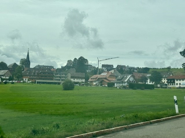
We passed through a couple of peaceful-looking villages containing stone churches, several hotels and large buildings painted pastel orange and yellow, guessing nervously at the uncertain speed limit. At the risk of sounding like a naïve British tourist (again), I thought it looked very “European”, not dissimilar to parts of France or Switzerland. We joined the motorway and cruised back to Starigrad, enjoying mountain views the whole way, Ryan’s driving confidence having soared to the point he was willing to overtake the occasional car and sing merrily (if poorly) as the road snaked into the now-familiar little town.
We picked up a couple of supplies from the supermarket and returned to the apartment, where we relaxed for a couple of hours, making the most of the air con. We had our customary dinner of cheap, tasty slop, this time a rudimentary paella with rice, fake sausage and tomato sauce, then headed into town for a swim.
Evening: sea swim and surprise street party
We walked all the way along the pretty seafront, past the market by the main quay, and stopped on a concrete block jutting into the water between small, stony beaches backed by a leafy walkway and a little seafront campsite. I swam around while Ryan watched a snorkeler collect clams and stash them on the beach under (presumably) his mother’s straw hat. The sun dropped into the sea at the foot of the dark, jagged Velebit ridge that stretched behind the town, casting a soft orange glow between the deep, textured blue of the water and the smooth pastel sky. It was indescribably tranquil.
When the sun disappeared, we walked up a quiet street past rustic stone and whitewashed houses, then headed back to the town centre via the main road. It was a very homely place: washing hung in colourful lines from the verandas of terracotta-rooved houses, small, cosy restaurants served pizza and seafood, children of all ages played football in a small, fenced sports court and people congregated in little groups on the pavement, laughing and smoking.
Back at the main quay, which we’d only seen quiet and still under a hot sun, we stumbled into what felt like a random, Wednesday night street festival. It was 9pm but the seafront was alive with lit-up stalls selling all kinds of peculiar little gifts and edible treats. Open-fronted restaurants served food and drink to tables that had popped up across the walkway and people milled around everywhere. We bought a curly fried potato on a stick, which was spicy, salty and greasy but in a delicious way, and listened to an excellent live band that had popped up on a small seafront stage. Children and adults danced to the music and people wandered around left, right and centre with ice creams, pushchairs and dogs on leads. We finally felt like we understood the culture, and it was so charming.
We’d have liked to stay all night, but had ambitious designs on the towering vertical face of Anića Kuk in Paklenica National Park the following day. It would be our first “big wall” climb and we knew that it’d require a good night’s sleep, so we left the party after half an hour. We returned to the apartment, packed our rucksacks and went to bed feeling a strange mix of extreme contentment after our wonderful day, and intense anticipation for what we knew was to follow – “an epic”.
There’s something so liberating and solitary about kayaking on the open water, suspended between the earth and the sky and just existing. Keep still and you’ll feel simultaneously numb and hypersensitive; weightless and isolated, but acutely aware of sound, light and the feel of the air.
Perhaps my favourite thing about it is having the freedom to move without diversion. On land our direction of movement is constantly influenced by paths, roads, walls, barriers and landforms, but on the water there are no waymarkers or boundaries beyond boats, buoys and the occasional rock. Without these predetermined “invisible arrows”, you have 360 degrees of glassy expanse to carve your way through before the water swallows up your trail. You could be the first and last person to ever take that exact route; echoing the eternal Fleetwood Mac, you go your own way. You’ll know what I mean if you try it.
Being in such a small vessel enables you to explore places you’d otherwise never see and discover creeks, beaches, woodland and countryside you didn’t know existed. At risk of sounding like the Youtube “Gap Yah” guy (I wonder what happened to him?), you’ll feel at one with nature as you immerse yourself in a new, bustling world of plant, bird and marine life.
Nature, enlightenment and self-discovery aside, paddling is great for core and upper body strength because it uses muscles that are often neglected, particularly in the shoulders and back. There’s something so satisfying about stretching out your arms and pulling yourself through the water, feeling your strength translate into each powerful stroke, and the burn in your muscles is one of those oddly “nice” aches. You also use your legs a surprising amount to stabilise, brace and manoeuvre the kayak.
Once you settle into a rhythm the repetitive motion is really therapeutic. This, combined with the healthy dose of fresh air and gentle lapping of the water, makes it both relaxing and invigorating. I particularly like messing around on tidal rivers as there’s something refreshing and restorative about the tang of salty air – it works wonders at blowing out cobwebs caused by one too many drinks the night before.
All that said, it’s a surprisingly versatile activity which doesn’t have to be all about flat water and balmy air. Getting out on a choppy sea or a fast-flowing river affords plenty of opportunities to try some whitewater action, which is understandably less relaxing but (depending on your outlook) more exhilarating.
I got out on the water last week for the first time in a while and it reminded me how much I love everything about it, so I thought I’d pay tribute to kayaking on my blog. If I convince one person to hire, buy or borrow a kayak I’ll be delighted and I’m sure they won’t regret it. And if anyone wants someone to go with, count me in.