We drove the short distance up the hill from our camping spot to Whinlatter Forest Park and started on the Altura North trail, a 6-mile loop graded red (“difficult”). A fairly arduous climb with a few exposed sections rewarded us with a stunning view of the surrounding mountains and forest, then we descended through the trees along a good (if slightly wet) singletrack trail with flowing berms, technical rooty sections and some slippery rocky corners. The last part was one of the best bits of trail I’ve ever come across – a big switchback section down a flowing gravel track with a thrillingly steep drop on one side and quick berms, which gave little margin for error.
Exhilarated by the long, fast descent, we started off on the Altura South loop, which was 5.5 miles long and also graded red. Like the North loop, this started with a wooded climb which led to some lovely downhill sections with jumps, technical features and smooth, flowing bits, although nothing quite compared to the last section of the North loop.
Ryan’s knees were still suffering from our 12-hour hike a few days before, but for completeness we finished with the Quercus trail – a 4.5 mile blue (“moderate”) loop. It was certainly more easygoing but definitely worth doing, with some lovely open sections and smooth bits of singletrack.
Although my experience is limited to just a handful of purpose-built MTB trails, those at Whinlatter are without doubt some of the best I’ve done. I wrote about them previously (see blog post) as I’ve been once before, but then I didn’t have time for the Altura South and I was extremely keen to go back. All three trails are very well-maintained, offer stunning views of the surrounding mountains, valleys and forests, and provide an exciting variety of tough climbs, technical features and fast, flowing downhill. A great morning, and a great outing for my trusty but battered 2008 Specialized Rockhopper, Rocky.
Derwentwater canoeing
We wanted to make the most of the day, so after a quick snack we headed down to Derwentwater and hired a two-person canoe from the marina. I’d never canoed before and Ryan had only been once, but we were soon paddling merrily along. The single oar took a bit of getting used to as opposed to a double-ended kayak paddle, as did the synchronised manoeuvring, but it was good fun and we stayed surprisingly dry. I learnt that the back person follows the stroke of the front person and steers by angling/dragging their oar, and the front person paddles along, humming obliviously and swapping the oar from left to right and vice versa as and when they fancy. Or that’s how we did it, anyway.
We had two hours, which was enough time to paddle anti-clockwise around about half of Derwentwater. It’s a large lake with several wooded islands, one or two big enough for a posh house and others no bigger than a car bonnet, which is surrounded on all sides by high, majestic peaks. Halfway round we approached a medium-sized island, admiring how we could see the smooth, brown pebbles several feet below through the clear water, and beached the canoe on a bank that was lush with overhanging foliage. The island was deserted, although people had clearly lit campfires between the tall trees in the middle, and we enjoyed a Thatchers Haze each before paddling on. On our way back to the marina we were treated to a fly-by from a fighter jet, a couple of carrier planes and a helicopter.
Satisfied with the day’s activities, we drove the short distance back to Keswick and found ourselves back in the Wetherspoons (as a trainee lawyer, I consider additional time spent in an old courthouse building invaluable experience). We agreed to climb Corvus the next day (see previous day’s post for background), drove along Derwentwater’s east bank back into the beautiful Borrowdale valley, and camped in a discrete layby.
I peeked under the pull-down blind to take in the tranquility of early morning in Honister Pass. The sky was clear and the sun had drenched half the valley side in its balmy warmth. I waited for Ryan to wake up (I’m definitely more of a morning person), then we ate and drove up the steep “head end” of the pass. The road that joins the Buttermere and Borrowdale valleys is winding, hilly and incredibly scenic.
We parked at Thorneythwaite Farm, put £3 in the honesty box and headed up to the crag. We’d hoped to climb Corvus, a famous five pitch route graded Diff (easy) either today or tomorrow, but thought we’d check out the nearer Glaciated Slab at Combe Gill to begin with. There were a handful of single-pitch climbs there, which would be good for warming up our trad climbing brains after months of covid-induced abstinence. Given Monday’s epic hike, we also wanted to test Ryan’s still-sore knees before committing to a multipitch.
The walk in to the crag took about half an hour and the last section involved an awkward scramble up a steep boulderfield. Glaciated Slab was worth it, with its agreeable, off-vertical gradient, grippy looking rock and handful of cracks. It was quiet and wild, situated high up on one side of a steep, V-shaped valley, carpeted on both sides by scrubby grass, dark green forest and a litany of loose rocks. To our right Derwentwater peeked distantly through the trough of the “V”, backed by the hazy blue mountains beyond Keswick.
Our Rockfax climbing book informed us that all but two routes were within our grade, so we hoped to get a good few climbs in. Keen to feel cold rock under our fingers, we dropped bags and harnessed up. Ry started by leading Trod Too Far (HS 4b), then I led Trod Pip (VS 4c), then we took turns crossing off whatever we fancied. It had been over a year (tragically) since I last built a three-piece top anchor, but I was pleased that it came back so naturally. I didn’t have to think about the process of placing and testing gear, clipping in, equalising the sling and bringing the rope up to put Ryan on belay.
The rock was grippy, nicely cracked in some places and a bit bare in others, and it felt so solid that we threw in a couple of solo climbs (Diff/VDiff). I felt the old, toe-tingling thrill of looking down at the distant ground and accepting that up is the only option. After a good few hours climbing, we decided that we’d exhausted that crag and scrambled/walked back down the valley, returning to the van about 5pm.
We drove north along the pretty Borrowdale road to Keswick, on the north tip of Derwentwater, grabbed some supplies from the Co-op, and wandered round the pretty, bustling town. Before we knew it, we found ourselves in Wetherspoons. We discussed our plan to go mountain biking the next day over a pint and three small plates for £10 (every time), then hopped back in the van and drove up the road towards Whinlatter Forest Park. We found a discrete car park, went for a quick walk up a hill overlooking Keswick and chilled in the van for the rest of the evening, basking in the happy-exhausted feeling that comes after a good day’s climbing.
We’d hoped to finish the previous day’s epic hike in the Wasdale Head Inn, a classic climber/hiker’s pub at the end of Wasdale valley’s dead end road, but our late return thwarted this plan so it was first on Tuesday’s itinerary. We woke later than usual from our camping spot on the edge of Wast Water and enjoyed a pint in the lovely old pub, which is decorated with cool old mountainey pictures and maps. A sign states emphatically that there’s no wifi and that we should talk to each other instead, which I liked – although it would have been useful to let Ryan’s dad (who’d followed yesterday’s progress live until my phone died) know that we’re alive as there’s zero phone signal in the valley.
The most frog-like photo of me ever taken but it kind of shows the Wasdale Head Inn
We were suffering from mobility issues due to seized quadriceps and in Ryan’s case, potentially damaged knee ligaments/cartilage, so didn’t expect to do anything remarkable that day. We’d studied our climbing guidebooks in the pub at Wasdale and had decided to travel to the Borrowdale Valley to mess around at Raven crag and climb Corvus, a famous multipitch route graded Diff. The drive up the northwest side of the National Park felt a bit adminney in the middle of the day, but we’d planned well as in contrast to yesterday’s generally dry, clear weather, it was now wet and claggy.
Mountains, lakes and forests reappeared as we headed east through Buttermere, an area I’d never visited before. It was serene and beautiful, even under the grey sky. We went to Buttermere village for lunch and found the Bridge Hotel, a nice whitewashed, beamed, stone-floored bar, but it was eerily quiet and the whole facemasked waiter, disposable menu thing seemed a bit awkward. Ryan spotted a couple of big cherry trees out the window and we filled our pockets with juicy red snacky-snacks, then set off east to get closer to tomorrow’s climbing spot. The cherries didn’t make it to our next camping spot at Honister Pass.
Honister Pass is a winding road through a deep slate valley – the type you get on car adverts – which rises gradually as it runs parallel to a wide, shallow river, then steeply. After a brief stop to let the engine cool down (steep slopes set the overheating alarm off) we parked in a pull-in a couple of hundred metres down the road from Honister slate mine, high up at the head of the valley and overlooking the long road which snakes between its V-shaped sides. To my frustration we found a gash in the front passenger side tyre, probably caused by a sharp bit of slate. We changed the wheel and spent the evening admiring the sweeping, rock-strewn valley, drinking gin, cooking pasta, singing badly and looking down the picturesque road at a stunning, pink-orange sunset. Today had been quiet but we were happy knowing that tomorrow, we would climb.
This was one of those rare days that I know for certain I’ll never forget. It started innocuously enough, with Ryan cooking breakfast and me making sandwiches at our camping spot on the edge of Wast Water, overlooked by the rugged, imposing mountains and ridges of the Wasdale valley. We knew it’d be a long one as our route encompassed six summits, a lot of miles and a serious amount of elevation gain. Bags packed and bodies fuelled, we drove to the car park at Wasdale Head and set off at 10am.
Scafell Pike, 978m. Summited 11:55
The path began in the lowest point of the valley, just 80m above sea level. It crossed a wide, shallow river, Lingmell Beck, before climbing a little way up the side of a high, grassy ridge, Lingmell. It followed the contour of this ridge through scrubby sheep territory until we rounded the corner, at which point the sheer, dark west face of Scafell Pike emerged at the head of an immense valley. Lingmell Gill flowed high and fast on our right and we followed the path alongside it until the rocky crossing, which wasn’t particularly crossable due to the rainfall. A few hikers had gone quite a way upstream before crossing and heading back down to regain the path, but we didn’t go far before hopping across five or six sturdy-ish looking rocks in an ungainly (but dry) manner and continuing up the mountain.
The rocky path led the way clearly up Brown Tongue which, as well as the multitude of other hikers and my vague memory of the route, made the map redundant for the time being. We took the left fork and approached the summit from its northwest side, the slightly longer but more popular approach. From the fork, going as the crow flies to the summit would have necessitated a serious multipitch rock climb up its ominously sheer west face, which gives the mountain its wild, dangerous appearance.
Our legs were already feeling slightly sore from flying up and down the Old Man of Coniston (803m) the previous day, and I’d forgotten that although popular, the path up Scafell Pike is surprisingly long and steep. Shortly after taking the fork we were hit by a sudden heavy rainshower, which – as they always are, once you’ve committed to getting wet – was exhilarating. We pulled waterproofs on, snapped a couple of pictures and carried on, turning right up the steep, scree-covered path that leads to the summit. The clouds were stubborn but intermittent, and we had our fill of the stunning, rolling mountain scenery in glimpses as we made our way up.
The top section is pretty much a huge pile of jagged rocks, as if the tip of the mountain has been shattered into millions of pieces. At the summit is a trig point and a raised war memorial, and we delighted at being the highest two people on English soil for a minute before finding a sheltered spot for a sandwich. Although perfectly warm when we were moving, our sweaty backs got cold quite quickly in the bitter mountain wind so we took a compass bearing to ensure we were heading for Great End and descended the awkwardly boulder-strewn, loose northeast side of Scafell Pike.
Great End, 910m. Summited 13:06
The cloud subsided when we reached the trough of the col between Scafell Pike and Broad Crag, the mini-top just before Great End. The path to Great End was fairly steep and quite direct, although when it came to branching off the path towards Esk Pike for the actual summit Ryan took us an unecessarily awkward way over a series of rocks. We pulled out the Jetboil and had a brew at the wind shelter on the summit, wondered at the panoramic views and seemingly endless mountains and descended the proper way back to the main path.
Esk Pike, 885m. Summited 14:02
Esk Pike wasn’t easily discernible as the ground on the east of Scafell Pike is all quite high and the rocky ridges and summits seem to merge together. Experience has taught me to be wary of paths as they often look obvious on a map, but much less so on rocky ground where everything is the same colour, and it was around this point that I commented on how the path thus far was suspiciously clear and well-marked by plenty of cairns.
Bowfell, 902m. Summited 14:47
Next up was Bowfell, which had a more obvious summit as there was a group of people having lunch on it. For some reason I remember the scenery here being particularly unforgettable, even though we’d been fortunate enough to have a clear view of the surrounding mountains since before Great End.
The nearer peaks were rugged and olive green, and all had unique shapes with sides that occasionally fell away to reveal sheer, unvegetated rock faces. They weren’t jagged like the gargantuan mountains of Patagonia or the Himalayas – in fact they’re not even comparable – but they had their own wild, majestic kind of beauty. Rivers ran like tiny veins far below in the steep-sided valleys, some so perfectly U-shaped it was as if they were carved out with a giant ice cream scoop, and the mountains further away glowed in mysterious, hazy layers of grey-blue. This is perhaps what I love most about the Lake District: it’s the only place in England where I feel truly immersed in the mountains. I can’t imagine how incredible it must have been up here before hiking became popular and there were no paths scratched into the surface or bright down jackets pock-marking the wilderness.
Crinkle Crags, 859m. Summited 15:51
Crinkle Crags was a bit disheartening because gaining the summit would mean scrambling up a rocky path a kilometre long, starting at the unimaginatively named Three Tarns, only to scramble back down the same way and continue our route. Ry insisted that he wanted to do it despite his knee hurting a little, so we went up the now-elusive path-come-series of rocky scrambles and after what seemed like an age, arrived at the (also unimaginatively named) Pile of Stones marking the summit.
This is where the real fun started (English for where it all went wrong). We looked across two wide valleys towards Sca Fell and it looked terrifyingly far away, leering at us from the horizon. Ryan suggested that if we descend Crinkle Crags off-piste, we should hit the footpath we were aiming for low down in the first valley which would take us parallel to and then across a river, and we would then walk [a really long way] to the base of Sca Fell on flat terrain. This would remove the need to turn back along the annoyingly rocky and long path we’d just come along. He was correct and I agreed – indeed, we should have hit that footpath by the river.
The descent was pretty sketchy, super-steep and more of a downclimb in places via huge boulders, mini waterfalls and loose, scrubby bits of ground. We were careful not to disturb vegetation, rocks or sheep, and although I was inwardly questioning our decision, it was kind of thrilling to be off the beaten track. I was super happy to discover some bilberry bushes (bilberries are like small, sweet wild blueberries) as I’d always wanted to find some but never had before, so my fruity mid-descent snack perked me up.
The Trough, 350m ish
This section deserves its own sub-heading because it would unfair (on the mountain) to attribute it to a mountain. It was a trough in both senses of the word – the low bit between peaks, and a sustained dip in the extent to which the hike was going as planned. As they say, peaks and troughs.
After what seemed like an age we reached the bottom of the treacherous descent down Crinkle Crags, only to discover that the footpath we had hoped to join was untrodden to the point of non-existence. Instead we were met by soft, tufty, awkward ground covered in long, yellow grass. In the absence of a path and an obvious place to cross Lingcove Beck, we looked at the map and decided that the best course of action would be to walk south parallel to the river until we came to the fork, where we would join another path that runs alongside the other branch – the River Esk – to the base of Sca Fell. It would extend our route by a couple of long, slow miles over difficult terrain, but at least we’d be certain of where we are and that we could cross both rivers.
This was frustrating enough, so when my left foot punched through a hole in the ground and into over-the-top-of-my-boot deep muddy water, I became tetchy. After a couple of hundred metres of tramping with one wet foot through boggy ground in an exasperated sulk, it dawned on me that I’d only eaten half a sandwich, half a bag of mini cheddars, an apple, half a flapjack and a few bilberries. We wanted to press on but I self-diagnosed myself as hangry, so we stopped and munched a whole sandwich each. It tasted incredible and I perked up magnificently.
We maintained our course by keeping Lingcove Beck on our right hand side, which took a long time because of the awkward, soggy ground, occasionally picking up scraps of what looked like they could once have been path. Eventually we reached a stone bridge at the fork we were aiming for, glad to finally cross the river and start walking towards, rather than away from, Sca Fell. This time we kept the River Esk on our left, relieved that we were now following a clear path.
The first bit was steep, then it levelled out and we walked for a mile or so across a great, open plain in the belly of the valley between the towering ridges. The path was better than the previous one although ambiguous in places, so we kept a close eye on the map, noting the shape of the river, the contours around us and the bits of drystone wall marked down as boundaries. Unhelpfully, the path disappeared at the river crossing. We’d hoped for some rudimentary stepping stones, but there was nothing. The river was about eight paces wide and higher and faster than usual, and we followed it upstream in search of a way across for 20 minutes or so. Eventually we accepted that our feet were wet anyway and committed to a crossing place that was far from ideal but slightly less terrible than some other places and hopped across.
Sca Fell, 964m. Summited 20:17
We tramped across pathless ground to a long waterfall leading up Sca Fell, which was a mile away as the crow flies. The next section was a steep scramble up a dubiously labelled footpath, keeping the waterfall/river on our left. It was tough going but good to gain height as it made us feel closer to finishing the day. We got to a crossing place and stopped to make a decision. We could either cross the river and approach Sca Fell from the south, carry on along the clear path and approach it from the west – which would mean branching off left and going up and down the same way – or call it a day and continue on the same path, which would take us safely through the col between Sca Fell and Scafell Pike and back to the van, potentially with time for a drink in the pub.
We were tired, hungry and at risk of losing light, but stubbornness prevailed and we crossed the narrow, rushing river, hopeful of completing a circular route up and down the mountain. It looked as if there was a path on the other side, but this quickly disappeared and we were once again tramping through the wilderness. We knew the approximate direction of Sca Fell and we knew we had to do a lot more “up”, so we made a beeline for a high, steep scree slope on our right hand side.
This was one of the crippling low points of the day. The terrain was very rough (scrubby vegetation interspersed with loose rocks), we were exhausted, our phones were nearly dead, the summit was an uncertain, invisible concept beyond a serious amount of elevation gain on poor ground and there was a real risk that we’d lose daylight. We had everything we needed – headtorches, an emergency bivvy shelter, warm clothes, foil blankets and porridge – but we were damp, hungry and determined to get back to the van.
On either side of the scree slope were high rock faces and from a distance it looked as though a figure of a person was suspended from one of them. At first it looked like someone leaning back and taking a photo of something higher up, then it looked like a climber who had reached the top of a route, then it looked like someone hanging there eerily limp, as if they’d fallen and been caught by the rope. It’s funny how the mind plays tricks when you’re tired, as it turned out to be just a black, figure-shaped void between two slabs.
The scree slope took forever to reach, and once there it was even more terrible than we thought. I did something very unusual: I pulled out my last-resort snacks, an energy gel each, in a desperate attempt to boost us up the terrifyingly steep ascent. The scree was mostly saucer-to-dinnerplate sized reddish-grey rock, and I was careful not to climb above Ryan as I could have sent a rock tumbling down on him at any time. It took just about all our strength to reach the top, and I was almost too exhausted to feel relieved by the sight of the landscape opening out in front of me as I pulled over the brow.
We turned right and headed along the high ridge, relieved to be on more manageable terrain but uncertain exactly how far it was to the summit. Our phones pinged as we received signal for the first time in a few hours, but we were both on 1% so couldn’t faff around taking photos. The scenery either side of the ridge was beautiful, hazy in the fading light, but we didn’t appreciate it as much as usual. The ground got rockier and we finally came to the pile of stones and crude rock shelter that marks the summit of Sca Fell at 8.17pm. It was a huge relief to finally conquer this last peak, the bleakest and wildest of them all, after it had tormented us for the age that had passed since Crinkle Crags.
Return
It wasn’t over yet as we still needed to get on the path back before losing light. It’s common knowledge among mountaineers that most accidents happen on the way down, so we were careful not to get reckless. We descended down the path north east of the summit, which was once again ridiculously steep but this time marked by the odd cairn. It was a relief to be going down but our knees weren’t having a great time, and we half-slid down the loose slope. The path then bore left at the tiny Foxes Tarn and took us literally down a small river/waterfall, balancing on wet, slippery rock on whichever side of the water looked least treacherous.
Once we were at the bottom, miraculously intact, we munched our last snack bar and looked exasperatedly to our left at the next rocky slope we were required to climb to gain Mickledore, the col between Sca Fell and Scafell Pike. It was almost funny, and we just got on with the slow, awkward drag to the top, trying to keep on the vague, loose, steep, zig-zagging path. My concern was that the path over the col on this side of Scafell Pike wouldn’t be obvious (or even in existence) as I took this route the first time I climbed the mountain in 2014, and I remember scrabbling up a steep, scree-covered slope in claggy conditions following no obvious path and hoping for a cairn to appear through the fog. If this was the case, there was a risk that it’d get too dark to navigate and we’d have to bear a cold, damp, rocky night out.
At last we reached the top of the slope and spotted the emergency metal shelter on the ridge up to Scafell Pike. Its straight sided boxiness looked very strange against the rocky backdrop, having seen nothing but natural, jagged shapes all day. Then we experienced the best feeling in the world: pulling up over the lip of the col at Mickeldore. All of a sudden we could clearly see the path that would lead us back, and my concern evaporated. The world seemed to open out in front of us. We had Sca Fell on our left, Scafell Pike on our right, and in front was the vast valley that we’d hiked up eleven hours earlier. We could see the fork where our footpath met the path that we’d taken left up the other side of Scafell Pike that morning, the sun was low, and there wasn’t another person in sight.
We descended down the steep scree slope (see the pattern emerging?) that was the top of the footpath and gained slightly more level terrain, happy in the knowledge that there was no more up. The sun broke through the hazy clouds and glowed a magnificent, warm orange ahead of us, which illuminated the valley and accentuated the wild beauty of every rough, rocky, rugged corner. It felt like nature’s way of saying well done, you did it. I’ll never, ever forget that moment. The walk back along the strangely solid path was slow and unlike my vivid memories of earlier that day, I remember it vaguely as if it were a dream. We talked all the way back to the van, but I have no idea what we talked about.
We followed the path round to the right at the end of the valley, the same way we’d come up, through the steep sheep fields of Lingmell in dwindling light. We didn’t quite need to pull out the torches because the path was good, but it was dark by the time we reached the flat field and river at the bottom. We got back to the van at 10.30pm, equal parts exhausted, triumphant and famished, drove ten minutes to last night’s camping spot near Wast Water, and didn’t have the energy to cook stir fry so ate tinned soup, bread and cheese. Nothing has ever tasted so good.
We woke up in a quiet layby near Kendal just east of the National Park, having made the 6-hour journey on Friday evening. We did the grocery run in Kendal Morrisons, giddy about the prospect of our first van trip since before lockdown, and drove to Windermere for a poke around.
Windermere was pretty and as we wandered through its neat streets lined with slate-grey buildings, it felt as if the world was tentatively waking up. The pubs and restaurants reopened post-covid for the first time today and there was a quiet bustle about the town, which I expect is usually a bit too touristy. It’s quite small so we weren’t there long before driving down the road to Bowness (definitely too touristy). We walked behind the shops and bars along the edge of Lake Windermere, where geese, pigeons, crows and other annoying types of bird congregated, and looked out over the misty grey water.
We nearly went into a bar for a drink but decided to carry on to Coniston. The half-hour drive via Ambleside (bustling outdoorsey town, will return) gave us our first taste of the narrow, winding Lake District roads, and we parked in our tucked-away camping spot early afternoon. Coniston is a lovely village set against the scenic backdrop of rugged, high fells and we spent the afternoon enjoying our first post-covid pub visit in The Crown, eating fajitas in the van and talking rubbish.
Sunday 5th July – Old Man of Coniston (hiking), Grizedale Forest (mountain biking)
We climbed the Old Man of Coniston (803m) – see a previous post about a previous (solo) hike here -, a lovely mountain which towers over a valley of old copper mines and overlooks a panorama of fells, forests and lakes, its steep, winding path made interesting by the ruins of old mining ruins, long, forearm-thick wire cables and a high, black tarn. The weather was surprisingly clear until about twenty minutes before the summit, when the clouds thickened and the wind picked up. It’s amazing how the weather can change in the mountains – we watched as thick white cloud rolled unstoppably over the summit ridge and down the escarpment, like the froth spilling over the edge of an overpoured pint. At the top Ryan actually grabbed me as a particularly strong gust of wind caught me off balance, sending us into fits of giggles.
It took us two and a half hours’ quick walking there and back along the same path from Coniston (including a couple of stops to snack on the summit, faff around the old slate ruins and scramble down to a crystal clear, waterfall-fed river) and we were pleased that contrary to the forecast, the weather had held up. It looked to worsen that afternoon so we’d planned to do the North Face mountain bike trail (graded red – advanced) at Grizedale Forest, twenty minutes from Coniston.
The bike trail was very technical and very different to others we’ve done. What seemed like more than the first half was uphill, on fairly gradual gradients made complicated by large, sharp rocks protruding at all angles and constantly threatening to throw wheels off the trail or bottom-out the chainring. There was no smooth, flowing downhill, real berms or jumps, but there were quick rocky sections towards the end and it was really enjoyable in a different way – it felt much more “raw” and rugged, which was exacerbated by the fact that we didn’t see another person on the trail. Surrounded by an untamed melee of firs, ferns, grasses and foxgloves, with the occasional clearing showing off the magnificent mountainscape behind the dark, glassy Coniston Water, it felt like wild, “proper” mountain biking.
Soaked, muddied and elated, we loaded the van and drove an hour-and-a-half to Wasdale Head. That evening we planned a (really) long hike for the next day and went to bed blissfully unaware of the epic that was to follow. I’m still gathering up the energy to write about it…
I had one three-quarter day left in the Lakes and wanted to climb Great Gable or Bowfell. I decided on Great Gable as I could start at Seathwaite; I’d never approached these fells from the north, and as lovely as Wasdale is I wanted to see somewhere new.
I drove from Coniston and parked along the road just down from Seathwaite. I fell in love with the little cottages and farmyard feel of the hamlet, with its roaming chickens, stone walls and sleepy dogs. It sits nestled quietly in a valley carpeted by lush, green fields beneath wild, rocky ridges, alive with the sound of whispering rivers and rushing waterfalls, and feels a bit “F-you society”. Perfect.
I took the Gillercomb route as I’d read something that recommended it. I climbed the steep path which goes up the east side of the valley, through fields, over rocks and past a waterfall, and found myself on a gently ascending moorland plateau covered in the sandy-yellow grass that only grows in wild places. It rained but I didn’t mind; it meant I had the mountain (almost) to myself.
It got steeper and at the top of a ridge I made the mistake that I’ve made too many times before – to assume. This time I decided that the thick, green footpath on the map must be the obvious, well-trodden footpath on the ground at the top of the slope I’d just climbed, and that I was at spot x. I turned left, and it turns out I’d been a short distance from spot x at spot y, as I found myself inadvertently summiting a different hill – Base Brown.
Exasperated, I backtracked along the ridge and tramped up Great Gable’s little sister, Green Gable. After a quick detour to the fog-shrouded summit cairn, I descended the path south west and reached “windy gap”, a narrow gulley between the steep shoulders of the two Gables. It couldn’t be more aptly named – it was like all the wind in Cumbria was concentrated into that little gap, where it rushed and howled relentlessly as if it were trying to turn me into a squawking little human kite.
I escaped the noise and wind-beating by scrabbling round the side of Great Gable, which loomed ominously over me like a steep, rocky monster, shrouded in thick cloud. Then the all-too-common near-summit occurrence reared its smug, ugly head: the path became indistinguishable from the rock-strewn, scrambley mountainside. Footing was quite poor; steep, wet and loose, and I narrowly avoided a rockfall which, although small, would have knocked me a long, bone-breakingly hard way down the near-sheer edge.
I decided to stop searching for the path and climb directly upwards. Perilous but the right decision, as I realised when a tall cairn suddenly appeared through the fog. Relieved, I followed a series of just-visible cairns to the summit, which is marked only by a mountaineers’ memorial.
I descended back to windy gap via the proper path, then turned right to head back down Stye Head. I love a circular hike. This path is more well-trodden than Gillercomb, passes an attractive tarn and runs parallel to a crystal clear river down a long, gentle valley into Seathwaite. I arrived back at the van wet, triumphant and sad that I had to leave the Lakes.
Then I drove to Manchester for work the following day, which is not worth writing about in itself… But after a few days in the mountains a hotel shower felt indulgent!
This was possibly the most heroic day of my life. It was an emotional rollercoaster that took me from 4am surrounded by wedding-drunk friends in a Blackpool kebab shop to three hours’ sleep in a hotel car park to 4pm alone at the top of a mountain.
Given the previous night’s antics, I never really expected to bag any summits that day. I left the wedding place around midday and headed to the Lakes, lonely and a little worse for wear. I had half-formed ideas about climbing the Old Man of Coniston and/or Great Gable before heading up to Scotland, so I found a quiet parking spot in Coniston and submitted to the pull of the mountain. Despite the dwindling day, hangover and rain, I couldn’t resist.
I chose a straightforward up-and-down route along the old miner’s track from Coniston, recommended by the internet. It started in an incredibly scenic valley; on my left was a hillside covered by a sea of bluebells which led steeply down to a stream flanked by bright, almost luminescent green oaks and birches. The water ran between rushing, white waterfalls and clear blue pools, and on another day I’d have jumped in like a graceful nymph gollum.
I crossed a bridge and continued along the valley, which opened up to form a wide U-shape backed by low, homely-looking ridges. An odd description but it fits – a few whitewashed miner’s cottages are nestled cosily in the low, flat plain in the middle, fronted by a wide, shallow, rocky river, and the peaks aren’t jagged or intimidating like some of the high fells. Because of this and its proximity to Coniston, this place feels wild without being isolated.
The track continued along the left bank of the valley, then got steeper, rockier and twistier as it curved around the side of a hill. Old machinery has been abandoned along the route, and the stone ruins of mining buildings remain overlooking the scrubby, heathery, rocky landscape in front of Coniston. It didn’t really feel like a proper mountain until I got to the tarn north of the summit, which the steep, long ridge loomed ominously over. From there the path got a bit more serious and it finally felt like I was climbing a mountain.
After a brief half-scramble I reached the plateau at the top and headed for a stone igloo-shaped thing. Then the Lake District repeated what it did when I summitted Helvellyn last year – caught me off guard and took my breath away. Layers of hazy blue mountains emerged from the horizon, basking in the sultry glow coming from the moody, grey-gold sky. The view was panoramic, from the flat, glassy sea beyond wide salt plains to the west, through the rich, green pastures to the south to the mysterious, inviting mountains to the north east. The sheep were my only company and in that moment I was in heaven. The hangover was a distant memory.
After enjoying the lonely summit long enough to feel the cold, I defaulted to the Black Bull at Coniston. I flew back down the mountain, exhilarated to have defied the odds and made it up there, got the bed ready and wandered round the town before treating myself to a drink in the pub. I got funny looks from the locals but I’m used to that, and I set about planning the next day’s hike up Great Gable… Next post coming soon!
Endnote – I love all mountains but for some reason I particularly enjoyed this one. It could have been the fact that I had no expectations as I hadn’t expected to hike that day, the interesting and visible mining history, the variety of scenery, the fact I didn’t beast myself (for once) or the solitude, but I’d recommend this route to anyone and everyone – it’s beautiful, good fun and very do-able.
Woke up in the Lake District expecting to do one mountain, fell asleep after two and a pint (or two). *Borat voice* Great success!
Blencathra circuit via Sharp Edge
We parked at the White Horse Inn at Scales and set off up Blencathra. The start was quite steep and we had de-layered in a few minutes, laughing about our frailty. The gradient eased and we followed the curve of the hill round to Sharp Edge, a rocky arête that flanks the north side of the smooth, black Scales Tarn. The scramble was quite easy, apart from the odd bit of slippery rock, and we were soon on the “spine” of Blencathra which we followed round to the summit.
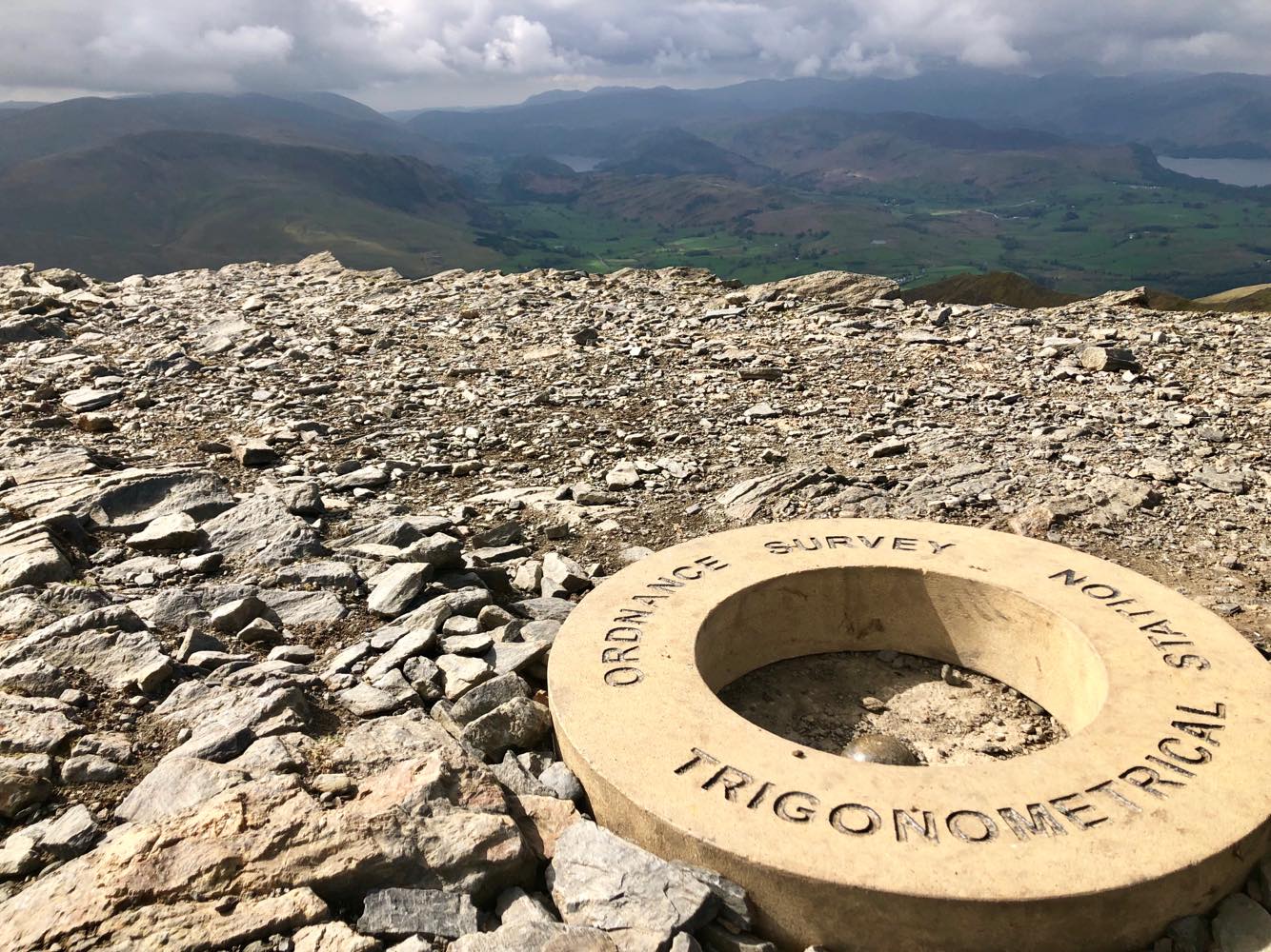
There’s an Ordnance Survey Trigonometrical Station at the top, a big concrete doughnut which – according to some fell runners – replaced the previous doughnut, which got stolen. Annoying but a solid beer trophy. The summit overlooks a lush, cultivated valley to the south and a sandy-yellow moor to the north. Rolling hills spread to the horizon in the east and layers of jagged, hazy blue mountains loom over Derwentwater to the west. It’s pretty.
We walked along the saddleback and descended down the steep path to the flat farmland at the base of the ridge. The walk back was very tranquil; we stopped for a picnic on a rock, petted a couple of curious cows, scrambled over Blease Gill, Gate Gill, Doddick Gill and Scaley Beck and enjoyed the sound of nothing but running water, birds and silence.
We popped into the White Horse for an early afternoon drink while I persuaded Bertie that we should do Skiddaw via Longside Edge/Ullock Pike, supposedly the “best” approach. Persuasion successful, we drove the short distance and parked by the Ravenstone Manor Hotel, near Bassenthwaite Lake.
Skiddaw via Longside Edge
The first half hour or so was a killer. A relentless, steep incline, first through woods then over heathery moor. It eased a little as we made our way along the long, undulating Longside Edge, covered in rocks and heather, and I could see why Wainwright recommended this way.
The landscape opened up ahead and on our right hand side, stretching from dark Bassenthwaite Lake and Derwentwater out over open, green fields to the great blue fells towering over each other on the horizon. On our left was Skiddaw, a great, grey lump that looked intimidatingly steep and distant as it loomed over the coarse, scrubby valley cradled by Longside Edge. Behind us the ridge sloped down to a flat, open expanse of farmland that stretched out to the calm shores of the north west coast, and it must have been the south west tip of Scotland that emerged invitingly through the sea haze.
We followed the curve of the Edge round and eventually reached Skiddaw. The climb was long, steep and loose, untouched by vegetation and surfaced by loose plates of slatey mudstone that made it feel like some desolate, alien planet. We pushed on up (Bert managed despite bad hips, knees, ankles etc, poor old thing), basked in the glorious air that surrounds every trig point, and half walked, half skidded down the steep slope and back the same way we came.
Unusually (but perhaps unsurprisingly, given the distance/altitude covered and hunger/thirst worked up) Longside Edge seemed longer on the way back. Fortunately it was still stunning. Eventually we made it back to the van, somehow without killing each other, peeled off the sweaty layers and made our desperate way to some unknown Keswick pub.
Pub
True to form, classy old me resorted to Wetherspoons for cheap, greasy food and cheap, alcoholey drink. It was so busy that we couldn’t get a table, so we stumbled into the cosy, unpretentious, also-busy Golden Lion on the high street and indulged in the tastiest average pizzas I’ve ever come across. I was drunk after half a cider but I had two anyway, so Bertie drove us across to the Yorkshire Dales in preparation for day two’s mountain – Ingleborough. More to follow…
I discovered Whinlatter Forest Park almost by accident. Bertie and I planned to hire bikes and spend the day exploring the Langdale Valley, but we didn’t pre-book (“we won’t need to”, he said…) and the hire place was closed when we got there. Cue arguing, sulking and a conciliatory drink at the lovely, remote Woolpack Inn.
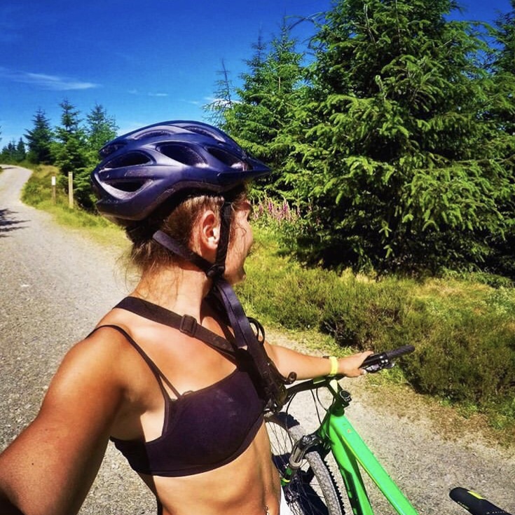
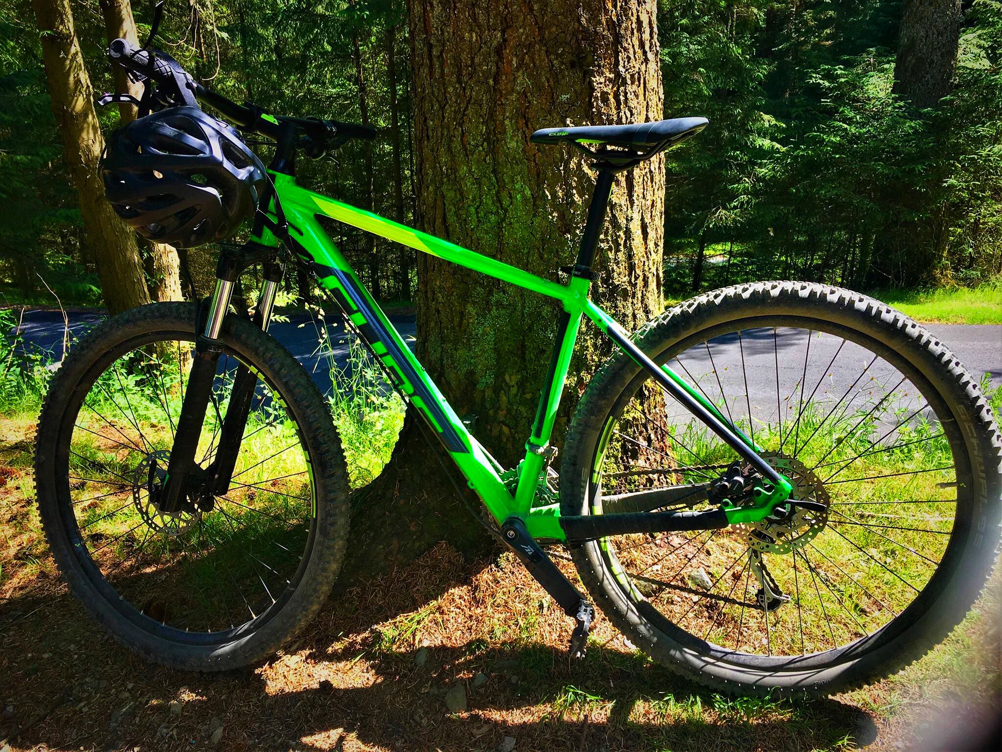
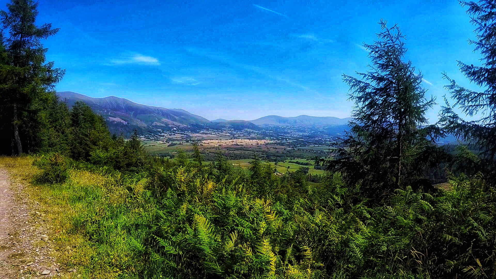
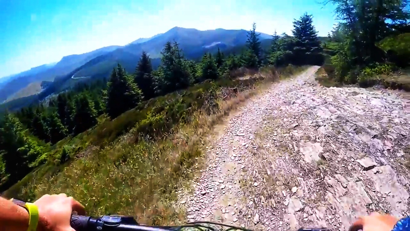
I googled other hire places and the nearest ones were at Keswick or Whinlatter, which I’d never heard of. I was sold when I saw “mountain bike trails” at Whinlatter, so after an hour’s (silent) drive we were fed, helmetted and fixed up with a couple of neat Cube hardtail bikes. The centre is well thought out, with a good café, shop, loos, information centre and big car park, and there are three MTB trails – the blue Quercus trail (“moderate”), red Altura North loop and red Altura South loop (both “difficult”).
Altura North
We started with the Altura North trail, 10km of bliss (for me) / terror (Bertie). It’s a well-signposted, well-maintained singletrack route with 200m ascent, exhilarating downhill sections and breathtaking views over layer upon layer of green, brown and hazy blue mountains. There are some tough climbs, particularly “The Slog”, which require a decent level of fitness and determination. Equally, the downhill sections are challenging in places but SO worth the effort, with sweeping berms, technical rocky and rooty bits, small drop-offs, jumps, flowing switchbacks and optional features graded “black”; the “Grand National” section is particularly thrilling, as the forest opens out onto a steep, gravelly, long switchback. Somehow I avoided causing serious damage to myself, the bike and the densely wooded forest, and I grinned stupidly for the whole 10km.
Quercus
Running out of time, we skipped the Altura South loop to my absolute dismay. However, the 7.5km Quercus trail didn’t disappoint. While it was more family friendly than the Altura, it still had technical sections, a few boardwalks, some flowing downhill and stunning views. The terrain was smoother (less rocky/rooty) than the Altura trail and it felt slightly more artificial, possibly just because it was less rugged. Although less thrilling, it was definitely sufficiently fun – a great warm down XC trail with some really satisfying, flowing sections.
Despite being a glorious day, mid-heatwave (late June), the forest wasn’t too busy. There were a handful of other riders out; a mix of seasoned-looking bikers with bank-breaking kit, happy-go-lucky visitors (sadly our category…) and a couple of family groups on the Quercus trail. The forest is also popular with walkers, but fortunately the real singletrack didn’t cross any pedestrian paths so our human contact was limited to pointing a lost rambler in the right direction on one of the gravel tracks between the “fun bits”.
So by late afternoon, the grumpy Naomi of that morning had transformed into a gleeful, buzzing idiot with sparkly eyes and an uncontrollable grin. Whinlatter exceeded my expectations and I’ve sworn to return to take on the Altura South loop. I’d also like to do the trails at Grizedale (west of Lake Windermere, also exhilarating) again, which – back in 2014 – I crashed on, horribly twisting an ankle and ending up at Keswick minor injuries unit (but not before I bandaged it up and completed the trail). Looks like another Lake District trip may be in the pipeline…
https://youtu.be/mI0SFrkyv_w – GoPro clips of the trails, unfortunately I adjusted the chest strap badly so it’s angled down!