Zimbabwe 2025 (2): Build-up to a Domboshava sunset

Friday 7 March

Morning run

Having just emerged from an English winter full of cold, dark mornings, it was blissful to wake up to warm air and bright sunshine. Reece and I set off on a run around the block at 8am, before the heat of the day set in. Harare sits on a plateau at an elevation of 1,500m above sea level and – as Reece had warned – 6km felt a lot harder than usual (particularly the long, steady hills) due to the lower air pressure and warm temperature.

I enjoyed the run regardless, which was mostly on the road except for the occasional dirt “pavement”. We passed lots of leafy, walled gardens filled with trees, people going about their mornings, a couple of schools and a few rickety-looking market stalls. At one point a lanky teenage boy started running after us and I gripped my phone a bit tighter until Reece turned, unperturbed, and complimented his pace. At this, he sprinted off ahead – his feet barely touching the ground – before returning to his friends. That was a bit weird.

Errands

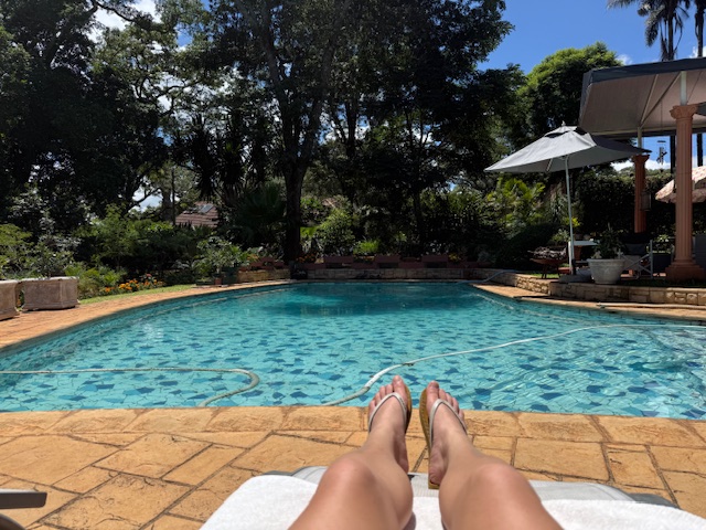
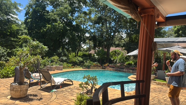
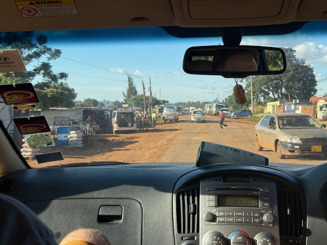
We returned to the house, puffing, and took brief respite in the pool. After a breakfast of croissants with ham and cheese, the six “kids” – Reece, Bryn, Ryan, Isabelle, Tilman and myself – drove 20 minutes to Kieran’s house, which is set in a fancy-looking golf estate with its own security guards, to collect his people carrier. We met Kieran’s lovely wife Trish, had a quick look around the garden – which backs onto the fairway and reportedly receives the occasional golf ball (and cobra in the pool) – and continued on errands.

We stopped at a petrol station (full service) to get fuel, then went to a pharmacy to consider a course of malaria tablets. Shelley had done the right thing and advised us to take them, with the caveat that if we didn’t then we could take antibiotics home just in case, and on learning that they’d set us back $60 each – and might make us feel rough – I decided against it. We bought coffee from a little cart instead.

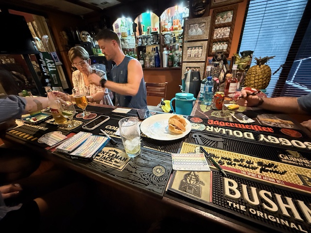
After a quick detour to drop off a deposit for tattoos, we returned to the house and chilled for a couple of hours. I chatted to Iz by the pool while the boys wound each other up playing darts until lunchtime, when we all headed out to Tin Roof, the local bar/bistro that Reece used to manage.

Tin Roof

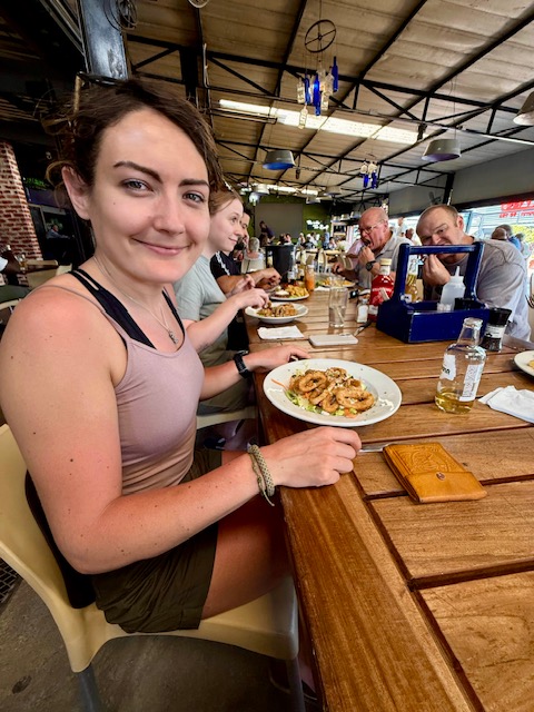
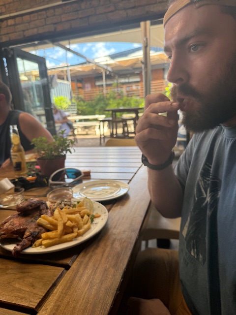
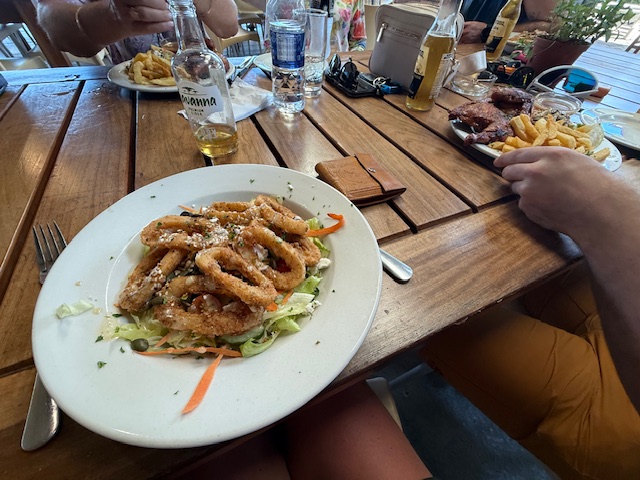
Set in a small shopping park, we found Tin Roof to be a lively place with an open-sided, indoor-outdoor feel, cheap drinks and a great menu. We sat at a long table and tried to keep up with the introductions – Reece’s family seemed to know just about everyone in there. Between us, Ryan and I had a calamari salad and a half chicken with chips, both of which were very good. An ice bucket of beers kept thirst at bay.

Venturing outside Harare

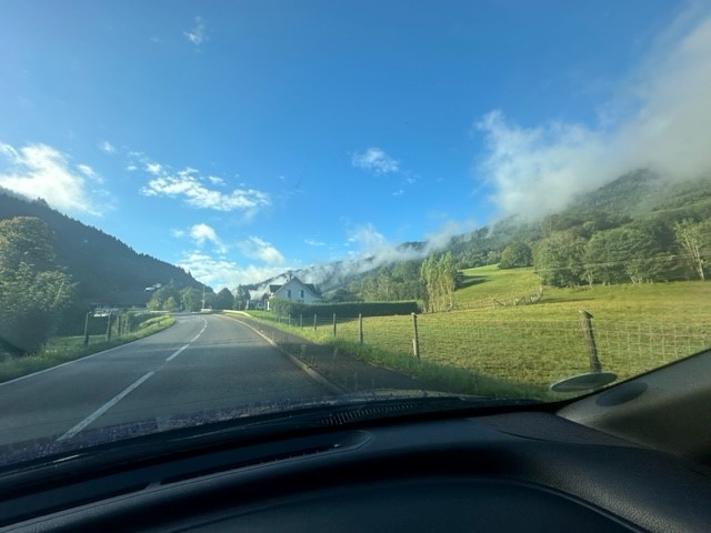
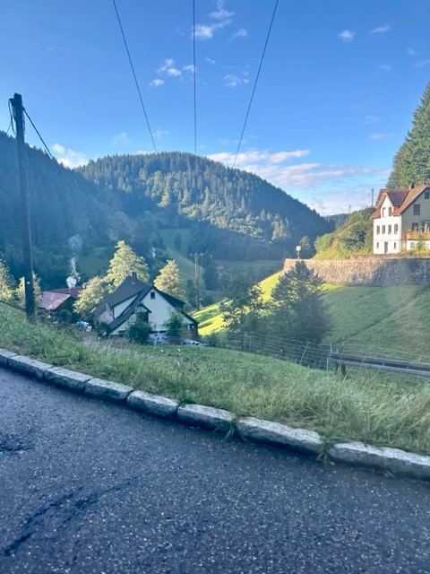
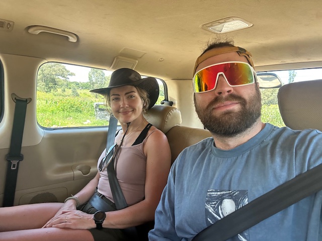
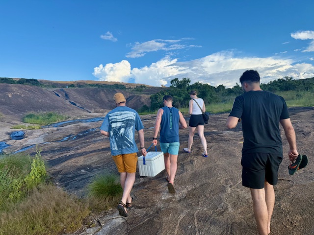
We got back to the house about 4pm to fill a coolbox, then headed straight out for an easy hike and “sundowners” – drinks and a sunset – at a place called Domboshava. Reece conducted the 40-minute drive, which took us north out of rush-hour Harare and provided our first experience of more rural Zimbabwe.

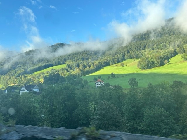
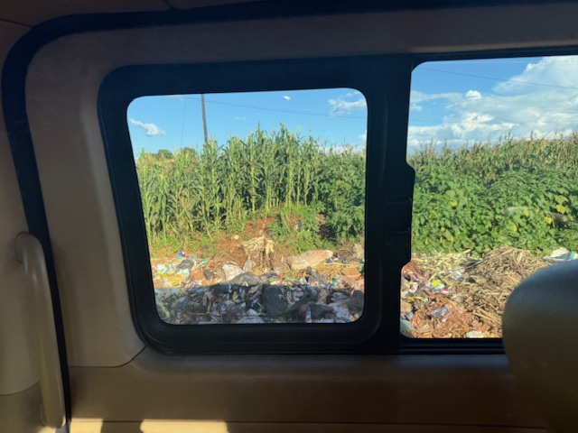
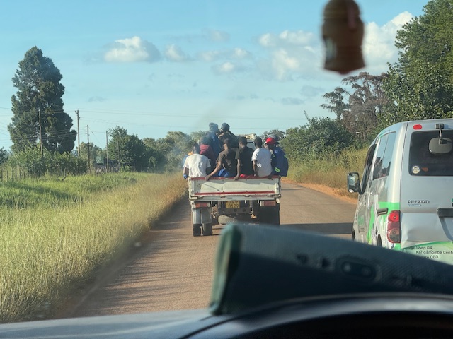
We passed a few farms and a lot of barren-looking scrubland, then came to a shabby-looking village where numerous huts made of just about every material under the sun – wood, chipboard, corrugated metal, tyres, cloth and cardboard – seemed to merge into one another. A boundary was formed between the potholed road and small maize fields by plonked cars, trucks and a ditch completely filled with black sacks and plastic rubbish – Reece explained that public bin services were non-existent. People milled around everywhere and we soon found ourselves behind a pickup truck rammed with a dozen haphazard-looking passengers.

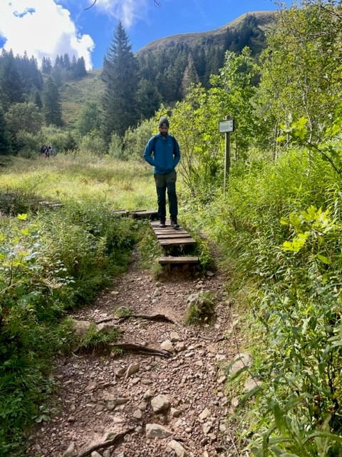
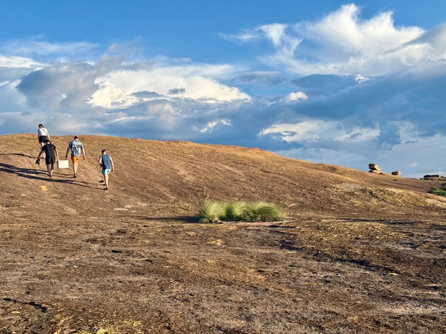
After more potholes, fields, assorted settlements, scrub and the occasional smart-looking bungalow, we turned onto an even bouncier dirt track and soon arrived at a small car park. We each paid the $10 tourist fee for entry to Domboshava and set off on our walk.

Domboshava hike and sunset

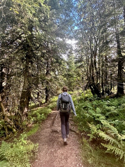
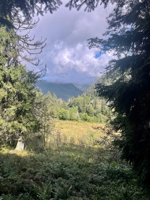
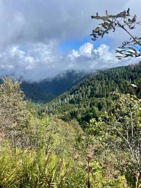
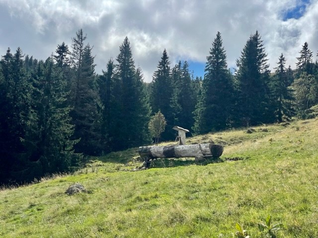
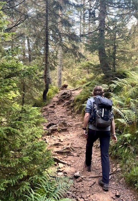
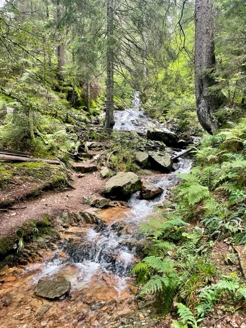
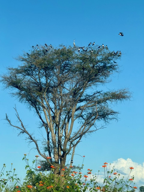
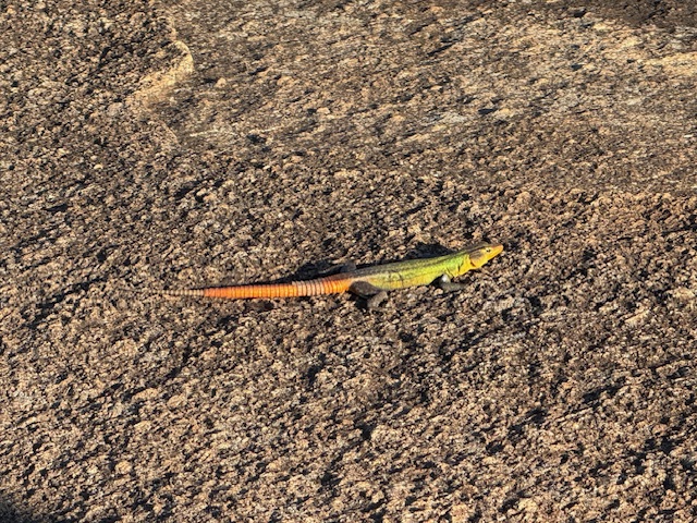
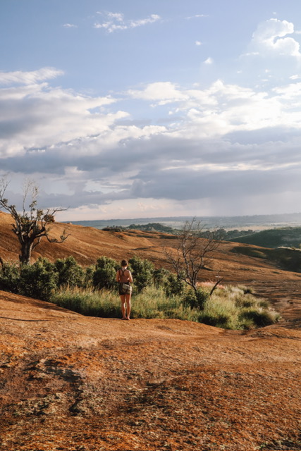
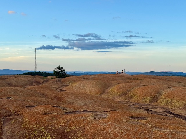
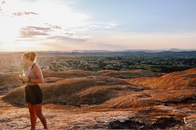
Domboshava is an area of granite hills that features caves, unusual rock formations and ancient paintings. The landscape was unlike any I’d seen before: a great, rolling mass of bare, grey-pink rock rose up ahead like the back of a great, sleeping beast, punctuated by occasional fine cracks, thin streams and inexplicable pockets of greenery. We followed painted arrows up the side of the hill, stopping to watch colourful lizards that basked in the sinking sun and darted away as we approached, their legs wheeling comically in a quick, circular motion.

Barefoot and new to Zimbabwe, I remained conscious – to Reece’s amusement, I think – of the snakes I’d read about, whose venom can kill or maim in diverse and unpleasant ways. However, this fear was overridden by my fascination with the vegetation that somehow took hold in the seemingly soil-less granite, which ranged from patches of yellowish grass to thickets of shrub and swathes of verdant trees. In the “wild” for the first time, I was in my element.

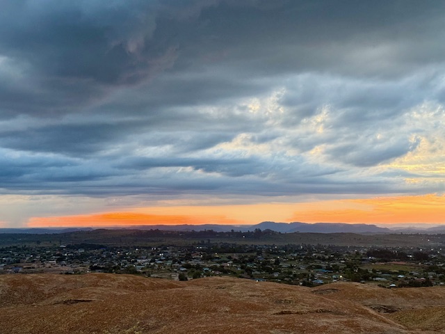
As we gained the rounded crest of the ridge, the greenery receded. A low sun cast exaggerated shadows across the rolling undulations ahead and illuminated the thin layer of yellow-orange lichen that covered the rock, such that the land appeared to glow copper-gold. This, combined with the ominous, blue-grey sky on the horizon, gave the other-worldly impression that the normal order of light – bright above, dark below – had inverted. We could have been walking on Mars.

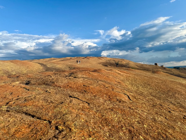
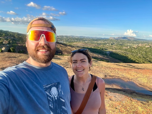
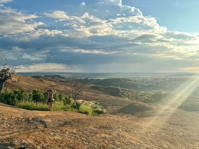
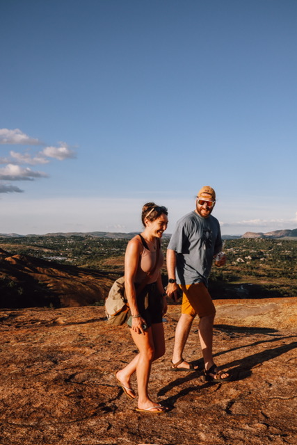
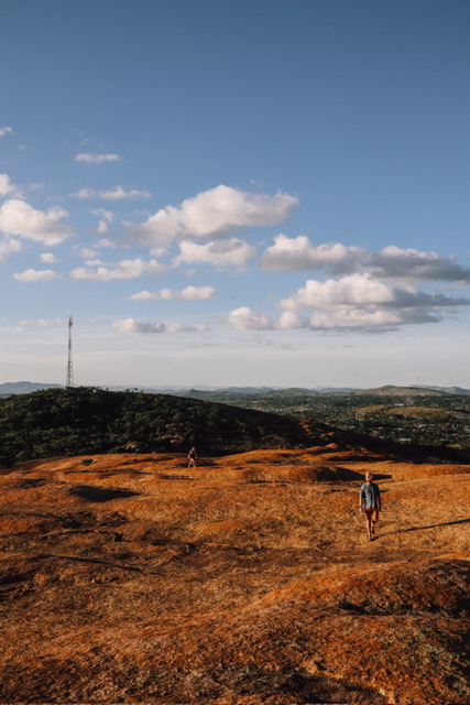
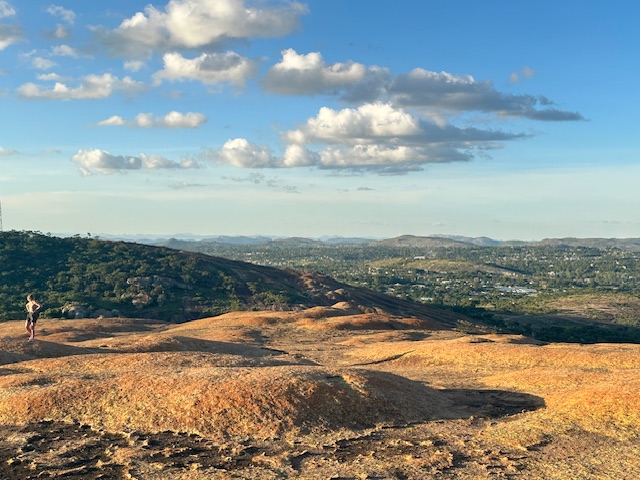
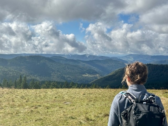
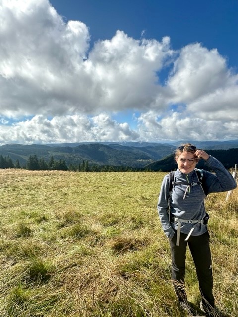
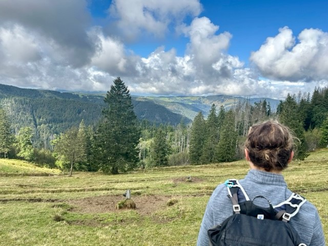
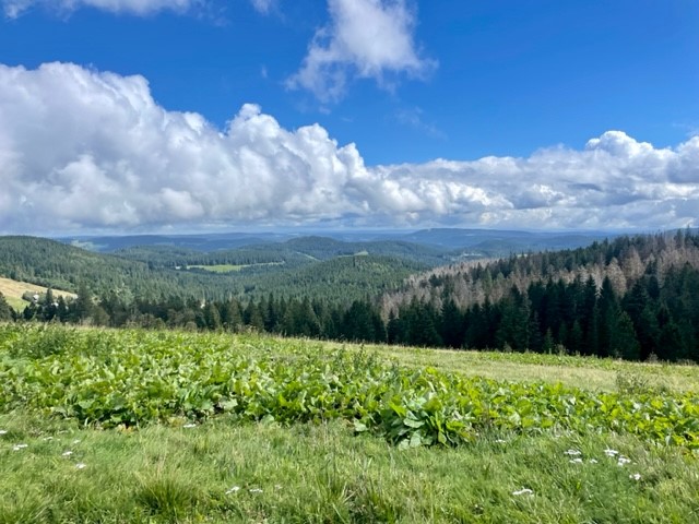
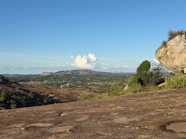
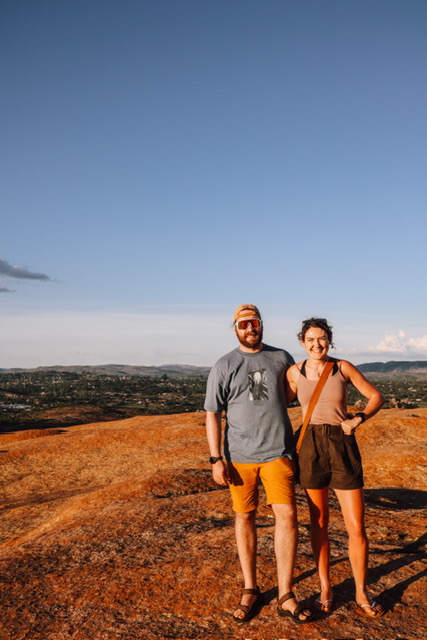
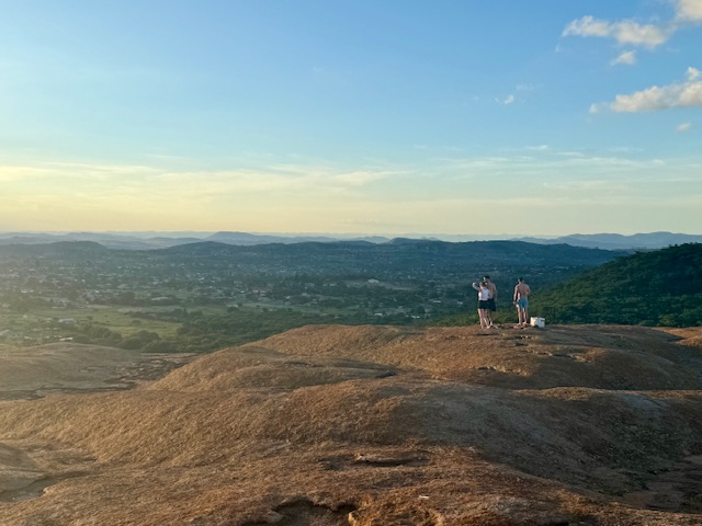
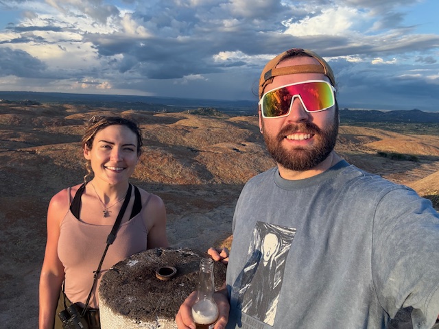
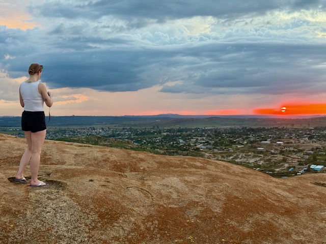
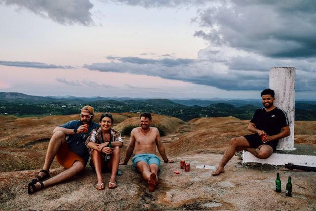
We followed the wide, humpy ridge all the way to the summit, which was marked by a round trig point. The view was spectacular: a 360 degree panorama of surrounding hills arranged in long, layered ridges, separated by wide, flat-bottomed valleys filled with fields, plains, forests and scattered villages. The sky above was clear and blue, with occasional fluffy white clouds drifting above the horizon, and we could hear some happy Friday evening clamour coming from indistinct parts of the basin below. We cracked the beers and I wandered alone across the strangely undulating plateau, drinking in every detail and looking for bugs, while the others sat and watched the sun as it fell towards the westerly hills.

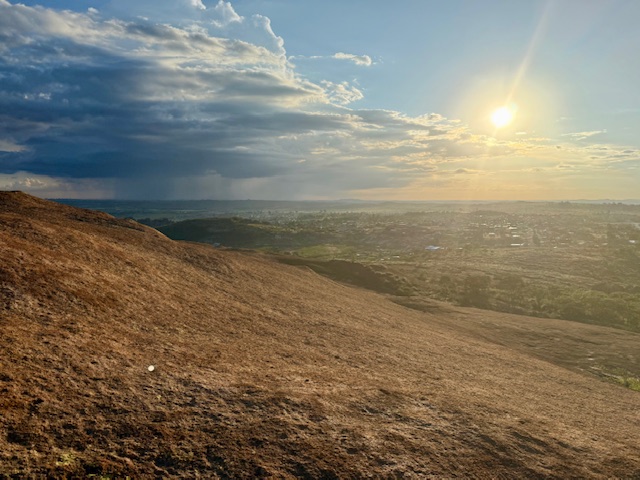
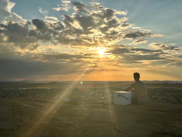
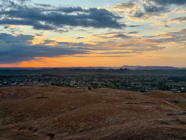
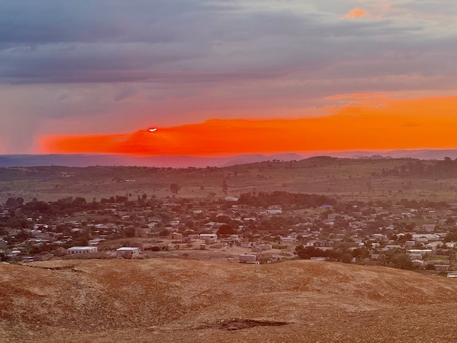
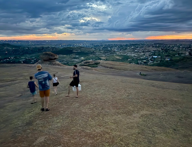
Dark clouds crept towards us from the south and east in long, thick fingers and I returned to the others just in time to see the sun setting beneath a foreboding, grey veil. It sunk behind the horizon through a clear, lava-red stretch of sky, which faded at the edges to a perfect watercolour of orange, pink and yellow that accentuated the hazy blue silhouettes of distant peaks. As the soft breeze picked up, we looked east to thick columns of localised rain and flashes of lightning and decided that it was time for tea.

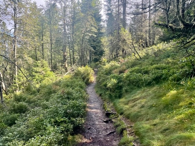
We descended the side of the hill via a couple of huge boulders balanced extraordinarily on natural plinths, connected by a very small surface area. They looked like abstract, unlikely works of art, ready to topple at any minute. The light faded and we found our way back by more painted arrows. As we approached the trees at the bottom, the air became alive with the incessant buzz of cicadas and the distinctive trill of a nightjar. We returned to the car just as the darkness closed in, and on the journey back – in between being brain-rattled by the roads and wincing at a few close overtakes – I watched lightning explode inside clouds above the hills as if someone had put a light bulb inside a balloon.

Home

Back at the house we sat at the bar and played Iz and Tilman’s game “Quixx”, which was good fun despite my record-low score, and Shelley made us plates of ham and cheese rolls while the rains came again. We each negotiated our individual attendance on the morning run Reece had planned and – in light of the run and tomorrow’s upcoming party – went to bed around 11pm.

My main takeaway from day two? Sundowners are a winner.

Hiking the Black Forest’s highest mountain: The Feldberg

Thursday 12th September 2024

We’d kept a close eye on the forecast since arriving in Germany and today looked to be the first (and perhaps only) sunny day. Consequently we had reserved it for the main thing on our holiday to do list – a hike up Feldberg, the Black Forest’s highest mountain. We left the apartment at 8:30am and set off south in our little hire car, itching to explore the hills. Bright morning sunshine saturated the green fields that filled the valleys as we snaked through the vast landscape, lifting mist from dark, thickly forested hillsides in atmospheric veils. We navigated an unexpected road closure, passed high above the glassy surface of Lake Titisee and arrived in a small roadside car park at 10am.

The Feldbergsteig trail

We set off uphill past a modern, sharp-angled church and found ourselves in an outdoorsey resort containing a large hotel, ski centre and cable car base. Eager to escape the tourist trap, we found an information board showing our intended route, the Feldbergsteig. We hadn’t appreciated that the trail starts at an elevation of 1,287m so it felt like cheating to say we were climbing a 1,493m peak, but nevertheless we were excited for a varied, circular hike in a new mountain range.

To the Bismarck memorial

We headed northwest up a wide, gently inclining track that ran roughly parallel to the cable car line, passing several small groups who greeted us with a friendly “hallo”, and soon began soaking in the view. The surrounding yellow-green meadows melted into dark treelines formed by tall, deep green spruces, beyond which stretched endless forest spread thickly over distant, hazy blue ridges arranged in undulating layers. It was sunny, still and resoundingly quiet.

The track narrowed and took us into a verdant coppice, then continued through rugged meadows past a severe-looking concrete tower laden with satellite dishes. The first landmark we arrived at was the Bismarck memorial, a great stone pillar dedicated to the first Chancellor of the German empire. It was a wonderful viewpoint; a continuous swathe of forest covered the surrounding  hills and valleys like a dark green blanket stretching all the way to the distant horizon, broken only by occasional ragged-edged, grassy clearings.

Up Feldberg

We left the memorial and headed down the side of the hill across open meadow. We went through a gate and followed a wide gravel path along the side of a ridge, which was covered in rough, yellowish grass and sloped gently downhill towards the endless forest. A strange, tinny sound tinkled across the valley and a thin curtain of fluffy cloud – which had drifted down the ridge and obscured the path ahead – cleared to reveal a small herd of Fresian cattle blocking the path. I’ve been averse to cows since getting charged by a bull a few years ago, so I gave them a wide berth and reached a gate with some relief.

We gained the summit of Feldberg via a straight path up a gentle incline, the only drama being the loud and alarming receipt (on our phones) of Germany’s annual nationwide emergency alert test at 11am. It was a grassy and oddly subtle, unremarkable peak marked by a low, flattened mound topped with a trig point and a circle of benches, marred slightly by a tall communications tower and grim looking building a short distance away. We munched a sandwich with our backs to the tower and gazed across gently rolling, forest-carpeted hills, pondering on the ethics of saying we’d climbed a mountain.

Through field and forest

My doubts about the mountainous nature of the area were allayed once we left the summit and headed down a track that passed the ugly tower. The peaks ahead of us to the west were steeper, more undulating and completely forested compared to the gentler, grassier slopes to the east, and the horizon was formed by wide, hazy triangles of more mountain-shaped mountains. We headed downhill past a lush, green meadow dotted with fir trees and cattle, their cowbells tinkling whimsically in the breeze, and reached the first alpine hut along the route – a large, tiled, welcoming-looking building. Resisting the temptation to stop and grab a drink, we continued on the path, which flattened out and arced around Feldberg’s lower reaches in a smooth curve.

We tramped across charming, rugged meadows, then entered the thickly forested hillside to the north of Feldberg. A thousand shades of green emanated from ferns, shrubs, trees, grasses, mosses and lichens, which grew in Jurassic Park-like abundance on the steep slope. Shrubby clearings allowed us to gaze across a deep valley to opposite, equally living slopes, which were drenched in warm sunlight that slipped beneath thin clouds that drifted lackadaisically over the valley tops. It was incredibly tranquil, as if the rest of the world didn’t exist.

Past river and lake

We followed the path diagonally down the hillside, crossed a marshy section via a boardwalk and found ourselves at another alpine hut. A steep climb through the forest took us up to another swathe of meadow on the east side of Feldberg’s neighbouring hill, which dropped gently down into more verdant forest. We crossed the narrow, crystal clear Sagenbach river and followed its wonderfully overgrown, mossy banks downstream, marvelling at several rocky waterfalls and – on seeing the many bridges made by fallen trunks – wondered what storm could possibly have touched this serene place.

After winding down the river via bridges, steps and rocks, the route bore us east along a straight, flat track along the side of a hill between legions of tall pines. We stopped for another sandwich at a picnic table, then followed the arc of a spur to the edge of a valley clearing, where another large hut sat below us among cattle fields and meandering tributaries. We followed the treeline down into a peaceful wood, then came to the shores of the perfectly round, cwm-like Feldsee Lake. The clear, gently rippling water was surrounded on three sides by towering, green walls that looked too steep to accommodate the dense mass of huge trees that had somehow taken root. We stood on the “beach” for a moment, watching the ducks and listening to the silence, then set off on the final section of the route.

Last leg

The path followed the east bank of the lake, then climbed steeply into the thicket of beech, sycamore, pine and spruce. We zigzagged up rocky sections until the ground levelled and we emerged from the trees quite suddenly at the cable car base. It felt slightly surreal to be back in the busy resort after the serenity of the hike, which had felt quite wild despite the clear, well-signposted trail. We headed straight back to the car and, after debating whether a trip to the city of Freiburg would be worth it at rush hour, left for home (via Lidl, of course).

To summarise, it had been a lovely, varied hike with beautiful scenery that made us feel truly immersed in the Black Forest. The trail was very easy to follow (we barely used my guidebook map) and I just wish it had been longer than 8.5 miles. We came away feeling very refreshed, happy with a good day exploring a new mountain range.

Evening

We got back at 4:30pm and spent the evening relaxing on the balcony, drinking wine/beer, watching Rings of Power on Netflix and playing with Kraut the cat. Ryan cooked a lovely dinner of homemade schnitzel with steak, salad and potatoes and I came up with a rough plan for another hike the next day, this time starting from our apartment. Three days in and we felt very at home in the Black Forest.

Scotland, Feb ’24: Hike up Merrick, Galloway Forest Park

As usual I’m way behind on the blog, but thought – perhaps to transport myself back to the mountains and glens – that I may as well make a start on this year’s winter trip while I grieve our return. For the first time, Ryan and I had a full 14 days roaming Scotland in our van, which remains largely unconverted (although necessarily insulated). Now that we’re home it feels as if we’ve been rudely and abruptly awakened from a wonderful dream.

Saturday 3 February

We arrived at our first overnight stop in Galloway Forest Park, southeast Scotland, at 3am. The 300-mile, 9 hour drive up – punctuated by a single stop at the spectacular Tebay Services – went remarkably smoothly, save for some inevitable traffic near Birmingham, and gave me the opportunity to decide on our first destination based on the abysmal weather further north. We slept soundly and woke at the leisurely time of 10:30.

It felt so good to recommence my morning van routine: jetboil coffee, get dressed, eat cereal, make sandwiches, brush teeth, pack a rucksack and tell Ryan about the hiking plan I’d already connived. Thankfully I met no resistance – he was just as excited as I was to return to the hills. We’d never explored Galloway Forest Park before, and were keen to kick the trip off with a worthwhile reintroduction to Scotland. We were to hike up Merrick (843m), the highest summit in the southern uplands.

We had a lazy morning packing bags, chatting on the phone to Adam (Ryan’s brother, who was on his way back from a week in the Cairngorms) and enjoying the freedom of having no obligations and very few amenities in the back of the van, which contained a mattress, an awful lot of outdoor kit and no permanent fixtures. The hike looked easy, so there was no rush.

Back in Scotland: Bruce’s Stone

We’d stayed in Bruce’s Stone car park, so before we headed uphill we wandered over to see what the large, raised boulder overlooking Loch Trool was all about. Its inscription provides a summary:

In loyal remembrance of Robert the Bruce, King of Scots, whose victory in this glen over an English force in March 1307, opened the campaign of independence which he brought to a decisive close at Bannockburn on 24th June 1314.

This memorial reminded me of the utterly immersive atmosphere that seems to envelop Scotland. The rugged glens, dark lochs and unforgiving hills make its dramatic, bloody history so tangible that it sometimes feels as if a battle-waging clan of tartan-clad warriors could round a corner at any minute, rightfully raring to defend their wild lands against our English encroachment. Yet I can’t stay away – I’m completely besotted with the harsh, beautiful wilderness. As I looked down over the opaque water of Loch Trool, backed by rough hillsides and surrounded by pockets of mixed forest, I felt – even though I’d never visited this part of Scotland before – as if I’d come home.

Hike up Merrick

We tore ourselves away from the view and headed north up a narrow, rocky footpath at the end of the car park. It was a later start than usual – 1pm – but we weren’t concerned, as we had headtorches and the route looked straightforward. Merrick was signposted, so we didn’t have to do much navigation anyway.

Section 1: Buchan Burn to Culsharg Bothy

The first mile followed the rushing Buchan Burn up a steady gradient along a rocky, muddy path which required some careful foot placements to avoid the boggiest sections. We didn’t care – we were thrilled to plunge into the rugged landscape. It was difficult to believe that 24 hours beforehand I’d been sat at my desk in the south of England, which now seemed mind-numbingly dull. Perhaps that’s why the colours were so vivid, the textures so varied and the river so resounding in the otherwise absolute silence. The hillsides were a seemingly random blend of rough, golden grass, coppery bracken and clumpy, purple-brown heather, punctuated by lilac birches, deep green spruces and skeletal broadleaves. Thick mosses had beaten the grass to little hummocks along the path, and Buchan Waterfall sent white water cascading between lichen-spangled boulders down broad, narrow steps. I was at peace.

After half an hour we reached Culsharg bothy, a small building on the edge of a tall evergreen forest, which looked both cosy and desolate. It had stone walls, a neat slate roof, a central chimney, a flat, grassy area that looked like a little front garden, and two broken, ominously black windows. Inside were two rooms, each with a fireplace and chipboard ceiling, a rudimentary wooden bench and a heavily graffitied door. Overlooking the gentle valley of Buchan Burn, it would have made a lovely cottage.

Section 2: Benyellary

We hiked a short distance through the tall trees behind the bothy and emerged onto a track that led us up the steepening hillside. Dozens of clean-cut stumps either side of us suggested the recent felling of a large swathe of forest, now reminiscent of a forlorn, quiet graveyard, and the moss that had covered the floor beneath the trees had given way to short, green grass. The sun emerged, casting a soft glow over the textured landscape, and we crossed a deer fence to the relatively featureless southwest slope of the first summit, Benyellary. Its shapeless, moor-like flanks, carpeted by rough grass and heather, shone gold and red in the afternoon light and rippled in the strengthening breeze.

We continued upwards, neither of us admitting at the time that the combination of gradient and pace felt quite taxing despite the untechnical terrain. The path cut through the moor, then steepened and followed a drystone wall to the summit of Benyellary. As we climbed (feeling quite out of condition), we realised that the forecast hadn’t erred in predicting wind – it had just been buffeted away from the approach path by the surrounding hills, which no longer offered any protection. Thankfully it didn’t feel as strong as the forecast 30-40mph but was certainly noticeable. The top was marked by a cairn and the base of the cloud, which scuppered the view and just about warranted waterproof jackets, which we hastily pulled on – in between mouthfuls of cereal bar – while sheltering from the wind on the steep east side of the summit.

Section 3: Merrick

We descended the gently sloping north side of Benyellary and followed a drystone wall along the romantically named “Neive of the Spit”, which is presumably the un-dramatic col between the hills, whose summits are 2km apart. The map showed that the ground on our right dropped steeply away to the “Scars of Benyellary”, but we couldn’t see thanks to the cloud that we now occupied. After the col we began the gradual climb up foggy, boggy Merrick. Our view was divided horizontally into two halves, which dissolved into each other in the poor visibility: swathes of sandy, tufty grass and the dull grey interior of enveloping cloud.

Nevertheless, we remained delighted to be back in the hills. The dirt path to the summit was easy to follow, and after half an hour Merrick’s blurry trig point emerged into view. We took the obligatory summit photos, “rescued” a bamboo thermos that had been abandoned in a low stone shelter, decided against my half-formed plan of making the route circular – the return would have involved an inevitably boggy trek past several small lochs and across potentially uncrossable burns – and headed back the way we came.

Section 4: Return

Just as we began the descent, the rain came in. We debated whether the initially innocuous mizzle would turn into anything and agreed, from hard-won experience, that it was worth donning waterproof jackets. That was the correct decision, as minutes later we were drenched and slogging through an un-forecast, cold, wind-driven onslaught, grinning ear to ear. “At least we get to test our new kit”, we rationalised, which – thanks to Christmas and a work bonus – comprised Ryan’s boots, my waterproof jacket and both our rucksacks. We embraced the Scottish weather – there’s no point trying to resist it.

The hike continued in this way until we had retraced our steps back over Benyellary and down its moor-like western flank. There the wind abated, the rain eased and the colourful landscape came back into view, seeming even brighter and more contrasting beneath a bank of thick cloud. We wound down the hillside, past the stump graveyard, through the tall forest and along the vegetated, boggy, rocky Buchan Burn path, barely drying at all in the damp air and intermittent drizzle.

We got back to the van at 4:30pm just as a narrow band of glowing, deep orange light emerged beneath the now-lilac cloud above Loch Trool, marking the last of the daylight. It was as if the sun were teasing us, reminding us that it had been there all along. It was a lovely moment, and – looking over the vivid colours of the hill-backed, forest-ringed loch, soaking wet and starting to get cold – we felt truly re-initiated back into Scotland.

Evening

We spread our wet kit out in the front of the van as best we could, using a length of paracord to make a washing line between the two side windows, and settled in the back for the evening. Dry clothes felt amazing and the hot chocolate I made tasted out of this world. Ryan cooked a lovely pasta carbonara for dinner and we snuggled into the sleeping bag, making plans to head north the following day and – given the miserable forecast all over Scotland – visit the Hunterian museum in Glasgow on our way up to the Cairngorms.

We were home.

Croatia 2023: Manita Peć cave, Hiking & Climbing in Paklenica

Tuesday 4 July

Our apartment was so close to Paklenica National Park that we were desperate to venture there as soon as possible. The plan for the day was to hike for six kilometres up to Manita Peć, a show cave set high in the hills at an altitude of 570m, then to come back down and find some easy sport climbing.

Hiking in Paklenica: trail to Manita Peć

We left at 8:30am and headed toward the dramatic, lumpy skyline of the rocky national park, which was just a 10 minute walk up the road. After a gradual climb, the road curved and dipped down into the mouth of a great canyon and we came to a small building, where we each paid the 20€ fee for three days’ entry to the park – we thought it a bit steep at first, but it later transpired to be well worth the money.

Once inside the park the narrow road followed the gentle curves of the canyon, which cleaved a natural rift between towering hills and vast limestone faces. We walked uphill alongside the Paklenica River, which trickled below us in a leafy valley brimming with all kinds of shrubs and trees, notably fragrant pines and verdant beeches. The constant trill of cicadas saturated the warm air, and after 20 minutes we reached the final small car park and the tarmacked road became a wide, gravel footpath.

The climbing looked wonderful. Vast rock walls rose steeply up on either side of us, spanned by tens of bolted routes – the Klanci area. The gorge was so narrow that the left hand wall could be climbed from the path and the even steeper, higher right hand wall was accessible through a strip of tall beech trees. I’d never been anywhere like it: everything was so high and enormous, yet the canyon was so inescapably steep-sided that it could have felt claustrophobic. I felt exquisitely tiny in that leafy, rocky paradise – even the sky seemed small.

We passed a little gift shop and a toilet block cut into the wall on our left, then the “Underground Secrets of Paklenica”, a visitor centre set in old bunkers built by the Yugoslav army in 1950-53 during the period of political tension between Yugoslavia and the Soviet Union. We didn’t go in as we were so enthralled with the canyon itself, but I wish we’d gone back there.

Shortly after the visitor area, the gravel path became a well-maintained cobbled trail. We continued up it, marvelling at the impossibly high sides of the gorge and the incredible abundance of vegetation despite the apparent lack of soil. We passed a ranger leading a pack horse laden with panniers, somehow navigating the uneven cobbles with nonchalant ease, and followed the path as it wound uphill around jutting rock faces. After 15 minutes we rounded a corner and the gargantuan face of Anića Kuk – the 350m vertical wall we’d eyed the previous day from the Mirila stones loomed over the valley on our right hand side, and an information board showed the lines of several quite serious climbing routes. In all its dark terror, it planted a seed in our minds, and at that moment we knew – even if we hadn’t yet acknowledged it – that we’d be back there soon. The sight of it was inspiration enough.

The trail curved round to the left, through the thickly forested lower reaches of the canyon, and I felt as if I’d never been anywhere so green. I paused to address a blister, then we continued through the canopy for about a kilometre, skirting past families until a sign told us to take a left fork to the cave. From here the path climbed up the left hand side of the gorge, first through more verdant forest, then ascending above the trees in a steep, narrow and increasingly tight switchback that afforded breathtaking views of the canyon, which widened to an immense valley of rock and shrub, with layered peaks stretching left and right across the high, undulating horizon. We revelled in this new, completely unfamiliar landscape.

Manita Peć cave

After a mile of twisting and turning up the hill, overtaking lots of people on the way, we reached a large, distinctive finger of rock that towered into the sky like a church spire, then rounded a corner and arrived at the entrance to the cave. You can only enter as part of a guided group tour, and we arrived just in time to join a group of about 30 people. This was very fortunate, as otherwise we’d have had to wait half an hour until the next lot went in – we were so “just in time” that the guide told us we could pay the 5€ fee after the tour.

Our luck struck again when the guide offered the tour in English or Croatian, and we were surprised when the majority vote was for English. We entered at the back of the line through a narrow passage and descended into the cave, our eyes taking a few minutes to adjust to the darkness, and were led down into an enormous chamber. The group spread along a handrailed walkway that curved around the edge of the chamber, so everyone had a clear view of the vast, open, dimly lit space.

Hundreds of long, sharp stalactites hung from the ceiling like icicles, looking ready to fall at any minute, and lumpy, cactus-like stalagmites rose from the floor as if reaching up to touch them. The guide’s voice rung from across the chamber, and he explained how they grow from carboniferous deposits dissolved in water droplets at a rate of 1mm every 5-10 years, which would make some of the innocuous-looking structures – which were over a metre tall – about 10,000 years old.

We followed the line around the edge of the cave and descended through another low, narrow passage into a second, cathedral-like chamber, which was smaller but even more grandiose, with a high ceiling and walls formed of regular, clumped stalactites and rounded, vertical columns. The rock formations were fascinating: “the witch” brooded in front of us, an irregular mass that looked like a large-nosed woman hunched eerily still in the middle of a room, and the left wall was spanned by “the organ”, a series of multitudinous towering columns stretching from floor to ceiling that resembled organ pipes. I was in awe of the age and grandeur of these natural structures.

Shallow pools of gin clear water spread across the floor, providing a strange habitat for tiny, invisible creatures – incredibly, the barren-looking cave is home to 52 species of invertebrate. While waving a flickering torch over various rock features, the guide explained how this cave had never been inhabited by humans due to its dampness and constant 10 degree temperature – it would have been impossible to heat the space to stay warm and dry. Being English and used to miserable, damp cold, we were just about the only visitors still in shorts and t-shirts, relieved by the coolness of the air.

After half an hour in the blessed cool, we filed back up to the first chamber and out of the narrow entrance into the hot, blinding day, very impressed with the magnificent caves and the engaging tour. We grabbed the guide, who had started attempting to organise the large group milling outside for the next tour, paid our 5€ and slipped past the crowd onto the path we’d come up. Our plan was to return to the Klanci area to climb some of the single pitch sport routes we’d walked past that morning.

Hike down from Manita Peć

We started back down the gravelly switchback, excitedly noting the drop where the loose, rocky valley side fell steeply away to the left of the path. Happy to have made it to the cave in good time (it was only open from 10:00-13:00), we descended at a leisurely pace, taking in the dramatic peaks, faces and drops of the canyon and the lush richness of the forest. We read all the information boards, which told of the park’s abundant flora, fauna and rock formations, and had a budget sandwich (tiny slices of bread, processed cheese and a slice of reformed sausage – surprisingly delicious) on a bench overlooking the valley.

At the bottom of the switchback we plunged into the trees that fill the valley basin and, on our way back through the forest canopy, slipped through a small, natural rock arch to a little clearing just off the path. It was almost too idyllic to be real: an umbrella of young beech leaves glowed green as they shaded us from the burning sun, the Paklenica River flowed smoothly into a crystal clear pool over rounded stones and the vast face of Anića Kuk rose above the trees in the V of the valley under a clear blue sky. I went to investigate a little waterfall below the pool, then found a way of cooling off without undressing or getting my clothes wet – I kneeled in the river, ankles raised on a rock, and submerged my arms in a kind of press-up position, relishing the cool water. We sat here for a few minutes, enjoying the peace, then returned to the path and headed down the valley in search of some climbing.

Sport climbing in the Klanci area

On the way down we stopped to fill a bottle from a pipe in the ground, which provided pure, cold drinking water from the river,  scrambled up a large boulder for a clear view of – once again – the mesmerising Anića Kuk, and had a second sandwich while watching some climbers on the steep right hand wall of the Klanci area. After a short rest we left the shade of the tall beech trees and perused the sunny left hand wall for a nice looking, relatively low grade climb. We decided not to spend 30€ on a guidebook as several routes were helpfully named and graded by little triangular plaques at the bottom of the wall. I chose “Banana Split”, an interesting-looking, eight-draw 5c with varied features.

I harnessed up and started the climb while Ryan belayed from the gravel path that runs through the canyon, just down the hill from the little gift shop. We climbed with two 60m half ropes, which we’d bought with Anića Kuk in mind – this was good practice (if a little awkward for a straight-up sport route) as we’re used to a single rope. The rock was solid but quite polished, which made it feel hard for the grade. Luckily I climbed boldly that day and wasn’t bothered by clipping in awkward positions (which is not always the case!). The limestone was different from the Dorset rock we’re used to: there were no dubious-looking loose blocks, small, juggy pockets provided good holds, and random cracks made for interesting, balancey movements and some high feet as I moved left and right up the wall. I thoroughly enjoyed the route, despite having to rest at the final clip after tiring my forearms out looking for holds.

Ryan lowered me to the ground, then led the route up to the last bolt while I, rooted to the belay, batted away a large, bitey looking insect and got to grips with the two ropes and our new mega jul belay device. He couldn’t work out the final sequence to the ramshorn anchor at the top, and after some frustration, much deliberation and the odd bit of swearing, he came down so I could (to my reluctance) re-climb the route and retrieve the quickdraws.

Evening

Unfortunately this knocked Ryan’s confidence, which doesn’t happen often, so we called it a day and silently pondered over Anića Kuk. We headed back down the canyon at 4:30pm and returned to the apartment, where I cooked a memorably good improvised spaghetti carbonara with cream cheese, unthinkably processed sausage, fried tomato  and rosemary pinched from a bush on the pavement. We had a frank discussion about Anića Kuk, agreed to postpone until the time felt right, and made plans to get up early the following day to drive to Plitvice Lakes.

That evening we walked down to the seafront and sat on the wall to watch the sunset. I ate fresh plums and apricots, drank more of our new favourite, Somersby cider, and swam around as the sun – which looked much bigger than usual – dipped into the sea. It cast a warm, orange glow over the calm water, and the long, jagged ridge behind Starigrad climbed in a layered, grey-blue haze into Paklenica. I thought once again how lovely everything was.

Garmin got confused in the canyon, hence the squiggliness of the route

Scotland, Feb ’23: Hiking Ben Wyvis

Sunday 5 February

We awoke to an incredibly tranquil view over Loch Glascarnoch, whose glassy surface reflected a sky of blue-grey that melted to lilac-pink at the eastern horizon, betraying the previously uncertain existence of the Scottish sun. The air was strangely still and the steep brown slopes across the loch were capped by snow which seemed to glow in the morning light. It looked like a good, clear day for a hike. Given Ryan’s ongoing blister situation, we decided to tackle the relatively easy-looking Ben Wyvis, which was just down the road from our scenic overnight spot.

The Ascent

We drove east for 10 minutes and stopped in the car park for Ben Wyvis mountain and nature reserve. We had our usual disagreement over timings, as I’d hoped for an earlier start but Ryan – who is generally immovable before 8am and will often complain on being disturbed until around 9 – appreciates a lie in, so unfortunately the hike began about 10:30 with some sourness. The first section took us on a clear path which followed the rocky, birch-lined Allt a’ Bhealaich Mhoir river through verdant pine forest for a couple of kilometres, then popped out onto open, grassy heathland at the base of the mountain, which loomed ahead looking bulky, steep and rugged.

The gradient continued moderately for another half kilometre, then steepened as the path began to wind up the western side of the hill. We stopped a couple of times to de-layer, snack on cereal bars and take in the growing view behind us over rolling, heather and forest covered hills, which were backed by snow-capped mountains that stretched for tens of miles across a clear horizon under a layer of flat, pale grey cloud. We powered upwards, still in a silent state of bitterness which thankfully started to dissipate with altitude and the emerging view.

The path zig-zagged up the steep mountainside for a hot, sweaty mile and the view seemed to grow with each turn. Over the valley between Ben Wyvis and adjacent Tom na Callich we could now see distant mountains to the southeast – the Cairngorm plateau – which spanned the skyline in broad, hazy swathes and stood out against a bright, yellow-orange glow hanging beneath a flat ceiling of thin cloud. We stopped for a quick chat with a friendly man out with his dog, who told us that of all the several times he’d climbed Ben Wyvis, today was the clearest. Happy at this news, we continued up the steep path and reached An Cabar (946m), the first summit of the range, at about 12:30.

The wind hit us quite suddenly at the top, so we layered up and quickly continued northeast along a wide, icy ridge towards Glas Leathad Mor (1046m). It was a little slippery, but not quite enough to warrant pulling out our crampons. We munched some sandwiches – I had peanut butter and jam and Ryan had cheese – and tramped up the long, easy slope for another mile to the next summit, passing a few other hikers and heeding the sign back at An Cabar that told us to keep to the footpath to protect the sensitive flora. The wind was so bitter that even through my gloves my hands were stinging, so I balled them up and shoved them under my arms.

A sunken trig point marked the snowy summit of Glas Leathad Mor, which we reached at 1pm. Along the ridge the view had developed into a 360 degree panorama of distant mountains, some snow capped and all stretching in hazy layers under a smooth, striated sky that looked as though it had been painted in several shades of blue-grey watercolour. The brush strokes parted occasionally, revealing a pale blue canvas that faded to orange near the horizon. It was almost as lovely as the land.

An Unplanned Summit

Now for my confession: I hadn’t been in the Ben Wyvis area before and the hike was a last minute plan, so – my research having confirmed that it was a beginner-level hike on easy terrain – we’d gone up without a paper map. I wouldn’t normally condone this, but the weather looked so reliably clear, the mountain so whale-back-shaped and isolated, and the route so well-walked that we were quite comfortable with just a phone (we had a power bank and charger) and a good sense of direction. This of itself wasn’t an issue, but it meant that we hadn’t planned the hike as meticulously as usual, so at the summit of the munro I gave Ryan the familiar and perhaps inevitable look that suggested “shall we just pop up that other mountain over there”.

He capitulated and off we went over the back of the hill towards Tom a Choinnich (953m), a munro top one mile to the north. It was a straightforward but fairly steep yomp down into a col and up the next snowy mountainside, but the decision was controversial enough to rekindle some of the morning’s tension. After half an hour of relative silence we were at the next summit, which is where we made what was, with hindsight, the wrong decision.

The Bog Slog

We had three options: retrace our steps back the way we came (which I intensely dislike doing), take a path that would take us back to the van via a long, c.8.5mi detour around Loch Bealach Culaidh, or follow a drystone wall with what looked like a path running alongside it that headed for the van as the crow flies. With Ryan’s blister in mind, we picked option 3, hoping that the path would continue, or at least that the terrain would be relatively amenable.

The path did not continue and the terrain was not even remotely amenable. We clambered awkwardly across a large, icy boulderfield, following the wall for half a kilometre until it just stopped. What was type 1 fun quite quickly slipped firmly into the type 2 category, but we decided that we’d gone too far to turn around so continued in a straight line – firstly downhill across more awkward rocks, then through damp, knee-high moss, grass and heather. Hoping desperately that we weren’t a) damaging the vegetation, and b) being scrutinised by distant onlookers, we slogged across the landscape, slowly and as carefully as possible.

Under other circumstances the colourful, diverse vegetation underfoot would have been fascinating and the mountain scenery breathtaking in the yellowish afternoon light, but at the time the route we chose was simply long, awkward and wet. With every step requiring a high knee and careful foot placement, the going was slow and I felt terribly guilty about deviating from the path. After what felt like an age we reached a stream that cut a little valley into the wild scrubland, which provided some relief as we felt a bit more discrete lower down. We followed a deer path down river, frequently treading in bits of bog and at one point tiptoeing along a small but sheer, muddy drop above the water, and reached the edge of Garbat Forest after a couple of long, arduous miles.

Garbat Forest

We followed a dilapidated fence south for another even boggier mile, then clambered warily over a very rotten stile that led us into the forest. According to the map on my phone, the fire break we’d found should have led us to a path that would cut through the woods and rejoin the path we’d hiked in on, but it looked like neither the fire break nor the path had been used for a long time as both were overgrown and wet. We had another awkward mile ahead.

Despite our exasperation at yet more trailblazing, the forest was fascinating. Tall, densely packed pines formed a canopy above an undulating, mossy carpet, which was reddened by years’ worth of fallen needles, and hundreds of twiggy offshoots harboured masses of pale, green-grey lichen. These offshoots stuck out from the tree trunks and made passage quite difficult as they were both prolific and pointy, so we slipped through carefully – sometimes deploying Matrix-worthy manoeuvres – in an effort to minimise damage and remain unstabbed, while also avoiding huge marshy areas that somehow submerged the trunks without drowning the trees. It felt ancient, atmospheric, serene and slightly eerie.

In the absence of a path we ducked and side-stepped our way through the forest in the general direction of the van, stopping a couple of times to observe some fallen trees that were in the fascinating process of being absorbed by moss, grass, lichen and an enormous ants nest. Animal paths provided the most accessible routes but seemed to start and end at random, so it took a while for us to reach the high wire fence on the edge of the forest. We climbed over it and rejoined the path we’d walked in on with some relief, then tramped the final, easy mile back to the car park along the river.

Recovery

We de-bagged and drove back to the Loch Glascarnoch pull in, slightly giddy at the relief and excitement of having climbed another munro, but more so at our adventurous choice of route. I was impressed that my boots had kept my feet almost completely dry despite the bog-trotting and I expressed my empathy towards Ryan, who had decided to test his new trail running shoes and as a result had wet feet – which I have a particular enmity towards – all afternoon.

We stuffed our shoes with newspaper, cooked a notably delicious Thai green curry and settled for the night, feeling victorious at having extracted ourselves from that difficult terrain, but also ever so slightly disappointed that we’d made the decision to chance the route in the first place. Another lesson learnt.

Girona, Spain: Forest Hike to Castell de Sant Miquel, Home

10 July 2022

It was the final day of our little holiday and we were determined not to waste it. With the flight home not being until 8pm, we asked our AirBnB host if we could store our small luggage bag in the hallway until the afternoon and she kindly agreed. We left about 10am for Castell De Sant Miquel, a tower on a hilltop in the middle of a vast, rolling forest. Getting there would involve a 1.5 hour hike that had been recommended to us by one of the people at the bike shop the day before, starting from the middle of Old Town.

Ascent up Les Gavarres

We walked through the quaint streets (I’m nearly done banging on about them), through the castle-like cathedral area, across a narrow dried-up river channel near the pretty John Lennon gardens and east out of the city. Within just a few minutes it felt as if we were in a rural village, walking along a quiet road lined with rustic houses which soon turned to dry, hedge-lined arable fields. After about a mile and a half we reached the edge of the Gavarres massif, a vast range of relatively low mountains covered in a dense forest of oaks, pines and other lush green vegetation, and we took a well-signposted gravel path into the trees, which provided some respite from the relentless sun.

The hike up to the tower was hot but enjoyable and it felt very exotic, given our unfamiliarity with non-British forests. Noisy cicadas filled the air with a constant, croaky hum and I was amazed by how the trees seemed to thrive despite the dry, dusty conditions. We passed a herd of goats rambling casually up a track after a goatherd, stopping to chew on leaves with their tinny goat bells tinkling. The winding, hilly route passed a couple of interesting features, including a tall double column sculpture and the ruins of medieval stone farmhouses with information boards in several languages, and at a clearing in the trees we stopped to look over the distant, sprawling red rooves of Girona backed by layers of hazy blue mountains in the Guilleries massif.

Castell de Sant Miquel

As we approached the top of the hill the gravel path turned to bare, slabby, rooty granite, then levelled out to a flattish plateau. We walked up to the castell, which sits on one of the many summits of the Gavarres. It appeared suddenly through the trees, seemingly out of nowhere, a perfectly square, three-storey stone tower with a set of exterior metal stairs leading up to the entrance on the first floor. Behind it stood the semi-intact remains of a long stone chapel, a section of old wall and a lonely information board that told us in vague terms that the tower was built in 1848 on the remains of a medieval hermitage (religious retreat). As I write this I’m surprised at how little of the history seems to have been recorded – Google offers no substantial results.

We wandered into the crumbled open end of the chapel and along to the intact-rooved end, where a large, rough-edged hole served as a window that perfectly framed the far-reaching views over rolling forest and way out to a smooth, distant sea. A small altar stood looking a little sad in the middle, and the place exuded lonely, slightly mysterious simplicity. We went back to the tower, climbed the steps and popped out on the flat, square roof.

We were prepared for the incredible views because the structures stand in a clearing that allowed us to catch glimpses of distant mountains above the treetops, but we weren’t quite prepared for the overall effect of the totally unimpeded 360 degree panorama that hit us at the top. We looked down on verdant, almost rainforest-like woodland that rolled over undulating hills all around, stretching way out to the south and east in deep green swathes. This gave way to a short length of smooth blue sea that sat in a wide valley between gently rising mountains, which – apart from that little bit of coast – stretched around us the entire length of the horizon in a long, hazy blue chain. Expanses of butter-coloured farmland and little towns formed a mosaic on flat plains and in valleys, and Girona looked strangely small tucked below the highest peaks. It was breathtaking, and so novel compared to the UK landscapes we’re used to.

Hike back to Girona

We walked around the top of the tower, taking it all in, then climbed down the metal stairs and headed back into the trees the way we came. After the rooty granite “steps” we took a right fork to make the route circular, then tramped down a wide, dusty dirt track lined with conifers and birches. After about a mile we crossed a main road and walked back to Girona along a quiet, rolling country lane, past rugged fields, large, spread-out rural houses and lots of trees occupying all the in-between bits of land that hadn’t been otherwise claimed.

As we neared the city the houses became more packed in but still large, spacious and quite plush-looking. This was clearly a well-off suburb, with clean streets, bright whitewashed walls, lovely views over the distant mountains and a startling number of private pools. We walked down the hill to the medieval area around the cathedral, glad to have squeezed such a lovely walk into our last day, and treated ourselves to a refreshing smoothie from a little shop near the basilica, which we drank overlooking the river.

Homeward bound

We reluctantly conceded that the holiday was over and walked the cobbles of Old Town one last time to collect our bag from the AirBnb. After saying goodbye to our host we squeezed into the tiny lift, went through the narrow passageway onto Placa del Raims, crossed the bridge and returned to the bus station through the long, straight, less quaint streets to the west of the river. We grabbed drinks and snacks from a tiny convenience store and waited in the air conditioned station for the bus, which was due about 3.30pm. Time dragged, partly due to the our unnecessary earliness and partly due to the Sunday afternoon quietness of the large station plaza, which was beautifully sunny yet eerily quiet and empty.

We were lucky to board when we did as the bus driver told us it was cash only, which would have left us stuck if the very kind American in front of us (who we’d already spoken to at the station) hadn’t insisted on paying our fares. As the bus took us out of the city we gazed wistfully over the long streets hectic with signs, overhead cables and shop shutters, then over dusty fields and rustic farms before reaching the airport. We hung around outside for a while, then hung around inside for a while, then finally went through security and reached the great, sprawling duty free / lounge / restaurant bit, which had huge glass windows looking out across hazy blue mountains. It was a nice, small airport, which was a huge relief given that our flight was delayed by an hour. We had a Burger King (Vegan Whopper – delicious) on a small terrace, lamented the end of our little holiday and had an uneventful flight back to Bournemouth.

Girona: 9/10 would recommend. Minus one point due to the citywide absence of triangular sandwiches, but that’s a personal thing.

Scotland, Feb ’22: The Cobbler

Monday 14 February

We woke in Glencoe, happy to be in my favourite place but painfully conscious that we only had one day left in Scotland. The last thing on our to do list was hike up the Cobbler, an iconic small mountain in the Trossachs range near Loch Lomond. We had poached eggs on toast and drove out of dramatic Glencoe one last time – I’ve probably over-described it in previous posts so I’ll spare the gushing detail of how beautiful it is. We headed south across marshy Rannoch Moor, where the vast, sprawling wilderness was accentuated by the rugged, rolling mountains all around.

The drive down to Loch Lomond was very scenic and I saw my much-anticipated red squirrel, although sadly it was flat as a pancake in the middle of the road. We drove along the long, winding edge of the loch and turned off towards Arrochar, a village which sits at the head of unimaginatively but accurately named Loch Long. We parked in the lochside car park and booted up, leaving the van about 12.30pm.

The first section took us on a long, steady hike up a switchback path that climbs above Loch Long and through thick birch and evergreen forest, then pops out onto open, undulating moorland covered in golden grass, brown heather and the large, grey, randomly strewn Narnain boulders. The distinctive form of the Cobbler appeared as we emerged from the trees, its dark, gnarled rocks distorting the horizon and standing in stark contrast against the pale, cloudy sky and patchy white snow.

The Cobbler, otherwise known as Ben Arthur, is so called because of the distinctive, tall, dark lump of rock that sits on the central summit of the hilly mass, which is supposed to look like a cobbler bending over at work when viewed from the east – the way we were approaching. Personally I’m not sure I see it, but it certainly is a peculiar shape.

With that iconic figure straight ahead of us, the steady hike up the hillside moor was stunning, with far-reaching views across the rolling, golden peaks of the Arrochar Alps rising all around us. We passed vast boulders and followed the gently flowing Coire a Bhalachain river for about a mile to the base of the imposing, obscure obtrusion, where snow started to appear on the ground in patches. Here we took a right fork to approach the summit from the obvious path to the north. The alternative option was a shorter but steeper route that looks on a map like it goes west up a wide gully, which looked snowy – we hadn’t taken ice axes so didn’t fancy climbing, nor ending up in an avalanche.

The path continued gradually up and northwest along the river for another kilometre to the small Lochan a Chlaidheimh, which sits in the col between the Cobbler and neighbouring Beinn Narnain. Suddenly exposed to the westerly wind, able to see the deep, rolling valleys over the back of the mountain, and stood just below a thick grey curtain of clag, the place took on a whole new character – wilder, more ominous and more exciting.

We took a left fork at the col and began the steeper climb up stone “steps”, now heading south up the mountain’s north face. The snow thickened and spread as we climbed up, and the icy rocks became quite awkward to move across; luckily sensible Ryan had brought his hiking poles. Once we’d gained some height the path levelled into a narrow, slippery traverse below the lumpy North Peak, which was a little sketchy but afforded good views over the undulating brown valley below (the summits of Beinn Luibhean and Beinn Ime had been absorbed by cloud) and the Cobbler’s snow-covered northwest side, which rolled down in a vast white mass that was quite different to the iconic grey cliffs on the sheer eastern face.

We reached this white mass and made our way up, which was difficult given the steep gradient and slipperiness of the compacted snow and the unpredictable sizes, shapes and locations of the rocks hidden underneath. The snowy summit (884m) was about a kilometre on from the Lochan where we’d branched left, and we were relieved to gain it after the awkward climb. Once up there I was keen to “thread the needle”, a famous move which involves climbing through a hole in the highest pinnacle onto an exposed ledge on the sheer east face, then scrambling up to stand on the narrow rocky peak. I went partly through the hole but the conditions were way too windy and icy, so I decided against it – Ryan had already had kittens.

Pleased to have reached the top but slightly amused and exasperated to once again achieve a summit with extensive views of the inside of a cloud, we took a few photos and headed back down the way we came. It was just as awkward as the way up, if not more so, and we were relieved when we returned to the Lochan and the easier path back across the golden moor.

The walk back from there was lovely, with excellent views over the rugged hills all around. For some bizarre, probably food-related reason, Ryan, who hates running, decided to start jogging back, which we did for a few hundred metres before I became concerned about a potential shin splint (an old injury) and becoming unnecessarily sweaty. We crossed the boulder-strewn moor, looking back wistfully at the wild hills, entered the forest and took the switchback path back down to the car park.

We got back to the van about 16:30, de-kitted and drove south along the bank of stunning Loch Lomond to the town of Balloch, where we treated ourselves to a mayo chicken from McDonalds and looked for a half-decent overnight spot. Having not found anywhere, I used the Park4nite app and spotted a perfect little pull-in between Dumbarton and Helensburgh on the bank of the wide, tidal River Clyde, a 20 minute drive west. It was on a very quiet road by a sandy beach, which was a lovely, bird-rich nature reserve, and as the day faded it overlooked the twinkling lights of Greenock on the far side of the river.

I cooked vegan mince stew for dinner with bulgur wheat and veg, and to mark Valentine’s Day we lit a candle – a bit extravagant, I know. We spent a long time watching the lights of Greenock dance on the water, looking up at a clear, starry, unusually bright sky, listening to the strange wading birds, and reflecting on our lovely trip. We went to bed reluctantly, not wanting our time in Scotland to end and half-considering just living wild.

And just like that, it was over. To conclude the trip, the drive home the next day was long and uneventful – we left about 9.30am and got back to the New Forest about 6pm. As usual, I think I left my heart in Scotland. Must go back soon.

Scotland, Feb ’22: Skye Fairy Pools to Fort William

Thursday 10 February

We had breakfast overlooking atmospheric, moodily grey Dunvegan Loch and drove down Skye’s pretty eastern edge for 40 minutes to the Fairy Pools. On the way Ryan spotted a huge white-tailed sea eagle soar high above the van and dip below some tall pines, and to my absolute delight I just about caught a glimpse of it before it disappeared.

Our plan was to hike up to the Fairy Pools, then leave Skye for the Ben Nevis range in the hope of some half decent climbing weather the next day. We wound along a remote road, parked in a free car park near the start of the Fairy Pools walk and headed down to the wide, well-maintained tourist path.

The Fairy Pools (extended edition)

The Fairy Pools are a series of waterfalls and clear pools on the Allt Coir’ a’ Tairneilear river, which snakes up to the base of the infamous Black Cuillin mountains described in the previous day’s blog post. The pools are set beneath the vast ridges of Sgurr Thuilm, Bidein Druim nan Ramh and Bruach na Frithe, which curve around the river in a protective yet imposing C-shape. These great giants form a wild, open-ended bowl carpeted with golden grass and brownish heather, and directly in front of us at the head of the bowl stood Sgurr an Fheadain, a perfectly triangular, dark grey, child’s drawing of a mountain tucked neatly between two sloping ridges as if quietly watching over its territory from a throne. Low cloud hanging over the mysterious, snow-spangled peaks gave the place a self-contained atmosphere that made it seem like the rest of the world simply didn’t exist.

We got rained on as we started up the path, which follows the river’s left bank. I didn’t mind as it meant there were few other visitors. The deep, round, extraordinarily blue Fairy Pools sat below low, rushing white waterfalls, some wide and low, some narrow and high, and the meandering river carved relentlessly over, around and through solid rock in an endless torrent. The pools were a beautiful, crystal clear blue-green colour, and if the air temperature had been in double digits I’d have jumped in. We instantly understood its popularity as a tourist destination, although I wouldn’t want to visit on a busy summer’s day. Even beneath a cloudy sky it was worthy of a Herbal Essences advert.

The path along this extraordinary river continued for about 2.5km up to the base of the Cuillins. Our plan had been to see the pools and head back the same way, but having eyed up the map I had new designs on making the hike circular (triangular) by taking a path that follows the base of the immense ridge northward, then west across the moor and back to the van. I entreated Ryan, who rolled his eyes and followed me onto our new path.

As is standard, the rocky path became muddy then boggy, to Ryan’s great disgruntlement. We trudged and slopped along wet, tufty grassland, trying desperately to keep our feet dry. After a mild bout of whinging we suddenly spotted the dark forms of several red deer a short way ahead of us, well camouflaged against the boulder-strewn, yellow-brown heathland, and our agitation evaporated. They were such majestic animals, easily large and powerful enough to do us a mischief, yet they warily kept their distance as we blundered through their territory, and idled casually up the sleep slope to the right as we approached. Then we spotted more over to our left, watching us quietly from about thirty yards away as they chewed rhythmically in peaceful little groups.

The path had been absorbed by the wild terrain so we walked carefully through heather and bog until we reached a small river, the Allt a’Mhaim, and a parallel path which would take us southwest back towards the road. We followed it all the way down the gently sloping moorland, admiring the rolling brown wilderness that was now illuminated in the golden glow of the soft winter sun, and more red deer appeared from nowhere on either side of us. The bluish clouds over the Cuillins and the dark shadows of the undulating high ridges accentuated the warm light that fell on the mountainous bowl, giving the landscape an other-worldly, dream-like quality. It was a harsh, thriving, unadulterated place.

After walking along this path for about 2km we reached a fairytale-like waterfall set just below a thick fir forest, took a wistful look back towards the Cuillins, and rejoined the road back to the car park. What a beautiful place.

Back to the mainland

It took us an hour to reach the Skye Bridge via Sligachan and Broadford Co-op, a drive that involved a lot of “wow look at that”s, referring to various lofty peaks and wild islands. Back on the mainland we drove southeast along the main A87 Old Military road that follows the length of long Lochs Alsh and Duich, then  cuts through the belly of vast Glen Shiel and past lochs Cluanie, Loyne, Garry and Lochy. As we passed wonderfully named Loch Lochy the sun set over golden water, sinking below the distant peaks in a soft haze.

Almost two hours after leaving Skye we arrived at Fort William and nipped to the familiar Morrisons, then drove for 15 more minutes to Ben Nevis’s north face car park. For dinner we had a strange combination of leftover vegan bolognese, bulgur wheat and stovies – a Scottish dish made of beef, onion and potato, all minced together in a delicious (if unsightly) mush – then had a very serious discussion about what we should do the following day.

We both really wanted a big mountain day on or around Ben Nevis, either ice climbing a route like Number 2 Gully or hiking/scrambling the Carn Mor Dearg arete, but after a lot of research and consideration we decided that given the high winds and “considerable” avalanche risk on north east aspects in that area it wasn’t the day for it. We settled, after some squabbling (I was team bike, Ryan was team find somewhere else to climb), on mountain biking the famous Nevis Range trails that started from the car park we were in, which had been on my to do list for years. It was a good thing we did because we went to bed much later than planned, having spent a long time deliberating over Ben Nevis.

Scotland, Feb ’22: Hiking Cairn Gorm

Sunday 6 February

We woke to ice on the inside of the van windows and fog, snow and bitter wind outside, so we had a lie in. Snuggling up inside layers of clothes with nowhere to be was lovely, especially with the hob and kettle at the end of the bed. Because of the inclement weather we decided to go out for an easy hike up to the summit of Cairn Gorm as a warm up to the rest of the trip, thinking that this would enable us to recce the high parts of the Cairngorms for ice climbing.

After coffee and poached eggs on toast we drove the short way up the steep, twisty, newly gritted road to Cairngorm ski centre and kitted up for the hike. We set off around midday, just when the weather started to clear. The route began steeply up a path made of large slabs of rock that cut up and across a snowy, heathery hillside, and we quickly rose high above the ski centre building and large car park.

As we climbed higher the fog hanging over the distant slopes seemed to gradually lift, revealing a panorama of vast, rolling white hills, dark evergreen forests and in the valley behind us, the glassy blue water of Loch Morlich. We continued up the slabby path until it joined some ski runs (which were closed due to not enough snow), then reached the large, metal-roofed Ptarmigan building which houses the UK’s highest restaurant, a shop, an exhibition and viewing platforms. I imagine it’d provide a cosy rest stop if open, but it’s been closed since 2018 and is undergoing refurbishment. As if we need more reasons to go back.

We sheltered behind the building for a cereal bar break, then pushed on up the steepening slope. The path was well-laid and marked by stakes on both sides, making it almost boringly easy to follow, but this meant that we could take in the amazing formations of rime ice – where thousands of frozen ice “fingers” are formed by tiny water droplets, very cold temperatures and high winds – that clung to the thinly snow-covered boulders all around us.

As we climbed higher the sun emerged hazily through the cloud ahead and some icy cairns led the way through a boulderfield to the top of Cairn Gorm. We snapped a couple of pictures at the large summit cairn but couldn’t stop for long because the cold wind was savage. The cloud to the north of us had lifted and we were treated to a view of sprawling forests and distant snowy summits, but the high Cairngorm plateau to the south was overcast by thick grey clag that hung like an impenetrable curtain. Occasionally that curtain would lift, allowing us a glimpse across the wild, inhospitable expanse of white peaks, dark ridges and barren, rocky plains.

We’d taken the uncomplicated tourist path up, which went southeast in a fairly straight line for about 3km, so we decided to take a different route down to test our ice axes on some thicker snow and to make the hike circular – something I get very funny about. We scrabbled down Cairn Gorm’s rock-strewn west side to a very photogenic icy plateau, then bore northwest towards Fiacaill a’ Choire Chais, a finger-like ridge that slopes down to the ski centre. As we approached it the snow thickened into a knee-deep drift – very fun – until we pulled over the lip, then we navigated our way down the long, rocky ridge through intermittent fog and snow.

We enjoyed this more technical ground, particularly the deep snow drifts that had built up on the east side at the base of the ridge, until we reached the icy buggy track at the bottom of the ski runs that led us back to the car park. We de-kitted at the van and ate soup while the blowers cleared the condensation from the windscreen, then drove off down the long hill back to Aviemore along the Glenmore road. Near Loch Morlich we passed a van with a “Ross’s Garages” logo and I commented that my dad, being called Ross and owning a second hand car sales business, would like that.

We grabbed some bits from Tesco and refuelled at the petrol station. Then there was a disaster. Ryan went to turn the key and the van wouldn’t start. By some divine coincidence the Ross’s Garages van driver was filling up at the pump next to us, so we asked if he had a jump pack we could borrow. We rolled our van off the forecourt (sparks and fuel vapour don’t mix) and Mr Ross’s Garages jumped the battery. To my intense relief the engine started straight away, and we gave him all the cash we had – a fiver – and showered him with gratitude. Filled with vanxiety, I drove us down the road towards Loch Insh for about half an hour to charge the battery, then headed back along the Glenmore road to our favourite overnight spot overlooking Rothiemurcus and the Spey Valley.

We decided that keeping the blowers on full to demist the van had drawn too much current and killed the battery, which didn’t recharge properly on the way to Aviemore as it was a short, mostly downhill journey. Lesson learnt, but from that point I did get nervous every time we went to start the engine. We cooked stir fry for dinner and spent the evening planning the next day’s ice climbing route in Coire an t-Sneachda. Disaster averted.

Scotland, Feb ’22: Balmoral Cairns to Aviemore

Saturday 5 February

We woke in our pretty, quiet spot overlooking Braemar and were up and breakfasted by 10am, which is unreasonably early by Ryan’s standards and catastrophically late by mine. It was set to be a bad weather day  with all the trimmings – high winds, heavy rain, dark clouds and poor visibility, so we wrote off the idea of going up a mountain and settled on the Balmoral Cairns walk, a 6-mile hike between the 11 cairns erected in memory of Queen Victoria’s family in the thick forest of Balmoral Estate. We were particularly interested in Prince Albert’s pyramid, which we’d seen sneak peeks of in the Wild Guide.

We drove half an hour east to Balmoral, parked in a pull-in by the Royal Lochnagar Distillery, donned full waterproofs and headed towards the forest via a narrow track, which took us past some quaint cottages. A well-trodden footpath branched left and led us into the trees through a tall metal gate. The forest was reminiscent of that I described in the previous day’s blog post – vast, ancient and thriving, every inch of floor, trunk and branch covered in some kind of mossy, licheny life.

The first cairn, a neat, conical pile of rocks about three times my height belonging to Princess Beatrice, was a short walk into the forest. From there the path curved through the tall pines, climbed a hill and passed a few small, rocky crags before Prince Albert’s pyramid emerged through an opening in the trees. This opening dropped down steeply on one side to reveal a lovely panorama of rolling hills covered in dark forest, brown heather and in the distance, bright white snow. The pyramid’s perfectly straight, sharp edges and unnaturally symmetrical silhouette dominated the foreground and contrasted with the rough, irregular outlines of nature’s branches, ridges and undulations, and we were both taken aback by the size of the structure, which stood about as high as a three-storey house. Its cold, grey granite blocks were dark against the bright white sky and seemed to glisten in the light. It was a beautiful, poignant monument made mysterious – almost cult-esque – by the Egyptian-borne intrigue that surely every visitor must feel on fantasising about what probably isn’t, but could be, inside.

I informed Ryan that I expect at least an equivalent shrine in the event of my demise and we rejoined the path, already feeling pleased with our choice of rainy day activity. It snaked down the other side of the thickly wooded hill, whose trees occasionally parted to reveal the vast ridges of the mountains to the south and possibly – although I wasn’t certain – a view out to dark Lochnagar. The tall pines provided shelter from the intermittent rain and the recent storms were evidenced by many splintered and uprooted trunks, which lay like fallen giants.

We took a right at a gravel track, then a left through another tall gate. After about a kilometre we joined a narrow path that led us into the thick forest on our right and up another hill to Princess Alice’s cairn, which was much the same as Beatrice’s. It was wild, peaceful, and we didn’t see another person for quite a long time. At one point a small clearing treated us to a view of some misty, snow-capped peaks that were perfectly framed by birches, pines and a floor that was so full of rocks, moss, heather, lichen and little plants that not an inch of bare soil was visible.

We were deep in conversation when we took a wrong turn and inadvertantly rejoined the gravel track, so – a little irritated by this rookie error – I insisted that we continue to the rest of the cairns by another route. We walked a short way along the track before taking a path that took us back into the forest, then along the east-facing slope of thickly wooded Craig Gowan hill for about a kilometre to Prince Leopold’s cairn, which looked out over Balmoral Castle and the wide River Dee. From there we backtracked along the same path to the Purchase Cairn, which boasted a stunning view over the Dee valley and the rolling peaks to the east. Louise’s cairn was a little way on just off the main path, and we found the final cairn – Helena’s – up the slope on our right, tucked conspicuously into the forest. We returned to the track we’d come in on via an overgrown path and an old footbridge over a steep, narrow wooded valley that was filled with fallen trees – the spoils of the recent winds.

While writing this blog post – a surprisingly lengthy process which involves a combination of memory, using maps to check routes and looking at photos to fill in gaps – I came to the sad realisation that by taking a wrong turn, we inadvertently missed out a cairn. Prince Arthur’s cairn lies on the path between Alice’s and the Purchase Cairn and it escaped our notice, which – thanks to my compulsive tendencies – means I’ll have to go back to it, which isn’t such a shame given the wild beauty of the place.

We retraced our steps along the track, past the little cottages and back along the road to the van. Naturally it rained quite heavily on us just before we got back, so we de-waterproofed, bundled inside for bread and soup, then set off across the Cairngorms. A road closure meant we had to go near the fairytale-like town of Ballater, a 15 minute drive east along the River Dee, so I insisted on using their public loos just to warrant a quick visit.

From there we took the road north that goes past the steep, forested Pass of Ballater valley and through the eastern side of the national park via Cock Bridge (snigger) and Tomintoul. Shortly after leaving Ballater the landscape became quite dramatic in that strange, enchanting way that makes you feel very, very small. Huge, open plains of sandy yellow grass and red-brown heather rolled over enormous, undulating hills which elevated the horizon to captivating heights, and the road carved and snaked through the vast, sheep-spangled wilderness. As we came to the high northern part of the mountainous plateau the weather changed from bright sunshine, whose low rays accentuated the undulations and cast a warm, enchanting light over the golden landscape, to sudden thick, grey clag and heavy rain. We climbed higher into the cloud and the weather worsened. The steepest, twistiest bits of road were covered in an anxiety-inducing layer of snow and ice as we crawled along through a relentless blizzard, praying with an almost unprecedented intensity that Bjorn wouldn’t decide to break down on one of these merciless slopes.

After what felt like an endless time we made it out the other side and descended to Boat of Garten, where we joined the main A95 road south to Aviemore. Our relief was palpable, and we got to the buzzing, outdoorsy town in time for the 4.45pm England vs Scotland Six Nations opening game. The Winking Owl pub put the rugby on in its cosy “Bothy Bar”, where we squeezed in feeling conspicuous amid a throng of Scotland supporters, but fortunately everyone was friendly and three very loud English supporters diverted any teasing banter away from us. Watching England lose had a poignant sting in a Scottish pub, but we enjoyed the game and I was merry enough to send a glass of gin crashing down on the floor, which I insisted on cleaning up myself with a dustpan and brush from the bar.

Ryan convinced me that we should not stay in the pub for more drinks for money and hangover reasons which, although I objected at the time, was definitely a blessing with hindsight. He drove us through Aviemore and along the foresty, lochside Glenmore road up to the large, flat car park we’d stayed in previously near the Cairngorm Mountain ski centre. He did an excellent job of cooking burgers while I made myself far from useful, and we slept so well in that wild place.