Scotland, Feb ’23: Ullapool, Lael Forest Garden, Corrieshalloch Gorge

Monday 6 February

Following the previous day’s unexpectedly adventurous excursion up Ben Wyvis, we indulged in a “rest day”. This meant exploring the area with no real agenda, so after a cup of coffee and a quick google we decided to head to Ullapool, a lochside fishing village 25 minutes northwest of our picturesque parking spot overlooking Loch Glascarnoch.

It was a fine day, although forecast to be windy up in the mountains, so we didn’t feel like we were missing out too much – particularly with Ryan’s ongoing (but thankfully improving) blister situation. The road to Ullapool was quiet and beautiful, carving through rugged hillsides carpeted in reddish heather and golden grass that glowed in the morning sun against a blue sky made wilder by smooth clouds that hung portentously over the dramatic, dark peaks and ridges of An Teallach mountain range straight ahead – another one high on the to do list. This was followed by a pretty drive along the bank of Loch Broom before arriving at the village, which is nestled on a low-lying promontory on the northern edge of the loch.
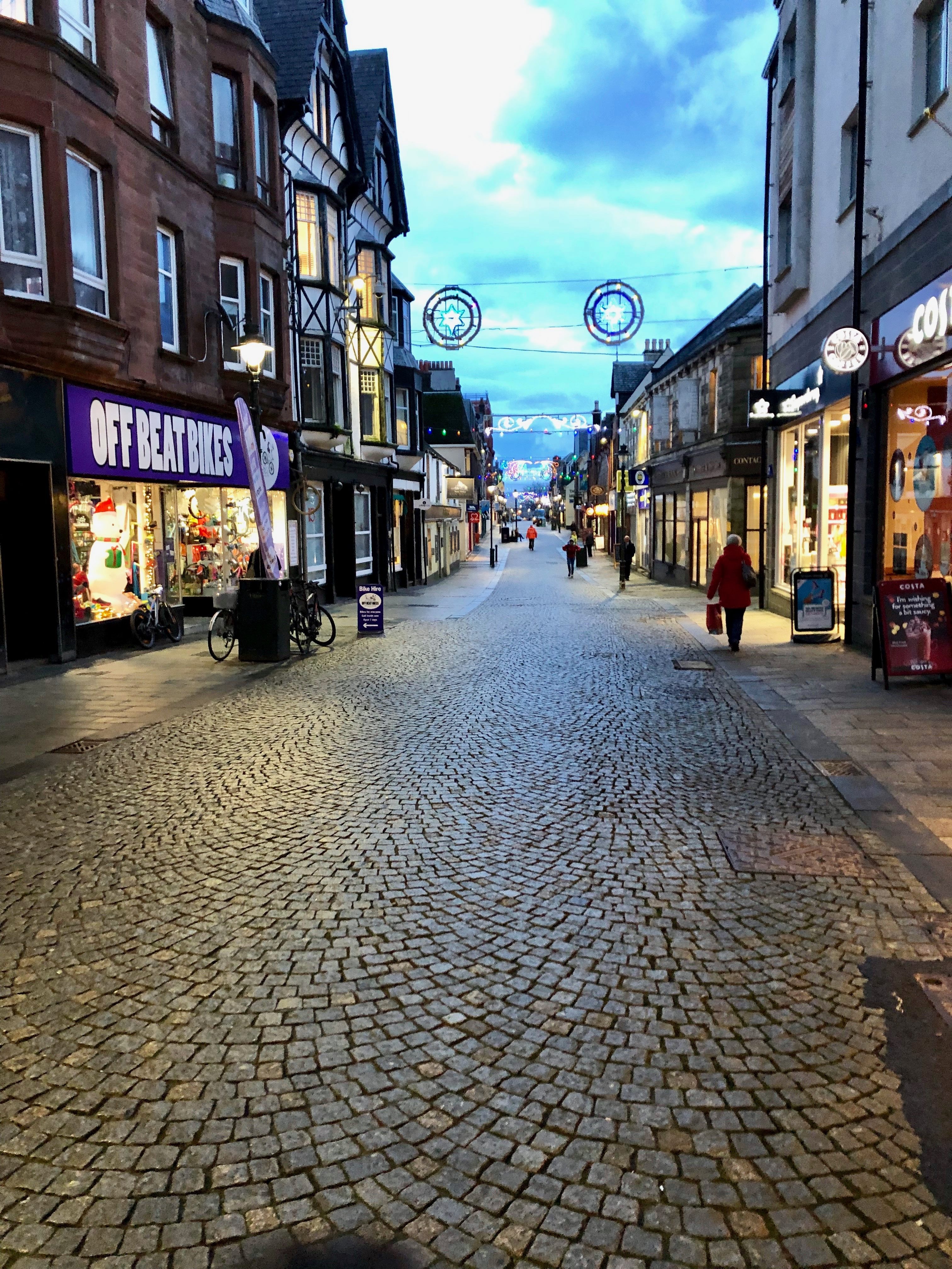
Ullapool

We parked at Tesco, which was just about the only indication (in a good way) that the village was connected to the rest of the world. A short walk through quiet, pretty, uniform streets took us to Ullapool Outdoors, a lovely independent shop where we picked up some stove gas and washing up liquid. From there we continued on to the water’s edge, which was lined by a row of whitewashed cottages overlooking a narrow, stony beach. We absorbed the tranquility as we wandered along the shore, skimming stones and marvelling like children at enormous mussel shells and seaweeds that clung to pebbles with masses of rubbery roots, all the while taking in the mountains that surrounded the loch. It was an utterly self-contained, other-worldly place.

We walked along the loch front past the ferry terminal, where a bustle of construction work was taking place, then popped into a country clothes shop, a charity shop, a small gallery and a delicatessen. We returned to the van with our bounty – a new jacket for Ryan, some charity shop clothes for me and a couple of rolls for lunch. We ate them overlooking the loch and left Ullapool feeling very tranquil.

Lael Forest Garden

Our next stop, just south of Loch Broom,  is perhaps best described as a living tree museum. Lael Forest Garden was founded in the 1870s by Victorian seed collectors who planted over 200 species from all around the world.

We pulled up in the small car park, entered through a gate and wandered the short trails, which showcased an interesting variety of trees and a wild, tumbling waterfall. Despite Scotland’s barely temperate winters the trees seemed to be thriving, perhaps because of their position up the steep eastern bank of a deep gorge. A personal highlight was the soft-barked sequoia redwoods, which – in their immense stillness – dwarfed everything else with a quiet, humbling majesty.

It only took half an hour to walk around in a loop, but there was nobody else around and that half hour felt very peaceful. I’d like to come back in spring or autumn.

Corrieshalloch Gorge & the Falls of Measach

Our next stop was a few minutes’ drive south. Corrieshalloch Gorge is a narrow, sheer-sided cut in the landscape that was formed during the ice age by a strong river flowing beneath a glacier into Loch Broom. The path from the roadside car park took us down through woodland to a narrow, 25 metre long Victorian suspension bridge that spanned the deep gorge quite spectacularly and bounced slightly underfoot.

Looking down into the vertigo-inducing 60 metre chasm below was a memorable experience. A white river rushed urgently through a narrow channel at the base of the gorge, fed by what seemed an impossibly voluminous, 45 metre high waterfall – the impressive Falls of Measach. It was wild, beautiful and, with nothing but air between my feet and the rocky water way below, quite unnerving to consider the consequences if the bridge failed.

We crossed the gorge, nipped along to a protruding, equally vertiginous platform for a good view of the bridge and the waterfall – which seemed even bigger from a distance – then crossed back and walked along the wooded brink for about half a kilometre. The gorge’s dark, sheer rock walls were covered in mosses, lichens, shrubby little plants and – wherever their audacious roots could take hold – trees, which all seemed to thrive in their damp, inaccessible sanctuary.

The path curved back on itself as it climbed towards the car park, and as we rose above the lilac birch tops we enjoyed a stunning view of the valley at the northern end of the gorge, looking back towards Ullapool. Loch Broom appeared in the V, backed by heathery slopes, and in the foreground deep green forests sprawled over undulating, yellow-brown hillsides. The air was still and once again I felt uncommonly peaceful.

North West Coast

I can’t tolerate serenity for too long, so we formulated a plan to climb another mountain the next day. Ryan had researched Beinn Alligin in Torridon, so we set off from Corrieshalloch on a 70-mile journey southwest along the not-very-direct, but scenic, road that snaked down the remote, jagged northwest coast.

As I’d hoped, the road was quiet and afforded lovely views of wild mountains, dark lochs, clear blue sea and tiny, timeless villages. We stopped briefly at the coastal village of Gairloch for a token beach trip, where the sand was pale, fine and backed by grassy dunes, then – sufficiently wind-nipped – we returned to the van and continued on to the wilderness of vast Glen Torridon, where we’d previously had an epic day mountain biking the Torridon Loop. It almost felt like going home.

We drove a short way up the hill behind Torridon village to the Beinn Alligin car park, arriving about 6pm. Ryan cooked sausage pasta and we spent a couple of hours researching the mountain, then went to bed early in anticipation of a 6am start. Like I said, serenity doesn’t last long.

Scotland, Feb ’23: Hiking Ben Wyvis

Sunday 5 February

We awoke to an incredibly tranquil view over Loch Glascarnoch, whose glassy surface reflected a sky of blue-grey that melted to lilac-pink at the eastern horizon, betraying the previously uncertain existence of the Scottish sun. The air was strangely still and the steep brown slopes across the loch were capped by snow which seemed to glow in the morning light. It looked like a good, clear day for a hike. Given Ryan’s ongoing blister situation, we decided to tackle the relatively easy-looking Ben Wyvis, which was just down the road from our scenic overnight spot.

The Ascent

We drove east for 10 minutes and stopped in the car park for Ben Wyvis mountain and nature reserve. We had our usual disagreement over timings, as I’d hoped for an earlier start but Ryan – who is generally immovable before 8am and will often complain on being disturbed until around 9 – appreciates a lie in, so unfortunately the hike began about 10:30 with some sourness. The first section took us on a clear path which followed the rocky, birch-lined Allt a’ Bhealaich Mhoir river through verdant pine forest for a couple of kilometres, then popped out onto open, grassy heathland at the base of the mountain, which loomed ahead looking bulky, steep and rugged.

The gradient continued moderately for another half kilometre, then steepened as the path began to wind up the western side of the hill. We stopped a couple of times to de-layer, snack on cereal bars and take in the growing view behind us over rolling, heather and forest covered hills, which were backed by snow-capped mountains that stretched for tens of miles across a clear horizon under a layer of flat, pale grey cloud. We powered upwards, still in a silent state of bitterness which thankfully started to dissipate with altitude and the emerging view.

The path zig-zagged up the steep mountainside for a hot, sweaty mile and the view seemed to grow with each turn. Over the valley between Ben Wyvis and adjacent Tom na Callich we could now see distant mountains to the southeast – the Cairngorm plateau – which spanned the skyline in broad, hazy swathes and stood out against a bright, yellow-orange glow hanging beneath a flat ceiling of thin cloud. We stopped for a quick chat with a friendly man out with his dog, who told us that of all the several times he’d climbed Ben Wyvis, today was the clearest. Happy at this news, we continued up the steep path and reached An Cabar (946m), the first summit of the range, at about 12:30.

The wind hit us quite suddenly at the top, so we layered up and quickly continued northeast along a wide, icy ridge towards Glas Leathad Mor (1046m). It was a little slippery, but not quite enough to warrant pulling out our crampons. We munched some sandwiches – I had peanut butter and jam and Ryan had cheese – and tramped up the long, easy slope for another mile to the next summit, passing a few other hikers and heeding the sign back at An Cabar that told us to keep to the footpath to protect the sensitive flora. The wind was so bitter that even through my gloves my hands were stinging, so I balled them up and shoved them under my arms.

A sunken trig point marked the snowy summit of Glas Leathad Mor, which we reached at 1pm. Along the ridge the view had developed into a 360 degree panorama of distant mountains, some snow capped and all stretching in hazy layers under a smooth, striated sky that looked as though it had been painted in several shades of blue-grey watercolour. The brush strokes parted occasionally, revealing a pale blue canvas that faded to orange near the horizon. It was almost as lovely as the land.

An Unplanned Summit

Now for my confession: I hadn’t been in the Ben Wyvis area before and the hike was a last minute plan, so – my research having confirmed that it was a beginner-level hike on easy terrain – we’d gone up without a paper map. I wouldn’t normally condone this, but the weather looked so reliably clear, the mountain so whale-back-shaped and isolated, and the route so well-walked that we were quite comfortable with just a phone (we had a power bank and charger) and a good sense of direction. This of itself wasn’t an issue, but it meant that we hadn’t planned the hike as meticulously as usual, so at the summit of the munro I gave Ryan the familiar and perhaps inevitable look that suggested “shall we just pop up that other mountain over there”.

He capitulated and off we went over the back of the hill towards Tom a Choinnich (953m), a munro top one mile to the north. It was a straightforward but fairly steep yomp down into a col and up the next snowy mountainside, but the decision was controversial enough to rekindle some of the morning’s tension. After half an hour of relative silence we were at the next summit, which is where we made what was, with hindsight, the wrong decision.

The Bog Slog

We had three options: retrace our steps back the way we came (which I intensely dislike doing), take a path that would take us back to the van via a long, c.8.5mi detour around Loch Bealach Culaidh, or follow a drystone wall with what looked like a path running alongside it that headed for the van as the crow flies. With Ryan’s blister in mind, we picked option 3, hoping that the path would continue, or at least that the terrain would be relatively amenable.

The path did not continue and the terrain was not even remotely amenable. We clambered awkwardly across a large, icy boulderfield, following the wall for half a kilometre until it just stopped. What was type 1 fun quite quickly slipped firmly into the type 2 category, but we decided that we’d gone too far to turn around so continued in a straight line – firstly downhill across more awkward rocks, then through damp, knee-high moss, grass and heather. Hoping desperately that we weren’t a) damaging the vegetation, and b) being scrutinised by distant onlookers, we slogged across the landscape, slowly and as carefully as possible.

Under other circumstances the colourful, diverse vegetation underfoot would have been fascinating and the mountain scenery breathtaking in the yellowish afternoon light, but at the time the route we chose was simply long, awkward and wet. With every step requiring a high knee and careful foot placement, the going was slow and I felt terribly guilty about deviating from the path. After what felt like an age we reached a stream that cut a little valley into the wild scrubland, which provided some relief as we felt a bit more discrete lower down. We followed a deer path down river, frequently treading in bits of bog and at one point tiptoeing along a small but sheer, muddy drop above the water, and reached the edge of Garbat Forest after a couple of long, arduous miles.

Garbat Forest

We followed a dilapidated fence south for another even boggier mile, then clambered warily over a very rotten stile that led us into the forest. According to the map on my phone, the fire break we’d found should have led us to a path that would cut through the woods and rejoin the path we’d hiked in on, but it looked like neither the fire break nor the path had been used for a long time as both were overgrown and wet. We had another awkward mile ahead.

Despite our exasperation at yet more trailblazing, the forest was fascinating. Tall, densely packed pines formed a canopy above an undulating, mossy carpet, which was reddened by years’ worth of fallen needles, and hundreds of twiggy offshoots harboured masses of pale, green-grey lichen. These offshoots stuck out from the tree trunks and made passage quite difficult as they were both prolific and pointy, so we slipped through carefully – sometimes deploying Matrix-worthy manoeuvres – in an effort to minimise damage and remain unstabbed, while also avoiding huge marshy areas that somehow submerged the trunks without drowning the trees. It felt ancient, atmospheric, serene and slightly eerie.

In the absence of a path we ducked and side-stepped our way through the forest in the general direction of the van, stopping a couple of times to observe some fallen trees that were in the fascinating process of being absorbed by moss, grass, lichen and an enormous ants nest. Animal paths provided the most accessible routes but seemed to start and end at random, so it took a while for us to reach the high wire fence on the edge of the forest. We climbed over it and rejoined the path we’d walked in on with some relief, then tramped the final, easy mile back to the car park along the river.

Recovery

We de-bagged and drove back to the Loch Glascarnoch pull in, slightly giddy at the relief and excitement of having climbed another munro, but more so at our adventurous choice of route. I was impressed that my boots had kept my feet almost completely dry despite the bog-trotting and I expressed my empathy towards Ryan, who had decided to test his new trail running shoes and as a result had wet feet – which I have a particular enmity towards – all afternoon.

We stuffed our shoes with newspaper, cooked a notably delicious Thai green curry and settled for the night, feeling victorious at having extracted ourselves from that difficult terrain, but also ever so slightly disappointed that we’d made the decision to chance the route in the first place. Another lesson learnt.

Scotland, Feb ’22: Skye Fairy Pools to Fort William

Thursday 10 February

We had breakfast overlooking atmospheric, moodily grey Dunvegan Loch and drove down Skye’s pretty eastern edge for 40 minutes to the Fairy Pools. On the way Ryan spotted a huge white-tailed sea eagle soar high above the van and dip below some tall pines, and to my absolute delight I just about caught a glimpse of it before it disappeared.

Our plan was to hike up to the Fairy Pools, then leave Skye for the Ben Nevis range in the hope of some half decent climbing weather the next day. We wound along a remote road, parked in a free car park near the start of the Fairy Pools walk and headed down to the wide, well-maintained tourist path.

The Fairy Pools (extended edition)

The Fairy Pools are a series of waterfalls and clear pools on the Allt Coir’ a’ Tairneilear river, which snakes up to the base of the infamous Black Cuillin mountains described in the previous day’s blog post. The pools are set beneath the vast ridges of Sgurr Thuilm, Bidein Druim nan Ramh and Bruach na Frithe, which curve around the river in a protective yet imposing C-shape. These great giants form a wild, open-ended bowl carpeted with golden grass and brownish heather, and directly in front of us at the head of the bowl stood Sgurr an Fheadain, a perfectly triangular, dark grey, child’s drawing of a mountain tucked neatly between two sloping ridges as if quietly watching over its territory from a throne. Low cloud hanging over the mysterious, snow-spangled peaks gave the place a self-contained atmosphere that made it seem like the rest of the world simply didn’t exist.

We got rained on as we started up the path, which follows the river’s left bank. I didn’t mind as it meant there were few other visitors. The deep, round, extraordinarily blue Fairy Pools sat below low, rushing white waterfalls, some wide and low, some narrow and high, and the meandering river carved relentlessly over, around and through solid rock in an endless torrent. The pools were a beautiful, crystal clear blue-green colour, and if the air temperature had been in double digits I’d have jumped in. We instantly understood its popularity as a tourist destination, although I wouldn’t want to visit on a busy summer’s day. Even beneath a cloudy sky it was worthy of a Herbal Essences advert.

The path along this extraordinary river continued for about 2.5km up to the base of the Cuillins. Our plan had been to see the pools and head back the same way, but having eyed up the map I had new designs on making the hike circular (triangular) by taking a path that follows the base of the immense ridge northward, then west across the moor and back to the van. I entreated Ryan, who rolled his eyes and followed me onto our new path.

As is standard, the rocky path became muddy then boggy, to Ryan’s great disgruntlement. We trudged and slopped along wet, tufty grassland, trying desperately to keep our feet dry. After a mild bout of whinging we suddenly spotted the dark forms of several red deer a short way ahead of us, well camouflaged against the boulder-strewn, yellow-brown heathland, and our agitation evaporated. They were such majestic animals, easily large and powerful enough to do us a mischief, yet they warily kept their distance as we blundered through their territory, and idled casually up the sleep slope to the right as we approached. Then we spotted more over to our left, watching us quietly from about thirty yards away as they chewed rhythmically in peaceful little groups.

The path had been absorbed by the wild terrain so we walked carefully through heather and bog until we reached a small river, the Allt a’Mhaim, and a parallel path which would take us southwest back towards the road. We followed it all the way down the gently sloping moorland, admiring the rolling brown wilderness that was now illuminated in the golden glow of the soft winter sun, and more red deer appeared from nowhere on either side of us. The bluish clouds over the Cuillins and the dark shadows of the undulating high ridges accentuated the warm light that fell on the mountainous bowl, giving the landscape an other-worldly, dream-like quality. It was a harsh, thriving, unadulterated place.

After walking along this path for about 2km we reached a fairytale-like waterfall set just below a thick fir forest, took a wistful look back towards the Cuillins, and rejoined the road back to the car park. What a beautiful place.

Back to the mainland

It took us an hour to reach the Skye Bridge via Sligachan and Broadford Co-op, a drive that involved a lot of “wow look at that”s, referring to various lofty peaks and wild islands. Back on the mainland we drove southeast along the main A87 Old Military road that follows the length of long Lochs Alsh and Duich, then  cuts through the belly of vast Glen Shiel and past lochs Cluanie, Loyne, Garry and Lochy. As we passed wonderfully named Loch Lochy the sun set over golden water, sinking below the distant peaks in a soft haze.

Almost two hours after leaving Skye we arrived at Fort William and nipped to the familiar Morrisons, then drove for 15 more minutes to Ben Nevis’s north face car park. For dinner we had a strange combination of leftover vegan bolognese, bulgur wheat and stovies – a Scottish dish made of beef, onion and potato, all minced together in a delicious (if unsightly) mush – then had a very serious discussion about what we should do the following day.

We both really wanted a big mountain day on or around Ben Nevis, either ice climbing a route like Number 2 Gully or hiking/scrambling the Carn Mor Dearg arete, but after a lot of research and consideration we decided that given the high winds and “considerable” avalanche risk on north east aspects in that area it wasn’t the day for it. We settled, after some squabbling (I was team bike, Ryan was team find somewhere else to climb), on mountain biking the famous Nevis Range trails that started from the car park we were in, which had been on my to do list for years. It was a good thing we did because we went to bed much later than planned, having spent a long time deliberating over Ben Nevis.

Mountain biking the Torridon Loop: Scotland day 4, Sep ’20

After much deliberation about the day’s activities, we decided that taking on a renowned mountain bike route would be more fun than hiking up Liathach in the clag. The Torridon loop is a 30-mile trail around some of the vast glens of the northwest Highlands, rated on various websites as “hard”, “advanced”, “expert” and “very hard”. Irresistible.

We parked in a layby outside the pretty lochside village of Torridon and set off along the road. The first few miles took us through the belly of the vast Glen Torridon, flanked by the towering Torridon Hills. The road flowed through the valley like the river that ran alongside it (unsurprisingly enough, the River Torridon), its path dictated by the unheeding topography of this great Scottish wilderness.

Eventually we turned right off the road and cycled along the east side of Loch Clair. A couple of ownerless black labradors ran over to investigate our intrusion on their land, and we lamented the fact that we weren’t born into rich Scottish estates. We took a left along a muddy path through a wood and encountered our first hill; I spent the climb telling Ryan all about the Jacobite movement in the 17-18th century, a piece of Highland history which I find fascinating. I’ll spare the detail. At the top we realised that we’d climbed the hill unnecessarily as we’d missed a right fork which would have kept us on the flat, but it was worth it for the fast descent along a gravel track to rejoin the route.

Another bit of gentle cycling saw us across the sweeping farmland around the head of the small Loch Coulin, then along the River Coulin. By this time we were suspicious about the lack of ascent/descent/anything that felt like real mountain biking, especially on a route that was supposedly so difficult. And rightfully so – we had no idea what was to come.

The gradient gradually increased, and soon we were chugging up a steep track running parallel to the river. We reached a small bothy, had a quick nose inside, then crossed a bridge by a waterfall. It was uphill from there, along a narrow path littered with rocks large enough to render the way largely unrideable. We found ourselves on a wide, upland heath surrounded by yellow grass, purple heather and hills hidden in cloud. Then the rain came.

It crept in silently but quickly; one minute we could look back on the hills and valleys behind us, the next we were engulfed by wet mist. Eventually the ground levelled out to a high, scrubby plateau and we jumped back on the bikes.

The next section was totally unexpected and pretty epic. A long, extremely rocky couple of miles of incredibly technical downhill over big chunks of solid slickrock, with some very tight corners and definitely-don’t-want-to-fall-off steep bits. Our bikes clattered over massive rocks in a quick – slow – quick – slow pattern, and we finally understood why the route was graded difficult. It was a shame the rock was so wet as the slipperiness slowed us down, but it was an incredible trail nonetheless. I hit a rock side on and ended up over the handlebars only once, which – considering I was riding my 12 year old, bashed up hardtail – I thought was good going.

The most annoying thing was the frequent channels cut in the path, which consisted of two slabs placed vertically opposite each other with a big gap in the middle for drainage. Our rear tyres whacked the harsh edge of the slabs repeatedly, so  when the ground finally levelled out I wasn’t surprised to find a slow puncture. We pumped it up, then made our way through a forest section and across a railway track to the hamlet of Achnashellach. For some reason, it seemed strange to be in civilisation again. We munched a sandwich in a layby, swapped my inner tube and carried on west along the road for a few long, grey, very wet miles, wondering whether we were actually having a good time.

After what felt like a long time we turned right and followed a gravel track up along a river that headed into the mountains, which were ominously dark and shrouded in thick cloud. It was just about rideable, but the big, wet rocks on the path made it very awkward, and the wheel-bashing channels had returned. After a lot more time we reached the coolest bothy I’ve ever seen: a two-storey cottage with two big rooms downstairs and three “bedrooms”. It was the stuff of horror films, but would have been a great place to stay.

If we weren’t so stubborn, the next couple of hours might have seen us lose the will to live. We walked our bikes most of the way along the soaking wet, boggy, rocky path up, up and up. At first we tried to retain some element of dryness by avoiding the worst of the bog, but before long we were wading through rivers halfway up to our knees and dragging our bikes through dark mud and mire. It just kept going. The most soul-destroying part was that while the cloud above was bright grey where the light of the distant sky shone through, the cloud ahead and on all sides was dark grey. The kind of grey that announced that we were surrounded by high, steep ridges, which meant that we hadn’t reached the top of anything – we were effectively trapped in a big bowl of misery.

We stopped at the high Loch Choire Fionnaraich and did the thing we only ever do when in dire straits: had an energy gel. It perked us up enough to push on up the hill, barely speaking. After what felt like another age we pulled up onto a kind of rocky plateau pass between Maol Chean-dearg and Meall Dearg. Our relief was dampened by the pressing concern that we’d soon start losing daylight, so – happy to be back in the saddle, but still racked with anxiety and suspicion at what this wretched day would throw at us next – we pedalled along the rocky path, startled a few red deer which had inexplicably chosen this godforsaken place to graze, then flew past Loch an Eoin and another couple of small lochs (imagine the dead marshes from Lord of the Rings) which were backed by mysterious ridges. The trail was steep in places, very technical, quick and (most notably) often indistinguishable from a narrow, fast-flowing river.

Despite the treacherous weather and unforgiving terrain, we made it across the wild plateau quite quickly and relatively unscathed. I wish my GoPro hadn’t died, as we weren’t in a position to take photos and I can’t convey with words how wet, fast and rocky the trail was. We emerged on the other side of the plateau and the gradient got steeper, the rocks slipperier and the drops bigger. Our bikes (mine in particular, poor old thing – Ryan was on his new, full suspension Giant) clattered down the rocks begging for mercy, and my brakes had gotten soft to the point of uselessness. But ever since we’d been going downhill, I was secretly having a good time again.

It’s a shame the weather was so bad, my brakes were shot, we were exhausted from lack of food and the light was fading, as otherwise the way down would have been amazing. It was unlike anything we’d done before, but we couldn’t quite appreciate it or go as quickly as we’d have liked. We’d climbed for hours and it was a long, steep descent, well worthy of any hard / expert / advanced / very hard label. As the houses of Torridon and the little silver speck of the van appeared, we made our way down the final technical slickrock descent, knackered and very relieved.

We got to the van soaked to the bone. We threw the bikes on the rack, shivered awkwardly into dry clothes and fumbled around arranging a wet bag, which everything went into. I made the best hot chocolate we’d ever tasted and we polished off a pack of shortbread in minutes, then we drove the short distance back up the hill to the picturesque layby we’d stayed in the previous night. Ryan cooked the best carbonara in the history of the universe and we didn’t take anything for granted that evening: food, warmth, dryness, cider and rest. We slept well that night.

Torridon loop conclusion: Largely unrideable. Probably a different story in good weather / a big group / plenty of daylight. Would recommend if you like Type 2 fun. Scenery is probably lovely. Oddly enough, would do again.

NB: The photos don’t do justice to the awkwardness of the trails – the awkward bits were too awkward to move along while taking pictures.

Ben Nevis climb via Tower Ridge: Scotland day 2, Sep ’20

We parked in the North Face car park just north east of Fort William and set off through the dense, wild Leanachan forest. We practically trotted through the trees, flailing limbs at the infamous West Highland midges and – although the forest was enchanting – were keen to put as much distance as possible between our as yet unbitten skin and the river by the car park.

We emerged onto a wide sweep of heather dotted with bright green shrubbery and small broadleaf trees, backed by the majestic hump of Ben Nevis’s north face, dark against the clear blue sky. Our next destination, the CIC hut, sat neatly at the head of the valley in a cosy, three-sided bowl formed by Carn Dearg, Ben Nevis and Carn Mor Dearg, looking down the length of the Allt a Mhuilinn river to a north-westerly horizon full of hazy blue mountains. Our path up to the hut was well-maintained and parallel to the river, so there was no real prospect of getting lost. The tricky bit would be determining our target – Tower Ridge.

We had no guidebook and the previous night’s googling yielded little light on the exact location of the ridge, so we were going off a couple of vague diagrams and a singular, hand-drawn map found on google images. At the hut, where a handful of raggedy climbers and seasoned-looking walkers congregated, we munched a sandwich and identified what we were fairly certain was Tower Ridge – a narrow, protruding finger of rock that joins the high, plateaued ridge between Ben Nevis and Car Mor Dearg at a 90 degree angle.

The giveaway was the Douglas boulder, a hulking mass of rock at the base of the ridge. From the hut, we walked, then scrabbled, up the loose, rocky debris that constituted the ground. It was hard work and the ridge definitely felt further away than it had appeared. Eventually we got to the other side of the Douglas boulder, turned towards its vast east face and started climbing, now in the dark shadow of the formidable Ben. This is considered a more sensible way to gain the ridge than from the west, even though the walk-in is longer.

Buzzing at the first real bit of exposure, we stopped once we were straddling the spine of the ridge to take in the view and decide whether to get the rope out. Although the way was steep and either side of the ridge was treacherously sheer, we decided against it for this first section; the holds looked big and solid, and we were confident that it was no more than a steep scramble. It wasn’t long, however, before we got to a more questionable face on the west side of the ridge.

We roped up and I led the first pitch, which turned out to be less technical than it had looked. I set up a quick anchor and brought Ryan up safely, then we scrambled on carrying a few feet of rope between us, coils stored over shoulders, not secured to the ridge but confident with the easy climbing. We moved at a steady pace, sometimes debating whether to use the rope and, more often than not, deciding against it. On our left loomed the intimidatingly dark, sheer face of Ben Nevis, and on our right we were spoilt by seemingly endless stretches of lush heathland, green forests and blue mountains.

There was one sketchy moment when we decided that the best route was to go left around the ridge, only to realise – once I was balancing somewhat precariously above the apparently bottomless east face – that the holds were few and far between and some of the rock was loose, and that we should have gone right. Ryan quickly took the most convincing right hand route and set up an anchor, so I could climb safely out of my uncomfortable, teetering position. I wasn’t happy with my Salomon Quest boots, as they’re thick-soled and chunky – perfect for hiking but not for use as climbing shoes, as I could barely feel the rock between my feet and I didn’t trust the grip. It would have been a little too easy to tread a little too aggressively and misjudge a foothold. Ryan’s LaSportiva XXX approach shoes, on the other hand, were perfect for the purpose – grippy and flexible enough that he could feel holds with accuracy, but without the foot-choking tightness of climbing shoes.

About three-quarters of the way along, we found ourselves squeezing up a narrow tunnel on the left hand side of the ridge. After giggling at the ungainly way we each emerged from the gap, we looked up and realised that our next move wasn’t obvious. Up until now, it had seemed that there was no “right” route along the ridge, apart from that which didn’t take us too close to either of its perilous sides. Here, we were pinned to one side and faced an unlikely-looking climb upwards, or a tight traverse along the left side of the ridge, which seemed to take us downwards. We chose left, but stopped at a strange whistling sound. A moment later, a cheery-looking climber popped out of the tunnel, wearing just a pair of bright yellow shorts, trainers and a small rucksack. We asked him the way and he grinned as he told us it was not left but “up”, then proceeded to float up the wall with irritating ease. He explained that this was the most difficult move of the route, probably around VDiff, but foraged around with his arm in a crack and reassured us that there’s a good hold somewhere.

Bemused by his timely appearance and nonchalent manner, we climbed upwards after him, roped up. He was long gone by the time we’d reached the top of that section, Great Tower. Ahead of us was the bit of the ridge that we’d watched videos of, and which we were looking forward to most. Ryan led the way across the most exposed part of the route, which is a skinny arete about 50 feet long and as wide as a pavement, which drops down hundreds of sheer feet either side. It was exhilarating to walk across, and I picked each uneven step carefully – although I was on belay, the length of the traverse meant that a fall would mean a nasty swing and crash against one of the ridge’s treacherous faces.

At the end of the pavement was the famous Tower Gap, a break in the ridge that required a slight downclimb and committal step across to the other side. The holds were good, and I joined Ryan quickly. From  there, the way to the top was quite straightforward – up and over another high, but solid, grey mass, unroped. We pulled over onto the Nevis plateau elated and to the shock of several hikers.

We walked left along the flat top to the summit, which was teeming with people.  It was as if we’d suddenly plunged back into reality, the timeless thrill of the climb behind us. On the ridge, we’d overtaken a group of three and been overtaken by whistling guy, but otherwise hadn’t seen anyone up close (we could see people on the plateau from the ridge) for hours. We took in the panoramic view of endless mountains, layered on top of each other in an enticing blue haze, had a sandwich and (to our horror) queued for a quick summit picture. People eyed us with interest, and a group asked us whether we’d climbed up. I refrained from telling them that “no, I wear a harness everywhere and the rope’s for show”, and we made our way down the loose, zig-zag pony track before we got too peopled out.

The view over Glen Nevis was stunning, but unfortunately we were busy focusing on each loose, uneven step down to appreciate it fully. We passed a waterfall and came to a fork near the dark water of Lochan Meall an t-suidhe, where most people went left down the pony track. We went right, which took us east around the north face of Carn Mor Dearg and back along a long path towards the CIC hut. Before we reached the hut, we cut left down the bank to cross the river and join the path we’d come up that morning, but not as soon as we could have – we were keen to avoid finding a bog, which we’ve become uncannily adept at.

I stopped to pick a handful of bilberries, which are lovely, sweet little wild blueberries that grow on low, scrubby bushes. The walk back to the van back down the Allt a Mhullain river was beautiful, and we soaked in the wilderness of open heath speckled with lilac cornflowers, pink heather and leafy green bushes, backed by dark forest and countless mountains. Breathtaking, but still we were keen to get back; we were starving, walking on sore feet and eager to find a pub.

Eventually we reached Leanachan forest. In its late afternoon quietness, it took on a sense of mystery that we hadn’t felt earlier; it was as if the trees were watching us pass, but it was peaceful, rather than creepy. Our heightened senses took in the grassy, mossy carpet, the lichen growing abundantly on the dark side of the trees, the fungi nestling in crevices and the intricate detail on the bark of the gnarly birches and towering pines. Every time I’ve been to Scotland, I’ve noted that there’s something magical about the forests.

We got back to the van, shut out the midges and de-booted. A twenty minute drive later and we were at the Ben Nevis Inn, tucked on one bank of the valley of Glen Nevis. We were pleased to see that we could stay overnight in the Achintree Road car park, right by the pub down a dead-end road. Unfortunately the pub was full indoors and booking-only, thanks to covid, but we enjoyed a pint of Thistly Cross cider (delicious) in the garden. I’d recommend the pub – amazing location and lovely looking inside, an old barn I think. That night we cooked and enjoyed a couple of ciders in the van before collapsing into bed, exhausted. We’d been incredibly lucky to have had clear, sunny weather all day – that night, it’d be an understatement to say the rain came.

Glencoe: Scotland Day 1, Sep ’20

We drove up to Scotland with ten days of freedom, no concrete plans and enough tinned soup to keep an army going for a week, and we came back (reluctantly) with twinkly eyes and tartan hearts.

The drive up from the New Forest was uneventful and went unusually quickly, for a seven-hour journey. We stayed in a layby on a quiet road about half an hour into Scotland and woke early the next day to drive to the West Highlands, stopping briefly on the bank of Loch Lomond to admire the mountains and the vast, choppy blackness of the water. Our planning had been as comprehensive as “let’s go to Glencoe and see where we end up”.

Glencoe

As we approached the Highlands, hills turned into mountains and foresty, swampy, heathy wilderness crept up all around us. The horizon grew higher until rugged slopes towered over the smooth road, which snaked around the valley floor as if frightened of treading on the toes of the giants. We had reached wild country, where hulking masses of great grey rock reign over dramatic glens carpeted by reddish-purplish-brown heather and the kind of yellow-green grass that thrives on harsh weather, poor soil and general hardship. My favourite place.

No words could do justice to the drama and excitement of the route that is flanked by the impossibly mountain-shaped Buachaille Etive Mor, the towering Three Sisters, and the strikingly insignificant whitewashed Lagangarbh hut, which looks imminently susceptible to being devoured by its barren backdrop. Despite having visited a couple of times before (the very reason I insisted on returning), I gawped all the way to the visitor centre at the far end of the glen.

Here we learnt about the history of Scottish mountaineering, mountain rescue, avalanches and the infamous 1692 massacre of Glencoe, in which the McDonald clan were murdered by the same soldiers that they’d housed and fed for two weeks. The centre is newly refurbished and really interesting, and the big relief map shows how Glencoe is just one part of an immense landscape.

We drove back the way we’d come and parked by a waterfall just up the road from the Three Sisters to take in the scenery. I was keen for a decent hike but Ryan wanted a bit of a rest as we wanted to climb the following day, so after a few photos we drove back towards the visitor centre. We parked off the road and did a short, waymarked trail through a fairytale-like forest of towering pines and lush broadleaf trees that took us to Signal Rock, a big mound purportedly used by the McDonald clan as a beacon. I squinted through the trees in an unsuccessful search for a pine marten, and after a bit more gawping at the wild glen we drove through its western “entrance” to Glencoe village.

The village is a funny, quirky little place with a small shop, a couple of cafes, a museum and a village hall. We parked on what I suppose is the high street and paid £3 each to visit the folk museum, a heather-thatched old croft cottage with some really interesting displays of Highland weaponry, clothing, toys, trinkets and tools. The bulk of the exhibits were in the two big rooms that made up the entire building, and a couple of outbuildings housed some other interesting bits.

On the way back to the van we stopped at a Himalayan market held in the unlikely location of Glencoe village hall, which was a deluge of colour and exotic ornaments, jewellery and clothing. Then, after a brief search – it’s not signposted – we found the impressive Glencoe massacre memorial monument.

Having decided that we’d climb Ben Nevis the next day due to a one-day window of clear weather, we drove half an hour north and camped in a quiet, pretty spot just outside Fort William. We had a humble dinner of pasta and spam in a tomato sauce and planned our route up the mountain’s North face, which would be a scramble/rock climb up the famous Tower Ridge. I look forward to writing about that…

Endnote: having researched mountaineering in Glencoe, Buachaille Etive Mor in particular has moved right to the top of my list of mountains to climb. We’d have liked to have done it this time but decided that Ben Nevis via Tower Ridge took precedence, so rather than travel back on ourselves (we wanted to head further north) we’ve firmly resolved to return at our earliest convenience…

Scotland, Day 3: The Highlands – Kinlochleven, Fort William

Admin

We woke later than usual, around 7.30am. I was surprised by how much later the sun rose and how much earlier it set compared to home – about 8-8.30am and 3.30-4pm. Morning admin was a repeat of yesterday; porridge, coffee, tidying and jam sandwich making.

Ice climbing

50442196_1979578599017896_1329863299524722688_n

After a 10-minute drive from our overnight spot, we arrived at Ice Factor in Kinlochleven – the largest indoor ice climbing centre in the world. It’s an impressive building which houses an indoor rock climbing wall, shop, cosy café and ice climbing area, which is pretty much a giant freezer. We’d booked in for the earliest taster session of the day, keen to have as much exploring time left over as possible. I started to write about ice climbing in this post but I got carried away, so for the fine detail read my separate post – Ice Climbing for Idiots. Basically, it was really fun and I want more.

Hiking

We left the centre with big smiles, grabbed our hiking kit from the van and set off on a route we’d planned the previous evening. We had hoped to climb some munros (Scottish mountains over 3,000ft high) in the Mamores range, which lies between Kinlochleven and Ben Nevis. We actually ended up doing a different route which took us up and west, rather than north, due to a disappearing footpath and some dodgy-looking weather over the mountain tops, so unfortunately we didn’t reach any summits.

Nevertheless, we didn’t mind deviating from the plan because we’d set off late, got some breathtakingly-awesomely-stunningly beautiful views down the length of Loch Leven and had a lovely couple of hours anyway, despite some questionable “footpath” terrain and glute-burningly steep bits. The hike also took us past Grey Mare’s Tail waterfall, which is well worth the short walk from Kinlochleven.


Fort William50474548_550658935436708_6670099998987780096_n

Our alternative route meant that we got back to Björn with enough time spare to get to Fort William for a wander round. It’s an attractive town with plenty of shops and pubs, and seems to be a kind of outdoorsey “hub” with a nice buzz. We managed to do a bit of Christmas shopping before treating ourselves to a meal in a café – I don’t think a jacket potato has ever tasted so good. Fed, warmed and out of daylight, we got in the van and headed east.

The Cairngorms

We’d arranged to meet a friend to climb a munro in the Cairngorms the following day. I chose Lochnagar after reading about it in a “Britain’s greatest mountains” feature of The Great Outdoors magazine (don’t tell my cool friends), so we drove the three hours there from Fort William. It was a shame to drive across so much of the National Park in the dark, but we’d seen it before and were keen to make the most of the daylight hours outside. We arrived at the Spittal of Glenmuick quite late and quite tired, so we parked along the dead-end road, admired the blackness of the sky and the utter, pindrop silence, packed bags ready for an early start and slept.

Scotland, Day 2: The Highlands – Glencoe

Monday 10th December

Admin

I woke up in heaven. We were nestled at the base of Buachaille Etive Mor, a towering, perfectly triangular snow-topped mountain, with just a small coppice between the van and a wild, open plain surrounded by rugged peaks. The horizon glowed orange, which turned from pink through lilac into the cool blue sky above, and the air was dry and crisp.

Once I’d stopped staring, morning admin commenced. This consists of changing the bedroom into the kitchen/living room (ie. turning the bed into the rear-facing seats and putting the table up), eating porridge, drinking coffee, tidying things away, making packed lunches (jam sandwiches on every trip, without exception – quick, cheap and highly transportable), brushing teeth, attempting to tame hair, packing daysacks and coming up with some kind of plan.

From the moment I decided to go to Scotland, I knew I wouldn’t leave without immersing myself in Glencoe – an area I’d fallen hopelessly in love with the previous year. Our Ben Nevis map doesn’t quite cover this area, so we went to the Glencoe visitor centre (usually well worth a visit, but this time the majority of it was being renovated) to pick up an OS map. We also did a bit of Christmas shopping in the small National Trust for Scotland shop, most notably buying a “wild haggis” toy (now called Hamish) for Nellie, my naughty black lab. Apparently tourists swear by haggis sightings.

Glencoe hike

From there we headed back to a roadside car park at the base of the three sisters of Glencoe, part of the Bidean nam Bian mountain range of complex peaks, ridges and crags. It’s clearly a popular spot; I was bemused by a coach-full of handbag-clutching, vans-wearing tourists that stopped to admire the view through their iPhone cameras before deciding it was too cold to hang about and scuttling off.

We followed a path between the left and middle “sister” ridges, Beinn Fhada and Gearr Aonach, which saw us scrambling over rocks, squeezing through gaps, peering down at waterfalls over sheer edges and generally being awestruck by the dramatic, serene beauty of the place. The sisters towered over us on both sides, cold, hard rocks stood in front waiting to be scrambled over, and behind was the valley of Glencoe in all its wild, rugged, sandy-yellow winter glory. Oh Scotland.

Eventually we reached the end of the path, which overlooked a long, bathtub-shaped plateau surrounded on three sides by curving, steep-sided ridges. We sat on a rock enjoying our jam sandwiches, then clambered down. It looked as though there was once a river (or glacier?) running through from the narrow end with the snow-topped ridge, which had carved out the valley and left thousands of loose rocks that were awkward to walk on, and there were huge, house-sized boulders scattered as if giants had thrown and left them there.

I couldn’t resist the lure of nature’s playground, so I had a quick climb on a too-tempting boulder plonked in the middle of the plateau. As the path didn’t seem to go anywhere we headed back along the same route, stumbling down the uneven paths and grinning as we bashed knees and scuffed elbows on sticky-out bits of rock. Fortunately there was barely anyone else on the path, so our ungainliness went unnoticed.

Back at the car park we found a tourist information board, which informed us that we’d walked along the Lost Valley (Coire Gabhail). The “plateau” was where the MacDonald clan hid stolen cattle in the 1600s – I have no idea how they mooved (not even sorry) cows up there – and fled to after some escaped the famous Glen Coe massacre of 1692 (fascinating and heartbreaking bit of history, google it).

Red deer at Glen Etive

We left the car park and drove back to the 12-mile dead-end Glen Etive road where we’d stayed the previous night. Glen Etive is where the Skyfall (James Bond) house was set/CGI’d onto, and I’d read that it’s worth a visit because of its remote beauty. It’s a stunning valley, less well-known than Glencoe, flanked by imposing ridges darkened in places by deep green pine forests.

I was desperate to see red deer on this trip and I’d been looking out carefully since we’d got to the Highlands. So a few miles along the road, I could barely contain myself when we came across a couple of people hand-feeding carrots to a young stag. We stopped, and when they left I slipped out the van to try and get some photos.

The rest of the herd were down a bank by a wide, shallow river, guarded watchfully by a majestic stag. I snuck down the bank and moved diagonally through the trees to get a better shot without approaching the deer directly; the stag kept an eye on me as his herd grazed and drank from the river. It was so surreal – I’d have been thrilled to see one red deer at a distance, let alone a whole herd at close range. The light was fading so I had to hold the camera super still; I would have got better photos in better light, but I don’t care – I’m delighted. The deer are even more wildly, gracefully beautiful in person.

Admin

Eventually I tore myself away and we drove back to Glencoe between towering, silhouetted ridges against a navy blue sky. I loved that drive; I found the mountains bearing over us in the dark simultaneously humbling, ominous and comforting, as if we were both at their mercy and under their protection. We stopped for supplies (notably wine) at the Co-op in Ballachulish, near Glen Coe village, then went to Kinlochleven to book an ice climbing session at the indoor centre for the next day.

That done, we stopped for the night in a layby on the south side of Loch Leven. The blackness of the water merged with the dark silhouette of the huge ridge that lay on its north side, which was interspersed at loch level with the twinkling lights of occasional buildings. We appreciated the twinkly lights while eating sausage casserole and planning for tomorrow.

Another good day.