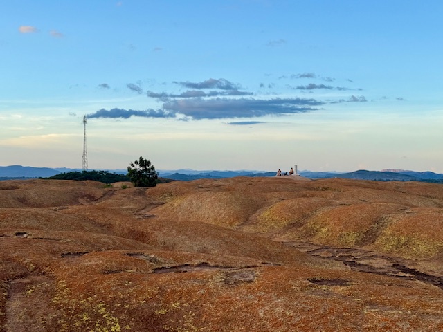
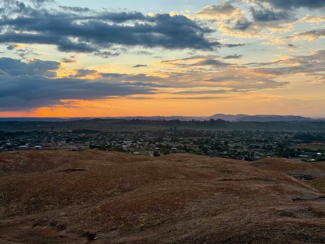
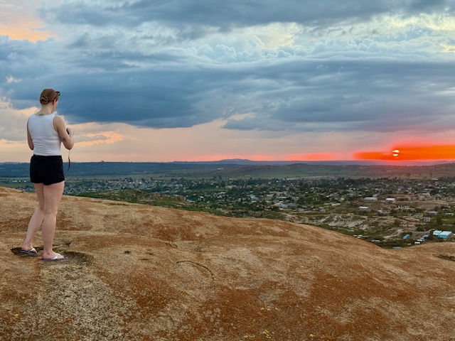
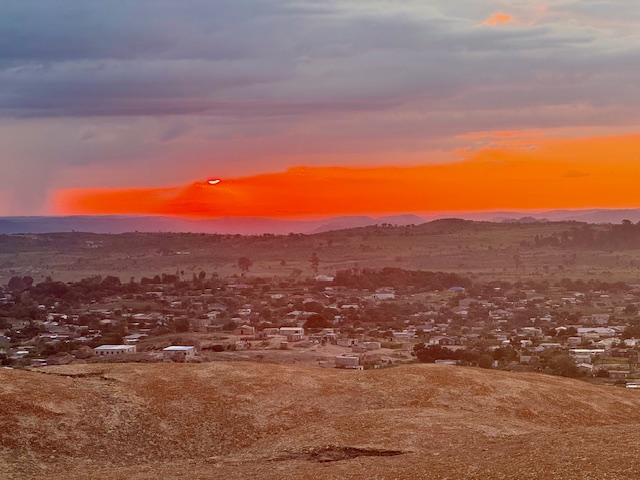
Scotland, Feb ’23: Ullapool, Lael Forest Garden, Corrieshalloch Gorge

Monday 6 February

Following the previous day’s unexpectedly adventurous excursion up Ben Wyvis, we indulged in a “rest day”. This meant exploring the area with no real agenda, so after a cup of coffee and a quick google we decided to head to Ullapool, a lochside fishing village 25 minutes northwest of our picturesque parking spot overlooking Loch Glascarnoch.

It was a fine day, although forecast to be windy up in the mountains, so we didn’t feel like we were missing out too much – particularly with Ryan’s ongoing (but thankfully improving) blister situation. The road to Ullapool was quiet and beautiful, carving through rugged hillsides carpeted in reddish heather and golden grass that glowed in the morning sun against a blue sky made wilder by smooth clouds that hung portentously over the dramatic, dark peaks and ridges of An Teallach mountain range straight ahead – another one high on the to do list. This was followed by a pretty drive along the bank of Loch Broom before arriving at the village, which is nestled on a low-lying promontory on the northern edge of the loch.

Ullapool

We parked at Tesco, which was just about the only indication (in a good way) that the village was connected to the rest of the world. A short walk through quiet, pretty, uniform streets took us to Ullapool Outdoors, a lovely independent shop where we picked up some stove gas and washing up liquid. From there we continued on to the water’s edge, which was lined by a row of whitewashed cottages overlooking a narrow, stony beach. We absorbed the tranquility as we wandered along the shore, skimming stones and marvelling like children at enormous mussel shells and seaweeds that clung to pebbles with masses of rubbery roots, all the while taking in the mountains that surrounded the loch. It was an utterly self-contained, other-worldly place.

We walked along the loch front past the ferry terminal, where a bustle of construction work was taking place, then popped into a country clothes shop, a charity shop, a small gallery and a delicatessen. We returned to the van with our bounty – a new jacket for Ryan, some charity shop clothes for me and a couple of rolls for lunch. We ate them overlooking the loch and left Ullapool feeling very tranquil.

Lael Forest Garden

Our next stop, just south of Loch Broom,  is perhaps best described as a living tree museum. Lael Forest Garden was founded in the 1870s by Victorian seed collectors who planted over 200 species from all around the world.

We pulled up in the small car park, entered through a gate and wandered the short trails, which showcased an interesting variety of trees and a wild, tumbling waterfall. Despite Scotland’s barely temperate winters the trees seemed to be thriving, perhaps because of their position up the steep eastern bank of a deep gorge. A personal highlight was the soft-barked sequoia redwoods, which – in their immense stillness – dwarfed everything else with a quiet, humbling majesty.

It only took half an hour to walk around in a loop, but there was nobody else around and that half hour felt very peaceful. I’d like to come back in spring or autumn.

Corrieshalloch Gorge & the Falls of Measach

Our next stop was a few minutes’ drive south. Corrieshalloch Gorge is a narrow, sheer-sided cut in the landscape that was formed during the ice age by a strong river flowing beneath a glacier into Loch Broom. The path from the roadside car park took us down through woodland to a narrow, 25 metre long Victorian suspension bridge that spanned the deep gorge quite spectacularly and bounced slightly underfoot.

Looking down into the vertigo-inducing 60 metre chasm below was a memorable experience. A white river rushed urgently through a narrow channel at the base of the gorge, fed by what seemed an impossibly voluminous, 45 metre high waterfall – the impressive Falls of Measach. It was wild, beautiful and, with nothing but air between my feet and the rocky water way below, quite unnerving to consider the consequences if the bridge failed.

We crossed the gorge, nipped along to a protruding, equally vertiginous platform for a good view of the bridge and the waterfall – which seemed even bigger from a distance – then crossed back and walked along the wooded brink for about half a kilometre. The gorge’s dark, sheer rock walls were covered in mosses, lichens, shrubby little plants and – wherever their audacious roots could take hold – trees, which all seemed to thrive in their damp, inaccessible sanctuary.

The path curved back on itself as it climbed towards the car park, and as we rose above the lilac birch tops we enjoyed a stunning view of the valley at the northern end of the gorge, looking back towards Ullapool. Loch Broom appeared in the V, backed by heathery slopes, and in the foreground deep green forests sprawled over undulating, yellow-brown hillsides. The air was still and once again I felt uncommonly peaceful.

North West Coast

I can’t tolerate serenity for too long, so we formulated a plan to climb another mountain the next day. Ryan had researched Beinn Alligin in Torridon, so we set off from Corrieshalloch on a 70-mile journey southwest along the not-very-direct, but scenic, road that snaked down the remote, jagged northwest coast.

As I’d hoped, the road was quiet and afforded lovely views of wild mountains, dark lochs, clear blue sea and tiny, timeless villages. We stopped briefly at the coastal village of Gairloch for a token beach trip, where the sand was pale, fine and backed by grassy dunes, then – sufficiently wind-nipped – we returned to the van and continued on to the wilderness of vast Glen Torridon, where we’d previously had an epic day mountain biking the Torridon Loop. It almost felt like going home.

We drove a short way up the hill behind Torridon village to the Beinn Alligin car park, arriving about 6pm. Ryan cooked sausage pasta and we spent a couple of hours researching the mountain, then went to bed early in anticipation of a 6am start. Like I said, serenity doesn’t last long.

Scotland, Feb ’23: Loch Garten, Elgin, Findhorn

Saturday 4 February

After an active couple of days skiing at the Lecht and climbing Aladdin’s Couloir, we decided to have a rest day exploring new places and giving Ryan’s sore-looking new blisters a chance to heal (graphic photo at the end of this post). From our scenic overnight spot overlooking Glenmore Forest, we drove a couple of minutes up the hill to Cairngorm ski centre, had a quick look in the large, cosy, chalet-style café, decided it was too expensive and headed back down into Aviemore. On the way we gave a hitchhiker with a broken boot a lift back to his accommodation in Glenmore Forest, then parked at Tesco and treated ourselves to a couple of tasty pies from Ashers bakery.

Loch Garten nature reserve

Ryan was keen to show me the nature reserve at Loch Garten and I was even more keen to go, so we left Aviemore (a little reluctantly, as usual) and drove 20 minutes north to the RSPB car park. Unfortunately the visitor centre was closed, but we walked up to it through mossy, lichen-covered pine forest and watched an incredible number of great, blue and coal tits feast on huge bird feeders. I was delighted when a brave coal tit landed briefly on my outstretched hand, and I wished I’d saved him some pie. I didn’t see any crested tits but I managed some relatively awful photos of the other tits and chaffinches, although I missed the greater spotted woodpecker – my wildlife photography skills could be improved:

We returned to the car park and enjoyed the Big Pines trail, which was a half-mile, there-and back footpath through the “best bits” of the forest according to the information board. It took us past some huge Scots pines which towered over a thick canopy forest on the edge of wild Loch Garten, and I was captivated by the abundance of thriving vegetation. Feeling very tranquil and (excuse the cliché) in touch with nature, we went back to the van once again and decided to head north through what was for us an uncharted part of Scotland, to the former city of Elgin.

Leaving the Cairngorms

The drive began through the northern Cairngorms, where huge grazing fields and swathes of heathland stretched between thick forests beneath rolling hills. These levelled out slightly after the pretty town of Grantown-on-Spey, and once we’d left the national park the sprawling, agricultural landscape, dotted with occasional buildings, seemed incredibly vast compared with England’s densely packed fields. We passed through the unremarkable-looking town of Forres and arrived at Elgin after just over an hour’s drive.

Elgin town

We refuelled and parked at a very busy big Tesco in the middle of Elgin town. A short walk took us onto the high street, which was old and pretty – if slightly tired – and featured a large, tiered fountain, a toga-clad statue and an impressive, six-columned church plonked in the middle of the cobbles. The yellowish-grey buildings reminded me of Inverness and the town had a pleasant buzz. Ryan grabbed some more blister plasters from Boots and we wandered towards the cathedral, stopping briefly at a couple of estate agent windows to contemplate buying a larger, cheaper, closer-to-the-mountains house than our own, and wondering why on earth anyone (including us) would choose to live in southern England rather than northern Scotland.

Elgin Cathedral

The cathedral is near the middle of the town at the end of a long, straight path that runs alongside a large, grassy park. Although most of the nave has collapsed, leaving only foundations, its two tall, graceful towers stand at the entrance, a slightly wistful reminder of architecture’s lost majesty. It was free for us to enter thanks to my English Heritage life membership (an 18th birthday gift from my incredibly generous cousin) and we wandered around for half an hour.

The two towers contained several round, high-ceilinged rooms full of old sculptures and features salvaged from the ruin, and we climbed to the top of one up a spiral stone staircase for an excellent view of Elgin and its relatively flat surroundings. To get there we went through a tiny door and walked between the towers via a narrow first or second floor passage, and it was interesting looking at the ruins to work out where other passages would have connected the various parts of the building. While we were up the tower the air smelt like rain, so we descended and shot around the rest of the cathedral.

Back on the ground it was clear where several vast columns would have supported the roof of the nave, which is now carpeted by grass and surrounded by gravestones. We walked over to the well-preserved octagonal chapter house, went inside and marvelled at its intricate arched ceiling (I’m mind-blown by our ancestors’ understanding of physics), whizzed round the rest of the grounds, where old walls stood in varying states of ruin, and left just as the deluge came.

We got utterly drenched on the 15-minute walk back to the van, although nipping into Lidl for some rugby drinks gave a moment’s respite. We’d had the audacity to venture out without waterproofs during a Scottish winter, which is a mistake I’ve made before and I’ll certainly make again. Fortunately our plans for the rest of the day involved a fair bit of driving, which gave me the chance to dry my soggy fleece.

Findhorn Foundation

From Elgin it was a 20-minute drive through flat, arable land to the Findhorn Foundation, which is situated down a long, straight road between the wide River Findhorn and Findhorn Beach. I’d read about this “ecovillage and spiritual community” online and was fascinated by the concept of an alternative type of society based around self-sufficiency and communal living. We turned right into the village and immediately it felt like a kind of holiday park, with lots of signs, narrow, tarmacked tracks, pine trees, communal buildings and a bizarrely eclectic mix of houses, huts and chalets in all shapes and sizes made from wood, stone and corrugated metal.

Findhorn Beach

We felt a bit guilty and intrusive as we drove around the Foundation, so didn’t stay long before turning back onto the long, straight road towards the pretty, coastal, almost Cornish-looking Findhorn village. We did an accidental lap around the cottage-lined streets before finding the turning for the beach, then parked up and headed over some rolling sand dunes to the edge of the North Sea.

It was grey, on-off rainy and very atmospheric. The top half of the beach was a raised stretch of smooth, multicoloured pebbles, backed by grassy dunes and a row of brightly coloured beach huts, and the bottom half was a vast, flat stretch of compact golden sand where water sat in shallow channels left by the retreating tide. The sea was calm and dark grey beneath a moody sky, which accentuated the colours of the sand and the huts, and everything was cold, wild and tranquil.

Having got sufficiently wet and chilly on our beach trip we returned to the van over the dunes, which were thick with rippling, butter-coloured grass and dark green gorse, and started our journey west. We’d finished in the Cairngorms and planned to travel across the country to do some hiking, climbing and exploring in the wilderness of the northwest highlands. We travelled along the main A96 road through Forres, Nairn and Inverness and it was dark by the time we arrived at Loch Glascarnoch, halfway between the east and west coasts of the Highlands, about an hour and a half later.

Evening

We pulled up for the night in a large roadside layby overlooking the dark, mountain-backed loch. Despite my best efforts to stream the England-Scotland six nations game I’d failed to find a way to watch the whole thing as it had already finished (thanks ITV), so we got by – having accidentally seen the score on whatsapp group chats and news headlines – watching the highlights. This was frustrating, although at least England lost (classic England – they did the same the previous year when we watched the opening game in a pub in Aviemore). Once the rugby was over we had dinner, assessed Ryan’s blister situation and planned the following day’s outing: a hike up nearby Ben Wyvis.

Girona, Spain: Forest Hike to Castell de Sant Miquel, Home

10 July 2022

It was the final day of our little holiday and we were determined not to waste it. With the flight home not being until 8pm, we asked our AirBnB host if we could store our small luggage bag in the hallway until the afternoon and she kindly agreed. We left about 10am for Castell De Sant Miquel, a tower on a hilltop in the middle of a vast, rolling forest. Getting there would involve a 1.5 hour hike that had been recommended to us by one of the people at the bike shop the day before, starting from the middle of Old Town.

Ascent up Les Gavarres

We walked through the quaint streets (I’m nearly done banging on about them), through the castle-like cathedral area, across a narrow dried-up river channel near the pretty John Lennon gardens and east out of the city. Within just a few minutes it felt as if we were in a rural village, walking along a quiet road lined with rustic houses which soon turned to dry, hedge-lined arable fields. After about a mile and a half we reached the edge of the Gavarres massif, a vast range of relatively low mountains covered in a dense forest of oaks, pines and other lush green vegetation, and we took a well-signposted gravel path into the trees, which provided some respite from the relentless sun.

The hike up to the tower was hot but enjoyable and it felt very exotic, given our unfamiliarity with non-British forests. Noisy cicadas filled the air with a constant, croaky hum and I was amazed by how the trees seemed to thrive despite the dry, dusty conditions. We passed a herd of goats rambling casually up a track after a goatherd, stopping to chew on leaves with their tinny goat bells tinkling. The winding, hilly route passed a couple of interesting features, including a tall double column sculpture and the ruins of medieval stone farmhouses with information boards in several languages, and at a clearing in the trees we stopped to look over the distant, sprawling red rooves of Girona backed by layers of hazy blue mountains in the Guilleries massif.

Castell de Sant Miquel

As we approached the top of the hill the gravel path turned to bare, slabby, rooty granite, then levelled out to a flattish plateau. We walked up to the castell, which sits on one of the many summits of the Gavarres. It appeared suddenly through the trees, seemingly out of nowhere, a perfectly square, three-storey stone tower with a set of exterior metal stairs leading up to the entrance on the first floor. Behind it stood the semi-intact remains of a long stone chapel, a section of old wall and a lonely information board that told us in vague terms that the tower was built in 1848 on the remains of a medieval hermitage (religious retreat). As I write this I’m surprised at how little of the history seems to have been recorded – Google offers no substantial results.

We wandered into the crumbled open end of the chapel and along to the intact-rooved end, where a large, rough-edged hole served as a window that perfectly framed the far-reaching views over rolling forest and way out to a smooth, distant sea. A small altar stood looking a little sad in the middle, and the place exuded lonely, slightly mysterious simplicity. We went back to the tower, climbed the steps and popped out on the flat, square roof.

We were prepared for the incredible views because the structures stand in a clearing that allowed us to catch glimpses of distant mountains above the treetops, but we weren’t quite prepared for the overall effect of the totally unimpeded 360 degree panorama that hit us at the top. We looked down on verdant, almost rainforest-like woodland that rolled over undulating hills all around, stretching way out to the south and east in deep green swathes. This gave way to a short length of smooth blue sea that sat in a wide valley between gently rising mountains, which – apart from that little bit of coast – stretched around us the entire length of the horizon in a long, hazy blue chain. Expanses of butter-coloured farmland and little towns formed a mosaic on flat plains and in valleys, and Girona looked strangely small tucked below the highest peaks. It was breathtaking, and so novel compared to the UK landscapes we’re used to.

Hike back to Girona

We walked around the top of the tower, taking it all in, then climbed down the metal stairs and headed back into the trees the way we came. After the rooty granite “steps” we took a right fork to make the route circular, then tramped down a wide, dusty dirt track lined with conifers and birches. After about a mile we crossed a main road and walked back to Girona along a quiet, rolling country lane, past rugged fields, large, spread-out rural houses and lots of trees occupying all the in-between bits of land that hadn’t been otherwise claimed.

As we neared the city the houses became more packed in but still large, spacious and quite plush-looking. This was clearly a well-off suburb, with clean streets, bright whitewashed walls, lovely views over the distant mountains and a startling number of private pools. We walked down the hill to the medieval area around the cathedral, glad to have squeezed such a lovely walk into our last day, and treated ourselves to a refreshing smoothie from a little shop near the basilica, which we drank overlooking the river.

Homeward bound

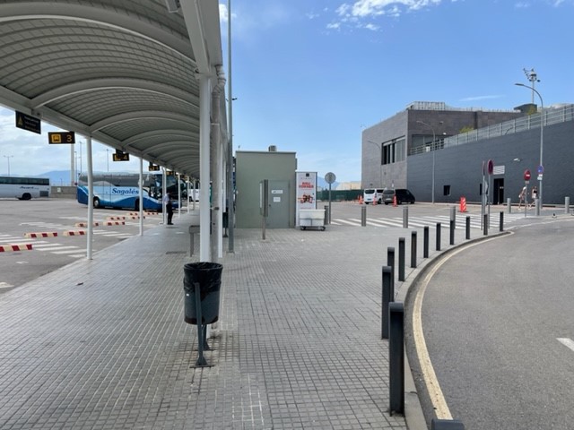
We reluctantly conceded that the holiday was over and walked the cobbles of Old Town one last time to collect our bag from the AirBnb. After saying goodbye to our host we squeezed into the tiny lift, went through the narrow passageway onto Placa del Raims, crossed the bridge and returned to the bus station through the long, straight, less quaint streets to the west of the river. We grabbed drinks and snacks from a tiny convenience store and waited in the air conditioned station for the bus, which was due about 3.30pm. Time dragged, partly due to the our unnecessary earliness and partly due to the Sunday afternoon quietness of the large station plaza, which was beautifully sunny yet eerily quiet and empty.

We were lucky to board when we did as the bus driver told us it was cash only, which would have left us stuck if the very kind American in front of us (who we’d already spoken to at the station) hadn’t insisted on paying our fares. As the bus took us out of the city we gazed wistfully over the long streets hectic with signs, overhead cables and shop shutters, then over dusty fields and rustic farms before reaching the airport. We hung around outside for a while, then hung around inside for a while, then finally went through security and reached the great, sprawling duty free / lounge / restaurant bit, which had huge glass windows looking out across hazy blue mountains. It was a nice, small airport, which was a huge relief given that our flight was delayed by an hour. We had a Burger King (Vegan Whopper – delicious) on a small terrace, lamented the end of our little holiday and had an uneventful flight back to Bournemouth.

Girona: 9/10 would recommend. Minus one point due to the citywide absence of triangular sandwiches, but that’s a personal thing.

Girona, Spain: First impressions

5 – 6 July 2022

Poor planning

I had an extremely stressful evening on Tuesday 5 July. We went indoor climbing as normal and on the way back I decided it’d be a good idea to check the covid requirements for our flight to Spain at 12:25 the following day. It turned out that although we were double vaccinated, we could only enter Spain if our second vaccine had been received within 270 days of the flight, we’d had the booster (which takes up to 5 days to register on covid records), or we had a negative test result. Negative (by about 25 days), negative, and negative, respectively.

After hours of googling, despair at realising most test centres (including the one at Bournemouth airport) had 24-hour turnaround times, and a small degree of extremely sceptical relief at having found a centre in Southampton offering £22.50 lateral flows with 2-hour results and an 8am appointment slot, we packed at 1am, hoping that we weren’t tempting fate. We went to bed at 2am and were up by 6.

Ryan’s dad rushed us into Southampton for 7.30, we had our lateral flows at the test centre – surprisingly busy for 8am – and we went to a nearby walk-in vaccination centre to get our boosters at 9am, just in case the covid app updated on time. Miraculously our negative test results were emailed through as we were queuing, to our immense relief, but we were still slightly anxious that they wouldn’t be accepted at the airport.

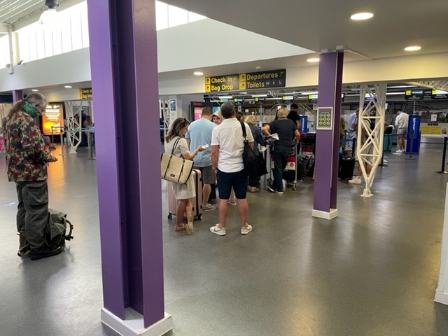
On the way to Bournemouth airport I filled out our Spanish government issue entry forms, uploaded our test result documents to our boarding passes, and breathed for the first time in 12 hours. We went through security, had a drink in the bar, bought a phrase book from the shop and boarded our busy flight without any hassle.

Arrival in Girona

We stepped off the plane to that intense, slightly stifling wave of heat that marks the beginning of a hot summer holiday. We left the airport, slightly incredulous that Spain had let us in without batting an eyelid, and waited half an hour for a bus in the searing heat. I was delighted to find a vending machine at the bus stop selling impossibly processed ham and cheese sandwiches and paprika crisps, which kept us going until the bus came.

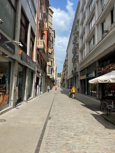
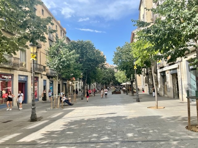
The 30-minute trip to Girona bus station took us past dry, golden fields, dusty buildings and the industrial southern end of the city, which seemed to be full of car and motorbike dealerships. We left the large, air conditioned station building and were once again hit by the heat of a Spanish summer as we walked out onto a large, open, very clean plaza. We headed east through intermittent, warm rain towards our airbnb past slightly tired-looking offices and flats, then along a long, straight, smooth-cobbled street flanked by tall, six-storeyed buildings with a variety of narrow shops underneath.

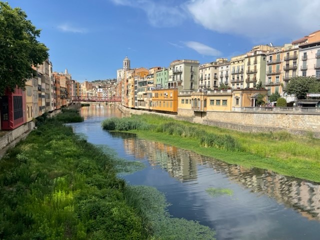
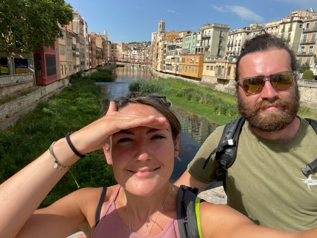
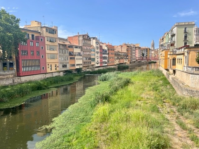
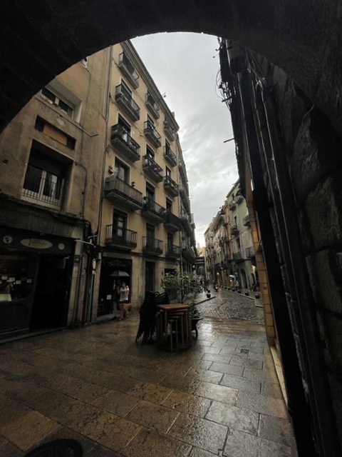
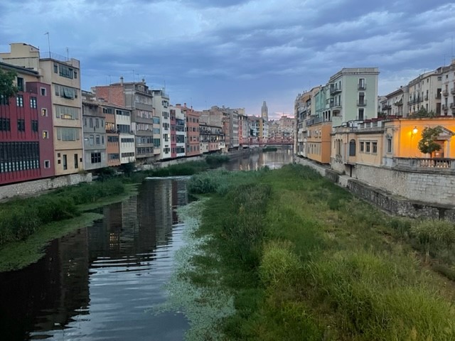
Then we reached the river Onyar and realised what Girona was all about. We stopped on the wide stone Pedra bridge to admire the river, which consisted of a barely flowing channel of clear water between two lush green strips of grasses, reeds and wetland plants, set about 15 feet below street level. It was incredibly clean, and large carp swam lazily around the weeds directly below us, to Ryan’s delight. The river was lined on both sides by pretty, flat-fronted buildings two to six storeys high, painted in a striking array of oranges, yellows, reds and creams, and the elegant grey towers of the cathedral and basilica soared above the flat rooves on the right bank. This was the view that came up when we’d google imaged Girona, but it was even more beautiful.

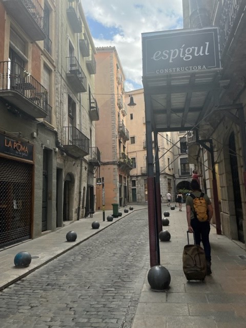
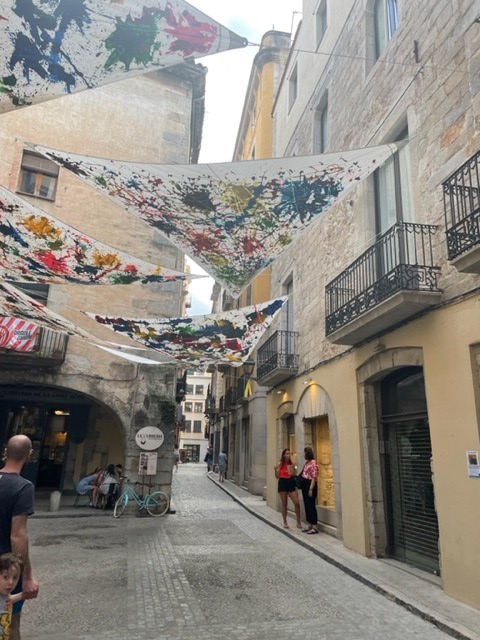
We crossed the bridge and wandered down the cobbled, tree-lined Rambla de la Libertat, which was bustling with pretty shops and little restaurants with tables spilling across one side of the street. We turned right at the end onto a narrower street squeezed between attractive, five storey high buildings, some painted pastel oranges and some bare-stoned, all with pretty balconies and shutters or blinds to keep out the heat. The streets brimmed with all kinds of little shops and restaurants and it was remarkably clean and tidy – not a speck of litter. Old town had delighted us already.

Accommodation

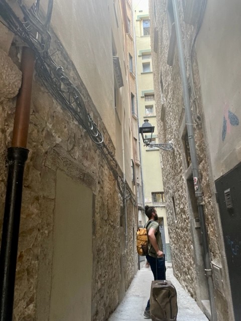
Our airbnb was in a third floor apartment right in the middle of old town, down a narrow alley on the Placa dels Raims, the smallest square in Europe. It took a little bit of finding but we were delighted with it. Our host – despite barely speaking a word of English – was extremely welcoming and our room was along a corridor in a separate part of the apartment to the main bit where she lived with her family. It was high-ceilinged and timeless, with whitewashed walls and a lovely stone feature wall, shelves full of books, towels and trinkets, a tall shuttered window opening out onto a narrow gap between the tall buildings, and our own large, clean private bathroom. It was lovely to be spending the trip in a Catalonian home, rather than a common-or-garden hotel room.

Paella & Chill

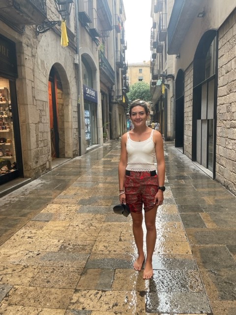
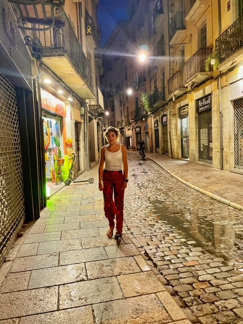
We took some time to settle and relax in the room following the stress of our poor-planning-related near miss, then got changed and went to explore a little. We had a little walk around the picture-postcard narrow, cobbled streets, enjoying that distinctive summer smell of warm, fat raindrops (none of that nasty British drizzle) hitting the stone floor. My flip flops were slippery on the smooth slabs so I walked around barefoot with my silky trousers rolled up. We went back to the tree-lined Rambla de la Libertat for dinner and found a reasonably priced (we later found out that most restaurants were reasonable) Catalonian restaurant with street seating under large stone arches and grappled – probably quite poorly – with ordering our dinner in Spanish.

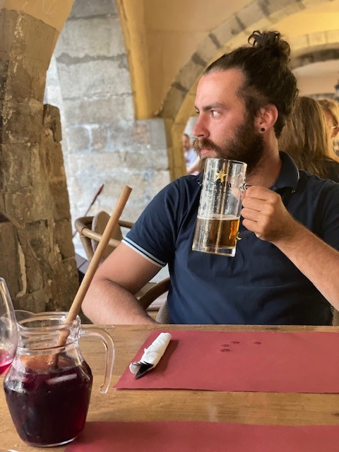
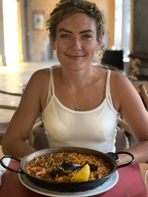
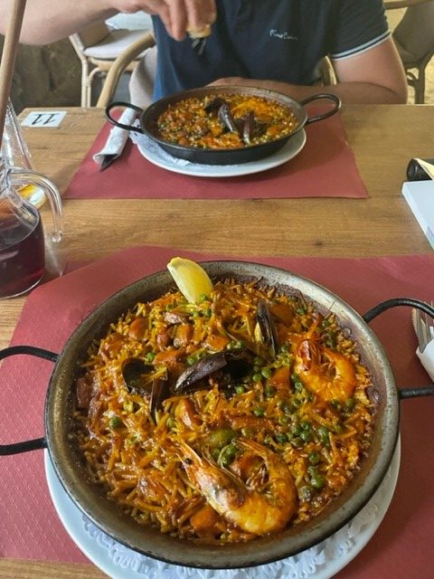
We shared a lovely seafood paella and “fideua”, a similar dish but with noodles and a different sauce. I enjoyed my first ever (!) sangria and we sat people watching, drinking in the unfamiliar and refreshing lack of English-ness. The rain subsided and we went for an evening walk. We crossed back over the Onya, which was equally beautiful under a fading, grey-pink sky, and wandered around the clean, more modern, slightly wider streets on the west side of the river, intrigued by the randomly situated but bustling small eat-and-drinkeries. We found the large, buzzing Placa de la Independencia square, lined on all four sides by long, tall, balconied apartment buildings above a multitude of bars and restaurants, and decided to return for lunch the following day.

We crossed back over a bridge further down the river and returned to our little flat in the middle of old town. We were extremely pleasantly surprised by Girona’s charm and atmosphere and planned to spend the next day exploring the city more thoroughly. My biggest qualm was my aching left arm from the booster jab that morning and the warm temperature, which made getting to sleep difficult, particularly as I was concerned about jab side effects. After some tossing and turning I drifted off, probably thanks to the air con unit in the room and the thin sheet instead of a duvet, excited for the rest of the holiday.

Scotland, Feb ’22: Skye Fairy Pools to Fort William

Thursday 10 February

We had breakfast overlooking atmospheric, moodily grey Dunvegan Loch and drove down Skye’s pretty eastern edge for 40 minutes to the Fairy Pools. On the way Ryan spotted a huge white-tailed sea eagle soar high above the van and dip below some tall pines, and to my absolute delight I just about caught a glimpse of it before it disappeared.

Our plan was to hike up to the Fairy Pools, then leave Skye for the Ben Nevis range in the hope of some half decent climbing weather the next day. We wound along a remote road, parked in a free car park near the start of the Fairy Pools walk and headed down to the wide, well-maintained tourist path.

The Fairy Pools (extended edition)

The Fairy Pools are a series of waterfalls and clear pools on the Allt Coir’ a’ Tairneilear river, which snakes up to the base of the infamous Black Cuillin mountains described in the previous day’s blog post. The pools are set beneath the vast ridges of Sgurr Thuilm, Bidein Druim nan Ramh and Bruach na Frithe, which curve around the river in a protective yet imposing C-shape. These great giants form a wild, open-ended bowl carpeted with golden grass and brownish heather, and directly in front of us at the head of the bowl stood Sgurr an Fheadain, a perfectly triangular, dark grey, child’s drawing of a mountain tucked neatly between two sloping ridges as if quietly watching over its territory from a throne. Low cloud hanging over the mysterious, snow-spangled peaks gave the place a self-contained atmosphere that made it seem like the rest of the world simply didn’t exist.

We got rained on as we started up the path, which follows the river’s left bank. I didn’t mind as it meant there were few other visitors. The deep, round, extraordinarily blue Fairy Pools sat below low, rushing white waterfalls, some wide and low, some narrow and high, and the meandering river carved relentlessly over, around and through solid rock in an endless torrent. The pools were a beautiful, crystal clear blue-green colour, and if the air temperature had been in double digits I’d have jumped in. We instantly understood its popularity as a tourist destination, although I wouldn’t want to visit on a busy summer’s day. Even beneath a cloudy sky it was worthy of a Herbal Essences advert.

The path along this extraordinary river continued for about 2.5km up to the base of the Cuillins. Our plan had been to see the pools and head back the same way, but having eyed up the map I had new designs on making the hike circular (triangular) by taking a path that follows the base of the immense ridge northward, then west across the moor and back to the van. I entreated Ryan, who rolled his eyes and followed me onto our new path.

As is standard, the rocky path became muddy then boggy, to Ryan’s great disgruntlement. We trudged and slopped along wet, tufty grassland, trying desperately to keep our feet dry. After a mild bout of whinging we suddenly spotted the dark forms of several red deer a short way ahead of us, well camouflaged against the boulder-strewn, yellow-brown heathland, and our agitation evaporated. They were such majestic animals, easily large and powerful enough to do us a mischief, yet they warily kept their distance as we blundered through their territory, and idled casually up the sleep slope to the right as we approached. Then we spotted more over to our left, watching us quietly from about thirty yards away as they chewed rhythmically in peaceful little groups.

The path had been absorbed by the wild terrain so we walked carefully through heather and bog until we reached a small river, the Allt a’Mhaim, and a parallel path which would take us southwest back towards the road. We followed it all the way down the gently sloping moorland, admiring the rolling brown wilderness that was now illuminated in the golden glow of the soft winter sun, and more red deer appeared from nowhere on either side of us. The bluish clouds over the Cuillins and the dark shadows of the undulating high ridges accentuated the warm light that fell on the mountainous bowl, giving the landscape an other-worldly, dream-like quality. It was a harsh, thriving, unadulterated place.

After walking along this path for about 2km we reached a fairytale-like waterfall set just below a thick fir forest, took a wistful look back towards the Cuillins, and rejoined the road back to the car park. What a beautiful place.

Back to the mainland

It took us an hour to reach the Skye Bridge via Sligachan and Broadford Co-op, a drive that involved a lot of “wow look at that”s, referring to various lofty peaks and wild islands. Back on the mainland we drove southeast along the main A87 Old Military road that follows the length of long Lochs Alsh and Duich, then  cuts through the belly of vast Glen Shiel and past lochs Cluanie, Loyne, Garry and Lochy. As we passed wonderfully named Loch Lochy the sun set over golden water, sinking below the distant peaks in a soft haze.

Almost two hours after leaving Skye we arrived at Fort William and nipped to the familiar Morrisons, then drove for 15 more minutes to Ben Nevis’s north face car park. For dinner we had a strange combination of leftover vegan bolognese, bulgur wheat and stovies – a Scottish dish made of beef, onion and potato, all minced together in a delicious (if unsightly) mush – then had a very serious discussion about what we should do the following day.

We both really wanted a big mountain day on or around Ben Nevis, either ice climbing a route like Number 2 Gully or hiking/scrambling the Carn Mor Dearg arete, but after a lot of research and consideration we decided that given the high winds and “considerable” avalanche risk on north east aspects in that area it wasn’t the day for it. We settled, after some squabbling (I was team bike, Ryan was team find somewhere else to climb), on mountain biking the famous Nevis Range trails that started from the car park we were in, which had been on my to do list for years. It was a good thing we did because we went to bed much later than planned, having spent a long time deliberating over Ben Nevis.

Scotland, Feb ’22: Ice climbing at Coire an t-Sneachda – Jacobs Ladder route

Monday 7 February

True to form, I was up at the crack of dawn while Ryan remained dead to the world. I went for a little walk down the valley to enjoy the extraordinary solitude of an early Scottish morning, whose sky glowed pink to lilac to clear, pale blue over the snow-capped peaks and dark forests nestled below. I found some strange animal tracks in the snow, possibly a fox and hare:

Back at the van I woke Ryan, made breakfast, packed rucksacks for winter climbing and drove up the hill to the Cairn Gorm ski centre car park where we’d been the previous day. Our plan was to hike up to Coire an t-Sneachda corrie, a huge bowl carved out of the Cairngorm plateau by a glacier, and try a low grade ice climbing route – our first – up one of the three steep, rocky, icy walls that form the sides of the bowl. We thought about doing the well-known Fiacaill Ridge scramble, but a high crosswind was forecast so we decided against it.

Hiking up

We set off at 10am and headed south along the clear, slabby path from the car park. We climbed steadily uphill towards the high plateau in front of us, and apart from the long, thickly forested Spey Valley behind, everything was vast, glacial ridges, bowls and valleys. The corrie sits two miles up this path, which was long and steady enough for us to regret our warm winter gear and pause to de-layer.

As we approached, the corrie’s intimidating black and white walls rose higher and higher, making us feel smaller and smaller. Vast swathes of snow and rock sprawled under grey clouds which hung low over the ridges ahead, making the sky above seem unusually blue and our winter coats unusually bright. It was a truly wild, unforgiving, beautiful place.

As we approached the high back wall of the corrie the path dissolved into a boulderfield – there’s nowhere to go apart from back the same way unless you’re climbing out of the bowl. We’d eyed up the “Aladdin’s Couloir” route in our guidebook but there was a large group climbing at the base and we didn’t fancy waiting around, so we headed left towards the obvious gully of “Jacobs Ladder”, a well-known classic route (grade I, **) that we’d found on youtube before the trip. After a lot of hopping, clambering and scrabbling across the boulderfield we reached the base of the route, pulled on our crampons and made our way up a steep neve ice slope to the rocky face, a short “hike” which in itself was verging on graded ice climbing territory.

The climb

Jacobs Ladder is effectively a steep ice slide about 2-4 metres wide cut into the vertical face of the corrie. Its gentle (for a climbing route) gradient and sheltered position make it a perfect first-time ice excursion, although that also meant there were a couple of other groups doing the route. We practised a couple of self-arrests, a technique that involves sticking an ice axe into the ground to achieve a controlled stop if you start sliding down the slope, then set up a belay and Ryan led the first pitch.

Once he’d set up the second belay I followed with my single Alpine axe, a lightweight hybrid which is more angled than a straight hiking axe but less aggressive than a technical climbing tool. I followed him up, frontpointing with my crampons (firmly kicking the two front spikes into the slope and standing into the boots, like climbing up steps), hacking the axe into solid ice and pulling up on the handle, and using my free fist against the slope to balance and keep the foot-foot-hand-hand rhythm. I reached the belay, swapped to two technical axes and climbed through to lead the second pitch, placing nuts and throwing slings over horns at quite run-out intervals due to the solid, comfortable feeling of neve-topped ice beneath me. There were enough rock placements on the faces either side that there was no need to use ice screws.

I really enjoyed the feeling of climbing on ice. It was completely different to rock as my focus was on maintaining a steady, rhythmic movement and sinking the contact points into solid ground, rather than searching for abstract little holds with fingers and toes. Moving one limb at a time – foot-foot-hand-hand – just took a little getting used to, as the climb was mostly easy enough to climb like a ladder, and holding my boots at a constant-90 degree angle worked up a good calf burn. I reached the end of our 40m rope surprisingly quickly and set up a belay, but made the silly mistake of sitting on a wet rock and having to endure a cold bum while belaying Ryan up. At this middle section the ice was thin and we had to be very careful not to dislodge any loose rock onto the climbers below – Scottish winters are becoming increasingly fickle.

We had to wait (slightly agonisingly) for the group in front of us to get ahead, then continued in this way to the top, a total of five near rope-length pitches. The gear placements were quite spaced throughout the climb but the ice felt solid – in terms of technicality I’d have been quite comfortable soloing the route, but it was an excellent introduction to ice climbing and I wouldn’t want to climb ropeless with another group below us.

The descent

The wind hit us like a bus as we pulled over the lip at the top, and we realised that our earlier decision not to do Fiacaill Ridge (something else to come back for) was very sensible. We de-cramponned, stuffed our gear into rucksacks and walked north along loose, rocky ground to Fiacaill a’ Coire Chais, the ridge we’d walked down after summiting Cairn Gorm the previous day. It was an entirely different place in the wind, which roared up the steep ridge to the west and across the barren plateau with relentless ferocity. As we approached the descent I was nearly blown off my feet several times. It was funny at first but as it battered us down the uneven slope I got quite bored of it – the rocky terrain meant that every step necessitated good timing and a lot of concentration. Having appreciated almost none of the incredible scenery around us, I was positively cross by the time we reached the bottom of the ridge, having been blown off my feet three times. I was aggrieved that Ryan, at one and a half times my bodyweight, was comparatively stable.

Back safe & sound

After what felt like several calendar weeks we reached the deep snow drift at the bottom, got frustrated at the difficulty of trawling through that, and joined the buggy track back to the car park. Our spirits returned very quickly out of the wind, and we were back in the van by about 5pm. We returned to our favourite car park just down the road for the third and final time, cooked a mighty fine Thai green curry and spent the evening in our usual way, eating, drinking and scheming.

Scotland, Feb ’22: Travelling up, Braemar

Friday 4 February

Travelling up

It took our 12-day Scotland trip a long time to come around but when it did, it was spectacular. We drove up on Thursday night and stayed in a quiet spot we’d used before about an hour over the Scottish border, near a village called Abingdon, 7.5 hours and 410 miles later – luckily we had a clear run.

We’d made a vague plan to head up the west coast to Skye via Loch Lomond, Glen Coe and Fort William, then east to the Cairngorms. When we checked the weather in the morning it looked dire in the west and marginally less dire in the east, so we made the last minute decision to go to the Cairngorms first. We drove for an hour and a half up to Perth, through bright sunshine and heavy snow, noticing the welcome abundance of wind turbines and large swathes of semi-wild agricultural land. We’d washed and waxed the van the weekend before but we needn’t have bothered, as it was already caked in road salt from gritters like Carrie Bradthaw, which we passed on the way.

Perth to the Cairngorms

Perth is an attractive, old, very small city, which has tall, elegant buildings of reddish-yellow sandstone, plenty of greenery and the wide river Tay running through. We parked in the central car park and walked the short distance to Wetherspoons for a cheap brunch, then wandered to Mountain Warehouse to pick up some trousers for Ryan, who’d managed to lose a pair at home somewhere.

From Perth we drove for another hour and a half to the charming village of Braemar, nestled in the heart of the Cairngorms. Farmland grew upwards into the rugged, steep rolling hills of the national park, and green fields became unboundaried patchworks of yellow grass, brown heather and dark green forest. As we drove along the smooth, wide road that snakes between the lofty slopes, we spotted a herd of about 30 young, antlered red deer. I was delighted, and we pulled over to get some photos before continuing on to Braemar.

Braemar & Creag Choinnich

We arrived in the small central car park just before 4pm and after a quick chat with a friendly local, who was selling a campervan and keen to show us some pictures from his recent trip to Skye, we decided to squeeze in a short walk recommended by our Wild Guide book. Creag Choinnich is a small (by Scottish standards – 538m), perfectly round hill overlooking the village from its north east side, accessed by a well-trodden footpath through what I consider a classic Caledonian forest. Dominated by tall, fragrant pines blanketed by clinging lichen and connected by a verdant carpet of moss and heather, interspersed with rocks and tree debris, it had that truly thriving, alive, ancient feeling that human toil and rigour has never been able to replicate through intensive forest management. Nibbled pine cones gave away the presence of evasive red squirrels, and I wished in vain for a sighting. It was as if we’d just walked into the quiet, secretive home of nature, but the weather-battered trunks and branches reminded us that for all her reclusive gentility, she’s equally powerful.

We walked along a steepening brown path of dry, softly yielding pine needles that took us past some large, mossy grey boulders before emerging above the treeline onto a heather-covered hill. We were simultaneously exposed to a cold, sleety wind and treated to a stunning view of the sun setting over the valley, which boasted the glistening, snaking river Dee and mountainous sides that ensconced cosy Braemar. Classic nature – harsh and beautiful. We climbed up to the rocky hilltop and took in our first taste of Scotland as we’d hoped to experience it.

Charmed by the beauty of the place and chilled by the breeze, we scrabbled down the hill the way we’d come up and walked back to the van, fantasising that we lived in one of the cosy cabins or cottages that sat between the forest and the village centre. Somehow mustering the willpower not to nip into the pub by the car park, we drove the mile or so up the road past the Highland games stadium to the quiet, out-the-way car park we’d found on a previous trip, overlooking the village from the other side. We spent the evening planning, eating soup and delighting at the fact we were, at last, in Scotland’s vast wilderness.

2021: My Highlights

Another year, another fluctuating labyrinth of lockdown restrictions and uncertainties. Like most of my projects I’m behind on the blog, although I did manage to do a bit of catching up earlier this year – who cares if I write about my January 2020 Alps trip 18 months later, with the wistful knowledge that – to my contemporaneous blissful ignorance, the reminiscence of which is bittersweet – the following 17 months would be spent in varying levels of lockdown?

It’s been a whirlwind: I’ve been rejected from a couple of jobs, spent a lot of money fixing the van, lost my beloved dog and a funny, kind uncle, missed family and friends, experienced the stress of buying a house in complicated circumstances and regularly questioned what I want to do with my life. But I’ve also qualified as a lawyer, got my first full-time permanent “proper” job, started the process of buying a house and juggled work with regular running, hiking, climbing, cycling and mountain biking, as well as a few art projects, an ongoing environmental project and this blog, and a bunch of other, less regular activities. Swings and roundabouts.

In keeping with the focus (or lack of) of this blog, here’s a summary of my year in adventure:

January/February

The deep, dark depths of winter lockdown. I saw no family or friends and my only solaces were the comforting buzz of activity at Hill HQ, running, cycling and walking (notably a 15-mile hike one grey January weekend) in and near the New Forest, a bit of snow towards the end of January and wildlife-watching.

March

Lockdown eased very slowly. Ryan’s powerkite gave me an unsolicited flying lesson one windy afternoon, we built and slept in a shelter in Godshill Wood (a very uncomfortable night but stubbornness prevailed), went coarse fishing locally, climbed at Hedbury on the Dorset coast, attempted and failed to surf and paddleboard at Christchurch and saw my parents for the first time all year. I became a fully fledged lawyer.

April

We managed a van weekend in the South Downs, which involved a good hike  and a trip to mum and dad’s. We celebrated Ryan’s grandad’s 80th birthday with a “day at the races” fancy dress party and went to the pub for a drink on the day it reopened. Ryan rescued a baby squirrel (Cyril) from a road at work and we released it into the wood. We visited Monkey World in Dorset, met my parents at a campsite in the New Forest and visited Bucklers Hard.

May

The first “proper” van trip – we climbed at the Devil’s Jump on Bodmin Moor and at Sennen cliffs, visited Porthcurno and Lands End and explored Padstow and Port Isaac. We started weekly indoor climbing sessions with our friend Luke, visited Shaftesbury, both fell off skateboards, had a Hill family fancy dress Eurovision party, saw more friends and family and celebrated our birthdays – Ryan’s with a climbing session followed by pub lunch, driving range and barbecue, and mine with a party and a visit to the local raptor and reptile centre.

June

A sunny weekend van trip to the Dorset coast saw us climbing at Winspit, snorkelling in the cold, clear water over a “coral reef”, exploring Corfe and visiting the naturist beach at Studland. We explored pretty Warwick and impressive Warwick Castle with Ryan’s family and saw more of my family. We spent a few days in the van in Cornwall again, this time climbing at Cheesewring Quarry on Bodmin Moor, surfing, beach exploring, drinking and “rave in a cave”ing at Perranporth, and visiting Newquay, Bodmin Jail and Tintagel Castle. Started a week-long holiday in Pembrokeshire with my parents and brother.

July

Pembrokeshire continued – we visited Castell Henllys Iron Age village, explored St David’s and Whitesands Bay, hiked across the Preseli Hills, had a barbecue on Newport Sands, tombstoned and swam in Blue Lagoon at Abereiddy, kayaked and paddleboarded at Llys y Fran, walked along Newgale Beach, visited Pembroke Castle, explored and powerkited at  Broadhaven beach, climbed at St Govan’s Head, visited Stackpole gardens, surfed (unsuccessfully)/bodyboarded in fierce waves at Freshwater West and came back via Cardiff National Museum. Back home we watched England lose the Euros final, went bouldering at St Aldhelm’s Head and swimming in Chapman’s Pool, visited Blue Pool near Wareham, swam in the river Hamble, trad climbed at Subliminal cliffs (including the Avernus blowhole) and took the van to the Forest of Dean/Wye Valley.

August

Forest of Dean/Wye Valley weekend continued – we looked for wild boar, mountain biked the red trail at Coleford, explored Clearwell Caves, walked into Wales without realising, spent a day canoeing along the Wye from Ross-on-Wye to Symonds Yat and walked up to Yat Rock. Locally we powerkited, swam and paddleboarded on Bournemouth beach (the day before a “large marine animal” was sighted in the water), went clubbing in Chichester and hiked, cycled and indoor climbed. We took the van to the Brecon Beacons, where we mountain biked the epic “Gap” route, did the Four Waterfalls walk at Ystradfellte and trad climbed at Llangattock escarpment. On the last bank holiday weekend we took our friend Gus to the Dorset coast, where we frequented the Square and Compass, paddleboarded from Winspit to Swanage, swam and climbed at Winspit, night-hiked back to the van from the Scott Arms and mountain biked at Puddletown Forest.

September

We put in an offer on a house and the seller promptly passed away (still buying, still awaiting probate). We mountain biked at Queen Elizabeth Country Park and the New Forest, celebrated Ryan’s dad’s 60th, went coasteering at Dancing Ledge, barbecued at Poole Harbour and went to Snowdonia for a week. Here we trad climbed up Little and Big Tryfan, took a road trip round Anglesey (including Beaumaris town, Baron Hill abandoned mansion, Din Lligwy ancient site, Parys Mountain copper mines, Holy Island and South Stack lighthouse),  explored Betws-y-Coed, mountain biked the Marin Trail, hiked/scrambled the Snowdon Horseshoe – Crib Goch, Garnedd Ugain, Snowdon and Y Lliwedd, sport climbed at Dinorwig Quarry, hiked/scrambled up Bristly Ridge, Glyder Fach and Glyder Fawr, mountain biked at Coed y Brenin and wild swam/dipped near Dolgellau.

October

We explored the aquariums, museums and pubs of Lyme Regis in west Dorset, climbed up Golden Cap hill, met my parents’ new puppy, I went on my friend’s stag do near Bath, which involved clay pigeon shooting, paintballing and drinking, we visited Gilbert White’s museum and the Oates exhibition (notably the Antarctic section) in Selborne village, fished unsuccessfully at Todber, walked around the New Forest and went to the local pub for a Halloween party.

November

I played rugby for the first time since before lockdown, visited the puppy as much as possible, went to a best friend’s beautiful wedding in the New Forest, spent a day exploring Bradford on Avon, took the pup to Meon beach and tried to keep up with a heavy workload. We spent a weekend in Brecon with some friends, which involved completing the Pen y Fan horseshoe hike (Fan y Big, Cribyn, Pen y Fan and Corn Du) in below freezing 70mph gusts and drinking enough to write off the next day.

December

Suddenly Christmas loomed. We walked the pup (and my parents) up the zig zag at Selborne, I went for a tough 32 mile mountain bike ride across the Forest in freezing winds and explored Bristol after a practically unheard of day in the office, we mountain biked the blue and red routes at Swinley Forest, bouldered and climbed at Portland with Ryan’s younger brother Adam, rode our bikes at Moors Valley with Gus, had a Christmas climbing social and have spent Christmas seeing a lot of family and getting (quite frankly) fat and drunk.

And so ends a turbulent year. I think I’m getting better at keeping my life in order – occasionally I tidy my room now and I’m sure I eat more spinach. Progress is progress. I’m never really sure which direction I’m going in, but wherever it is I just have as much fun as possible along the way, and although sometimes idiotic I try to be a good person. I’m not yet rich enough to travel the world or influential enough to stop climate change, but I’ll keep trying – maybe next year.

Endnote: I’ve kept it to one photo per month for the sake of my ebbing sanity, and that was tough enough… read my other posts for more pictures!

Snowdonia, Sep ’21: Day trip around Anglesey

Saturday 18th September

We agreed to have a “rest” day following the excitement (and mild trauma) of the previous day’s climbing excursion up Tryfan. Neither of us had been to Anglesey before so we decided to embark on a road trip around the island, stopping at various places recommended by our Wild Guide – shoutout to Angus (my long-suffering brother) for an excellent birthday present, although I know it was probably mum’s idea.

After watching the morning mist rise above Llyn Ogwen, scrabbling down to the water’s edge for a refreshing face wash, sorting out various bits of van admin and appreciating the beauty of the valley over breakfast, we set off northwest, between the hulking mountains that tower over the A5. We drove through the greyish town of Bethesda, past the outskirts of Bangor and across the attractive, stone-and-steel Menai suspension bridge, which spans the Menai Strait to connect Anglesey to the mainland.

Anglesey is kind of egg-shaped, with a big shark’s fin sticking out of its eastern side and a smaller lump of land barely attached to its western side by two bridges. We planned to drive around it anti-clockwise and our first stop was Beaumaris, a small, seaside town on the shark’s fin. The short drive there was along an attractive coastal road looking across the Menai Strait and back towards the dark, fog-shrouded mountains of the mainland, and our first impressions of the island were of a clean, pretty and peaceful place.

Beaumaris town

These impressions were confirmed when we reached the town’s quaint, pastel-painted streets and parked in an empty car park which seemed to be shared by the community, leisure and medical centres. We walked past a moated, compact and nearly-intact castle onto a small square where we found the Old Court House Museum, which was – to my considerable disappointment – closed.

We wandered through a small street to the seafront, where a large grassy car park charged £5 a day, a kiosk advertised boat trips, a long pier and adjacent small, triangular beach jutted into the water and people ambled lazily along the promenade. It was quietly busy – there was enough bustle that it didn’t feel like a ghost town, but not so much that we were peopled out.

As usual Ryan was after a snack, so we cut through an alley onto the high street. The buildings were attractive and of varying styles, and we particularly liked a tiny old beamed cottage – now an estate agent’s – dating back to about 1400. It claimed to be one of the oldest houses in Britain and it had a door which only just came up to Ryan’s shoulders.

We found a lovely old-fashioned butchers/deli a short way down the colourful street, where Ryan treated “us” to a small lamb and mint pie, a scotch egg and a bottle of dandelion and burdock. We ate it back at the small square by the castle, then went back to the van to continue our island tour.

Baron Hill abandoned mansion

As I started writing about Baron Hill, I realised that it deserves its own post which you can read here. This is a shortened account.

We found Baron Hill in the Wales Wild Guide, which describes it as “an extraordinary and completely overgrown ruined country mansion and gardens”. As it was nearby we thought we’d look for it, not knowing what to expect. We parked in a housing estate on the edge of the town and followed the book’s obscure directions across a road and over a shoulder-high wall into a wood thick with mature trees, shrubs and near-impenetrable rhododendron.

We stumbled across the old garden first, which was made up of several strange, waist-high old greenhouse foundations hidden in the thickets. A large walled garden appeared through the trees, nearly absorbed by Jurassic-Park-esque vegetation. Tiptoeing tentatively along the length of the high wall, struggling to imagine this overgrown jungle as a once-productive, bright, blooming courtyard, we found the stables and servants’ quarters.

Five or six large, symmetrical arches beckoned us down a long corridor lined  by overgrown, roofless stables and servants’ rooms. Patterned tiles clung desperately to the walls, and the occasional fireplace, horse stall and water trough served as a slightly unsettling reminder of the place’s forgotten grandeur. Ivy crept everywhere and undergrowth hid most, but not all, the detritus from the broken rooms.

Then we found the house. We stepped out of the corridor and our eyes were drawn upwards, just above the tree canopy, to the corner of an enormous, neo-classical mansion rising above the jungle, well into the process of being devoured by ivy. Fascinated, we approached the three-storey building, which been thoroughly reclaimed by nature. Huge, frameless windows and doors granted access to the inside, which was empty of all the things that should be in a house but full to the brim with vegetation, detritus and the eerie caw of crows. It was devoid of humanity, a shell of a once-glorious home, yet abundant with life – plants, mosses, lichens, birds and insects.

It was an extraordinary place. For more descriptive waffling [shameless plug alert] I urge you (again) to read my separate post about it.

We tore ourselves away from the towering walls and after a quick go on the rope swing we found around the back of the house, fought our way through the thick wood and back to the van.

Din Lligwy ancient settlement

We drove 20 minutes northwards along the east side of Anglesey to the roadside parking at Din Lligwy, a trio of ancient sites. We missed out the first one – a Neolithic burial chamber – in the interests of time, as we’d poked around Baron Hill for longer than planned and wanted to see the rest of the island. A short walk across a grassy meadow took us to the second site, a pretty, compact 12th century chapel ruin with a lovely view over fields that stretched down to the sweeping curve of Lligwy Bay.

A bit further on we found the third site surrounded by leafy woodland. Din Lligwy is a small Romano-British village dating back to the Bronze or Iron Age, whose huge stone foundations mark the positions of several round and rectangular buildings. I imagined the bustle of the old walled settlement, the fires that would have been lit to warm the huts and the simple (if perilous) lives people once lived, and I tried to work out how on earth they manoeuvred those enormous rocks around.

The short walk back to the van was pleasant, through wood and meadow and past a sheep field. Anglesey had impressed us so far, with its rolling green hills, well-spaced towns, smooth roads and air of quiet self-containment.

Parys Mountain copper mines

The next place of interest was another 20 minute drive north. Parys Mountain is a  huge copper mining site set high up on a hill with panoramic views of the Anglesey countryside. We parked in the large, free car park and walked up a large bank of loose, orange-brown gravel. As we climbed, the excavated landscape opened out around us: an enormous plateau of hillocks, banks, ridges and dips made of compact earth and rock covered in shale, which seemed to span the colour spectrum from reddish brown through several shades of pink to bright orange and yellow. It was like we’d wandered onto another planet.

We spotted an old stone windmill tower and walked towards it through the alien landscape along a yellow-orange track. It was dry and desert-like except for the swathes of coarse brown heather that grew everywhere in large patches, somehow finding nutrients in the loose, pinky-orange ground. The windmill was on a high point and we looked around at the Anglesey countryside. The sleek white wind turbines and rolling green fields contrasted strangely with the arid plateau where we stood.

After reading about the old copper mines, we wandered down another track and came to the top of what I can only describe as a small canyon, a bathtub-shaped hollow over 200 feet deep that was formed by the excavation of 3.5 million tonnes of rock by 1,500 men in the late 18th century. It looked as if the land had been gorged out by a giant ice cream scoop, and it was amazing to think that humans had created this vast landscape by hand. The steep banks were a rich yellow-orange-pink colour and dark heather blanketed patches of the dry, loose rock. It was very wild west, like we’d just walked into a cowboy film, and it reminded me of pictures I’ve seen of Utah or Arizona. Hard to believe it was rainy old Wales.

We squeezed through an irresistible gap between some large orange-brown rocks, found another bit of canyon on the other side, then started heading back around the giant bathtub towards the van. We spotted a cave halfway down one of the steep banks and obviously scrabbled down to investigate, disappointed to discover that it was just a hollow in the rock as opposed to the old mine shaft we’d hoped for. We walked all the way along the long edge of the gorge, took a last look at the incredible scenery, scrambled back over the loose mounds and got back to the van just as it started to drizzle, our minds slightly blown by the other-worldliness of the place and the travesty that we’d never even heard of it.

Holyhead & South Stack

The next section of the road trip was a 40 minute drive around the north and west of the island. This took us through swathes of lush farmland and across a tidal spit to Holy Island, a small, sticky-outey lump of land halfway down Anglesey’s western edge, until we reached a big petrol station on the outskirts of the town of Holyhead. We refuelled the van, grabbed a few bits from Tesco and drove through the busy, slightly shabby-looking streets towards South Stack.

We found the car park a couple of miles west of the town along a narrow, twisty, dead-end road. We wandered up to the clifftop and spent a good few minutes just looking at the view. To the south, sheer grey cliffs dropped into the flat water, grass and vegetation breaking up their hardness in all the nooks and crannies where roots could take hold. The coastline was far from straight like the long stretches of the Dorset coast where we usually climb, but “squiggly”, as if an imaginative child had drawn the line between land and sea and chosen to embellish it with lots of little headlands, inlets and sticky-outey bits. This made the cliffs look wild, rugged and very intriguing, and we watched slightly enviously as a couple of tiny climbers clung to the rough rock faces. Behind them a finger of land jutted out into the sea, and behind that the blue haze of the mainland mountains resembled the scaley back of a sleeping dragon.

South Stack is a tiny island attached to Holy Island by a footbridge, which is accessed by climbing down a lot of zig-zagging steps. We didn’t fancy paying to go over, so we just climbed down a few steps for a good view of the iconic white lighthouse perched on the grassy, rocky hump. It was a stunning, bleak clifftop view. The dead calm, blue-grey sea took up most of my field of vision, stretching an impossibly long way to the crisp horizon which itself seemed impossibly wide, and the soft grey sky looked like strokes of a watercolour brush.

We heard a few people making a fuss about something and looked over to where they were pointing. It was worth visiting South Stack for the next couple of minutes alone. I watched through my binoculars as a group of dolphins drifted lazily around the bay to the right of the lighthouse, five or six dorsal fins appearing and disappearing above the surface at once. I’d never seen dolphins before so I was very excited, and I watched them until a couple of jetskis appeared and they dived down out of sight. We also saw a bulky grey seal bobbing in the water near the rocks of South Stack and a lot of choughs, whose bright red beaks and legs contrast with their jet black feathers.

We wandered back up the steps and up the hill to a lookout hut, took in the brown, heathy, wild clifftops and hills to the north, and agreed that as much as we’d love to keep exploring, we were also keen to see Betws-y-Coed on a Saturday evening.

“Back to Betsy”

We hopped in the van and drove back to the mainland along Anglesey’s south side. I’d wanted to explore Newborough Forest nature reserve and some of the beaches but we were pressed for time as we wanted to eat out in Betws-y-Coed, so we admired the sand dunes from the van and decided to come back another time. We crossed the bridge, slipped back into the mountains and made it to the town with plenty of daylight left.

We found a discrete parking spot, wandered onto Sappers Suspension Bridge to look at the river, then went to find somewhere to eat. An ultramarathon had finished on the grassy rec in the middle of town that day, so everywhere was rammed. Hangin’ Pizzeria had an hour’s wait, the queue for Y Stabblau pub snaked way back into the Cotswold car park and Gwydyr Hotel had stopped doing food, although we had a drink there. We decided to go back to the pizzeria and drink through the wait. It was so worth it – out of all the pizzas I’ve ever eaten, this came second only to pizza from a renowned pizzeria in Italy (featured in this post, not sorry), despite being vegan. After food and a couple of drinks on an outside table, we watched bemusedly as the heavens opened around the canopy we were sheltered under, hammering water down with the unrelenting fury of Welsh rain clouds. Somehow we managed to get across to Y Stabblau for a drink and then back to the van wet, but not quite drowned.

Cornwall, May 2021

May bank holiday meant a free three-day opportunity to get away in the van, our first proper trip post-lockdown easing (excepting a quick foray in the South Downs). We left on Friday evening and found an excellent, out the way overnight spot on Bodmin Moor, the car park at Crowdy Reservoir, and spent the night under a jet black sky full of stars.

Saturday 1st May

I was up at 6am to go down to the water and watch the sunrise over the reservoir, which was very tranquil in the morning mist. After a lovely little walk I went back and badgered Ryan to get up, then we ate breakfast (a Subway salad we didn’t eat the night before, not even sorry) and drove along tiny, twisty roads to the discrete parking spot for the Devil’s Jump crag just west of Bodmin Moor, near Helstone.

Climbing at Bodmin Moor

We followed the instructions in the Rockfax guide to get to the crag, which took us uphill along a path and through a farm, over a wall (in slightly the wrong place, but we worked it out) and over open moorland past a bunch of cows. We approached the crag from above and saw what looked like a nest of crows on the left hand side of the rocky outcrop. We got a bit closer, realised to my excitement that it was actually a raven’s nest, and scrambled down the steep, overgrown bank to reach the bottom of the rock face.

While gearing up at the bottom we felt a few drips and realised that we’d been pooed on by a raven, which – if anything – added to the experience. We climbed the two-pitch, 24m VDiff South East Climb, the only route in the Rockfax guide. Ryan led the first pitch up the solid granite and I led the second. It was straightforward trad climbing up an obvious crack, as far as I can remember (I’m writing this three months late), which was a good thing as we were a bit out of practice post-lockdown. I belayed Ryan up to the top of the slabby face while enjoying stunning views over a long, wooded valley. At the top we jumped across a disconcertingly wide gap, clambered down the back side of the outcrop and scrabbled back down the bank to retrieve our stuff.

Porthcurno beach

We stopped at Asda in Bodmin to do a supermarket shop, then headed south west to Porthcurno. We’d considered stopping for an explore in Penzance and Mousehole, but the former was too busy and the latter was too awkward to park in. The car park at Porthcurno is set just above the beach, which is narrow and quite deep, nestled in between two  rocky, grassy headlands. The water was Mediterranean blue, the sand glowed in the sun, and we’d found a new favourite place. We sat against the rocks on the right side of the beach and I pottered around the rockpools, considered a dip in the sea (but got no further), people watched – although it wasn’t too busy – and played Ryan at beach chess.

After a while we walked up the steep, grassy cliff on the other side of the beach and sat admiring the view on an old wartime pillbox. The bay in front of us was dream-like, with the deep blue water on the horizon fading gradually to clear azure as it stretched in to touch the yellow-grey rocks and nearly white sands of the small beaches. Having been in some form of lockdown for what felt like an age, we were so pleased to taste freedom again. With evening approaching, we walked back to the van and drove to Lands End.

Lands End

We parked on the grassy area towards the back of the large, mostly empty car park and after chatting to some other van people who’d decided to stay overnight, walked through the tourist complex to see the heathery cliffs of the UK’s most southwesterly point.. It was a very attractive place and I liked the whitewashed First & Last House sat alone against the wide sea and wild moorland, but in my opinion it was slightly spoilt by the visitor attractions, which include a Shaun the Sheep and Arthur’s Quest experience, eateries and gift shops. We took an obligatory signpost photo and went back to the van for stir fry. A bit later on we went back to watch the sunset over the sea, which was beautiful.

Sunday 2nd May

Climbing at Sennen Cove

In the morning we drove the short distance along the coast to the pretty village of Sennen, set overlooking the long stretch of white sand that is Sennen Beach. We parked in the harbour car park, grabbed our climbing gear and walked up the hill to an old coastguard lookout. The descent down to the climbing area was a steep, rocky scramble, and at the bottom we followed the large ledge around to the easy-looking climbs of Golva area on the right.

We spent the day ticking off some very easy grade climbs, including the Diff grades Junior’s Route, Senior’s Route and Staircase. We alternated leading, seconding and scrambling back down to go again. The rock was solid and the lines we took were up wide cracks – it was good to get back into the swing of trad climbing after so long, but we felt quite out of practice. Just being there was lovely after lockdown, and for a few hours the world was reduced to a high, grey-brown rock face, the deep blue sea stretched across the horizon and just us sandwiched in the middle under a clear blue sky.

Sennen Cove beach

The crag started to get busy by early afternoon, so we topped out and walked back down the hill to the van. We had lunch then walked along to Sennen Beach via a roundhouse gallery where I bought a map, and a tourist-type convenience shop where Ryan the child bought a couple of snorkels and a stunt kite.

The whitish sand sweeps across the curve of the bay in a long stretch between gentle green cliffs, and towards the back of the beach is a boulderfield made from large, sea-smoothed rocks. I spent a while collecting plastic from crevices between the rocks, mostly old rope and fishing line, and was amazed (and saddened) by how much there was.

We went back to the van, had a gin and decided to squeeze an evening climb in – I think it was the mod grade Sinner’s Route. We were pleased that the crag had emptied and glad for the late sun. Back at the van we spent the night talking, cooking (or watching Ryan cook, on my part) stir fry and playing chess. The harbour car park allowed overnight stays, so we tucked the van in a corner and slept peacefully by the sea.

Monday 3rd May

We’d hoped to go snorkelling but the sea was grey and choppy, so we thought better of it. After a good explore of the rock pools just below the harbour car park at Sennen, we started making our way slowly home.

Padstow

First we stopped at Padstow, a very pretty old fishing village on the north Cornish coast. Annoyingly but not surprisingly as it was bank holiday Monday, it was heaving with people. We parked by the lobster hatchery (sadly closed at the time) and walked the short distance to the small harbour, which is surrounded on three sides by quaint pubs, cafes and shops selling fish, chips, coffee, boaty-type clothes and a hundred million varieties of pasty. We walked round to the far side to look at the fishing boats, then headed up the narrow, bustling streets to look in some of the surf-type shops. This time Ryan the child bought a skateboard, which we’ve both since fallen off quite spectacularly.

Port Isaac

Feeling a bit peopled out, we left Padstow and drove north east along little roads to Port Isaac, where Doc Martin was filmed. We parked at the top of the hill and walked down the steep slope into the village, the majority of which sits in a tight little bowl connected to the sea by a narrow opening in the harbour wall. It was another very pretty, quaint and cosy place, with steep, narrow streets lined with a mix of quirky stone, whitewashed, painted and slated cottages.

We walked up the hill on the other side of the harbour to Doc Martin’s house (just to send a photo to Ryan’s mum) and poked around some back streets to find “squeezy belly alley”, which was once recorded as the world’s narrowest thoroughfare. Charmed by the timeless little streets, we grabbed a drink from an outdoor bar on the harbour, sat and watched the seagulls and reluctantly traipsed back up the hill to the van (via the Co-op for road snacks to dampen the back-to-work-tomorrow feeling) and headed home, refreshed in equal measures by the sea air and the taste of freedom.