Wednesday 11th September 2024
Eager to immerse ourselves in German culture, our plan for the morning was to visit the twice-weekly market in the small, nearby town of Waldkirch. The damp weather didn’t inspire us to rush out of our cosy apartment, so we took our time over a tasty breakfast of sausage, egg and toast, watched closely by Kraut the cat. When the rain subsided we set off in our little hire car through the scenic Simonswälder valley and arrived in the town at 11am. Parking was a stressful experience as the numerous little roadside car parks were full and we didn’t understand the road signs, but thankfully we found an underground place with plenty of space.
Waldkirch Market
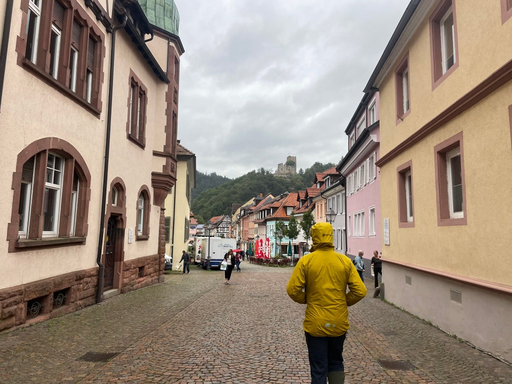
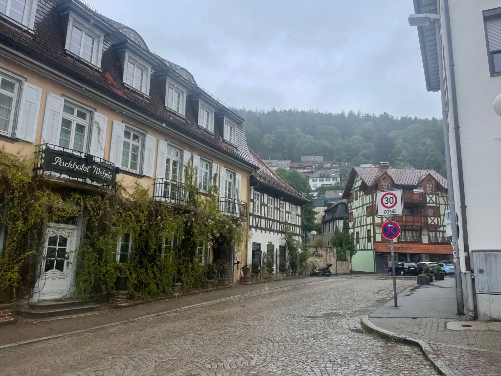
The market spanned both sides of a cobbled street lined with pastel-painted houses and backed by misty, forested hills that rose high on either side of the town, their dark tops cloaked by an obstinate curtain of cloud. An atmospheric castle ruin loomed above red-tiled rooves at one end of the street, looking as if it had fallen out of a fairytale. The market was quite small but there was a wonderful array of crates, baskets and counters filled to the brim with local produce: colourful fruit and veg, fresh and cured meats, bread, cheese, eggs stacked in big trays, herbs and spices and a stall full of homewares and utensils all made of wood. It was utterly charming, and there was no disposable plastic to be seen.


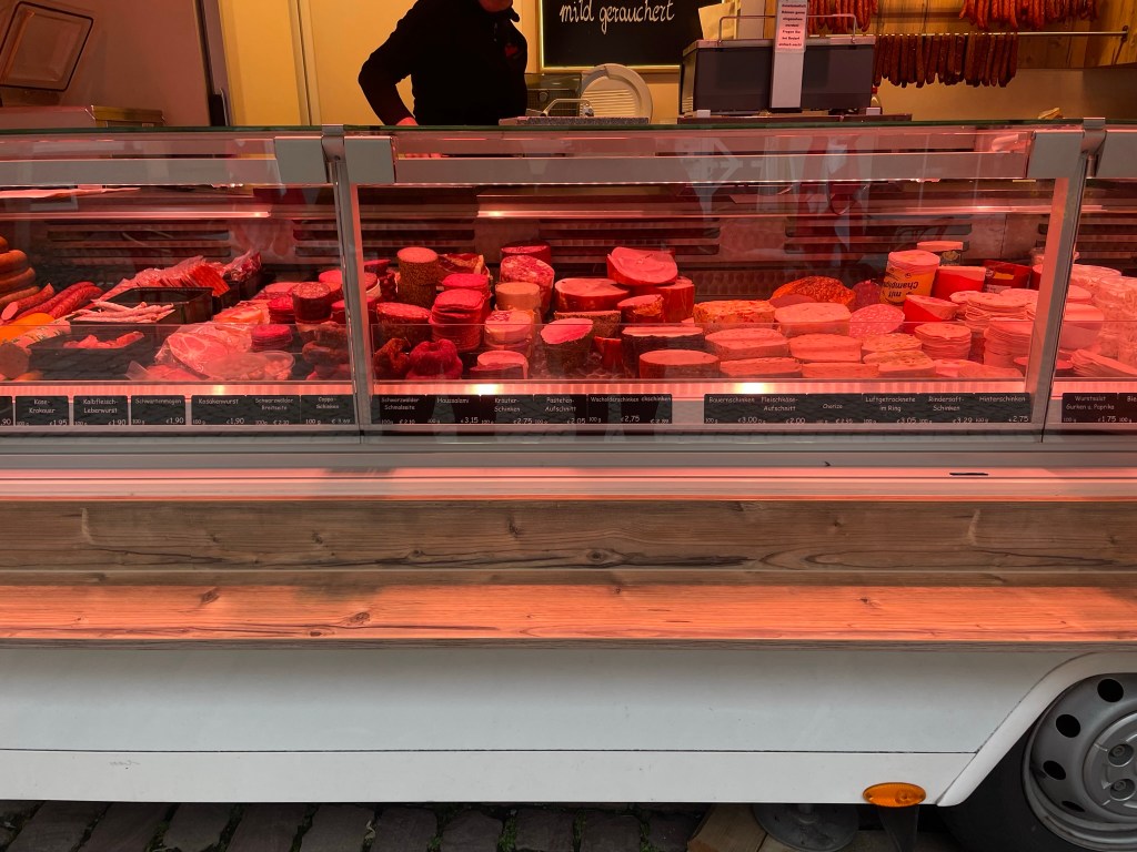
I had a pleasant conversation in broken French with a cheesemaker and we came away with large chunks of – I think – morbier and comté, which had travelled across the nearby border with eastern France. I was almost as pleased with the conversation as I was with the cheese. We had a slightly less successful time communicating to an accommodating German butcher that we wanted to try the famous Black Forest ham and a couple of skewers (meat unknown), but got the message across with some emphatic pointing. We sat on a bench and tried the ham, which was divine – wafer thin with a very strong woodsmoke taste. Our last purchase (which also necessitated pointing) included a jar of homemade tomato sauce, fresh spinach and some bright orange chanterelle mushrooms from a greengrocer.
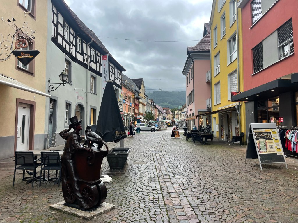
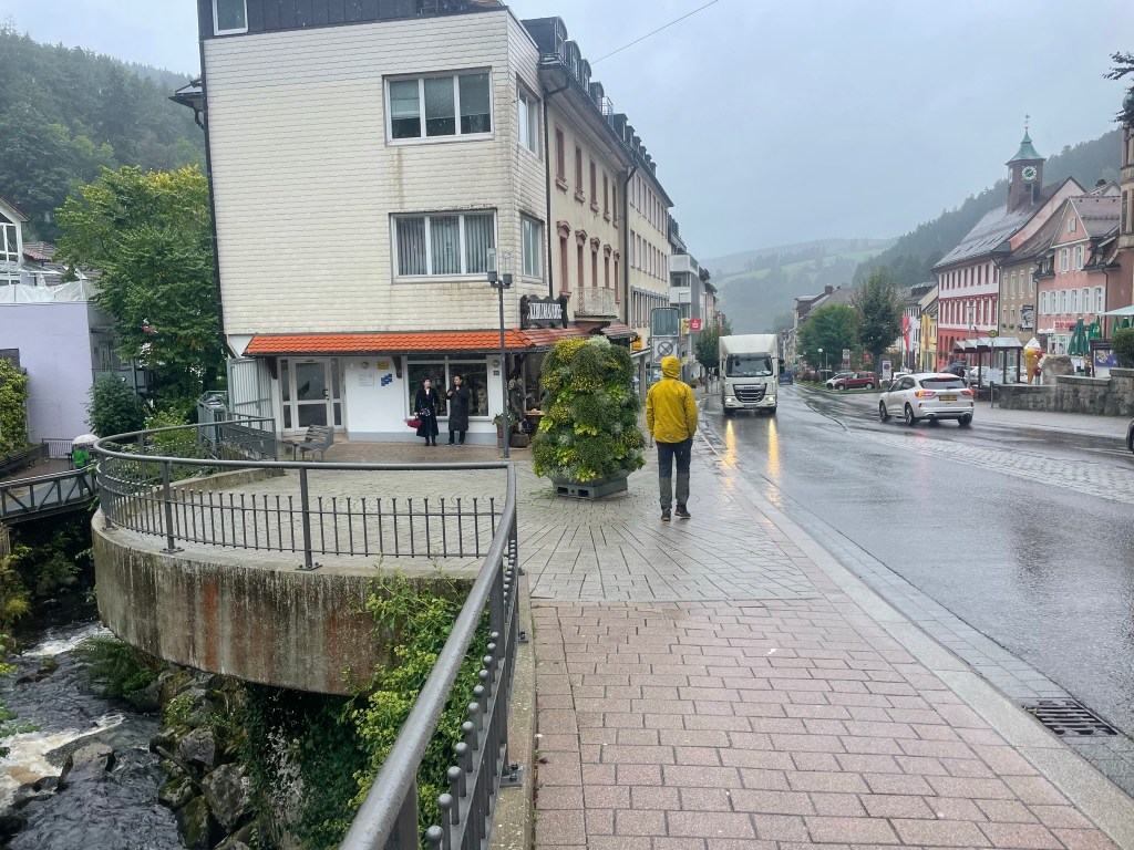
Satisfied with our miscellaneous ingredients for an unplanned meal, we wandered around the town, resisting the pull of cosy little cafés and bakeries crammed with pastries and pretzels. The regional theme of clean, cobbled streets and neat, colourful houses was as present in Waldkirch as everywhere else we’d been the day before. The town was small and it didn’t take us long to feel as if we’d completed it, so we returned to the car and formed a plan to drive east to Triberg, which we’d read about in various “Black Forest must-do” articles.

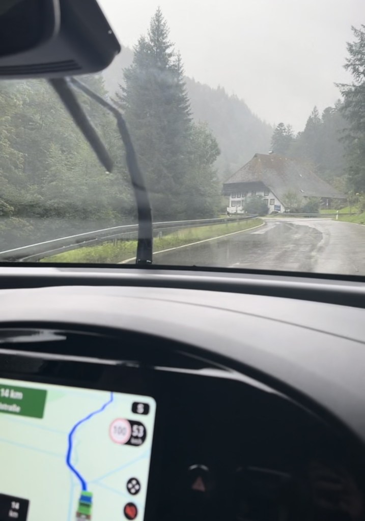
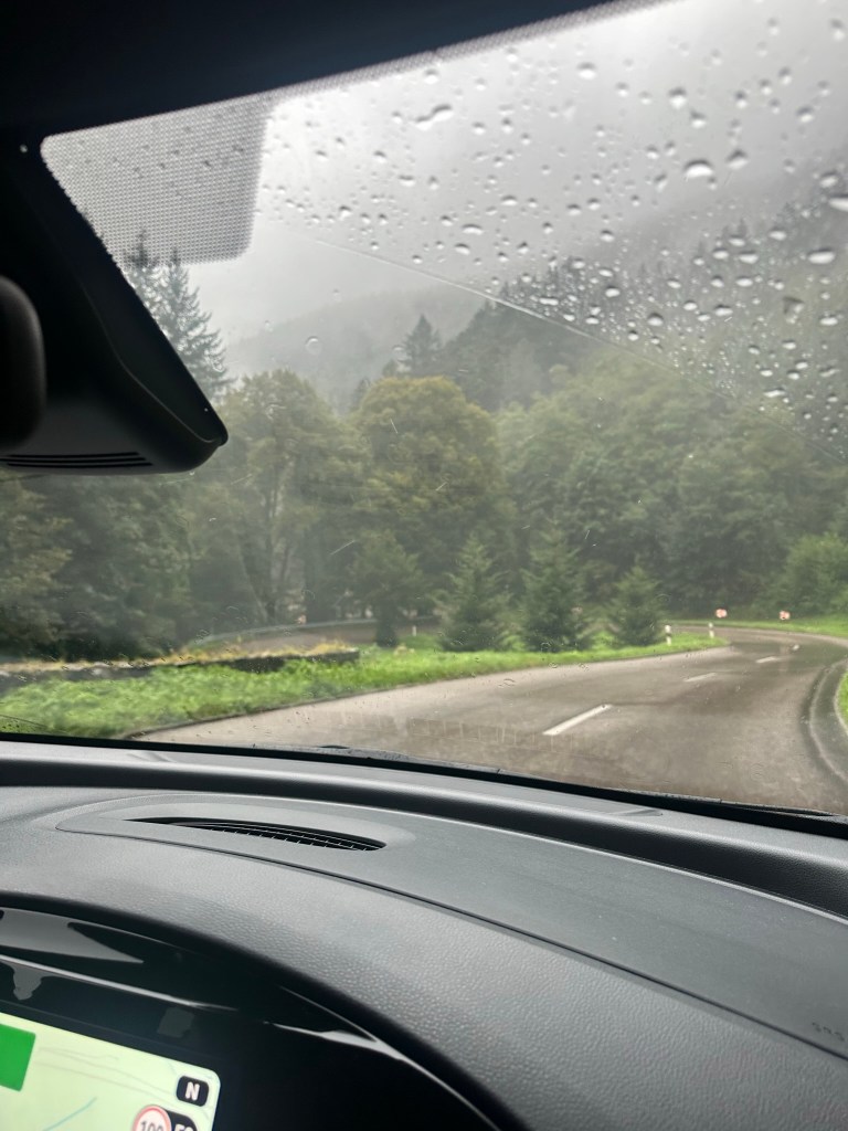
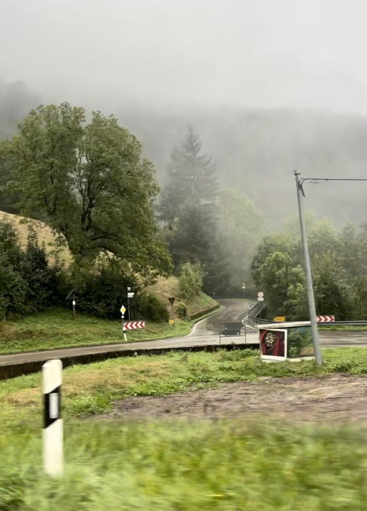
The drive took us northeast up the long Elz Valley to Oberprechtal, where we’d walked the previous day, then south along a high, scenic, serpentine road which carved a narrow line through endless dark forest. It rained heavily the entire way, but thankfully I’d become quite accustomed to the Black Forest’s hairpin bends and lofty glimpses of great, green valleys. Nevertheless, I was relieved when we dropped into the town and arrived safely in a multistorey car park – the 50-minute journey had seemed a lot longer.

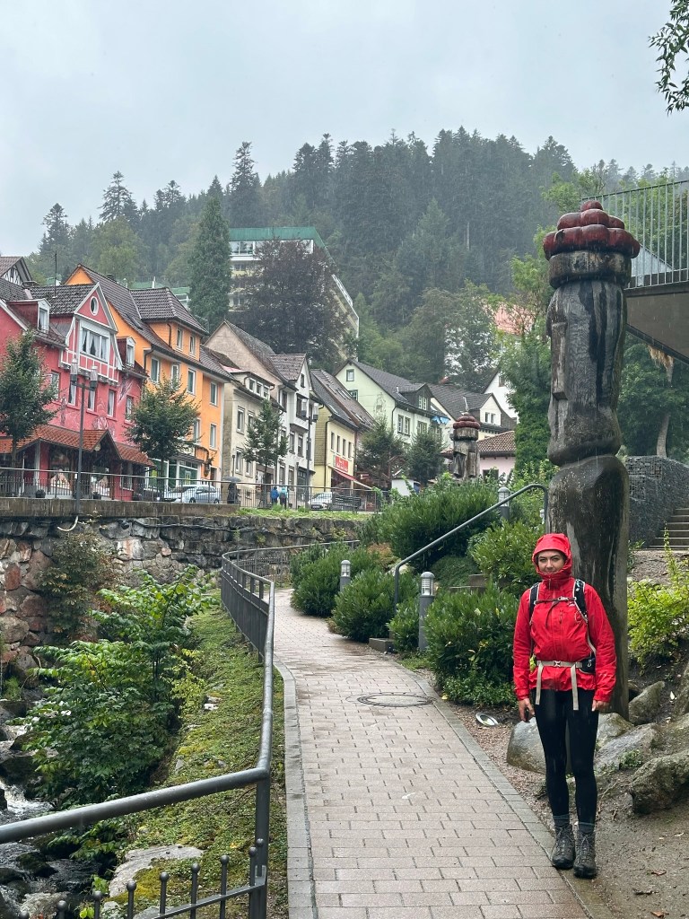
Triberg
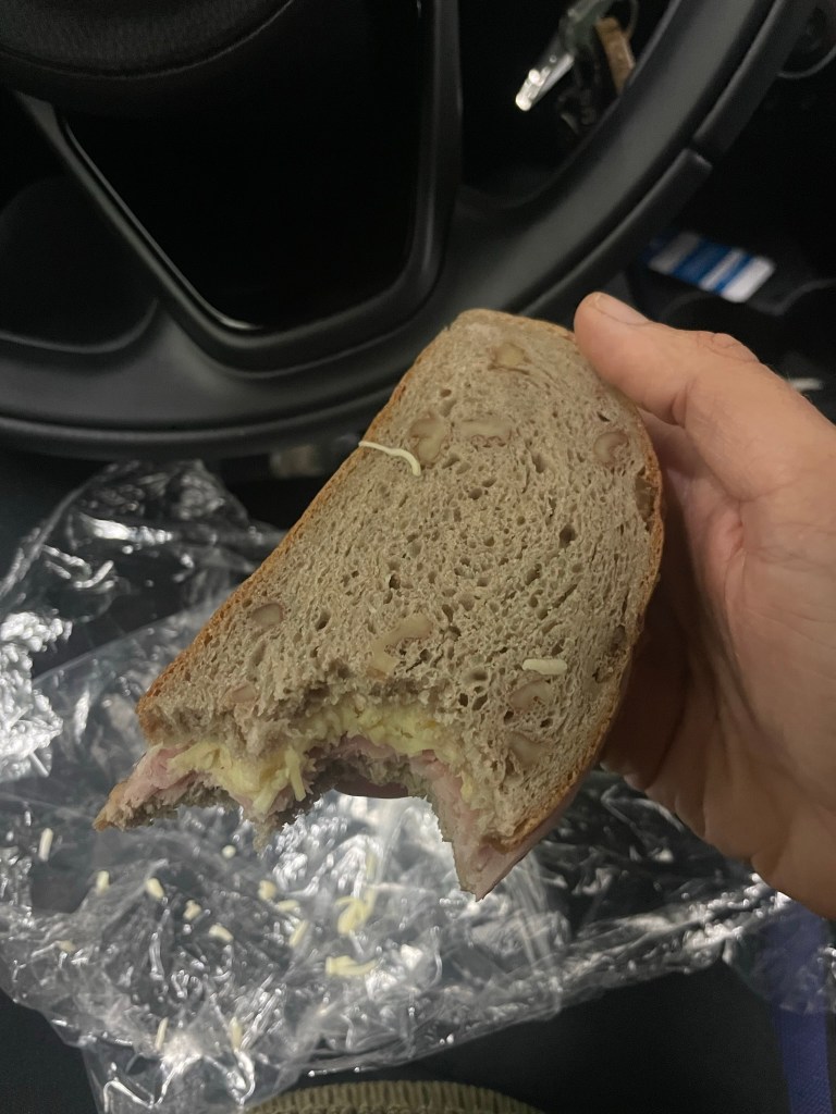
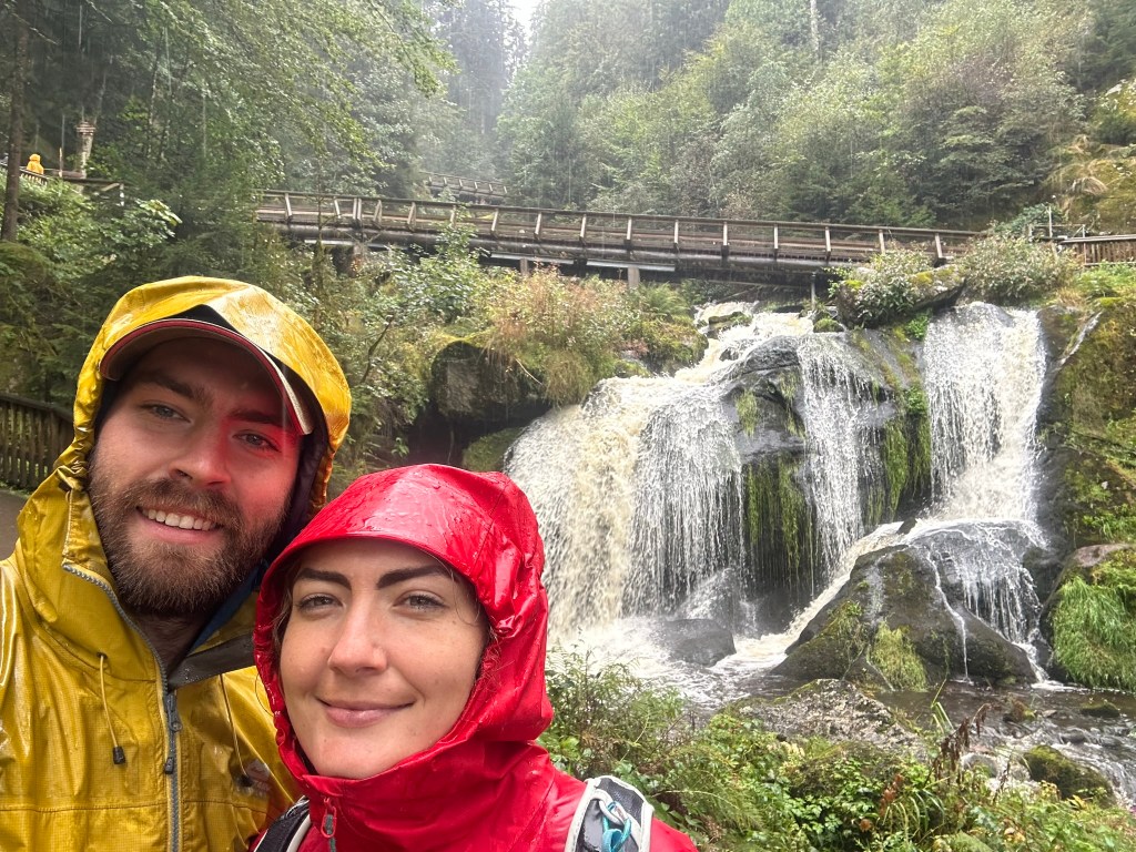
We munched ham and cheese sandwiches in the car, then headed out into the pouring rain. A walkway that followed the rushing Gutach river upstream led us to the centre of the small town, which sat in a kind of bowl surrounded by rising, impenetrable-looking forest. Unlike Waldkirch, which was set in the flattish belly of a valley, the colourful buildings of Triberg followed the contours of the slanting streets and rose into the trees in steep layers, giving a sense of self-contained, nestled cosiness.


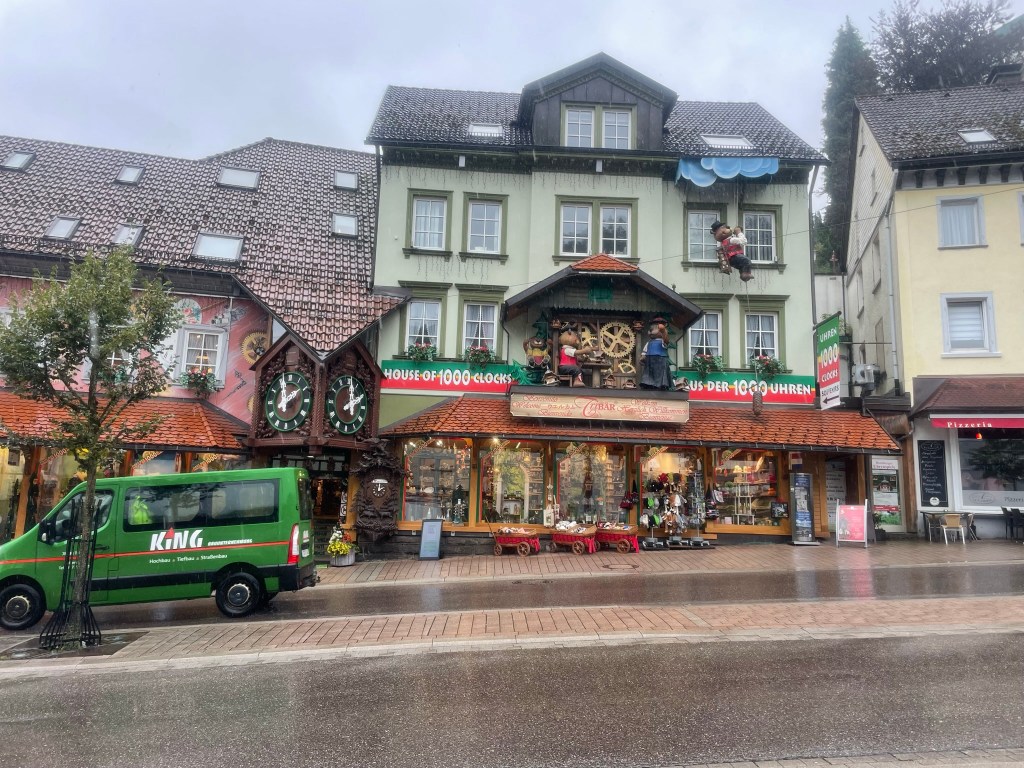
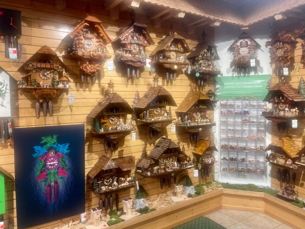
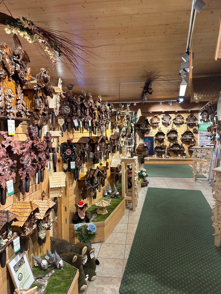
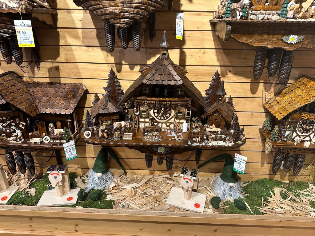
House of 1000 Clocks
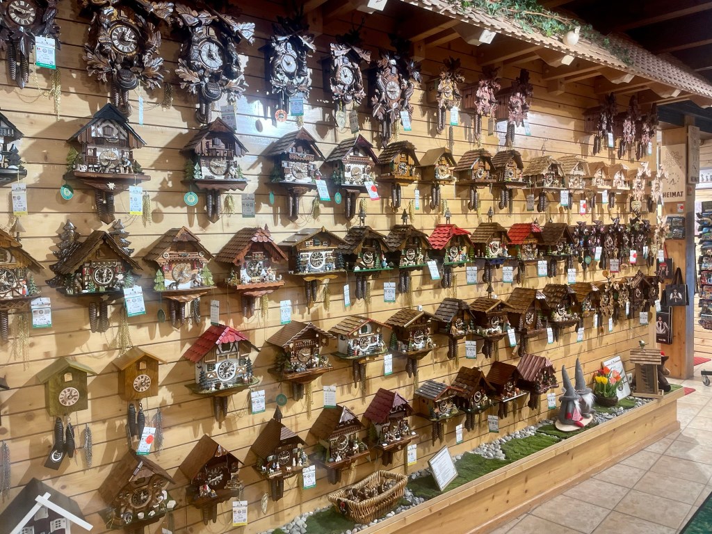
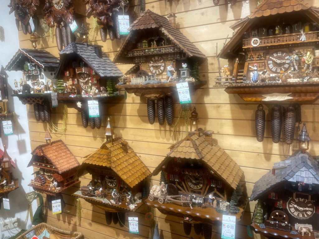
After a brief look down the high street, we crossed a main road and took respite from the rain in the House of 1000 Clocks, a charming shop with a huge wooden cuckoo clock built into the front. Its name is self-explanatory and it was unlike any shop I’ve ever seen: its cladded walls were covered in hundreds of intricate wooden cuckoo clocks, all unique and all incredibly detailed. They featured tiled rooves with chimneys and bell towers, balconies, shuttered windows, carved trees, animals and scenes of farmers, lumberjacks, craftspeople and beer-drinkers, all in traditional German dresses and lederhosen, complete with carts, mill wheels, log stacks and endless other little intricacies.
The shop also sold beautifully carved clocks featuring leaves, stags, hares and birds, and glass and metal clocks showing their mechanical workings, but I was most taken with the little cabins. They ranged from about 150€ to 3,000€ and I sorely wanted one of the cheaper, simpler ones, but we couldn’t have transported it home. We bought a cuckoo clock fridge magnet from the souvenir section in lieu of the real thing, and a little bottle of kirschwasser – a colourless local brandy – to try, then headed back out into the rain in time to see the cuckoo emerge from the huge shopfront clock at 2pm.
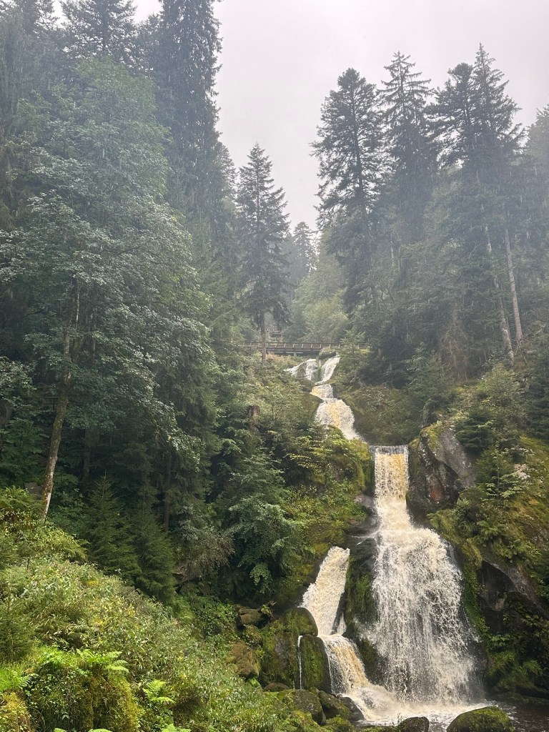
Waterfalls and Nature Trail
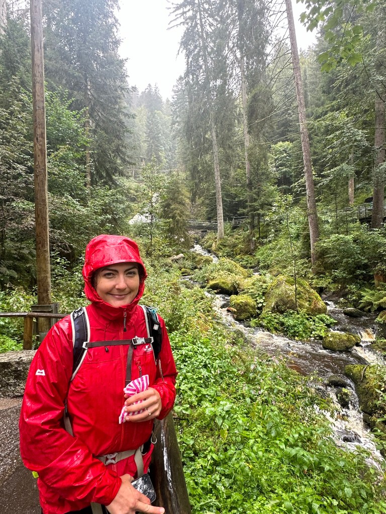
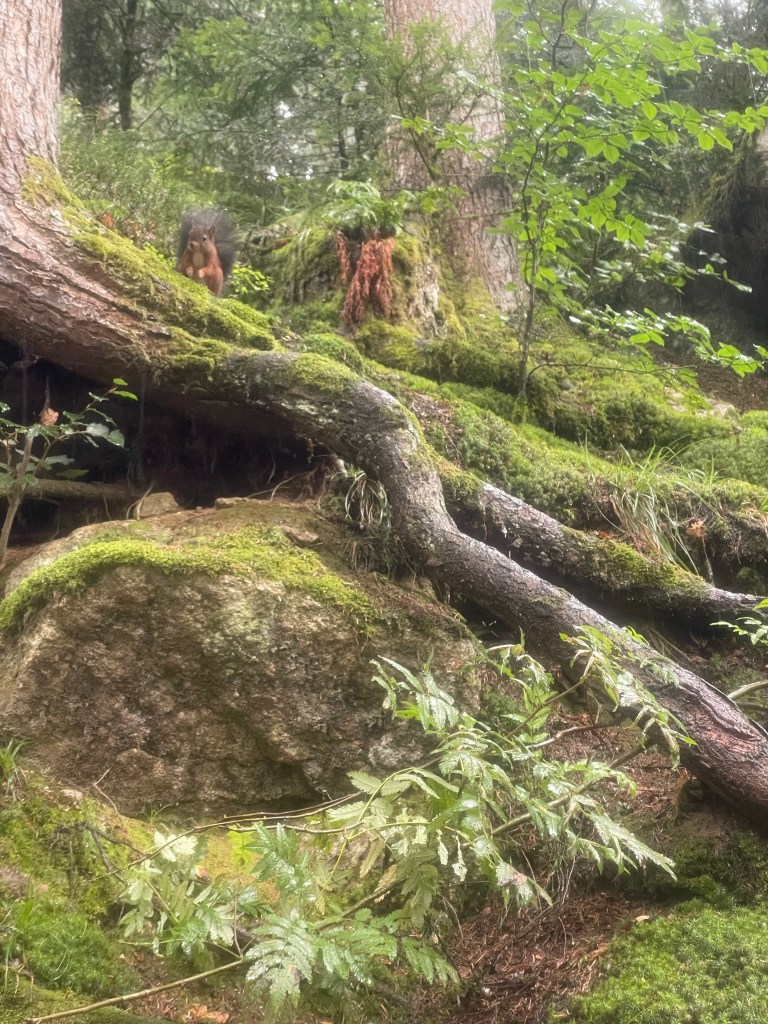
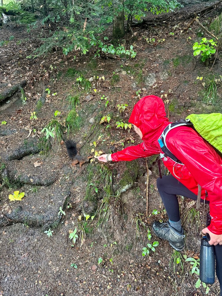
Triberg Falls comes up in a Google search as one of the Black Forest’s top attractions. We walked a short distance uphill from the clock shop, paid 15€ at the kiosk and picked the “nature trail” walking route. A red squirrel appeared just off the path and I ran back to the kiosk for peanuts, which Ryan had failed to mention when I was busy butchering the German language in my attempt to buy tickets. I was thrilled when the dainty little squirrel tentatively took a nut from just a couple of feet away: I’m very fond of red squirrels and always keep a close eye out for just a glimpse of one in Scotland, usually to no avail.
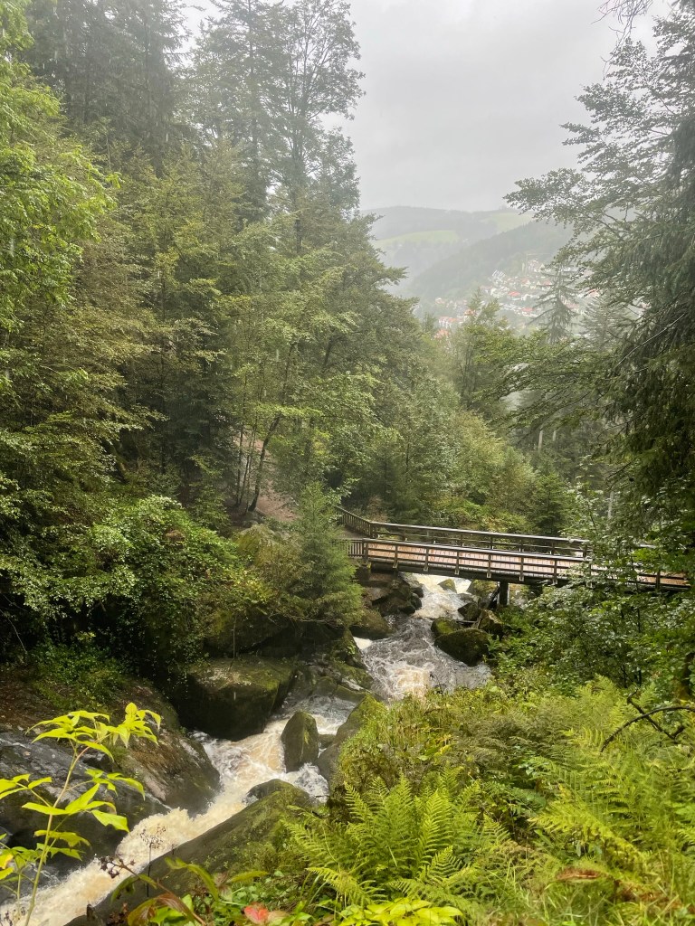
The tarmac path followed the rushing Gutach River upstream through lush forest. Tall pines formed a high canopy above layers of dark firs and leafy birches, and an array of bright green plants carpeted the ground leading steeply down to the water. Moss-covered boulders protruded from the river’s surface, allowing more greenery to take hold in their multitudinous crevices, and as we climbed higher the river took an increasingly tumultuous path down great rocky steps. After five wet minutes we reached the largest waterfall, a dramatic cascade that plunged down a huge, kinked “staircase”, and we took a moment at the viewing platform to gaze up and down the deep cleft carved by the furious water. In the downpour, it felt as though we were in a rainforest.

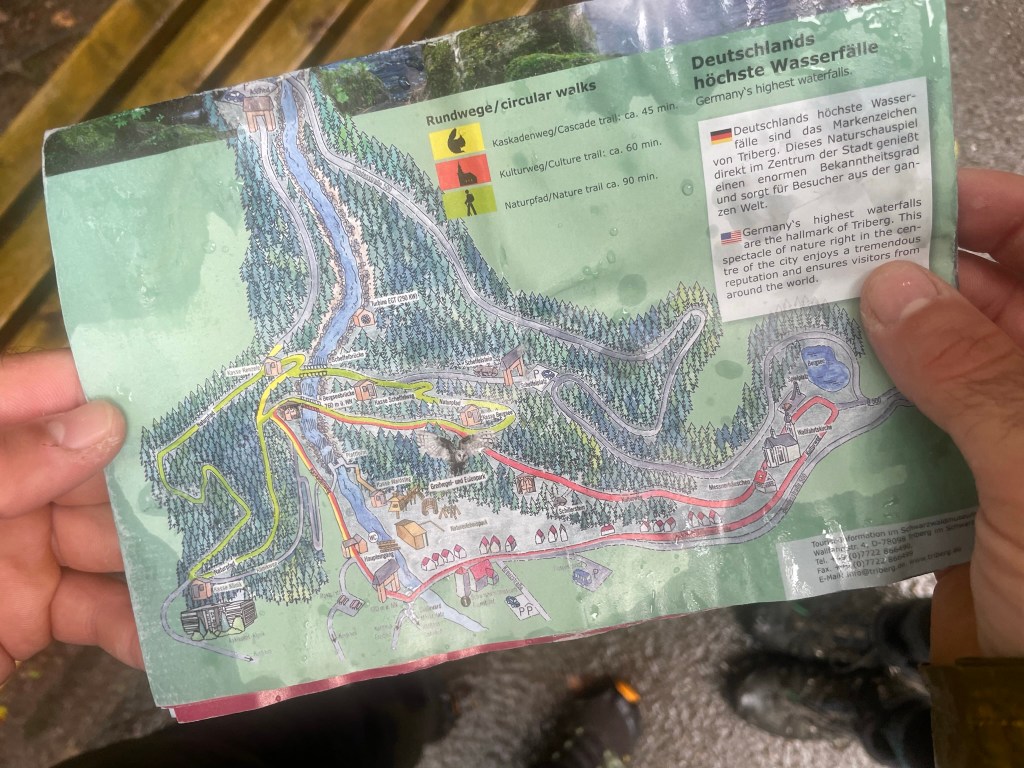


We crossed the river further up and followed the nature trail deep into the trees, away from the noisy banks. The way was clearly marked by a rough, rocky path, and – although the falls were beautiful – I was glad to be away from the manicured neatness of smooth tarmac and endless handrails, where the small handful of other tourists congregated in wet little groups. We snaked through the forest in a big loop, crossing back over the river further up and passing a couple of tiny huts where our tickets were checked – presumably to stop people sneaking in via the numerous hiking trails around the forest.
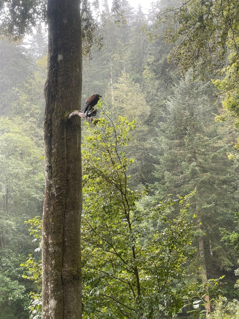
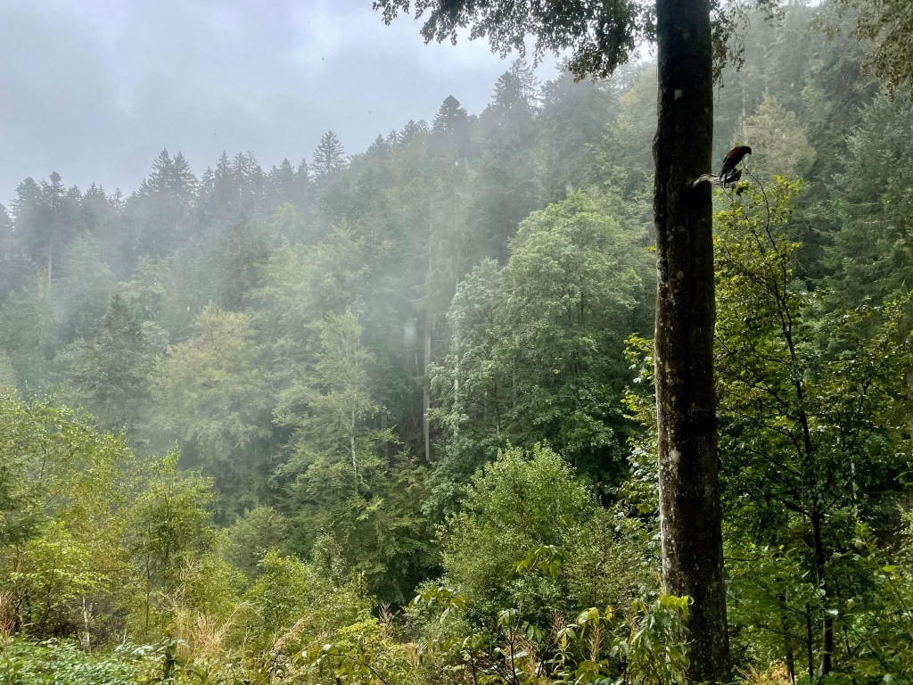
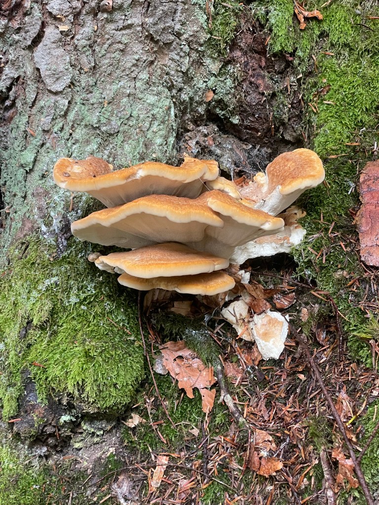
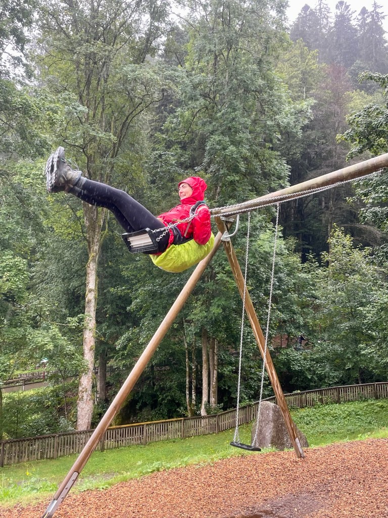
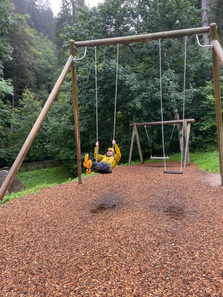
It was a lovely, circular route and we were thankful for the rain as we had the tranquil forest all to ourselves. We saw an escaped hawk with its jess still attached sat on a branch, fixated menacingly on something in the undergrowth, lots of red squirrels, jays, chaffinches, blackbirds, robins, mushrooms and – needless to say – an awful lot of trees. It took about an hour to get round, including dawdling and squirrel-feeding, and we topped it off with a few minutes playing on the giant swings overlooking the town, which we found just outside the exit. We were dripping wet and completely carefree.


Black Forest Museum
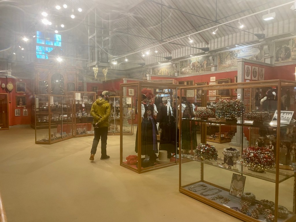
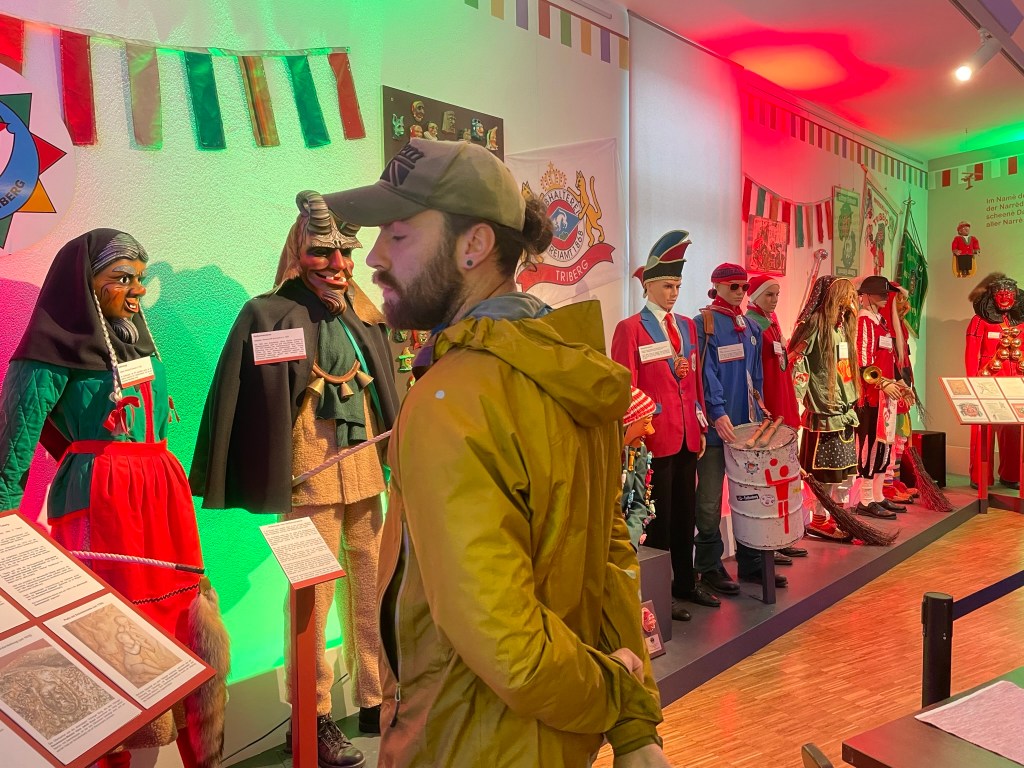
Once we’d exploited the swings, we crossed the road and dripped our way into the Black Forest Museum. We entered for free with our waterfall tickets and wandered through to a large, tin-rooved hall scattered with glass cabinets displaying traditional clothing from the region, an assortment of bizarre, heavily bejewelled headpieces, miscellaneous trinkets and generic old paintings. All the information signs were in German, which in a way was a relief (especially for Ryan) as I didn’t feel obliged to read anything.
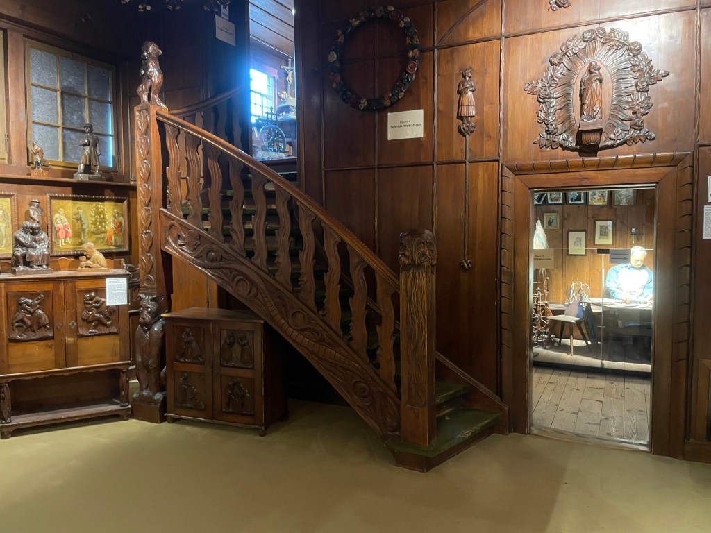
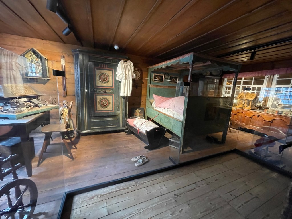
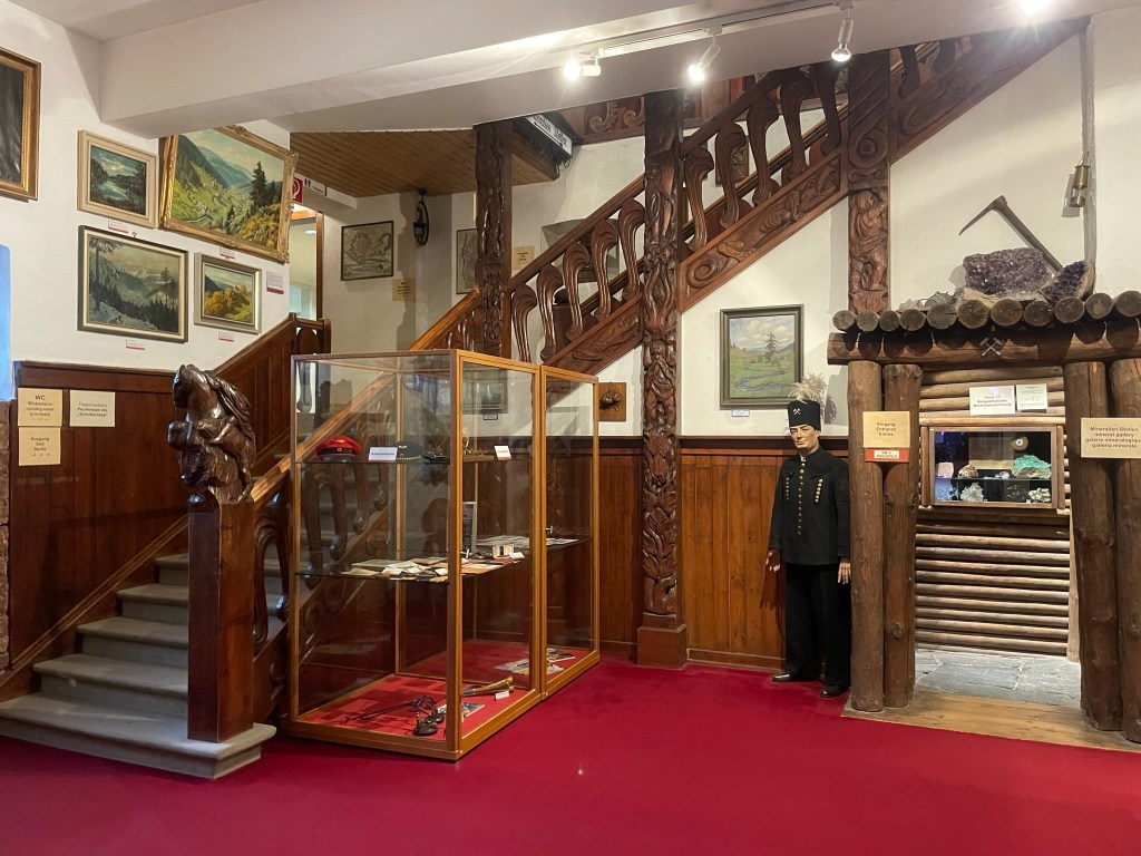
Although innocuous-looking from the outside, the museum turned out to be a small labyrinth. We went through a doorway into a wide, wood-panelled hallway, which led to a couple of little rooms decorated in a traditional style. There was a charming, low-ceilinged child’s bedroom, tucked away up some beautifully carved stairs, and a workshop containing a vast array of hand tools and woodwork projects.

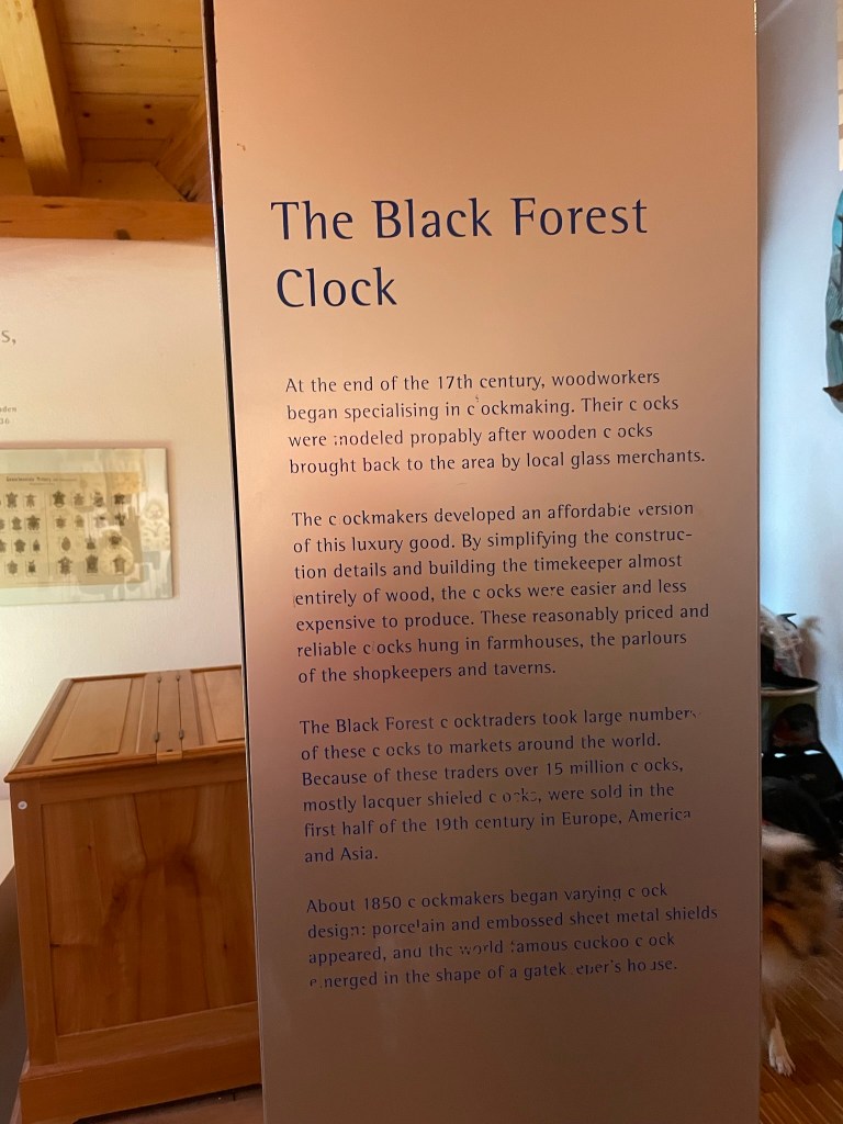
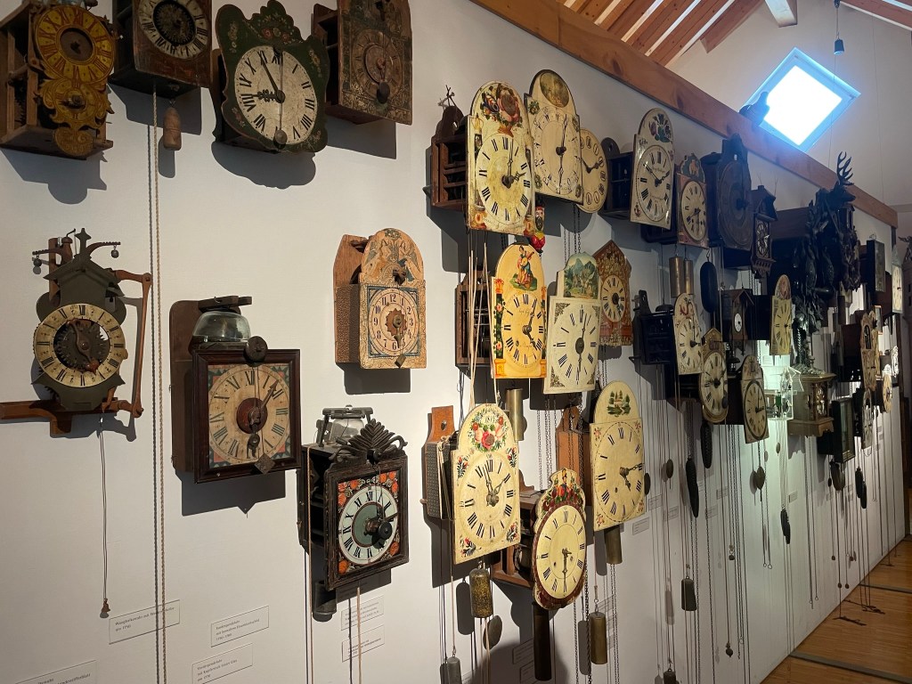
An arrow pointed us to the next section, which contained an awful lot of clocks and an information board in English – the only one we found in the whole museum, and for good reason:
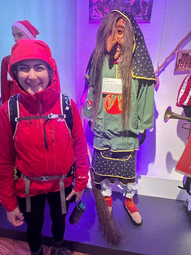
We emerged in the museum café, which was lined with several mannequins dressed up in traditional costumes ranging from fancy suits with obscure hats to witch and devil-masked festival outfits, made even more fascinating by the absence of an English explanation. This led to another hall containing a huge model of the area and a tight corridor dressed as a mine shaft, featuring an incredible variety of glittering rocks displayed in the walls. We emerged from the passage and climbed an elaborately carved staircase back into the tin-rooved hall, impressed by the diverse content and curious layout of the museum; although we couldn’t read anything, the rich visual exhibits gave us good feel for the cultural, woodcraft, agricultural and mining history of the area.


Black Forest cake
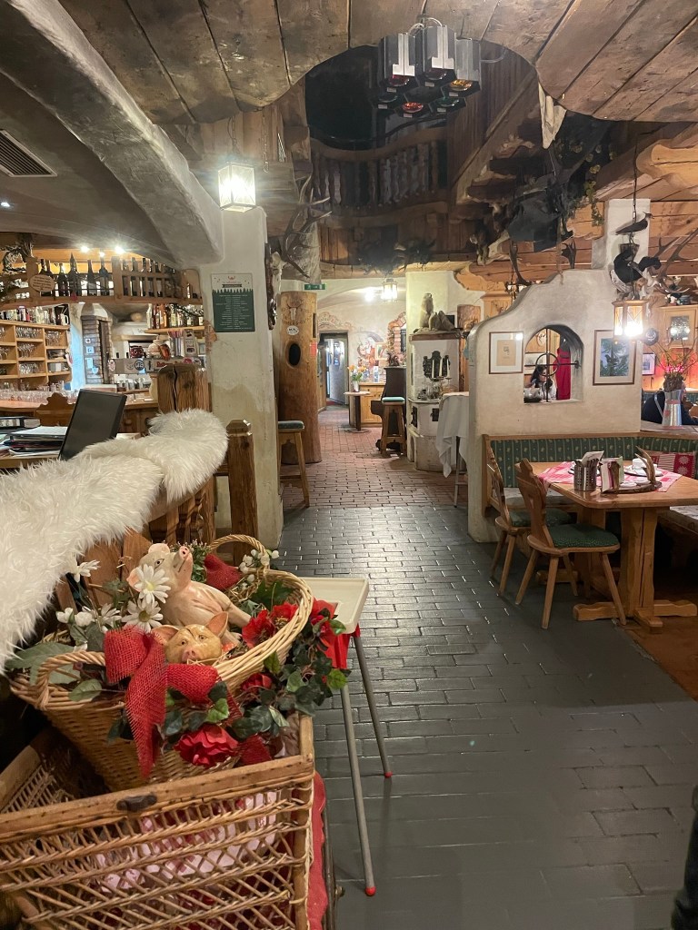
I was desperate to try some authentic Black Forest cake, so we left the museum and walked a short, wet distance to the guesthouse-café we’d spotted on our way out from the waterfalls. We climbed some stone steps, entered through a small doorway, communicated to a waiter that we’d like some coffee and were pointed through to the rear of the building. We were instantly charmed: a stone-flagged floor led us past a long, wooden bar and an open-plan dining area separated roughly into sections by rustic, whitewashed walls, adorned with forest paintings, assorted taxidermy and mounted antlers. An upper mezzanine gave a feeling of spaciousness, which was balanced by the timeless cosiness that emanated from the wooden furniture, cladded, lantern-hung ceiling and eclectic mix of rustic décor.
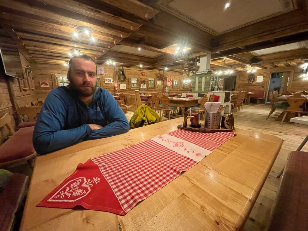
We sat in a corner of a large room at the back of the building, which was wood-cladded from floor to ceiling like a forest lodge from a fairytale. It was lined by small, square faux windows and miscellaneous art, and our table was decorated with a red-check runner and white doilies. Ryan had German beer while I had coffee and – at last – Black Forest cake. It was unlike any I’d had in England: incredibly light and fluffy, mildly chocolatey, and layered with light, sweet cream and sweet, sour, kirsch-infused cherry filling. I’m not a huge cakey person, and Black Forest cake has never been a favourite, but this experience has converted me.


Evening
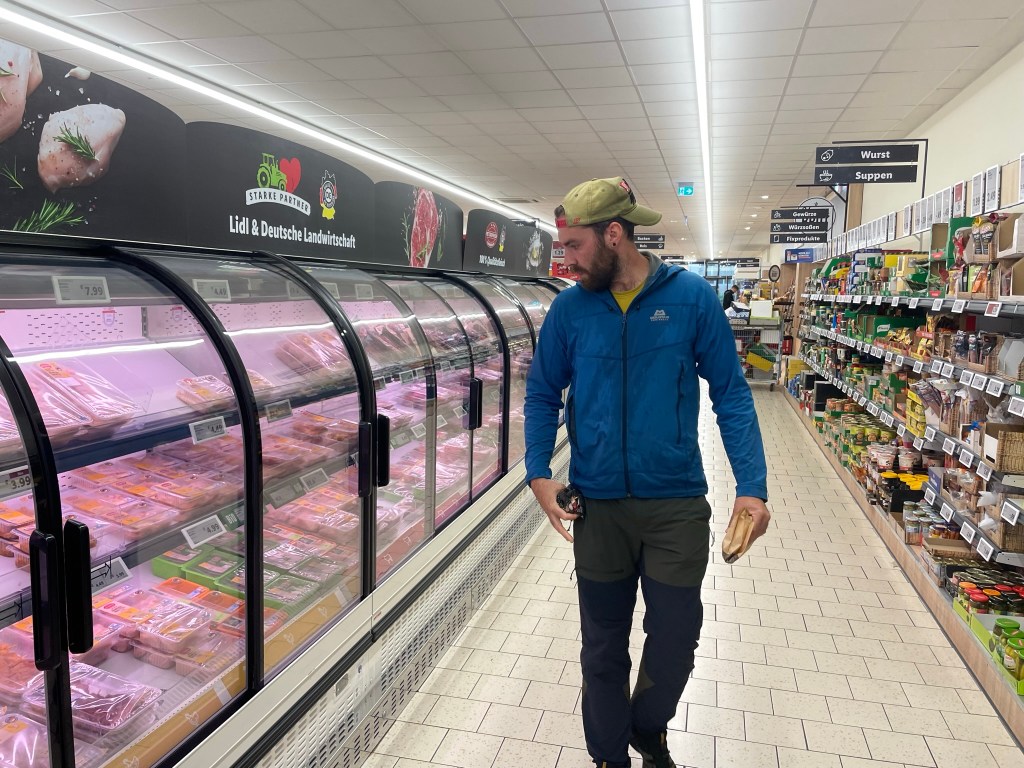
At 5pm we left the café with no little reluctance and returned to the car. On our way out of Triberg I realised anxiously that I’d forgotten to pick up my much-loved, much-used filter water bottle, so I pulled over so Ryan could run in and grab it – thankfully it was still there. We stopped at Furtwangen Lidl on the way back to Simonswald, marvelled once again at the vast selection of meat and cheese and the cheap alcohol (I picked up a local bottle of wine for 3€ and Ryan grabbed a few 44c beers), and rather enjoyed the atmospheric drive through relentless rain and dark, misty valleys.


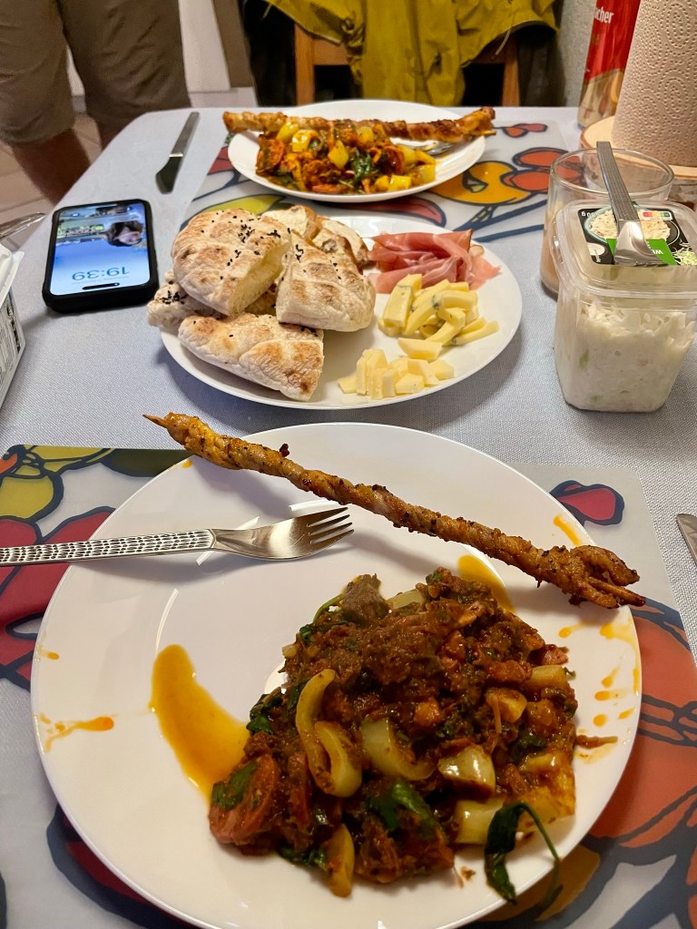
Back in our cosy apartment, I cobbled together a dinner with the ingredients we’d picked up from Waldkirch market and some random bits from Lidl. We had chanterelle mushroom and tomato stew with chunks of frozen sausage, paprika peppers and spinach, accompanied by the meat skewer (which turned out to be pork), bread, Black Forest ham, cheese and sauerkraut. It was delicious, if a little haphazard, and we washed it down with shots of kirshwasser – which turned out to be unequivocally vile.


We spent the rest of the evening planning a hike up Feldberg, the Black Forest’s highest mountain, with the “help” of Kraut, and reflecting on our time in Germany so far. It had been another lovely day full of local culture, nature and history despite, or perhaps because of, the rain, as – in the absence of crowds, which I’d read often swarmed on Triberg – we barely felt like tourists.