Scotland, Feb 23: Glenshee, Linn of Dee, Braemar, Tomintoul

Happily I’ve slipped into the habit of going to Scotland every winter in search of mountaineering exploits, tourist-free roads and cold, midgeless air. 2023’s trip was preceded by two weeks of chaos as Ryan and I (with some help from my perpetually patient dad) scrambled to convert our new campervan to a point where we probably wouldn’t freeze to death in our sleep, which meant spending every non-working minute sound deadening, running cables, making thermal blinds and installing a skylight, electric hookup unit, extractor vent and vapour barrier into Vandalf the Blue. It was an utterly exhausting, all-consuming, antisocial and rewarding couple of weeks, and we left for Scotland inside our shiny silver spaceship, which contained a lot of outdoor gear and an old mattress, on Tuesday 31 January at 1:30pm.

The drive up went surprisingly quickly despite two mechanical hiccups: on returning to the van at Warwick services, the driver’s seatbelt jammed as a result of – as we discovered to my intense chagrin – my overzealous stuffing of wool insulation above the mechanism. We managed to extract the insulation from the tiny holes I’d poked it in and went on our way, relieved. All was quiet until shortly after Perth, when the full beam and fog lights decided to call it quits after nearly 9 hours of driving; vanxiety returned in full force as I googled fuse box diagrams and relay replacement costs, but on finding a layby to stay in shortly after entering the Cairngorms, we turned the engine off and on again and the truant lights returned. We settled into our tin can at 1:30am.

Wednesday 1 February

Glenshee

I woke up in another world. We’d parked in a large layby set back from the A93 between the Spittal of Glenshee and Glenshee ski centre in the southern Cairngorms. I slipped (literally, the ground was icy) out of bed and climbed a little way up a hillside to get a better view, not quite believing that after the van-related stress of the previous few weeks, we were finally in Scotland. The road snaked smoothly between vast, rolling, heather-covered hills, which sprawled around each other as if each trying to take up as much space as possible. The sun had just risen over the high, near horizon, the sky was clear, the heathery ground was thinly covered in snow, and I remembered what peace felt like.

Ryan, who had spent half the night sleepily whinging that he had cold legs while also refusing to put trousers or socks on, emerged from the van, nearly slipped on the ice, and retreated back inside. I joined him and we checked the ski forecast for Glenshee. There were only a few lifts open lower down due to a lack of snow, so we improvised a plan B and headed off to explore the Linn of Dee, a well-known beauty spot half an hour northwest of us.

We wove through the immense, rising glen, which whitened as we climbed, to Braemar village, then took a long, dead-end road to the Linn of Dee. We passed some lovely, cabin-like houses overlooking a wide, flat-bottomed valley backed by the huge, smooth humps of the Cairngorm plateau and harbouring the almost delta-like River Dee, crossed a stately stone bridge and parked in the National Trust car park (£3 for the day).

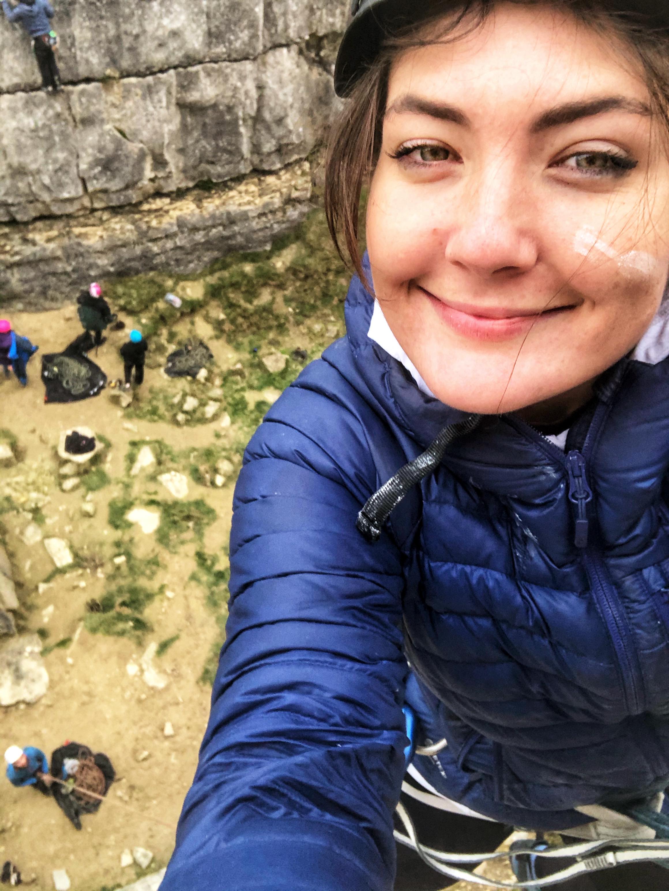
Hike around the Linn of Dee

We wanted to explore but didn’t want to use up too much time, so we took a 2-mile waymarked circular trail. From the car park it descended a short way through an enchanting pine forest brimming with mosses and lichens to the bank of the Dee, which flowed white through a short, narrow, rocky gorge, then gin clear over a wide, stony riverbed. Above the gorge stood the bridge we’d crossed, which had a single arch and was made from neat, pinkish-grey stone blocks. It was a very pretty place – I could see why it was a favourite picnic spot of Queen Victoria’s.

We followed a well-maintained footpath along the river through the verdant trees. Ryan spotted a red squirrel ahead, which – presumably on hearing my squawk of eager delight at the early sighting – shot up a tree and crept around the trunk as I tried to photograph it. After half a mile we took a track north along a different branch of the river, which widened and narrowed at intervals. Majestic Scots pines lined the banks at random, heather and blaeberry bushes blanketed the undulating ground and everywhere that wasn’t river was covered in forest or scrub; the whole place felt so alive and unadulterated.

It started sleeting but lacked conviction – I needn’t have put my waterproof on. We passed an island, a couple of waterfalls and a salmon ladder (a series of steps that allow salmon to swim up steep sections of river), then headed back to the van through another kilometre of thriving, wild forest. Backed by snow-topped mountains, it was still and serene, and I felt like a not-unwelcome outsider passing through an ancient, whispering landscape. It was so good to be back in Scotland.

Braemar

After 15 picturesque minutes we arrived back in Braemar, an almost obnoxiously quaint, pretty village nestled between high hillsides and sweeping glens that – after a handful of visits – I feel very at home in. We popped to Co-op for some snacks, had a quick look in a local craft/gift shop (of which there are several) and went to the irresistible Braemar Mountain Sports, where we somehow managed not to buy anything. Ryan treated me to coffee and cake in the adjoining, cabin-like Bothy café and we sat looking at the pretty buildings, watching the river run its wide course and planning our upcoming mountaineering exploits – the frantic build-up to the trip meant we’d done no prep, which is very unusual. A moment of cosy bliss.

Scenic route to The Lecht & Tomintoul

We wanted to make the most of the thawing snow and having scoured google for ski resorts with open lifts, we concluded that our best bet was to head up to the Lecht ski centre in the northeast of the national park. Braemar is central-south and there’s no as-the-crow-flies road due to the impassable nature of the mountain plateau, so we took the incredibly scenic and now quite familiar route around the east side of the Cairngorms. After the deep forests and wide rivers around Balmoral, the landscape opened up to a rolling panorama of endless, white-topped hills, whose lower swathes were carpeted with golden grass and red-brown heather, broken only by the occasional remote farmhouse. I felt so wonderfully small.

Having stopped just once to allow a twee-clad roadside shotgun-wielder (I wasn’t going to argue) to down a pigeon and a pheasant, which were quickly retrieved by a labrador, we arrived at the Lecht about 3pm. We went in to check that we didn’t have to pre-book  ski equipment for the next day and were told by a friendly instructor that we were welcome to camp in the large car park, so with that plan in mind we watched some inconceivably-looking heavy snow ploughs darting around the slopes above, then continued a little way along the scenic road to kill some time.

Shops were closing by the time we arrived in the small, distinctly rectangular village of Tomintoul, where neat terraced houses lined the single main road. It was dead quiet, even a little eerie, so after a quick poke around a little gift shop/café we headed 10 minutes back up the road to the Lecht, nestled deep in the barely inhabited hills.

Evening at the Lecht

Our first evening in the van was lovely. I missed Björn Bongo so deeply and for the first time since selling him last August, I felt truly free. I sat on a camping chair on the mattress and did some research for the trip while Ryan cooked at the end of the bed, both of us surrounded by miscellaneous climbing and winter gear. Ryan’s lovely stew was made from burgers and leftover veg and we ate hungrily, excited to go skiing/snowboarding the next day. Life was simple and good.

Lake District, June 2022: 1 – Lancaster, Windermere, Thirlmere

Saturday 11 June

Our week-long family holiday arrived not a moment too soon and I was so excited to show my parents the Lakes for the first time. We left the New Forest at 4am and had a mercifully uneventful 4ish-hour drive up to Lancaster, where we parked in the centre by the bus station and met them for a bimble.

Lancaster

Lancaster is a nice city, perhaps (like most) a little tired around the edges, with attractive sandstone buildings, quirky little side-street pubs and a wide high street filled with market stalls and chain stores. We wandered along the high street, waited an age for Ryan and Angus to get a Gregg’s, then turned left down a road that led to a grand, tall-columned town hall by a quiet, grassy square, where an imposing statue of Queen Victoria stood proud on a magnificent plinth of stone and bronze.

After some indecisiveness about which way to go next, a short walk up a pretty, cobbled hill took us to the beautifully intact Lancaster Castle, whose tall, two-towered, pleasingly symmetrical gatehouse overlooks the city. The walls are made of blocky yellow, red and grey stone and it ticks all the castle boxes – battlements, arrowslits, a portcullis, a delicately carved figure inlaid above the gate and a large, well-kept lawn and pretty flowerbed out the front. A fun-sponge of a security guard told us sternly that we couldn’t take the dog in, so we peered into the courtyard and admired it from the outside, where we read about its long history as a prison and ongoing use as Lancaster Crown Court.

Satisfied with Lancaster and keen to reach the Lakes, we walked back down the cobbled hill to the car park and left the city. It didn’t take long to get through the suburbs and onto the M6, and as we approached the edge of the National Park the hills rose around us, kindling my excitement to be in the mountains again. Despite one wrong turn thanks to my poor direction-giving, we made it to Windermere in about 45 minutes.

Windermere

Ryan and I parked at Booths – a very posh, Northern version of Waitrose – and walked down the hill into the little town, having forgotten that it isn’t actually on the edge of Lake Windermere – previously we’d stopped at Bowness, just down the road and right on the water. It’s a pretty, bustling little town with lots of lovely shops but we decided it was a bit too busy with tourists like us, so having failed to bump into the others after a circuit of the centre we had a drink at the delightfully quirky Crafty Baa, a tiny, timeless pub with an overwhelming number of miscellaneous items hanging from the ceiling and a mind-boggling selection of craft beers. We sat on a pallet bench in the cosy garden out the front and sipped fruity Herefordshire cider, utterly content as we watched the world go by, then made our way back to the car.

Our first classic Lake District view came as we drove along the Ambleside road, which twists and curves along the eastern edge of Lake Windermere and offers wonderful glimpses of the rolling fells that give the water a striking backdrop as they rise up from the west bank. The peaks were tantalising, and I felt so excited to be back. We stopped briefly in the middle of pretty, bustling, outdoorsey Ambleside to grab some supplies and a couple of parking discs that give free, limited-time street parking in several areas, then met mum, dad and Angus in the car park by the northern tip of Lake Windermere. We decided collectively to give Ambleside a miss on the grounds of it being too busy, so we left for the campsite. It was early afternoon and we wanted to get pitched and settled in good time, and I was particularly keen to establish our plans for the week.

Thirlmere

The campsite was situated on the A591 road between Ambleside and Keswick, just above Thirlmere reservoir and below the hulking east face of Helvellyn. The 20-minute drive from Ambleside was lovely: twisty through Rydal and Grasmere, then incredibly scenic as we cut between the dramatic Eastern and Central fells, whose rugged, steep sides were carpeted by rough, dull grass interrupted by large patches of heather and evergreen forest. The mountains had got me again – for the first time since our March trip to Snowdonia, I experienced that exhilarating, humbling realisation, which dawns on me again and again as if every time were the first, of my own overwhelming smallness.

We got to Thirlspot Farm about 2pm, set up camp and spent the suddenly windy, rainy afternoon sheltering in the awning. Ryan and I were in my trusty, no-frills, 15-year-old tent, which has more than served its sentence over the years (as demonstrated by the heavily taped poles) but is certainly not – as it claims to be – suitable for four people, although it is perfect for two with a couple of bags. Angus was in his neat little two-man, mum and dad had their campervan with pop-top roof and side awning, and we were all crammed together between a gravel track and a wire fence.

We weren’t sure on the campsite at first, which was just a thin strip of grass running parallel to the main road that was shielded from the noise only by a hedge and a narrow line of trees, but it grew on us over the next few days. Because that road cuts along a huge valley, the campsite sits nestled below the steep, grassy, rocky western slopes of Brown Crag (610m) and Helvellyn (949m), which gave it a wild feeling and made us appreciate the vastness of the fells. The farm was pleasantly old-fashioned, the resident lambs were charming, the toilets were clean, the showers were hot, the road was quiet at night and there was only space for a handful of campers at a time, so it felt quite private.

A strong southerly wind was whipping up the valley and drizzle came and went, so after setting up we sat in the awning, ate mum’s homemade brownies, recovered from the journey and made plans for the rest of the week, which involved several books and maps, at least two different weather forecasts, a notebook and some minor frustration at everyone’s indecisiveness. Mum cooked a delicious veggie chilli con carne for tea and to our relief the weather improved that evening.

It was a very atmospheric first night below the mountainside; bright daylight reflected off the clouds until late, and I don’t think it ever really got dark – it was as if the normal rules of day and night didn’t apply in this wild place. All tired from our early start, we went to bed at 9ish and I dropped straight off, remaining dead to the world until morning.

North Pembrokeshire, June 2021 (2/2)

Thursday 1st July

Newgale Beach

The fog was still thick around our wild camping spot on the Preseli Hills when we woke up. We were due travel to South Pembrokeshire for the second half of the holiday and had arranged to meet mum, dad and Angus at Pembroke Castle at 1pm.  We spent the morning driving down via Newgale Beach on the west coast, with a view to seeing as much of the national park as possible.

We dropped down into Newgale after an hour’s drive through pretty farmland and parked at the large beachfront car park. Newgale is a small village in a basin that opens onto St Brides Bay, with a large, lively-looking campsite set just across the road from the beach. The beach is long, sandy and scattered with smooth pebbles. The weather was strange – still, warm and bright, but grey sea mist stopped sunlight penetrating and gave the sea and sky a serene, dream-like quality. We walked along the shore until we reached some cliffs and caves at the southern end, explored for a little bit and headed back to the van.

Pembroke Castle & Town

We stopped at Morrisons in Haverfordwest for shopping and fuel, then met the others in Pembroke early afternoon. Pembroke is a small, bustling town that still seems to revolve around the castle, which has high, well-preserved walls that tower over a long pond on one side and the high street on the other. Inside, the large, grassy courtyard is contained by walkable walls and several towers which house a lot of interesting information about the castle’s history, including some realistic mannequin scenes and the room where Henry VII was born. It has a “proper” castle feel, with its huge keep (sadly closed), dungeon room, herb garden, scattered flowerpots, battlements, towers and high walls. Definitely worth a visit.

After a thorough poke around the castle we  wandered up the high street, where we looked round an old fashioned convenience store and a tiny shop that sells handmade, surfwear type clothes. I bought a pair of yoga shorts with a honeycomb pattern and a couple of headbands, all made in the shop with organic cotton – would recommend, see the website here – https://www.iseasurfwear.co.uk/. Ryan and I then went on to the Watermans Arms pub and enjoyed a cold cider on the deck, which is raised on stilts over the edge of the pond and has a lovely view over the water, the castle and the town. We watched in amusement as a single, angry-looking swan chased a group of at least 30 much more passive swans around.

Camping, Kiting & Broad Haven South Beach

We drove a little way south along tiny roads to the new campsite, Trefalen Farm, late afternoon. This is another lovely site with sea views, basic facilities and a really remote feel. The first thing we did was find an open field near the cliffs and fly Ryan’s powerkite, as so far the weather had been record-breakingly non-windy (for Wales) and having felt a slight breeze, we were very keen to get it in the air. There wasn’t lots of wind but there was enough to have some fun for half an hour or so before going back to the van and cooking fajitas for tea.

After eating we all tramped down the hill to Broad Haven South, a deep, attractive sandy beach with dunes set way back from the sea and impressive rocks and caves on either side. We walked and footballed our way to the far side, where we explored narrow caves and clambered around on the rocks. Angus was introduced to the slimy delights of large, light-hating cave lice and we found some random sea junk wedged high in damp cave systems, including ropes, buoys, jerry cans and a tyre. Satisfied with a day spent poking around castles and caves, we went back to the campsite and played some stupid card game Angus bought at the castle gift shop, which became hilariously long-winded.

Friday 2nd July

Climbing at St Govan’s Head

Ryan, Angus and I set off from the campsite to climb at the nearby coastal crag of St Govan’s Head. We walked west along a wild section of the Pembrokeshire coast path which had lovely views of dramatic cliffs towering over little rocky beaches and coves filled with clear blue water. We’d definitely chosen the right day for it as it was dry, still and kind of sunny, kind of cloudy, so not too hot or cold. We arrived at some abseil stakes by the edge of a cliff near a military training zone and after a little bit of faff, worked out the right stake to abseil off.

We set up the rope, took what gear we needed and one by one, abseiled over the edge of the cliff. As always the most awkward bit was going over the lip, where your legs go from vertical to horizontal against the wall. The abseil was really fun – about 30m high and against a pleasantly sheer wall, with some free space to hang into in the middle, and with dramatic views of the wild, intimidating cliffs and calm sea below.

The climbs were graded quite high and described as high in the grade, so we went for easy stuff. Angus hadn’t trad climbed for ages and Ryan and I hadn’t done much at all during a year of lockdown. First Ryan led “Exit Corner”, a straightforward VDiff up a blocky corner, I seconded and Angus toproped. We abseiled down again and I led “Lemming Way”, a Severe route up another corner with a fairly exposed, awkward section which had a disconcertingly damp crack where I faffed around with some tricky gear placements.

I belayed the other two up and we abseiled down again. This time Ryan picked “Centurion”, a Severe line up a nice-looking crack with one difficult looking move under an overhanging block. He got to that move without much difficulty but got stuck there, so he came down and I had a go without any real expectation of getting any further. It was an awkward and fairly bold move involving a high right leg and some dubious holds, but I committed to it and to my surprise pulled up over the block. The finish was quite loose but otherwise fine, and I belayed Ryan and Angus up (using a munter hitch as I’d given Ryan my belay plate) feeling quite pleased with myself. As I was doing so I watched a little nervously as a cow approached and sniffed another belayer’s rope anchor at the edge of the cliff –  I didn’t want anyone to have to contend with curious cows while belaying, and I definitely didn’t want a cow to fall off a cliff. Luckily the cow lost interest and wandered back to safety.

Trad climbing always takes longer than you expect, especially when you’re a little out of practice and there are three of you. By this time we’d only done three climbs and three abseils, but it was mid-afternoon and we were getting hungry (having overlooked the value of packing lunch). We were satisfied with our taster of Pembrokeshire climbing (although Ryan and Angus slightly more so than me) so we packed up and headed for the nearest pub.

We walked west and took a detour via St Govan’s Head chapel, a tiny, ancient limestone chapel down steep steps built into the side of a cliff and perched above a small cove. It’s a striking building which merges into the cliff quite naturally, as if it’s always been there, and some of the etchings on the stone altar suggest that it’s drawn interest for a very long time.

We climbed back up the steep steps and walked north for half an hour into the village of Bosherston and found the pub, the St Govan’s Head Inn. Dad had left me a voicemail saying that he’d booked the five of us in for dinner at (unhelpfully) “the local pub” and nobody had any phone signal to find out which pub it was, so we had a couple of drinks there and after a bit of phone-waving, I received a text suggesting that we were in the right one so we stayed.

Mum and dad turned up about 6 and true to form, I was decidedly wavy after two or three ciders while Angus and Ryan were fine. The pub was lovely inside, with wooden beams and low ceilings, and the food was very good – I had dressed crab and some chocolate thing for pudding, and my only complaint was that Ryan promised me one of his prawns but ate them all before I could get there. We split the bill between Ryan, Angus and I and walked back to the campsite along a narrow, hedge-lined road, happy with a good day’s climbing and pubbing.

Saturday 3rd July

Stackpole Gardens

It was mum’s turn to pick something to do, so we ended up at Stackpole Walled Gardens. Entry is free and a lot of the gardening is done by adults with learning difficulties as part of a charity thing. It’s a nice place to go, with long greenhouses, strange plants and sculptures, and it had lots of little corners to explore. Our favourite part was the rows of fruit available to pick for free, including strawberries, raspberries, gooseberries, blackberries and tayberries. We were there for an hour or so, until we ended up getting drizzled on while waiting for mum to finish bumbling around.

Surfing at Freshwater West

Taxi of dad then took us to Freshwater West beach, where we just about found a parking spot. Ryan and I changed into wetsuits and took the surfboard and bodyboard down to the long, sandy beach just down from the car park, and waded into the rough sea. We didn’t get far at all before being batted back by the waves. The surf was beyond our skill level in that we couldn’t even get the surfboard out far enough to catch the longer waves – the ones close to shore were short and ferocious, crashing high above our heads and pulled quickly back from under our feet.

We were washing machined around for a while, which involved getting hit multiple times with the boards and noting that a hard surfboard is considerably more painful than a foamie. One such collision (with my thigh) resulted in one of the three fins snapping off the surfboard and from then our attempts at proper surfing ceased. I’d managed to stand twice, both times in the shallows, and both times for a record-breakingly short duration. Body boarding was good fun though, and less calamitous.

After about an hour of being battered by the sea, we tramped back along the beach. Dobby’s grave, consisting of a lot of stones all piled up, was up on the sand dunes to the left – apparently it’s where the scene was filmed (spoiler – Dobby dies). The sea, and our attempt to find some surfable waves, had dragged us quite a long way to the right, and annoyingly we noticed on our way back that the surf to the left had calmed down a lot to the point where surf schools had started eyeing it up.

Feeling half-starved, we grabbed lunch from the famous Café Mor burger van in the car park. I had the vegetarian burger and Ryan had the classic Mor burger with chips. The people were really friendly and the burgers were amazing, served with some kind of seaweedy pickles and relish.

Powerkiting at Broad Haven South

We went back to the campsite via Pembroke so that mum could grab some bits from (ie. spend an inordinate length of time in) the shop. We helped pack up the awning and for tea mum cooked a strange but very nice mix of bits that needed using up, which included buckwheat, mackerel and salad.

That evening we wandered back down to Broad Haven South beach to show the others Ryan’s powerkite. There was practically no wind but we just about managed to get it up and give dad and Angus a go. It was nice to fly it on the beach regardless and the only downside was that in my enthusiasm to take the mountain board despite the lack of wind, I graunched my heel on the axle while scooting along and it bled quite a lot.

On the walk back up the hill the heavens opened. I’m not exaggerating when I say it was like a tropical storm – we were dry one minute and drenched to the bone the next, so much so that it stopped being annoying and became funny. Once back at the vans and changed into dry clothes, we all huddled in dad’s van and spent the last evening chatting away.

Sunday 4th July

National Museum & Cardiff

We parted and left, a little sad, quite early on Sunday morning. It was grey and wet and we counted ourselves lucky that the Welsh weather had arrived just as we were leaving. Ryan and I came back via the National Museum at Cardiff as I was keen to see the city, having never been before, and thought the museum would be a good rainy day activity.

We parked in the city centre quite cheaply – £5.50 for 4 hours – and walked the short distance to the museum, through an attractive, leafy park and past the grand university and court buildings. Entry was free and it was very interesting. The ground floor was all about the natural history of Wales and housed an incredible collection of rocks and meteorites, dinosaur and prehistoric animal skeletons and information about plants, fungi and habitats. After a lot of reading I sensed Ryan’s growing impatience and we moved upstairs to the art floor.

This had lots of cabinets filled with pottery which was, in our untrained opinion, of uncertain aesthetic value. It was a bit of a labyrinth, with different rooms housing works of photography, paintings and sculptures. The work ranged from very old-looking portraits of heavy-eyelidded, curly-wigged posh people to modern paintings in blocky colours with dubious justifications as to what makes them worthy of gallery status. One exhibition featured huge paintings by a couple of artists which I thought were excellent and very poignant, having read about their cultural backgrounds, but I can’t remember their names.

After a couple of hours we left the impressive building through the large marbled, columned foyer and went for a wander around Cardiff city centre, pleased that the weather had cleared up. I thought it was a very attractive and clean city, with a young, lively atmosphere and lots going on. There were all sorts of shops, cafes and bars in a very small area and the castle was impressive, set near the centre with high, well-preserved walls. After a quick excursion to a phone shop so Ryan could sort out a new phone contract, we grabbed a subway and headed back to the van.

And so concludes our holiday in Wales. We had a lovely, busy week and it was really nice spending some time with my family, especially after lockdown(s). The two van, one tent setup worked well and we got to see a lot of Pembrokeshire, although there’s definitely more to see. I have a feeling we’ll be back…

North Pembrokeshire, June 2021 (1/2)

This blog post (1 of 2) tells the tale of the first half of a week campervanning in Pembrokeshire, a coastal national park in west Wales, spent with Ryan (boyfriend), Mum (mother and chef), Dad (father and taxi driver) and Angus (not-so-little brother).

Ryan and I drove up as soon as he finished work on Saturday evening and we found a quiet wild camping spot near the village of Newport, where we’d be staying. The van was fully loaded with climbing gear, surfboard, bodyboard, mountain board, power kite and other miscellaneous toys, so the week was looking good.

Sunday 27th June

Parrog & Newport

We joined mum, dad and Angus at Tycanol campsite, a basic site with lots of green space and stunning views over the wide, sweeping Newport beach. First on the agenda was a walk along the Pembrokeshire coast path, conveniently accessible from the site, down to the quaint old port of Parrog. It was a tiny, pretty place, where little boats sat moored in a calm quay cut off from the sea by a sand bar and green hills perched above the cliffs and dunes across the bay.

We walked a short way up the hill to the bigger village of Newport, where the busy streets were lined by attractive stone houses, shops and cafes. We grabbed some supplies and walked back along the main road to the campsite, where we took advantage of the wind and flew Ryan’s stunt kite.

Castell Henllys

After a ploughman’s lunch, we all got into dad’s van and went to Castell Henllys Iron Age village. It was worth the £7.50 entry fee – the walk up to the village took us along an ancient stream, through leafy woodland and past the resident pig. The roundhouses were very authentic and the three talks/demonstrations on food, village life and battle were excellent. To my delight, we had a go with the slingshots and I took great joy in lobbing a lump of dough at dad. Remarkably, he still treated us to a drink and a cake at the café.

Nevern & Preselis

On the way back we stopped at a timeless hamlet called Nevern to see the bleeding yew, a remarkable, 700 year old tree in an atmospheric little churchyard which oozes blood red sap. It was simultaneously eerie and serene, a strange combination, and the sap smelt nasty on my fingers. A brief excursion across a stream and up a wooded hill took us to the site of an old motte and bailey castle, now reclaimed by nature, where only earth mounds disclosed its human past.

Still keen to explore, dad then drove us back through Newport and a little way into the Preseli Hills, where the four of us (minus mum, who had a bad knee) walked the short distance up through heathery moorland to the rocky tor of Mynydd Caregog. The plateaued landscape reminded me of Dartmoor, with its distant rolling peaks and scattered granite outcrops, and there were spectacular views over the sweeping blue curve of Newport Bay, tucked between strikingly green Dinas Head to the left and pasture-topped cliffs to the right.

Realising that it was 7pm, we hurried down to Parrog and arrived just in time to order fish and chips. After a long wait and some impatience on my part, we ate them in the van – delicious – then went back to the campsite for some drinks.

Monday 28th June

St Davids

The weather looked wet in the morning, so we decided against strenuous activity. After another bimble around Newport we drove 40 minutes west to St Davids, the smallest city in Britain with a population of 1,600. Grey stone houses and shops lined its bustling streets, which were pretty despite the overcast sky, and the old cathedral was incredible, with flagstone floors, carved and painted high ceilings and perfectly symmetrical stone arches. Ryan and I walked back up the hill to the stone cross at the city(!) centre, queued for ages to get lunch (chicken baguette and a pasty), and met the others back at the modern information centre by the car park.

Whitesands Beach

We realised that we hadn’t planned beyond St Davids, so decided last minute to visit Whitesands Beach just up the (very narrow, twisty) road. An archaeological excavation was going on at the site of an old chapel just above the beach, which is being threatened by erosion. We peered down, fascinated, on people brushing dust from thousand-year-plus old human skeletons, including that of a baby. See https://www.bbc.co.uk/news/uk-wales-57685284 if you’re interested.

While mum and dad sat on the beach, Ryan built stone towers, Angus pottered around the rockpools and I went to explore a rocky promontory. The vertically layered slate was awkward to walk on but the excursion was worth it for the deep, coral reef-like rockpools, sea-filled tunnels and wild, remote scenery. I went over the other side of the big rocky lump, away from the beach, and looked out on a small, empty beach, wild headlands and a calm sea under a moody sky. There wasn’t a boat in sight and all that interrupted the horizon was a few small, hazy islands.

I clambered around the rocky lump and made my way back to the beach via a rockpool-bottomed tunnel, which required a short climb out the other side. We regrouped and went back to the campsite for the evening, where mum cooked vegetarian curry and we sat planning the next day’s hike.

Tuesday 29th June

Hiking in the Preseli Hills

In the morning Ryan, Angus and I were dropped off on a roadside near the village of Crymych. Our plan was to walk the bridleway that runs east to west across the spine of the Preseli Hills (sometimes – dubiously in my opinion – called Mountains) and get picked up from a pub on the other side. Meanwhile, mum and dad went to a woollen mill, much to mum’s delight and dad’s indifference.

The forecast was dry and overcast, but there was a distinctly wet-looking fog hanging over the hills as we approached. We went through a wooden gate which marked the eastern boundary of the Preselis and instantly deviated from the bridleway to climb Foeldrygarn, the first hill – a big, green, rocky lump looming in front of us – that sits slightly north of the path and is topped by a trig point, which we decided made it worth a visit. It was steep enough to break a sweat and once at the top we messed around on the rocks (at one point I got stuck a little too high and needed a spot from Angus) while Ryan experimented with his new gimbal video thing.

We rejoined the main path and headed west across the undulating moorland plateau, which was full of sheep, fog and rocky outcrops. We spotted an enormous red kite (questioning at one point whether it was a lost eagle) and a few skylarks, but it was otherwise quite barren. We stopped to pull on raincoats on account of the wet fog that engulfed the hills and thwarted what was probably a stunning view over north Pembrokeshire. The next four miles was oddly enjoyable and consisted of bleak fog, the occasional bog and passable banter.

We stopped for a strange lunch of pork pie, cheese, lamb pasty and mugshot pasta (I can’t recommend a Jetboil enough) by the edge of Pantmaenog Forest, then headed south away from the main bridleway towards Foel Cwmcerwyn, the highest peak in the Preselis and the last hill of the hike. The sun had started to burn through the fog and it was quite clear by the time we reached the top. The view was incredible, stretching out over miles of quiet valleys, green fields and dark forests, and we looked back to see the Preselis still shrouded in the isolated layer of thick white cloud we’d just emerged from.

The walk down was reminiscent of the hobbits leaving the Shire, with abundantly biodiverse meadows and verges on either side of us filled with all kinds of grasses, wild flowers and trees. In front and to the left was a heartwarmingly pastoral view over peaceful Welsh fields rolling way into the distance, and behind was the lush, fir-lined edge of Pantmaenog Forest.

The path dropped down through a sheep field into the village of Rosebush, where our 8.5 mile hike ended at the Tafarn Sinc pub. The community-owned pub is worth a mention in itself, with its purple corrugated iron cladding, sawdust-scattered floor and timeless décor, which includes various mysterious agricultural implements and several legs of ham hung up to cure. We had a drink while awaiting our taxi, then another when it arrived bearing mixed reviews of the woollen mill.

Newport Beach BBQ

The taxi (dad) drove us onto Newport beach, where we kicked a ball around and explored rockpools, shallow caves, a small waterfall and grassy sand dunes. Ryan and I watched England beat Germany (much to our surprise) on my phone, in terrible quality as signal was bad, while dad cooked the barbecue. We had sausages, burgers and salad (to which my contribution was foraged sea beet and dandelion), washed up in the back of the van and went for a walk along the long stretch of sand towards Parrog, which was cut off by a deep stream. The beach was practically empty and the sunset was lovely.

Wednesday 30th June

Tombstoning at Blue Lagoon

The forecast was good so we decided to get wet. We went west along the coast to Abereiddy, a tiny, pretty coastal hamlet with a small beach and a disused slate quarry which has become a hotspot for swimmers, paddlers and ledge jumpers. The quarry is called Blue Lagoon, which is a lovely if unimaginative name as it’s effectively a large bowl of clear blue water connected to the sea by a narrow channel. On the far side are two man-made platforms, once used as part of the quarry, which drop straight down into the water.

The three of us (mum and dad chose to stay at the beach) walked down into the bowl, changed and clambered over the rocks and into the cold water. We swam across to the other side, dodging swimmers, paddleboarders and a huge jellyfish, and climbed out and up to the platforms. There were a lot of people queuing for the lower one, which is about 4 or 5m high, so we went straight to the higher one, about 12m – nearly the same height as three double decker buses.

Peering straight down into the dark water below was adrenaline-inducing enough, so without hesitating we checked it was clear and one-by-one, jumped off the edge before reluctance could take hold. It’s the highest thing I’ve ever jumped off and the feeling of weightlessness was exhilarating, if a little terrifying – my instinctive fear response sent a “what the hell are you doing” type message through every fibre of my being and it felt like I was falling for an age. I hit the water the right way but it was still quite an impact due to the height of the drop, and – relieved to be alive – I swam to the surface grinning, retrieved the terrible wedgie, and hauled myself out onto the rocks like an ungainly seal. For some reason, I did it several times more.

We were probably in the water about an hour before deciding we should get back to make our pre-booked 2pm kayaking spot, so we swam back across the lagoon to our stuff on the beach. I shivered my way into my changing robe, which provided immense relief, and we walked the short distance around the coast back to the van, parked just behind Abereiddy beach.

Kayaking & Paddleboarding at Llys-y-frân

I’d booked a canoe for dad and Angus, a paddleboard for Ryan and a kayak for myself at Llys y Frân, a lake and country park at the foot of the Preseli Hills. After a brief altercation – I think the only one of the holiday – about washing up and being slightly late, we were out on the water in the warm sun. It was incredibly quiet, wild and peaceful. First we paddled up the smaller, left hand “arm” of the lake, past lush green banks with trees overhanging the water and over roots visible through the shallows – it could have been prehistoric. The only people we saw were a couple picnicking in a clearing at the end and the safety man in his powerboat.

Ryan and I swapped, then we paddled back to the bigger, wider arm of the lake, which gave a good view of the Preseli hills. It was less sheltered here and we were fighting the wind, which was fun as it was quite hard work. On one side the bank was crammed with thick, leafy trees and on the other a grassy slope was occupied by people fishing, walking and sitting on benches. We paddled as far as we could go given the 2 hour hire time, then turned around and came back. Angus treated us to a drink at the clean, modern café, then we headed on to the pub for a meal.

Tafarn Sinc & Bessie’s Pub

The food at the Tafarn Sinc was lovely and service was good, considering how early we arrived. It was a simple, proper pub menu with nothing fancy or unpronounceable (apart from the Welsh side). After a meal and a couple of drinks we headed back to the campsite via Bessie’s pub, properly called the Dyffryn Arms, nestled in the thickly wooded old valley of Cwm Gwaun.

I’ve never known a pub so cemented in time. The bar is a tiny hatch in a room with a tiled floor and granny-style floral wallpaper, filled with a hotchpotch of chairs and decorated with what would be, if hung up anywhere else, a naff old bunch of pictures (including a painting of Queen Elizabeth in her 20s, probably the most modern object in the pub). They do approximately one ale and one cider, mysteriously extracted from somewhere behind the hatch, and the unlit outside toilets are charmingly ancient, cold and dark. Our pints just about stayed upright on the wonky bench as we overlooked the field, stream and woods on the other side of the narrow valley. I think it’s one of those places that should never change.

It was our last night in North Pembrokeshire and the end of the first half of the holiday. When we got back to the campsite, Ryan and I packed up our stuff and went wild camping for a night on the Preseli Hills, where we found a small, pull-in car park hidden in thick fog. We watched Jeremy Clarkson’s Farm on my phone and planned the next day, where my next blog post begins…

Portland Climb/Camp, Nov/Dec’19

Apparently Portland is “the” place to go climbing on the central-south coast of England. Connected to Dorset by only a skinny finger of land, it offers long stretches of walk-in limestone cliffs with easy parking and lovely sea views.

We made a last-minute decision to join my brother’s climbing club trip, inhaled some bacon at Hill HQ, threw our gear into the car and headed to Portland. It was a fine day and we arrived at the Battleship Back Cliff area on the west side of the island late morning. After missing the concealed approach down the cliff, we found a fixed rope and scrambled down. On the way down we saw what looked like a red climbing helmet by the base of a rock near sea level. I scrabbled off to look for it/its owner but couldn’t see it again, and we carried on along the cliff to find Angus’s group.

80439363_497839824417765_1635229401186566144_n

They were climbing at The Block and The Veranda, two opposing walls which form a kind of open-roofed, wind-sheltered corridor. The routes on the landward-facing Block side were short and grades ranged from 4 to 6b+. The group had left a few ropes in the wall which, although annoying at a busy crag (which it wasn’t), was good as it meant we could fly up and down quickly. It was nice and chilled as Angus’s friends had mixed climbing experience, so there was lots of milling about/chatting/coaching/milling about. Ryan might like me to mention that he led a tricky 6a+ (hope you’re reading); I climbed four Block routes and a nice, high one on the Veranda side, then helped the club clean some gear before we lost daylight.


We scrabbled back to the car via a near via-ferrata type scramble/staircase, shoes slipping and clagging with clayey mud, said bye to the group (who were staying in Weymouth) and headed off to scout out a camping spot. We found a perfect place tucked between two bolted rock faces on Portland’s southeast side, went to a shop for cider and snacks, then found ourselves in the lovely and cosy Eight Kings pub in Southwell.

Well fed and watered*, we carried our gear into the cold and very windy dark, through brambles, over a gaping crevasse, down a steep, loose slope and round an awkward tight corner to the camping spot. We had the tent pitched and occupied in less than 15 minutes and spent the evening talking rubbish, drinking Old Rosie and feeling happily isolated from the world. Cold November nights spent confined under a thin bit of fabric are tragically underrated.

We laid in on Sunday morning, which I could cope with (I’m not a lay-in kind of person) because camping is worthwhile in its own right. The weather was finer than the previous day – clear and dry, but still windy. It was a lovely spot, a mini gorge tucked away from view and enclosed on all sides, accessible only by a narrow scramble around a corner and wild with brambles. The coastal path runs along the top of the seaward wall, but is just far enough back from the scrubby edge that the gorge is hidden. The view from that path was magnificent – colourful vegetation and scattered rocks covered the gradual slope down to the clear blue sea, and the pale cliffs of the Jurassic coast shone to the east in the low winter sun.

There was no need to look for climbs as the two opposing limestone walls of the gorge were bolted and climbable, so we harnessed up. We rattled through six short bolted routes in a couple of hours, swapping leads. We didn’t climb particularly hard but it was good to get through a handful of climbs. The only really memorable bit was the awkward position I managed to get myself into when I jammed both knees into a big, overhanging horizontal crack, leant back and practically dislocated a shoulder to clip a bolt above.

We finished with a fun, flakey route, which Ryan led and belayed from a top anchor, and were lured home by talk of a fire and Raclette at Hill HQ (thanks to lovely Cam). We returned with rosy cheeks and rock-battered hands, bitter at Monday’s imminence but pleased to have got back on real rock. Portland had shown us its climbing potential and needless to say we’ll be back.


*cidered

Brecon Beacons, September ’19

Usk Valley camping

One of my favourite camping spots is halfway up the Sugar Loaf side of the Usk Valley, accessible only by narrow, winding roads often blocked by sheep. We arrived about 9pm and spent the rest of the evening doing my favourite kind of relaxing – under a starry sky, cider in hand, van door open, Dire Straits playing and overlooking the streetlight-spangled valley.

The Big Four horseshoe hike

After cooked breakfast and admin (feat. both hobs and a gas burner), we drove to Blaen-y-Glyn and parked at a jaunty angle on a bank. We planned to do the Big Four horseshoe hike, an 8-mile loop which includes the summits of Fan y Big, Cribyn, Pen y Fan and Corn Du.

After an accidental detour into a forest, we set off past a waterfall and up an alarmingly long, steep hill. The path was rocky but well-kept and the view became increasingly impressive as we climbed, with the sweeping ridges stretching in long layers out to the horizon, carpeted by that hardy kind of grass that lives stubbornly on bleak, rugged hills. Eventually the ground levelled out and we followed the path around three sheer sides of a rectangular plateau which forms the easternmost edge of the four horseshoe-shaped ridges.

We walked along the curved ridge of the first horseshoe to Fan y Big (heehee) and decided to skip a photo on the diving board shaped slab of rock. People were congregating with sandwiches and elaborate camera setups, and ain’t nobody got time for queuing when post-hike pub plans have been made. I stopped to tend to a potential blister, then we descended the steep ridge to the base of the ominously steep first section of Cribyn.

We pushed on up the slope, heads down and toes jamming into the soily steps kicked into the hillside by hundreds of stubborn, stampey walkers. I hate stopping for breaks on tough, steep sections, so I ignored my protesting legs and let the pull of a promised pint power me up. The gradient eased as we followed the curve of the second horseshoe to the summit, then plummeted down as we turned towards the distinctive twin tabletop peaks of Pen y Fan and Corn Du.

The section between Cribyn and Pen y Fan is distinctly V-shaped, with a boggy bit in the middle and a long set of steps up to the summit. As expected this was swarming with people and there was a cringe-ily British queue for the 886m sign, which we pointedly ignored. The wind had got up since Cribyn and we hurried along the short, busy ridge to the cairn at the top of Corn Du, past the throng from the Storey Arms “donkey track”, and wasted no time in moving south along the long, straight ridge that runs parallel to the curved ridges of Cribyn and Fan y Big.

The long valley created by the smooth, curved sides of the two parallel ridges contains the now drained Neuadd reservoirs, walled on one side by an imposing, slate-grey gothic dam and encircled by trees. To the south, dark pine forests cover vast sections of the hillsides like creeping shadows. After a long stretch along the Graig Fan Ddu path, we bore left down the steep slope into the belly of the valley, came to the lower Neuadd reservoir, and followed the works diversion across the Taf Fechan river to the edge of Taf Fechan forest.

The path curved round along the edge of the dark treeline, which now revealed an abundant variety of evergreens, conifers, shrubs and flowers. Sheep bumbled around scrubby fields, and although pleasant (-ly flat) the last section along dirt track and road dragged a little – we were well into pub o’clock.

4hours 45mins and 8 miles later, we got back to the van, changed and rushed off to the pretty town of Brecon, where we found a spot to stay overnight. Somehow we ended up in Wetherspoons* and spent the evening quelling hunger and sobriety.

*somehow = £3.60 a pint

MTBing, Forest of Dean

It was too wet to climb on Sunday, so after a quick detour to the National Park visitor centre and a walk round the quaint village of Crickhowell, we headed to the Forest of Dean for a spin on the mountain bikes.

We managed to get lost before we even started and ended up joining the Verderer’s trail (graded blue, intermediate), a 7 mile cross country loop, a few waymarkers past the start. It was mostly well-kept singletrack, with mainly sustained uphill sections to begin with and flowing downhill runs towards the end. It wasn’t too technical, but on a downhill bit with an “adverse” camber my fairly bald front tyre slid out and sent me flying down the bank. I was more concerned for my bike than my scraped left shoulder, arm and leg, but it was fine.

I wasn’t going to mention Ryan’s achey legs but I will, purely for the fact that he was being a fanny and – once we reached the car park where we should have started – decided that he was too tired to complete the loop and ride the couple of hundred metres to where we actually started. Sorry not sorry – the map on my Garmin app has a gap in. But we agreed to come back for longer and complete it next time, along with the Freeminers trail (graded red, experienced), so he was forgiven.

Verdict: 9.5/10, great weekend (-0.5 for the incomplete bike trail)

Scotland, Day 2: The Highlands – Glencoe

Monday 10th December

Admin

I woke up in heaven. We were nestled at the base of Buachaille Etive Mor, a towering, perfectly triangular snow-topped mountain, with just a small coppice between the van and a wild, open plain surrounded by rugged peaks. The horizon glowed orange, which turned from pink through lilac into the cool blue sky above, and the air was dry and crisp.

Once I’d stopped staring, morning admin commenced. This consists of changing the bedroom into the kitchen/living room (ie. turning the bed into the rear-facing seats and putting the table up), eating porridge, drinking coffee, tidying things away, making packed lunches (jam sandwiches on every trip, without exception – quick, cheap and highly transportable), brushing teeth, attempting to tame hair, packing daysacks and coming up with some kind of plan.

From the moment I decided to go to Scotland, I knew I wouldn’t leave without immersing myself in Glencoe – an area I’d fallen hopelessly in love with the previous year. Our Ben Nevis map doesn’t quite cover this area, so we went to the Glencoe visitor centre (usually well worth a visit, but this time the majority of it was being renovated) to pick up an OS map. We also did a bit of Christmas shopping in the small National Trust for Scotland shop, most notably buying a “wild haggis” toy (now called Hamish) for Nellie, my naughty black lab. Apparently tourists swear by haggis sightings.

Glencoe hike

From there we headed back to a roadside car park at the base of the three sisters of Glencoe, part of the Bidean nam Bian mountain range of complex peaks, ridges and crags. It’s clearly a popular spot; I was bemused by a coach-full of handbag-clutching, vans-wearing tourists that stopped to admire the view through their iPhone cameras before deciding it was too cold to hang about and scuttling off.

We followed a path between the left and middle “sister” ridges, Beinn Fhada and Gearr Aonach, which saw us scrambling over rocks, squeezing through gaps, peering down at waterfalls over sheer edges and generally being awestruck by the dramatic, serene beauty of the place. The sisters towered over us on both sides, cold, hard rocks stood in front waiting to be scrambled over, and behind was the valley of Glencoe in all its wild, rugged, sandy-yellow winter glory. Oh Scotland.

Eventually we reached the end of the path, which overlooked a long, bathtub-shaped plateau surrounded on three sides by curving, steep-sided ridges. We sat on a rock enjoying our jam sandwiches, then clambered down. It looked as though there was once a river (or glacier?) running through from the narrow end with the snow-topped ridge, which had carved out the valley and left thousands of loose rocks that were awkward to walk on, and there were huge, house-sized boulders scattered as if giants had thrown and left them there.

I couldn’t resist the lure of nature’s playground, so I had a quick climb on a too-tempting boulder plonked in the middle of the plateau. As the path didn’t seem to go anywhere we headed back along the same route, stumbling down the uneven paths and grinning as we bashed knees and scuffed elbows on sticky-out bits of rock. Fortunately there was barely anyone else on the path, so our ungainliness went unnoticed.

Back at the car park we found a tourist information board, which informed us that we’d walked along the Lost Valley (Coire Gabhail). The “plateau” was where the MacDonald clan hid stolen cattle in the 1600s – I have no idea how they mooved (not even sorry) cows up there – and fled to after some escaped the famous Glen Coe massacre of 1692 (fascinating and heartbreaking bit of history, google it).

Red deer at Glen Etive

We left the car park and drove back to the 12-mile dead-end Glen Etive road where we’d stayed the previous night. Glen Etive is where the Skyfall (James Bond) house was set/CGI’d onto, and I’d read that it’s worth a visit because of its remote beauty. It’s a stunning valley, less well-known than Glencoe, flanked by imposing ridges darkened in places by deep green pine forests.

I was desperate to see red deer on this trip and I’d been looking out carefully since we’d got to the Highlands. So a few miles along the road, I could barely contain myself when we came across a couple of people hand-feeding carrots to a young stag. We stopped, and when they left I slipped out the van to try and get some photos.

The rest of the herd were down a bank by a wide, shallow river, guarded watchfully by a majestic stag. I snuck down the bank and moved diagonally through the trees to get a better shot without approaching the deer directly; the stag kept an eye on me as his herd grazed and drank from the river. It was so surreal – I’d have been thrilled to see one red deer at a distance, let alone a whole herd at close range. The light was fading so I had to hold the camera super still; I would have got better photos in better light, but I don’t care – I’m delighted. The deer are even more wildly, gracefully beautiful in person.

Admin

Eventually I tore myself away and we drove back to Glencoe between towering, silhouetted ridges against a navy blue sky. I loved that drive; I found the mountains bearing over us in the dark simultaneously humbling, ominous and comforting, as if we were both at their mercy and under their protection. We stopped for supplies (notably wine) at the Co-op in Ballachulish, near Glen Coe village, then went to Kinlochleven to book an ice climbing session at the indoor centre for the next day.

That done, we stopped for the night in a layby on the south side of Loch Leven. The blackness of the water merged with the dark silhouette of the huge ridge that lay on its north side, which was interspersed at loch level with the twinkling lights of occasional buildings. We appreciated the twinkly lights while eating sausage casserole and planning for tomorrow.

Another good day.

Dartmoor, March ’18

This was the first time I put a tent up in the middle of a bog, at night, in the snow. Conditions weren’t ideal but without the bitter wind it might have been almost comfortable.


I love Dartmoor for its sand-coloured plains, rocky tors and open ruggedness. Although you’re never more than a mile or so from some kind of settlement in Southern England, this place feels really wild – like you could be anywhere. As you enter the National Park there’s a stark, knife-edge contrast between the cultivated green fields of Devon behind you and the vast, untouched moors in front, and then you’re plunged into a bleak, beautiful expanse of wilderness.


The main roads through the middle can get busy, particularly during summer, but it’s easy to park in one of the many roadside spots and slip away into the moors. Most visitors don’t venture far from picnic spots, viewpoints and tors within bimbling distance of the car.


This time I arrived as the daylight was fading and parked in a Princetown residential road. Dartmoor has a climate of its own, so I shouldn’t have been surprised that it was snowing heavily despite being grey and muggy when I left Hampshire a couple of hours before. I set off NE towards the mast (a hugely useful landmark) which towers over the town, following a roughly pre-planned route.


The wind was bitter and the blizzard was relentless, but I was glad for it. Night navigation was much easier with the snow reflecting any kind of light; I could distinguish treelines, tors and hill brows, which I wouldn’t have been able to do without the white-black contrast. A couple of hours into tramping through mean, rocky, slippery terrain, I found myself on track but in a nasty patch of boggy, wet, undulating ground. The snow wasn’t so helpful here, as it hid what was under my feet rather than illuminating it. I found a semi-flat bit of ground that was slightly sheltered by a low grassy mound; although keen to press on, I conceded that I’d rather camp in a dry-ish spot, so settled down onto my cheap Quechua sleeping mat after a bitter fight with the wind, snow and my cheap Eurohike tent.


Top tip: if you’ll be sleeping on snow, spend more than £4.99 on a mat. I should have learnt that in Scotland last year, but investing in a self-inflating mat is still on my to-do list. Fully clothed and curled into two cheap sleeping bags (spot the pattern?) I was still cold, but I survived.


Top tip #2: if you think you might be getting a blister, no matter how cold you are, right now is the time to sort it out. This was me half an hour after fight no.2 with cheap Eurohike tent (the weather didn’t ease overnight, by the way). Fortunately Great Mis Tor offered some shelter as I reluctantly stopped to shove a blister plaster on each heel, and I didn’t have any further issues despite wearing my shiny new Salomon Quest 2 4Ds for the first time.


It took a while to warm up, but once I did I could finally appreciate Dartmoor in all its rugged glory. After stumbling happily down a windswept slope, I realised that I couldn’t follow my route as a “stream” was less crossable than I anticipated, probably due to a combination of heavy snow and poor planning. I didn’t fancy a) getting myself and my 70l backpack wet, or b) drowning, so I followed it upstream hoping to find a place to cross. I was unsuccessful, so re-routed and ended up slogging through the most awkward, humpy, dippy, tufty, boggy ground I’ve ever walked across. This went on for a while, and despite it being a Saturday in the middle of the Easter Holidays, I didn’t see a soul.


After another uncrossable river, a few sketchy traverses across rock edges perilously close to said river and a glute-achingly steep, rough valley climb, I found myself at Lydford Tor and in the MOD danger area (having checked firing times beforehand – please do this). With the original route out the window and the smell of mum’s promised roast lamb filling my head, I adjusted my course  to arc back towards Princetown, using the map as a rough guide and aiming vaguely for the big mast. The weather had finally relented and the hike back was pleasant but uneventful; the landscape opened up and I could see the Beardown Tors, dark woods towards Two Bridges and the ominous granite walls of Dartmoor Prison.


I made it back to the car unscathed and, true to form, went straight to the pub (I should probably sort out my spending priorities). I recommend the Plume of Feathers in Princetown – it’s welcoming, cosy and does great steak pie. Fed, thawed and thirst for adventure temporarily quenched, I trundled back to Hampshire just in time for Sunday roast lamb.