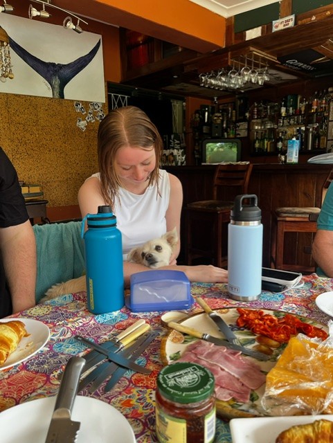
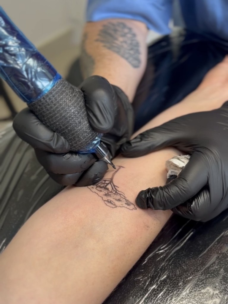
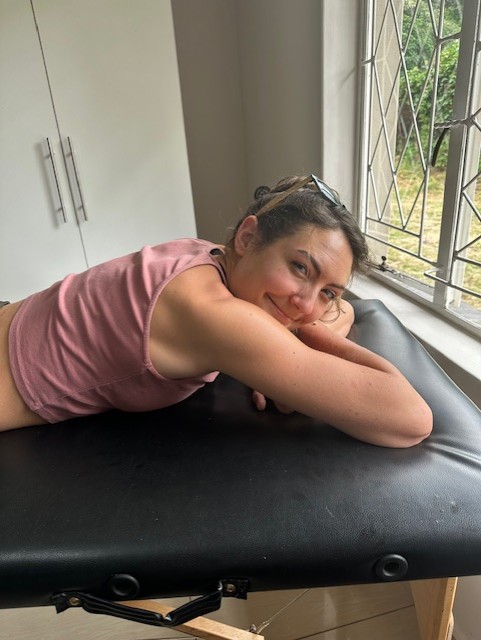
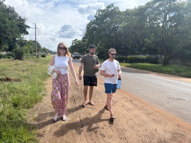
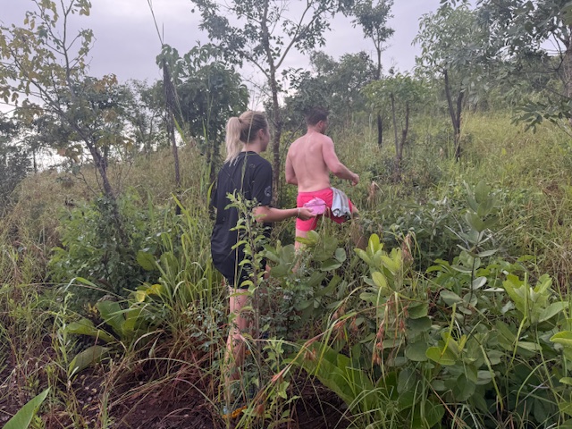
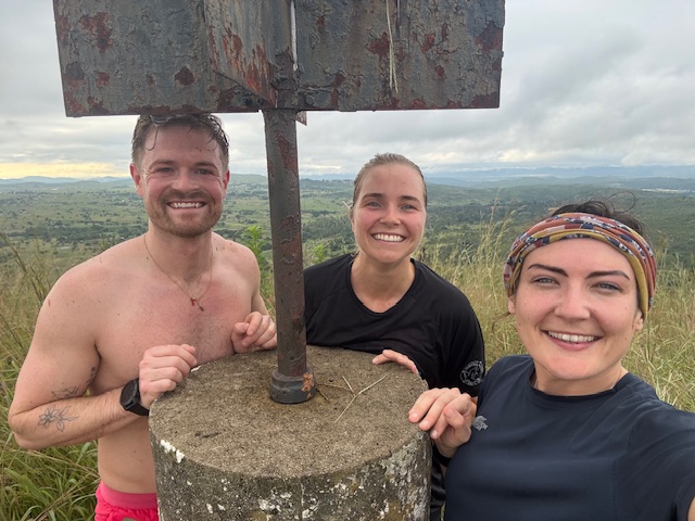
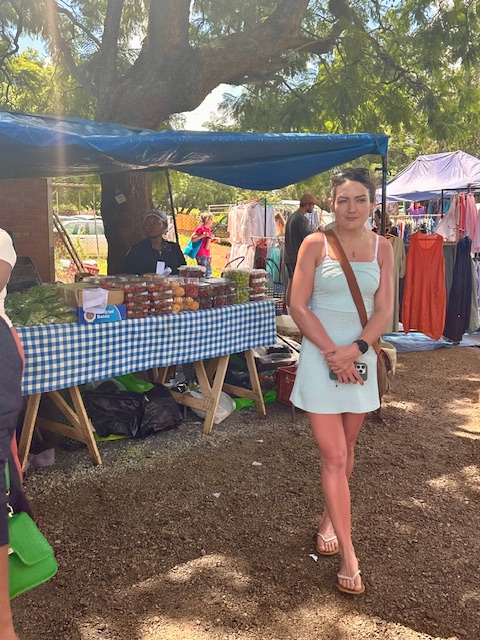
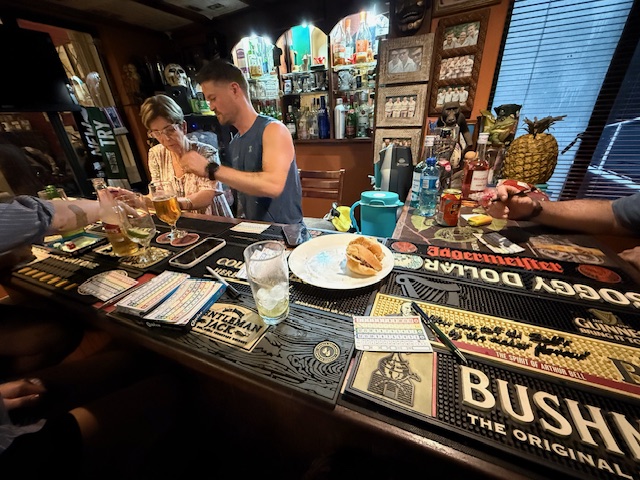
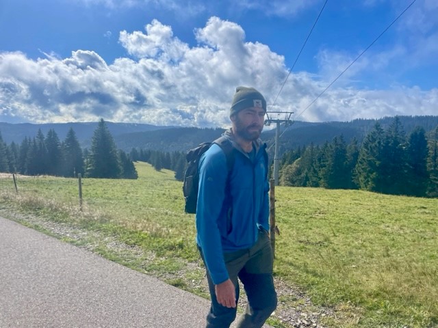
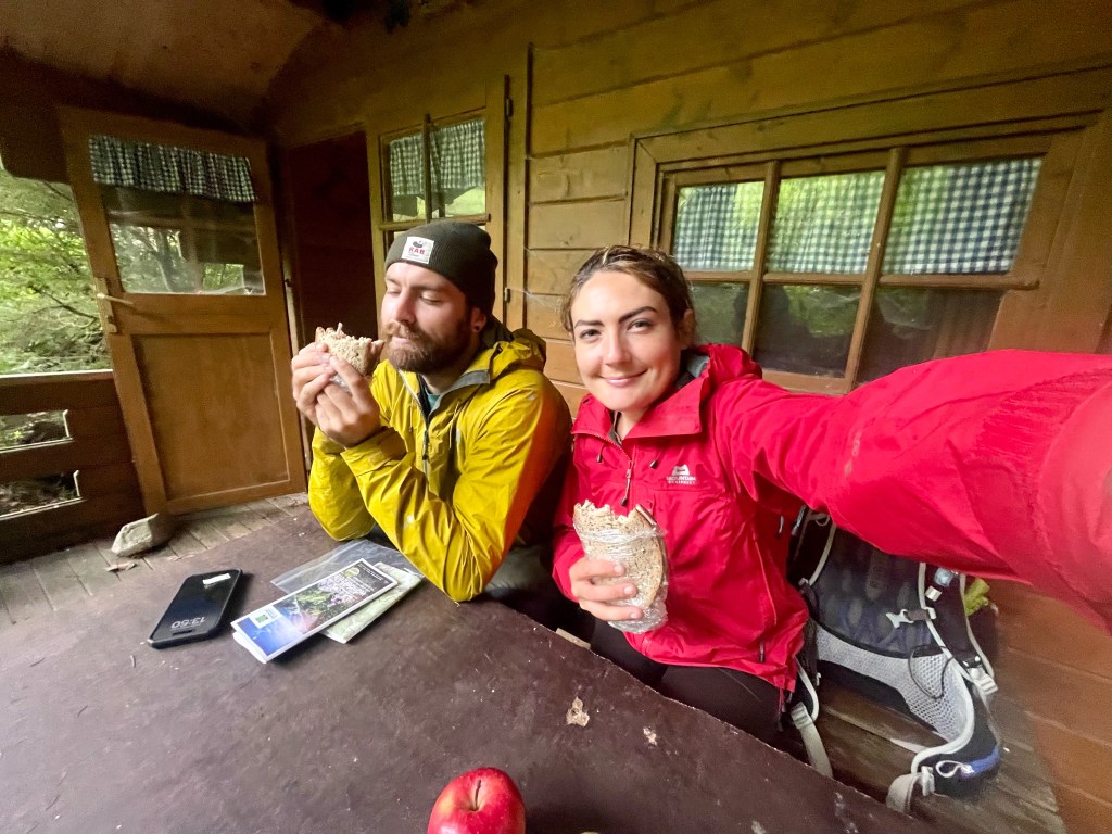
The time had come, a day later than planned, to get tattoos. After a breakfast of ham and cheese croissants I headed out with Reece, Iz, Tilman and Ryan to the artist’s house in a leafy suburb of Harare. Several of Reece’s friends had recommended Kazz and we hoped that there would be time for each of us to get a small, simple piece as a permanent souvenir.
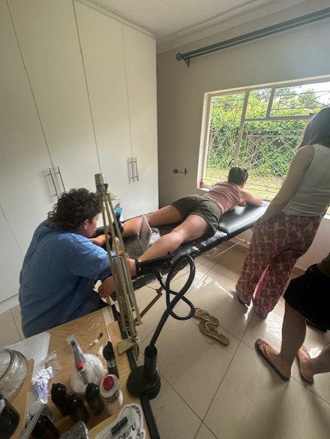
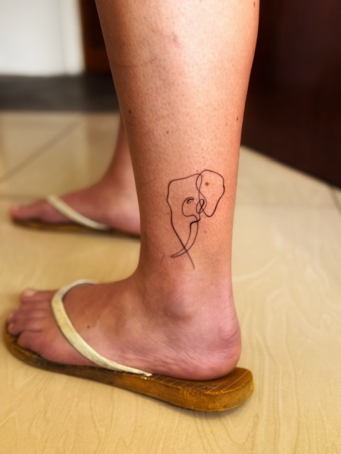
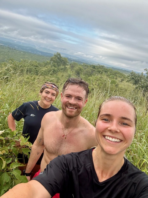
Kazz was tattooed, tousle-haired and very attentive. We talked through ideas and she came up with designs on an iPad while we hung around in her garden, eyeing the exotic-looking plants and huge boulders perched above a swampy green pool (she’d just moved in). She called us back into the studio room and tattooed four of us in turn while the others watched: Iz chose an acacia tree on her forearm, I had Mac the Imire elephant on my ankle, Tilman had an outline of Africa above his elbow and Reece had Nyami Nyami, the Zambezi river god, on his forearm. There wasn’t time for Ryan, but he didn’t mind.
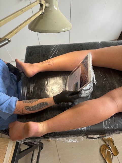
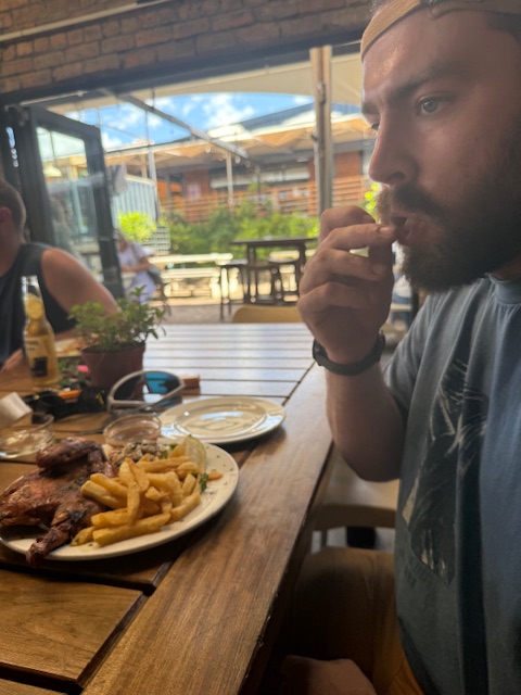
The process took about 3 1/2 hours and I was blown away by Kazz’s artwork. First I showed her my idea, a line drawing of the elephant’s face, which she used to trace over a photo that Iz had taken at Imire. We discussed the size and location, then she printed and cut out a stencil so I could test it. I decided against having it on my foot as planned as she advised that it’d fade quite quickly, so I settled on my outer ankle/calf and lay face-down on the bench, watching birds through the window. It hurt a little, but wasn’t unbearable – just a scratchy feeling, which dulled as I got used to it, and took about half an hour. I was delighted with the result, as were the others, and we left clingfilmed and very happy – I thought my first tattoo well worth $60.
Our joy didn’t last long. It was 2:45pm and we were booked onto a wildlife sanctuary tour on the edge of Harare at 3:30, but we couldn’t leave Kazz’s house in the car as her partner had taken the electric gate fob. She was very apologetic as we climbed over the high garden wall onto the street. After a frantic phone call to Shelley, she and Bryn arranged to come and pick us up with Gus and Dan in tow.
Wild is Life
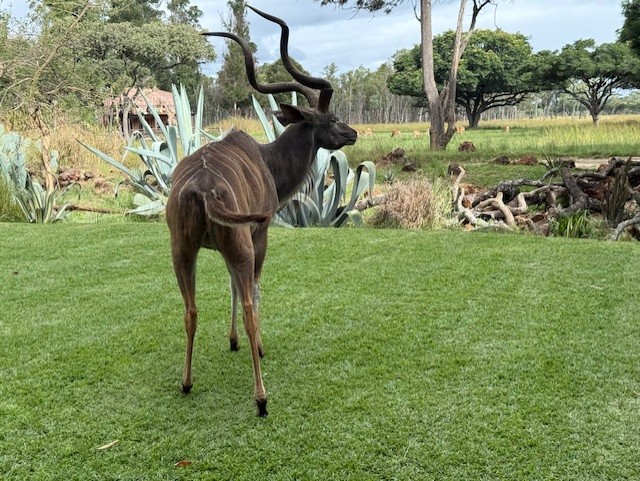
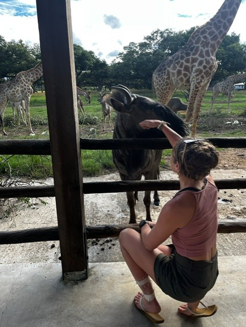
We traipsed along the road in the afternoon heat and were collected after a short walk. The drivers raced across Harare and we arrived at Wild is Life just a couple of minutes late. It was a much fancier setup than I’d expected, and I wondered if Shelley and Bryn had downplayed it so we had a nice surprise. If so, it worked: a path bordered by flowers and succulents led us to an open lawn dotted with trees, thatched buildings and – unexpectedly – an enormous , roaming kudu, which I gave a wide berth. It felt posh, a bit like Imire lodge. By the end of our tour, I understood why tickets cost $100pp.
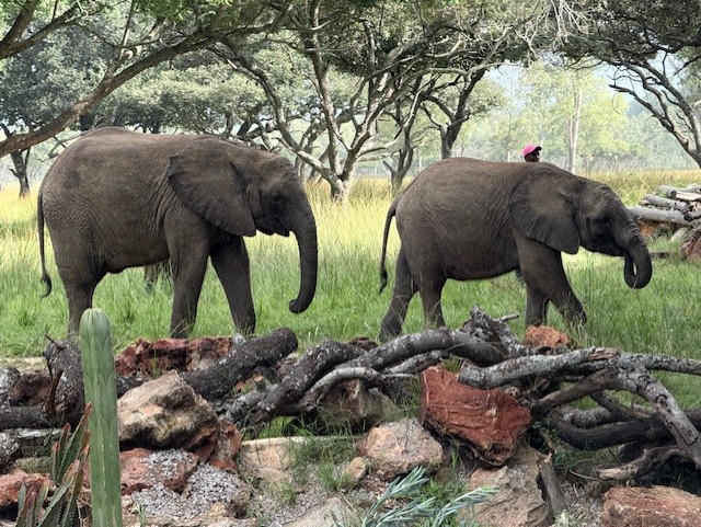
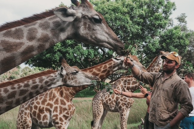
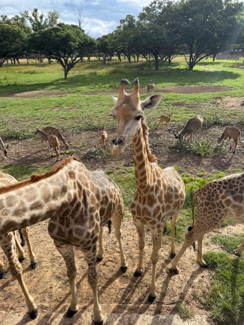
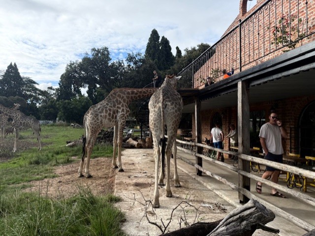
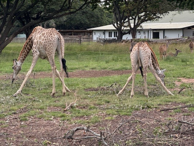
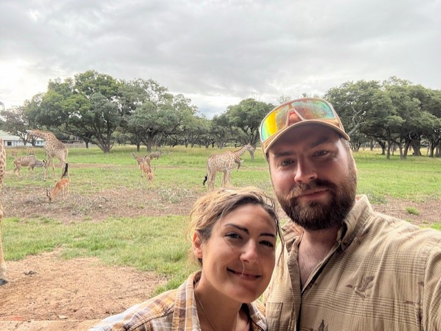
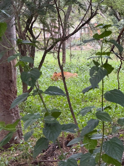
We crossed the lawn and joined a group gathered by a baby elephant, Nina, who was nuzzling her human carer like a needy child. She was captivating. Our guide (Sean) explained how the animals are all orphaned or rescued, and as he spoke I looked beyond Nina to a wide, grassy plain, where giraffes, kudu, wildebeest, deer and a few small elephants roamed and grazed harmoniously. It was a wonderful scene and seemed quite surreal, having just come from the busy streets of Zimbabwe’s capital city.
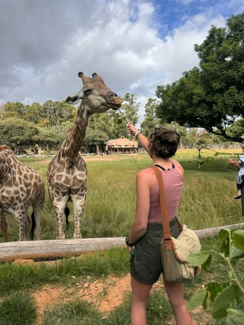
Nina was taken away, trailing behind her carer as she held his hand with her trunk, and we were led up to a raised platform and handed leafy sticks. The giraffes knew the drill and strolled over with their easy, rolling gait. They used their teeth, dextrous lips and long, black tongues to strip the leaves as we held them up, and I was amazed at the strength in their skinny necks – we watched, amused, as a parent quickly retrieved a child dangling from a stick. It was amazing to stand so close to – literally underneath – such strange, elegant, nonchalant creatures.
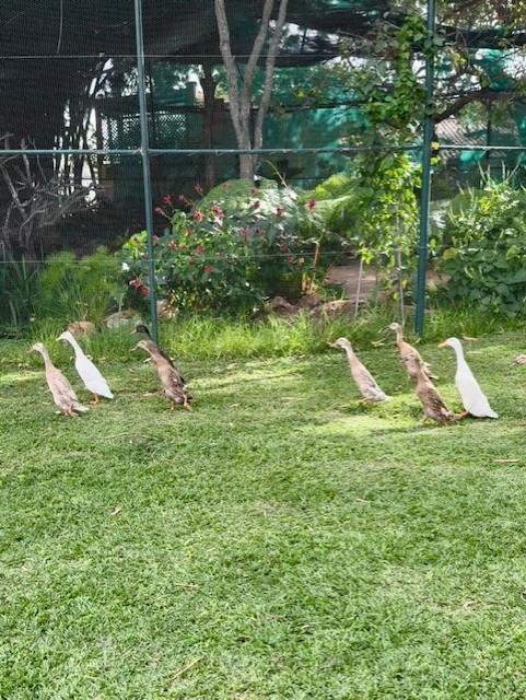
We returned to the lawn and watched the elephants get led away in a line, jostling each other and being reprimanded when they attempted to upend some of the boundary logs that separated the visitor area from the plain. A small flock of runner ducks appeared from nowhere and wheeled past us, to our surprise, and we were ushered on to the next part of the tour.
Afternoon tea
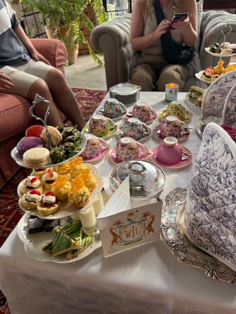
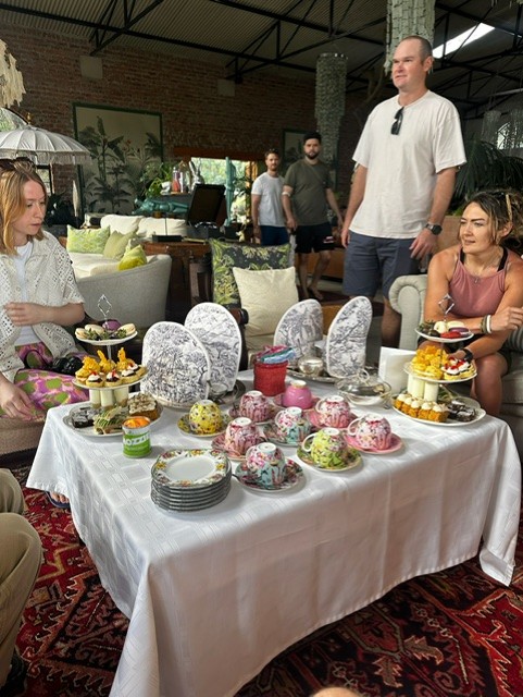
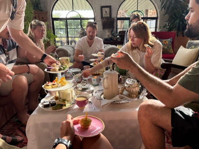
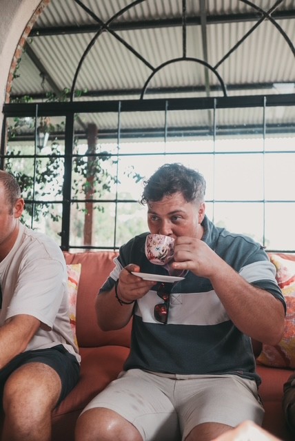
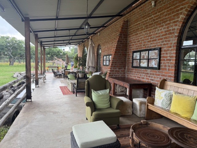
Having not eaten since breakfast, we were delighted to hear it was time for afternoon tea. We walked over to a large, high-ceilinged, warehouse-like building, which we found to be filled with sofas, plants, rugs and random furniture that gave it an eclectic, shabby-chic and oddly stylish feel. Scattered tables were laden with teacups and tiered plates of cakes, sandwiches and scones, and we gladly established our place in a corner to settle down for an indulgent snack.
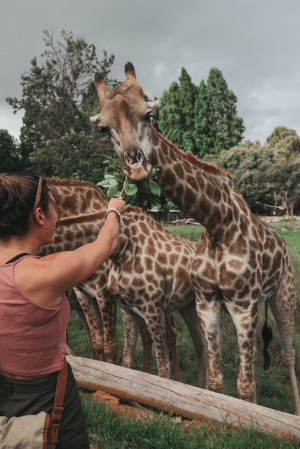
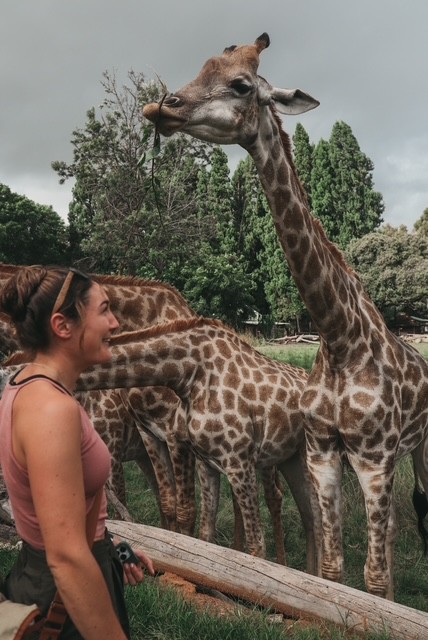
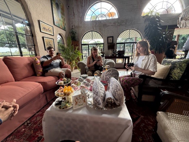
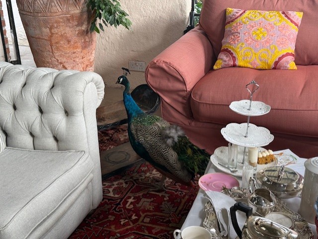
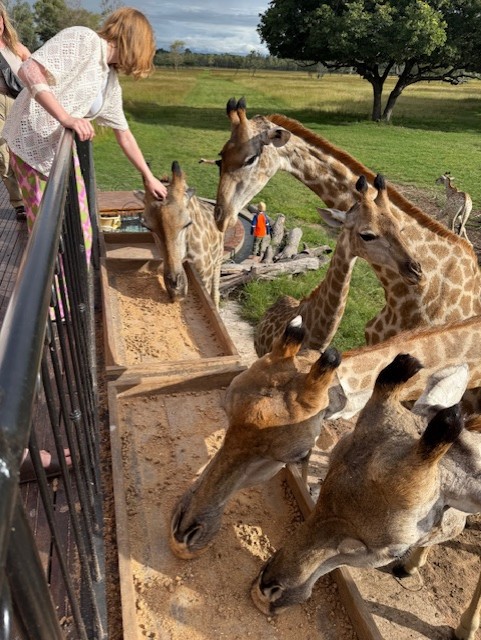
As we ate, a peacock strutted between the sofas, which seemed almost as bizarre as Gus sipping tea from a dainty little cup. We watched the herbivores through large, arched windows, then headed outside to see how close we could get. The grazing area came right up to the building and we leaned over a wooden fence to stroke Noodle, a friendly wildebeest, then climbed a spiral staircase to a balcony to feed handfuls of pellets to the giraffes; some took them more gently than others. Like at Imire, it struck me how several species of large mammal mingled together in one great, patchwork herd, content to share their space and utterly unfazed by their disparate neighbours.
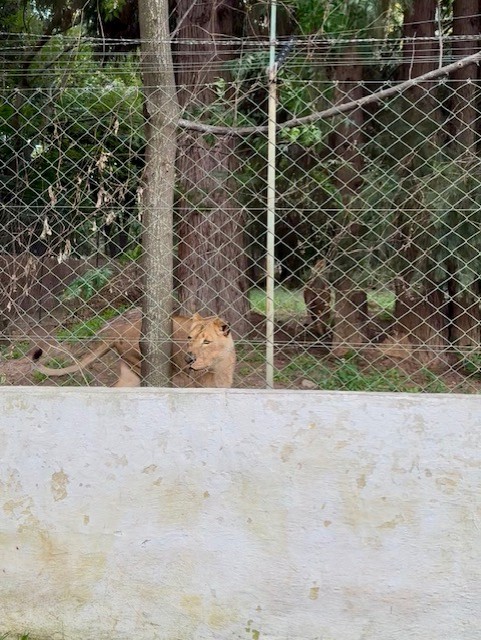
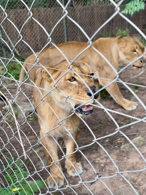
Lions
After tea we were led behind the building to a wooded area. A deep purr betrayed the next part of the tour before we arrived at the enclosure. It was a thrilling, chilling sound that I felt as much as heard – a resonating, bass rumble that penetrated the air as if it were surrounding us. Two female lions – Savannah and Lucy – greeted us expectantly, purring and prowling along a high wire fence just a few feet away, lean muscles rippling through their sand-coloured coats as they observed us with a cool, black-rimmed, golden gaze. The guide threw them a couple of slabs of horse meat, which they plucked up before withdrawing into the trees. It was the closest I’d seen lions and I was struck by their size and composure – they were equal parts graceful and powerful, and they made me feel quite puny.
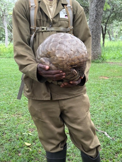
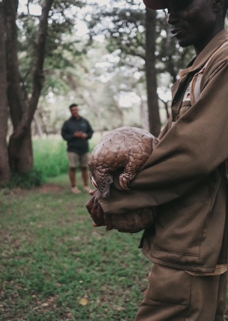
Pangolin
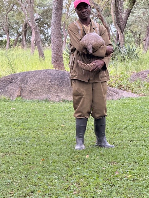
My disdain for the human race deepened during the next part of the tour. After a short walk from the lion enclosure, the group spread out along a large, semicircular bench in front of a man holding Marimba, aged 20, one of the world’s oldest known pangolins. Sean explained how this bizarre, armoured mammal is an elusive but highly sought-after target for poachers and traffickers, who profit from their meat and scales. These are made of the same keratin as our hair and nails but are believed in some cultures to have medicinal properties. Marimba is constantly accompanied during daylight hours by her carer, who cycles round with her in search of ants, and sleeps in a secret location unknown to almost all the staff. He might have the best job ever.
She was shown around the group at a distance, as pangolins are susceptible to human diseases, then released for a wander. She unballed herself and pottered along the ground on her two hind legs, leaning forward with her curved, blunt-clawed “hands” crossed in front of her, her long, heavy tail acting as a counter-weight. She was bigger than I’d expected, very cute, very slow, and – apart from her scales – heartbreakingly defenceless. We all fell in love with her immediately.
Hyenas
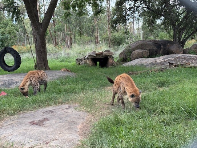
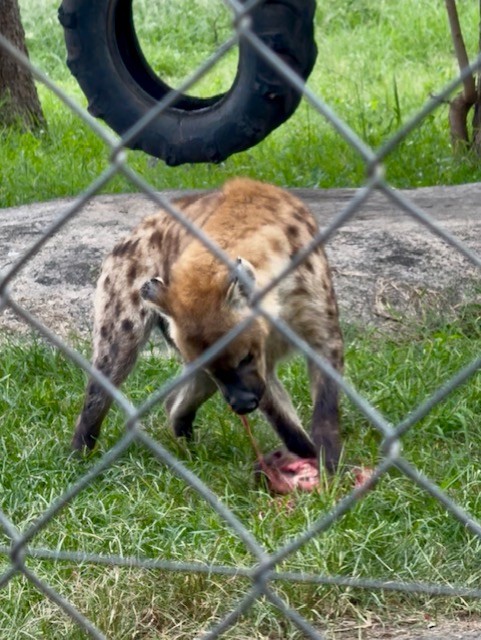
Next up, by way of contrast, were the spotted hyenas, which lurked in a wire enclosure just across from Marimba’s arena. Athena and Harry were each tearing into roughly hewn sections of meat, and we watched with grim fascination as their wide jaws – the most powerful in proportion to their size of any mammal – crunched effortlessly through bone and muscle. Harry rolled playfully around with his dinner while Athena dismembered a whole horse head, its toothed lower jaw dangling by a sinew.
Unlike the lions, I thought their beauty subjective: they looked like dogs that had been genetically modified, with huge, bear-like heads, close-set eyes, rounded ears, sloping backs and bow legs. Despite their appearance and their indiscriminate butchery, I found them oddly endearing – their tails wagged excitedly as they chomped and the guide explained that they’d been rescued as pups from a botched trafficking attempt at Harare airport.
More posh food
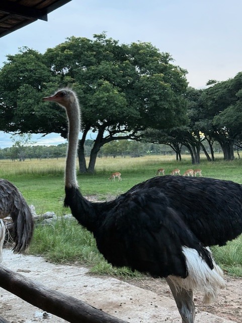
We made our way back to the big, central building, which was a relief as a throng of midges had descended on us as we watched the hyenas. We sat on a long table by an outdoor bar and made the most of that installation – I enjoyed a sparkling rose and discovered a love for baileys-like amarula in quite close succession. It was surreal to sit and relax so close to the herd of herbivores, which had been joined by a few ostriches, separated from us only by a boundary made of logs.
I wandered over to see an ostrich and was warned off getting too close by Sean, who explained that they’re powerful, spiteful animals that peck things for no good reason beyond being able to reach them. This was evidenced by a half-gouged tabletop, accessible to their beaks – which were slightly downturned at the corners, giving them a look of constant irritation – by virtue of long legs and necks. I eyed the bird warily and went off to stroke Noodle, who was much more accommodating.
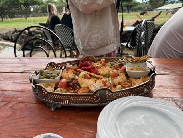
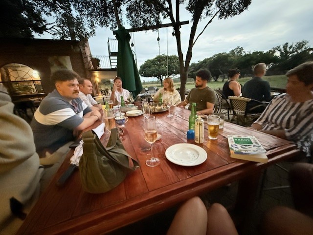
Back at the table, a waitress came over with a large tray of canapes. The nine of us enjoyed filo pastries, smoked salmon, olives, cheesesticks, little quiches and other bite-sized snacks I couldn’t name, accompanied by a constant supply of drinks. We sat and talked under the trees as we watched the herd grazing contentedly, and I wondered if my life had peaked.
Evening
We left around 7pm, reluctantly, and headed back to the house in preparation for an early start to drive to Lake Kariba, where we’d be staying on a houseboat for the next few days. Once packed, we spent the evening checking our tattoos and discussing the merits of each animal at Wild is Life – and so ended another memorable day in Zimbabwe.
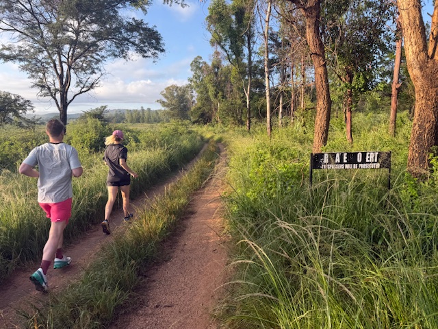
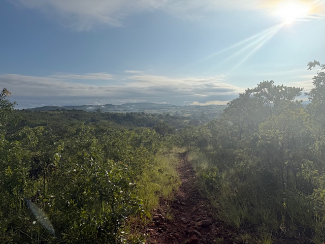
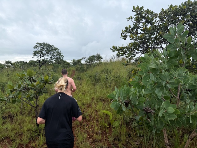
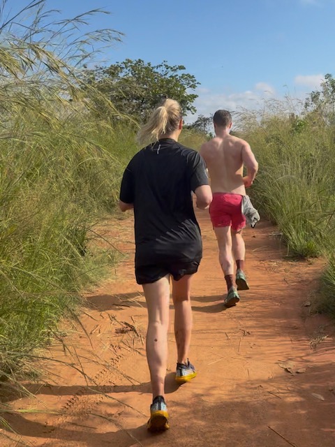
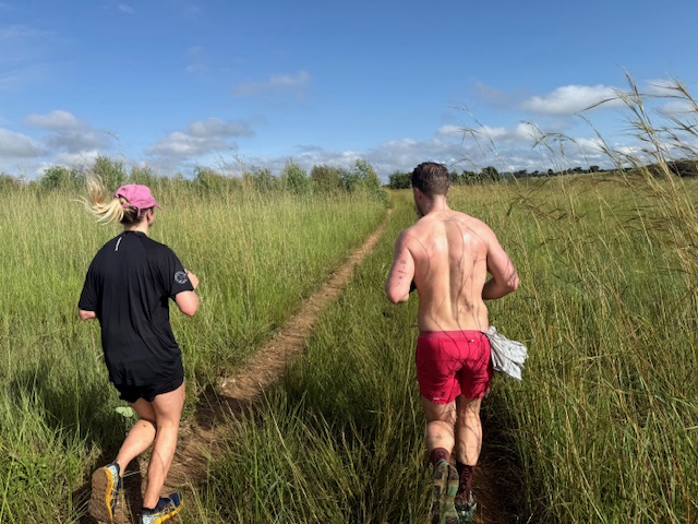
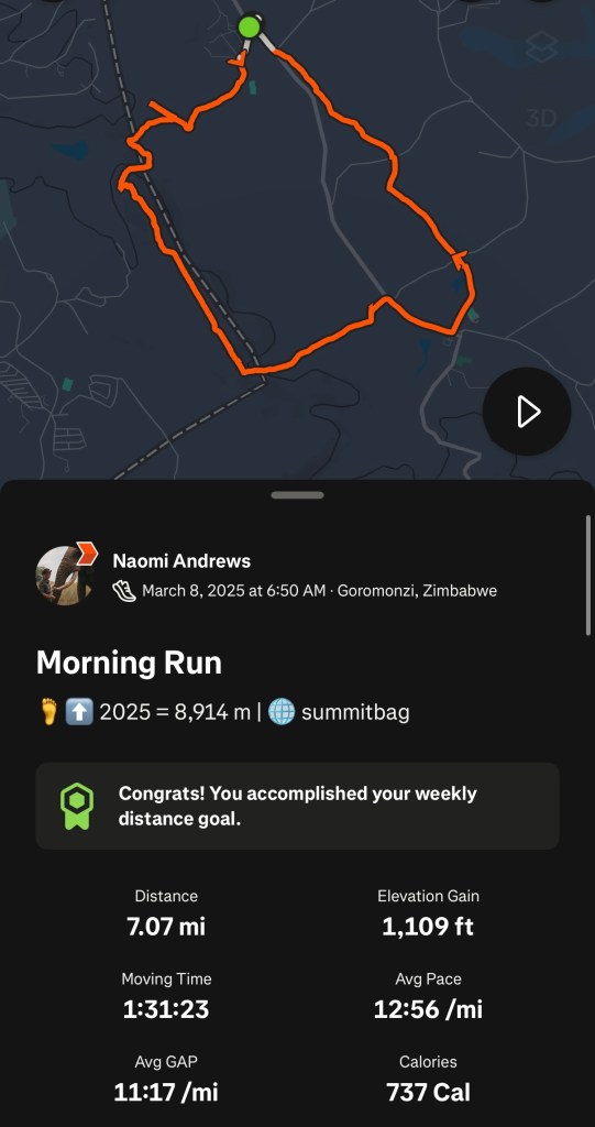
Once again, Reece and I were up early to run before the day’s heat kicked in. His lovely friend Emma picked us up at 6:30 and drove us to a leafy car park 20 minutes from the house. We were heading into the Shawasha Hills, a rural area on the northeastern edge of Harare, to complete an 11km off-road loop.
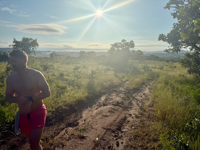
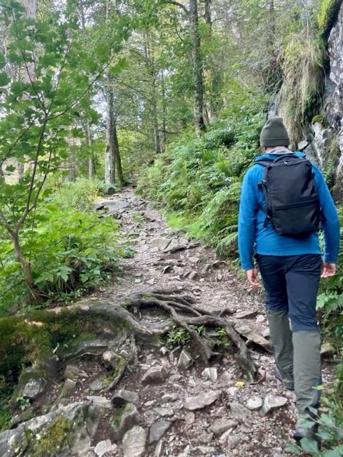
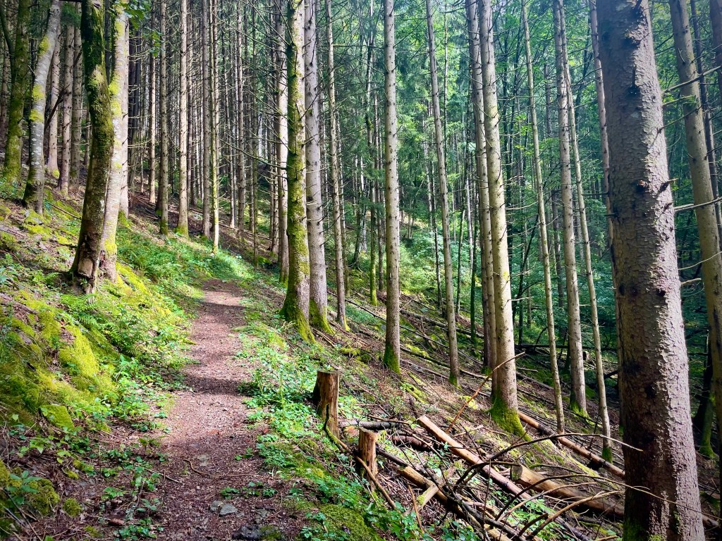
We set off on a dirt track and were soon heading up a steady incline. I really noticed the thin air despite the relatively easy pace. Thankfully the stony trail and unfamiliar scenery, which consisted of distant ridges and diverse hillside shrubs, grasses and trees, kept me occupied. Being the FT (T meaning tourist) I stayed at the back, having decided that I was most expendable in the event of some kind of chase. Although slightly conscious of the numerous snakes, spiders, scorpions and other perilous wildlife I’d read about, I was heartened by the others’ lack of concern.
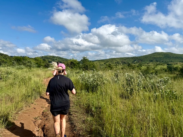
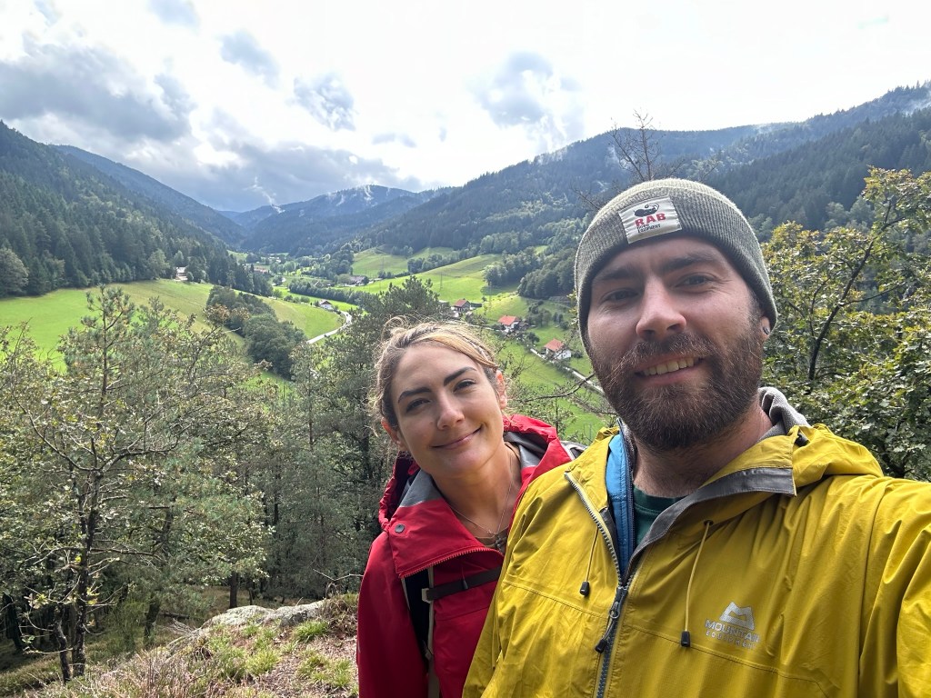
We backtracked once after missing a turn, then the narrow path became almost obscured by thick bush. We hacked our way up, down and back up rough slopes at a slow jog while spines, thorns and seeds did their best to ravage our limbs. We failed to find another overgrown turn and bushwhacked our way, slowly and as the crow flies, up the second hill to a trig point, where we stopped to take in the view. A great patchwork of grassland, trees and maize fields sprawled across a low plain to the east, backed by undulating, bluish silhouettes of layered ridges. The view west was less aesthetic – a huge, terraced mine, presumably gold, had been carved into the hillside like a great, industrial scar. I turned my back to it and, as I had at Domboshava the evening before, drank in the vastness of the landscape.
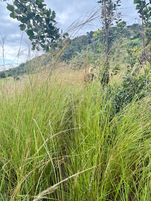
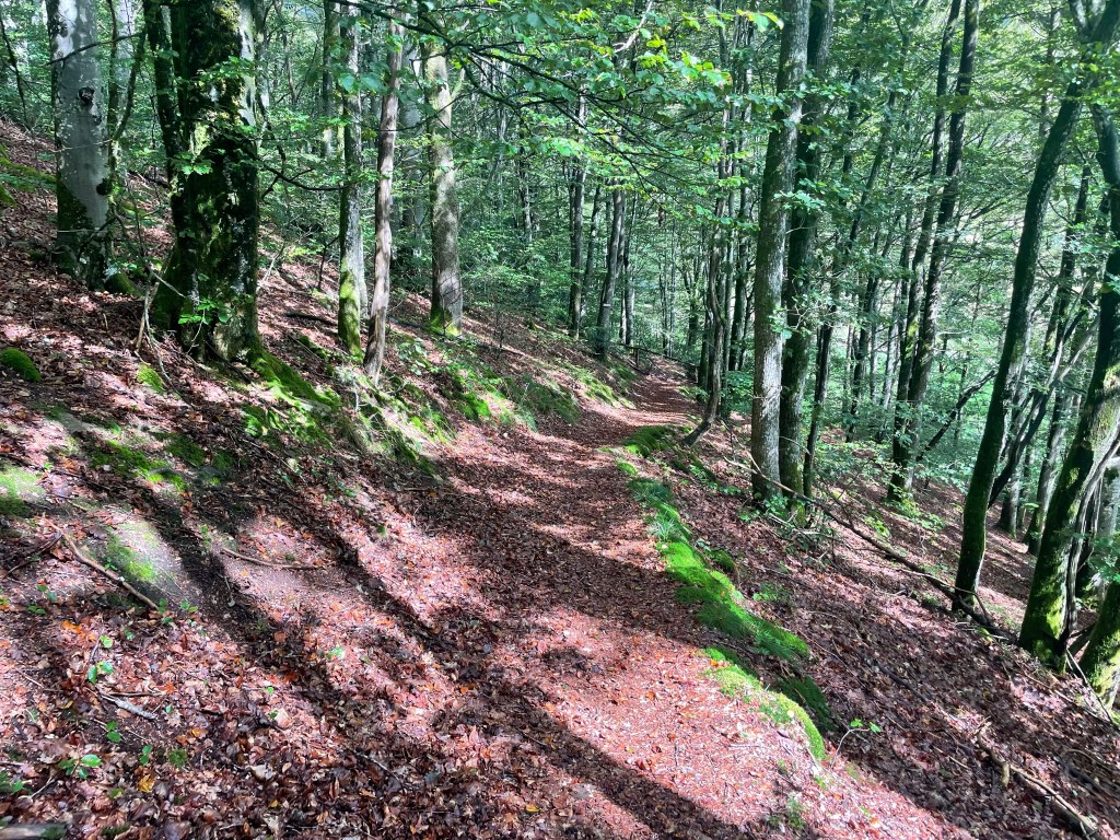
We found a narrow path and continued down the south side of the hill, through more bush and down some steep sections made slippery by clayey soil. At the bottom we came to a marsh and waded through ankle deep muddy water, our view obscured by taller-than-head-high grass. We emerged grinning, feet sodden, and picked up the pace along a track that cleaved a straight course between the swathes of endless grass, stopping briefly to watch a long-tailed widowbird (I think) land on a tall reed, its disproportionately long tail swooping elegantly after its little black body.
SwampA not-so-great photo of the widowbird – if only Iz were there…
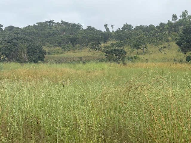
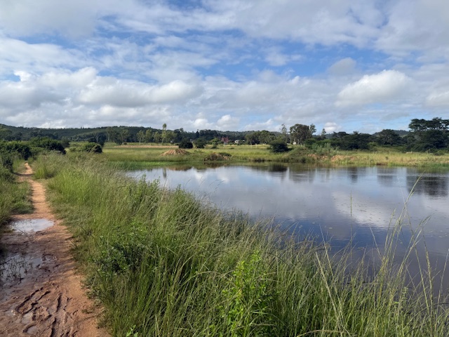
The rest of the route was relatively flat and straightforward, apart from the sudden appearance of a stray dog from the grass (they can be aggressive) and a small river crossing. We passed a glassy lake that captured blue sky and fluffy, white clouds in a perfect reflection, and returned friendly “hellos” to occasional pedestrians. I wondered where they’d come from and where they were going, until I realised that little rustic buildings were dotted amid the grasses down subtle, red dirt paths. Given the hindrance of the earlier terrain, it was a relief to regain some time in the last few miles, although I struggled noticeably more than usual in the heat and altitude.
Blister prevention
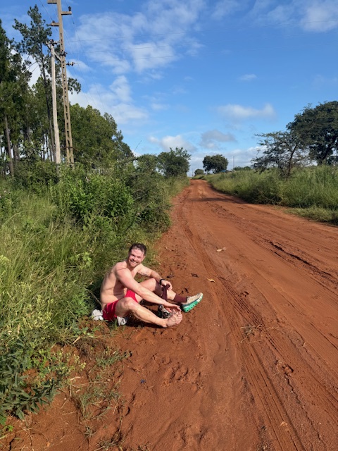
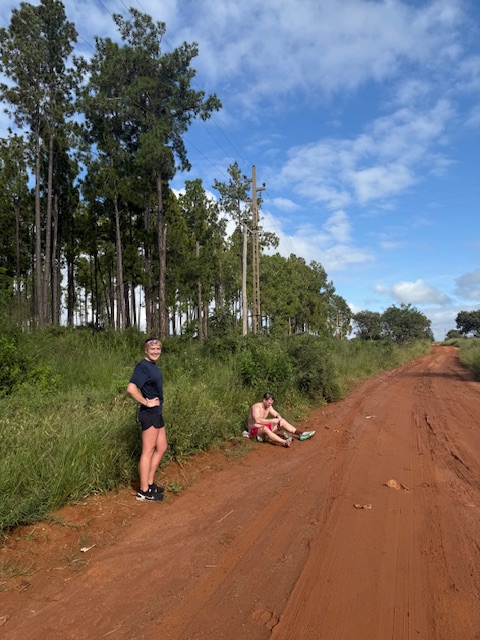
We got back to Emma’s car covered in scratches and grass seeds, which stuck securely to our tacky skin. We picked up a couple of hitchhikers on the potholey road, dropped them at a garage at the edge of Harare and returned to the house. Emma left to rush to a christening and Reece and I took a much-needed shower. On reflection, I gave the run 10/10 for scenery, varied terrain and excitement.
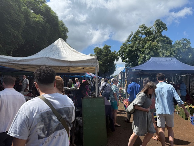
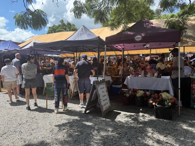
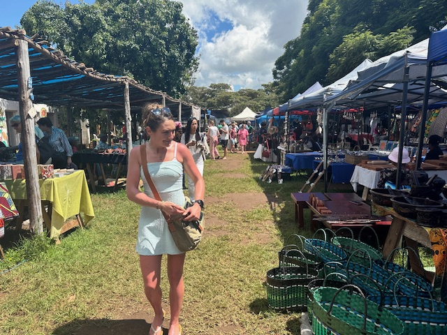
Local market: snacks & a bushbaby
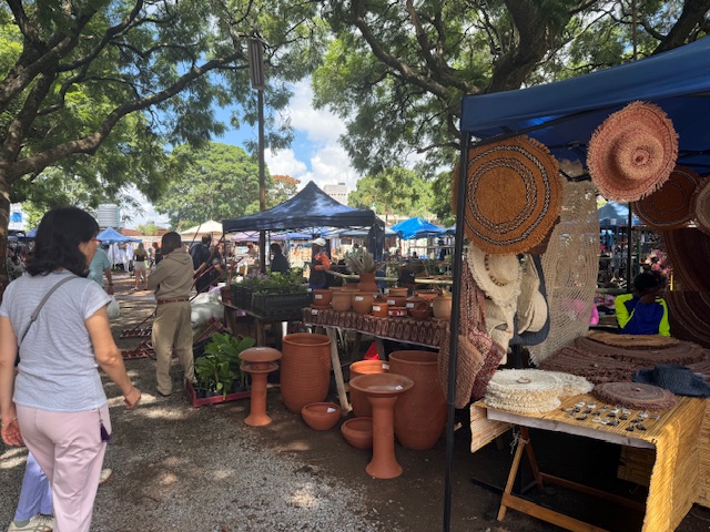
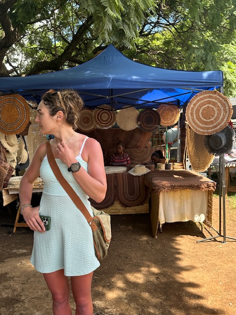
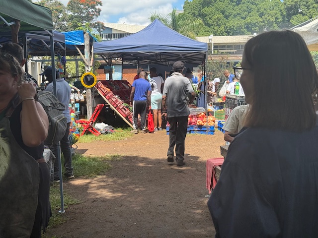
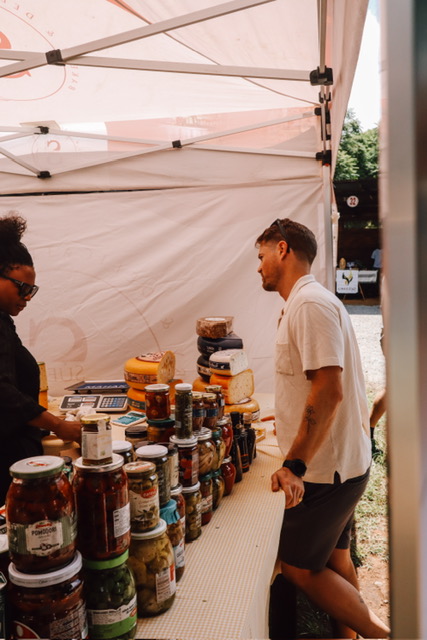
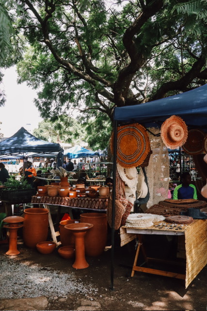
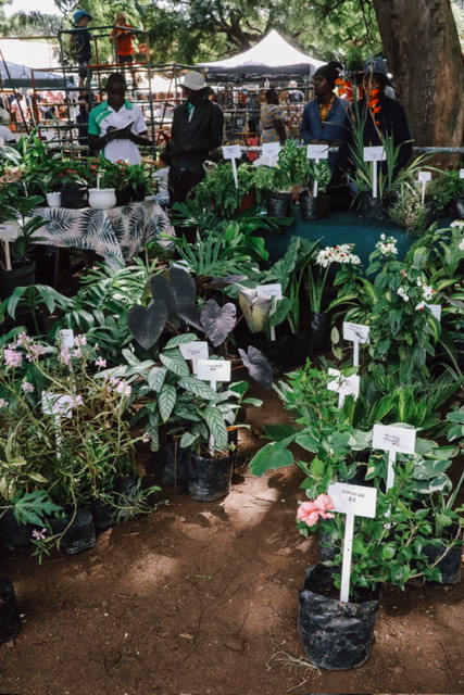
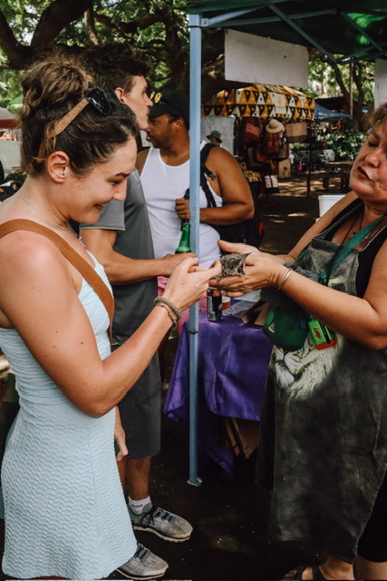
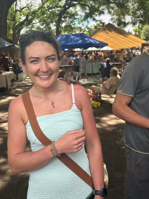
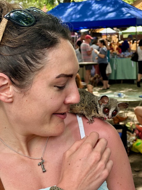
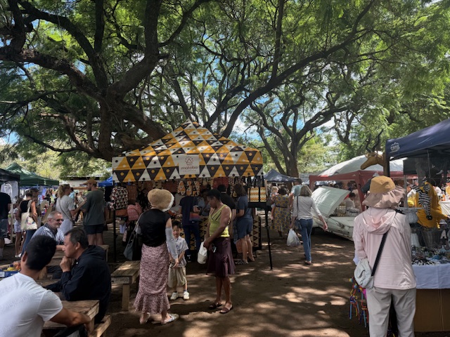
After a quick coffee, Reece, Iz, Tilman, Ryan and I hopped into the car and went off to Old Stables, the local Saturday morning market. Tens of gazebos filled a walled square, shaded by a handful of big trees with fern-like leaves. It was like an exotic version of an English farmer’s market, with stalls selling fruit, flowers, baskets, pottery, plants, clothes and hot food. We circumnavigated half of the busy square, pausing for Reece to buy (and try) cheese, then returned to the hot food area near the entrance.
The cheese connoisseur
While perusing the food stalls, we spotted a lady wearing a tiny bushbaby on her shoulder. Not wanting to accost her, we watched from a distance as she let someone pet it, but I took a small step in for a closer look and she started telling me – quite enthusiastically – all about its rescue from a bushfire and the carnage that can stem from cigarettes and barbecues. I returned her enthusiasm and before I knew it – to my delight – the bushbaby was on my shoulder, its enormous, conker-brown eyes shining like lamps. After a moment it sprang back to her in a surprising burst of propulsion and I thanked her profusely. Afterwards, Reece took great pleasure in telling me how they wee on their fingers to help them stick.
Elated
We whizzed round the other half of the market, stopping to buy fridge magnets and peaches, then shared some delicious chicken and pork gyozas at a shady table in the middle. Satisfied with our purchases, we went back to the house and spent a couple of hours cooling down at the bar (which always involved darts, dix-mille – a dice game – and a lot of laughing) while Shelley prepared food for the evening’s much-anticipated family party. As usual, I spent a while scouring the garden for wildlife.
Ryan’s “light snack”Bitey CharlieTilman eyeing up the spread
Airportrun for Gus & Dan
The five of us set off around 3pm to pick up Gus and Dan, the final British arrivals, from the airport. On the way there we got caught in a deluge like we’d never seen. Rain hammered relentlessly at the windows in a loud, angry torrent and quick, brown rivers coalesced from nowhere at the edges of the roads. It was pleasingly dramatic, and thankfully only held us up by a few minutes.
Iz didn’t mind the rain
We sat in the airport bar and watched, bemused, as tens of people gathered at the window overlooking the runway. Something happened and they erupted in jubilant uproar. We assumed that a long-delayed plane had finally arrived, or perhaps a football team, but – on asking a barman – Reece confirmed that the event was nothing more than the landing of a common-or-garden Kenyan Airlines plane. The excitement was short-lived and the crowd quickly dissipated as we sat and drank our beers, baffled.
Shortly afterwards we spotted Gus and Dan from above, negotiating their way through passport control. Dan clearly did a better job of this as she sailed through and collected their luggage, while Gus stood for a suspiciously long time at the kiosk, at one point – to our concern – slapping his hand down on the desk. Thankfully they were both allowed into the country and we met them with joy, delighted to have finally assembled the fellowship.
The rain had completely cleared on our journey back to the house, as if nothing had ever happened. Gus and Dan were shown to their room, then – as family had already started arriving – thrown headfirst into the party.
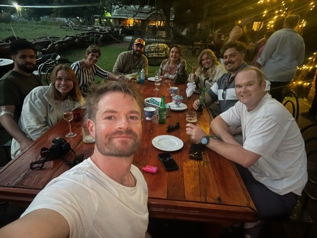
The Party
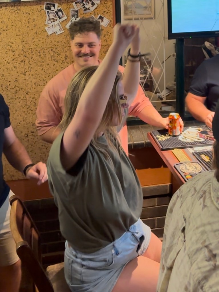
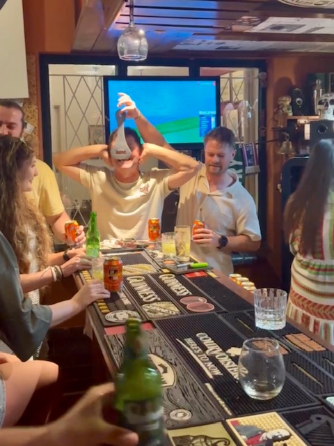
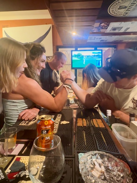
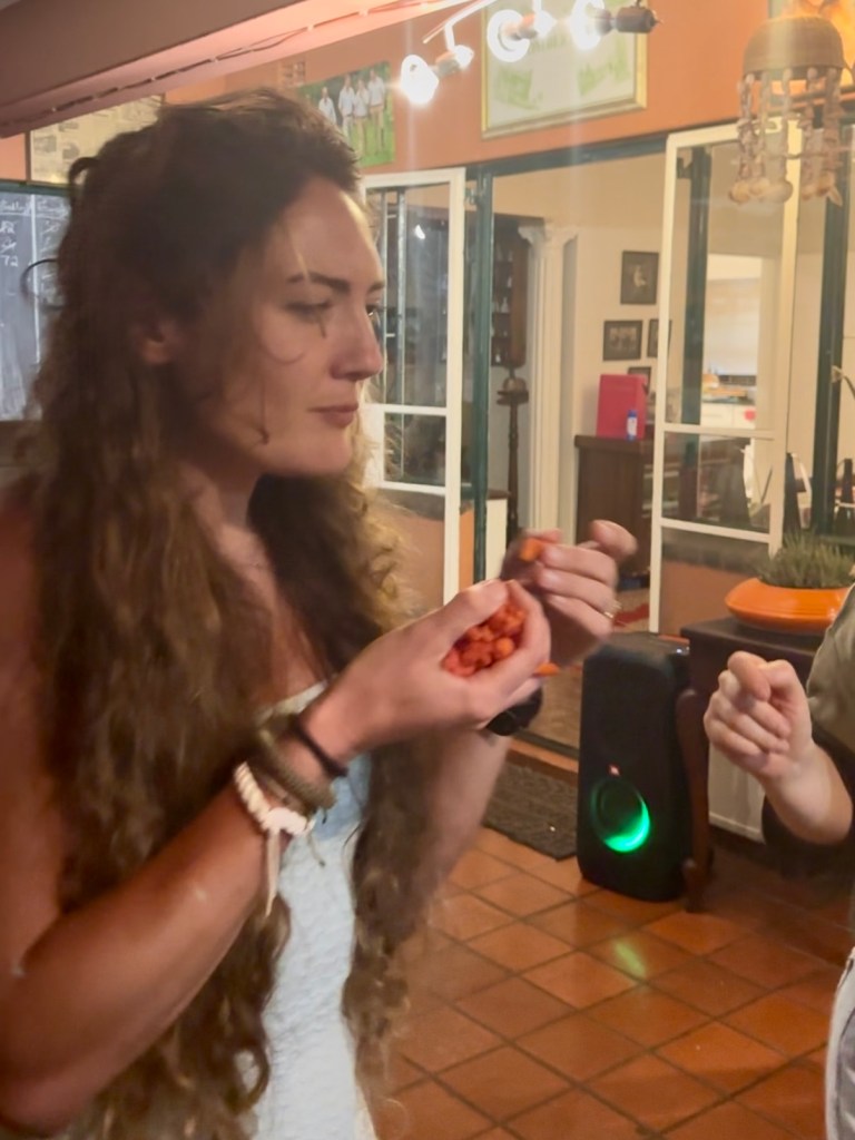
I won’t and can’t recall much of the party that evening, but can share that everyone had a really great time. I’ll list a few highlights, instead: meeting a lot of very lovely people, Shelley’s stellar table spread, Paul’s diligent bartending, at least five dogs, Gus and Dan diving into the pool (fully clothed), Dan dancing on a stool (sunglasses on), darts, Ryan with Uncle Kieran on his shoulders, arm wrestling Kieran (who didn’t win) and Luca (who would have if he’d tried), dancing with a clawful of Cheeky Chilli crisps, Bryn and Kieran’s Birkenstock cheek-slap contest and an awful lot more dancing to DJ Shelley’s excellent music.
The claw
My lesson of the day: Zimbabwe is the best kind of wild.
Having just emerged from an English winter full of cold, dark mornings, it was blissful to wake up to warm air and bright sunshine. Reece and I set off on a run around the block at 8am, before the heat of the day set in. Harare sits on a plateau at an elevation of 1,500m above sea level and – as Reece had warned – 6km felt a lot harder than usual (particularly the long, steady hills) due to the lower air pressure and warm temperature.
I enjoyed the run regardless, which was mostly on the road except for the occasional dirt “pavement”. We passed lots of leafy, walled gardens filled with trees, people going about their mornings, a couple of schools and a few rickety-looking market stalls. At one point a lanky teenage boy started running after us and I gripped my phone a bit tighter until Reece turned, unperturbed, and complimented his pace. At this, he sprinted off ahead – his feet barely touching the ground – before returning to his friends. That was a bit weird.
Errands
We returned to the house, puffing, and took brief respite in the pool. After a breakfast of croissants with ham and cheese, the six “kids” – Reece, Bryn, Ryan, Isabelle, Tilman and myself – drove 20 minutes to Kieran’s house, which is set in a fancy-looking golf estate with its own security guards, to collect his people carrier. We met Kieran’s lovely wife Trish, had a quick look around the garden – which backs onto the fairway and reportedly receives the occasional golf ball (and cobra in the pool) – and continued on errands.
We stopped at a petrol station (full service) to get fuel, then went to a pharmacy to consider a course of malaria tablets. Shelley had done the right thing and advised us to take them, with the caveat that if we didn’t then we could take antibiotics home just in case, and on learning that they’d set us back $60 each – and might make us feel rough – I decided against it. We bought coffee from a little cart instead.
After a quick detour to drop off a deposit for tattoos, we returned to the house and chilled for a couple of hours. I chatted to Iz by the pool while the boys wound each other up playing darts until lunchtime, when we all headed out to Tin Roof, the local bar/bistro that Reece used to manage.
Tin Roof
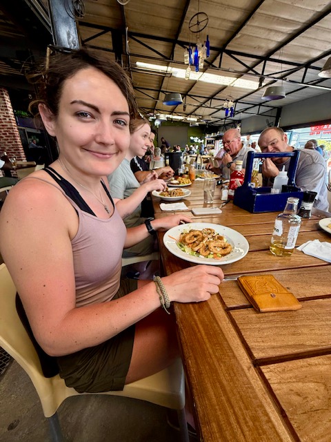
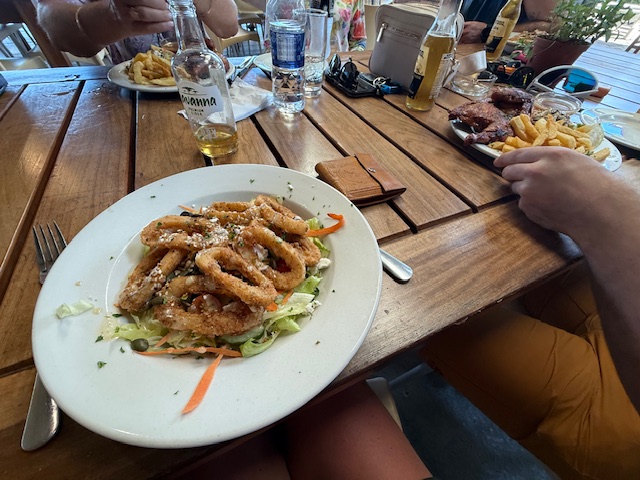
Set in a small shopping park, we found Tin Roof to be a lively place with an open-sided, indoor-outdoor feel, cheap drinks and a great menu. We sat at a long table and tried to keep up with the introductions – Reece’s family seemed to know just about everyone in there. Between us, Ryan and I had a calamari salad and a half chicken with chips, both of which were very good. An ice bucket of beers kept thirst at bay.
Venturing outside Harare
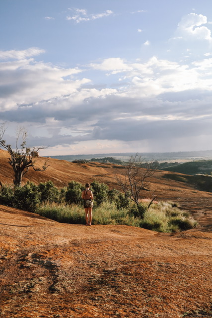
We got back to the house about 4pm to fill a coolbox, then headed straight out for an easy hike and “sundowners” – drinks and a sunset – at a place called Domboshava. Reece conducted the 40-minute drive, which took us north out of rush-hour Harare and provided our first experience of more rural Zimbabwe.
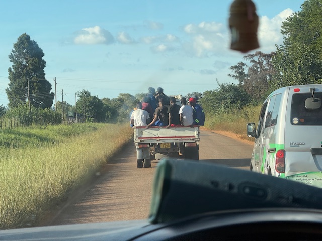
We passed a few farms and a lot of barren-looking scrubland, then came to a shabby-looking village where numerous huts made of just about every material under the sun – wood, chipboard, corrugated metal, tyres, cloth and cardboard – seemed to merge into one another. A boundary was formed between the potholed road and small maize fields by plonked cars, trucks and a ditch completely filled with black sacks and plastic rubbish – Reece explained that public bin services were non-existent. People milled around everywhere and we soon found ourselves behind a pickup truck rammed with a dozen haphazard-looking passengers.
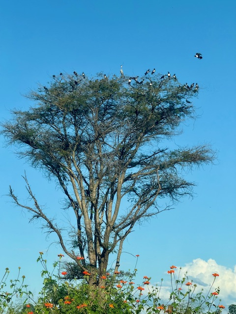
Forgot the gate key…Tree full of pied crows
After more potholes, fields, assorted settlements, scrub and the occasional smart-looking bungalow, we turned onto an even bouncier dirt track and soon arrived at a small car park. We each paid the $10 tourist fee for entry to Domboshava and set off on our walk.
Domboshava hike and sunset
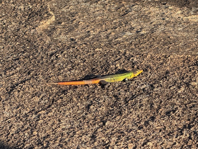
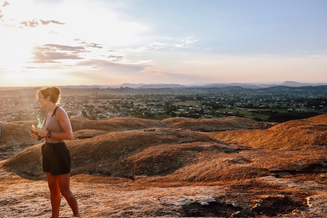
Domboshava is an area of granite hills that features caves, unusual rock formations and ancient paintings. The landscape was unlike any I’d seen before: a great, rolling mass of bare, grey-pink rock rose up ahead like the back of a great, sleeping beast, punctuated by occasional fine cracks, thin streams and inexplicable pockets of greenery. We followed painted arrows up the side of the hill, stopping to watch colourful lizards that basked in the sinking sun and darted away as we approached, their legs wheeling comically in a quick, circular motion.
Some lizards……are better camouflaged than others
Barefoot and new to Zimbabwe, I remained conscious – to Reece’s amusement, I think – of the snakes I’d read about, whose venom can kill or maim in diverse and unpleasant ways. However, this fear was overridden by my fascination with the vegetation that somehow took hold in the seemingly soil-less granite, which ranged from patches of yellowish grass to thickets of shrub and swathes of verdant trees. In the “wild” for the first time, I was in my element.
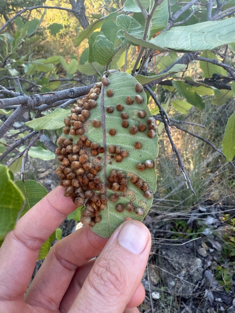
Some kind of parasite/fungus/spawn
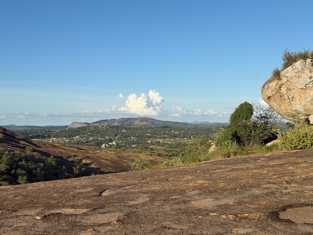
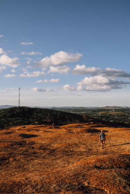
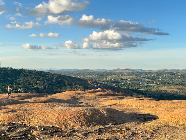
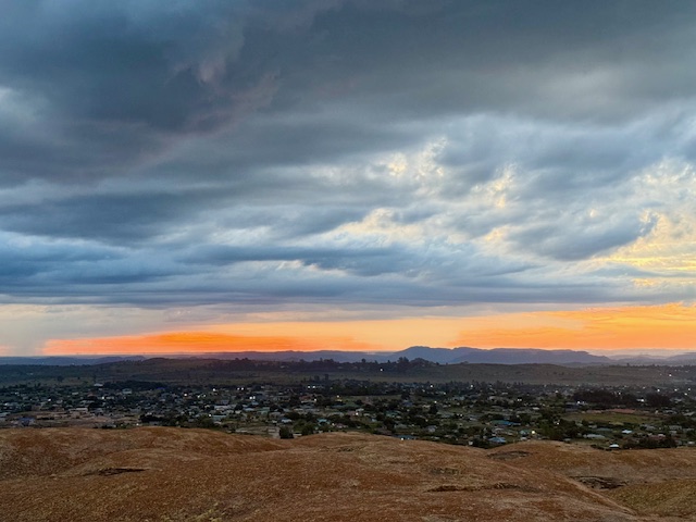
As we gained the rounded crest of the ridge, the greenery receded. A low sun cast exaggerated shadows across the rolling undulations ahead and illuminated the thin layer of yellow-orange lichen that covered the rock, such that the land appeared to glow copper-gold. This, combined with the ominous, blue-grey sky on the horizon, gave the other-worldly impression that the normal order of light – bright above, dark below – had inverted. We could have been walking on Mars.
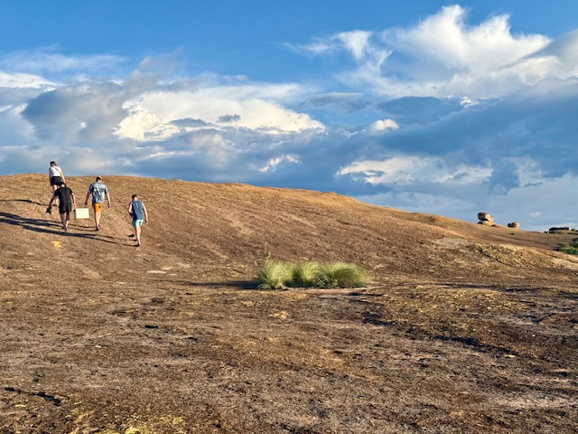
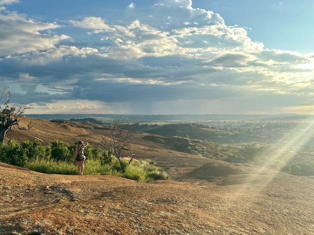
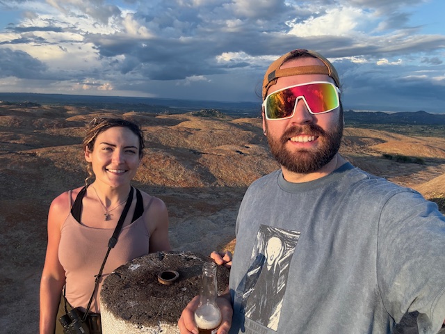
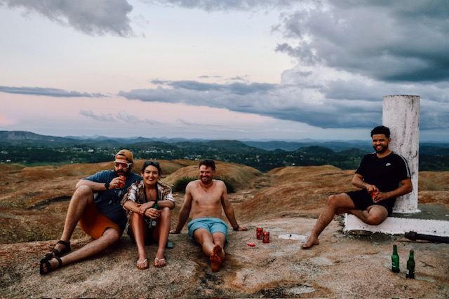
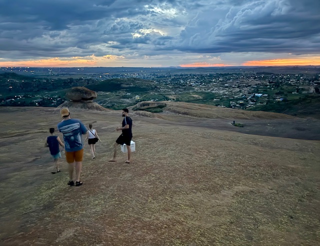
We followed the wide, humpy ridge all the way to the summit, which was marked by a round trig point. The view was spectacular: a 360 degree panorama of surrounding hills arranged in long, layered ridges, separated by wide, flat-bottomed valleys filled with fields, plains, forests and scattered villages. The sky above was clear and blue, with occasional fluffy white clouds drifting above the horizon, and we could hear some happy Friday evening clamour coming from indistinct parts of the basin below. We cracked the beers and I wandered alone across the strangely undulating plateau, drinking in every detail and looking for bugs, while the others sat and watched the sun as it fell towards the westerly hills.
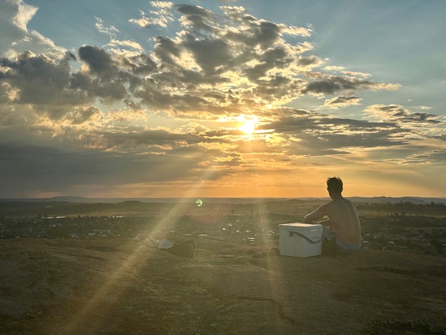
Dark clouds crept towards us from the south and east in long, thick fingers and I returned to the others just in time to see the sun setting beneath a foreboding, grey veil. It sunk behind the horizon through a clear, lava-red stretch of sky, which faded at the edges to a perfect watercolour of orange, pink and yellow that accentuated the hazy blue silhouettes of distant peaks. As the soft breeze picked up, we looked east to thick columns of localised rain and flashes of lightning and decided that it was time for tea.
We descended the side of the hill via a couple of huge boulders balanced extraordinarily on natural plinths, connected by a very small surface area. They looked like abstract, unlikely works of art, ready to topple at any minute. The light faded and we found our way back by more painted arrows. As we approached the trees at the bottom, the air became alive with the incessant buzz of cicadas and the distinctive trill of a nightjar. We returned to the car just as the darkness closed in, and on the journey back – in between being brain-rattled by the roads and wincing at a few close overtakes – I watched lightning explode inside clouds above the hills as if someone had put a light bulb inside a balloon.
Probably won’t win any photography awards but this shows lightning inside a cloud
Home
Back at the house we sat at the bar and played Iz and Tilman’s game “Quixx”, which was good fun despite my record-low score, and Shelley made us plates of ham and cheese rolls while the rains came again. We each negotiated our individual attendance on the morning run Reece had planned and – in light of the run and tomorrow’s upcoming party – went to bed around 11pm.
My main takeaway from day two? Sundowners are a winner.
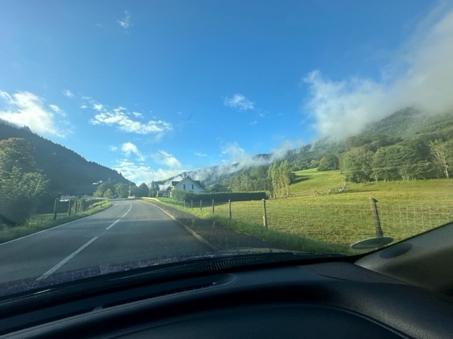
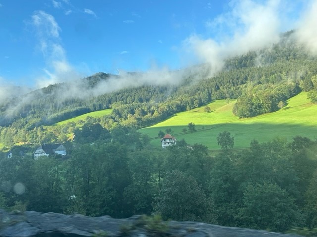
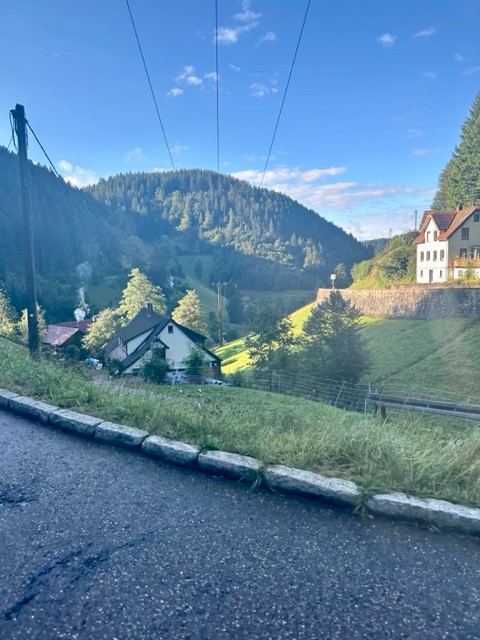
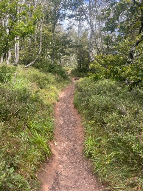
We’d kept a close eye on the forecast since arriving in Germany and today looked to be the first (and perhaps only) sunny day. Consequently we had reserved it for the main thing on our holiday to do list – a hike up Feldberg, the Black Forest’s highest mountain. We left the apartment at 8:30am and set off south in our little hire car, itching to explore the hills. Bright morning sunshine saturated the green fields that filled the valleys as we snaked through the vast landscape, lifting mist from dark, thickly forested hillsides in atmospheric veils. We navigated an unexpected road closure, passed high above the glassy surface of Lake Titisee and arrived in a small roadside car park at 10am.
The Feldbergsteig trail
We set off uphill past a modern, sharp-angled church and found ourselves in an outdoorsey resort containing a large hotel, ski centre and cable car base. Eager to escape the tourist trap, we found an information board showing our intended route, the Feldbergsteig. We hadn’t appreciated that the trail starts at an elevation of 1,287m so it felt like cheating to say we were climbing a 1,493m peak, but nevertheless we were excited for a varied, circular hike in a new mountain range.
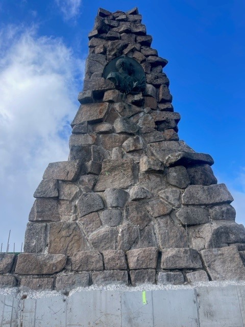
To the Bismarck memorial
We headed northwest up a wide, gently inclining track that ran roughly parallel to the cable car line, passing several small groups who greeted us with a friendly “hallo”, and soon began soaking in the view. The surrounding yellow-green meadows melted into dark treelines formed by tall, deep green spruces, beyond which stretched endless forest spread thickly over distant, hazy blue ridges arranged in undulating layers. It was sunny, still and resoundingly quiet.
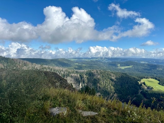
The track narrowed and took us into a verdant coppice, then continued through rugged meadows past a severe-looking concrete tower laden with satellite dishes. The first landmark we arrived at was the Bismarck memorial, a great stone pillar dedicated to the first Chancellor of the German empire. It was a wonderful viewpoint; a continuous swathe of forest covered the surrounding hills and valleys like a dark green blanket stretching all the way to the distant horizon, broken only by occasional ragged-edged, grassy clearings.
Up Feldberg
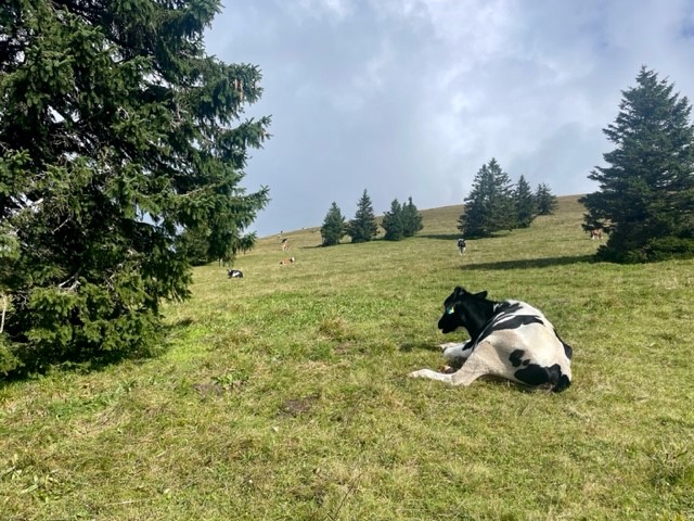
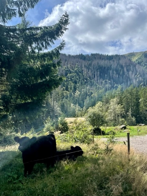
We left the memorial and headed down the side of the hill across open meadow. We went through a gate and followed a wide gravel path along the side of a ridge, which was covered in rough, yellowish grass and sloped gently downhill towards the endless forest. A strange, tinny sound tinkled across the valley and a thin curtain of fluffy cloud – which had drifted down the ridge and obscured the path ahead – cleared to reveal a small herd of Fresian cattle blocking the path. I’ve been averse to cows since getting charged by a bull a few years ago, so I gave them a wide berth and reached a gate with some relief.
We gained the summit of Feldberg via a straight path up a gentle incline, the only drama being the loud and alarming receipt (on our phones) of Germany’s annual nationwide emergency alert test at 11am. It was a grassy and oddly subtle, unremarkable peak marked by a low, flattened mound topped with a trig point and a circle of benches, marred slightly by a tall communications tower and grim looking building a short distance away. We munched a sandwich with our backs to the tower and gazed across gently rolling, forest-carpeted hills, pondering on the ethics of saying we’d climbed a mountain.
Through field and forest
My doubts about the mountainous nature of the area were allayed once we left the summit and headed down a track that passed the ugly tower. The peaks ahead of us to the west were steeper, more undulating and completely forested compared to the gentler, grassier slopes to the east, and the horizon was formed by wide, hazy triangles of more mountain-shaped mountains. We headed downhill past a lush, green meadow dotted with fir trees and cattle, their cowbells tinkling whimsically in the breeze, and reached the first alpine hut along the route – a large, tiled, welcoming-looking building. Resisting the temptation to stop and grab a drink, we continued on the path, which flattened out and arced around Feldberg’s lower reaches in a smooth curve.
We tramped across charming, rugged meadows, then entered the thickly forested hillside to the north of Feldberg. A thousand shades of green emanated from ferns, shrubs, trees, grasses, mosses and lichens, which grew in Jurassic Park-like abundance on the steep slope. Shrubby clearings allowed us to gaze across a deep valley to opposite, equally living slopes, which were drenched in warm sunlight that slipped beneath thin clouds that drifted lackadaisically over the valley tops. It was incredibly tranquil, as if the rest of the world didn’t exist.
Past river and lake
We followed the path diagonally down the hillside, crossed a marshy section via a boardwalk and found ourselves at another alpine hut. A steep climb through the forest took us up to another swathe of meadow on the east side of Feldberg’s neighbouring hill, which dropped gently down into more verdant forest. We crossed the narrow, crystal clear Sagenbach river and followed its wonderfully overgrown, mossy banks downstream, marvelling at several rocky waterfalls and – on seeing the many bridges made by fallen trunks – wondered what storm could possibly have touched this serene place.
After winding down the river via bridges, steps and rocks, the route bore us east along a straight, flat track along the side of a hill between legions of tall pines. We stopped for another sandwich at a picnic table, then followed the arc of a spur to the edge of a valley clearing, where another large hut sat below us among cattle fields and meandering tributaries. We followed the treeline down into a peaceful wood, then came to the shores of the perfectly round, cwm-like Feldsee Lake. The clear, gently rippling water was surrounded on three sides by towering, green walls that looked too steep to accommodate the dense mass of huge trees that had somehow taken root. We stood on the “beach” for a moment, watching the ducks and listening to the silence, then set off on the final section of the route.
Last leg
The path followed the east bank of the lake, then climbed steeply into the thicket of beech, sycamore, pine and spruce. We zigzagged up rocky sections until the ground levelled and we emerged from the trees quite suddenly at the cable car base. It felt slightly surreal to be back in the busy resort after the serenity of the hike, which had felt quite wild despite the clear, well-signposted trail. We headed straight back to the car and, after debating whether a trip to the city of Freiburg would be worth it at rush hour, left for home (via Lidl, of course).
To summarise, it had been a lovely, varied hike with beautiful scenery that made us feel truly immersed in the Black Forest. The trail was very easy to follow (we barely used my guidebook map) and I just wish it had been longer than 8.5 miles. We came away feeling very refreshed, happy with a good day exploring a new mountain range.
Evening
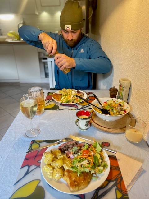
We got back at 4:30pm and spent the evening relaxing on the balcony, drinking wine/beer, watching Rings of Power on Netflix and playing with Kraut the cat. Ryan cooked a lovely dinner of homemade schnitzel with steak, salad and potatoes and I came up with a rough plan for another hike the next day, this time starting from our apartment. Three days in and we felt very at home in the Black Forest.
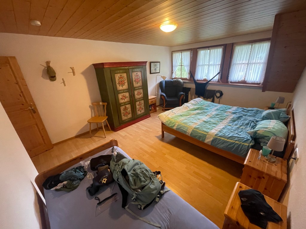
I felt as if I’d woken up in a dream. I lay under a pine-clad ceiling in a large room furnished plainly with a double and single bed, a floral-painted wardrobe and a comfy-looking armchair in a corner by three net-curtained windows, which revealed a steep, forested bank rising high above the back of the house in the misty morning light. After a hectic time planning this very-last-minute trip, it finally sank in that we’d made it past the travel hurdles I’d needlessly fussed about and were now deep in Germany’s Black Forest.
Journey
The first hurdle was getting to Stansted airport after a 4am start – not the easiest trip from the New Forest, but thankfully both National Express coaches were on time. The second was the flight, which was delayed by almost two hours and necessitated an anxious call to Europcar to check they’d wait for us. The third was collecting the car, which was more straightforward that I’d expected thanks to the lovely lady who received us, showed us round our shiny blue Toyota Aygo and – to my surprise – didn’t try to push us into purchasing deposit protection insurance. The fourth, and most intimidating, was driving an unfamiliar vehicle on the wrong side of the road (notably the autobahn in rush hour), without deposit protection insurance, for the first time in nearly five years, in the knowledge that the tiniest of knocks or scratches would cost us £800. The fifth and sixth were squeezing in a Lidl shop so we could eat and negotiating our late arrival with our host, as our accommodation was an hour and a half from Baden-Baden airport near a small town called Simonswald.
Accommodation
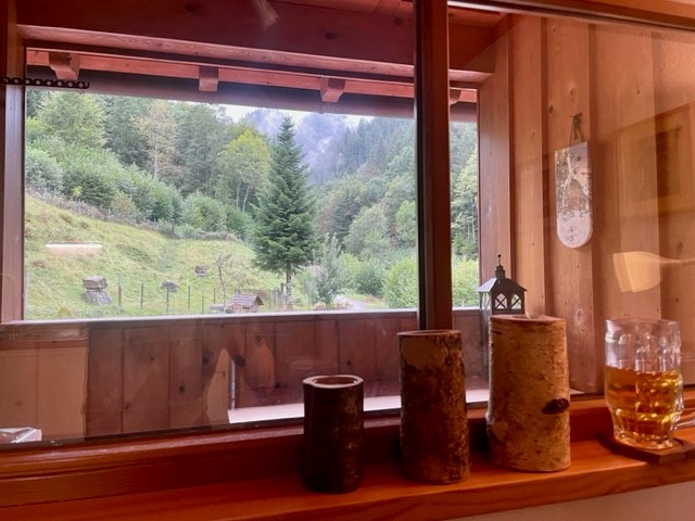
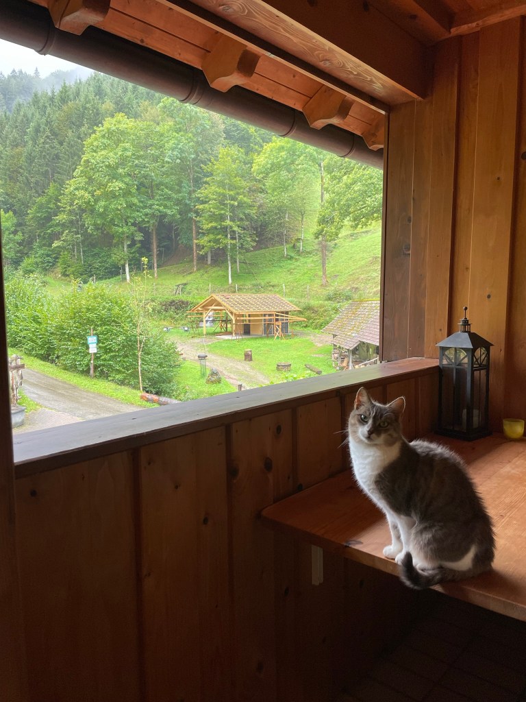
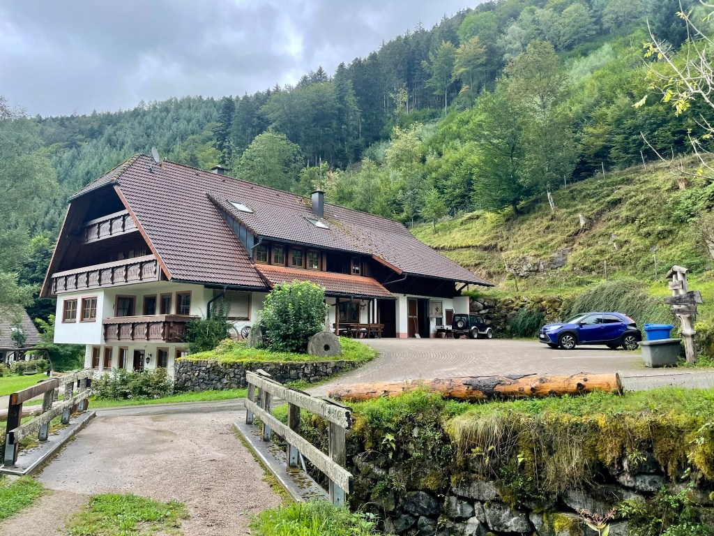
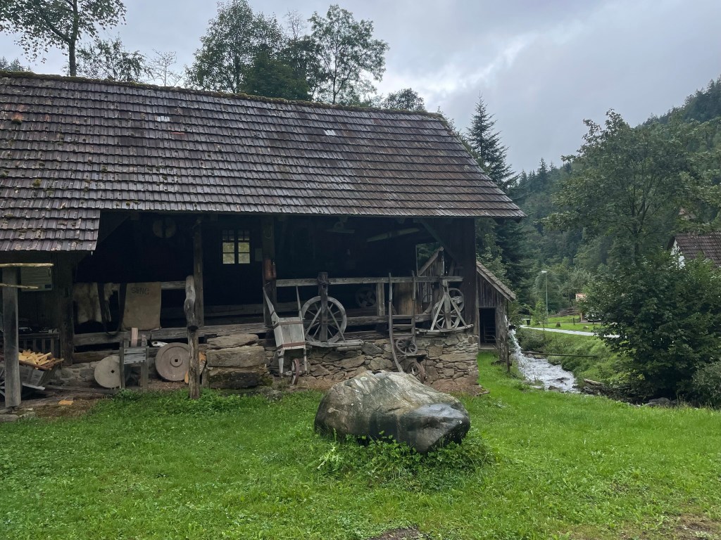
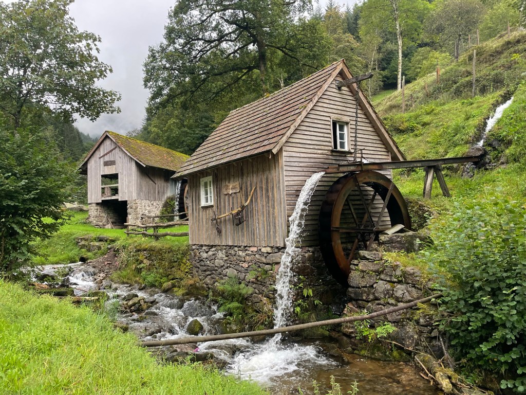
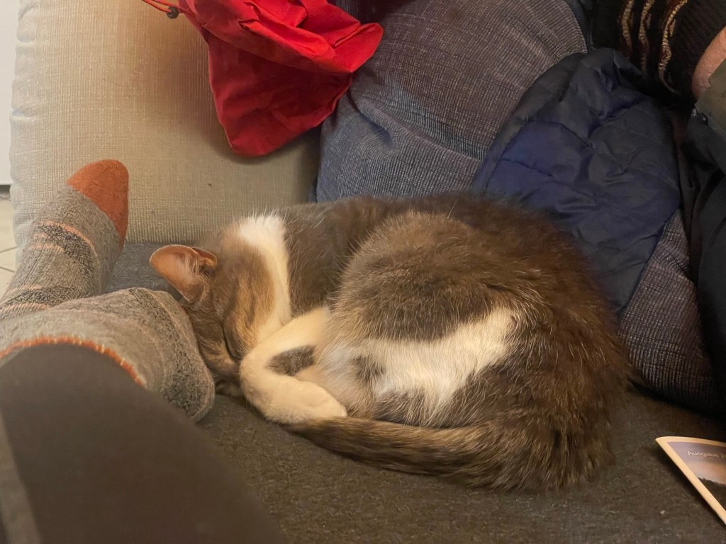
I got up and delighted on fully realising our location, which had not been revealed on our 9pm arrival in the dark. Our spacious apartment was on the first floor of a large, traditional Black Forest house on a small farm at the end of a dead-end road that climbed into a high-sided, dark-forested valley. The farm was timeless and fairytale-like, with its own watermill, wooden workshop and tiny chapel, and – as well as cosy wooden charm and a large living room-diner-kitchen, bedroom and bathroom – the apartment came with two bonuses that I hadn’t appreciated from my hasty peruse on AirBnB: an enclosed balcony looking up the valley, on which sat a large white and grey cat.
Kraut
I opened the balcony door and the cat promptly entered – the host hadn’t mentioned it and I assumed, by the way it padded around and settled immediately on the L-shaped sofa, that we were the ones imposing on its private space. I made coffee and, on opening the fridge door, had to extract both milk and the cat. There was a jar of sauerkraut leftover from last night’s dinner (chicken schnitzel with potato salad and sausage kale, cooked by Ryan while I recovered from the drive) which inspired the cat’s temporary name – Kraut.
Belated trip planning
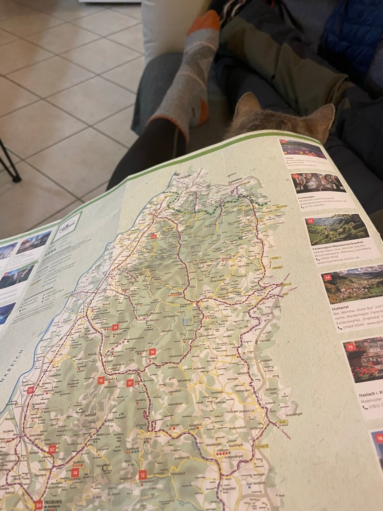
Ryan soon emerged and cooked a delicious breakfast of egg, tomato, rich German sausage (which may have been beef) and thin, seeded bread from a pre-cut loaf, which made lovely, crispy toast. Having done precisely zero holiday planning beyond a resolution to climb Feldberg, the region’s highest mountain, we scoured the numerous leaflets (all in German) and settled on a day exploring mainly by car, given the grey sky and forecast rain.
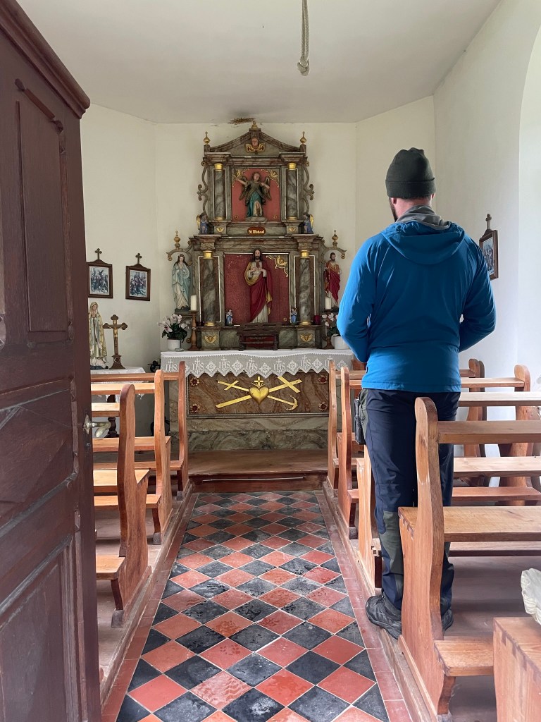
We had a quick poke around the farm workshop, mill and chapel, then drove into the pretty, rural town of Simonswald to visit the little information centre. We didn’t learn much as everything was in German, but I took photos of some maps and we decided to head on to Elzach, a slightly bigger town in the next valley.
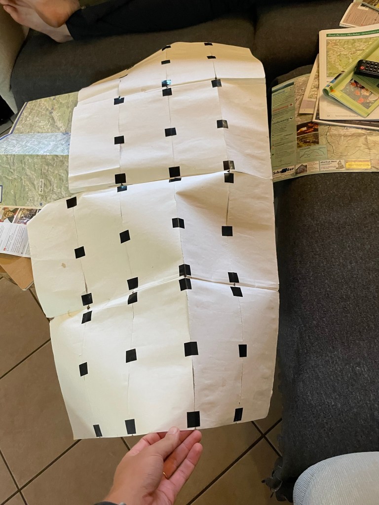
“Fixed” a battered map found in the apartment … What can’t electrical tape do?An honesty box outside the front door filled with drinks and honeyOutside the information centre in Simonswald
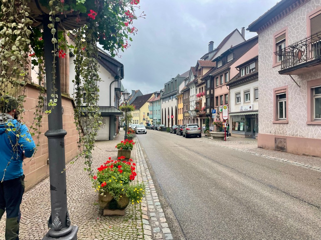
Elzach
We parked near a residential area and noted how well-kept and big the houses were, how pothole-free the roads, and how there wasn’t a single bit of litter anywhere. The town centre was very pretty: old-fashioned street lamps and planters full of red geraniums lined cobbled pavements, and colourful buildings were punctuated by balconies, dormer windows and shutters. We found the information centre near a big pink-washed church and a primary school, where children played football despite the rain and didn’t wear uniforms. The man working there was very friendly and explained to us, in very good English, that there were dozens of signposted hiking trails in the area and that we should take two free leaflets – one a regional hiking map and the other containing descriptions of the corresponding routes – to navigate. We left wondering why England can’t implement such effective systems for tourists.
Many buildings featured lovely murals
Local history hiking trail
We picked a short 5km loop – “heimatkundlicher wanderweg” – that started in a village 10 minutes up the valley, Oberprechtal, and encompassed 18 information boards (all of which I translated with an app) detailing the nature, culture and geography of the area. We climbed above the village and followed a clear path into the forest, which at first consisted of leafy ashes, hazels and brambles, then tall, dense pines with linear trunks that stretched straight upwards, emphasising the steepness – about 30 degrees – of the valley sides. We passed a sloping bank of moss-covered rocks and came to a small, wendy-house-like cabin looking upwards to a grassy, forest-lined meadow. It was very Hansel and Gretel and we couldn’t resist.
We sat in the porch and enjoyed ham and cheese sandwiches, sheltered from the torrential downpour that came in suddenly and swept over the meadow. When it seemed like the worst of the rain had passed, we continued through moss-covered, bracken-strewn pine forest for another kilometre, which was now dappled with soft sunlight that illuminated mosses, leaves and fronds in countless shades of green. We snaked down a steep switchback and emerged at the crest of a small ridge that looked up the Elz valley. Its lower reaches were carpeted by astonishingly green fields which rose into thick, dark forest on both sides, and a tiny road lined by spaced-out, red-rooved buildings wound up the belly of the valley towards hazy blue hills at its head. It was fairytale-like:
Once we’d absorbed the view, we headed down the side of the ridge through a tranquil young beech wood and came out on the road at the tiny, pretty village of Vor dem Wittenbach. Some construction workers had fenced off the bridge we were supposed to cross, so we found a diversion and returned to Oberprechtal on a footpath that followed a shallow stream past cattle fields and a pen of enormous turkeys. It was a lovely little loop and a good “taster” hike that left us thoroughly charmed with the quaintness and serene, timeless beauty of the Black Forest.
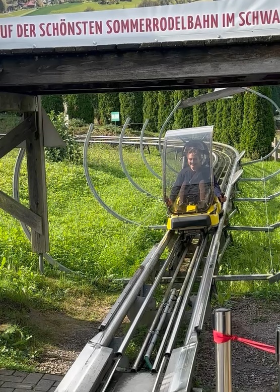
Toboggan run
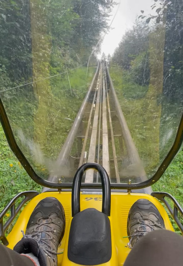
We got back to the car at 3pm and decided that there was plenty of time for more activities, so Ryan – being the large child that he is – suggested a “summer toboggan run”, a one-person rollercoaster where the rider controls the brake, in the nearby town of Gutach. The 20-minute drive took double that due to a missed turn and a winding road that climbed high into thick forest and snaked down into the next valley. I’m sure it was very scenic, but I was too busy navigating the hairpin bends to appreciate the glimpses of distant pine-covered ridges through the trees.
We paid 4€ each at a little wooden kiosk, timed our turn so that we wouldn’t get stuck behind any children, and followed the instructions of the operator as well as we could – fünfundzwanzig meter, which I took to mean stay 25m behind Ryan. The carts were low and exposed, like glorified dinner trays with a windscreen, open sides and a handbrake on a raised metal track. I chugged joltily up the steep side of the valley at a snail’s pace with a bolt jabbing into my back at every track joint. It levelled out at the top and I had a brief moment to gaze over the valley. The red rooves of Gutach huddled between fields that climbed into dark-forested ridges, now drenched in soft afternoon sun. Then the fun bit began.
The cart swooped into a series of twists and turns and I hurtled down with a huge grin on my face. The track joints were loud and very noticeable and the sides of each berm were protected by a low wire net, which I’m sure would have done little in the event of disembarkment, but the dubious safety features certainly added to the excitement and even inspired me to feather the brake on some of the tighter corners. The descent lasted a couple of minutes and by the time I clambered out of the cart, my grin felt permanent. We agreed that it was well worth 4€.
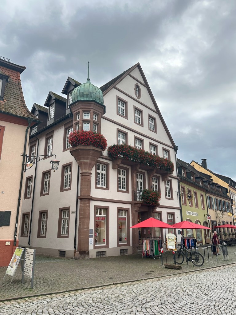
Gengenbach
As we were already some way north of Simonswald, we thought we may as well make our way further north to see the town of Gengenbach, which I’d come across during my brief time spent researching the Black Forest. The 40-minute drive followed a wide valley through several sprawling, pretty towns and we arrived at a car park just outside the town centre at 5pm.
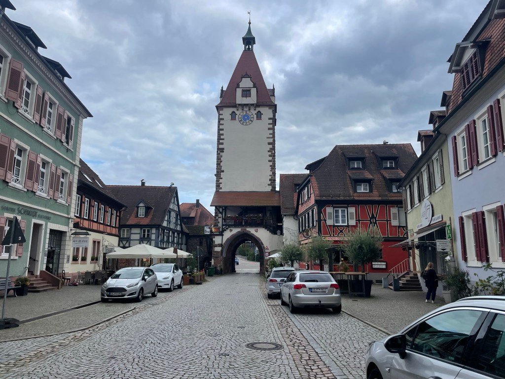
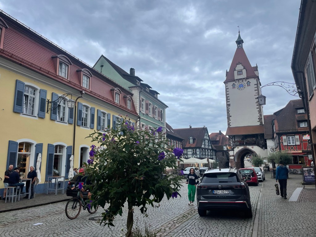
We entered the town through a gateway with a raised portcullis beneath a high, square tower – the Kinzigtor – which was painted white and decorated with a splay-winged German eagle and three coats of arms. It felt as if we’d stepped into a fairytale. Colourful buildings with painted shutters and hanging lanterns lined the wide, cobbled street, which converged with two other streets at the central market square. I’d never seen a place like it – there were so many focal points, and nothing was uniform but everything was perfect.
Nicest looking kebab shop I’ve ever seen…
A huge, pink, grand-looking town hall rose impressively on one side, its 22 symmetrical windows and 11 ground-floor arches each adorned with pink flowers. Three large buildings stood opposite the hall, painted white and cream with exposed timbers in hatched patterns. They had high-apexed, sloping tile rooves and flower boxes at each window. Along each cobbled street – the whole town was cobbled, and not a stone was missing – stretched more of these buildings, some painted pastel colours and some timber-framed, all with charmingly irregular rooves. The red spires of cream towers dominated the skyline at the end of each perfect row, and a stone fountain topped with red, pink and white geraniums and a statue of a knight trickled in the middle of the marketplace. Apart from the few cars, it was convincingly medieval. It didn’t seem real – I half-expected the walls to topple over and reveal it all to be a two-dimensional film set. It is, without doubt, the most attractive town I’ve ever seen.
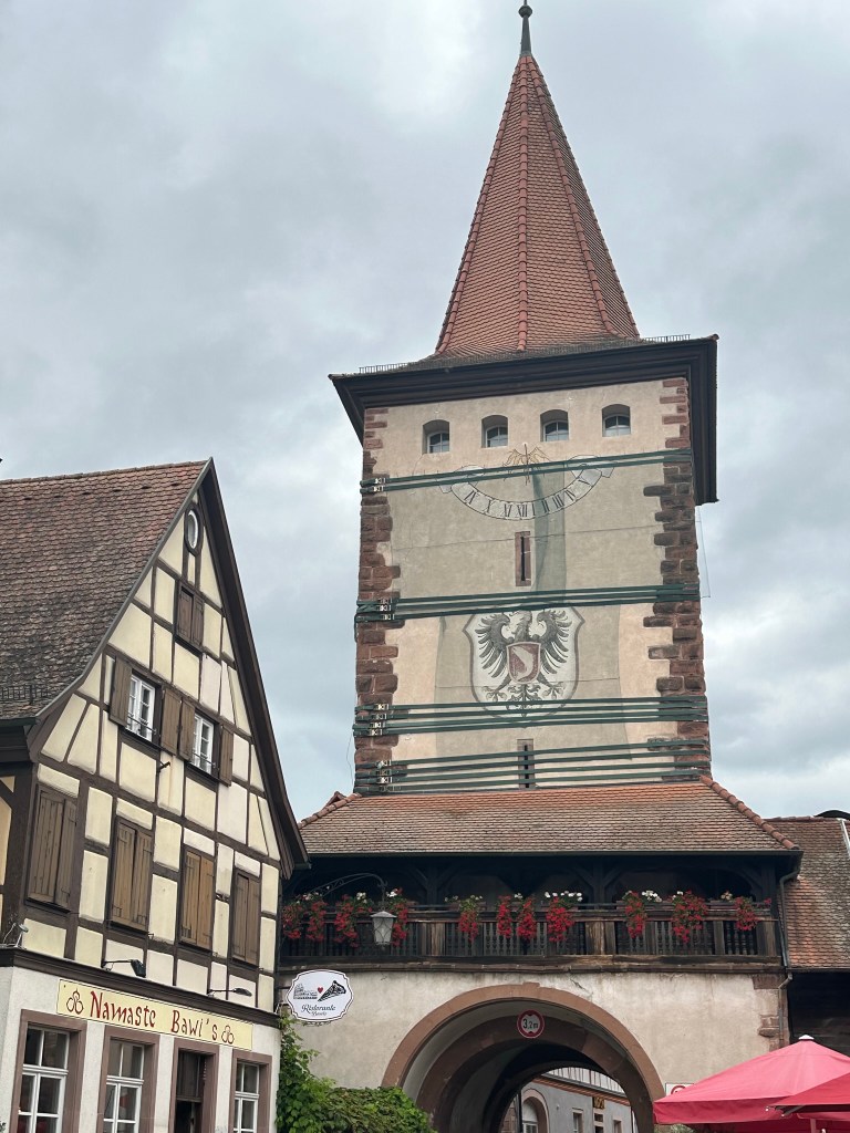
We walked past the fountain along Victor-Kretz-Strasse and took the first right turn, not wanting to miss any of the real-life fairytale. We passed a couple of blue-shuttered buildings and a little car park fringed by tall, leafy trees, then came to a grand, cream building with dozens of uniform, pink-framed windows and a perfect front lawn dotted with round topiary bushes – the Black Forest Business School – that stood in front of an intricate sandstone tower, which belonged to the adjacent St Marien church. This was on the edge of the small town, which was backed by vineyard-covered hillsides, so we returned to the high street and headed towards Obertorturm, the north tower.
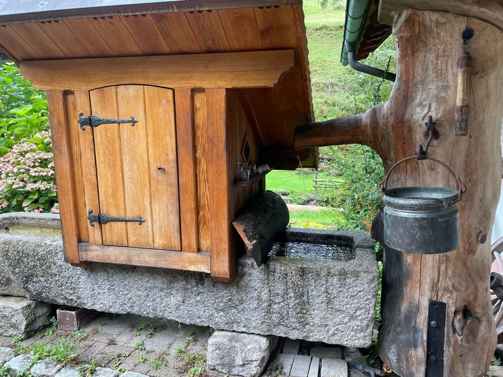
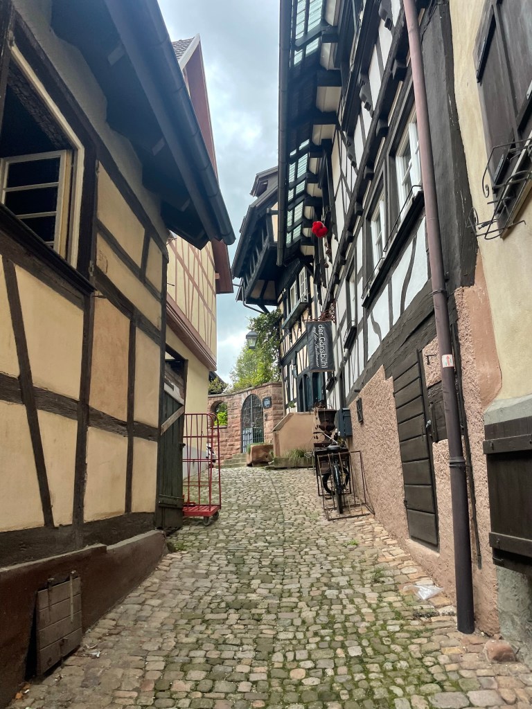
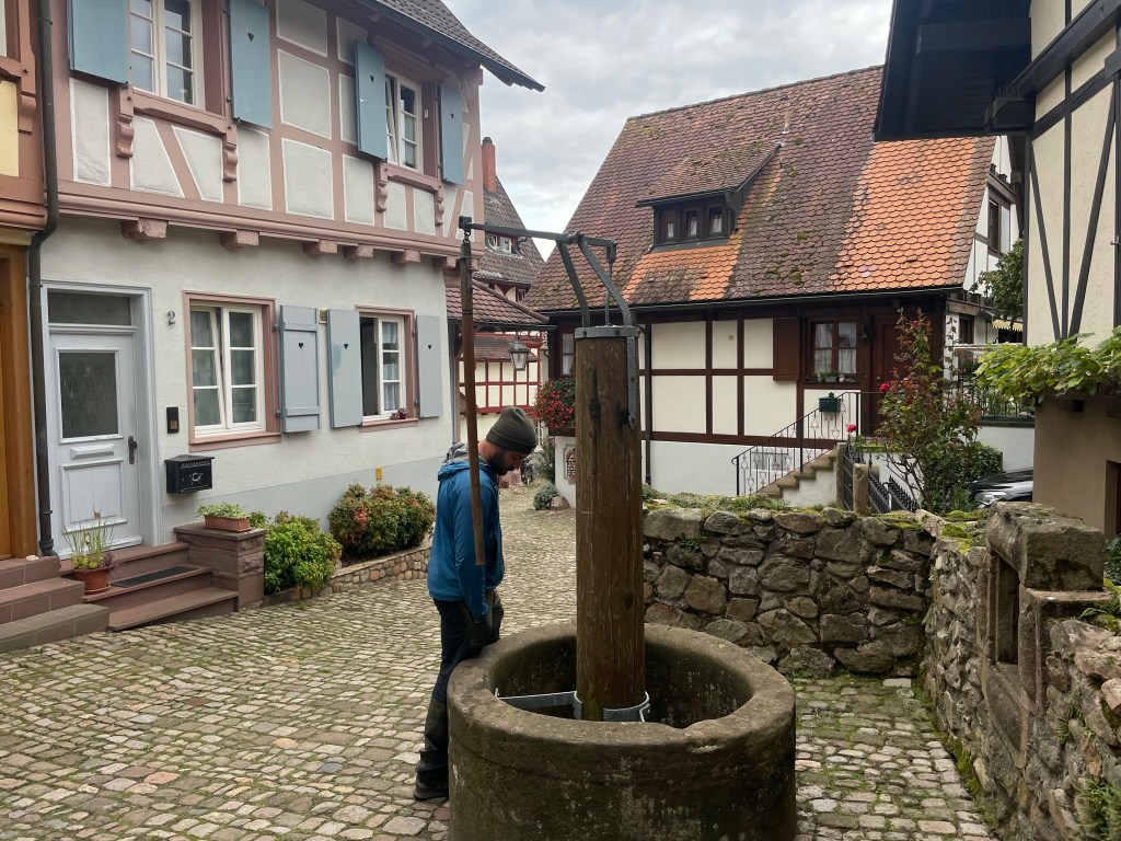
We passed shops selling clothes, shoes, books and souvenirs, all with little canopies stretching over the pavement, and bustling cafes that spilled out onto the street. There were plants everywhere, filling stone troughs lining the paths, in pots outside restaurants and cafes, and flowerboxes decorated the windows of most buildings. We turned left along a narrow alley just before the tower, poked around an old stone well with a wooden pump that looked like it worked, and wove through narrow, cobbled alleys lined by timber-framed houses back to the main street.
Charmed by the quaintness of every nook and cranny, we took the next turn and found ourselves down another surreal alley. Large lanterns protruded from the beams of houses and climbing greenery covered many of the walls, seeming to emanate from the cobbles. Grapevines crept above wooden front doors and the residents seemed to compete over who could encroach on the street with the greatest abundance of potted shrubs and geranium-lined windows. I wondered why any architect or town planner would ever deviate from such aesthetic perfection – if only every town looked like this.
We emerged on Haupstrasse, the other main street off the central marketplace, popped into a little supermarket for a drink, then were lured into a lovely, old-fashioned bakery. The tiny old lady smiled patiently through my attempts to communicate which bread I wanted and asked (via gestures) whether we wanted it sliced. Resisting the delicious-looking cakes and pastries, we left with a loaf of sliced walnut bread, which we later found to be divine. We returned to the car via the marketplace and the Kinzigtor, utterly enchanted by Gengenbach.
Evening
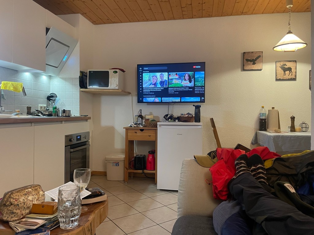
The hour-long drive back to Simonswald was thankfully uneventful, and took us through more pretty towns and fields nestled in wide valleys between great, sloping banks of rich forest. We arrived just before 7pm and settled in with a glass of wine (a German beer for Ryan) on the balcony, gazing up the green, wooded valley and listening to the sound of nothing but the birds and the stream. Kraut arrived, bit and scratched me when I was slow to give her some ham, and made herself comfortable on the sofa. Ryan cooked what turned out to be a thick pea and ham stew from a large Lidl can, which we had with cheese and walnut bread. We researched the area with the help of various leaflets (in German) and YouTube, which we could access on the TV, and decided – in light of the wet forecast – to go to the weekly market at Waldkirch the following morning. It was a lovely end to a successful first day. We went to bed besotted with the Black Forest.
As usual I’m way behind on the blog, but thought – perhaps to transport myself back to the mountains and glens – that I may as well make a start on this year’s winter trip while I grieve our return. For the first time, Ryan and I had a full 14 days roaming Scotland in our van, which remains largely unconverted (although necessarily insulated). Now that we’re home it feels as if we’ve been rudely and abruptly awakened from a wonderful dream.
Saturday 3 February
We arrived at our first overnight stop in Galloway Forest Park, southeast Scotland, at 3am. The 300-mile, 9 hour drive up – punctuated by a single stop at the spectacular Tebay Services – went remarkably smoothly, save for some inevitable traffic near Birmingham, and gave me the opportunity to decide on our first destination based on the abysmal weather further north. We slept soundly and woke at the leisurely time of 10:30.
It felt so good to recommence my morning van routine: jetboil coffee, get dressed, eat cereal, make sandwiches, brush teeth, pack a rucksack and tell Ryan about the hiking plan I’d already connived. Thankfully I met no resistance – he was just as excited as I was to return to the hills. We’d never explored Galloway Forest Park before, and were keen to kick the trip off with a worthwhile reintroduction to Scotland. We were to hike up Merrick (843m), the highest summit in the southern uplands.
We had a lazy morning packing bags, chatting on the phone to Adam (Ryan’s brother, who was on his way back from a week in the Cairngorms) and enjoying the freedom of having no obligations and very few amenities in the back of the van, which contained a mattress, an awful lot of outdoor kit and no permanent fixtures. The hike looked easy, so there was no rush.
Back in Scotland: Bruce’s Stone
We’d stayed in Bruce’s Stone car park, so before we headed uphill we wandered over to see what the large, raised boulder overlooking Loch Trool was all about. Its inscription provides a summary:
In loyal remembrance of Robert the Bruce, King of Scots, whose victory in this glen over an English force in March 1307, opened the campaign of independence which he brought to a decisive close at Bannockburn on 24th June 1314.
This memorial reminded me of the utterly immersive atmosphere that seems to envelop Scotland. The rugged glens, dark lochs and unforgiving hills make its dramatic, bloody history so tangible that it sometimes feels as if a battle-waging clan of tartan-clad warriors could round a corner at any minute, rightfully raring to defend their wild lands against our English encroachment. Yet I can’t stay away – I’m completely besotted with the harsh, beautiful wilderness. As I looked down over the opaque water of Loch Trool, backed by rough hillsides and surrounded by pockets of mixed forest, I felt – even though I’d never visited this part of Scotland before – as if I’d come home.
Hike up Merrick
We tore ourselves away from the view and headed north up a narrow, rocky footpath at the end of the car park. It was a later start than usual – 1pm – but we weren’t concerned, as we had headtorches and the route looked straightforward. Merrick was signposted, so we didn’t have to do much navigation anyway.
Section 1: Buchan Burn to Culsharg Bothy
The first mile followed the rushing Buchan Burn up a steady gradient along a rocky, muddy path which required some careful foot placements to avoid the boggiest sections. We didn’t care – we were thrilled to plunge into the rugged landscape. It was difficult to believe that 24 hours beforehand I’d been sat at my desk in the south of England, which now seemed mind-numbingly dull. Perhaps that’s why the colours were so vivid, the textures so varied and the river so resounding in the otherwise absolute silence. The hillsides were a seemingly random blend of rough, golden grass, coppery bracken and clumpy, purple-brown heather, punctuated by lilac birches, deep green spruces and skeletal broadleaves. Thick mosses had beaten the grass to little hummocks along the path, and Buchan Waterfall sent white water cascading between lichen-spangled boulders down broad, narrow steps. I was at peace.
After half an hour we reached Culsharg bothy, a small building on the edge of a tall evergreen forest, which looked both cosy and desolate. It had stone walls, a neat slate roof, a central chimney, a flat, grassy area that looked like a little front garden, and two broken, ominously black windows. Inside were two rooms, each with a fireplace and chipboard ceiling, a rudimentary wooden bench and a heavily graffitied door. Overlooking the gentle valley of Buchan Burn, it would have made a lovely cottage.
Section 2: Benyellary
We hiked a short distance through the tall trees behind the bothy and emerged onto a track that led us up the steepening hillside. Dozens of clean-cut stumps either side of us suggested the recent felling of a large swathe of forest, now reminiscent of a forlorn, quiet graveyard, and the moss that had covered the floor beneath the trees had given way to short, green grass. The sun emerged, casting a soft glow over the textured landscape, and we crossed a deer fence to the relatively featureless southwest slope of the first summit, Benyellary. Its shapeless, moor-like flanks, carpeted by rough grass and heather, shone gold and red in the afternoon light and rippled in the strengthening breeze.
We continued upwards, neither of us admitting at the time that the combination of gradient and pace felt quite taxing despite the untechnical terrain. The path cut through the moor, then steepened and followed a drystone wall to the summit of Benyellary. As we climbed (feeling quite out of condition), we realised that the forecast hadn’t erred in predicting wind – it had just been buffeted away from the approach path by the surrounding hills, which no longer offered any protection. Thankfully it didn’t feel as strong as the forecast 30-40mph but was certainly noticeable. The top was marked by a cairn and the base of the cloud, which scuppered the view and just about warranted waterproof jackets, which we hastily pulled on – in between mouthfuls of cereal bar – while sheltering from the wind on the steep east side of the summit.
Section 3: Merrick
We descended the gently sloping north side of Benyellary and followed a drystone wall along the romantically named “Neive of the Spit”, which is presumably the un-dramatic col between the hills, whose summits are 2km apart. The map showed that the ground on our right dropped steeply away to the “Scars of Benyellary”, but we couldn’t see thanks to the cloud that we now occupied. After the col we began the gradual climb up foggy, boggy Merrick. Our view was divided horizontally into two halves, which dissolved into each other in the poor visibility: swathes of sandy, tufty grass and the dull grey interior of enveloping cloud.
Nevertheless, we remained delighted to be back in the hills. The dirt path to the summit was easy to follow, and after half an hour Merrick’s blurry trig point emerged into view. We took the obligatory summit photos, “rescued” a bamboo thermos that had been abandoned in a low stone shelter, decided against my half-formed plan of making the route circular – the return would have involved an inevitably boggy trek past several small lochs and across potentially uncrossable burns – and headed back the way we came.
Section 4: Return
Just as we began the descent, the rain came in. We debated whether the initially innocuous mizzle would turn into anything and agreed, from hard-won experience, that it was worth donning waterproof jackets. That was the correct decision, as minutes later we were drenched and slogging through an un-forecast, cold, wind-driven onslaught, grinning ear to ear. “At least we get to test our new kit”, we rationalised, which – thanks to Christmas and a work bonus – comprised Ryan’s boots, my waterproof jacket and both our rucksacks. We embraced the Scottish weather – there’s no point trying to resist it.
The hike continued in this way until we had retraced our steps back over Benyellary and down its moor-like western flank. There the wind abated, the rain eased and the colourful landscape came back into view, seeming even brighter and more contrasting beneath a bank of thick cloud. We wound down the hillside, past the stump graveyard, through the tall forest and along the vegetated, boggy, rocky Buchan Burn path, barely drying at all in the damp air and intermittent drizzle.
We got back to the van at 4:30pm just as a narrow band of glowing, deep orange light emerged beneath the now-lilac cloud above Loch Trool, marking the last of the daylight. It was as if the sun were teasing us, reminding us that it had been there all along. It was a lovely moment, and – looking over the vivid colours of the hill-backed, forest-ringed loch, soaking wet and starting to get cold – we felt truly re-initiated back into Scotland.
Evening
We spread our wet kit out in the front of the van as best we could, using a length of paracord to make a washing line between the two side windows, and settled in the back for the evening. Dry clothes felt amazing and the hot chocolate I made tasted out of this world. Ryan cooked a lovely pasta carbonara for dinner and we snuggled into the sleeping bag, making plans to head north the following day and – given the miserable forecast all over Scotland – visit the Hunterian museum in Glasgow on our way up to the Cairngorms.
Following the previous day’s unexpectedly adventurous excursion up Ben Wyvis, we indulged in a “rest day”. This meant exploring the area with no real agenda, so after a cup of coffee and a quick google we decided to head to Ullapool, a lochside fishing village 25 minutes northwest of our picturesque parking spot overlooking Loch Glascarnoch.
It was a fine day, although forecast to be windy up in the mountains, so we didn’t feel like we were missing out too much – particularly with Ryan’s ongoing (but thankfully improving) blister situation. The road to Ullapool was quiet and beautiful, carving through rugged hillsides carpeted in reddish heather and golden grass that glowed in the morning sun against a blue sky made wilder by smooth clouds that hung portentously over the dramatic, dark peaks and ridges of An Teallach mountain range straight ahead – another one high on the to do list. This was followed by a pretty drive along the bank of Loch Broom before arriving at the village, which is nestled on a low-lying promontory on the northern edge of the loch.
Ullapool
We parked at Tesco, which was just about the only indication (in a good way) that the village was connected to the rest of the world. A short walk through quiet, pretty, uniform streets took us to Ullapool Outdoors, a lovely independent shop where we picked up some stove gas and washing up liquid. From there we continued on to the water’s edge, which was lined by a row of whitewashed cottages overlooking a narrow, stony beach. We absorbed the tranquility as we wandered along the shore, skimming stones and marvelling like children at enormous mussel shells and seaweeds that clung to pebbles with masses of rubbery roots, all the while taking in the mountains that surrounded the loch. It was an utterly self-contained, other-worldly place.
We walked along the loch front past the ferry terminal, where a bustle of construction work was taking place, then popped into a country clothes shop, a charity shop, a small gallery and a delicatessen. We returned to the van with our bounty – a new jacket for Ryan, some charity shop clothes for me and a couple of rolls for lunch. We ate them overlooking the loch and left Ullapool feeling very tranquil.
Lael Forest Garden
Our next stop, just south of Loch Broom, is perhaps best described as a living tree museum. Lael Forest Garden was founded in the 1870s by Victorian seed collectors who planted over 200 species from all around the world.
We pulled up in the small car park, entered through a gate and wandered the short trails, which showcased an interesting variety of trees and a wild, tumbling waterfall. Despite Scotland’s barely temperate winters the trees seemed to be thriving, perhaps because of their position up the steep eastern bank of a deep gorge. A personal highlight was the soft-barked sequoia redwoods, which – in their immense stillness – dwarfed everything else with a quiet, humbling majesty.
It only took half an hour to walk around in a loop, but there was nobody else around and that half hour felt very peaceful. I’d like to come back in spring or autumn.
Corrieshalloch Gorge & the Falls of Measach
Our next stop was a few minutes’ drive south. Corrieshalloch Gorge is a narrow, sheer-sided cut in the landscape that was formed during the ice age by a strong river flowing beneath a glacier into Loch Broom. The path from the roadside car park took us down through woodland to a narrow, 25 metre long Victorian suspension bridge that spanned the deep gorge quite spectacularly and bounced slightly underfoot.
Looking down into the vertigo-inducing 60 metre chasm below was a memorable experience. A white river rushed urgently through a narrow channel at the base of the gorge, fed by what seemed an impossibly voluminous, 45 metre high waterfall – the impressive Falls of Measach. It was wild, beautiful and, with nothing but air between my feet and the rocky water way below, quite unnerving to consider the consequences if the bridge failed.
We crossed the gorge, nipped along to a protruding, equally vertiginous platform for a good view of the bridge and the waterfall – which seemed even bigger from a distance – then crossed back and walked along the wooded brink for about half a kilometre. The gorge’s dark, sheer rock walls were covered in mosses, lichens, shrubby little plants and – wherever their audacious roots could take hold – trees, which all seemed to thrive in their damp, inaccessible sanctuary.
The path curved back on itself as it climbed towards the car park, and as we rose above the lilac birch tops we enjoyed a stunning view of the valley at the northern end of the gorge, looking back towards Ullapool. Loch Broom appeared in the V, backed by heathery slopes, and in the foreground deep green forests sprawled over undulating, yellow-brown hillsides. The air was still and once again I felt uncommonly peaceful.
North West Coast
I can’t tolerate serenity for too long, so we formulated a plan to climb another mountain the next day. Ryan had researched Beinn Alligin in Torridon, so we set off from Corrieshalloch on a 70-mile journey southwest along the not-very-direct, but scenic, road that snaked down the remote, jagged northwest coast.
As I’d hoped, the road was quiet and afforded lovely views of wild mountains, dark lochs, clear blue sea and tiny, timeless villages. We stopped briefly at the coastal village of Gairloch for a token beach trip, where the sand was pale, fine and backed by grassy dunes, then – sufficiently wind-nipped – we returned to the van and continued on to the wilderness of vast Glen Torridon, where we’d previously had an epic day mountain biking the Torridon Loop. It almost felt like going home.
We drove a short way up the hill behind Torridon village to the Beinn Alligin car park, arriving about 6pm. Ryan cooked sausage pasta and we spent a couple of hours researching the mountain, then went to bed early in anticipation of a 6am start. Like I said, serenity doesn’t last long.
As if repentant for the previous day’s soaking, the weather looked to be dry and sunny – perfect for a day scrambling in the Ogwen Valley. After rushing back and forth to collect my gear from various locations around Capel Tanrallt, I bundled into Graeme’s van and spent the 45 minute journey interrogating him about a trip he’d taken to Greenland.
The route became very scenic as we entered the sweeping Nant Ffrancon valley from Bethesda. Rugged hills rose upwards either side of us and a wide, meandering river snaked between lush green fields along the broad base of the valley. The anticipation of approach grew with the mountains and reached its pinnacle as we rounded a corner into the long Ogwen Valley, which sits between the towering, lumpy Carneddau range and the set-back Glyderau, whose dark, jagged faces – although now quite familiar – never lose their ominous, tantalising mystery. After a short drive along the bank of Llyn Ogwen, we met the others in a roadside car park and walked to the little National Trust centre by Ogwen Cottage.
Lou met us there just after 9am, delivered the sad news that Geoff had developed a cold so couldn’t make it, and introduced us to Dave, who would be in charge of the other group for the day. She then went over some scrambling “theory”, which covered what equipment to take and key considerations when leading a group. We split into our two groups of six and headed up towards Llyn Idwal, with Lou taking charge of my group.
Testing the Group
The walk up to Idwal was as scenic as ever. The great, craggy ridge of the Glyderau towered in a great silhouette over undulating, rugged moraines carpeted in swathes of sandy grass, clumps of heather and a hectic array of boulders, and the morning sun – which hung low in the gap between Tryfan and Bristly Ridge – accentuated the darkness of the mountains against the warm, golden glow of the moors. On the way up we stopped several times at different boulders for little lessons on leading a scrambling group, which I summarise as follows:
Before committing to a route, assess each individual’s ability on technical terrain by watching them move up and over steep-angled, low-level boulders, giving pointers on technique where appropriate
Help others on difficult moves by holding their heel and pushing their foot into the rock at a 90 degree angle
“Spot” others on steep or insecure sections by standing below them, feet wide, hands out and elbows bent, ready to control their direction of fall in the event of a slip
Use games such as “the floor is lava” (a personal favourite in all situations) combined with “race to the lake” to determine the more and less confident members of a group on rocky ground
After lots of practice on various boulders near the path, we reached glassy Llyn Idwal via a floor is lava race, in which Darren indiscriminately charged through the rest of us scattering bodies as he went. This hanging lake is elevated in an atmospheric glacial cwm and has its own fittingly charming (if slightly melancholic) legend, which Lou conveyed very well – we were captivated.
Idwal Legend
Prince Idwal was the much-loved and widely talented grandson of an ancient Welsh king, who was taken to the lake one day by his jealous cousin. His cousin, knowing that the prince could do everything except swim, pushed him in. The prince drowned, the lake was given his name, and to this day no bird will fly over the lake’s surface as a mark of respect.
After scrutinising the sky above Llyn Idwal for signs of avian passage to no avail, we accepted the legend as fact and stopped for “first lunch” (a unanimously celebrated concept) on the eastern side of the lake. As we ate we took in the great cwm, whose vast, craggy faces towered menacingly above us on three sides. On the far side the sinister, black cleft of the Devil’s Kitchen loomed high above the water; mist often emanates from that rocky chasm and drifts around the bowl-like cwm, which means the Devil is cooking – another fact, although harder to verify. Today was clear, and the only mist in sight came as steam from my thermos of interminable stew.
Leading a Scramble
First lunch finished, we walked to the south-eastern end of the lake and stood by Idwal Slabs, which I’d climbed the previous year. We were to scramble up Senior’s Gully, a grade I route that follows a blocky channel up the northern side of Glyder Fawr. We set off upwards and Lou demonstrated how to lead a group scramble. From memory, the notable points were:
Choose the safest-looking route, taking into account difficulty, protectability and consequence, but allow confident group members to pick their own route within reason
As a leader, station yourself at the crux of difficult sections in a place where you can help group members without getting in the way
Help others on technical moves by spotting, holding their boots into the wall and steering them in the right direction by holding their rucksack
Ensure you can communicate with (and ideally see) the whole group at all times by staying within calling distance and letting everyone catch up before rounding corners
Position stronger group members next to less confident members so they can provide assistance, and place a stronger member at the back of the group
Senior’s Gully
The gully was fairly “technically” easy, with an abundance of good holds and grassy, heathery ledges, a relatively shallow gradient (for a gully) and just a couple of trickier moves up slabs, but although solid the rock was quite wet, which made it slippery and slowed us down significantly. It did, however, mean that we had plenty of practice helping others up the more technical moves, as water dampens confidence as well as rock.
We took turns leading and found that there was significantly more to think about on-the-spot than when leading a hike. Visibility of the gully ahead was often limited to just the next few moves, so the safest route wasn’t always obvious, and it was quite tricky focusing on personal safety, route choice and the rest of the group at the same time. I also found it quite hard to determine the best place to stop and assist others, having never really scrambled with anyone other than Ryan, who is so absurdly confident that I never really think about him.
We reached the top just after 3pm, a couple of hours after setting off upwards. We had second lunch at the edge of the Nameless Cwm, which isn’t actually nameless as it’s called Cwm Cneifion. Google reckons this means “cwm of the tufts of sheared wool” – I prefer the more mysterious (and more pronounceable) title. I celebrated the long-awaited final mouthful of stew and watched enviously as a couple of climbers made their way up Cneifion Arete. After pinpointing our location on the map (we were never safe from nav practice) we started the descent down the steep, winding path that takes a diagonal line down the western flank of Y Gribin.
We wound down the side of the grassy ridge, chatting away and making plans to go to the pub. We reached Llyn Idwal and returned to Ogwen Cottage area on the slabby path we’d walked in, coincidentally meeting the other group right at the end. Lou debriefed our group, which was really helpful as it cemented in everything we’d covered, and we returned to the cars in great anticipation of a good pub meal.
Evening
All twelve of us reconvened in the Black Boy at Caernarfon, a large, quirky, charmingly old-fashioned and necessarily haunted pub set within surprisingly intact, battlemented castle walls. We took two six-seater tables and most of us tucked into a hearty pie and pint, which was too much for Darren, who completely lost all decorum in a mad giggling fit just as the waitress came over – I can’t remember why but it was at Jack’s expense. The merriment continued in Connie’s car and back at the chapel, where Jack produced an elaborate cheeseboard and we celebrated the week over a few drinks with the help of an 80’s classics playlist. I wasn’t ready to leave the following morning, both literally and emotionally.
Friday: Expedition up Yr Aran, Wild camp, Night navigation
After a mad morning doing all the packing I should have done the night before instead of eating cheese and drinking wine, I loaded all my gear into poor Scabbers and – with great sadness – left Capel Tanrallt for the last time. After a relatively dismal 25 minute drive along narrow, winding roads, rain pounding the windscreen the whole way, we all met at Caffi Gwynant, a cosy, elegant converted-chapel-come-cafe nestled in the Nant Gwynant valley.
We had our fill of sausage sandwiches and coffee, then met Lou and Smyrff (the other instructor) in the courtyard for an expedition brief. We were to hike up Yr Aran via a set but undisclosed route, taking it in turns to navigate legs individually using a 1:50,000 scale map. Then we would hike to an overnight camp spot, pitch our tents, spend the evening doing a night navigation exercise and return to the cars the next morning.
Morning: wet, windy & very nearly miserable
We set off towards Snowdon on the Watkin path just after 11am. The first section took us gently uphill along the edge of an old broadleaf wood, overlooking the increasingly scenic Nant Gwynant valley, which was green, lush and flanked by thickly forested hillsides set beneath high, oddly lumpy ridges. We were bemused to spot an alpaca chewing nonchalantly among sheep in a clump of copper-coloured bracken, and Darren – who was leading this leg – talked us through the seven S’s of camouflage, which are useful to consider if you need to attract (or avoid) attention in the mountains: shape, silhouette, sound, shadow, shade, shine and speed (movement).
We reached the Afon Cwm Llan after a kilometre and continued on the Watkin path, which ran parallel to the river and climbed steadily up a wide valley. Trees no longer shielded us from the weather and I felt sorry for Mohan, who led this section through torrential rain and relentless wind. Thankfully the scenery was stunning despite the grim sky. The river cut a snaking channel down from Cwm Tregalen ahead, whose towering walls loomed high in the distance, and carved between the sloping sides of Y Lliwedd, Allt Maenderyn and Yr Aran. The water plunged downwards in several places via rushing falls, which were so white they seemed to emit light amongst the swathes of russet-coloured bracken, yellow-green grass and fading early autumn trees.
We rounded a craggy corner and turned left off the Watkin Path onto the Cambrian Way, which was slightly sheltered thanks to Yr Aran’s bulky presence. Connie took the lead and (being a doctor) gave a very useful crash course in first aid, which kept us entertained during a long, steady slog up the side of Snowdon’s south ridge. As we climbed, Lou pointed out a disused slate quarry across the valley, which consisted of some ruined buildings, spoil heaps and great slate terraces forming large platforms up the lower reaches of Y Lliwedd. The steady chatter fortified our collective mood against the miserable weather.
The weather breaks
We stopped for first lunch just below the col between Yr Aran and Snowdon’s south ridge, then tramped up its slippery, slatey side to receive a hearty battering from the wind. We left the path and Jack navigated us south along the rugged crest to a small mound, at which point the rain finally abated and the sun cast an ethereal, entirely unexpected golden glow over the landscape, which now revealed itself as a vast, wild sprawl of lumpy ridges and irregular summits. Old slate works formed a strangely industrial foreground, spread across the flattish area by the col, and the Nantlle Ridge stretched out along the western horizon, its green flanks now bathed in low sunlight above the wide Beddgelert valley. Accordingly, we all took a sudden interest in photography:
Yr Aran
My turn to navigate was spent leading the group down the awkward back of the mound, over a wall, through a bog and up the steep north side of Yr Aran. The others had all given interesting talks on relevant subjects while navigating, which I failed to match with my sermon on the ecological importance of peat bogs. In an attempt to be more interesting I mentioned that George Mallory, the Everest pioneer, trained for the Himalayas on the craggy northeastern side of Y Lliwedd, the vast ridge over to our left. Having exhausted my reserves of tenuously relevant knowledge, I tramped up the mountain with the others trailing behind.
We had second lunch on Yr Aran’s sheltered eastern face, which provided a lovely view of Snowdon under a newly blue sky scattered with pale clouds. We all watched amusedly while Graeme instigated a conversation between a phone recording of a raven and a real raven, which had materialised at the rustle of a bag of jelly babies. Once the croaking had concluded we continued up and over the mountain’s symmetrical top, where I managed to miss the remains of an RAF helicopter that caught fire after an emergency landing a few years ago. Graeme then led us down the western side, a long, grassy ridge, stopping at intervals to crush my peat bog lecture with interactive dissections of fox poo and/or owl pellets, one of which contained the unmistakeable shell of a species we’d learnt to identify while on the Nantlle Ridge hike – the violet ground beetle, which glinted in the afternoon sun.
To camp
Having navigated only a short leg, Lou gave me the cruel job of getting us to a specific, indistinct point on the northwestern slope of Yr Aran. In the absence of features and paths I could only use a bearing, pacing and contours, so was relatively satisfied to be only a few metres out on arrival. After a bit more bogtrotting we rejoined a path and returned to the slate-strewn col, where old spoil heaps, walls and ruins lay vast and still in the hazy, waning light, looking serene and wistful in their abandonment.
We crossed the col and dipped back down the other side, then followed Mohan along a vague path along the base of Snowdon’s south ridge for about a kilometre. We stopped at a flattish grassy area nestled between the hillsides of Cwm Tregalan, which towered above our camp spot on three sides, and busied ourselves by erecting tents, offloading sleeping bags and preparing dinner. Jack joined me while I munched boil in a bag chicken and rice, gave me half his hot chocolate and was unshaken by everyone’s relentless teasing: by sharing Connie’s tent and my jetboil, he’d achieved what was deemed a “lightweight hike” and concluded, quite rightly I suppose, that he’d simply “taken initiative”.
Night nav
Our preparations for a night navigation exercise were interrupted by the arrival of a poorly-looking lamb, which stood very close to Lou’s tent, swaying slightly, and seemed quite unaware of its surroundings. It looked a little forlorn but otherwise happy enough, but it clearly wasn’t well, so Lou texted a local farmer to arrange for its collection. Once this minor drama had been seen to we partnered up and set off in the dark, taking it in turns to lead short but time-consuming legs across the rugged terrain.
Jack and Darren led the first leg downhill, across a stream and to a small stone sheepfold, while the rest of us followed by taking a bearing off the leaders each time they changed direction and counting paces. This was slow and difficult on the rough ground, but it was quite exciting hiking in pitch dark and we were thankful for the lack of wind and meaningful rain (drizzle doesn’t count in Wales). Connie and I took over, took a bearing to a stream then handrailed it up a steep bank, helpfully advising the others not to fall in. We reached our destination – a featureless point on a small hill, denoted by the curve of a contour – using a bearing and pacing, and remarked how different the landscape seemed in the dark. Using contours as visual features was almost useless, as each tiny mound seemed extremely large without the context of its surroundings. This was the key thing I took away from the exercise – focus on bearings and pacing.
Mohan and Graeme led the final leg across undulating mounds and we bumped into the other group, a cluster of headtorches and cheery voices, just before returning to camp. I scouted round for the lamb but it was nowhere to be seen, so – hoping that the farmer would come and look for it early in the morning – we inspected each others’ tents. I admired Darren’s two porches, while he described mine as “palatial”, and I inwardly added “smaller tent” to my shopping list before heading to bed. I certainly do not need a new tent.
Saturday: Return, River Crossings, Debrief
After a good night’s sleep (the rain only woke me once) we were all breakfasted, packed and ready to leave by 8. Gold-lined clouds sat low above the distant hill that spanned the V of our valley as the sun crept above the horizon, making for a spectacular start to our final day. We hiked down the rugged slope for a kilometre, commenting on how near the features from the night nav seemed in daylight, and I quizzed Graeme on the merits of sphagnum moss while Connie recited the lichens she’d learnt.
Back on the Watkin path, the river rushed vigorously alongside us and we passed a small weir which Lou explained forms part of a local hydroelectric scheme (I think these should be widely endorsed). Lou then diverted the conversation back to the ML syllabus and we discussed campcraft, which encompasses various considerations around taking a group on a multi-day expedition such as hygiene, safety, cooking, equipment and environmental impact. Then, just as I was reading an information board about the Watkin Path being the first official footpath in Britain, Lou’s friend the farmer appeared on a quad bike on his way up to search for our poorly lamb, to everyone’s relief. He later reported that it had been found and collected.
By the time we descended into the pretty broadleaf wood we’d passed the previous day, people had started up Snowdon in droves and I was glad for the relatively quiet experience we’d had up Yr Aran. We emerged onto the Nantgwynant Valley road and saw that the laybys we’d parked in were now full, being a dry Saturday morning. With the expedition over, we crossed the road and commenced our final practical exercise of the week – river crossings.
River crossings and emergencies
We found the other group knee-deep in the wide, relatively shallow Afon Glaslyn and made our preparations to get wet. I thought I’d experiment by tying a spare bootlace tight around the top of my waterproof socks, outside my waterproof trousers, to see if my feet stayed dry (they did not). As Glyn led the other group across the river in a loud, military fashion, Lou talked us through how to deal with emergencies in the mountains, useful phone apps/services and demonstrated how to evacuate casualties using firstly a group shelter, then a jacket and hiking poles. After parading each other around on makeshift stretchers, we practised several methods of crossing rivers in a group – I’ll attempt to summarise what we learnt:
Choose the safest looking place to cross, taking into account the depth and speed of flow
Face upstream, maintain a wide, stable stance and walk sideways like a crab
Straight line: the group crosses together in a line facing upstream, one behind the other, holding on to each others’ shoulders/rucksacks. The leading person creates an eddy that protects the others from the brunt of the flow
Wedge: the strongest person forms the apex of a wedge and the others form a triangle behind them, all holding onto each other. The smallest/weakest people at the back are protected by an eddy and the group moves sideways together
Chain: the group spans the width of the river, holding on to each others arms/bags, and the last person moves from one end of the chain to the other by passing behind the line of people, taking it in turns to move one at a time until the chain reaches the opposite bank
With that done, we wobbled and giggled our way out of the water and back to the cars, wet to the knees, and drove in a loose convoy to Llanberis via the winding Nantgwynant valley road and the ever-scenic Llanberis Pass. I parked by Llyn Padarn and joined some of the others for a coffee and sausage roll in a little café, then we made our way to the previously visited Y Festri village hall.
Conclusion
The final session covered how to record Quality Mountain Days (40 of which are required to pass the assessment) on the online database, QMD requirements, how to navigate the training portal and useful learning resources. Lou gave us feedback and we all parted, slowly and reluctantly, with many promises to meet up for catch ups and QMDs in the near future. Llanberis’s colourful high street seemed uncharacteristically gloomy on leaving Y Festri and I set off on my drive home at 2:30pm, keenly feeling the quiet dullness of unaccustomed solitude after the constant camaraderie of the course.
To conclude, I had an incredibly enjoyable and memorable week making new friends and learning an abundance of new skills. Our group became quite tight in just a few days and we remain in contact – in November I met some of the others in the Brecon Beacons for a lovely hike, and the group chat still pops up fairly regularly. Having already spent a fair amount of time in the mountains, I was amazed at the depth of the syllabus, the variety of useful skills I learnt, and the knowledge imparted by the course instructors – for example, I never expected to come away able to identify an arsenal of plants, mosses and lichens. I plan to book the assessment within the next year or so, but in the meantime I’ll be off to the mountains again – now (hopefully) with corresponding competence and confidence!
Following the stress of preparing for our last minute holiday, it was blissful to wake up in our peaceful Croatian apartment with no urgent responsibilities. I did battle with the window blind and the coffee machine, two of my arch-nemeses (objects that I always struggle to operate, no matter the make/model), and ate cereal while Ryan worked on getting up.
Starigrad town
Our plan was to walk into central Starigrad on a reconnaissance mission – a term I used to help justify a relaxing day in this wild, exciting country – to gather information on the area and obtain a local map. We left the apartment at 9am and headed down the road towards the sea, drinking in everything about the place: the constant croaky hum of cicadas, the generously spaced out buildings, the variety of shrubs and trees, the clean streets and the hot sun. Most houses were painted white or cream, with red tiled rooves, verandas and shuttered windows. The gardens contained large, stone-chimneyed outdoor ovens, seating areas and abundant vegetable patches filled with all kinds of produce, and several residents had set up little stalls selling homemade jams, liqueurs, oils and home-grown fruit and veg. I was instantly sold on the place.
We walked past houses, campsites, cafes, supermarkets, restaurants and a petrol station, all lined up along the main E65 road through the long, narrow town, which is sandwiched between the Velebit mountains and a large inlet of the Adriatic Sea. On reaching the town centre we were drawn straight to the water, which was calm and impossibly clear. Little boats were moored in little quays and a small tourist market spread along the wide waterfront walkway, but – unlike other places we’ve visited – nobody tried to draw us in, despite our apparently obvious Englishness (throughout the week lots of people greeted us with “hello” rather than the Croatian “dobar dan”).
Remembering our mission, we peeled away from the inviting water and headed for the tourist information centre across the road. We picked up some leaflets and free maps, which we perused on a little wall outside. One of them described a 3-mile circular hike from Starigrad to the Mirila, a series of stone monuments in the Velebit foothills dedicated to the departed relatives of local people. I pitched the idea to Ryan, who must have inwardly rolled his eyes before agreeing.
Starigrad-Mirila hiking trail
We returned to the little market to buy a much-needed pair of sunglasses each, then headed up a peaceful, residential street to the start of the hike, examining the sun-drenched, productive, leafy gardens along the way. We followed a quiet road which climbed above the town, tried some not-quite-ripe fruit from a wild fig tree, and stopped at a viewpoint to gaze contentedly at the view. Orange rooves sprawled among lush trees, and we looked across the flat, blue water to the stretch of semi-arid mainland on the other side of the inlet. In, that moment, we knew that the hassle of travelling was well worthwhile.
We left the road and took a narrow gravel trail into the Velebit foothills and Paklenica National Park. It didn’t take long for me to regret – for once – wearing flip flops, as they became quite greasy under my hot feet and much of the route involved balancing across large, uneven boulders, but the karst limestone was too sharp to go barefoot. This, however, wasn’t my main concern: I was busy concentrating on not being bitten, having glimpsed a sandy brown snake (which I retrospectively identified as probably a balkan whip or aesculapian – both non-venomous) slither into a crevice a few metres away.
I struggled along, holding Ryan up for once, but I was far too happy to turn back. The way was marked by intermittent red paint on the rocks and required some careful route-finding – at one point we lost it in a boulderfield, so Ryan acted as scout while I examined a snakeskin and fended off a large hornet. We were keen not to stray as I’d read of unexploded land mines off the trails within Paklenica, but thankfully we regained the path and continued up the hill. I developed a snake-scaring tactic, which involved picking up handfuls of stones and tossing them onto the path a short way ahead to frighten off any lurking creatures prior to the arrival of my feet – this seemed to work, as apart from a few scratches I remained unscathed and unbitten.
After about a mile of this precarious fun we reached the mirila stones, which are set in a kind of basin between the hills of Mali Vitrenik and Veliki Vitrenik. This was our first taste of Paklenica’s beautiful wilderness: high, rounded hills of pale grey rock and dark green shrub dominated the landscape and the valley ahead of us brimmed with lush vegetation, filled with the ever-present buzz of cicadas. The bare, 350m vertical face of Anica Kuk instantly drew our attention, rising prominently above the valley and looking – from a climber’s point of view – both ominous and irresistible. We perceived (correctly, as we’d find out that coming Thursday) that Paklenica would become a very special place.
The stones themselves are small and so in-fitting that they could almost be missed among the textured, busy scenery. They were placed by the people of the mountain hamlets in the 17th to 20th centuries in memory of their loved ones, and the tradition was that the bodies must be carried there without stopping – a strenuous task – to greet the sun for the last time. Stone tablets were laid at the head and feet (the people must have been quite short), carved with various symbols, then the bodies were returned to local graveyards. It was believed that the souls of the deceased would remain at the site of the mirila, which the families visited more often than the actual graves.
There were several of these stones dotted around a small area, and I found the markings – mostly circles and crosses, some celtic-looking – mysterious and very interesting. It felt serene, poignant and strangely humbling, and I informed Ryan of my desire for a similar ritual in the event of my inevitable snake-induced demise.
After a thorough and respectful poke around we headed back down another rocky path towards Starigrad. I was interrupted during a “wild wee” (as my mum calls it) by the jingling of a large, multicoloured goatherd passing across the valley above us, led by a tanned, bare-chested man wielding a crook, the first person we’d seen since setting out on the mountain trail. The way down was otherwise uneventful and very pleasant, save for my continued struggle across rocks in sweaty flip flops, which I had to fix a few times after pulling the strap through the sole – this was very frustrating.
We were back on tarmac after about a mile, and as we walked through quiet streets we observed yet more thriving vegetable gardens thick with tomatoes, cucumbers, melons, grapevines and – strangely, I thought – cabbages. I was delighted to find a scarce swallowtail butterfly, retrospectively identified, basking on the street, with large, zebra-striped wings and two long tail points. We returned to the town centre and went straight to the sea for a dip.
First swim
The waterfront at Starigrad was unlike any I’ve seen. A wall stretched along the length of the perfect little town, with a 4-5 foot drop down to the clear, blue water, and the walkways were peppered with trees, flowers, benches and bins. Small, square concrete sections jutted into the sea at regular intervals, providing moorings for several boats, separated by slipways and little grey pebble beaches. Because the front was broken up in this way, it never felt too busy despite lots of people – mostly Croatians on holiday, it seemed – having set up inflatable mats (there was no sand) and towels.
We followed a wide walkway from the little tourist market to a small, empty beach between two mooring blocks and settled on the wall. Houses, a small restaurant and a pretty cream church were set back from the water on the other side of a quiet road, and I watched a young man on a moped cross himself as he rode past – the majority of Croatian people are Catholic.
I was in the sea within minutes and wore flip flops until it was deep enough to swim, as I’d read of painful sea urchins and noticed that children, paddleboarders and bobbers-around were all wearing water shoes. Once treading water I awkwardly fastened them to my bikini, then went exploring. The water was mild – a great relief in the 30 degree heat – and incredibly clear. Little fish shoaled and sniffed around, avoiding me, and I could see spiky urchins and squishy anemones among the pebbles at the bottom. Warm and cool currents came and went as I swam about, and I didn’t get far from the shore before it got too deep to see the bottom.
A balmy afternoon/evening
After my dip I munched crisps on the wall while Ryan bobbed around, then we headed back to the apartment via a little climbing shop, where I bought a map of Paklenica. We drank fruity cider and had an early dinner of sheep cheese ravioli (delicious), then sat out on the veranda and did our first real bit of holiday planning. We sprawled maps, leaflets and books across the table, ate slices of melon and came up with a rough itinerary for the rest of the trip.
In the evening we walked up the road towards the official entrance to Paklenica, which was just 15 minutes from our apartment. Its towering, lumpy rock faces loomed invitingly above the large houses on the outskirts of the town, where locals lounged on verandas as they watched the world go by and enjoyed the balmy air. A series of old stone buildings sat quaintly below the vast backdrop of the national park, the town’s final outpost before the great, rocky canyon that cleaves southern Paklenica in two, and people drank on a square of decking under a leafy tree. There was a lovely, quiet buzz of community where everybody seemed to spend the evening casually socialising outdoors, rather than tucked up in their homes.
We turned left onto a quiet, leafy road and returned to the seafront along attractive residential streets, noting again how spaced out the houses were – no greedy developers rubbed their hands together for a few square feet in this undefiled place. We stood on the sea wall and watched the sun dip behind smooth lilac clouds, then fall into the flat sea at the toe of a long, jagged mountain ridge that rose up high behind the town. In finding Starigrad, we’d stumbled across a little slice of paradise.
We awoke to an incredibly tranquil view over Loch Glascarnoch, whose glassy surface reflected a sky of blue-grey that melted to lilac-pink at the eastern horizon, betraying the previously uncertain existence of the Scottish sun. The air was strangely still and the steep brown slopes across the loch were capped by snow which seemed to glow in the morning light. It looked like a good, clear day for a hike. Given Ryan’s ongoing blister situation, we decided to tackle the relatively easy-looking Ben Wyvis, which was just down the road from our scenic overnight spot.
The Ascent
We drove east for 10 minutes and stopped in the car park for Ben Wyvis mountain and nature reserve. We had our usual disagreement over timings, as I’d hoped for an earlier start but Ryan – who is generally immovable before 8am and will often complain on being disturbed until around 9 – appreciates a lie in, so unfortunately the hike began about 10:30 with some sourness. The first section took us on a clear path which followed the rocky, birch-lined Allt a’ Bhealaich Mhoir river through verdant pine forest for a couple of kilometres, then popped out onto open, grassy heathland at the base of the mountain, which loomed ahead looking bulky, steep and rugged.
The gradient continued moderately for another half kilometre, then steepened as the path began to wind up the western side of the hill. We stopped a couple of times to de-layer, snack on cereal bars and take in the growing view behind us over rolling, heather and forest covered hills, which were backed by snow-capped mountains that stretched for tens of miles across a clear horizon under a layer of flat, pale grey cloud. We powered upwards, still in a silent state of bitterness which thankfully started to dissipate with altitude and the emerging view.
The path zig-zagged up the steep mountainside for a hot, sweaty mile and the view seemed to grow with each turn. Over the valley between Ben Wyvis and adjacent Tom na Callich we could now see distant mountains to the southeast – the Cairngorm plateau – which spanned the skyline in broad, hazy swathes and stood out against a bright, yellow-orange glow hanging beneath a flat ceiling of thin cloud. We stopped for a quick chat with a friendly man out with his dog, who told us that of all the several times he’d climbed Ben Wyvis, today was the clearest. Happy at this news, we continued up the steep path and reached An Cabar (946m), the first summit of the range, at about 12:30.
The wind hit us quite suddenly at the top, so we layered up and quickly continued northeast along a wide, icy ridge towards Glas Leathad Mor (1046m). It was a little slippery, but not quite enough to warrant pulling out our crampons. We munched some sandwiches – I had peanut butter and jam and Ryan had cheese – and tramped up the long, easy slope for another mile to the next summit, passing a few other hikers and heeding the sign back at An Cabar that told us to keep to the footpath to protect the sensitive flora. The wind was so bitter that even through my gloves my hands were stinging, so I balled them up and shoved them under my arms.
A sunken trig point marked the snowy summit of Glas Leathad Mor, which we reached at 1pm. Along the ridge the view had developed into a 360 degree panorama of distant mountains, some snow capped and all stretching in hazy layers under a smooth, striated sky that looked as though it had been painted in several shades of blue-grey watercolour. The brush strokes parted occasionally, revealing a pale blue canvas that faded to orange near the horizon. It was almost as lovely as the land.
An Unplanned Summit
Now for my confession: I hadn’t been in the Ben Wyvis area before and the hike was a last minute plan, so – my research having confirmed that it was a beginner-level hike on easy terrain – we’d gone up without a paper map. I wouldn’t normally condone this, but the weather looked so reliably clear, the mountain so whale-back-shaped and isolated, and the route so well-walked that we were quite comfortable with just a phone (we had a power bank and charger) and a good sense of direction. This of itself wasn’t an issue, but it meant that we hadn’t planned the hike as meticulously as usual, so at the summit of the munro I gave Ryan the familiar and perhaps inevitable look that suggested “shall we just pop up that other mountain over there”.
He capitulated and off we went over the back of the hill towards Tom a Choinnich (953m), a munro top one mile to the north. It was a straightforward but fairly steep yomp down into a col and up the next snowy mountainside, but the decision was controversial enough to rekindle some of the morning’s tension. After half an hour of relative silence we were at the next summit, which is where we made what was, with hindsight, the wrong decision.
The Bog Slog
We had three options: retrace our steps back the way we came (which I intensely dislike doing), take a path that would take us back to the van via a long, c.8.5mi detour around Loch Bealach Culaidh, or follow a drystone wall with what looked like a path running alongside it that headed for the van as the crow flies. With Ryan’s blister in mind, we picked option 3, hoping that the path would continue, or at least that the terrain would be relatively amenable.
The path did not continue and the terrain was not even remotely amenable. We clambered awkwardly across a large, icy boulderfield, following the wall for half a kilometre until it just stopped. What was type 1 fun quite quickly slipped firmly into the type 2 category, but we decided that we’d gone too far to turn around so continued in a straight line – firstly downhill across more awkward rocks, then through damp, knee-high moss, grass and heather. Hoping desperately that we weren’t a) damaging the vegetation, and b) being scrutinised by distant onlookers, we slogged across the landscape, slowly and as carefully as possible.
Under other circumstances the colourful, diverse vegetation underfoot would have been fascinating and the mountain scenery breathtaking in the yellowish afternoon light, but at the time the route we chose was simply long, awkward and wet. With every step requiring a high knee and careful foot placement, the going was slow and I felt terribly guilty about deviating from the path. After what felt like an age we reached a stream that cut a little valley into the wild scrubland, which provided some relief as we felt a bit more discrete lower down. We followed a deer path down river, frequently treading in bits of bog and at one point tiptoeing along a small but sheer, muddy drop above the water, and reached the edge of Garbat Forest after a couple of long, arduous miles.
Garbat Forest
We followed a dilapidated fence south for another even boggier mile, then clambered warily over a very rotten stile that led us into the forest. According to the map on my phone, the fire break we’d found should have led us to a path that would cut through the woods and rejoin the path we’d hiked in on, but it looked like neither the fire break nor the path had been used for a long time as both were overgrown and wet. We had another awkward mile ahead.
Despite our exasperation at yet more trailblazing, the forest was fascinating. Tall, densely packed pines formed a canopy above an undulating, mossy carpet, which was reddened by years’ worth of fallen needles, and hundreds of twiggy offshoots harboured masses of pale, green-grey lichen. These offshoots stuck out from the tree trunks and made passage quite difficult as they were both prolific and pointy, so we slipped through carefully – sometimes deploying Matrix-worthy manoeuvres – in an effort to minimise damage and remain unstabbed, while also avoiding huge marshy areas that somehow submerged the trunks without drowning the trees. It felt ancient, atmospheric, serene and slightly eerie.
In the absence of a path we ducked and side-stepped our way through the forest in the general direction of the van, stopping a couple of times to observe some fallen trees that were in the fascinating process of being absorbed by moss, grass, lichen and an enormous ants nest. Animal paths provided the most accessible routes but seemed to start and end at random, so it took a while for us to reach the high wire fence on the edge of the forest. We climbed over it and rejoined the path we’d walked in on with some relief, then tramped the final, easy mile back to the car park along the river.
Recovery
We de-bagged and drove back to the Loch Glascarnoch pull in, slightly giddy at the relief and excitement of having climbed another munro, but more so at our adventurous choice of route. I was impressed that my boots had kept my feet almost completely dry despite the bog-trotting and I expressed my empathy towards Ryan, who had decided to test his new trail running shoes and as a result had wet feet – which I have a particular enmity towards – all afternoon.
We stuffed our shoes with newspaper, cooked a notably delicious Thai green curry and settled for the night, feeling victorious at having extracted ourselves from that difficult terrain, but also ever so slightly disappointed that we’d made the decision to chance the route in the first place. Another lesson learnt.