Cornwall, May 2021

May bank holiday meant a free three-day opportunity to get away in the van, our first proper trip post-lockdown easing (excepting a quick foray in the South Downs). We left on Friday evening and found an excellent, out the way overnight spot on Bodmin Moor, the car park at Crowdy Reservoir, and spent the night under a jet black sky full of stars.

Saturday 1st May

I was up at 6am to go down to the water and watch the sunrise over the reservoir, which was very tranquil in the morning mist. After a lovely little walk I went back and badgered Ryan to get up, then we ate breakfast (a Subway salad we didn’t eat the night before, not even sorry) and drove along tiny, twisty roads to the discrete parking spot for the Devil’s Jump crag just west of Bodmin Moor, near Helstone.

Climbing at Bodmin Moor

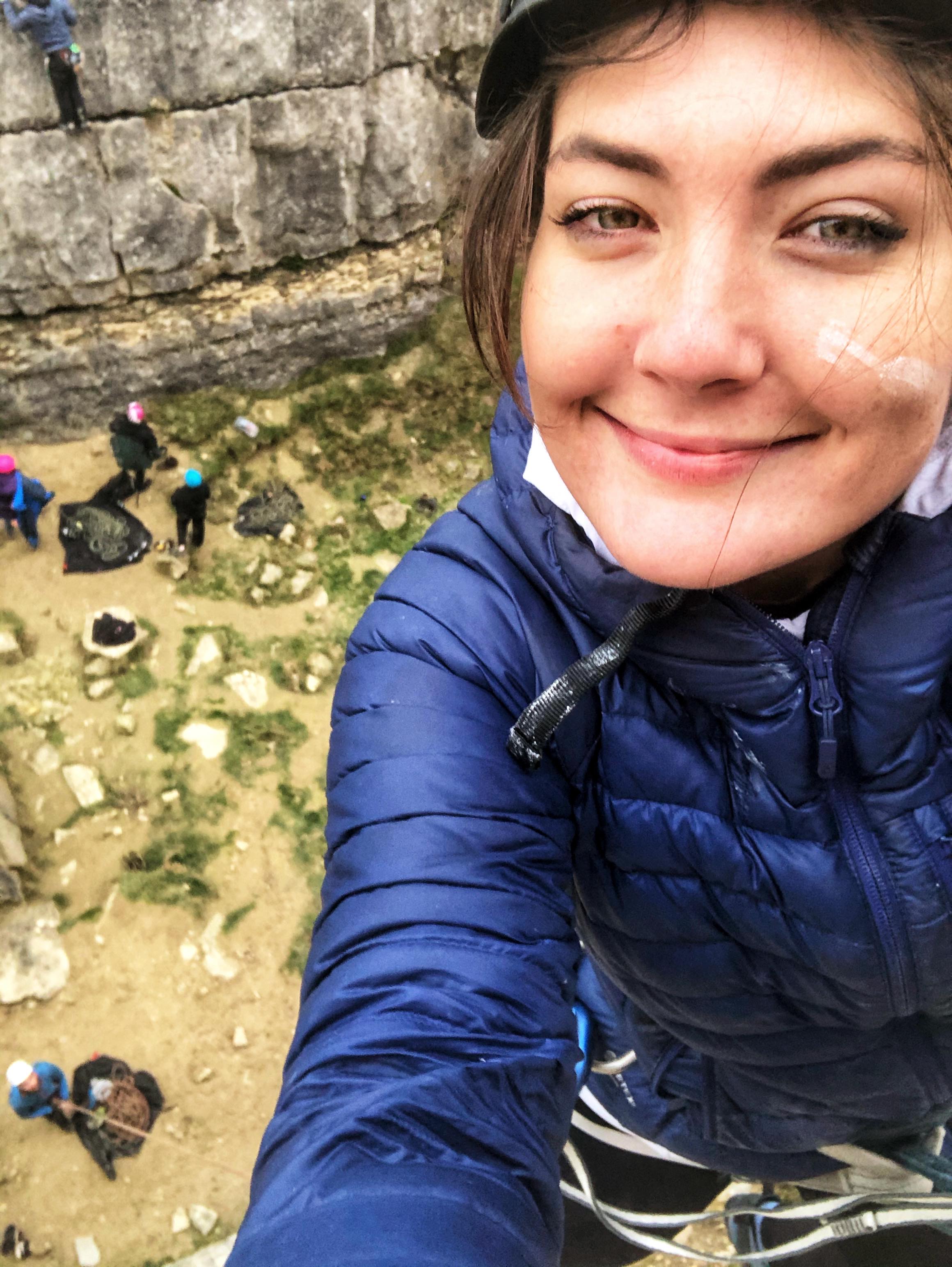
We followed the instructions in the Rockfax guide to get to the crag, which took us uphill along a path and through a farm, over a wall (in slightly the wrong place, but we worked it out) and over open moorland past a bunch of cows. We approached the crag from above and saw what looked like a nest of crows on the left hand side of the rocky outcrop. We got a bit closer, realised to my excitement that it was actually a raven’s nest, and scrambled down the steep, overgrown bank to reach the bottom of the rock face.

While gearing up at the bottom we felt a few drips and realised that we’d been pooed on by a raven, which – if anything – added to the experience. We climbed the two-pitch, 24m VDiff South East Climb, the only route in the Rockfax guide. Ryan led the first pitch up the solid granite and I led the second. It was straightforward trad climbing up an obvious crack, as far as I can remember (I’m writing this three months late), which was a good thing as we were a bit out of practice post-lockdown. I belayed Ryan up to the top of the slabby face while enjoying stunning views over a long, wooded valley. At the top we jumped across a disconcertingly wide gap, clambered down the back side of the outcrop and scrabbled back down the bank to retrieve our stuff.

Porthcurno beach

We stopped at Asda in Bodmin to do a supermarket shop, then headed south west to Porthcurno. We’d considered stopping for an explore in Penzance and Mousehole, but the former was too busy and the latter was too awkward to park in. The car park at Porthcurno is set just above the beach, which is narrow and quite deep, nestled in between two  rocky, grassy headlands. The water was Mediterranean blue, the sand glowed in the sun, and we’d found a new favourite place. We sat against the rocks on the right side of the beach and I pottered around the rockpools, considered a dip in the sea (but got no further), people watched – although it wasn’t too busy – and played Ryan at beach chess.

After a while we walked up the steep, grassy cliff on the other side of the beach and sat admiring the view on an old wartime pillbox. The bay in front of us was dream-like, with the deep blue water on the horizon fading gradually to clear azure as it stretched in to touch the yellow-grey rocks and nearly white sands of the small beaches. Having been in some form of lockdown for what felt like an age, we were so pleased to taste freedom again. With evening approaching, we walked back to the van and drove to Lands End.

Lands End

We parked on the grassy area towards the back of the large, mostly empty car park and after chatting to some other van people who’d decided to stay overnight, walked through the tourist complex to see the heathery cliffs of the UK’s most southwesterly point.. It was a very attractive place and I liked the whitewashed First & Last House sat alone against the wide sea and wild moorland, but in my opinion it was slightly spoilt by the visitor attractions, which include a Shaun the Sheep and Arthur’s Quest experience, eateries and gift shops. We took an obligatory signpost photo and went back to the van for stir fry. A bit later on we went back to watch the sunset over the sea, which was beautiful.

Sunday 2nd May

Climbing at Sennen Cove

In the morning we drove the short distance along the coast to the pretty village of Sennen, set overlooking the long stretch of white sand that is Sennen Beach. We parked in the harbour car park, grabbed our climbing gear and walked up the hill to an old coastguard lookout. The descent down to the climbing area was a steep, rocky scramble, and at the bottom we followed the large ledge around to the easy-looking climbs of Golva area on the right.

We spent the day ticking off some very easy grade climbs, including the Diff grades Junior’s Route, Senior’s Route and Staircase. We alternated leading, seconding and scrambling back down to go again. The rock was solid and the lines we took were up wide cracks – it was good to get back into the swing of trad climbing after so long, but we felt quite out of practice. Just being there was lovely after lockdown, and for a few hours the world was reduced to a high, grey-brown rock face, the deep blue sea stretched across the horizon and just us sandwiched in the middle under a clear blue sky.

Sennen Cove beach

The crag started to get busy by early afternoon, so we topped out and walked back down the hill to the van. We had lunch then walked along to Sennen Beach via a roundhouse gallery where I bought a map, and a tourist-type convenience shop where Ryan the child bought a couple of snorkels and a stunt kite.

The whitish sand sweeps across the curve of the bay in a long stretch between gentle green cliffs, and towards the back of the beach is a boulderfield made from large, sea-smoothed rocks. I spent a while collecting plastic from crevices between the rocks, mostly old rope and fishing line, and was amazed (and saddened) by how much there was.

We went back to the van, had a gin and decided to squeeze an evening climb in – I think it was the mod grade Sinner’s Route. We were pleased that the crag had emptied and glad for the late sun. Back at the van we spent the night talking, cooking (or watching Ryan cook, on my part) stir fry and playing chess. The harbour car park allowed overnight stays, so we tucked the van in a corner and slept peacefully by the sea.

Monday 3rd May

We’d hoped to go snorkelling but the sea was grey and choppy, so we thought better of it. After a good explore of the rock pools just below the harbour car park at Sennen, we started making our way slowly home.

Padstow

First we stopped at Padstow, a very pretty old fishing village on the north Cornish coast. Annoyingly but not surprisingly as it was bank holiday Monday, it was heaving with people. We parked by the lobster hatchery (sadly closed at the time) and walked the short distance to the small harbour, which is surrounded on three sides by quaint pubs, cafes and shops selling fish, chips, coffee, boaty-type clothes and a hundred million varieties of pasty. We walked round to the far side to look at the fishing boats, then headed up the narrow, bustling streets to look in some of the surf-type shops. This time Ryan the child bought a skateboard, which we’ve both since fallen off quite spectacularly.

Port Isaac

Feeling a bit peopled out, we left Padstow and drove north east along little roads to Port Isaac, where Doc Martin was filmed. We parked at the top of the hill and walked down the steep slope into the village, the majority of which sits in a tight little bowl connected to the sea by a narrow opening in the harbour wall. It was another very pretty, quaint and cosy place, with steep, narrow streets lined with a mix of quirky stone, whitewashed, painted and slated cottages.

We walked up the hill on the other side of the harbour to Doc Martin’s house (just to send a photo to Ryan’s mum) and poked around some back streets to find “squeezy belly alley”, which was once recorded as the world’s narrowest thoroughfare. Charmed by the timeless little streets, we grabbed a drink from an outdoor bar on the harbour, sat and watched the seagulls and reluctantly traipsed back up the hill to the van (via the Co-op for road snacks to dampen the back-to-work-tomorrow feeling) and headed home, refreshed in equal measures by the sea air and the taste of freedom.

Dorset Adventures, August Bank Holiday 2021

Friday 27th August: The Square & Compass

We drove down in the evening and met our friend Gus in the car park near the Square and Compass pub at Worth Matravers. This pub is something special – I’ve mentioned it before but on reflection it deserves its own post, so I won’t go into detail. We turned up, ordered three Kiss me Kate ciders and drank in the garden, enjoying the mild summer air and sea views.

Once we were a pint or so in and approaching the giggly stage, a Spanish band started playing from a small gazebo next to us. We didn’t understand a word but appreciated some post-covid, impromptu live music, especially when the keyboardist came out with an impressive solo and the singer donned some bright yellow, horizontal-barred sunglasses with flashing rims which had no business being designed, manufactured or worn, but somehow added to the slightly trippy atmosphere.

My hazy memory suggests that we chatted to the singer and came away with some random band stickers, listened to a mind-numbingly repetitive encore song which had approximately two chords and precisely two lyrics – te and amo – , stayed until (and a bit beyond) last orders, got unintentionally drunk and (on my part) threw up outside the van. I’m not proud, so I’ll move onto the next day.

Saturday 28th August: Paddleboarding Winspit to Swanage, 6.5 miles

Gus slept in the pop-top roof of the van and reported that it was surprisingly comfy, although I suspect he’s too polite to say anything less. We had bacon and sausage sandwiches for breakfast, packed a day’s worth of paddleboarding stuff and walked the mile-or-so down the beautifully green, wild valley to the sea-level ledge at Winspit. After some exertion, the three paddleboards were pumped up and launched.

Section 1: Winspit to Dancing Ledge

We paddled away from the shore and looked back on the sheer limestone cliffs that dominate the long Purbeck coastline, topped by rolling green fields under a blue sky punctuated by fluffy, harmless-looking white clouds. The weather was dry and the sea was fairly calm, but an annoying north-easterly headwind hampered our progress and disturbed the water enough to make travelling in a straight line very difficult for me, as I’d borrowed Tom’s short-finned river/lake paddleboard.

A kayaker passed us and asked if everything was okay, which we perhaps should have taken as a warning. I told him we were fine and enjoying our trip from Winspit to Swanage and he looked at me as if I was positively mad.

After a frustrating half hour Ryan and I swapped, realised to my amusement that he was heavy enough to submerge the board, then both jumped on the family-sized board that Gus had lent us. We paddled along happier, towing the other board, speaker blaring one of my questionable Spotify playlists. Gus flew ahead at an impressive speed on his racing board, which cut through the water like soft butter.

We passed some big caves, resisting the temptation to take a closer look as we realised that reaching Swanage might be an ambitious task. Hedbury Quarry seemed to take forever to pass, and eventually we reached a very busy Dancing Ledge after about an hour and a half.

Section 2: Dancing Ledge to Durlston Lighthouse

Lunch at Dancing Ledge was a good idea as it broke up the journey, lifted our spirits and gave the tens of people sitting and swimming there a chuckle as we attempted to beach and re-launch the boards over the sharp-barnacled, uneven rock ledges. Ryan’s homemade Scotch eggs went down a treat – I think he’s finally found his calling.

The wind seemed to die down along this section, which was by far the most pleasant. We paddled happily along the calm surface as the sun warmed our skin, and even when it clouded over the air was still mild. “You’re Beautiful” came on the speaker and Gus fell in the water, presumably due to James Blunt-induced overexcitement, and we watched a handful of climbers making their way up the blocky limestone cliffs. It was interesting to see the areas we usually climb from this angle because the abseil-in trad climbing at Swanage tends to feel quite lonely, as if there’s noone else on the rock, but there were quite a few people fairly close together who wouldn’t have been able to see each other.

Section 3: Durlston Lighthouse to Peveril Point (AKA Peril Point)

After another hour along the long, straight section of cliffs we reached Anvil Point and Durlston Lighthouse, which had taunted us for so long by not appearing to get any closer. This stretch changed our course from due east to north-east, so the land no longer sheltered from the chilly northeasterly wind.

It took us a painfully long time to get past some people fishing at Tilly Whim caves, then along to Durlston Head. We stoicly rejected the offer of a tow from a jetski, paddled hard as the strange little turrets of Durlston Castle on our left barely moved at all, and fought the frighteningly strong currents around the corner between Durlston Bay and the open sea.

Eventually, after some soul-destroyingly slow progress, we made it around the headland and into the less-windy-but-still-quite-choppy Durlston Bay. This was tough news to swallow as I’d forgotten that this bay lies between Durlston Head and Swanage, so had expected to turn the corner and see the finish line. Exasperated but kind of bemused, we pushed northwards along the wild, empty bay using land reference points to check that we were actually moving, watched enviously as Gus made the whole thing look easy, and regrouped just before Peveril Point to agree how to approach the treacherous-looking thin, rocky spit.

Section 4: Peveril Point to Swanage beach

Acutely aware of the lookout station directly to our left and the numerous people observing our plight, probably with a mixture of concern and amusement, we adopted a plan to paddle aggressively past the rocky finger as if striding confidently into battle. Gus went first and again made it look easy, although he later confessed that his life had flashed before his eyes and he thought the end was nigh.

Ryan and I reached the choppy water, which looked as if a frenzy of sharks were feeding just below the surface, and paddled hard. I thought things were under control until I glanced left at the rocks and realised that we were making absolutely no progress whatsoever. I irritably expressed my concern when Ryan decided to point out (using his paddle, which at that moment should have been being used as a paddle) how mesmerising the calm water ahead of us was. Recoiling at the telling-off, he returned to paddling and we made it past the choppy section, thinking we were in the clear.

As it turned out, I was right to be suspicious about the rolling, mesmerisingly calm water that appeared abruptly beyond the choppy bit. We quickly realised that the flattest sea was in fact the worst, where the currents are strongest, and I watched hopelessly as the water pulled us effortlessly back. Ryan said something along the lines of “let’s go as hard as we can”, I refrained from sarcastically replying “you reckon”, and we paddled our sorry little shoulders off to get out of the current. The paddleboard we were towing was pulling us back and it took nearly everything we had to paddle fast and hard enough to escape, but by some miracle we eventually made it out before muscle fatigue set in.

From there it was plain sailing through the gentle water of Swanage Bay. We paddled triumphantly past the people watching us near the lookout station, between the moored up boats, under the pier and onto the southern end of the busy beach. Relieved to feel solid land beneath our feet, we checked in with Gus to make sure he struggled with Peveril (later named Peril) Point too – he reassured us that he did – and we packed up our stuff.

A few celebratory drinks

We traipsed through the busy streets of Swanage and quickly found ourselves in the tucked-away garden of the White Swan with a cold pint each. The customary post-adventure, post-near-death-experience debrief ensued and we laughed about how – with hindsight – oddly enjoyable the journey had been, and how – even with hindsight – it wasn’t quite all enjoyable. A combination of all day sun, exposure to the elements, hunger, fatigue, relief and on my part lightweightedness meant that the alcohol got to us quite quickly.

We caught the bus from Swanage to Acton with our big paddleboard bags and walked a mile across a field and along a quiet road back to the van. To the others’ delight I managed to flick a big dollop of wet sheep poo up the back of my legs, thanks to my April to October flip-flop policy. We met Tom and Cam (Tom’s girlfriend) in the car park, had a discrete barbecue as we watched the sun set, then returned to the Square and Compass to while the night away. After last orders we came back to the van to talk more rubbish and play card games, but I don’t remember much of that.

Sunday 29th August: Snorkelling and climbing at Winspit

Sunday was comparatively relaxed. After breakfast the five of us walked down to the sea-level ledge at Winspit and had a dip in the sea, with varying levels of reluctance. On jumping in I dropped my snorkel mask, which was thankfully retrieved by Ryan. The others messed around while I snorkelled over colourful rocks covered in all kinds of barnacles, anemones, plants and algae, underwater forests of long, gently swaying seaweed and fish, including large, tropical-looking red, yellow, blue and green wrasse.

We sat talking, eating, drinking and people/dog watching on the flat, rocky ledge, enjoying the sun. Around mid-afternoon we persuaded a reluctant Gus to try rock climbing, so we walked up the bank to Winspit west Quarry and Ryan led Bread Knife, a grade 4 sport climb up a corner crack with a couple of tricky-ish moves for the grade. I belayed while Gus trembled his way up (in Vans as Ryan’s shoes didn’t fit him, poor boy), until he reached a difficult section and decided that the most sensible option was to come down. He did a good job of putting on a brave face – we only realised his genuine terror once he was back on the ground.

I toproped the climb, came down, then toproped again to clean it once we realised Gus wasn’t getting back on the wall. Having successfully managed to put him off climbing, we walked back up the valley to Worth Matravers, all jumped in Tom and Cam’s van and went down the road to the Scott Arms at Kingston for dinner.

We were pleased to find that their outdoor Jamaican shack was open and serving food for the first time since we’d been there, so we found a table in the busy garden overlooking Corfe Castle and ordered various jerk dishes. We were all starving and the food seemed to take an age to come, but it was so worth it once it did – I’ve never had proper Jamaican food before and it was lovely – sweet, spicy and incredibly satisfying. We enjoyed the evening sun and the lovely view (but not so much the occasional sewage smell coming from a drain in the garden) over a couple of drinks, then Tom and Cam went home ready to work the following day.

The remaining three of us walked 3 miles back to Worth Matravers as the sun was setting, through a cattlefield and along a wild, narrow, steep-sided wooded valley on a path filled with slugs and stinging nettles. I’m glad I took a headtorch because it was absolutely pitch black when I turned it off. We emerged in a field at the back of Worth and walked to the Square and Compass via the cobbled village. The rest of the evening involved mead, jelly snakes, deep conversations, admiring the mustard walls and eclectic décor and a visit to the pub’s fossil museum.

Monday 30th August: Mountain biking at Puddletown Forest

We got up, packed up, had a classic van breakfast of eggs in purgatory and headed about half an hour west to Puddletown Forest, where Gus knew some mountain bike trails.

Puddletown Forest is a large area of Forestry Commission leased woodland interspersed by bridleways, firebreaks and footpaths. It’s quite hilly and after a climb up a sandy, gravelly track, we emerged from the trees onto a high, heathery ridge. Mountain bikers have carved natural trails through the heather and the first section we did was very narrow, overgrown and scratchy, which woke us up and started the adrenaline pump.

From there we went to find a couple of bombhole-type bits with flowy jumps and steep drop-ins. I’m confident downhill but very much in the learning stage of jumping a bike, so I messed about on my own while the other two flew around all over the place. Some of the jumps looked crazy – way too ambitious for any of us – and I wonder how on earth people manage them. The ground was nice, compact dirt, but the tree roots were a bit annoying as they threatened to throw wheels off course at the most inconvenient moments.

We spent the rest of the afternoon riding around looking for more trails, which cropped up either side of the bridleways and provided some lovely singletrack riding. Some of it was quite committing (mainly because of the loose ground, roots, steepness and drop-offs) but we made it round fine. The trails have been named but the location feature of Gus’s Trail Forks app was playing up, so we had no idea where we were or how to get to each one; instead we ended up riding along until we saw something that looked good. One trail in particular had a lovely section of flowing, S-shaped berms, and another had some fun, technical rooty downhill.

I felt quite sluggish after a long weekend of exertion, drinking and a less-than-ideal amount of sleep, but I really enjoyed the riding and I’ll definitely come back. It’s the kind of place where you have to spend time to work out how to get around, but I’m sure that once you do it’s easier to link the trails together and cut down on the firebreak/gravel track riding.

Tired and hungry, we accepted that the weekend had to finish at some point and made the unanimous decision to soften this blow with a team McDonalds. We packed the bikes up after 3 hours of riding and met at Ferndown Maccies, where we ate naughty food and agreed that we can’t leave it too long until the next adventure… and so concluded a pretty epic weekend.

North Pembrokeshire, June 2021 (2/2)

Thursday 1st July

Newgale Beach

The fog was still thick around our wild camping spot on the Preseli Hills when we woke up. We were due travel to South Pembrokeshire for the second half of the holiday and had arranged to meet mum, dad and Angus at Pembroke Castle at 1pm.  We spent the morning driving down via Newgale Beach on the west coast, with a view to seeing as much of the national park as possible.

We dropped down into Newgale after an hour’s drive through pretty farmland and parked at the large beachfront car park. Newgale is a small village in a basin that opens onto St Brides Bay, with a large, lively-looking campsite set just across the road from the beach. The beach is long, sandy and scattered with smooth pebbles. The weather was strange – still, warm and bright, but grey sea mist stopped sunlight penetrating and gave the sea and sky a serene, dream-like quality. We walked along the shore until we reached some cliffs and caves at the southern end, explored for a little bit and headed back to the van.

Pembroke Castle & Town

We stopped at Morrisons in Haverfordwest for shopping and fuel, then met the others in Pembroke early afternoon. Pembroke is a small, bustling town that still seems to revolve around the castle, which has high, well-preserved walls that tower over a long pond on one side and the high street on the other. Inside, the large, grassy courtyard is contained by walkable walls and several towers which house a lot of interesting information about the castle’s history, including some realistic mannequin scenes and the room where Henry VII was born. It has a “proper” castle feel, with its huge keep (sadly closed), dungeon room, herb garden, scattered flowerpots, battlements, towers and high walls. Definitely worth a visit.

After a thorough poke around the castle we  wandered up the high street, where we looked round an old fashioned convenience store and a tiny shop that sells handmade, surfwear type clothes. I bought a pair of yoga shorts with a honeycomb pattern and a couple of headbands, all made in the shop with organic cotton – would recommend, see the website here – https://www.iseasurfwear.co.uk/. Ryan and I then went on to the Watermans Arms pub and enjoyed a cold cider on the deck, which is raised on stilts over the edge of the pond and has a lovely view over the water, the castle and the town. We watched in amusement as a single, angry-looking swan chased a group of at least 30 much more passive swans around.

Camping, Kiting & Broad Haven South Beach

We drove a little way south along tiny roads to the new campsite, Trefalen Farm, late afternoon. This is another lovely site with sea views, basic facilities and a really remote feel. The first thing we did was find an open field near the cliffs and fly Ryan’s powerkite, as so far the weather had been record-breakingly non-windy (for Wales) and having felt a slight breeze, we were very keen to get it in the air. There wasn’t lots of wind but there was enough to have some fun for half an hour or so before going back to the van and cooking fajitas for tea.

After eating we all tramped down the hill to Broad Haven South, a deep, attractive sandy beach with dunes set way back from the sea and impressive rocks and caves on either side. We walked and footballed our way to the far side, where we explored narrow caves and clambered around on the rocks. Angus was introduced to the slimy delights of large, light-hating cave lice and we found some random sea junk wedged high in damp cave systems, including ropes, buoys, jerry cans and a tyre. Satisfied with a day spent poking around castles and caves, we went back to the campsite and played some stupid card game Angus bought at the castle gift shop, which became hilariously long-winded.

Friday 2nd July

Climbing at St Govan’s Head

Ryan, Angus and I set off from the campsite to climb at the nearby coastal crag of St Govan’s Head. We walked west along a wild section of the Pembrokeshire coast path which had lovely views of dramatic cliffs towering over little rocky beaches and coves filled with clear blue water. We’d definitely chosen the right day for it as it was dry, still and kind of sunny, kind of cloudy, so not too hot or cold. We arrived at some abseil stakes by the edge of a cliff near a military training zone and after a little bit of faff, worked out the right stake to abseil off.

We set up the rope, took what gear we needed and one by one, abseiled over the edge of the cliff. As always the most awkward bit was going over the lip, where your legs go from vertical to horizontal against the wall. The abseil was really fun – about 30m high and against a pleasantly sheer wall, with some free space to hang into in the middle, and with dramatic views of the wild, intimidating cliffs and calm sea below.

The climbs were graded quite high and described as high in the grade, so we went for easy stuff. Angus hadn’t trad climbed for ages and Ryan and I hadn’t done much at all during a year of lockdown. First Ryan led “Exit Corner”, a straightforward VDiff up a blocky corner, I seconded and Angus toproped. We abseiled down again and I led “Lemming Way”, a Severe route up another corner with a fairly exposed, awkward section which had a disconcertingly damp crack where I faffed around with some tricky gear placements.

I belayed the other two up and we abseiled down again. This time Ryan picked “Centurion”, a Severe line up a nice-looking crack with one difficult looking move under an overhanging block. He got to that move without much difficulty but got stuck there, so he came down and I had a go without any real expectation of getting any further. It was an awkward and fairly bold move involving a high right leg and some dubious holds, but I committed to it and to my surprise pulled up over the block. The finish was quite loose but otherwise fine, and I belayed Ryan and Angus up (using a munter hitch as I’d given Ryan my belay plate) feeling quite pleased with myself. As I was doing so I watched a little nervously as a cow approached and sniffed another belayer’s rope anchor at the edge of the cliff –  I didn’t want anyone to have to contend with curious cows while belaying, and I definitely didn’t want a cow to fall off a cliff. Luckily the cow lost interest and wandered back to safety.

Trad climbing always takes longer than you expect, especially when you’re a little out of practice and there are three of you. By this time we’d only done three climbs and three abseils, but it was mid-afternoon and we were getting hungry (having overlooked the value of packing lunch). We were satisfied with our taster of Pembrokeshire climbing (although Ryan and Angus slightly more so than me) so we packed up and headed for the nearest pub.

We walked west and took a detour via St Govan’s Head chapel, a tiny, ancient limestone chapel down steep steps built into the side of a cliff and perched above a small cove. It’s a striking building which merges into the cliff quite naturally, as if it’s always been there, and some of the etchings on the stone altar suggest that it’s drawn interest for a very long time.

We climbed back up the steep steps and walked north for half an hour into the village of Bosherston and found the pub, the St Govan’s Head Inn. Dad had left me a voicemail saying that he’d booked the five of us in for dinner at (unhelpfully) “the local pub” and nobody had any phone signal to find out which pub it was, so we had a couple of drinks there and after a bit of phone-waving, I received a text suggesting that we were in the right one so we stayed.

Mum and dad turned up about 6 and true to form, I was decidedly wavy after two or three ciders while Angus and Ryan were fine. The pub was lovely inside, with wooden beams and low ceilings, and the food was very good – I had dressed crab and some chocolate thing for pudding, and my only complaint was that Ryan promised me one of his prawns but ate them all before I could get there. We split the bill between Ryan, Angus and I and walked back to the campsite along a narrow, hedge-lined road, happy with a good day’s climbing and pubbing.

Saturday 3rd July

Stackpole Gardens

It was mum’s turn to pick something to do, so we ended up at Stackpole Walled Gardens. Entry is free and a lot of the gardening is done by adults with learning difficulties as part of a charity thing. It’s a nice place to go, with long greenhouses, strange plants and sculptures, and it had lots of little corners to explore. Our favourite part was the rows of fruit available to pick for free, including strawberries, raspberries, gooseberries, blackberries and tayberries. We were there for an hour or so, until we ended up getting drizzled on while waiting for mum to finish bumbling around.

Surfing at Freshwater West

Taxi of dad then took us to Freshwater West beach, where we just about found a parking spot. Ryan and I changed into wetsuits and took the surfboard and bodyboard down to the long, sandy beach just down from the car park, and waded into the rough sea. We didn’t get far at all before being batted back by the waves. The surf was beyond our skill level in that we couldn’t even get the surfboard out far enough to catch the longer waves – the ones close to shore were short and ferocious, crashing high above our heads and pulled quickly back from under our feet.

We were washing machined around for a while, which involved getting hit multiple times with the boards and noting that a hard surfboard is considerably more painful than a foamie. One such collision (with my thigh) resulted in one of the three fins snapping off the surfboard and from then our attempts at proper surfing ceased. I’d managed to stand twice, both times in the shallows, and both times for a record-breakingly short duration. Body boarding was good fun though, and less calamitous.

After about an hour of being battered by the sea, we tramped back along the beach. Dobby’s grave, consisting of a lot of stones all piled up, was up on the sand dunes to the left – apparently it’s where the scene was filmed (spoiler – Dobby dies). The sea, and our attempt to find some surfable waves, had dragged us quite a long way to the right, and annoyingly we noticed on our way back that the surf to the left had calmed down a lot to the point where surf schools had started eyeing it up.

Feeling half-starved, we grabbed lunch from the famous Café Mor burger van in the car park. I had the vegetarian burger and Ryan had the classic Mor burger with chips. The people were really friendly and the burgers were amazing, served with some kind of seaweedy pickles and relish.

Powerkiting at Broad Haven South

We went back to the campsite via Pembroke so that mum could grab some bits from (ie. spend an inordinate length of time in) the shop. We helped pack up the awning and for tea mum cooked a strange but very nice mix of bits that needed using up, which included buckwheat, mackerel and salad.

That evening we wandered back down to Broad Haven South beach to show the others Ryan’s powerkite. There was practically no wind but we just about managed to get it up and give dad and Angus a go. It was nice to fly it on the beach regardless and the only downside was that in my enthusiasm to take the mountain board despite the lack of wind, I graunched my heel on the axle while scooting along and it bled quite a lot.

On the walk back up the hill the heavens opened. I’m not exaggerating when I say it was like a tropical storm – we were dry one minute and drenched to the bone the next, so much so that it stopped being annoying and became funny. Once back at the vans and changed into dry clothes, we all huddled in dad’s van and spent the last evening chatting away.

Sunday 4th July

National Museum & Cardiff

We parted and left, a little sad, quite early on Sunday morning. It was grey and wet and we counted ourselves lucky that the Welsh weather had arrived just as we were leaving. Ryan and I came back via the National Museum at Cardiff as I was keen to see the city, having never been before, and thought the museum would be a good rainy day activity.

We parked in the city centre quite cheaply – £5.50 for 4 hours – and walked the short distance to the museum, through an attractive, leafy park and past the grand university and court buildings. Entry was free and it was very interesting. The ground floor was all about the natural history of Wales and housed an incredible collection of rocks and meteorites, dinosaur and prehistoric animal skeletons and information about plants, fungi and habitats. After a lot of reading I sensed Ryan’s growing impatience and we moved upstairs to the art floor.

This had lots of cabinets filled with pottery which was, in our untrained opinion, of uncertain aesthetic value. It was a bit of a labyrinth, with different rooms housing works of photography, paintings and sculptures. The work ranged from very old-looking portraits of heavy-eyelidded, curly-wigged posh people to modern paintings in blocky colours with dubious justifications as to what makes them worthy of gallery status. One exhibition featured huge paintings by a couple of artists which I thought were excellent and very poignant, having read about their cultural backgrounds, but I can’t remember their names.

After a couple of hours we left the impressive building through the large marbled, columned foyer and went for a wander around Cardiff city centre, pleased that the weather had cleared up. I thought it was a very attractive and clean city, with a young, lively atmosphere and lots going on. There were all sorts of shops, cafes and bars in a very small area and the castle was impressive, set near the centre with high, well-preserved walls. After a quick excursion to a phone shop so Ryan could sort out a new phone contract, we grabbed a subway and headed back to the van.

And so concludes our holiday in Wales. We had a lovely, busy week and it was really nice spending some time with my family, especially after lockdown(s). The two van, one tent setup worked well and we got to see a lot of Pembrokeshire, although there’s definitely more to see. I have a feeling we’ll be back…

Climbing Benny Beg, Stirling Castle: Scotland Day 8, Sep ’20

Our day started in the van on the edge of Braemar, with a conversation about climbing Lochnagar. Ryan’s knee was quite sore so after much deliberation we decided that instead of hiking the White Mounth loop, which takes in five Munros in the southeast Cairngorms, we’d head towards Edinburgh and find somewhere to rock climb.

A quick Google search later pointed us in the direction of Benny Beg, a small crag about 2 hours south of Braemar, between Perth and Stirling. We drove away from the immense, rolling peaks of the Cairngorms quite reluctantly, through miles of open farmland, and found the crag car park behind a small garden centre.

A one minute walk along the footpath at the back of the car park took us to the wall, a long section of bare rock face about 10m high that seemed to be plonked very randomly (and very conveniently) in the middle of a fairly unremarkable landscape consisting mainly of crop fields.

The climbing was really enjoyable – a series of easy single-pitch routes on solid rock. The bolts were nicely spaced (ie. very close together!) and there were plenty of low grade routes, which suited us as we didn’t fancy anything particularly hard. We alternated leading four or five climbs, from 3c to 4c, before the rain crept in and we made a hasty escape back to the van.

I’d recommend Benny Beg to anyone in the area, largely because it’s so easily accessible from the road. It would be a great place to learn to climb or to take kids because the grades are easy and the bolts are forgivingly spaced. The downside is that I imagine it gets busy at peak times in good weather.


Having decided to spend the next day exploring Edinburgh, we meandered south towards the city. We’d booked a cheap hotel and had a few hours of the afternoon left, so we took a minor detour to Stirling Castle. As castle locations go, this has to be one of the best: perched on a high rock plateau whose sheer faces rise high above the forest below on one side, and which towers over the attractive, ancient city of Stirling on the other.

I have a soft spot for castles, perhaps because every childhood holiday incorporated at least one, or perhaps it was inherited from my dad (who I tease for being a medieval relic in his own right). Stirling didn’t disappoint – it had towers, turrets, battlements, dungeons, a portcullis, a (dry) moat, a (famous) bridge, a keep, a great hall, a church, cannons, mountain views, walls you can walk around – it ticked all the castle boxes. The only shame was that most of the indoor bits were closed due to some pesky pandemic, so it’s definitely one to return to.

We got to Edinburgh in the evening, checked into the hotel and planned the next day. The van is small enough to park in a city centre car park without any fuss, but also small enough that washing facilities are very limited, so we were particularly grateful for a hot shower that night.

Ben Nevis climb via Tower Ridge: Scotland day 2, Sep ’20

We parked in the North Face car park just north east of Fort William and set off through the dense, wild Leanachan forest. We practically trotted through the trees, flailing limbs at the infamous West Highland midges and – although the forest was enchanting – were keen to put as much distance as possible between our as yet unbitten skin and the river by the car park.

We emerged onto a wide sweep of heather dotted with bright green shrubbery and small broadleaf trees, backed by the majestic hump of Ben Nevis’s north face, dark against the clear blue sky. Our next destination, the CIC hut, sat neatly at the head of the valley in a cosy, three-sided bowl formed by Carn Dearg, Ben Nevis and Carn Mor Dearg, looking down the length of the Allt a Mhuilinn river to a north-westerly horizon full of hazy blue mountains. Our path up to the hut was well-maintained and parallel to the river, so there was no real prospect of getting lost. The tricky bit would be determining our target – Tower Ridge.

We had no guidebook and the previous night’s googling yielded little light on the exact location of the ridge, so we were going off a couple of vague diagrams and a singular, hand-drawn map found on google images. At the hut, where a handful of raggedy climbers and seasoned-looking walkers congregated, we munched a sandwich and identified what we were fairly certain was Tower Ridge – a narrow, protruding finger of rock that joins the high, plateaued ridge between Ben Nevis and Car Mor Dearg at a 90 degree angle.

The giveaway was the Douglas boulder, a hulking mass of rock at the base of the ridge. From the hut, we walked, then scrabbled, up the loose, rocky debris that constituted the ground. It was hard work and the ridge definitely felt further away than it had appeared. Eventually we got to the other side of the Douglas boulder, turned towards its vast east face and started climbing, now in the dark shadow of the formidable Ben. This is considered a more sensible way to gain the ridge than from the west, even though the walk-in is longer.

Buzzing at the first real bit of exposure, we stopped once we were straddling the spine of the ridge to take in the view and decide whether to get the rope out. Although the way was steep and either side of the ridge was treacherously sheer, we decided against it for this first section; the holds looked big and solid, and we were confident that it was no more than a steep scramble. It wasn’t long, however, before we got to a more questionable face on the west side of the ridge.

We roped up and I led the first pitch, which turned out to be less technical than it had looked. I set up a quick anchor and brought Ryan up safely, then we scrambled on carrying a few feet of rope between us, coils stored over shoulders, not secured to the ridge but confident with the easy climbing. We moved at a steady pace, sometimes debating whether to use the rope and, more often than not, deciding against it. On our left loomed the intimidatingly dark, sheer face of Ben Nevis, and on our right we were spoilt by seemingly endless stretches of lush heathland, green forests and blue mountains.

There was one sketchy moment when we decided that the best route was to go left around the ridge, only to realise – once I was balancing somewhat precariously above the apparently bottomless east face – that the holds were few and far between and some of the rock was loose, and that we should have gone right. Ryan quickly took the most convincing right hand route and set up an anchor, so I could climb safely out of my uncomfortable, teetering position. I wasn’t happy with my Salomon Quest boots, as they’re thick-soled and chunky – perfect for hiking but not for use as climbing shoes, as I could barely feel the rock between my feet and I didn’t trust the grip. It would have been a little too easy to tread a little too aggressively and misjudge a foothold. Ryan’s LaSportiva XXX approach shoes, on the other hand, were perfect for the purpose – grippy and flexible enough that he could feel holds with accuracy, but without the foot-choking tightness of climbing shoes.

About three-quarters of the way along, we found ourselves squeezing up a narrow tunnel on the left hand side of the ridge. After giggling at the ungainly way we each emerged from the gap, we looked up and realised that our next move wasn’t obvious. Up until now, it had seemed that there was no “right” route along the ridge, apart from that which didn’t take us too close to either of its perilous sides. Here, we were pinned to one side and faced an unlikely-looking climb upwards, or a tight traverse along the left side of the ridge, which seemed to take us downwards. We chose left, but stopped at a strange whistling sound. A moment later, a cheery-looking climber popped out of the tunnel, wearing just a pair of bright yellow shorts, trainers and a small rucksack. We asked him the way and he grinned as he told us it was not left but “up”, then proceeded to float up the wall with irritating ease. He explained that this was the most difficult move of the route, probably around VDiff, but foraged around with his arm in a crack and reassured us that there’s a good hold somewhere.

Bemused by his timely appearance and nonchalent manner, we climbed upwards after him, roped up. He was long gone by the time we’d reached the top of that section, Great Tower. Ahead of us was the bit of the ridge that we’d watched videos of, and which we were looking forward to most. Ryan led the way across the most exposed part of the route, which is a skinny arete about 50 feet long and as wide as a pavement, which drops down hundreds of sheer feet either side. It was exhilarating to walk across, and I picked each uneven step carefully – although I was on belay, the length of the traverse meant that a fall would mean a nasty swing and crash against one of the ridge’s treacherous faces.

At the end of the pavement was the famous Tower Gap, a break in the ridge that required a slight downclimb and committal step across to the other side. The holds were good, and I joined Ryan quickly. From  there, the way to the top was quite straightforward – up and over another high, but solid, grey mass, unroped. We pulled over onto the Nevis plateau elated and to the shock of several hikers.

We walked left along the flat top to the summit, which was teeming with people.  It was as if we’d suddenly plunged back into reality, the timeless thrill of the climb behind us. On the ridge, we’d overtaken a group of three and been overtaken by whistling guy, but otherwise hadn’t seen anyone up close (we could see people on the plateau from the ridge) for hours. We took in the panoramic view of endless mountains, layered on top of each other in an enticing blue haze, had a sandwich and (to our horror) queued for a quick summit picture. People eyed us with interest, and a group asked us whether we’d climbed up. I refrained from telling them that “no, I wear a harness everywhere and the rope’s for show”, and we made our way down the loose, zig-zag pony track before we got too peopled out.

The view over Glen Nevis was stunning, but unfortunately we were busy focusing on each loose, uneven step down to appreciate it fully. We passed a waterfall and came to a fork near the dark water of Lochan Meall an t-suidhe, where most people went left down the pony track. We went right, which took us east around the north face of Carn Mor Dearg and back along a long path towards the CIC hut. Before we reached the hut, we cut left down the bank to cross the river and join the path we’d come up that morning, but not as soon as we could have – we were keen to avoid finding a bog, which we’ve become uncannily adept at.

I stopped to pick a handful of bilberries, which are lovely, sweet little wild blueberries that grow on low, scrubby bushes. The walk back to the van back down the Allt a Mhullain river was beautiful, and we soaked in the wilderness of open heath speckled with lilac cornflowers, pink heather and leafy green bushes, backed by dark forest and countless mountains. Breathtaking, but still we were keen to get back; we were starving, walking on sore feet and eager to find a pub.

Eventually we reached Leanachan forest. In its late afternoon quietness, it took on a sense of mystery that we hadn’t felt earlier; it was as if the trees were watching us pass, but it was peaceful, rather than creepy. Our heightened senses took in the grassy, mossy carpet, the lichen growing abundantly on the dark side of the trees, the fungi nestling in crevices and the intricate detail on the bark of the gnarly birches and towering pines. Every time I’ve been to Scotland, I’ve noted that there’s something magical about the forests.

We got back to the van, shut out the midges and de-booted. A twenty minute drive later and we were at the Ben Nevis Inn, tucked on one bank of the valley of Glen Nevis. We were pleased to see that we could stay overnight in the Achintree Road car park, right by the pub down a dead-end road. Unfortunately the pub was full indoors and booking-only, thanks to covid, but we enjoyed a pint of Thistly Cross cider (delicious) in the garden. I’d recommend the pub – amazing location and lovely looking inside, an old barn I think. That night we cooked and enjoyed a couple of ciders in the van before collapsing into bed, exhausted. We’d been incredibly lucky to have had clear, sunny weather all day – that night, it’d be an understatement to say the rain came.

Lakes Rampage 2020, Day 9: Climbing at Langdale, Home

Faced with the end of our adventure and a six-hour drive home, we woke quite reluctantly on Sunday. However, we had a saving grace: during my waiting-for-Ryan-to-wake-up perusal of our Lake District climbing guide, I’d come across a crag that was on the way back and only a five-minute walk-in from the road and on our way back. Naturally, it was impossible not to incorporate it into our morning.

The discovery of Raven Crag at Langdale almost made up for the fact we’d missed out on climbing Corvus (see previous posts – I’ve probably lamented this fact in all of them). We left Glenridding early, made our way to Chapel Stile and tucked into the tiny roadside parking spot, from which we could see the crag just up a bracken-covered hill. The bare rock face lured us up, the unmistakeable clink of trad gear rattling noisily.

We chose a 37m, two-pitch climb, Route 2, graded HS 4b and supposedly “one of the finest at the grade in Langdale”. I led the first pitch, which went up a corner groove and pulled out over a corner to an arête. It was quite straightforward and the rock was solid, and I found a nice thick tree on a ledge to belay from. I brought Ryan up and he led the second pitch.

It turned out that this pitch was a little more exposed, and one section in particular was quite hairy – a traverse of several metres, diagonally across and up a blank face with teeny little holds and zero gear placement. Ry made it up without issue, although there were a couple of disco-leg moments when I expected to catch his fall. He took a long time setting up a belay at the top, and it was only when I joined him up there that I saw that the anchor-building opportunities were very few.

Once I was up we took a moment to rave about how good it felt to climb, and another moment to admire the sweeping, green Langdale Valley. It was a walk-off crag, so we half-walked, half slid through the ferns to retrieve our stuff from the bottom of the climb, then plodded back to the van.

We twisted along the narrow roads to Grasmere village and bought a load of the famous Grasmere gingerbread for our families. I could go on about this gingerbread – a work colleague once brought some in and having tasted its chewy, sweet, gingery goodness, I wasn’t going to leave the Lakes empty handed. There was a queue for the tiny, old-fashioned shop, right in the middle of the pretty village of Grasmere, which – although a bit touristy – was once home to poet William Wordsworth, and is probably worth returning to with a bit more time.

Satisfied with having found a multipitch climb and loaded up with gingerbread, we reluctantly left the Lake District. We fuelled up at Kendal early afternoon and arrived home just in time for tea, having killed the driving time by listening to the excellent audiobook of Aron Ralston’s 127 hours. So concludes a wonderful adventure – and we were fortunate enough to return with all eight limbs.

Lakes Rampage 2020, Day 5: Climbing in Borrowdale

I peeked under the pull-down blind to take in the tranquility of early morning in Honister Pass. The sky was clear and the sun had drenched half the valley side in its balmy warmth. I waited for Ryan to wake up (I’m definitely more of a morning person), then we ate and drove up the steep “head end” of the pass. The road that joins the Buttermere and Borrowdale valleys is winding, hilly and incredibly scenic.

We parked at Thorneythwaite Farm, put £3 in the honesty box and headed up to the crag. We’d hoped to climb Corvus, a famous five pitch route graded Diff (easy) either today or tomorrow, but thought we’d check out the nearer Glaciated Slab at Combe Gill to begin with. There were a handful of single-pitch climbs there, which would be good for warming up our trad climbing brains after months of covid-induced abstinence. Given Monday’s epic hike, we also wanted to test Ryan’s still-sore knees before committing to a multipitch.

The walk in to the crag took about half an hour and the last section involved an awkward scramble up a steep boulderfield. Glaciated Slab was worth it, with its agreeable, off-vertical gradient, grippy looking rock and handful of cracks. It was quiet and wild, situated high up on one side of a steep, V-shaped valley, carpeted on both sides by scrubby grass, dark green forest and a litany of loose rocks. To our right Derwentwater peeked distantly through the trough of the “V”, backed by the hazy blue mountains beyond Keswick.

Our Rockfax climbing book informed us that all but two routes were within our grade, so we hoped to get a good few climbs in. Keen to feel cold rock under our fingers, we dropped bags and harnessed up. Ry started by leading Trod Too Far (HS 4b), then I led Trod Pip (VS 4c), then we took turns crossing off whatever we fancied. It had been over a year (tragically) since I last built a three-piece top anchor, but I was pleased that it came back so naturally. I didn’t have to think about the process of placing and testing gear, clipping in, equalising the sling and bringing the rope up to put Ryan on belay.

The rock was grippy, nicely cracked in some places and a bit bare in others, and it felt so solid that we threw in a couple of solo climbs (Diff/VDiff). I felt the old, toe-tingling thrill of looking down at the distant ground and accepting that up is the only option. After a good few hours climbing, we decided that we’d exhausted that crag and scrambled/walked back down the valley, returning to the van about 5pm.

We drove north along the pretty Borrowdale road to Keswick, on the north tip of Derwentwater, grabbed some supplies from the Co-op, and wandered round the pretty, bustling town. Before we knew it, we found ourselves in Wetherspoons. We discussed our plan to go mountain biking the next day over a pint and three small plates for £10 (every time), then hopped back in the van and drove up the road towards Whinlatter Forest Park. We found a discrete car park, went for a quick walk up a hill overlooking Keswick and chilled in the van for the rest of the evening, basking in the happy-exhausted feeling that comes after a good day’s climbing.

Portland Climb/Camp, Nov/Dec’19

Apparently Portland is “the” place to go climbing on the central-south coast of England. Connected to Dorset by only a skinny finger of land, it offers long stretches of walk-in limestone cliffs with easy parking and lovely sea views.

We made a last-minute decision to join my brother’s climbing club trip, inhaled some bacon at Hill HQ, threw our gear into the car and headed to Portland. It was a fine day and we arrived at the Battleship Back Cliff area on the west side of the island late morning. After missing the concealed approach down the cliff, we found a fixed rope and scrambled down. On the way down we saw what looked like a red climbing helmet by the base of a rock near sea level. I scrabbled off to look for it/its owner but couldn’t see it again, and we carried on along the cliff to find Angus’s group.

80439363_497839824417765_1635229401186566144_n

They were climbing at The Block and The Veranda, two opposing walls which form a kind of open-roofed, wind-sheltered corridor. The routes on the landward-facing Block side were short and grades ranged from 4 to 6b+. The group had left a few ropes in the wall which, although annoying at a busy crag (which it wasn’t), was good as it meant we could fly up and down quickly. It was nice and chilled as Angus’s friends had mixed climbing experience, so there was lots of milling about/chatting/coaching/milling about. Ryan might like me to mention that he led a tricky 6a+ (hope you’re reading); I climbed four Block routes and a nice, high one on the Veranda side, then helped the club clean some gear before we lost daylight.


We scrabbled back to the car via a near via-ferrata type scramble/staircase, shoes slipping and clagging with clayey mud, said bye to the group (who were staying in Weymouth) and headed off to scout out a camping spot. We found a perfect place tucked between two bolted rock faces on Portland’s southeast side, went to a shop for cider and snacks, then found ourselves in the lovely and cosy Eight Kings pub in Southwell.

Well fed and watered*, we carried our gear into the cold and very windy dark, through brambles, over a gaping crevasse, down a steep, loose slope and round an awkward tight corner to the camping spot. We had the tent pitched and occupied in less than 15 minutes and spent the evening talking rubbish, drinking Old Rosie and feeling happily isolated from the world. Cold November nights spent confined under a thin bit of fabric are tragically underrated.

We laid in on Sunday morning, which I could cope with (I’m not a lay-in kind of person) because camping is worthwhile in its own right. The weather was finer than the previous day – clear and dry, but still windy. It was a lovely spot, a mini gorge tucked away from view and enclosed on all sides, accessible only by a narrow scramble around a corner and wild with brambles. The coastal path runs along the top of the seaward wall, but is just far enough back from the scrubby edge that the gorge is hidden. The view from that path was magnificent – colourful vegetation and scattered rocks covered the gradual slope down to the clear blue sea, and the pale cliffs of the Jurassic coast shone to the east in the low winter sun.

There was no need to look for climbs as the two opposing limestone walls of the gorge were bolted and climbable, so we harnessed up. We rattled through six short bolted routes in a couple of hours, swapping leads. We didn’t climb particularly hard but it was good to get through a handful of climbs. The only really memorable bit was the awkward position I managed to get myself into when I jammed both knees into a big, overhanging horizontal crack, leant back and practically dislocated a shoulder to clip a bolt above.

We finished with a fun, flakey route, which Ryan led and belayed from a top anchor, and were lured home by talk of a fire and Raclette at Hill HQ (thanks to lovely Cam). We returned with rosy cheeks and rock-battered hands, bitter at Monday’s imminence but pleased to have got back on real rock. Portland had shown us its climbing potential and needless to say we’ll be back.


*cidered

Lazy weekend (feat. a 20mile bike ride, a scrapbook and a climb)

Deviating from my usual trip-away-type post, I thought I’d scribble a few words about a weekend spent making the most of a lack of plans, no van and a poorly man.

There were seven of us drinking at Hill HQ on Friday night, which was spent talking happy nonsense about nobody knows what. Ryan was due to play rugby on Saturday but he’d been ill the previous day and still wasn’t in great shape, so after cooking breakfast he spent the morning dying on the sofa while I cleaned up the night’s wreckage, painted a mountain and read a book.

By early afternoon I was twitching with restlessness, so I announced my plan to go out walking in the New Forest. Sicknote gallantly objected and insisted that he accompany me on a bike ride, so we cycled out into the drizzle. We stopped under a graffiti-covered concrete bridge over the wide river Avon, squawked and whistled like little kids in return for an echo, then rode past flooded fields, pretty villages, damp ponies and striking amber beeches, birches and oaks to the Red Shoot pub.

I realised the severity of his condition when he ordered a Coke instead of a beer, so although the pub was lovely we didn’t hang about long. On the way back we passed through (and nearly brought home) a herd of inquisitive pigs, and watched in amusement as they were shooed out of a garden by a boy with a broom. Ryan kept adding bits to the route, either to show me more of the area or to tire me out, and after flying down a long, muddy track we returned as the light dwindled.

The evening was unusually quiet and alcohol-free, but lovely and chilled. We de-mudded, he cooked and I made an adventure scrapbook, sprawled on the floor with a Pritt stick, a wodge of photos and Red Bull TV in the background.

Sunday threatened to be a quiet one and I couldn’t get to rugby because a) I’d made New Forest plans and b) was vanless, so after a morning of cooking, painting and last minute dashing to the shop for Cam’s birthday card, we headed down to Calshot indoor climbing centre to do the first bit of roped climbing I’d done in way too long.

I hadn’t been there for about 18 months, and since then they’ve added a “twiglet” feature, new bouldering cave and more autobelays. We did some toproping, leading and autobelaying, and I messily attempted the twiglet’s crack climb. Having borrowed a mixture of Tom, Adam and Millie’s climbing stuff, we were done fairly quickly due to too-tight shoes and Ryan’s lingering illness, but it was good to get down there and I promised myself I’ll go more often.

The weekend finished as it had started – around the table at Hill HQ, this time over a Sunday roast. To conclude – lovely, relaxing and over-too-soon.

Climbing in the Pass of Ballater

Every place looks better in the sun but especially Aberdeen. Dubbed “granite city”, dark grey buildings against a dark grey sky make it seem very dull. Against a blue sky, however, the granite blocks glitter, accentuating every other colour and making the tree-lined streets look surreally bright.

I appreciated the sunny sky as we wandered into town and enjoyed a chilled Saturday morning before heading out to the Cairngorms. It’s about an hour’s drive from Aberdeen, through vast, open countryside. The cattle and sheep fields sprawl out over the long, low hills as if the land goes on forever, buildings are few and far between, and there’s a general sense of spaciousness that makes the countryside of southern England seem very cramped.

The plateau of the Cairngorms rose up from the horizon, giving a dramatic, snow-capped backdrop to the wide, lush valley with its shallow salmon rivers and dark patches of forest. We drove into the national park and found the Pass of Ballater car park after a quick look at the UKC crag map. It’s a beautifully self-contained valley with steep sides made of scrambley forest sections and climbable rock faces, and we scrabbled our ungainly way up the steep northern bank to a vertical slab.

We lacked a guidebook so finding a [doable] climb was a stab in the dark. Luckily we soon came across chalk marks on what turned out to be (thanks to another group’s book) an HVS 5a called Original Route. I led it with some difficulty – getting off the ground was tough and protection at the awkward top section was sparse – and was relieved to find a nice tree belay at the top.

It was one of those days where “we” felt a bit fluffy, so we were happy to spend the rest of the afternoon messing around – chatting to other climbers, bouldering and staring transfixed over the magnificent forest on the opposite side of the pass, which was alive with an incredible mix of trees. I’ve never seen so many shades of green, and the branches seemed to whisper to each other as they brushed together in the breeze. The snow-capped peak of Lochnagar rose in the distance at one end of the pass, and the open valley swept across the landscape at the other end. Perfect, humanless tranquillity.

We tore ourselves away in time to nip into Ballater and grab a Balmoral loaf from Chalmers bakery as recommended by another climber. Set nestled among mountains and forests, Ballater has a timeless, fairytale-like feel, with its pretty buildings, grassy square and clean, colourful, tree-lined streets.

Carb-loaded and content, we headed back to Aberdeen in time to catch the rugby and spent the evening testing a few pubs. I can’t share the detail as I don’t know it, but the next morning we were fragile enough that we woke up late and had to cut three munros out of our planned hiking route…