Mountain Leader Training: Part 2 of 2

Thursday: Scrambling in the Ogwen Valley

As if repentant for the previous day’s soaking, the weather looked to be dry and sunny – perfect for a day scrambling in the Ogwen Valley. After rushing back and forth to collect my gear from various locations around Capel Tanrallt, I bundled into Graeme’s van and spent the 45 minute journey interrogating him about a trip he’d taken to Greenland.

The route became very scenic as we entered the sweeping Nant Ffrancon valley from Bethesda. Rugged hills rose upwards either side of us and a wide, meandering river snaked between lush green fields along the broad base of the valley. The anticipation of approach grew with the mountains and reached its pinnacle as we rounded a corner into the long Ogwen Valley, which sits between the towering, lumpy Carneddau range and the set-back Glyderau, whose dark, jagged faces – although now quite familiar – never lose their ominous, tantalising mystery. After a short drive along the bank of Llyn Ogwen, we met the others in a roadside car park and walked to the little National Trust centre by Ogwen Cottage.

Lou met us there just after 9am, delivered the sad news that Geoff had developed a cold so couldn’t make it, and introduced us to Dave, who would be in charge of the other group for the day. She then went over some scrambling “theory”, which covered what equipment to take and key considerations when leading a group. We split into our two groups of six and headed up towards Llyn Idwal, with Lou taking charge of my group.

Testing the Group

The walk up to Idwal was as scenic as ever. The great, craggy ridge of the Glyderau towered in a great silhouette over undulating, rugged moraines carpeted in swathes of sandy grass, clumps of heather and a hectic array of boulders, and the morning sun – which hung low in the gap between Tryfan and Bristly Ridge – accentuated the darkness of the mountains against the warm, golden glow of the moors. On the way up we stopped several times at different boulders for little lessons on leading a scrambling group, which I summarise as follows:

  •  Before committing to a route, assess each individual’s ability on technical terrain by watching them move up and over steep-angled, low-level boulders, giving pointers on technique where appropriate
  • Help others on difficult moves by holding their heel and pushing their foot into the rock at a 90 degree angle
  • “Spot” others on steep or insecure sections by standing below them, feet wide, hands out and elbows bent, ready to control their direction of fall in the event of a slip
  • Use games such as “the floor is lava” (a personal favourite in all situations) combined with “race to the lake” to determine the more and less confident members of a group on rocky ground

After lots of practice on various boulders near the path, we reached glassy Llyn Idwal via a floor is lava race, in which Darren indiscriminately charged through the rest of us scattering bodies as he went. This hanging lake is elevated in an atmospheric glacial cwm and has its own fittingly charming (if slightly melancholic) legend, which Lou conveyed very well – we were captivated.

Idwal Legend

Prince Idwal was the much-loved and widely talented grandson of an ancient Welsh king, who was taken to the lake one day by his jealous cousin. His cousin, knowing that the prince could do everything except swim, pushed him in. The prince drowned, the lake was given his name, and to this day no bird will fly over the lake’s surface as a mark of respect.

After scrutinising the sky above Llyn Idwal for signs of avian passage to no avail, we accepted the legend as fact and stopped for “first lunch” (a unanimously celebrated concept) on the eastern side of the lake. As we ate we took in the great cwm, whose vast, craggy faces towered menacingly above us on three sides. On the far side the sinister, black cleft of the Devil’s Kitchen loomed high above the water; mist often emanates from that rocky chasm and drifts around the bowl-like cwm, which means the Devil is cooking – another fact, although harder to verify. Today was clear, and the only mist in sight came as steam from my thermos of interminable stew.

Leading a Scramble

First lunch finished, we walked to the south-eastern end of the lake and stood by Idwal Slabs, which I’d climbed the previous year. We were to scramble up Senior’s Gully, a grade I route that follows a blocky channel up the northern side of Glyder Fawr. We set off upwards and Lou demonstrated how to lead a group scramble. From memory, the notable points were:

  • Choose the safest-looking route, taking into account difficulty, protectability and consequence, but allow confident group members to pick their own route within reason
  • As a leader, station yourself at the crux of difficult sections in a place where you can help group members without getting in the way
  • Help others on technical moves by spotting, holding their boots into the wall and steering them in the right direction by holding their rucksack
  • Ensure you can communicate with (and ideally see) the whole group at all times by staying within calling distance and letting everyone catch up before rounding corners
  • Position stronger group members next to less confident members so they can provide assistance, and place a stronger member at the back of the group

Senior’s Gully

The gully was fairly “technically” easy, with an abundance of good holds and grassy, heathery ledges, a relatively shallow gradient (for a gully) and just a couple of trickier moves up slabs, but although solid the rock was quite wet, which made it slippery and slowed us down significantly. It did, however, mean that we had plenty of practice helping others up the more technical moves, as water dampens confidence as well as rock.

We took turns leading and found that there was significantly more to think about on-the-spot than when leading a hike. Visibility of the gully ahead was often limited to just the next few moves, so the safest route wasn’t always obvious, and it was quite tricky focusing on personal safety, route choice and the rest of the group at the same time. I also found it quite hard to determine the best place to stop and assist others, having never really scrambled with anyone other than Ryan, who is so absurdly confident that I never really think about him.

We reached the top just after 3pm, a couple of hours after setting off upwards. We had second lunch at the edge of the Nameless Cwm, which isn’t actually nameless as it’s called Cwm Cneifion. Google reckons this means “cwm of the tufts of sheared wool” – I prefer the more mysterious (and more pronounceable) title. I celebrated the long-awaited final mouthful of stew and watched enviously as a couple of climbers made their way up Cneifion Arete. After pinpointing our location on the map (we were never safe from nav practice) we started the descent down the steep, winding path that takes a diagonal line down the western flank of Y Gribin.

We wound down the side of the grassy ridge, chatting away and making plans to go to the pub. We reached Llyn Idwal and returned to Ogwen Cottage area on the slabby path we’d walked in, coincidentally meeting the other group right at the end. Lou debriefed our group, which was really helpful as it cemented in everything we’d covered, and we returned to the cars in great anticipation of a good pub meal.

Evening

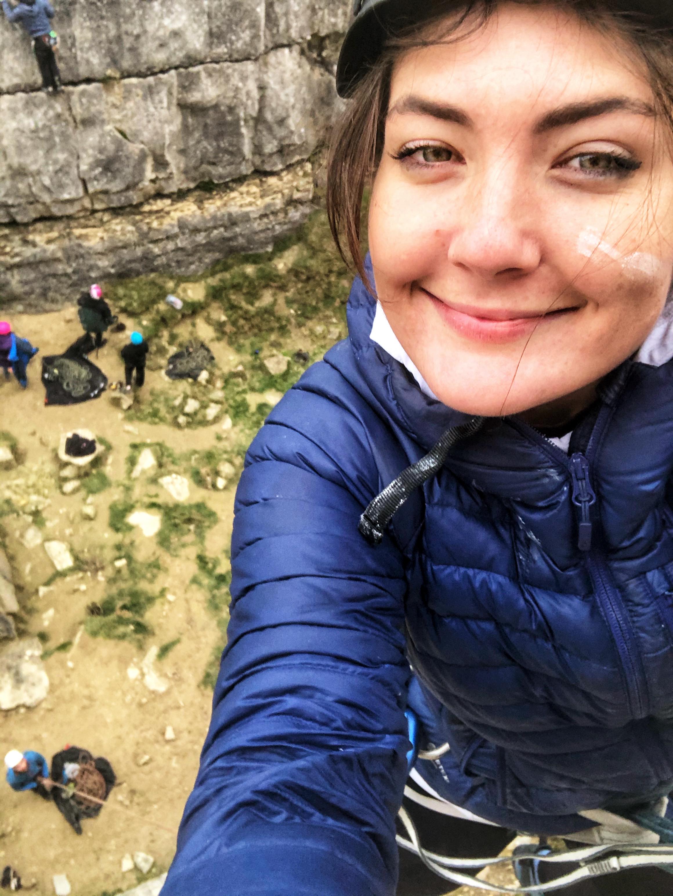
All twelve of us reconvened in the Black Boy at Caernarfon, a large, quirky, charmingly old-fashioned and necessarily haunted pub set within surprisingly intact, battlemented castle walls. We took two six-seater tables and most of us tucked into a hearty pie and pint, which was too much for Darren, who completely lost all decorum in a mad giggling fit just as the waitress came over – I can’t remember why but it was at Jack’s expense. The merriment continued in Connie’s car and back at the chapel, where Jack produced an elaborate cheeseboard and we celebrated the week over a few drinks with the help of an 80’s classics playlist. I wasn’t ready to leave the following morning, both literally and emotionally.

Friday: Expedition up Yr Aran, Wild camp, Night navigation

After a mad morning doing all the packing I should have done the night before instead of eating cheese and drinking wine, I loaded all my gear into poor Scabbers and – with great sadness – left Capel Tanrallt for the last time. After a relatively dismal 25 minute drive along narrow, winding roads, rain pounding the windscreen the whole way, we all met at Caffi Gwynant, a cosy, elegant converted-chapel-come-cafe nestled in the Nant Gwynant valley.

We had our fill of sausage sandwiches and coffee, then met Lou and Smyrff (the other instructor) in the courtyard for an expedition brief. We were to hike up Yr Aran via a set but undisclosed route, taking it in turns to navigate legs individually using a 1:50,000 scale map. Then we would hike to an overnight camp spot, pitch our tents, spend the evening doing a night navigation exercise and return to the cars the next morning.

Morning: wet, windy & very nearly miserable

We set off towards Snowdon on the Watkin path just after 11am. The first section took us gently uphill along the edge of an old broadleaf wood, overlooking the increasingly scenic Nant Gwynant valley, which was green, lush and flanked by thickly forested hillsides set beneath high, oddly lumpy ridges. We were bemused to spot an alpaca chewing nonchalantly among sheep in a clump of copper-coloured bracken, and Darren – who was leading this leg – talked us through the seven S’s of camouflage, which are useful to consider if you need to attract (or avoid) attention in the mountains: shape, silhouette, sound, shadow, shade, shine and speed (movement).

We reached the Afon Cwm Llan after a kilometre and continued on the Watkin path, which ran parallel to the river and climbed steadily up a wide valley. Trees no longer shielded us from the weather and I felt sorry for Mohan, who led this section through torrential rain and relentless wind. Thankfully the scenery was stunning despite the grim sky. The river cut a snaking channel down from Cwm Tregalen ahead, whose towering walls loomed high in the distance, and carved between the sloping sides of Y Lliwedd, Allt Maenderyn and Yr Aran. The water plunged downwards in several places via rushing falls, which were so white they seemed to emit light amongst the swathes of russet-coloured bracken, yellow-green grass and fading early autumn trees.

We rounded a craggy corner and turned left off the Watkin Path onto the Cambrian Way, which was slightly sheltered thanks to Yr Aran’s bulky presence. Connie took the lead and (being a doctor) gave a very useful crash course in first aid, which kept us entertained during a long, steady slog up the side of Snowdon’s south ridge. As we climbed, Lou pointed out a disused slate quarry across the valley, which consisted of some ruined buildings, spoil heaps and great slate terraces forming large platforms up the lower reaches of Y Lliwedd. The steady chatter fortified our collective mood against the miserable weather.

The weather breaks

We stopped for first lunch just below the col between Yr Aran and Snowdon’s south ridge, then tramped up its slippery, slatey side to receive a hearty battering from the wind. We left the path and Jack navigated us south along the rugged crest to a small mound, at which point the rain finally abated and the sun cast an ethereal, entirely unexpected golden glow over the landscape, which now revealed itself as a vast, wild sprawl of lumpy ridges and irregular summits. Old slate works formed a strangely industrial foreground, spread across the flattish area by the col, and the Nantlle Ridge stretched out along the western horizon, its green flanks now bathed in low sunlight above the wide Beddgelert valley. Accordingly, we all took a sudden interest in photography:

Yr Aran

My turn to navigate was spent leading the group down the awkward back of the mound, over a wall, through a bog and up the steep north side of Yr Aran. The others had all given interesting talks on relevant subjects while navigating, which I failed to match with my sermon on the ecological importance of peat bogs. In an attempt to be more interesting I mentioned that George Mallory, the Everest pioneer, trained for the Himalayas on the craggy northeastern side of Y Lliwedd, the vast ridge over to our left. Having exhausted my reserves of tenuously relevant knowledge, I tramped up the mountain with the others trailing behind.

We had second lunch on Yr Aran’s sheltered eastern face, which provided a lovely view of Snowdon under a newly blue sky scattered with pale clouds. We all watched amusedly while Graeme instigated a conversation between a phone recording of a raven and a real raven, which had materialised at the rustle of a bag of jelly babies. Once the croaking had concluded we continued up and over the mountain’s symmetrical top, where I managed to miss the remains of an RAF helicopter that caught fire after an emergency landing a few years ago. Graeme then led us down the western side, a long, grassy ridge, stopping at intervals to crush my peat bog lecture with interactive dissections of fox poo and/or owl pellets, one of which contained the unmistakeable shell of a species we’d learnt to identify while on the Nantlle Ridge hike – the violet ground beetle, which glinted in the afternoon sun.

To camp

Having navigated only a short leg, Lou gave me the cruel job of getting us to a specific, indistinct point on the northwestern slope of Yr Aran. In the absence of features and paths I could only use a bearing, pacing and contours, so was relatively satisfied to be only a few metres out on arrival. After a bit more bogtrotting we rejoined a path and returned to the slate-strewn col, where old spoil heaps, walls and ruins lay vast and still in the hazy, waning light, looking serene and wistful in their abandonment.

We crossed the col and dipped back down the other side, then followed Mohan along a vague path along the base of Snowdon’s south ridge for about a kilometre. We stopped at a flattish grassy area nestled between the hillsides of Cwm Tregalan, which towered above our camp spot on three sides, and busied ourselves by erecting tents, offloading sleeping bags and preparing dinner. Jack joined me while I munched boil in a bag chicken and rice, gave me half his hot chocolate and was unshaken by everyone’s relentless teasing: by sharing Connie’s tent and my jetboil, he’d achieved what was deemed a “lightweight hike” and concluded, quite rightly I suppose, that he’d simply “taken initiative”.

Night nav

Our preparations for a night navigation exercise were interrupted by the arrival of a poorly-looking lamb, which stood very close to Lou’s tent, swaying slightly, and seemed quite unaware of its surroundings. It looked a little forlorn but otherwise happy enough, but it clearly wasn’t well, so Lou texted a local farmer to arrange for its collection. Once this minor drama had been seen to we partnered up and set off in the dark, taking it in turns to lead short but time-consuming legs across the rugged terrain.

Jack and Darren led the first leg downhill, across a stream and to a small stone sheepfold, while the rest of us followed by taking a bearing off the leaders each time they changed direction and counting paces. This was slow and difficult on the rough ground, but it was quite exciting hiking in pitch dark and we were thankful for the lack of wind and meaningful rain (drizzle doesn’t count in Wales). Connie and I took over, took a bearing to a stream then handrailed it up a steep bank, helpfully advising the others not to fall in. We reached our destination – a featureless point on a small hill, denoted by the curve of a contour – using a bearing and pacing, and remarked how different the landscape seemed in the dark. Using contours as visual features was almost useless, as each tiny mound seemed extremely large without the context of its surroundings. This was the key thing I took away from the exercise – focus on bearings and pacing.

Mohan and Graeme led the final leg across undulating mounds and we bumped into the other group, a cluster of headtorches and cheery voices, just before returning to camp. I scouted round for the lamb but it was nowhere to be seen, so – hoping that the farmer would come and look for it early in the morning – we inspected each others’ tents. I admired Darren’s two porches, while he described mine as “palatial”, and I inwardly added “smaller tent” to my shopping list before heading to bed. I certainly do not need a new tent.

Saturday: Return, River Crossings, Debrief

After a good night’s sleep (the rain only woke me once) we were all breakfasted, packed and ready to leave by 8. Gold-lined clouds sat low above the distant hill that spanned the V of our valley as the sun crept above the horizon, making for a spectacular start to our final day. We hiked down the rugged slope for a kilometre, commenting on how near the features from the night nav seemed in daylight, and I quizzed Graeme on the merits of sphagnum moss while Connie recited the lichens she’d learnt.

Back on the Watkin path, the river rushed vigorously alongside us and we passed a small weir which Lou explained forms part of a local hydroelectric scheme (I think these should be widely endorsed). Lou then diverted the conversation back to the ML syllabus and we discussed campcraft, which encompasses various considerations around taking a group on a multi-day expedition such as hygiene, safety, cooking, equipment and environmental impact. Then, just as I was reading an information board about the Watkin Path being the first official footpath in Britain, Lou’s friend the farmer appeared on a quad bike on his way up to search for our poorly lamb, to everyone’s relief. He later reported that it had been found and collected.

By the time we descended into the pretty broadleaf wood we’d passed the previous day, people had started up Snowdon in droves and I was glad for the relatively quiet experience we’d had up Yr Aran. We emerged onto the Nantgwynant Valley road and saw that the laybys we’d parked in were now full, being a dry Saturday morning. With the expedition over, we crossed the road and commenced our final practical exercise of the week – river crossings.

River crossings and emergencies

We found the other group knee-deep in the wide, relatively shallow Afon Glaslyn and made our preparations to get wet. I thought I’d experiment by tying a spare bootlace tight around the top of my waterproof socks, outside my waterproof trousers, to see if my feet stayed dry (they did not). As Glyn led the other group across the river in a loud, military fashion, Lou talked us through how to deal with emergencies in the mountains, useful phone apps/services and demonstrated how to evacuate casualties using firstly a group shelter, then a jacket and hiking poles. After parading each other around on makeshift stretchers, we practised several methods of crossing rivers in a group – I’ll attempt to summarise what we learnt:

  • Choose the safest looking place to cross, taking into account the depth and speed of flow
  • Face upstream, maintain a wide, stable stance and walk sideways like a crab
  • Straight line: the group crosses together in a line facing upstream, one behind the other, holding on to each others’ shoulders/rucksacks. The leading person creates an eddy that protects the others from the brunt of the flow
  • Wedge: the strongest person forms the apex of a wedge and the others form a triangle behind them, all holding onto each other. The smallest/weakest people at the back are protected by an eddy and the group moves sideways together
  • Chain: the group spans the width of the river, holding on to each others arms/bags, and the last person moves from one end of the chain to the other by passing behind the line of people, taking it in turns to move one at a time until the chain reaches the opposite bank

With that done, we wobbled and giggled our way out of the water and back to the cars, wet to the knees, and drove in a loose convoy to Llanberis via the winding Nantgwynant valley road and the ever-scenic Llanberis Pass. I parked by Llyn Padarn and joined some of the others for a coffee and sausage roll in a little café, then we made our way to the previously visited Y Festri village hall.

Conclusion

The final session covered how to record Quality Mountain Days (40 of which are required to pass the assessment) on the online database, QMD requirements, how to navigate the training portal and useful learning resources. Lou gave us feedback and we all parted, slowly and reluctantly, with many promises to meet up for catch ups and QMDs in the near future. Llanberis’s colourful high street seemed uncharacteristically gloomy on leaving Y Festri and I set off on my drive home at 2:30pm, keenly feeling the quiet dullness of unaccustomed solitude after the constant camaraderie of the course.

To conclude, I had an incredibly enjoyable and memorable week making new friends and learning an abundance of new skills. Our group became quite tight in just a few days and we remain in contact – in November I met some of the others in the Brecon Beacons for a lovely hike, and the group chat still pops up fairly regularly. Having already spent a fair amount of time in the mountains, I was amazed at the depth of the syllabus, the variety of useful skills I learnt, and the knowledge imparted by the course instructors – for example, I never expected to come away able to identify an arsenal of plants, mosses and lichens. I plan to book the assessment within the next year or so, but in the meantime I’ll be off to the mountains again – now (hopefully) with corresponding competence and confidence!

Bat in a Bothy

Brecon Beacons, 26 August 2022: Redefining “crazy Friday nights”

August was a sad month owing to the long-put-off but inevitable sale of Björn, my beloved campervan. I felt tethered, having tasted the freedom that comes with van life, so I was looking forward to a bank holiday weekend spent camping with friends in the Brecon Beacons.

Björn the Bold 😥

Ryan and I headed up in an accidental convoy with Gus (who has featured in my blog previously) and his girlfriend Dan, after realising 20 minutes from home that they were in the car behind us. The journey was uneventful apart from a long-awaited McDonalds and a stunning sunset as we crossed the Prince of Wales Bridge. We entered Wales, got past the drabness of Newport (sorry Newport) and drove across the National Park, which became darker and wilder as we moved further west. We crossed a moor, navigated the steep, snaking, dead-end road to the small car park for Llyn y Fan Fach, hauled our crammed rucksacks out the boot and set off hiking just after 10pm.

I already felt immersed in the mountains. The car park sat in a narrow valley between high, rugged hillsides whose jet black silhouettes stood beneath a star-spattered sky, and the air was still and quiet. Our plan was to hike up to a bothy by Llyn y Fan Fach, spend the night there, and set off early in the morning for a 14.5mi/23km loop around the Camarthen Fans, the distinctive flat-topped mountains of the western Beacons.

To reach the bothy we walked up a gravel track that ran parallel to a river between long, high hillsides for 2km. At one point we turned our torches off (curiosity is a strange thing) and were plunged into a blackness so thick that it was quite disorientating. The path was uphill all the way but easy to follow and we reached our accommodation after about half an hour.

The bothy is a simple stone hut on the flat northern edge of Llyn y Fan Fach. I have a feeling that within bothy circles it’s known as being one of the less pleasant ones to stay in, probably because of its prominent location by a popular lake and its slightly disconcerting graffiti. At least “english BASTARDS”, which was sprayed on the wall last time Ryan and I stayed there, had been mostly removed.

Its single room is big enough to sleep about 12 people (if you like each other) and has a squat wooden door held in place by a rock, benches along two walls, a small fireplace in the corner and a beamed ceiling that we attached a lamp to. We were immensely relieved to find it empty as we didn’t fancy spending the night with strangers, let alone ones who might consider us “english BASTARDS” – if it had been occupied and we didn’t like its occupants, we’d have had to hike back down to the cars to get the tents. We dumped our bags, set up our mats and sleeping bags on the floor and went out into the night to assess our position.

We climbed just above the bothy to the wall of a large concrete dam overlooking the lake. It was shockingly empty, presumably as a result of the summer drought; I’ve only ever seen it full of glassy, dark water, which in daylight reflects the colossal escarpment stretching high above and along its far bank, so I was a bit sad to see only a huge, deep crater of mud and concrete. In addition there was a load of construction/engineering work going on along the path up and along the edge of the lake, but that didn’t really bother us as we couldn’t see the temporary fences and assorted debris in the dark, so it was wild enough.

The dry lake and construction debris were more than made up for when we looked back towards the valley we’d walked up, over the roof of the bothy. We’d gained about 220m elevation on the hike up, which meant that the silhouettes of the huge black hills all around us had shrunk – apart from the huge, dark escarpment towering over the lake – to reveal a wide, clear, impossibly starry sky. We stood and stared, feeling incredibly small, then went back inside to try and get some sleep.

We shared Gus’s mead and settled in, four in a row. I felt a bit like a kid at a sleepover. Just before we turned the light off there was an exclamation from the vicinity of Gus that went something like “there’s a bat!”, which I giggled at and put down to his excitement, until I too spotted a shadow flitting across the ceiling. For some reason this was very funny and we watched it fly around for a while, although just for good measure we reassured each other that even Welsh bats don’t suck blood and no harm would come to us from sharing the bothy with a bat. The light went off about midnight and none of us slept much, but at least we didn’t come across any bothy-dwelling murderers.

North Pembrokeshire, June 2021 (2/2)

Thursday 1st July

Newgale Beach

The fog was still thick around our wild camping spot on the Preseli Hills when we woke up. We were due travel to South Pembrokeshire for the second half of the holiday and had arranged to meet mum, dad and Angus at Pembroke Castle at 1pm.  We spent the morning driving down via Newgale Beach on the west coast, with a view to seeing as much of the national park as possible.

We dropped down into Newgale after an hour’s drive through pretty farmland and parked at the large beachfront car park. Newgale is a small village in a basin that opens onto St Brides Bay, with a large, lively-looking campsite set just across the road from the beach. The beach is long, sandy and scattered with smooth pebbles. The weather was strange – still, warm and bright, but grey sea mist stopped sunlight penetrating and gave the sea and sky a serene, dream-like quality. We walked along the shore until we reached some cliffs and caves at the southern end, explored for a little bit and headed back to the van.

Pembroke Castle & Town

We stopped at Morrisons in Haverfordwest for shopping and fuel, then met the others in Pembroke early afternoon. Pembroke is a small, bustling town that still seems to revolve around the castle, which has high, well-preserved walls that tower over a long pond on one side and the high street on the other. Inside, the large, grassy courtyard is contained by walkable walls and several towers which house a lot of interesting information about the castle’s history, including some realistic mannequin scenes and the room where Henry VII was born. It has a “proper” castle feel, with its huge keep (sadly closed), dungeon room, herb garden, scattered flowerpots, battlements, towers and high walls. Definitely worth a visit.

After a thorough poke around the castle we  wandered up the high street, where we looked round an old fashioned convenience store and a tiny shop that sells handmade, surfwear type clothes. I bought a pair of yoga shorts with a honeycomb pattern and a couple of headbands, all made in the shop with organic cotton – would recommend, see the website here – https://www.iseasurfwear.co.uk/. Ryan and I then went on to the Watermans Arms pub and enjoyed a cold cider on the deck, which is raised on stilts over the edge of the pond and has a lovely view over the water, the castle and the town. We watched in amusement as a single, angry-looking swan chased a group of at least 30 much more passive swans around.

Camping, Kiting & Broad Haven South Beach

We drove a little way south along tiny roads to the new campsite, Trefalen Farm, late afternoon. This is another lovely site with sea views, basic facilities and a really remote feel. The first thing we did was find an open field near the cliffs and fly Ryan’s powerkite, as so far the weather had been record-breakingly non-windy (for Wales) and having felt a slight breeze, we were very keen to get it in the air. There wasn’t lots of wind but there was enough to have some fun for half an hour or so before going back to the van and cooking fajitas for tea.

After eating we all tramped down the hill to Broad Haven South, a deep, attractive sandy beach with dunes set way back from the sea and impressive rocks and caves on either side. We walked and footballed our way to the far side, where we explored narrow caves and clambered around on the rocks. Angus was introduced to the slimy delights of large, light-hating cave lice and we found some random sea junk wedged high in damp cave systems, including ropes, buoys, jerry cans and a tyre. Satisfied with a day spent poking around castles and caves, we went back to the campsite and played some stupid card game Angus bought at the castle gift shop, which became hilariously long-winded.

Friday 2nd July

Climbing at St Govan’s Head

Ryan, Angus and I set off from the campsite to climb at the nearby coastal crag of St Govan’s Head. We walked west along a wild section of the Pembrokeshire coast path which had lovely views of dramatic cliffs towering over little rocky beaches and coves filled with clear blue water. We’d definitely chosen the right day for it as it was dry, still and kind of sunny, kind of cloudy, so not too hot or cold. We arrived at some abseil stakes by the edge of a cliff near a military training zone and after a little bit of faff, worked out the right stake to abseil off.

We set up the rope, took what gear we needed and one by one, abseiled over the edge of the cliff. As always the most awkward bit was going over the lip, where your legs go from vertical to horizontal against the wall. The abseil was really fun – about 30m high and against a pleasantly sheer wall, with some free space to hang into in the middle, and with dramatic views of the wild, intimidating cliffs and calm sea below.

The climbs were graded quite high and described as high in the grade, so we went for easy stuff. Angus hadn’t trad climbed for ages and Ryan and I hadn’t done much at all during a year of lockdown. First Ryan led “Exit Corner”, a straightforward VDiff up a blocky corner, I seconded and Angus toproped. We abseiled down again and I led “Lemming Way”, a Severe route up another corner with a fairly exposed, awkward section which had a disconcertingly damp crack where I faffed around with some tricky gear placements.

I belayed the other two up and we abseiled down again. This time Ryan picked “Centurion”, a Severe line up a nice-looking crack with one difficult looking move under an overhanging block. He got to that move without much difficulty but got stuck there, so he came down and I had a go without any real expectation of getting any further. It was an awkward and fairly bold move involving a high right leg and some dubious holds, but I committed to it and to my surprise pulled up over the block. The finish was quite loose but otherwise fine, and I belayed Ryan and Angus up (using a munter hitch as I’d given Ryan my belay plate) feeling quite pleased with myself. As I was doing so I watched a little nervously as a cow approached and sniffed another belayer’s rope anchor at the edge of the cliff –  I didn’t want anyone to have to contend with curious cows while belaying, and I definitely didn’t want a cow to fall off a cliff. Luckily the cow lost interest and wandered back to safety.

Trad climbing always takes longer than you expect, especially when you’re a little out of practice and there are three of you. By this time we’d only done three climbs and three abseils, but it was mid-afternoon and we were getting hungry (having overlooked the value of packing lunch). We were satisfied with our taster of Pembrokeshire climbing (although Ryan and Angus slightly more so than me) so we packed up and headed for the nearest pub.

We walked west and took a detour via St Govan’s Head chapel, a tiny, ancient limestone chapel down steep steps built into the side of a cliff and perched above a small cove. It’s a striking building which merges into the cliff quite naturally, as if it’s always been there, and some of the etchings on the stone altar suggest that it’s drawn interest for a very long time.

We climbed back up the steep steps and walked north for half an hour into the village of Bosherston and found the pub, the St Govan’s Head Inn. Dad had left me a voicemail saying that he’d booked the five of us in for dinner at (unhelpfully) “the local pub” and nobody had any phone signal to find out which pub it was, so we had a couple of drinks there and after a bit of phone-waving, I received a text suggesting that we were in the right one so we stayed.

Mum and dad turned up about 6 and true to form, I was decidedly wavy after two or three ciders while Angus and Ryan were fine. The pub was lovely inside, with wooden beams and low ceilings, and the food was very good – I had dressed crab and some chocolate thing for pudding, and my only complaint was that Ryan promised me one of his prawns but ate them all before I could get there. We split the bill between Ryan, Angus and I and walked back to the campsite along a narrow, hedge-lined road, happy with a good day’s climbing and pubbing.

Saturday 3rd July

Stackpole Gardens

It was mum’s turn to pick something to do, so we ended up at Stackpole Walled Gardens. Entry is free and a lot of the gardening is done by adults with learning difficulties as part of a charity thing. It’s a nice place to go, with long greenhouses, strange plants and sculptures, and it had lots of little corners to explore. Our favourite part was the rows of fruit available to pick for free, including strawberries, raspberries, gooseberries, blackberries and tayberries. We were there for an hour or so, until we ended up getting drizzled on while waiting for mum to finish bumbling around.

Surfing at Freshwater West

Taxi of dad then took us to Freshwater West beach, where we just about found a parking spot. Ryan and I changed into wetsuits and took the surfboard and bodyboard down to the long, sandy beach just down from the car park, and waded into the rough sea. We didn’t get far at all before being batted back by the waves. The surf was beyond our skill level in that we couldn’t even get the surfboard out far enough to catch the longer waves – the ones close to shore were short and ferocious, crashing high above our heads and pulled quickly back from under our feet.

We were washing machined around for a while, which involved getting hit multiple times with the boards and noting that a hard surfboard is considerably more painful than a foamie. One such collision (with my thigh) resulted in one of the three fins snapping off the surfboard and from then our attempts at proper surfing ceased. I’d managed to stand twice, both times in the shallows, and both times for a record-breakingly short duration. Body boarding was good fun though, and less calamitous.

After about an hour of being battered by the sea, we tramped back along the beach. Dobby’s grave, consisting of a lot of stones all piled up, was up on the sand dunes to the left – apparently it’s where the scene was filmed (spoiler – Dobby dies). The sea, and our attempt to find some surfable waves, had dragged us quite a long way to the right, and annoyingly we noticed on our way back that the surf to the left had calmed down a lot to the point where surf schools had started eyeing it up.

Feeling half-starved, we grabbed lunch from the famous Café Mor burger van in the car park. I had the vegetarian burger and Ryan had the classic Mor burger with chips. The people were really friendly and the burgers were amazing, served with some kind of seaweedy pickles and relish.

Powerkiting at Broad Haven South

We went back to the campsite via Pembroke so that mum could grab some bits from (ie. spend an inordinate length of time in) the shop. We helped pack up the awning and for tea mum cooked a strange but very nice mix of bits that needed using up, which included buckwheat, mackerel and salad.

That evening we wandered back down to Broad Haven South beach to show the others Ryan’s powerkite. There was practically no wind but we just about managed to get it up and give dad and Angus a go. It was nice to fly it on the beach regardless and the only downside was that in my enthusiasm to take the mountain board despite the lack of wind, I graunched my heel on the axle while scooting along and it bled quite a lot.

On the walk back up the hill the heavens opened. I’m not exaggerating when I say it was like a tropical storm – we were dry one minute and drenched to the bone the next, so much so that it stopped being annoying and became funny. Once back at the vans and changed into dry clothes, we all huddled in dad’s van and spent the last evening chatting away.

Sunday 4th July

National Museum & Cardiff

We parted and left, a little sad, quite early on Sunday morning. It was grey and wet and we counted ourselves lucky that the Welsh weather had arrived just as we were leaving. Ryan and I came back via the National Museum at Cardiff as I was keen to see the city, having never been before, and thought the museum would be a good rainy day activity.

We parked in the city centre quite cheaply – £5.50 for 4 hours – and walked the short distance to the museum, through an attractive, leafy park and past the grand university and court buildings. Entry was free and it was very interesting. The ground floor was all about the natural history of Wales and housed an incredible collection of rocks and meteorites, dinosaur and prehistoric animal skeletons and information about plants, fungi and habitats. After a lot of reading I sensed Ryan’s growing impatience and we moved upstairs to the art floor.

This had lots of cabinets filled with pottery which was, in our untrained opinion, of uncertain aesthetic value. It was a bit of a labyrinth, with different rooms housing works of photography, paintings and sculptures. The work ranged from very old-looking portraits of heavy-eyelidded, curly-wigged posh people to modern paintings in blocky colours with dubious justifications as to what makes them worthy of gallery status. One exhibition featured huge paintings by a couple of artists which I thought were excellent and very poignant, having read about their cultural backgrounds, but I can’t remember their names.

After a couple of hours we left the impressive building through the large marbled, columned foyer and went for a wander around Cardiff city centre, pleased that the weather had cleared up. I thought it was a very attractive and clean city, with a young, lively atmosphere and lots going on. There were all sorts of shops, cafes and bars in a very small area and the castle was impressive, set near the centre with high, well-preserved walls. After a quick excursion to a phone shop so Ryan could sort out a new phone contract, we grabbed a subway and headed back to the van.

And so concludes our holiday in Wales. We had a lovely, busy week and it was really nice spending some time with my family, especially after lockdown(s). The two van, one tent setup worked well and we got to see a lot of Pembrokeshire, although there’s definitely more to see. I have a feeling we’ll be back…

North Pembrokeshire, June 2021 (1/2)

This blog post (1 of 2) tells the tale of the first half of a week campervanning in Pembrokeshire, a coastal national park in west Wales, spent with Ryan (boyfriend), Mum (mother and chef), Dad (father and taxi driver) and Angus (not-so-little brother).

Ryan and I drove up as soon as he finished work on Saturday evening and we found a quiet wild camping spot near the village of Newport, where we’d be staying. The van was fully loaded with climbing gear, surfboard, bodyboard, mountain board, power kite and other miscellaneous toys, so the week was looking good.

Sunday 27th June

Parrog & Newport

We joined mum, dad and Angus at Tycanol campsite, a basic site with lots of green space and stunning views over the wide, sweeping Newport beach. First on the agenda was a walk along the Pembrokeshire coast path, conveniently accessible from the site, down to the quaint old port of Parrog. It was a tiny, pretty place, where little boats sat moored in a calm quay cut off from the sea by a sand bar and green hills perched above the cliffs and dunes across the bay.

We walked a short way up the hill to the bigger village of Newport, where the busy streets were lined by attractive stone houses, shops and cafes. We grabbed some supplies and walked back along the main road to the campsite, where we took advantage of the wind and flew Ryan’s stunt kite.

Castell Henllys

After a ploughman’s lunch, we all got into dad’s van and went to Castell Henllys Iron Age village. It was worth the £7.50 entry fee – the walk up to the village took us along an ancient stream, through leafy woodland and past the resident pig. The roundhouses were very authentic and the three talks/demonstrations on food, village life and battle were excellent. To my delight, we had a go with the slingshots and I took great joy in lobbing a lump of dough at dad. Remarkably, he still treated us to a drink and a cake at the café.

Nevern & Preselis

On the way back we stopped at a timeless hamlet called Nevern to see the bleeding yew, a remarkable, 700 year old tree in an atmospheric little churchyard which oozes blood red sap. It was simultaneously eerie and serene, a strange combination, and the sap smelt nasty on my fingers. A brief excursion across a stream and up a wooded hill took us to the site of an old motte and bailey castle, now reclaimed by nature, where only earth mounds disclosed its human past.

Still keen to explore, dad then drove us back through Newport and a little way into the Preseli Hills, where the four of us (minus mum, who had a bad knee) walked the short distance up through heathery moorland to the rocky tor of Mynydd Caregog. The plateaued landscape reminded me of Dartmoor, with its distant rolling peaks and scattered granite outcrops, and there were spectacular views over the sweeping blue curve of Newport Bay, tucked between strikingly green Dinas Head to the left and pasture-topped cliffs to the right.

Realising that it was 7pm, we hurried down to Parrog and arrived just in time to order fish and chips. After a long wait and some impatience on my part, we ate them in the van – delicious – then went back to the campsite for some drinks.

Monday 28th June

St Davids

The weather looked wet in the morning, so we decided against strenuous activity. After another bimble around Newport we drove 40 minutes west to St Davids, the smallest city in Britain with a population of 1,600. Grey stone houses and shops lined its bustling streets, which were pretty despite the overcast sky, and the old cathedral was incredible, with flagstone floors, carved and painted high ceilings and perfectly symmetrical stone arches. Ryan and I walked back up the hill to the stone cross at the city(!) centre, queued for ages to get lunch (chicken baguette and a pasty), and met the others back at the modern information centre by the car park.

Whitesands Beach

We realised that we hadn’t planned beyond St Davids, so decided last minute to visit Whitesands Beach just up the (very narrow, twisty) road. An archaeological excavation was going on at the site of an old chapel just above the beach, which is being threatened by erosion. We peered down, fascinated, on people brushing dust from thousand-year-plus old human skeletons, including that of a baby. See https://www.bbc.co.uk/news/uk-wales-57685284 if you’re interested.

While mum and dad sat on the beach, Ryan built stone towers, Angus pottered around the rockpools and I went to explore a rocky promontory. The vertically layered slate was awkward to walk on but the excursion was worth it for the deep, coral reef-like rockpools, sea-filled tunnels and wild, remote scenery. I went over the other side of the big rocky lump, away from the beach, and looked out on a small, empty beach, wild headlands and a calm sea under a moody sky. There wasn’t a boat in sight and all that interrupted the horizon was a few small, hazy islands.

I clambered around the rocky lump and made my way back to the beach via a rockpool-bottomed tunnel, which required a short climb out the other side. We regrouped and went back to the campsite for the evening, where mum cooked vegetarian curry and we sat planning the next day’s hike.

Tuesday 29th June

Hiking in the Preseli Hills

In the morning Ryan, Angus and I were dropped off on a roadside near the village of Crymych. Our plan was to walk the bridleway that runs east to west across the spine of the Preseli Hills (sometimes – dubiously in my opinion – called Mountains) and get picked up from a pub on the other side. Meanwhile, mum and dad went to a woollen mill, much to mum’s delight and dad’s indifference.

The forecast was dry and overcast, but there was a distinctly wet-looking fog hanging over the hills as we approached. We went through a wooden gate which marked the eastern boundary of the Preselis and instantly deviated from the bridleway to climb Foeldrygarn, the first hill – a big, green, rocky lump looming in front of us – that sits slightly north of the path and is topped by a trig point, which we decided made it worth a visit. It was steep enough to break a sweat and once at the top we messed around on the rocks (at one point I got stuck a little too high and needed a spot from Angus) while Ryan experimented with his new gimbal video thing.

We rejoined the main path and headed west across the undulating moorland plateau, which was full of sheep, fog and rocky outcrops. We spotted an enormous red kite (questioning at one point whether it was a lost eagle) and a few skylarks, but it was otherwise quite barren. We stopped to pull on raincoats on account of the wet fog that engulfed the hills and thwarted what was probably a stunning view over north Pembrokeshire. The next four miles was oddly enjoyable and consisted of bleak fog, the occasional bog and passable banter.

We stopped for a strange lunch of pork pie, cheese, lamb pasty and mugshot pasta (I can’t recommend a Jetboil enough) by the edge of Pantmaenog Forest, then headed south away from the main bridleway towards Foel Cwmcerwyn, the highest peak in the Preselis and the last hill of the hike. The sun had started to burn through the fog and it was quite clear by the time we reached the top. The view was incredible, stretching out over miles of quiet valleys, green fields and dark forests, and we looked back to see the Preselis still shrouded in the isolated layer of thick white cloud we’d just emerged from.

The walk down was reminiscent of the hobbits leaving the Shire, with abundantly biodiverse meadows and verges on either side of us filled with all kinds of grasses, wild flowers and trees. In front and to the left was a heartwarmingly pastoral view over peaceful Welsh fields rolling way into the distance, and behind was the lush, fir-lined edge of Pantmaenog Forest.

The path dropped down through a sheep field into the village of Rosebush, where our 8.5 mile hike ended at the Tafarn Sinc pub. The community-owned pub is worth a mention in itself, with its purple corrugated iron cladding, sawdust-scattered floor and timeless décor, which includes various mysterious agricultural implements and several legs of ham hung up to cure. We had a drink while awaiting our taxi, then another when it arrived bearing mixed reviews of the woollen mill.

Newport Beach BBQ

The taxi (dad) drove us onto Newport beach, where we kicked a ball around and explored rockpools, shallow caves, a small waterfall and grassy sand dunes. Ryan and I watched England beat Germany (much to our surprise) on my phone, in terrible quality as signal was bad, while dad cooked the barbecue. We had sausages, burgers and salad (to which my contribution was foraged sea beet and dandelion), washed up in the back of the van and went for a walk along the long stretch of sand towards Parrog, which was cut off by a deep stream. The beach was practically empty and the sunset was lovely.

Wednesday 30th June

Tombstoning at Blue Lagoon

The forecast was good so we decided to get wet. We went west along the coast to Abereiddy, a tiny, pretty coastal hamlet with a small beach and a disused slate quarry which has become a hotspot for swimmers, paddlers and ledge jumpers. The quarry is called Blue Lagoon, which is a lovely if unimaginative name as it’s effectively a large bowl of clear blue water connected to the sea by a narrow channel. On the far side are two man-made platforms, once used as part of the quarry, which drop straight down into the water.

The three of us (mum and dad chose to stay at the beach) walked down into the bowl, changed and clambered over the rocks and into the cold water. We swam across to the other side, dodging swimmers, paddleboarders and a huge jellyfish, and climbed out and up to the platforms. There were a lot of people queuing for the lower one, which is about 4 or 5m high, so we went straight to the higher one, about 12m – nearly the same height as three double decker buses.

Peering straight down into the dark water below was adrenaline-inducing enough, so without hesitating we checked it was clear and one-by-one, jumped off the edge before reluctance could take hold. It’s the highest thing I’ve ever jumped off and the feeling of weightlessness was exhilarating, if a little terrifying – my instinctive fear response sent a “what the hell are you doing” type message through every fibre of my being and it felt like I was falling for an age. I hit the water the right way but it was still quite an impact due to the height of the drop, and – relieved to be alive – I swam to the surface grinning, retrieved the terrible wedgie, and hauled myself out onto the rocks like an ungainly seal. For some reason, I did it several times more.

We were probably in the water about an hour before deciding we should get back to make our pre-booked 2pm kayaking spot, so we swam back across the lagoon to our stuff on the beach. I shivered my way into my changing robe, which provided immense relief, and we walked the short distance around the coast back to the van, parked just behind Abereiddy beach.

Kayaking & Paddleboarding at Llys-y-frân

I’d booked a canoe for dad and Angus, a paddleboard for Ryan and a kayak for myself at Llys y Frân, a lake and country park at the foot of the Preseli Hills. After a brief altercation – I think the only one of the holiday – about washing up and being slightly late, we were out on the water in the warm sun. It was incredibly quiet, wild and peaceful. First we paddled up the smaller, left hand “arm” of the lake, past lush green banks with trees overhanging the water and over roots visible through the shallows – it could have been prehistoric. The only people we saw were a couple picnicking in a clearing at the end and the safety man in his powerboat.

Ryan and I swapped, then we paddled back to the bigger, wider arm of the lake, which gave a good view of the Preseli hills. It was less sheltered here and we were fighting the wind, which was fun as it was quite hard work. On one side the bank was crammed with thick, leafy trees and on the other a grassy slope was occupied by people fishing, walking and sitting on benches. We paddled as far as we could go given the 2 hour hire time, then turned around and came back. Angus treated us to a drink at the clean, modern café, then we headed on to the pub for a meal.

Tafarn Sinc & Bessie’s Pub

The food at the Tafarn Sinc was lovely and service was good, considering how early we arrived. It was a simple, proper pub menu with nothing fancy or unpronounceable (apart from the Welsh side). After a meal and a couple of drinks we headed back to the campsite via Bessie’s pub, properly called the Dyffryn Arms, nestled in the thickly wooded old valley of Cwm Gwaun.

I’ve never known a pub so cemented in time. The bar is a tiny hatch in a room with a tiled floor and granny-style floral wallpaper, filled with a hotchpotch of chairs and decorated with what would be, if hung up anywhere else, a naff old bunch of pictures (including a painting of Queen Elizabeth in her 20s, probably the most modern object in the pub). They do approximately one ale and one cider, mysteriously extracted from somewhere behind the hatch, and the unlit outside toilets are charmingly ancient, cold and dark. Our pints just about stayed upright on the wonky bench as we overlooked the field, stream and woods on the other side of the narrow valley. I think it’s one of those places that should never change.

It was our last night in North Pembrokeshire and the end of the first half of the holiday. When we got back to the campsite, Ryan and I packed up our stuff and went wild camping for a night on the Preseli Hills, where we found a small, pull-in car park hidden in thick fog. We watched Jeremy Clarkson’s Farm on my phone and planned the next day, where my next blog post begins…

Portland Climb/Camp, Nov/Dec’19

Apparently Portland is “the” place to go climbing on the central-south coast of England. Connected to Dorset by only a skinny finger of land, it offers long stretches of walk-in limestone cliffs with easy parking and lovely sea views.

We made a last-minute decision to join my brother’s climbing club trip, inhaled some bacon at Hill HQ, threw our gear into the car and headed to Portland. It was a fine day and we arrived at the Battleship Back Cliff area on the west side of the island late morning. After missing the concealed approach down the cliff, we found a fixed rope and scrambled down. On the way down we saw what looked like a red climbing helmet by the base of a rock near sea level. I scrabbled off to look for it/its owner but couldn’t see it again, and we carried on along the cliff to find Angus’s group.

80439363_497839824417765_1635229401186566144_n

They were climbing at The Block and The Veranda, two opposing walls which form a kind of open-roofed, wind-sheltered corridor. The routes on the landward-facing Block side were short and grades ranged from 4 to 6b+. The group had left a few ropes in the wall which, although annoying at a busy crag (which it wasn’t), was good as it meant we could fly up and down quickly. It was nice and chilled as Angus’s friends had mixed climbing experience, so there was lots of milling about/chatting/coaching/milling about. Ryan might like me to mention that he led a tricky 6a+ (hope you’re reading); I climbed four Block routes and a nice, high one on the Veranda side, then helped the club clean some gear before we lost daylight.


We scrabbled back to the car via a near via-ferrata type scramble/staircase, shoes slipping and clagging with clayey mud, said bye to the group (who were staying in Weymouth) and headed off to scout out a camping spot. We found a perfect place tucked between two bolted rock faces on Portland’s southeast side, went to a shop for cider and snacks, then found ourselves in the lovely and cosy Eight Kings pub in Southwell.

Well fed and watered*, we carried our gear into the cold and very windy dark, through brambles, over a gaping crevasse, down a steep, loose slope and round an awkward tight corner to the camping spot. We had the tent pitched and occupied in less than 15 minutes and spent the evening talking rubbish, drinking Old Rosie and feeling happily isolated from the world. Cold November nights spent confined under a thin bit of fabric are tragically underrated.

We laid in on Sunday morning, which I could cope with (I’m not a lay-in kind of person) because camping is worthwhile in its own right. The weather was finer than the previous day – clear and dry, but still windy. It was a lovely spot, a mini gorge tucked away from view and enclosed on all sides, accessible only by a narrow scramble around a corner and wild with brambles. The coastal path runs along the top of the seaward wall, but is just far enough back from the scrubby edge that the gorge is hidden. The view from that path was magnificent – colourful vegetation and scattered rocks covered the gradual slope down to the clear blue sea, and the pale cliffs of the Jurassic coast shone to the east in the low winter sun.

There was no need to look for climbs as the two opposing limestone walls of the gorge were bolted and climbable, so we harnessed up. We rattled through six short bolted routes in a couple of hours, swapping leads. We didn’t climb particularly hard but it was good to get through a handful of climbs. The only really memorable bit was the awkward position I managed to get myself into when I jammed both knees into a big, overhanging horizontal crack, leant back and practically dislocated a shoulder to clip a bolt above.

We finished with a fun, flakey route, which Ryan led and belayed from a top anchor, and were lured home by talk of a fire and Raclette at Hill HQ (thanks to lovely Cam). We returned with rosy cheeks and rock-battered hands, bitter at Monday’s imminence but pleased to have got back on real rock. Portland had shown us its climbing potential and needless to say we’ll be back.


*cidered

Dartmoor, March ’18

This was the first time I put a tent up in the middle of a bog, at night, in the snow. Conditions weren’t ideal but without the bitter wind it might have been almost comfortable.


I love Dartmoor for its sand-coloured plains, rocky tors and open ruggedness. Although you’re never more than a mile or so from some kind of settlement in Southern England, this place feels really wild – like you could be anywhere. As you enter the National Park there’s a stark, knife-edge contrast between the cultivated green fields of Devon behind you and the vast, untouched moors in front, and then you’re plunged into a bleak, beautiful expanse of wilderness.


The main roads through the middle can get busy, particularly during summer, but it’s easy to park in one of the many roadside spots and slip away into the moors. Most visitors don’t venture far from picnic spots, viewpoints and tors within bimbling distance of the car.


This time I arrived as the daylight was fading and parked in a Princetown residential road. Dartmoor has a climate of its own, so I shouldn’t have been surprised that it was snowing heavily despite being grey and muggy when I left Hampshire a couple of hours before. I set off NE towards the mast (a hugely useful landmark) which towers over the town, following a roughly pre-planned route.


The wind was bitter and the blizzard was relentless, but I was glad for it. Night navigation was much easier with the snow reflecting any kind of light; I could distinguish treelines, tors and hill brows, which I wouldn’t have been able to do without the white-black contrast. A couple of hours into tramping through mean, rocky, slippery terrain, I found myself on track but in a nasty patch of boggy, wet, undulating ground. The snow wasn’t so helpful here, as it hid what was under my feet rather than illuminating it. I found a semi-flat bit of ground that was slightly sheltered by a low grassy mound; although keen to press on, I conceded that I’d rather camp in a dry-ish spot, so settled down onto my cheap Quechua sleeping mat after a bitter fight with the wind, snow and my cheap Eurohike tent.


Top tip: if you’ll be sleeping on snow, spend more than £4.99 on a mat. I should have learnt that in Scotland last year, but investing in a self-inflating mat is still on my to-do list. Fully clothed and curled into two cheap sleeping bags (spot the pattern?) I was still cold, but I survived.


Top tip #2: if you think you might be getting a blister, no matter how cold you are, right now is the time to sort it out. This was me half an hour after fight no.2 with cheap Eurohike tent (the weather didn’t ease overnight, by the way). Fortunately Great Mis Tor offered some shelter as I reluctantly stopped to shove a blister plaster on each heel, and I didn’t have any further issues despite wearing my shiny new Salomon Quest 2 4Ds for the first time.


It took a while to warm up, but once I did I could finally appreciate Dartmoor in all its rugged glory. After stumbling happily down a windswept slope, I realised that I couldn’t follow my route as a “stream” was less crossable than I anticipated, probably due to a combination of heavy snow and poor planning. I didn’t fancy a) getting myself and my 70l backpack wet, or b) drowning, so I followed it upstream hoping to find a place to cross. I was unsuccessful, so re-routed and ended up slogging through the most awkward, humpy, dippy, tufty, boggy ground I’ve ever walked across. This went on for a while, and despite it being a Saturday in the middle of the Easter Holidays, I didn’t see a soul.


After another uncrossable river, a few sketchy traverses across rock edges perilously close to said river and a glute-achingly steep, rough valley climb, I found myself at Lydford Tor and in the MOD danger area (having checked firing times beforehand – please do this). With the original route out the window and the smell of mum’s promised roast lamb filling my head, I adjusted my course  to arc back towards Princetown, using the map as a rough guide and aiming vaguely for the big mast. The weather had finally relented and the hike back was pleasant but uneventful; the landscape opened up and I could see the Beardown Tors, dark woods towards Two Bridges and the ominous granite walls of Dartmoor Prison.


I made it back to the car unscathed and, true to form, went straight to the pub (I should probably sort out my spending priorities). I recommend the Plume of Feathers in Princetown – it’s welcoming, cosy and does great steak pie. Fed, thawed and thirst for adventure temporarily quenched, I trundled back to Hampshire just in time for Sunday roast lamb.