I peeked under the pull-down blind to take in the tranquility of early morning in Honister Pass. The sky was clear and the sun had drenched half the valley side in its balmy warmth. I waited for Ryan to wake up (I’m definitely more of a morning person), then we ate and drove up the steep “head end” of the pass. The road that joins the Buttermere and Borrowdale valleys is winding, hilly and incredibly scenic.
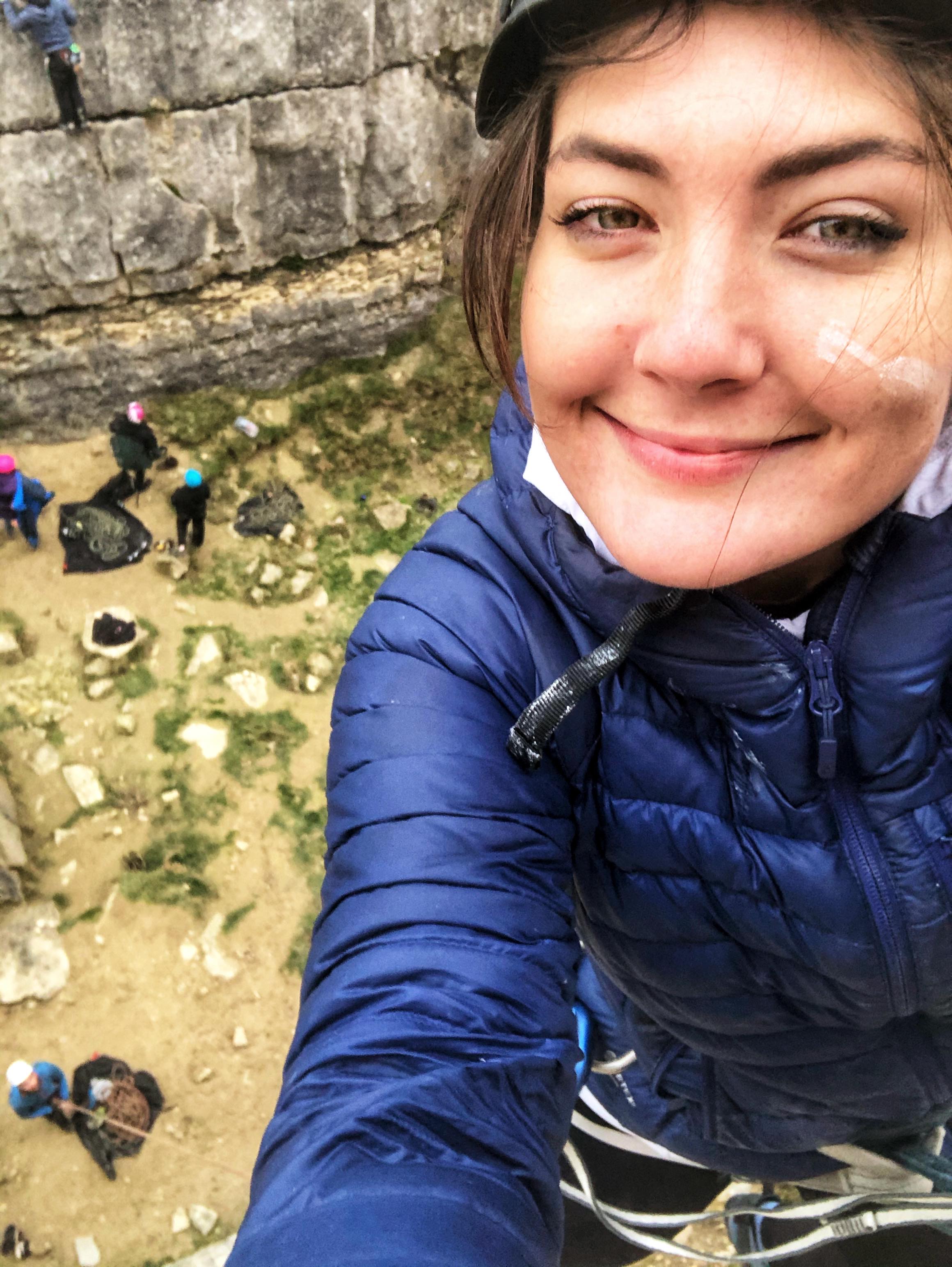
We parked at Thorneythwaite Farm, put £3 in the honesty box and headed up to the crag. We’d hoped to climb Corvus, a famous five pitch route graded Diff (easy) either today or tomorrow, but thought we’d check out the nearer Glaciated Slab at Combe Gill to begin with. There were a handful of single-pitch climbs there, which would be good for warming up our trad climbing brains after months of covid-induced abstinence. Given Monday’s epic hike, we also wanted to test Ryan’s still-sore knees before committing to a multipitch.
The walk in to the crag took about half an hour and the last section involved an awkward scramble up a steep boulderfield. Glaciated Slab was worth it, with its agreeable, off-vertical gradient, grippy looking rock and handful of cracks. It was quiet and wild, situated high up on one side of a steep, V-shaped valley, carpeted on both sides by scrubby grass, dark green forest and a litany of loose rocks. To our right Derwentwater peeked distantly through the trough of the “V”, backed by the hazy blue mountains beyond Keswick.
Our Rockfax climbing book informed us that all but two routes were within our grade, so we hoped to get a good few climbs in. Keen to feel cold rock under our fingers, we dropped bags and harnessed up. Ry started by leading Trod Too Far (HS 4b), then I led Trod Pip (VS 4c), then we took turns crossing off whatever we fancied. It had been over a year (tragically) since I last built a three-piece top anchor, but I was pleased that it came back so naturally. I didn’t have to think about the process of placing and testing gear, clipping in, equalising the sling and bringing the rope up to put Ryan on belay.
The rock was grippy, nicely cracked in some places and a bit bare in others, and it felt so solid that we threw in a couple of solo climbs (Diff/VDiff). I felt the old, toe-tingling thrill of looking down at the distant ground and accepting that up is the only option. After a good few hours climbing, we decided that we’d exhausted that crag and scrambled/walked back down the valley, returning to the van about 5pm.
We drove north along the pretty Borrowdale road to Keswick, on the north tip of Derwentwater, grabbed some supplies from the Co-op, and wandered round the pretty, bustling town. Before we knew it, we found ourselves in Wetherspoons. We discussed our plan to go mountain biking the next day over a pint and three small plates for £10 (every time), then hopped back in the van and drove up the road towards Whinlatter Forest Park. We found a discrete car park, went for a quick walk up a hill overlooking Keswick and chilled in the van for the rest of the evening, basking in the happy-exhausted feeling that comes after a good day’s climbing.
This was one of those rare days that I know for certain I’ll never forget. It started innocuously enough, with Ryan cooking breakfast and me making sandwiches at our camping spot on the edge of Wast Water, overlooked by the rugged, imposing mountains and ridges of the Wasdale valley. We knew it’d be a long one as our route encompassed six summits, a lot of miles and a serious amount of elevation gain. Bags packed and bodies fuelled, we drove to the car park at Wasdale Head and set off at 10am.
Scafell Pike, 978m. Summited 11:55
The path began in the lowest point of the valley, just 80m above sea level. It crossed a wide, shallow river, Lingmell Beck, before climbing a little way up the side of a high, grassy ridge, Lingmell. It followed the contour of this ridge through scrubby sheep territory until we rounded the corner, at which point the sheer, dark west face of Scafell Pike emerged at the head of an immense valley. Lingmell Gill flowed high and fast on our right and we followed the path alongside it until the rocky crossing, which wasn’t particularly crossable due to the rainfall. A few hikers had gone quite a way upstream before crossing and heading back down to regain the path, but we didn’t go far before hopping across five or six sturdy-ish looking rocks in an ungainly (but dry) manner and continuing up the mountain.
The rocky path led the way clearly up Brown Tongue which, as well as the multitude of other hikers and my vague memory of the route, made the map redundant for the time being. We took the left fork and approached the summit from its northwest side, the slightly longer but more popular approach. From the fork, going as the crow flies to the summit would have necessitated a serious multipitch rock climb up its ominously sheer west face, which gives the mountain its wild, dangerous appearance.
Our legs were already feeling slightly sore from flying up and down the Old Man of Coniston (803m) the previous day, and I’d forgotten that although popular, the path up Scafell Pike is surprisingly long and steep. Shortly after taking the fork we were hit by a sudden heavy rainshower, which – as they always are, once you’ve committed to getting wet – was exhilarating. We pulled waterproofs on, snapped a couple of pictures and carried on, turning right up the steep, scree-covered path that leads to the summit. The clouds were stubborn but intermittent, and we had our fill of the stunning, rolling mountain scenery in glimpses as we made our way up.
The top section is pretty much a huge pile of jagged rocks, as if the tip of the mountain has been shattered into millions of pieces. At the summit is a trig point and a raised war memorial, and we delighted at being the highest two people on English soil for a minute before finding a sheltered spot for a sandwich. Although perfectly warm when we were moving, our sweaty backs got cold quite quickly in the bitter mountain wind so we took a compass bearing to ensure we were heading for Great End and descended the awkwardly boulder-strewn, loose northeast side of Scafell Pike.
Great End, 910m. Summited 13:06
The cloud subsided when we reached the trough of the col between Scafell Pike and Broad Crag, the mini-top just before Great End. The path to Great End was fairly steep and quite direct, although when it came to branching off the path towards Esk Pike for the actual summit Ryan took us an unecessarily awkward way over a series of rocks. We pulled out the Jetboil and had a brew at the wind shelter on the summit, wondered at the panoramic views and seemingly endless mountains and descended the proper way back to the main path.
Esk Pike, 885m. Summited 14:02
Esk Pike wasn’t easily discernible as the ground on the east of Scafell Pike is all quite high and the rocky ridges and summits seem to merge together. Experience has taught me to be wary of paths as they often look obvious on a map, but much less so on rocky ground where everything is the same colour, and it was around this point that I commented on how the path thus far was suspiciously clear and well-marked by plenty of cairns.
Bowfell, 902m. Summited 14:47
Next up was Bowfell, which had a more obvious summit as there was a group of people having lunch on it. For some reason I remember the scenery here being particularly unforgettable, even though we’d been fortunate enough to have a clear view of the surrounding mountains since before Great End.
The nearer peaks were rugged and olive green, and all had unique shapes with sides that occasionally fell away to reveal sheer, unvegetated rock faces. They weren’t jagged like the gargantuan mountains of Patagonia or the Himalayas – in fact they’re not even comparable – but they had their own wild, majestic kind of beauty. Rivers ran like tiny veins far below in the steep-sided valleys, some so perfectly U-shaped it was as if they were carved out with a giant ice cream scoop, and the mountains further away glowed in mysterious, hazy layers of grey-blue. This is perhaps what I love most about the Lake District: it’s the only place in England where I feel truly immersed in the mountains. I can’t imagine how incredible it must have been up here before hiking became popular and there were no paths scratched into the surface or bright down jackets pock-marking the wilderness.
Crinkle Crags, 859m. Summited 15:51
Crinkle Crags was a bit disheartening because gaining the summit would mean scrambling up a rocky path a kilometre long, starting at the unimaginatively named Three Tarns, only to scramble back down the same way and continue our route. Ry insisted that he wanted to do it despite his knee hurting a little, so we went up the now-elusive path-come-series of rocky scrambles and after what seemed like an age, arrived at the (also unimaginatively named) Pile of Stones marking the summit.
This is where the real fun started (English for where it all went wrong). We looked across two wide valleys towards Sca Fell and it looked terrifyingly far away, leering at us from the horizon. Ryan suggested that if we descend Crinkle Crags off-piste, we should hit the footpath we were aiming for low down in the first valley which would take us parallel to and then across a river, and we would then walk [a really long way] to the base of Sca Fell on flat terrain. This would remove the need to turn back along the annoyingly rocky and long path we’d just come along. He was correct and I agreed – indeed, we should have hit that footpath by the river.
The descent was pretty sketchy, super-steep and more of a downclimb in places via huge boulders, mini waterfalls and loose, scrubby bits of ground. We were careful not to disturb vegetation, rocks or sheep, and although I was inwardly questioning our decision, it was kind of thrilling to be off the beaten track. I was super happy to discover some bilberry bushes (bilberries are like small, sweet wild blueberries) as I’d always wanted to find some but never had before, so my fruity mid-descent snack perked me up.
The Trough, 350m ish
This section deserves its own sub-heading because it would unfair (on the mountain) to attribute it to a mountain. It was a trough in both senses of the word – the low bit between peaks, and a sustained dip in the extent to which the hike was going as planned. As they say, peaks and troughs.
After what seemed like an age we reached the bottom of the treacherous descent down Crinkle Crags, only to discover that the footpath we had hoped to join was untrodden to the point of non-existence. Instead we were met by soft, tufty, awkward ground covered in long, yellow grass. In the absence of a path and an obvious place to cross Lingcove Beck, we looked at the map and decided that the best course of action would be to walk south parallel to the river until we came to the fork, where we would join another path that runs alongside the other branch – the River Esk – to the base of Sca Fell. It would extend our route by a couple of long, slow miles over difficult terrain, but at least we’d be certain of where we are and that we could cross both rivers.
This was frustrating enough, so when my left foot punched through a hole in the ground and into over-the-top-of-my-boot deep muddy water, I became tetchy. After a couple of hundred metres of tramping with one wet foot through boggy ground in an exasperated sulk, it dawned on me that I’d only eaten half a sandwich, half a bag of mini cheddars, an apple, half a flapjack and a few bilberries. We wanted to press on but I self-diagnosed myself as hangry, so we stopped and munched a whole sandwich each. It tasted incredible and I perked up magnificently.
We maintained our course by keeping Lingcove Beck on our right hand side, which took a long time because of the awkward, soggy ground, occasionally picking up scraps of what looked like they could once have been path. Eventually we reached a stone bridge at the fork we were aiming for, glad to finally cross the river and start walking towards, rather than away from, Sca Fell. This time we kept the River Esk on our left, relieved that we were now following a clear path.
The first bit was steep, then it levelled out and we walked for a mile or so across a great, open plain in the belly of the valley between the towering ridges. The path was better than the previous one although ambiguous in places, so we kept a close eye on the map, noting the shape of the river, the contours around us and the bits of drystone wall marked down as boundaries. Unhelpfully, the path disappeared at the river crossing. We’d hoped for some rudimentary stepping stones, but there was nothing. The river was about eight paces wide and higher and faster than usual, and we followed it upstream in search of a way across for 20 minutes or so. Eventually we accepted that our feet were wet anyway and committed to a crossing place that was far from ideal but slightly less terrible than some other places and hopped across.
Sca Fell, 964m. Summited 20:17
We tramped across pathless ground to a long waterfall leading up Sca Fell, which was a mile away as the crow flies. The next section was a steep scramble up a dubiously labelled footpath, keeping the waterfall/river on our left. It was tough going but good to gain height as it made us feel closer to finishing the day. We got to a crossing place and stopped to make a decision. We could either cross the river and approach Sca Fell from the south, carry on along the clear path and approach it from the west – which would mean branching off left and going up and down the same way – or call it a day and continue on the same path, which would take us safely through the col between Sca Fell and Scafell Pike and back to the van, potentially with time for a drink in the pub.
We were tired, hungry and at risk of losing light, but stubbornness prevailed and we crossed the narrow, rushing river, hopeful of completing a circular route up and down the mountain. It looked as if there was a path on the other side, but this quickly disappeared and we were once again tramping through the wilderness. We knew the approximate direction of Sca Fell and we knew we had to do a lot more “up”, so we made a beeline for a high, steep scree slope on our right hand side.
This was one of the crippling low points of the day. The terrain was very rough (scrubby vegetation interspersed with loose rocks), we were exhausted, our phones were nearly dead, the summit was an uncertain, invisible concept beyond a serious amount of elevation gain on poor ground and there was a real risk that we’d lose daylight. We had everything we needed – headtorches, an emergency bivvy shelter, warm clothes, foil blankets and porridge – but we were damp, hungry and determined to get back to the van.
On either side of the scree slope were high rock faces and from a distance it looked as though a figure of a person was suspended from one of them. At first it looked like someone leaning back and taking a photo of something higher up, then it looked like a climber who had reached the top of a route, then it looked like someone hanging there eerily limp, as if they’d fallen and been caught by the rope. It’s funny how the mind plays tricks when you’re tired, as it turned out to be just a black, figure-shaped void between two slabs.
The scree slope took forever to reach, and once there it was even more terrible than we thought. I did something very unusual: I pulled out my last-resort snacks, an energy gel each, in a desperate attempt to boost us up the terrifyingly steep ascent. The scree was mostly saucer-to-dinnerplate sized reddish-grey rock, and I was careful not to climb above Ryan as I could have sent a rock tumbling down on him at any time. It took just about all our strength to reach the top, and I was almost too exhausted to feel relieved by the sight of the landscape opening out in front of me as I pulled over the brow.
We turned right and headed along the high ridge, relieved to be on more manageable terrain but uncertain exactly how far it was to the summit. Our phones pinged as we received signal for the first time in a few hours, but we were both on 1% so couldn’t faff around taking photos. The scenery either side of the ridge was beautiful, hazy in the fading light, but we didn’t appreciate it as much as usual. The ground got rockier and we finally came to the pile of stones and crude rock shelter that marks the summit of Sca Fell at 8.17pm. It was a huge relief to finally conquer this last peak, the bleakest and wildest of them all, after it had tormented us for the age that had passed since Crinkle Crags.
Return
It wasn’t over yet as we still needed to get on the path back before losing light. It’s common knowledge among mountaineers that most accidents happen on the way down, so we were careful not to get reckless. We descended down the path north east of the summit, which was once again ridiculously steep but this time marked by the odd cairn. It was a relief to be going down but our knees weren’t having a great time, and we half-slid down the loose slope. The path then bore left at the tiny Foxes Tarn and took us literally down a small river/waterfall, balancing on wet, slippery rock on whichever side of the water looked least treacherous.
Once we were at the bottom, miraculously intact, we munched our last snack bar and looked exasperatedly to our left at the next rocky slope we were required to climb to gain Mickledore, the col between Sca Fell and Scafell Pike. It was almost funny, and we just got on with the slow, awkward drag to the top, trying to keep on the vague, loose, steep, zig-zagging path. My concern was that the path over the col on this side of Scafell Pike wouldn’t be obvious (or even in existence) as I took this route the first time I climbed the mountain in 2014, and I remember scrabbling up a steep, scree-covered slope in claggy conditions following no obvious path and hoping for a cairn to appear through the fog. If this was the case, there was a risk that it’d get too dark to navigate and we’d have to bear a cold, damp, rocky night out.
At last we reached the top of the slope and spotted the emergency metal shelter on the ridge up to Scafell Pike. Its straight sided boxiness looked very strange against the rocky backdrop, having seen nothing but natural, jagged shapes all day. Then we experienced the best feeling in the world: pulling up over the lip of the col at Mickeldore. All of a sudden we could clearly see the path that would lead us back, and my concern evaporated. The world seemed to open out in front of us. We had Sca Fell on our left, Scafell Pike on our right, and in front was the vast valley that we’d hiked up eleven hours earlier. We could see the fork where our footpath met the path that we’d taken left up the other side of Scafell Pike that morning, the sun was low, and there wasn’t another person in sight.
We descended down the steep scree slope (see the pattern emerging?) that was the top of the footpath and gained slightly more level terrain, happy in the knowledge that there was no more up. The sun broke through the hazy clouds and glowed a magnificent, warm orange ahead of us, which illuminated the valley and accentuated the wild beauty of every rough, rocky, rugged corner. It felt like nature’s way of saying well done, you did it. I’ll never, ever forget that moment. The walk back along the strangely solid path was slow and unlike my vivid memories of earlier that day, I remember it vaguely as if it were a dream. We talked all the way back to the van, but I have no idea what we talked about.
We followed the path round to the right at the end of the valley, the same way we’d come up, through the steep sheep fields of Lingmell in dwindling light. We didn’t quite need to pull out the torches because the path was good, but it was dark by the time we reached the flat field and river at the bottom. We got back to the van at 10.30pm, equal parts exhausted, triumphant and famished, drove ten minutes to last night’s camping spot near Wast Water, and didn’t have the energy to cook stir fry so ate tinned soup, bread and cheese. Nothing has ever tasted so good.
We woke up in a quiet layby near Kendal just east of the National Park, having made the 6-hour journey on Friday evening. We did the grocery run in Kendal Morrisons, giddy about the prospect of our first van trip since before lockdown, and drove to Windermere for a poke around.
Windermere was pretty and as we wandered through its neat streets lined with slate-grey buildings, it felt as if the world was tentatively waking up. The pubs and restaurants reopened post-covid for the first time today and there was a quiet bustle about the town, which I expect is usually a bit too touristy. It’s quite small so we weren’t there long before driving down the road to Bowness (definitely too touristy). We walked behind the shops and bars along the edge of Lake Windermere, where geese, pigeons, crows and other annoying types of bird congregated, and looked out over the misty grey water.
We nearly went into a bar for a drink but decided to carry on to Coniston. The half-hour drive via Ambleside (bustling outdoorsey town, will return) gave us our first taste of the narrow, winding Lake District roads, and we parked in our tucked-away camping spot early afternoon. Coniston is a lovely village set against the scenic backdrop of rugged, high fells and we spent the afternoon enjoying our first post-covid pub visit in The Crown, eating fajitas in the van and talking rubbish.
Sunday 5th July – Old Man of Coniston (hiking), Grizedale Forest (mountain biking)
We climbed the Old Man of Coniston (803m) – see a previous post about a previous (solo) hike here -, a lovely mountain which towers over a valley of old copper mines and overlooks a panorama of fells, forests and lakes, its steep, winding path made interesting by the ruins of old mining ruins, long, forearm-thick wire cables and a high, black tarn. The weather was surprisingly clear until about twenty minutes before the summit, when the clouds thickened and the wind picked up. It’s amazing how the weather can change in the mountains – we watched as thick white cloud rolled unstoppably over the summit ridge and down the escarpment, like the froth spilling over the edge of an overpoured pint. At the top Ryan actually grabbed me as a particularly strong gust of wind caught me off balance, sending us into fits of giggles.
It took us two and a half hours’ quick walking there and back along the same path from Coniston (including a couple of stops to snack on the summit, faff around the old slate ruins and scramble down to a crystal clear, waterfall-fed river) and we were pleased that contrary to the forecast, the weather had held up. It looked to worsen that afternoon so we’d planned to do the North Face mountain bike trail (graded red – advanced) at Grizedale Forest, twenty minutes from Coniston.
The bike trail was very technical and very different to others we’ve done. What seemed like more than the first half was uphill, on fairly gradual gradients made complicated by large, sharp rocks protruding at all angles and constantly threatening to throw wheels off the trail or bottom-out the chainring. There was no smooth, flowing downhill, real berms or jumps, but there were quick rocky sections towards the end and it was really enjoyable in a different way – it felt much more “raw” and rugged, which was exacerbated by the fact that we didn’t see another person on the trail. Surrounded by an untamed melee of firs, ferns, grasses and foxgloves, with the occasional clearing showing off the magnificent mountainscape behind the dark, glassy Coniston Water, it felt like wild, “proper” mountain biking.
Soaked, muddied and elated, we loaded the van and drove an hour-and-a-half to Wasdale Head. That evening we planned a (really) long hike for the next day and went to bed blissfully unaware of the epic that was to follow. I’m still gathering up the energy to write about it…
I’m not much of a stay-in-bed person, but given the previous day’s fiasco I granted Ryan a lie in. It was our last day in France, so we had a morning of admin n chill. After our things were packed into Pierre the Polo we stocked up on food at a supermarket in Les Houches and headed to Chamonix.
Considered the mountaineering capital of the Alps, Chamonix is a lively town full of outdoor shops and bars. High, snowy mountains interspersed with dark pine forest provide an impressive backdrop for the colourful streets, and a statue pointing towards Mont Blanc commemorates Jacques Balmat, the first person to climb the mountain in 1786, and his funder Horace Bénédict de Saussure. I particularly liked a mural depicting balconies and shuttered windows busy with old-fashioned mountaineers, skiiers and locals which was painted on the side of one of the five-storey buildings that line the streets.
We poked around a Decathlon and a North Face shop before doing the standard tat shop run for tourist bits – we picked up sew-on badges, car stickers and a small keyring knife. We went for a wander, backtracked after getting a little lost, fell out with an uncooperative parking machine and left for Italy, reflecting that Chamonix would be a great place to stay on a group holiday.
The Mont Blanc tunnel runs straight through the mountain for 12km and cost us €45. In 1999 there was a terrible fire which killed 35 people, so we were instructed by the tunnel’s own radio station to drive between 50 and 70kph and stay 150m (two road marks) behind the vehicle in front. The thought of driving literally through a mountain was cool, but it was quite a boring 12km and the long strips of lights lining the tunnel made it very samey.
We emerged in the midst of the Italian Alps, whose mysterious summits and low valleys were concealed by thick, snowy fog. The imposing slopes stood in contrast to the comparatively visible, majestic French mountains we’d been surrounded by twenty minutes before. The road wound through and under the mountains (driving in this region involves a lot of tunnels) and we got to our new village, Ayez, in an hour.
We parked in the village car park overlooking the lovely, mountainous Aosta valley and settled into our AirBnB place. We had the ground floor of a rustic house, which was basically one big room containing a kitchen, dining table, double bed, a few bits of furniture and a room-dividing shelving unit full of unidentifiable but functional-looking items. There was a bathroom with a bidet just off the main room, and by the kitchen area there was a door into a really cool stone cave (probably meant for storing wine) with a big map of the Aosta valley on the wall. It had a real timeless, rural feel, with its carved furniture, tiled floor and miscellaneous ornaments.
Our AirBnB host, Sergio, knocked on the door after a while. Sergio spoke about as much English as we spoke Italian, which was none. Once we figured out that he spoke French I managed a conversation about the occupancy form we were required to fill out under Italian law, reassured him that the temperature in the room was fine (he was very concerned) and he went on his merry Italian way.
That evening Ryan cooked his signature dish, the whatever-we-have stir fry, and we spent the evening updating our vlog, poking around the various bits of Italian literature (which ranged from local tourism to a huge volume on 18th century French furniture), drinking thrown-together cocktails and planning the next day. The highlight of the evening was a strangely mesmerising wooden game that I’ve since found is called Tyrolean roulette, which involves rolling little balls at a spinning top in the middle of a round board and keeping a score based on the numbered divots that the ball pings into. It’s the simple things.
We left the cabin much later than planned due to the reluctance of our slow, hungover bodies and plodded to the hire shop to pick up some snowshoes. We planned to hike up Mount Joly (2,525m) via the ski runs and hiking trails, which was fairly straightforward – navigable using the map in the ski leaflet, or so we thought.
I always thought of showshoes in the typical cartoon tennis racquet sense, which isn’t too far off. Ours were big, flat, foot-shaped bits of plastic with small metal studs on the bottom for grip, with two “settings” – hinged under the toe, which allowed the outside portion of the device to “flap” down and stay close to the ground when lifting the foot, and fixed, which locked the whole shoe stiff. Hinged was better for going uphill and fixed better downhill. It was strange at first and I kept treading on the edges of my own shoes, but got used to it after a little while. It was amazing how much grip we had, and the shoes enabled us to walk on deep, soft snow and up steep, icy slopes that we never would have been able to climb in just boots.
The Ascent
We hiked up blue runs, red runs and through tall, dark green pine forest, all the time backed by jagged, snow-capped mountains. As we climbed higher the mountains seemed to grow around us in size and number, until we reached l’Epaule du Joly (2,135m) – the shoulder of Mount Joly – and the high, white brow we’d been fixated on for over an hour suddenly gave way to a horizon full of rough, majestic peaks.
The hardest part was towards the top of that section. We had to hike up two red runs, which were unforgivingly steep and seemed never-ending. I focused on reaching that post, then that post, then that sign, breaking it down into more manageable bits, and I wouldn’t stop until I reached a more significant milestone, like the bottom of a new run. I watched some Alpine choughs diving off the roof of a cabin and listened to their high-pitched trill. Ryan and I didn’t speak for a long time.
Peril #1
L’Epaule was the highest ski lift, and to get to Mount Joly we had to move up steep, snow-covered rock. We swapped snowshoes for crampons, looked up at the looming white mass, and started upwards, using the leki poles to check that the snow and ice in front of us concealed hard rock, not open space. It was thigh-deep in places and we regretted leaving the ice axe back in the cabin.
We moved sideways up the steep face, front-pointing the toes of our crampons firmly into the ice, until one of mine came loose. I’d borrowed my crampons from Ryan’s dad and my boots were a bit too narrow for them, so my heel kept slipping out the back. While I adjusted, we really had to lean into the slope and find a solid footing as a slip would see us tumbling down the steep, rocky ridge with no means of arrest.
The crampon was wedged tight on the back of my boot, so much so that I couldn’t move it in our precarious position. Neither of us wanted to make the call and for a moment we just took in the near panoramic view, until Ryan expressed his concern in a strained tone that I’d never heard before. Recalling fatal stories of summit fever and remembering his dad’s words of caution, we reluctantly turned round and headed back down.
With hindsight I’m more disappointed now than I was at the time, but it was the right decision. While testing the ground for firmness on the way down, I punched a leki pole straight through a cornice (an overhanging snow edge that looks solid; we looked up at it afterwards and were almost certain that it was a cornice) into thin air, and with one pokey, semi-loose crampon, I couldn’t have pressed on much further. We’d expected a hike, not a graded ice ascent, so didn’t take axes. The sky had been growing thicker and darker all afternoon and we were concerned about visibility worsening; we didn’t fancy an overnighter. There was no other sensible option.
Descent
The plod back followed the same route and was scenic but very, very long. We’d both been a little hungover but Ryan felt really rough coming back down, which I maintain had something to do with him refusing to eat. I returned the snowshoes in dwindling light while sickie dragged his poor body straight back to the cabin, then I tried to revive him with a hot drink and some food. We didn’t have much and had planned to find somewhere to eat out for our last night in France, so we got in the Polo and set off on what would soon become a treacherous journey.
In our normal blasé fashion, we did zero research and intended to stumble across a place to eat. We found that the pizzeria in our tiny village was closed, so we sent Google maps to the nearest restaurant. We followed the innocent-looking little blue arrow off the main road and down a suspiciously steep drive, which narrowed, steepened, became twisty, and – most worryingly – increasingly icy.
Peril #2
We couldn’t turn back, so we crawled along. There’s no way to describe the heart-in-your-mouth feeling of suddenly being taken by black ice. We slid diagonally down the road, picking up speed, as I tried to feather the brakes. Our concern (verging on terror) grew, but luckily the gentle braking worked and we slowed to a precarious halt. It was so tense that we felt that breathing too hard could set the car off again. On our left – the side closest to me and the way the camber pushed the car – was a deep ditch and a bunch of not-very-soft-looking rocks and trees. We ran through our options. We had snow chains in the boot, but no way of putting them on without moving the wheels. Attempting to control the car was likely to result in another sliding session, but we didn’t seem to have much choice. For the second time that day, Ryan spoke in a tone that I’d never heard before.
Stifling the rising feeling of dread, I told myself that although I didn’t fancy losing the €800 deposit on the car or negotiating our recovery in French (then paying the fee), we weren’t going to die. Ryan got out (gingerly) and moved around to the driver’s side, then put all his weight into pushing the car towards the uphill camber, while I tentatively eased off the clutch and crept forward. We slid a little, then I was in control. We slid again, and I was in control again. Ryan left his post and walked/slid in front of the car, directing me to the least icy bits of road, and we moved down the hill this way – just tickling the accelerator and the brake – for what seemed like an age.
Finally we reached a flatter bit and Ryan got back in the car. We crept along, flanked on either side by dark, ominous trees and incredibly on-edge, crossed a bridge over a river, and started ascending the winding road on the opposite side of the monstrous valley. The relief was immense but fragile, as we were painstakingly aware that we could come across more ice.
Relief
We emerged literally out of the woods and onto a more major road. Very few times in my life have I felt comparable elation, mixed with the sudden realisation that I was famished and totally exhausted. Not only had we climbed more vertical metres in a day than either of us had before (about 1,000m), in snow, but we’d barely eaten a thing. It was about 9pm on a Monday and we weren’t near any major resorts, so our hopes of finding anywhere open were low.
By chance, we came to a Chinese restaurant on a road in Saint-Gervais-Les-Bains, the nearest large town to our village. We nearly didn’t get out the car as although the lights were on, it looked dead. We pushed at the door and it opened, sounding a bell, but there were no waiting staff or customers anywhere. We looked tentatively around the warm, colourful room decorated with Chinese art and didn’t dare to hope too hard. A minute or so later a waitress came along, looked a little confused by my desperate-sounding plea (in French) for a table and gave us the second-best news of the evening: that they were still serving food.
I have never tasted such delicious Chinese food anywhere, and I don’t think it was just because of the day we’d had. It was everything I could have wanted – prawns in a lovely spicy sauce and fragranced rice with veg, and Ryan had some noodley thing. He perked up afterwards, but we were both so exhausted that after the thankfully uneventful drive back to the cabin (safe to say we eschewed Google Maps and stuck to the main road) we collapsed into bed like two sacks of potatoes.
Having spent Day 2 of our Alps holiday snowboarding for the first time, I realised that snowsports could become yet another of my thrilling and unaffordable interests. I could happily have boarded for another day (as Ryan did, having done both before) but I wanted to try skiing too. We’d swapped my board for skis the previous evening, so we were wrapped up and back on the slopes bright and early.
Mounting and dismounting the lift for the first time on skis was much easier than on a board. I was still a cumbersome creature but at least I effectively just had two extremely long feet, rather than a clunky slab of wood being dragged around by one foot. We started on the blue run we’d whizzed round the previous afternoon, beginning at the top of the Chattrix ski lift and finishing at the end. It had a good mix of steep, twisty, open and forested sections, and although not ideal for an absolute beginner, I’d probably have got bored with more suitable slopes.
Skiing was much easier to pick up than snowboarding. Skis give you two independent points of contact with the ground, whereas having both feet strapped stiff to a snowboard mean that if you start going over, there’s no intuitive way of counterbalancing. Having thought about it, I won’t write about this too much as I’ll do a separate post comparing the two.
Once I’d got the hang of snowploughing my way down the Chattrix run, we went down the first blue run of the previous day (much more successfully), up the Croix du Christ lift and down the long blue run with the gentle but sheer-sided section. It was along here that I realised how much quicker skis are than boards as I lost Ryan very quickly, which was a shame as he was trying to film me.
I found the poles helped a lot with keeping speed on the gradual slopes and balancing generally, but I still managed a few fairly dramatic, snowcloud-inducing crashes on the steep sections. I preferred crashing on a snowboard as the long skis made me feel giraffe-like; at least on a board you land directly on bum or knees, whereas skis jabbing into snow threaten to bend knee and hip joints in ways they shouldn’t be bent.
Back at the bottom, I tentatively mounted the button lift that had given me so much grief the previous day, back to the top of the Chattrix run. Annoyingly (but to my relief) it was perfectly straightforward on skis. We nipped down the blue route, noting the thickening sky, and back to the cabin for a warming lunch of soup and baguette. It was only then that I realised that I’d been learning to ski with two straps undone on each boot.
The afternoon was spent doing laps of the Chattrix blue run and we both loved it. Occasionally I hated it, but that was only when I was reminded that I wasn’t very good at skiing by all the skiiers flying past making parallel skiing (if that’s what it’s even called) look as effortless as sipping an apres-ski mulled cider. The weather had deteriorated throughout the day and by mid-afternoon powdery snow was laying delicately on the slopes, making it increasingly difficult for this cumbersome infant giraffe to ski at a sensible speed and in a controlled manner, so we gave each other the mutually understood “time for a drink” look and abandoned slope.
We returned the gear to the shop and continued along the road away from the cabin to the nearby village of Saint-Nicolas-de-Véroce to pick up some supplies, namely a bottle of gin. The village was very quaint, situated halfway up the valley side with an elaborate chapel, big wooden chalets and a beautifully presented but small shop, which was crammed with all sorts of fascinating (to two uncultured English louts, anyway) tins, jars, packets, meats, cheeses and bottles.
Unfortunately we couldn’t justify spending €42 on gin, so we settled for c.€20 vodka and some snacky snacks. We walked the half hour or so back to our cabin, cooked improvised pea and ham soup with leftovers and spent the evening drinking far more than intended. The phrase “we’re on holiday” was getting a great workout. 10/10 would ski again, although on balance (and despite being more difficult) I’d pick up a snowboard first.
I’d never snowboarded nor watched anyone snowboard before, so I went in as blind and stupid as I was keen. The hire shop and Chattrix ski lift were a 10-minute walk from the cabin, so before I knew it Ryan was teaching me to mount a ski lift while I simultaneously attempted to mount the ski lift. This sounds okay, but given that I’d never touched a snowboard or a ski lift – which doesn’t stop and wait for you to get on – was bemusing to the seasoned skiiers watching the childishly excited and unmistakeably English novice.
Once mounted, the ski lift was amazing. As we rose higher, more and more mountains emerged, their jagged outlines crisp against the clear blue horizon. Mont Blanc dominated the skyline behind us and the ski runs below seemed very small, snaking around swathes of dark pine forest. It was smooth, still and deafeningly silent – the calm before the storm.
Thestorm refers to my mood when I realised that snowboarding is a skill that must be learnt, rather than picked up instantly once on a slope. Ryan was very patient with me, despite my attempts to whiz down nose-first like the snowboarders flying past us, and I spent the first half hour alternately on my back and my knees and constantly in a foul mood. It didn’t help that the whole learning process was done on an intermediate (blue) run and an intermediate board, with a heavy-ish rucksack on, but excuses aside it was more difficult that I’d anticipated.
Eventually I listened to instructions and concentrated on moving down the slope at a shallow angle, moving from one side to the other in a slow, controlled banana curve and always keeping the upper edge of the board in contact with the snow. I learnt that I could do this facing both uphill and downhill, but came to prefer facing downhill. Once I started to get the knack I loved the rush of gaining speed and controlling the board round the corners and away from the edges, but I never stopped getting overzealous and falling over.
Once we’d completed the first run we jumped onto the Croix du Christ lift, which took us up to another blue run. At the top I was absorbed by the panoramic view and I felt the pull of every mountain, vast, mysterious and incomprehensibly enticing. This run had a long, gently sloping section which – despite the steep, unprotected drop on one side – allowed me to cruise along nose-first and appreciate that regardless of ability, I was so happy to just exist in such a breath-taking place.
The run got steeper, I fell off a bit more, and we ended up back at the start. We were peckish and the only way back to the village was up an innocuous-sounding buttonlift, which turned out to be categorically un-innocuous. Having barely been on a snowboard a couple of hours, once I got the silly little seat between my legs I just couldn’t stay in a straight line up the steep slope. It moves quickly, doesn’t stop to wait for you to get into position, barely takes any of your weight and has nothing to help you balance; I must have fallen off ten times before deciding that I didn’t want to hold the other skiiers (there were very few snowboarders using it, as it’s notoriously un-snowboard friendly) up, so we faced a hike back up the first blue run. I was furious gnome.
This was long, tough and blister-inducing in stiff snowboarding boots, but quite satisfying once we were back at the top of the Chattrix lift. We went down the blue run that took us back to the village, which had some really nice, flowing sections and long, steep (for a beginner) runs.
We got to the bottom and demolished a huge panini and a bottle of cider, which tasted delicious after that rollercoaster morning. Sitting still, the cold quickly reminded us that it was January in the Alps, so we didn’t hang around before hopping (lolloping, in my case) back on the Chattrix ski lift.
We spent the rest of the afternoon going round the blue Chattrix run. My relationship with snowboarding fluctuated from love to hate and back again several times, with no middle ground, as I alternately got and lost the hang of it. I didn’t realise that so much falling was involved. Ryan was irritatingly good. Even his patience with me became annoying, as I felt like I held him back a bit. Overall I loved the speed and the thrill of taking the board right to the edge of the run, then smoothly (on occasion) pulling away from the steep drops just in time. I was sold.
When we finally decided the day was done, we walked (hobbled), grinning, back to the chalet and spent the evening cooking, drinking cheap wine mixed with syrup and chatting excitedly about snowboarding and the Alps and mountains and who knows what else. We were on a high, giddy from the adrenaline of snowboarding and the anticipation of getting back on the slopes the next day. That night the stars filled the clear black sky like I’ve never seen before, and nothing else mattered.
We flew from Bournemouth and landed in Geneva an hour and a half late, around midday. A combined baggage allowance of 23kg, which included climbing gear (ie. a bunch of metal) and winter clothes, meant that I was uncomfortably warm and resembled a shallot in both shape and number of layers. It was touch and go whether we’d make it to the car hire place before we lost our booking as we had less than an hour and our collection instructions weren’t clear, but we got there and happily accepted the keys to a Polo, which was better than the VW Up that we’d booked.
7am airport beers
The Shallot
Unfortunately all we saw of Geneva was tarmac, concrete and industrial / “functional” residential buildings. Driving on the wrong side of the road was fine – the hardest thing was adjusting to sitting on the wrong side of the car. It took a little while before Ryan stopped wincing in anticipation of scraping the curb, but it was otherwise surprisingly easy to pick up. We drove down to the French Alps, watching excitedly as increasingly large, jagged mountains emerged from either side of the autoroute, and arrived in a pretty town called Les Houches. We picked up some groceries from Carrefour and headed to our AirBnB cabin, half an hour down the road in a tiny village near Saint Gervais Les Bains.
Les Houches
The beautifully neat French shops put the English to shame
The cabin was dreamy. Tiny, cosy and well-equipped, with an easy to use (even drunk) pull-out sofa bed, small kitchen area and a bathroom so little that Ry had to sit diagonally on the toilet to fit his gangly limbs in. My only qualm was the coffee machine, which I just couldn’t get the hang of. Ryan made all kinds of hot drinks with ease and admittedly it did only have one button to contend with, but every drink I made was too small, too weak, too cold or served in a wet cup because I nailed the volcano effect – where the water exploded out the top of the machine, rather than the bottom.
He cooked a lovely sausage and prawn stir fry that evening, with an unknown orange fishy-smelling sauce which was horrible on its own but lovely in the stir fry, and we spent the first night drinking a €6.50 3l box of heinous wine mixed with grenadine syrup, working out how (not?) to vlog, climbing around the little wooden cabin and planning the next day.
This photo summarises our first attempt at vlogging. At least we can laugh about it
Apparently Portland is “the” place to go climbing on the central-south coast of England. Connected to Dorset by only a skinny finger of land, it offers long stretches of walk-in limestone cliffs with easy parking and lovely sea views.
We made a last-minute decision to join my brother’s climbing club trip, inhaled some bacon at Hill HQ, threw our gear into the car and headed to Portland. It was a fine day and we arrived at the Battleship Back Cliff area on the west side of the island late morning. After missing the concealed approach down the cliff, we found a fixed rope and scrambled down. On the way down we saw what looked like a red climbing helmet by the base of a rock near sea level. I scrabbled off to look for it/its owner but couldn’t see it again, and we carried on along the cliff to find Angus’s group.
They were climbing at The Block and The Veranda, two opposing walls which form a kind of open-roofed, wind-sheltered corridor. The routes on the landward-facing Block side were short and grades ranged from 4 to 6b+. The group had left a few ropes in the wall which, although annoying at a busy crag (which it wasn’t), was good as it meant we could fly up and down quickly. It was nice and chilled as Angus’s friends had mixed climbing experience, so there was lots of milling about/chatting/coaching/milling about. Ryan might like me to mention that he led a tricky 6a+ (hope you’re reading); I climbed four Block routes and a nice, high one on the Veranda side, then helped the club clean some gear before we lost daylight.
We scrabbled back to the car via a near via-ferrata type scramble/staircase, shoes slipping and clagging with clayey mud, said bye to the group (who were staying in Weymouth) and headed off to scout out a camping spot. We found a perfect place tucked between two bolted rock faces on Portland’s southeast side, went to a shop for cider and snacks, then found ourselves in the lovely and cosy Eight Kings pub in Southwell.
Well fed and watered*, we carried our gear into the cold and very windy dark, through brambles, over a gaping crevasse, down a steep, loose slope and round an awkward tight corner to the camping spot. We had the tent pitched and occupied in less than 15 minutes and spent the evening talking rubbish, drinking Old Rosie and feeling happily isolated from the world. Cold November nights spent confined under a thin bit of fabric are tragically underrated.
We laid in on Sunday morning, which I could cope with (I’m not a lay-in kind of person) because camping is worthwhile in its own right. The weather was finer than the previous day – clear and dry, but still windy. It was a lovely spot, a mini gorge tucked away from view and enclosed on all sides, accessible only by a narrow scramble around a corner and wild with brambles. The coastal path runs along the top of the seaward wall, but is just far enough back from the scrubby edge that the gorge is hidden. The view from that path was magnificent – colourful vegetation and scattered rocks covered the gradual slope down to the clear blue sea, and the pale cliffs of the Jurassic coast shone to the east in the low winter sun.
There was no need to look for climbs as the two opposing limestone walls of the gorge were bolted and climbable, so we harnessed up. We rattled through six short bolted routes in a couple of hours, swapping leads. We didn’t climb particularly hard but it was good to get through a handful of climbs. The only really memorable bit was the awkward position I managed to get myself into when I jammed both knees into a big, overhanging horizontal crack, leant back and practically dislocated a shoulder to clip a bolt above.
We finished with a fun, flakey route, which Ryan led and belayed from a top anchor, and were lured home by talk of a fire and Raclette at Hill HQ (thanks to lovely Cam). We returned with rosy cheeks and rock-battered hands, bitter at Monday’s imminence but pleased to have got back on real rock. Portland had shown us its climbing potential and needless to say we’ll be back.
We left for Devon on Friday evening, undeterred by the miserable forecast and keen to escape the week. After a drink in the Ring O’Bells at Chagford and a sketchy drive along some flooded back roads (sketchy because of the flooding, not the drink), we spent the night in an empty roadside car park on the moors near the Warren House Inn. The wind howled outside and sideways-rain thrashed relentlessly at the windows, making the van extra cosy and the thought of a Saturday hike extra unappealing.
Fortunately the 9am England vs New Zealand World Cup semi-final provided a watertight excuse to chill out in the van. That morning I discovered the best way to watch rugby: tucked in bed, coffee in hand, storm raging outside, on a phone held by two karabiners onto a bungee cord strung across the ceiling of the van. For those 80 minutes the world was perfect, and England’s 19-7 victory topped it off with icing and a cherry.
Reluctant to waste the day, we drove across the bleak, blustery moor. I’d hoped to wander over the old clapper bridge at Postbridge but it was flooded, so we went on to Princetown and went round Dartmoor Prison museum. The prison itself is a foreboding, horror film-esque building, but that morning it was swallowed and obscured by oppressive, thick grey fog. The museum was really interesting; highlights included escape stories, improvised weapons, cleverly concealed contraband and all sorts of prison-made matchstick models.
The weather was still grim so we wandered round the National Park visitor centre, turned down a (strangely?) friendly shopkeeper’s invite to a Halloween party, found a good overnight spot in Princetown, chilled out in the van for a while, planned Sunday’s hike and spent the evening eating and drinking in the cosy Plume of Feathers pub. I assume we had a good time as I don’t remember returning to the van.
We were up quite early on Sunday morning, thanks in part to the clocks going back. We watched South Africa beat Wales during breakfast at the Fox Tor café, a buzzing little outdoorsey hostel/café in Princetown, and plodded (mild hangovers prevented exuberant movement) out onto the moors to make the most of the dry weather.
I’d plotted a rough route by circling tors on the map and joining them up. We walked past the towering Princetown TV mast along a long stretch of bridleway, then scrambled down a rocky edge into disused Foggintor quarry. This is a big granite playground containing a lake, lots of bouldering/climbing/scrambling/camping potential and a few sheep bones. After messing around like children we carried on to King’s Tor as the crow flies, which involved scrambling down a huge pile of boulders and wading through knee-high tufts of boggy grass.
It was pleasantly dry at the top of the hill and we scrambled over the tor, admiring the view. Rugged moorland surrounded us on three sides, punctuated by granite tors which towered like huge stacks of elephant poo, and in front rolling countryside marked the edge of the National Park. We climbed down and carried on, following a curved track once used by quarry carts round to Ingra Tor. After a bit more scrambling we bore east and headed uphill past a group of hardy-looking Dartmoor ponies towards the scree-sided Sharpitor, but it was a little out the way and looked pretty similar to the other elephant poos so we turned left at the B3212 and headed back towards Princetown.
This section took us parallel to a slab-lined stream which we’ve decided to revisit in summer – it’s practically wasted as a water supply as it’d make a perfect lazy river. We walked along this low-lying bit of moor, past dark fir forest, reddish ferns and scrubby bushes, found a tucked-away spot by a waterfall for next time’s pre-lazy river camping, and climbed the gradual slope up to Hart Tor. Here the surrounding moorland is covered by rippling golden grass which touches the horizon on three sides, broken only by the blue haze silhouette of Sharpitor and Tryfan-shaped Leather Tor to the southwest. View admired and Hart Tor being our last circle on the map, we descended across the wild, yellowey moor and followed the road back into Princetown.
So far I’ve failed to mention my idiocy the previous afternoon, perhaps in the hope that anyone reading has got bored by now. I had been enjoying van’n’chill so much that time spent listening to music with the ignition on had flown by and drained the battery. We realised this on Saturday but prioritised the pub (which I do not regret), so we were left with the job of organising a jump start post-hike. I was devastated to find out that a) we couldn’t jump the main battery with the leisure one, and b) my breakdown cover doesn’t cover campervans, but found an alternative service (Kev from Plymouth) which arrived quickly and sorted the problem.*
And so we left Dartmoor, half ashamed, half amused, fully satisfied with a lovely weekend (despite the weather) and fully disappointed that it was over.
*NB – I’ve since written to the insurance provider and received a full refund plus the cost of Kev’s callout, so you can sleep tonight knowing that justice was served.


")