2 Mountains, 1 Day: Blencathra and Skiddaw (Lake District)

Sunday 5th May 2019

Woke up in the Lake District expecting to do one mountain, fell asleep after two and a pint (or two). *Borat voice* Great success!

Blencathra circuit via Sharp Edge

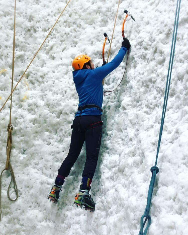
We parked at the White Horse Inn at Scales and set off up Blencathra. The start was quite steep and we had de-layered in a few minutes, laughing about our frailty. The gradient eased and we followed the curve of the hill round to Sharp Edge, a rocky arête that flanks the north side of the smooth, black Scales Tarn. The scramble was quite easy, apart from the odd bit of slippery rock, and we were soon on the “spine” of Blencathra which we followed round to the summit.

There’s an Ordnance Survey Trigonometrical Station at the top, a big concrete doughnut which – according to some fell runners – replaced the previous doughnut, which got stolen. Annoying but a solid beer trophy. The summit overlooks a lush, cultivated valley to the south and a sandy-yellow moor to the north. Rolling hills spread to the horizon in the east and layers of jagged, hazy blue mountains loom over Derwentwater to the west. It’s pretty.59885520_412628992908174_6610435511607623680_n

We walked along the saddleback and descended down the steep path to the flat farmland at the base of the ridge. The walk back was very tranquil; we stopped for a picnic on a rock, petted a couple of curious cows, scrambled over Blease Gill, Gate Gill, Doddick Gill and Scaley Beck and enjoyed the sound of nothing but running water, birds  and silence.

We popped into the White Horse for an early afternoon drink while I persuaded Bertie that we should do Skiddaw via Longside Edge/Ullock Pike, supposedly the “best” approach. Persuasion successful, we drove the short distance and parked by the Ravenstone Manor Hotel, near Bassenthwaite Lake.

Skiddaw via Longside Edge

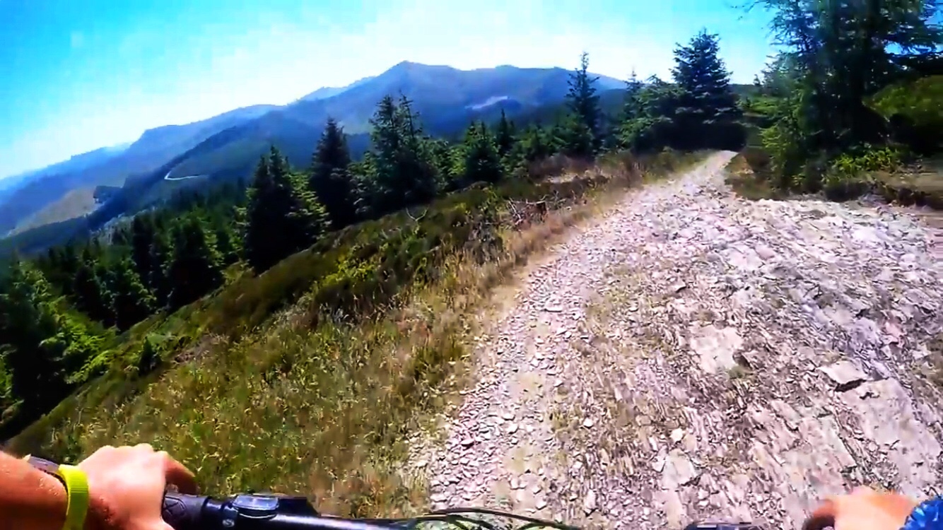
The first half hour or so was a killer. A relentless, steep incline, first through woods then over heathery moor. It eased a little as we made our way along the long, undulating Longside Edge, covered in rocks and heather, and I could see why Wainwright recommended this way.

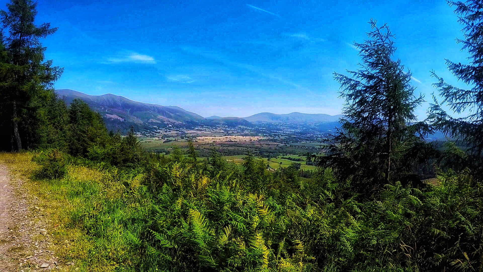
The landscape opened up ahead and on our right hand side, stretching from dark Bassenthwaite Lake and Derwentwater out over open, green fields to the great blue fells towering over each other on the horizon. On our left was Skiddaw, a great, grey lump that looked intimidatingly steep and distant as it loomed over the coarse, scrubby valley cradled by Longside Edge. Behind us the ridge sloped down to a flat, open expanse of farmland that stretched out to the calm shores of the north west coast, and it must have been the south west tip of Scotland that emerged invitingly through the sea haze.

We followed the curve of the Edge round and eventually reached Skiddaw. The climb was long, steep and loose, untouched by vegetation and surfaced by loose plates of slatey mudstone that made it feel like some desolate, alien planet. We pushed on up (Bert managed despite bad hips, knees, ankles etc, poor old thing), basked in the glorious air that surrounds every trig point, and half walked, half skidded down the steep slope and back the same way we came.

Unusually (but perhaps unsurprisingly, given the distance/altitude covered and hunger/thirst worked up) Longside Edge seemed longer on the way back. Fortunately it was still stunning. Eventually we made it back to the van, somehow without killing each other, peeled off the sweaty layers and made our desperate way to some unknown Keswick pub.

Pub

True to form, classy old me resorted to Wetherspoons for cheap, greasy food and cheap, alcoholey drink. It was so busy that we couldn’t get a table, so we stumbled into the cosy, unpretentious, also-busy Golden Lion on the high street and indulged in the tastiest average pizzas I’ve ever come across. I was drunk after half a cider but I had two anyway, so Bertie drove us across to the Yorkshire Dales in preparation for day two’s mountain – Ingleborough. More to follow…

Two Wet Climbers

Great days usually have three things in common: a remote location, a risk of death and a pub finish. Exhibit A – last Saturday…55576787_766649270376210_9170423551180668928_n

We got to West Lulworth earlyish and lugged our gear to Stair Hole, a small cove just round the corner from the more well-known Lulworth Cove. It’s a stunning place, with a secluded beach surrounded by zebra cliffs and could-be-caribbean turquoise water.

We dumped bags on the stony beach and waded across the knee-high water to the big lump of very climbable-looking rock. We scrambled up to the top like kids in a playground, searching unsuccessfully for a route before setting up an anchor and making one up.

Bored of messing around, we scrambled back to sea level. I went an awkward way and had to backtrack, but not before watching a handful of melon-sized rocks tumble past where I’d been standing just a few moments before. A sobering reality check.

We kitted up and committed to The Maypole, a circular trad traverse which should have been a doable HVS 5b. I enjoyed leading the second, third and fourth pitches; the gradient was mostly okay, there were some decent holds and it was super grippy, although it was weird rock – sharp and “horny”, with very few cracks for jamming or placing gear.

The route can be done as a deep water solo, which I would love on a warmer, sunnier day as it would mean less faffing and more climbing. I enjoyed traversing but I was aware of the need to place loads of gear so we wouldn’t swing too much if we fell. I’m glad we didn’t fall as I didn’t place much.

At belay point five (after a quick backtrack to retrieve a stuck nut) we looked at the next section and commented on how straightforward it looked. As if I’d never learnt that lesson before. I lowered down towards the water from the bolted belay, suddenly realising how much the rock leaned over me and how few foot placements there were.

There were two potential ways to get through the cave: up the only crack in the rock or practically touching the water along the coming-out-at-you slab. I tried both and learnt a formula: awkward belay angle + lack of placement + pumped forearms – elevation above water = wet climber. I could feel my partner laughing at me as I flapped about, searching for purchase on the rock and whinging about wet socks.

Then it was his turn, which was pretty much a carbon copy of mine. Being the safer climber and all-round better person, he decided it was his job to get us out. He employed the unconventional method of lassoing a horn of rock past the nasty coming-out-at-you slab, which – when I suggested tying a nut to the sling for a bit of weight (not just a pretty face) – actually worked.

By this time he was out of sight round the corner, so I just responded to his muffled grunts of “slack” and “take”. Eventually he decided that the only way back involved swimming, so I fed him the rope and hoped his drowning noises were for dramatic effect. Fortunately he made it to the beach, and I later found out that he was nearly pulled down by the weight of his jacket and harness.56177033_395067664380598_8633818574965702656_n

Knowing you’re going to get wet and cold when you really don’t want to is horrible. I climbed down as much as I could, struggling to remove the nuts, and resigned myself to the water after fumbling around trying to put my phone in my helmet so it could float safely back to shore. Which didn’t work, as I got tired holding onto the rock and dropped (luckily) my helmet.

Going in was terrible. I was desperate to not ruin my phone and lose all my pictures, so I’d stuffed it as high up in the front of my top as I could manage. I tried staying on my back and failed – I probably looked like I was drowning. The weight of my down jacket and a harness full of metal really dragged me down, and the “swim” back was unpleasant – although I managed to collect my floating helmet.

Back on the shore my partner was shaking and I was distraught at the fact we’d left a load of gear in the wall. Being poor and stingy, I insisted on swimming back to get it; again, mega unpleasant, but well worth it for the sake of a handful of nuts, slings and draws. Meanwhile, onlookers enjoyed the show – not one person seemed concerned!

Wet, cold, hungry and in dire need of hydration (by tea and cider), we shivered back to the van. But it could have been worse – we could have lost a lot of stuff, or died. Just like all other great days, this one finished happily ever after… in the pub.

I can’t wait to climb again.

Scotland, Day 4: The Cairngorms – Lochnagar

Lord Byron eulogised this mountain in 1807:

England! thy beauties are tame and domestic

To one who has roved o’er the  mountains afar:

Oh for the crags that are wild and majestic,

The steep frowning glories of the dark Loch na Garr.

In contrast, Queen Victoria wrote of Lochnagar in September 1848:

“But alas! Nothing whatever to be seen; and it was cold, and wet, and cheerless. At about twenty minutes after two we set off on our way downwards, the wind blowing a hurricane, and the mist being like rain, and everything quite dark with it”.

After experiencing Lochnagar on a bleak day in December, I agree with the poet’s “wild”, “steep” and “dark” but otherwise I’m with Queen Vic. We woke bright and early in the Spittal of Glenmuick and met our friend Mike at the Lochnagar car park before sunrise. We set off on the 10ish-mile hike in a mix of fog, drizzle and gloom, disappointed with the weather but glad for the company.

The first section took us across a flat, heather-covered plain, with Loch Muick away to the south and a dark line of trees to the north. We couldn’t see much through the fog, but I knew that Loch Muick was cradled on three sides by steep ridges; I expect it’s stunning on a clear day. Lochnagar is within a few miles of the Balmoral estate, and I could just imagine the Queen (maybe a few years ago) tearing round the track in a Landrover, or a shotgun-wielding Philip bumbling after some grouse.

It was an easygoing route  for about three miles, along a wide, stony track up a gradual incline. We branched off left about a mile east of Meikle Pap, where the track turned into a slabbed stone path. I got overexcited at catching a glimpse of a few startled red grouse, then we hit the snow and the hike got a bit more complicated.

Just as the path started getting scrambley, patches of snow appeared. Snow does a great job of concealing paths, especially when the landscape is strewn with rocks, covered in wild, tufty vegetation and bereft of other summit-seeking humans. We followed it as best we could but did a lot of guessing, aiming in the direction of “up” and “west-ish”.

The vegetation disappeared, and after scrambling up a formless sea of steep, slippery rocks, keeping close to avoid losing each other, we hit real trouble – just as I got excited at a flock of winter-white ptarmigans. Mulling over why on earth anything would choose to live up there, we struggled through an annoying mix of soft, calf-deep snow and hard, unyielding ice. As we reached a kind of plateau, the rocks grew sparse, the climb became less steep, and the already hurricane-like conditions worsened.

Lochnagar stands at a lofty 1,156m above sea level and curves around a beautiful northern corrie (I know it’s pretty thanks to Google images). The path follows the ridge along the top edge of the corrie, so the exposure is huge and complacency could result in a massive fall. This was problematic as by this time visibility was non-existent, we were ill-equipped (no crampons or axes – terrible foresight) and we didn’t know exactly where the summit was. Or where we were.

52669907_1980525335379703_1916488697524518912_n

White-out

As we pushed on, I truly understood the term “white-out” for the first time. The only way to distinguish “up” and “down” was by looking at the other two and seeing where their feet were in relation to their heads. Ice, snow, cloud and sky all merged into one disorienting, blinding, infinite nothingness, like in a dream in a film, until little dark specks appeared and I tried to blink them away. Communication was limited to shouting in each others’ ears, and any exposed inch of skin was beaten raw by the strong, bitterly icy winds.

Just when it couldn’t get any worse, it did. We reached a false summit and the ground became sheet ice. Literally like an ice rink, only harder and less flat. I’m sure we went round in circles for a bit, slipping over constantly, resorting to bum-shuffling and actually laughing at our own ridiculousness while remaining acutely aware of our proximity to the deadly edge of the ridge. Still determined to reach the summit, we paused for a painfully cold moment to check the map and decided simply to follow the compass north to where we thought it was.

This decisiveness saved the day, and as the towering pile of rocks loomed through the whiteness I almost collapsed with relief – I’ve never been so delighted to reach a trigpoint. I slipped onto my trusty old compass and snapped it, fortunately without stabbing myself, but it had done what it needed to do. We fumbled about for a quick photo, then practically flew back down the mountain, eyebrows, eyelashes and beards (even mine) heavy with ice.

I would have liked to make it a circular route and gone back along the north side of Loch Muick, but given the conditions we decided the way we came was the quickest and most certain way to the pub, and it’d look the same anyway. The fog had cleared slightly once we were back on the wide, stony track, revealing a rugged, heathery landscape. From there, the walk back was made a drag by our cold, wet-through clothes and desperation for a drink, but we reached the car park eventually. Lochnagar is definitely one to come back to on a better day, but I was glad for the adventure we had.

Semi-thawed, we drove to find a pub before heading to Perth for the night. We ended up collapsing on the sofas in the Deeside Inn at Ballater. It couldn’t have stood in starker contrast to the bleakness of a few hours earlier; the lounge was a huge room with deep red walls, thick curtains and dark wood beams, lit softly and warmed by a roaring fire. It had tartan sofas with pheasant-patterned cushions, a big Christmas tree, books, boardgames, a piano, complimentary crisps and (most importantly) cider. I think my life peaked at that moment – in there, the world was perfect.

52985861_2373960469515791_200852427610521600_n

Adventuring West: A Weekend of Climbing, Surfing and Pub-hopping

Last weekend I learnt about cold water, wet rock and hard drink.

Bude

52596452_2095616000730540_580513092601905152_n

Sunrise at Seatown

We left for Cornwall on Thursday evening and stopped overnight in Dorset, where we were spoiled by a stunning seaside sunrise at Seatown. We arrived in Bude late morning, by which time the mist had lifted to reveal clear blue skies and the air had a deliciously spring-like warmth. Keen to make the most of the weather, we decided to jump straight into the water.

I was so excited to be back in the sea that I quickly forgot two things: the cold and how to surf. Within minutes I had 1) snapped the leash, 2) realised that I’d seriously under-waxed the board (so amateur), and 3) got annoyed that I wasn’t instantly the most competent surfer in North Cornwall.

Also, the feeling of rough sand between semi-numb toes was unpleasant enough for me to regret leaving the surf boots in the van (idiot). The strong cross-current at Summerleaze beach meant that I took five painfully slow steps sideways for every metre gained paddling out, and I only stood up a [small] handful of times after several poorly judged attempts. Despite a terrible performance, I had a great time in the sea.

After a couple of hours of grinning at caught waves and swearing at missed ones, I lumbered (there’s nothing graceful about carrying a surfboard in a cross-wind) inland to my water bottle to dilute the gallons of saltwater I’d swallowed. Frustrated by the current and battered by the unrelenting sea, we heard the clock strike beer o’clock and thought it unholy to be late for mid-afternoon mass.

Refuelled and rehydrated, our little group went exploring the pretty, bustling streets of Bude. It reminded me of Perranporth – something to do with the layout and the mix of touristy shops and quirky little pubs and cafes.

The first place I fell in love with was the North Coast wine shop/bar. As I sipped craft cider, people-watched out the big windows and basked in the hazy late afternoon sun, I thought I’d died and snuck into heaven. The second place was the Barrel at Bude, a tiny, dark, timeless pub which implements fines for mobile phone use and serves “proper cider”. I’m not a great drinker but I do put a lot of effort in, and this cider set me on a downward trajectory that was intensified by a couple of cocktails back at the North Coast place. Needless to say that falling in love that night proved just short of fatal.

Hartland Heritage Coast

I woke up the next morning fully aware that I’d once again proved to be “that friend” that can’t be taken anywhere, disappointed with myself but hugely grateful to have been returned to my van. A pint of tea later and we drove to the Hartland Heritage Coast to blow out the cobwebs with a coastal climb.

That didn’t exactly go as planned; first we ended up in a farmyard down a dead-end road, then halfway down a steep, scree-covered cliff, then we realised that the climb we wanted to do (Wrecker’s Slab) was a few miles along the coast. Unfazed, we hiked along the South West Coast Path and stopped overlooking Vicarage Cliff. Although the rock looked lovely, it was totally inaccessible for a few hours around high tide and – consistent with our luck – high tide was about 1pm.

Despite being a little hungover and gutted about our failed climbing plans, the beauty of the rugged cliffs, moody sky and vast, boatless sea wasn’t wasted on us. We dumped our kit and went exploring, breathing in the salty, tangy air, dipping toes in the crystal clear stream and watching the sea crash relentlessly over jagged rocks and deserted, grey beach as we recovered on the soft, tufty grass. Heads cleared, we hiked back to Morwenstow via Hawker’s Hut, a lovely little driftwood folly, and went for one in The Bush. Lovely pub, great sandwiches, 10/10.

Sheepstor

Determined to climb, we drove to Dartmoor mid-afternoon and hiked up to Sheepstor. It was damp, foggy and exposed, but despite wet rock and dwindling light we managed a humble route (“Sheltered Crack”) up the tor. On a dry day the granite would have been lovely and grippy, with loads of gear placement, but being a) February and b) England it was slippery and algae-covered. One to return to…

It turns out that circumnavigating a foggy, rock-strewn tor in search of the biggest rock face is pretty disorienting. Fortunately the group had enough skill and (in my case) experience of being lost to get back to the car park before dark. Pleased to have a climb under our belts, we drove across the vast, open moorland to the Warren House Inn, where we spent a lovely evening enjoying a few gentle drinks and some great company.

Dewerstone

Sunday morning’s weather looked grey and mizzley, so we didn’t have high hopes for a decent climb. We optimistically headed south to climb the Dewerstone, one of the area’s best-known climbing spots. It’s a 50ish metre slab of rock in a fairytale-like wood, penetrated by a clear, rocky river and full of moss-covered trees. The rock was very damp at the base of the climb and the weekend’s alco-toll meant that we weren’t in peak physical condition, so we chose a very do-able route – “Mucky Gully”.

It was a really enjoyable climb because of the variety it offered – good holds, bridging and jamming – and its sheltered position. The rock was slippery at the bottom, but dry and really grippy from about halfway up. I had it easy as I seconded the climb so I can’t say how it was to lead, but we did it in three pitches to avoid running out of gear, particularly big stuff. By the time we reached the second pitch the sun had come out, and the view over the mossy woodland was lovely.

Having taken our time to enjoy the climb, we wandered back through the woods and headed homeward across the moor. I stopped briefly at Widecombe (pretty town, the Old Inn is okay but unremarkable), admired Haytor on the way past and exited Dartmoor reluctantly, drawn home only by the lure of a roast dinner and the unshakable burden of responsibilities. A near-perfect weekend.

Scotland, Day 3: The Highlands – Kinlochleven, Fort William

Admin

We woke later than usual, around 7.30am. I was surprised by how much later the sun rose and how much earlier it set compared to home – about 8-8.30am and 3.30-4pm. Morning admin was a repeat of yesterday; porridge, coffee, tidying and jam sandwich making.

Ice climbing

50442196_1979578599017896_1329863299524722688_n

After a 10-minute drive from our overnight spot, we arrived at Ice Factor in Kinlochleven – the largest indoor ice climbing centre in the world. It’s an impressive building which houses an indoor rock climbing wall, shop, cosy café and ice climbing area, which is pretty much a giant freezer. We’d booked in for the earliest taster session of the day, keen to have as much exploring time left over as possible. I started to write about ice climbing in this post but I got carried away, so for the fine detail read my separate post – Ice Climbing for Idiots. Basically, it was really fun and I want more.

Hiking

We left the centre with big smiles, grabbed our hiking kit from the van and set off on a route we’d planned the previous evening. We had hoped to climb some munros (Scottish mountains over 3,000ft high) in the Mamores range, which lies between Kinlochleven and Ben Nevis. We actually ended up doing a different route which took us up and west, rather than north, due to a disappearing footpath and some dodgy-looking weather over the mountain tops, so unfortunately we didn’t reach any summits.

Nevertheless, we didn’t mind deviating from the plan because we’d set off late, got some breathtakingly-awesomely-stunningly beautiful views down the length of Loch Leven and had a lovely couple of hours anyway, despite some questionable “footpath” terrain and glute-burningly steep bits. The hike also took us past Grey Mare’s Tail waterfall, which is well worth the short walk from Kinlochleven.


Fort William50474548_550658935436708_6670099998987780096_n

Our alternative route meant that we got back to Björn with enough time spare to get to Fort William for a wander round. It’s an attractive town with plenty of shops and pubs, and seems to be a kind of outdoorsey “hub” with a nice buzz. We managed to do a bit of Christmas shopping before treating ourselves to a meal in a café – I don’t think a jacket potato has ever tasted so good. Fed, warmed and out of daylight, we got in the van and headed east.

The Cairngorms

We’d arranged to meet a friend to climb a munro in the Cairngorms the following day. I chose Lochnagar after reading about it in a “Britain’s greatest mountains” feature of The Great Outdoors magazine (don’t tell my cool friends), so we drove the three hours there from Fort William. It was a shame to drive across so much of the National Park in the dark, but we’d seen it before and were keen to make the most of the daylight hours outside. We arrived at the Spittal of Glenmuick quite late and quite tired, so we parked along the dead-end road, admired the blackness of the sky and the utter, pindrop silence, packed bags ready for an early start and slept.

5k-a-day Update: Not Compatible with Rugby

Last month I devised and wrote about my latest scheme – I planned to run 5k every day. I stuck to the plan for a week and a half, running 5k some days, not at all on others and up to 15k to make up for missed days. But just as I was getting into the swing of it, rugby struck.

Two weeks ago I was half-carried off the pitch in the last two minutes of a game in Dorchester with a poorly leg/foot. I’m not sure what happened but my boot ended up a few metres away from me; ironically, the week before I’d teased a friend about being so silly as to wear his rugby boots so loose that they could come off mid-game. So under sod’s law I suppose it was my fault, but I offloaded the ball as I went down and the winger scored a try so it wasn’t in vain. (We won 68-0 FYI, I’m glad you asked.)

47242392_269121343802239_2570999279158034432_n

This means that I haven’t been running for two weeks. Our lovely physio thinks that I’ve ruptured a tendon , which isn’t too bad as apparently I have enough other bits of leg to compensate for it.  It bruised up pretty nicely, my big toenails finally came off (post-August ultramarathon..!) and my right foot isn’t quite right still, but it was strapped up tight and back on the pitch a week later so I think I’ll live.

That’s the problem with rugby… sometimes it messes up other plans, which – for a restless-to-the-point-of-twitchy person like me –  is frustrating at best and heartbreaking at worst.

I’ll try and restart my daily 5k plans from this week, foot-dependent, and get back in the gym… I’ve been terrible lately, and I’ve really noticed my overall mood/motivation dip as a result. I’ll also try and get back on top of my blog, career plans and life in general – wish me [a lot of] luck.


Endnote: this was the last (touch wood, fingers crossed, repent all sins) of a three-game injury streak for me – the game before  I was apparently knocked out, and the game before that I’m 95% certain I cracked a rib. Despite last week’s game being more physical than the others, I came off relatively unscathed… #problemswithrugbyaddiction

MTB Whinlatter, Lake District

I discovered Whinlatter Forest Park almost by accident. Bertie and I planned to hire bikes and spend the day exploring the Langdale Valley, but we didn’t pre-book (“we won’t need to”, he said…) and the hire place was closed when we got there. Cue arguing, sulking and a conciliatory drink at the lovely, remote Woolpack Inn.

I googled other hire places and the nearest ones were at Keswick or Whinlatter, which I’d never heard of. I was sold when I saw “mountain bike trails” at Whinlatter, so after an hour’s (silent) drive we were fed, helmetted and fixed up with a couple of neat Cube hardtail bikes. The centre is well thought out, with a good café, shop, loos, information centre and big car park, and there are three MTB trails – the blue Quercus trail (“moderate”), red Altura North loop and red Altura South loop (both “difficult”).

Altura North

We started with the Altura North trail, 10km of bliss (for me) / terror (Bertie). It’s a well-signposted, well-maintained singletrack route with 200m ascent, exhilarating downhill sections and breathtaking views over layer upon layer of green, brown and hazy blue mountains. There are some tough climbs, particularly “The Slog”, which require a decent level of fitness and determination. Equally, the downhill sections are challenging in places but SO worth the effort, with sweeping berms, technical rocky and rooty bits, small drop-offs, jumps, flowing switchbacks and optional features graded “black”; the “Grand National” section is particularly thrilling, as the forest opens out onto a steep, gravelly, long switchback. Somehow I avoided causing serious damage to myself, the bike and the densely wooded forest, and I grinned stupidly for the whole 10km.

Quercus

Running out of time, we skipped the Altura South loop to my absolute dismay. However, the 7.5km Quercus trail didn’t disappoint. While it was more family friendly than the Altura, it still had technical sections, a few boardwalks, some flowing downhill and stunning views. The terrain was smoother (less rocky/rooty) than the Altura trail and it felt slightly more artificial, possibly just because it was less rugged. Although less thrilling, it was definitely sufficiently fun – a great warm down XC trail with some really satisfying, flowing sections.

Despite being a glorious day, mid-heatwave (late June), the forest wasn’t too busy. There were a handful of other riders out; a mix of seasoned-looking bikers with bank-breaking kit, happy-go-lucky visitors (sadly our category…) and a couple of family groups on the Quercus trail. The forest is also popular with walkers, but fortunately the real singletrack didn’t cross any pedestrian paths so our human contact was limited to pointing a lost rambler in the right direction on one of the gravel tracks between the “fun bits”.

So by late afternoon, the grumpy Naomi of that morning had transformed into a gleeful, buzzing idiot with sparkly eyes and an uncontrollable grin. Whinlatter exceeded my expectations and I’ve sworn to return to take on the Altura South loop. I’d also like to do the trails at Grizedale (west of Lake Windermere, also exhilarating) again, which – back in 2014 – I crashed on, horribly twisting an ankle and ending up at Keswick minor injuries unit (but not before I bandaged it up and completed the trail). Looks like another Lake District trip may be in the pipeline…

https://youtu.be/mI0SFrkyv_w – GoPro clips of the trails, unfortunately I adjusted the chest strap badly so it’s angled down!

My Latest Scheme: 5k-a-day

It’s been two months since my ultramarathon and I’m bored. I haven’t really been running due to injury – first there was the post-ultra knee problem, which seemed to clear itself up (mostly) so I ran a half marathon. Then I’m 99.999% certain I cracked a rib playing rugby – moving/breathing heavily hurt for a couple of weeks, so I returned to wallowing in self pity. So being a bit twitchy and even more restless than usual, today I decided to start a new mini-challenge: I want to run 5k a day, indefinitely.

Having somehow completed the 50mile (80km) ultra, 5k feels like a silly little distance. However, I’m working on convincing myself that it’s a nice distance because it’s so manageable. It only takes 25 minutes (or that’s the target, at least..!) so it’s not really a chore and it fits easily in at any time of day.

Also, it gives my “fitness regime” (sounds WAY more impressive than it is) some kind of structure; I’ve always liked the thought of being a planner, but when it comes to actually planning stuff it turns out I’m naturally more of a “turn up and wing it” kind of person. I go to the gym fairly often, but I’m a bit scrappy – I might go five times one week and not at all the next, and I haven’t followed a plan since doing less weights work and more cardio. Same with running.

So by forcing a set distance within a set timeframe upon myself, I hope to ease myself into some kind of routine. I’d also like to get better at running and by doing 5k regularly I hope to see tangible results in a) the time, and b) the effort that it takes.

I say 5k a day, but if I miss a day (I have been afflicted by the occasional hangover in the past) I won’t beat myself up as long as I make 35k each week, and I’ll definitely accommodate longer runs too. Believe it or not I intend to do more ultramarathons…

The other major motivation behind this idea is that I’d like to get others out running too, and 5k is a good starting distance. Running with other people helps massively with motivation and is a fun (I promise) social activity, plus it helps keep your friends healthy, alive and – in my case – less neglected (there are lots of people I don’t see nearly as often as I’d like!).

So if anyone would like to join me for any 5k excursions I’d be delighted with the company, and I’m happy to travel about to try different routes. If you slow me down I’ll be glad to go at your pace – I get sick of beating myself up, and all that really matters is getting the miles in. If I slow you down please feel free to run off and get a pint in ready for me at the end… a cold cider will rarely go amiss 😉

Today’s run… 5k number one

New Forest Bike Ride, September 2018

When my outdoorsey friend from North Wales visited my humble little corner of England last month, I promised to show him the New Forest (National Park – absolutely not an innuendo). I figured the best way to do this was on bikes, so I fixed Rocky’s puncture and chain-lubed him up.

We met at Stoney Cross Car Park and headed West. I hadn’t planned a route, I just thought we’d go with the flow; naturally, after riding along roads, through trees and across grassy openings, we managed to end up in what is probably the least suitable part of the Forest for mountain biking and/or showing friends around: the Netley Marsh/Totton urban sprawl.

I have nothing against the area, but I’d wanted to show Mike  the New Forest in all its glory: heather-covered moors grazed by rugged ponies and edged by dark treelines. Purple-brown heaths, rippling golden grasses, trees every shade of green and open skies bathed in the translucent lilac-blue-gold of late summer sun. Netley Marsh/Totton was strikingly grey. And it rained.

Apologetically, I attempted to lead us back into the Forest and was unsuccessful for a while. However, we stumbled across a pump track at Totton which (in my opinion) made the detour worthwhile. I’d never been to one before but it was lots of fun – a couple of loops around and my heart rate was up, my arms were burning and I was grinning stupidly. It was sketchy at times, when I misjudged when to pedal and scraped the tarmac “humps”, but fortunately Rocky and I left in two complete pieces.  It turns out the track cost £43k and only opened a couple of months before. [See the GoPro footage from the pump track]

Playtime complete, we rode out of the urban sprawl back towards the Forest via Ashurst, travelling south through woods and across open heathland. This was more what I’d hoped for; I couldn’t call it mountain biking (especially not to Mike, hailing from Snowdonia) as the terrain was quite easy-going and there was nothing particularly steep. The most difficult part was the narrow section where the high, tufty “kerbs” on either side of the track meant I could only pedal in half-rotations, but at least I’d shown my friend some of the “actual” New Forest.

We went through Denny Lodge and stopped for a drink at the Mailmans Arms in Lyndhurst, then rode back towards the car park via Emery Down. The roads seemed long, and it was hard work having cycled a fair way on mountain bikes and empty stomachs. We cycled 40km in total; back at the van, I apologised for being such a terrible tour guide and promised I’d do a better job of showcasing the New Forest next time.

In the future I think I’ll show my “guests” the north west of the Forest, rather than the central east. I went for a lovely ride out Linwood/Mockbeggar/Fritham way  back in April, so maybe that’ll be my destination of choice… I’ve heard tell of a mountain bike centre in the south west, around Avon, so that’s on the cards for a future day out. In the mean time, I’ll work on my tour guide skills, and maybe I’ll prepare an actual route next time…

Endnote: Mike didn’t seem too disappointed  – we explored Corfe Castle afterwards and went climbing at Dancing Ledge in Dorset the next morning, so I think I made up for it!

Spontaneous Surf Trip, Perranporth, August ’18

Bored of being home for five days straight, I roped some friends into a spontaneous surfing trip. We left Winchester on Friday evening and stopped for dinner on the way, not arriving in Perranporth on the North Cornwall coast until the early hours of Saturday. We were fortunate enough to discover Droskyn car park, which had plenty of space and grassy areas where my friends could (naughtily) pitch their tents.


First light on Saturday morning revealed how lucky we were to have found that car park. I looked out of the van window over the long, wide expanse of sand, backed by picturesque cliffs and flanked by the open sea on one side and the colourful little town on the other. There were public loos by the car park (which were unlocked shortly after we got up) and it only cost £5.50 to park all day – much cheaper than elsewhere. A quick tip if you go – get there early as although there were just a handful of cars/vans there overnight (no charge), it got busy during the day.


42619389_792599621076177_2625509818667892736_n

The view from Droskyn car park


We walked down the hill into the town (about 10mins), had breakfast at a little café and found surf boards to hire for £6/day at Piran Surf – much cheaper than anywhere I’d been in Newquay. A 10-min walk to the water and we were splashing around in no time, attempting to surf like the bunch of idiots we always have been and always will be.


Bertie brought his own board, although it had been neglected for a long time – I liked its small size but it needed a clean and a sex-wax-up as it was frustratingly slippery. The 8ft foam boards we’d hired were really good (for beginners!) as they were buoyant, grippy and stable, if cumbersome. I reluctantly followed everyone’s advice and wore a wetsuit, which with hindsight I definitely don’t regret.


The waves were 4-5ft and spaced fairly nicely, although sometimes they all came at once and then not at all. We all improved as the day went on; I just regret not having a board mount for the GoPro (the adhesive takes 24hrs or so to stick), as the footage from my wrist strap isn’t the best. I did plenty of standing up and surfing around (not into) people – promise!


After a full day surfing (except a short break for an obligatory pasty) we hit the pub for dinner and ended up playing pool and making friends in The Deck, an “interesting” bar (I later found out we probably should have gone to the Watering Hole, but that can happen next time). A few too many ciders later and I was “assisted” up the hill to bed.


We woke on Sunday to heavy heads and a beach shrouded in sea fog. We met our Cornish friend for breakfast and hired boards again, then messed around on the beach waiting for the fog to clear. Just as Simon, Matt and Bruce were about to give up and go home, the veil lifted and the lifeguards opened the sea. We surfed at the North then the South end of the beach, eventually and reluctantly deciding that we should head home.


I’d recommend Perranporth over Newquay any day, so much so that I wrote a blog post on it – read it here. Overall, I had a great weekend in a lovely place with decent company. Note to self for next time : swallow less a) seawater, and b) cider.